|
|
|
 |
Remember: Press F11 for a
full screen view of this page. |
Web Counter when published 2 250 565 |
|
" Mockerkin Mob Walk to Mardale " Date & start time: 21st October 2025, 10am start from Haweswater (8.30 am from home). Location of Start : Mardale Head car park, Haweswater, Cumbria, Uk. ( NY 469 107). Places visited : Riggindale, High Street, Mardale Ill Bell, Nan Bield Pass, Small Water. Walk details : 6.5 mls, 2100 ft of ascent, 5 hrs 15 mins. Highest point : High Street Trig, 2,718ft - 828m. Walked with : 7 Members of the Mob, plus Myself and Dougal. Weather : Perfect, after a poor forecast just two days ago.
|
© Crown copyright. All rights reserved. Licence number PU 100034184. |

|
After a very changeable forecast for Sunday, the day dawned fine and bright, the sun was out, the air clear and superb day's fellwalking was in prospect. Peter had organised an "A" walk for our group, which involved a early start to get to Haweswater on the the far side of the Lakes. Summer water levels have been low so the fell paths should be dry. A couple of stream crossings after recent rain were Peter's only slight concern.
A quick stop at the Thirlmere Dam, on our way up the Mardale Valley.
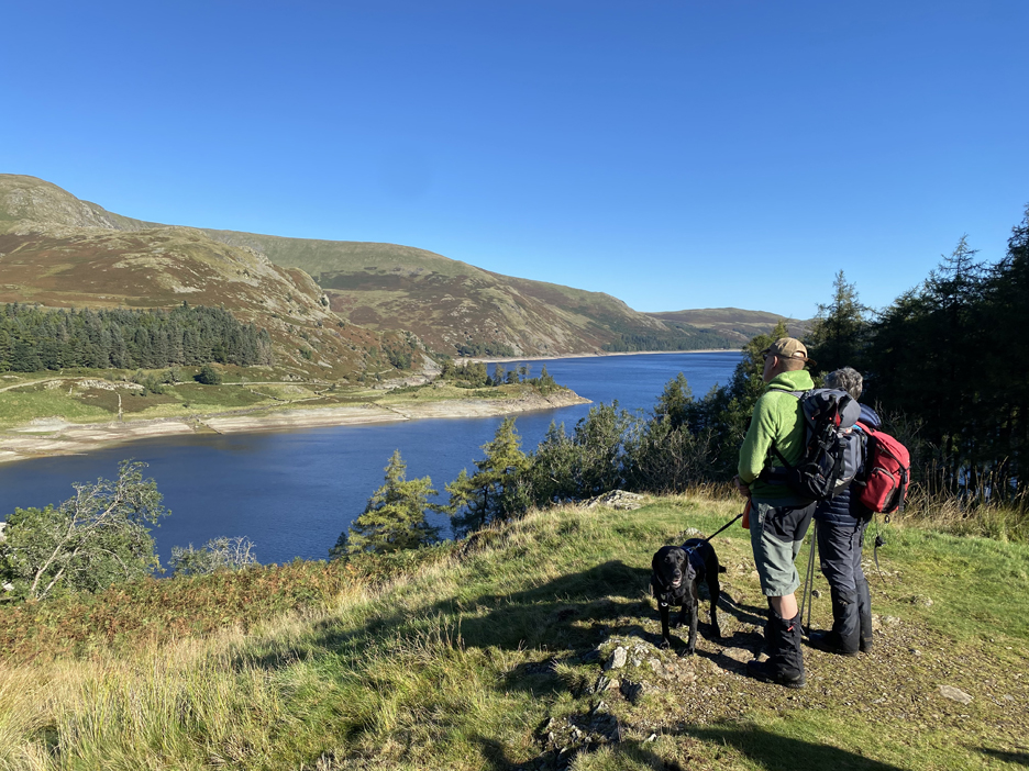
The classic view of Riggindale across the lake . . . technically it includes all of our route today. We'll walk to the wooded headland, up the ridge to High Street, round to the left on the skyline to Mardale Ill Bell, then back down the Small Water valley, seen centre behind the trees.
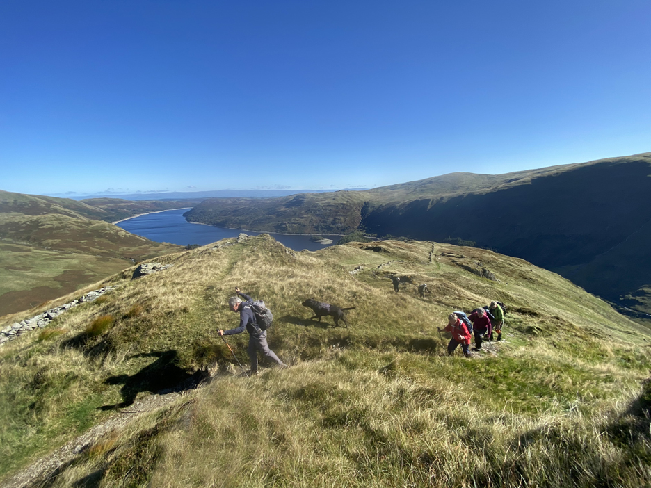
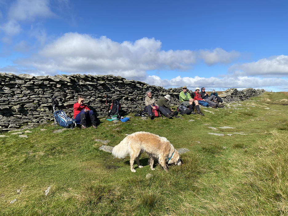
The Mob today . . . a full picture thanks to a kind fellow walker who took the photo. (left to right) Chris, Peter (our organiser) James, Richard, Kathryn, Sue, Pippa and myself. In there too are Bailey and Dougal.
On with the walk, eager to get going on this fine day. The temperatures are cool but the sun warming and the visibility promises to be superb.
Haweswater lake levels have been low enough to expose some of the old walls of the valley (that were flooded by the reservoir) but with a torrent of water like this entering the lake, it won't be long before the water levels rise once more.
Our route takes us above the fell wall, where we can look down onto the exposed bed of the lake.
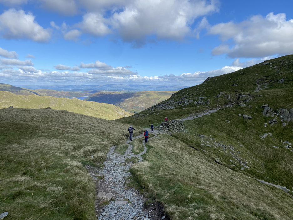
The route turns sharply behind the trees and we start the main climb.
We nearly continued on around the lake on the Bampton path, until Peter pointed out the lesser track heading upward. It was on these crags that Cumbria's remaining eagles made a home, but the last bird, a male, hasn't been seen for many years. The O.S. Map reflects, or remembers their presence, by naming the lower part of Rough Crag as Eagle Crag.
The 'last remaining' farm of the valley was down below us, the site of which is now lower than normal water level. The old farmhouse was seen last in the late 1930's, when it disappeared beneath the water of the new lake.
The long distance clarity today was superb, all the way over to the Pennines, half way to the east coast of England. The air has been washed clean by recent rains, with fresh breezes flowing off the clean Atlantic, rather than from the dusty continent to the south.
Climbing Rough Crag, gradually gaining height and now leaving the valley and our cars far below.
"The ghost of Rough Crag" leads Richard onward towards the next steep section of the path.
Ghost care not about refreshments, but we're quite partial to a coffee break after our early start from Loweswater. A sheltered, sunny and dry grassy bank suited the purpose.
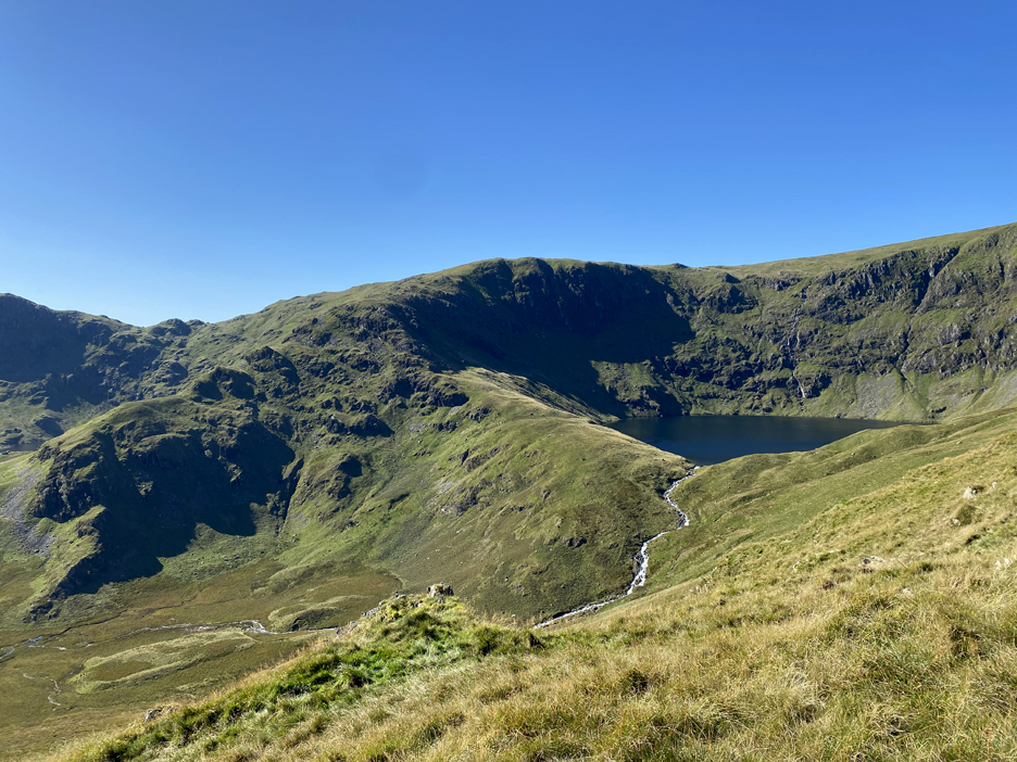
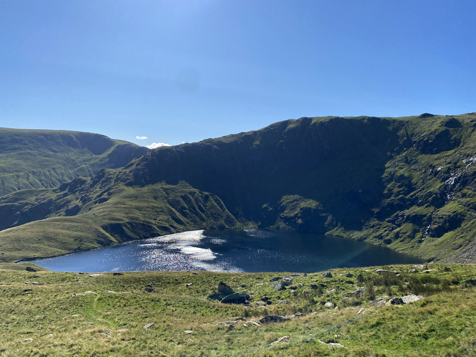
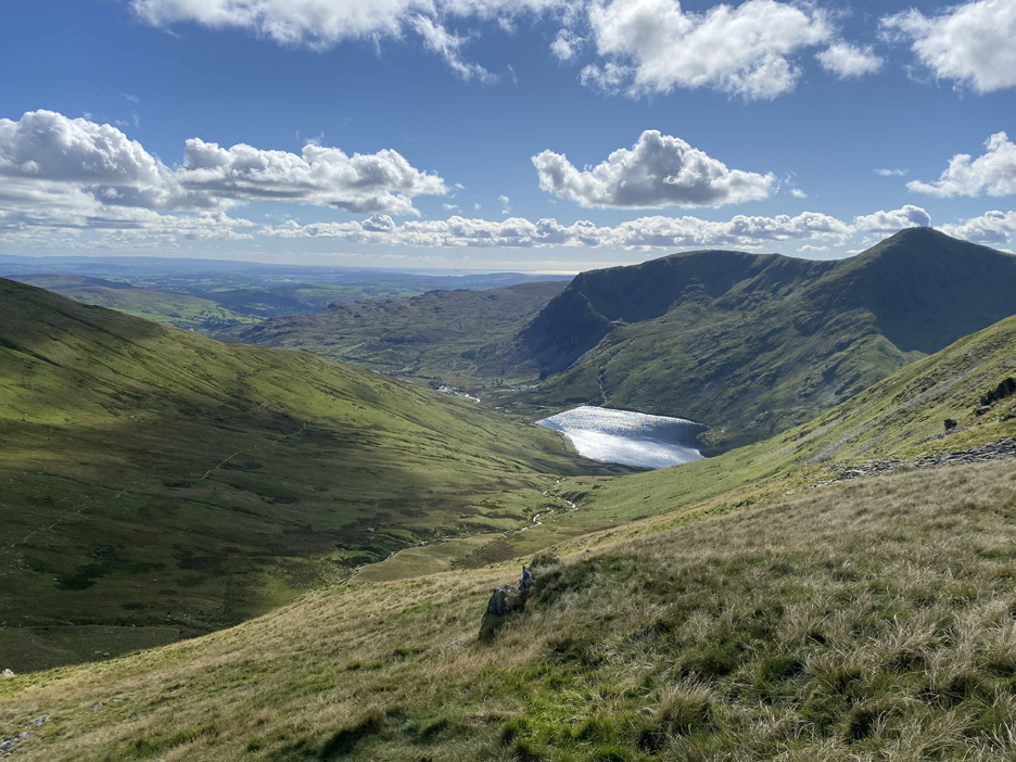
It also gave us our first close up view of Blea Tarn, the classic corrie lake, held high in the embrace of High Street and Mardale Ill Bell.
Unseen in the last photo, so a surprise to those who haven't been here before . . . is the tarn at Caspel Gate.
The tarn is as shallow as Blea Tarn is deep and once past the diminutive mapped feature we get a clear view of Blea Tarn once again. The gentle breeze gets twisted and turned and causes swirls on the water, which shine with reflected light from the midday sun.
Rough Crag has been a great climb . . . even better today given the weather.
The ridge tops out on what is virtually the middle of the summit plateau of High Street. Two fellow walkers rest at the summit, one tending to his feet, the other seemingly looking at the inside of his eyelids.
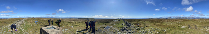
A summit cairn like this just calls for a stop to look around and to take a dozen pictures to stitch together for the panorama. Click here or on the photo above for the resulting 360 degree annotated photo
We join the Roman Road across the top of High Street, and head west in the direction of Galava Roman Fort at Ambleside.
The mid point of the walk and the highest point of the day . . . so a good spot to celebrate with the aid of some lunch. Thoughts of passing Romans fade as the wall protects us from the cool but gentle breeze.
Froswick, Ill Bell and Yoke lead away into the distance with Windermere clearly in view. Distant reflected sun now shines off Morcambe Bay beyond Grange over Sands and, appropriately, the area known as Silverdale.
Another turn onto a minor path as we diverge from the ancient track and head off towards Mardale Ill Bell and the Nan Bield Pass. The flat top of Mardale's Harter Fell lies ahead.
However the view was rather nice and it deserved another, this time a wider picture. This short diversion over, we turned and rejoin the main path.
A busy spot with the most people in one place that we had seen all day. There were walkers like ourselves, mountain bikers, several fell runners and a party of late-launchers all within this 50 yard stretch.
The sun reflects off a different lake now, this time it's Kentmare Reservoir to the west of us, as we start to drop down to the pass.
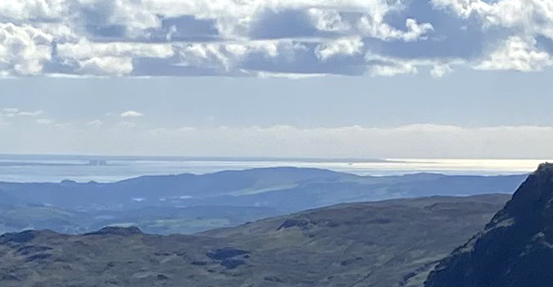
Wainwright was keen to point out that you can see Blackpool Tower from the top of Coniston Old Man. From here, with the naked eye, we could make out Heysham Power Station and the Heysham Ferry heading off down the channel, sailing towards Ireland. With the photo blown up at home, you can just see the famous tower to the right of the boat and see or imagine the Snowdon peaks beyond the headland. On the day and with the aid of binoculars the sightings were clear.
To no avail, there's only one path ahead and no-one can get lost in this weather. Another brief stop as 'Small Water' and the bigger Haweswater come into perfect astronomical alignment.
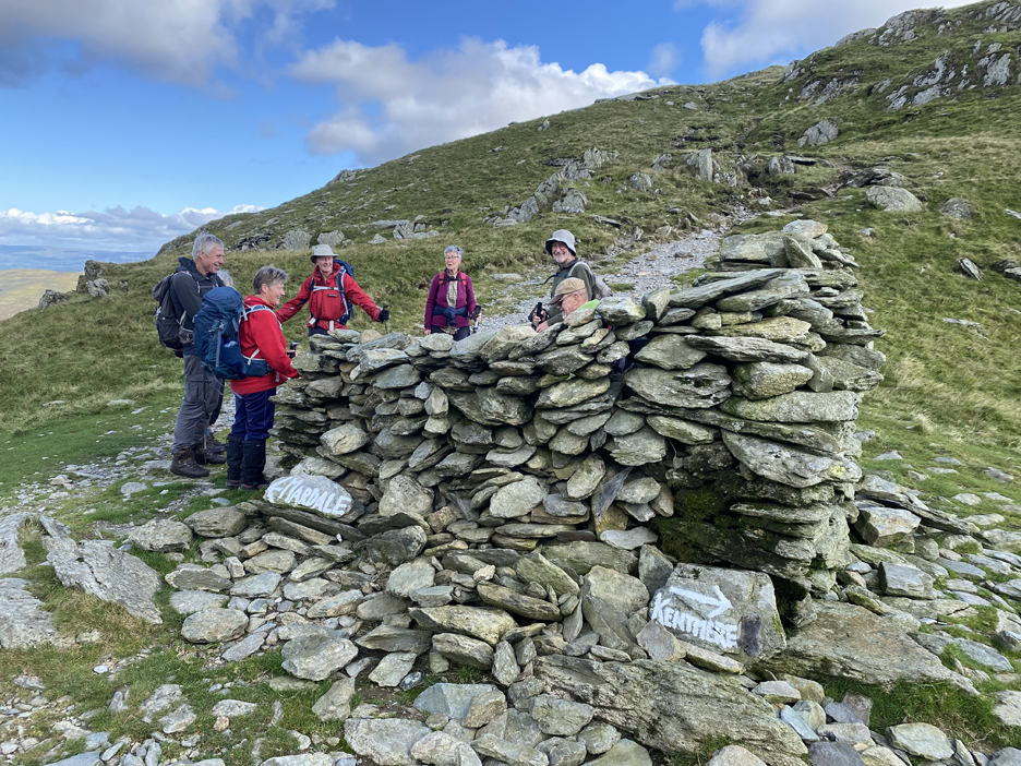
All paths lead to one of the larger bad weather shelters in The Lakes, that being the one at the head of the Nan Bield Pass.
Four square and a good shelter set against the prevailing wind that no doubt rattles through the Pass at times. Which way now . . . we'll take a left to Mardale.
A slow rocky and grass path takes us down towards Small Water.
The map and guide book mention the shelters that can be found alongside the path during this descent. Peter on his Recce recently failed to notice them . . . and I can understand why.
They are lot clearer to see when you look back at them. Again the entrances are all angled slightly to protect from the wind.
Chris ad Pippa passing the shelters.
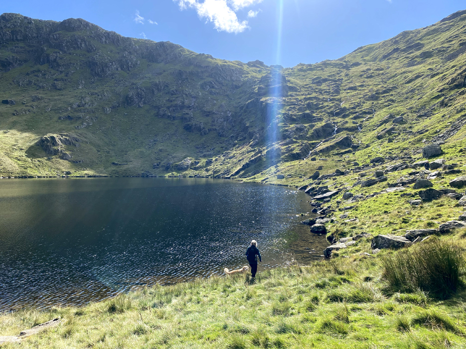
A ray of sun, caught through the lens of the camera, highlights Sue and Dougal down by the water.
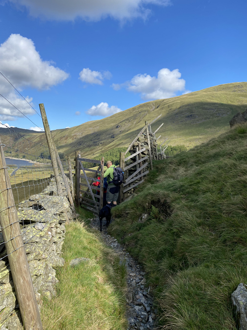
One of Peter's concerns after the recent rain, was the river crossing at the exit from Small Water. No matter, the water level was up but not sufficiently to cause a problem.
The eye was drawn 'over the edge' towards Haweswater and the valley below . . . comments were also made that the cars still seem a long way off. On the ground close to Peter are new plantings of individual trees. We noted Juniper, Holly and Rowan amongst them. Hopefully this kick start of open woodland will encourage more diversity, flora and fauna . . . and who knows, the eagles may return one day ?
Beyond the crag the Small Water Beck cascades over the rocks, heading for the valley below.
The area recently planted with trees has been surrounded by a large deer fence, extending up six feet high with two extra, angled top wires. Comments were expressed that the fence seemed to extend all the way up the fell side opposite, a major undertaking for someone to build. Presumably by the time the fence decays the tree saplings will be well established and less susceptible to damage.
The last stretch as Chris and Kathryn kindly stop and turn for my photo . . . thankfully the car park is looking an awful lot closer now. This has been a full 'five-hour-plus' fell walk through some stunning scenery, a type of walk I haven't undertaken for quite some time. Full marks to Peter who had delayed this walk until the weather was better . . . it came up trumps today. - - - o o o - - - Technical note: Pictures taken with my iPhone 11pro mobile phone camera. Resized in Photoshop, and built up on a Dreamweaver web builder. This site best viewed with . . . the extra sociability gained from today's group walk. Go to Home Page . . . © RmH . . . Email me here Previous walk - 15th September 2025 - NT Whitheaven Walk A previous time up here - 1st June 2013 - High Street and Mardale Ill Bell or with the O.F.C. - 31st July 2004 - Rough Crag, a Wainwright and OFC walk Next walk - 24th September 2025 - Germany to Scotland
|