|
|
|
 |
Remember: Press F11 for a
full screen view of this page. |
Web Counter when published 2
114 960 |
|
" Mockerkin Mob - Easedale Tarn " Date & start time: 15th October 2023. 10 am start. Location of Start : Roadside outside Grasmere, Cumbria, Uk. ( NY 338 084 ) Places visited : Butharlyp How path, Sour Milk Gill, Easedale Tarn, back via Far Easedale. Walk details : 5.1 miles, ft of ascent, 5 hours 40 mins incl coffee and lunch stops. Highest point : Easedale Tarn, 935 ft - 288 m. Walked with : Loes, eight other walkers, plus my dogs, Dylan and Dougal. Weather : Sunshine and blue skies, warm, a great walking day.
|
© Crown copyright. All rights reserved. Licence number PU 100034184. |

|
This was a Mob Walk . . . an walk organised by our informal local walking group, the Mockerkin Mob. Our leader for the day was Peter and his good lady Karen, but unfortunately they have been struck down by the lurgy, so I ended up at the front, when those not wanting to lead the walk all took a step backwards without me noticing. No problem, lets get going . . . as most of the others have done more Mob Walks than I and they were a well behaved lot.
Today's participants: Rosanne and her friend John, Ann, Joan (in the shade), Elly, Judy, Lois, Loes and my friend Peter (up from Staverley) . . . plus myself. Parking was at the long roadside parking area just outside Grasmere Village.
After a short section of road walking into the Village we passed the cemetery and here, the old Blacksmith's Shop. It is still in business but now concentrates more on metal engineering by the look of it.
We cross the River Rothay on the slightly humped road bridge, from where this photo of Helm Crag was taken. A gate to the right took us on a woodland path around the back of Butharlyp How and saved us a mile walk around via the village.
From the Easedale Road we found the wooden footbridge that took us across the Easedale Beck. This little area of housing is delightfully named Goody Bridge, but that probably refers to the road bridge we crossed a short while back.
Marked on the map as "New Bridge" and the slate plaque agrees, adding a date which looks like 1987. Surprisingly this bridge appears to provide the only vehicle crossing of Easedale Beck in this top end of the valley.
The path leaves the valley and starts its ascent towards Easedale Tarn.
Today's route was classed as 'easy but rugged under foot at times' . . . I think they were right.
The path re-unites with the river by the top pool and cascade of the waterfall. It would make a great infinity bathing pool, if the water was anything like warm enough . . . not today though.
. . . but the multiple paths at this point will make an excellent place to get off the main path and stop for a coffee and one of Elly's Bakewell style cakes.
We can't stop and enjoy the view all day . . . . so on we go on the last part of the climb to the tarn.
A beautifully shaped tree caught our eye.
Soon after the top of the path was reached and suddenly there ahead of us was Easedale Tarn.
The rest of the group and several other fellow fell walkers arrive at the big rock.
Peter took time out to climb up onto the rock for a better view. Fifty years ago there was still the remains of an old stone hut built around this rock, as there was a cafe serving refreshments here in late Victorian / early Edwardian Days. I paraphrase my report from 2006 . . .
Fifty years ago there was still the remains of an old stone hut here, where refreshments were served since Victorian Days. Today the area still holds the ghost of the hut, with signs of old wall foundations and the flat grass area in front. Hold the cursor over the picture to help the imagination - Anyone for tea? Right click here to open the "Past Presented" reference page to the old tearoom, or this for a view from the Cumbria Magazine article 2018
From his lofty viewpoint Pete took a photo of our group today, with Tarn Crags in the background.
. . . and a close up for those that prefer closer views of the people.
The lake represented the highest and the half way point of the walk and it was here we crossed the stepping stones over the infant Easedale Gill and headed down the path opposite.
It was said that this might be a bit of a damp section but with the lovely weather today the path was firm and only slightly muddy in places.
Even the wet sections had been improved by the path fairies and were easily crossed.
Another rock and Peter wanted another photo of the dogs. In the distance are the crags of Great Castle How and Blea Rigg.
A slight diversion was made to see the split stone with a mature holly tree growing out of the centre. The route to follow wasn't all together obvious here but a quick squint at the map showed us which wall to follow.
If only we had read the message on the large stone it would have been obvious. (I must admit I didn't see the sign and arrow till I looked closely at the photo today.)
The path would take us down into the Far Easedale Valley. The black bags are helicopter-dropped rock for future improvement of the path. We head down to the footbridge at a place called Stythwaite Steps (presumably an old crossing point using stepping stones).
Peter and Loes on the bridge. Peter wanted me in a picture so we swapped roles . . .
A south facing slope close to the bridge was sheltered from the slight breeze so we stopped for lunch. People chose their own spots but sitting places were so far apart and my camera lens couldn't include everyone in the same shot, so there's no photo of lunch (unless anyone else sends me one later). Lunch enjoyed, we packed bags and regained the valley path, following the river downstream towards a series of old barns.
Along the way we passed this interesting dry stone wall, which had been built across the top of a large slab, presumably to protect sheep from falling over the edge.
Walking down the valley we could look across to Sour Milk Gill and our footpath from earlier in the day. - - - o o o - - - We passed Brimmer Head Farm (a Grade 1 listed building) dates from late 16th/early 17th Century. It was extensively altered in the late 19th /early 20th Century, presumably before it was listed and preserved. Apparently many of the old internal features remain which justifies the protective classification.
As the path narrows before Lancrigg House we spotted an old tree with some modern chain saw carving on its trunk. Close inspection revealed not only the owl but a squirrel on the reverse.
The path exits onto the Easedale Road and we rejoined our outward route at Goody Bridge.
Post Script: . . . you know how most blokes like cars . . . and I'm no exception.
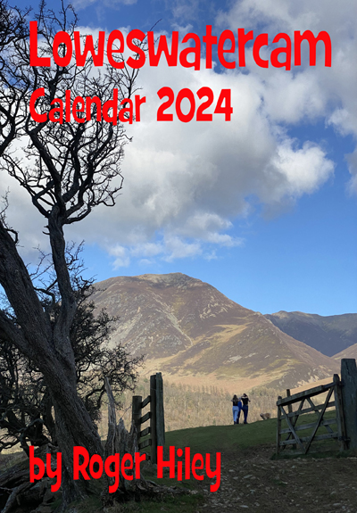
In the layby on our return I noticed these two cars parked next to each other. I sense a family resemblance . . . the same repainted colours, white roofs, similar personalised registrations. Two Mini's a whole generation apart but beautifully presented. The only thing missing was perhaps the two racing striped across the bonnet . . . but that would not be authentic on the older car would it. - - - o o o - - - Technical note: Pictures taken with my iPhone 11pro mobile phone camera. Resized in Photoshop, and built up on a Dreamweaver web builder. This site best viewed with . . . memories of restoring my old 850cc Mini. Go to Home Page . . . © RmH . . . Email me here Previous walk - 13th Oct 2023 - Buttermere Round The Lake A previous time up here - 27th April 2006 The Easedale Fells and Sergeant Man Next walk - 17th Oct 2023 - Dent, Flat Fell and other Walks - - - o o o - - - Talking of similarities . . . this year's calendar is similar to last years, except the pictures and dates have been changed . . .
|
|||||||||||||||||||||||||||||||||||||||