|
|
|
 |
Remember: Press F11 for a
full screen view of this page. |
Web Counter when published 2
067 675 |
|
" The River Derwent - by the Sea " Date & start time: 12th March 2023. 10.30 am start. Location of Start : Barepot, near Workington, Cumbria, Uk. ( NY 013 293) Places visited : Barepot, the Church, Hall and Village of Camerton, then back via Seaton. Walk details : 5.4 miles, 275 ft of ascent, 2 hours 20 mins. Highest point : Seaton Village, 215 ft - 66m above sea level. Walked with : Loes, myself and the dogs, Dylan and Dougal. Weather : Overcast, forecasting rain later.
|
© Crown copyright. All rights reserved. Licence number PU 100034184. |

|
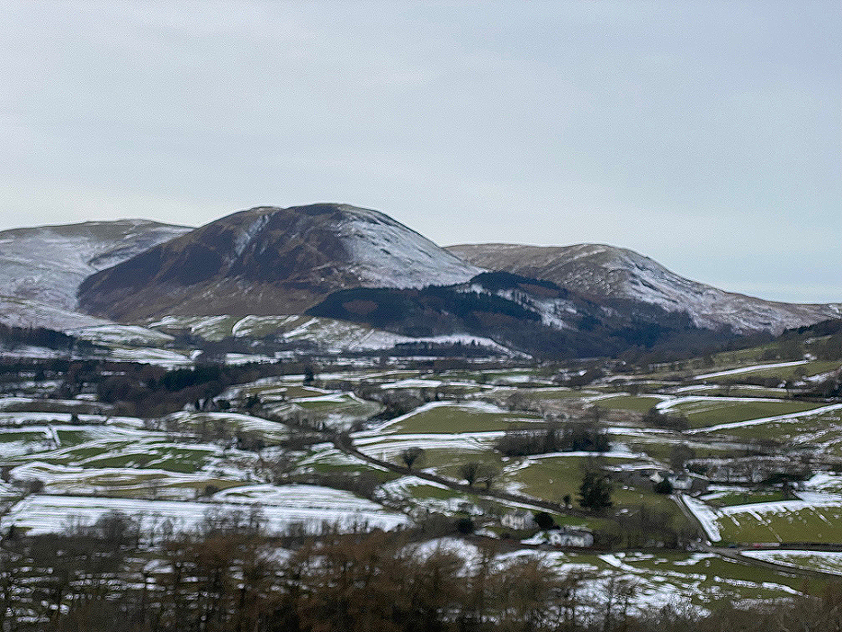
The snows of the 10th March melted quickly due to the mild air moving north, as it followed the warm front moving across the country. Next day I had a local walk up onto Scale Hill with the dogs and the valley was looking very different indeed.
Gone was most of the valley snow and the fells were looking rather more devoid of that consistent whiteness.
This was the panorama from the top of Scale Hill (Brackenthwaite Hows) this mild morning. Click here or on the photo above for a 360 degree annotated panorama.
The loweswater Pheasant, the woodland on Carling Knott, was looking rather moth-eaten due to the tree felling work of recent weeks. - - - o o o - - - On the Sunday, Loes and I chose a walk closer to the coast, as the forecast for Loweswater was for early rain. The prospect for the Workington area suggested it might be clear till midday.
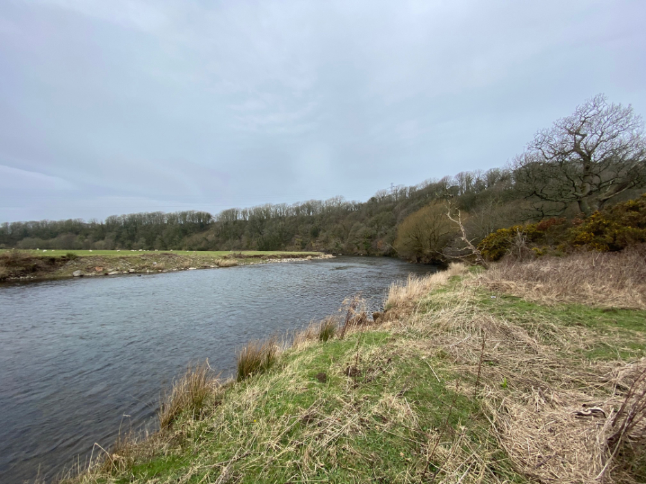
Hoping for dry but suitably dressed for rain, we parked at Barepot. The village is just up river from Workington, a mile or two from where Keswick's River Derwent meets the sea.
From the top of the slight flood embankment we could see the river and our route was along the footpath taken by these other visitors. This area is all new to me, but this will be a walk often done by Loes when she used to live in St Bees.
First stop is a magnificent diagonal weir, a huge structure spanning probably four times the width of the river. This area, as we will find, must have been full of industrial activity, of which only tantalising traces remain. The mill fed from this weir is still there but the mill leat is hidden by trees and can't be seen crossing the adjacent field.
A modern water measurement station sits on the edge of the river close to what seems like a hidden water extraction point.
On the footpath before Salmon Hall (see map above) is an old mill with a large water wheel, sadly it's in a poor state of repair. A drive shaft from this wheel even crosses the yard and presumably drove machinery in the building to the left.
The old leat behind it splits in two just above the mill, but the water turns right and the section beneath our bridge is no longer in use. It once fed to a mill pond behind the houses at Barepot where we parked the car. Somewhere here an old railway track also crossed the stream right to left.
Just a short distance further on, a delightful low arched bridge over the large water leat.
Through the trees is another engineered weir that was feeding water into the mill channel. The old railway track would have crossed the field behind.
Our riverside path has climbed up through Scarbank Woods and around the top of an escarpment carved out by a large meander of the river. We're close now to the houses of Seaton Village, including these two with extremely large mown lawns stretching down towards the river.
What goes up must come down . . . and we follow a stepped footpath back down to river level.
Looking back at the woods, the village of Seaton is up there but out of sight.
On the banks of the river, seemingly this side only, was the remains of a railway bridge, one of five crossings of the river on the route up towards the old workington to Cockermouth railway line. The other side of this bridge has probably been scoured away by the floods.
A slight jump up-river now to Camerton Church and its graveyard perched on high ground on the inside of the next river bend.
On the way round to Camerton Village we passed Camerton Hall, seen over the wall of their private grounds. The house seems to be offering "De Fenzi Relaxation classes for inner peace and personal development".
Looking back down the village street of Camerton, past a converted chapel on the right. - - - o o o - - - Time to head back to the car after our winding route up alongside the Derwent. Our return leg involved climbing the steep road out of the village, quite a pull up but thankfully not muddy. On the top of the hill we found another old railway track running parallel to the road. This one, again disused, had been paved as part of the West Coast cycle way.
See . . . told you so !
We branch off the main road through the village and join an old footway that follows the garden walls on the right.
It skirts the front of the remaining houses in the village . . . it must be quite an old path.
Seaton enjoys views over the river and across to Great Clifton on the other side. The buildings on the valley floor are the old mills that we passed soon after the start of the walk. Down below is a light brown crop of something in two of the fields.
They turn out to be willow, a cash crop planted for harvesting for their bio-mass potential. It can be cut a foot above ground level then chipped to feed into bio-mass boilers. The crop is being effectively pollarded and so re-grows every three or four years.
The smudge on the photo means it's stared raining. We've done well as it's 12.45 and the rain was forecasted for 12-ish. This final junction before the road is noteable for the ditch to the left which is the same dried up water leat that we saw earlier in the walk.
The mill pond at Barepot shown on the map, can't be seen from the road but still presumably exists. In front of it are the three United Utilities buildings, presumably linked to the water extraction building we saw alongside the river.
At the end of the walk, the big weir on the River Derwent comes into view once again. It seems that despite the mills having closed, the water extraction means that this weir is still very much in use. - - - o o o - - - |


Technical note: Pictures taken with my iphone 11pro Camera.
Resized in Photoshop, and built up on a Dreamweaver web builder.
This site best viewed with . . . A friendly (female) walking guide for a new area.
Go to Home Page . . . © RmH . . . Email me here
Previous walk - 10th March 2023 - Snowy Holme Wood Walk
A previous time up here - 24th March 2007 Seven go to Esk Pike in the sun (Sprinkling Tarn - source of the Derwent)
Next walk - 14th March 2023 - Snowy Coffin Route