|
|
|
 |
Remember: Press F11 for a
full screen view of this page. |
Web Counter when published 2
024 190 |
|
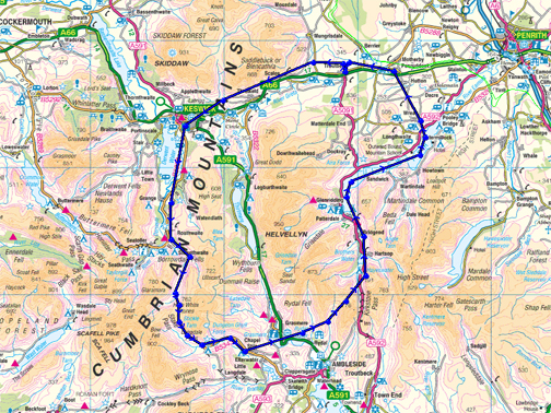
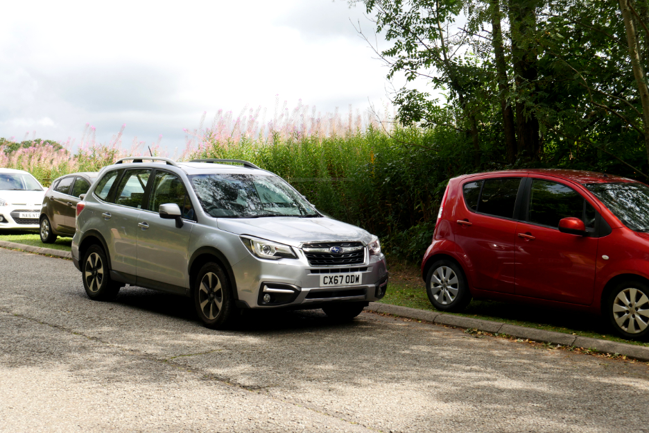
" Flying in for a Fell Walk " Date & start time: 31st August 2022. Location of Start : Northampton for Ian and Mark, Loweswater for myself and Loes. Places visited : Troutbeck Flying Club. (close to the A66). Walk details : 4.8 miles, 910 ft ascent, 1090 ft decent, 2 hours 40 mins. Highest point : Latrigg, 1,203ft - 368m. Walked with : Ian, Mark, Loes, Myself and the dogs, Dylan and Dougal. Weather : Fine and dry with reasonably high cloud. One shower. Map: Ian and Mark's journey to the Lakes this morning. |
© Crown copyright. All rights reserved. Licence number PU 100034184. |
 |
 |
Flight Path around the northern
Lakes. |
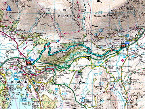
Our latrigg Fell Walk today. |
|
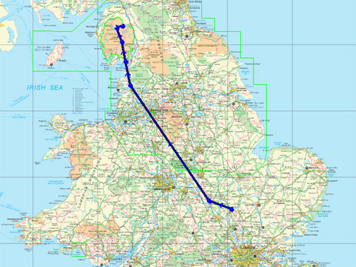
An unusual one this time as the three maps indicate. Ian, who lives in Bedford's Captain Tom's village of Marston Mortaine, has a son who's a commercial pilot but also has shares in a light aircraft. Mark wanted more small plane flying time and offered to fly his dad to Cumbria, so that Ian could do a Cumbrian fell and back, in a day from home. Helvellyn has a reputation for landing aircraft but it is a bit rough and no doubt frowned upon nowadays, so Ian was looking for someone to drive them from the club airstrip at Troutbeck (on the A66) to the nearest fell. Who lives in Cumbria and has a car ? He knew just the chap . . . we'll offer him the bribe of a free flight !
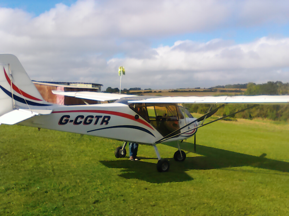
A real composite of photographers and cameras makes up today pictures After a favourable forecast Ian and Mark prepared to take off from Northampton in their light aircraft. Think "Cessna" only smaller, two seater, single prop, single joystick for controls, thermos flask if you get cold ! To be fair it was a beautiful little aircraft, comfortable with full electronic navigation aides and Gps.
[ Often the pictures were slightly blurred due to looking through the perspex of the cockpit windows.]
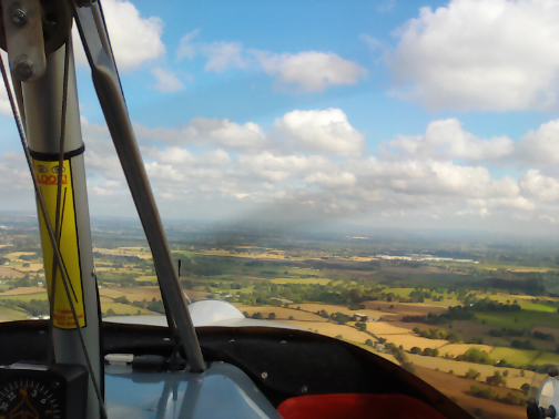
You can travel with the top section of window open to improve the view. Here Mark is flying over Steel Fell, heading up the Thirlmere Valley towards our rendezvous point . . . with Skiddaw and Blencathra ahead ! - - - o o o - - -
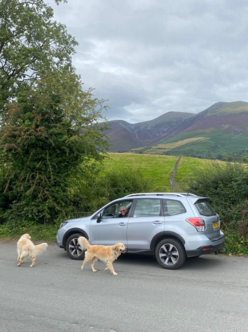
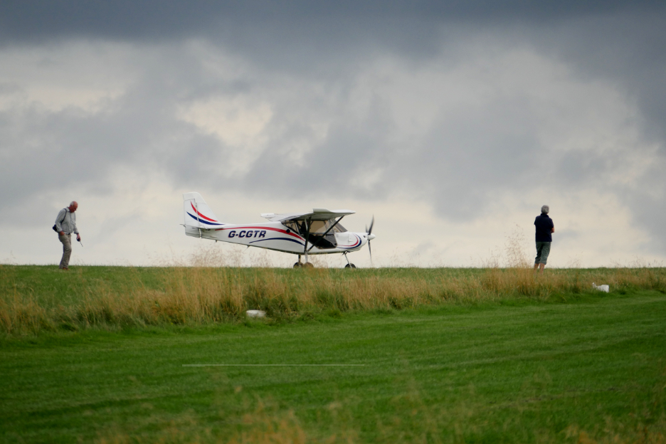
Meanwhile the ground crew were in position, ready for their arrival. I was looking in the skies to the right, thinking they would have followed the M6 from the south, if only to simplify navigation.
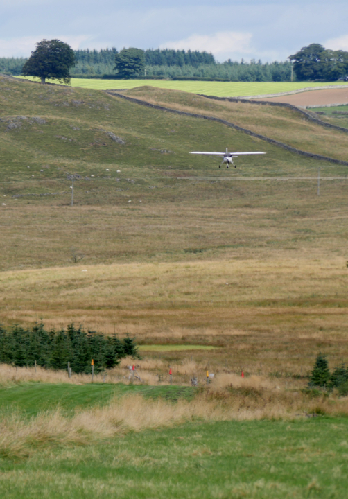
We became aware of a light aircraft arriving on time but from the westerly direction. Unknown to us at the time was the fact that they had taken the scenic route up through the centre of the Lakes.
A soft landing . . . even the plane was looking happy !
Taxiing to a stop, away from the runway.
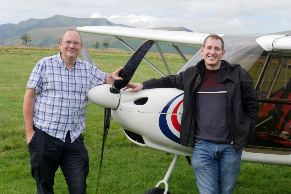
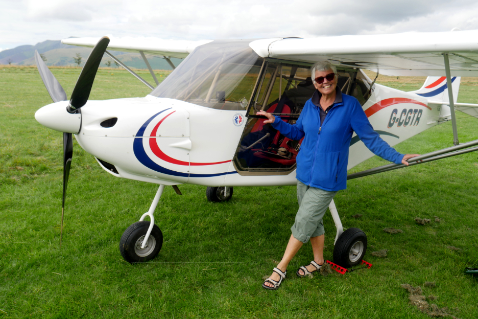
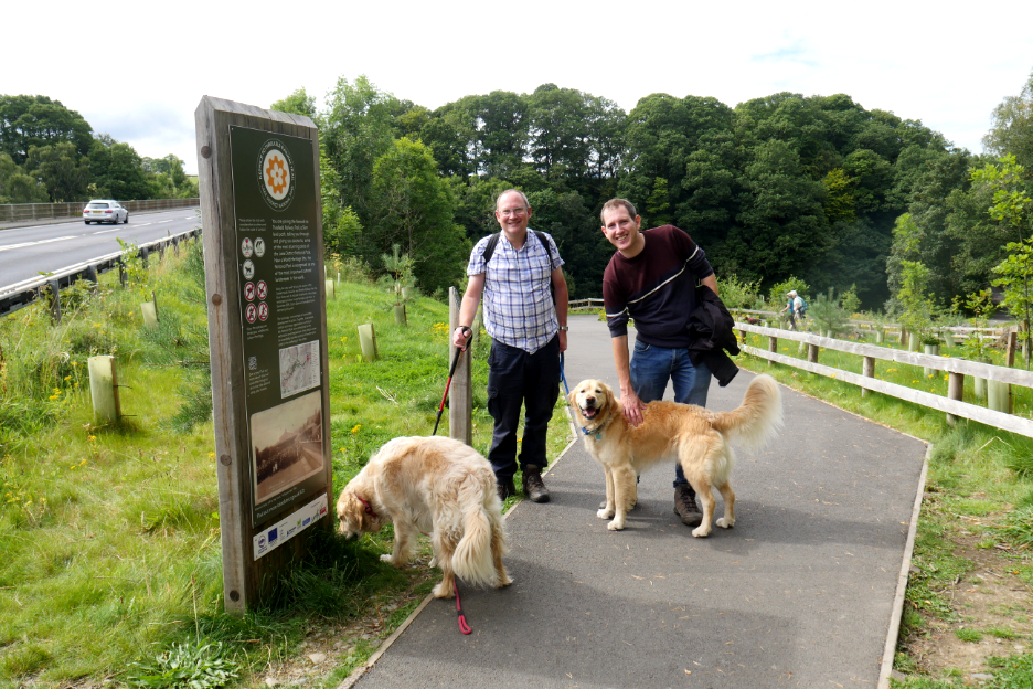
Dr Livingston I presume ! Ian and his son Mark after their hour and a half flight from the Midlands to Cumbria.
The plane is a two seater but they somehow managed to fit an air hostess in the luggage rack. - - - o o o - - - The thought was that if I could provide local transport and a suitable fell walk then I might like the opportunity of a quick flight around the northern Lakes . . . it would be churlish to say no !
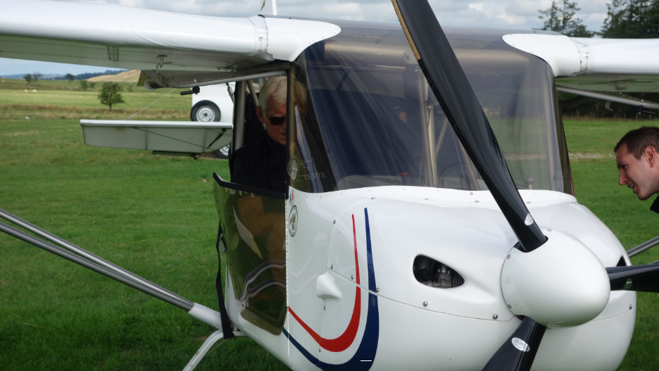
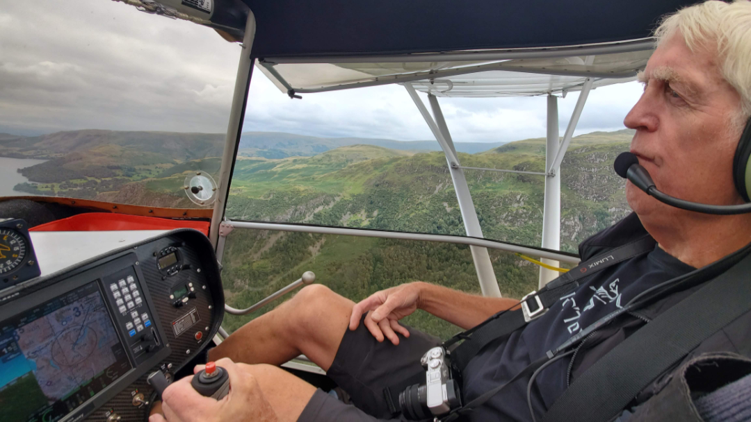
After quarter of an hour or so, Mark was ready to take to the skies once again. I took the co-pilots seat, as mark instructed me as to what I could and could not touch and where to put my size 12 feet !
We swung the plane around and prepared for takeoff.
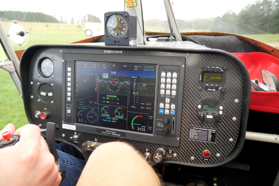
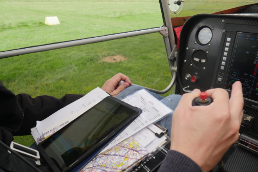
The comprehensive Gps and flight information dashboard included all the usual information about the aircraft, e.g. speed altitude, etc, plus a full navigation system with Ordnance Survey and 3D photo mapping.
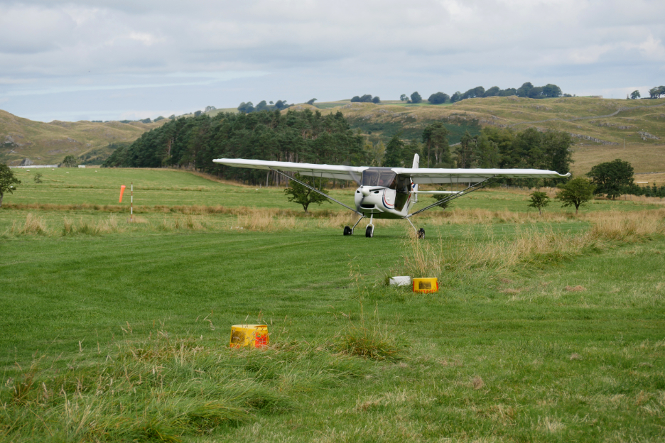
Ground crew photo of the pre take-off taxiing.
With a increase of the throttle the plane surged forward and before I knew it we were airborne. - - - o o o - - - Where do you fancy going was the question ?
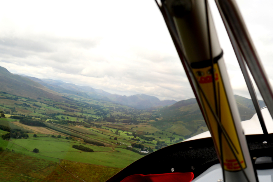
The aircraft banked as we headed back towards Keswick . . . climbing to an altitude of 1,500 to 2,000 feet.
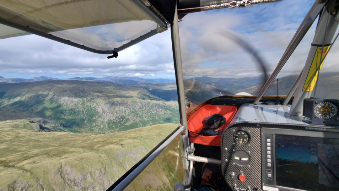
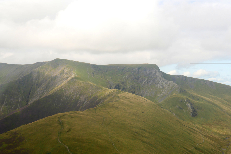
Immediately I was captivated by fresh views of familiar fells . . . This was Blencathra with its grey coloured arête of Sharp Edge.
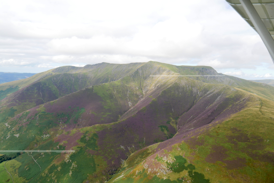
The heather provided a deep purple to the southern slopes of the same fell.
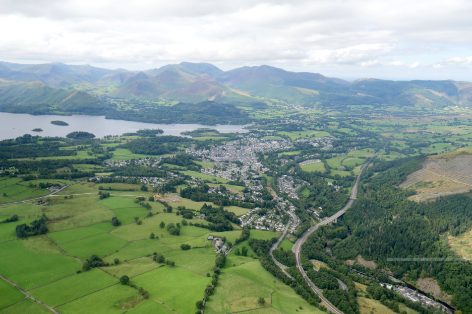
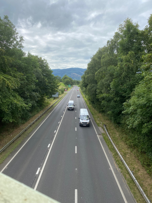
Far below was the gradual curves of the A66 roadway, heading west towards Derwent Water.
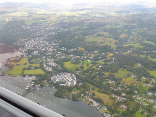
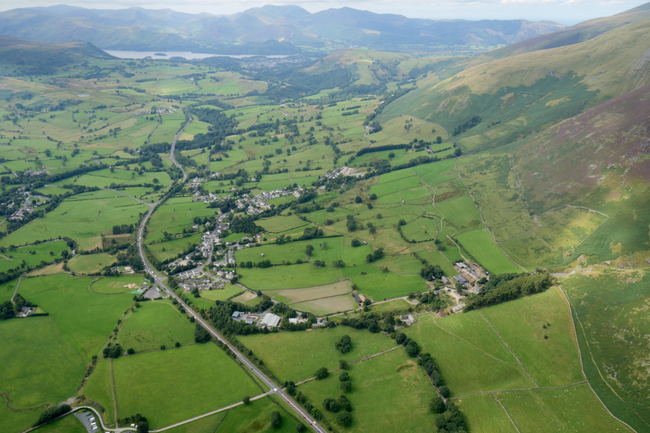
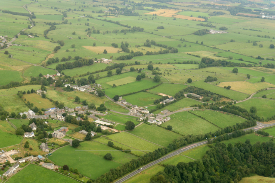
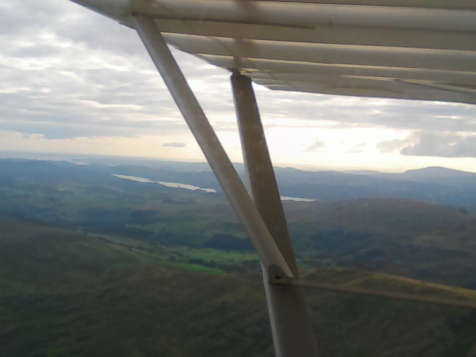
Keswick seen from the air. The general rule was that you should not be lower than 500 feet above any habitation. Our altitude here also gave us confidence to fly through the high fells ahead and avoid any paragliders.
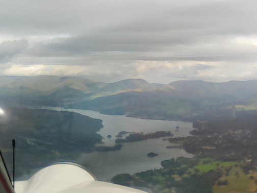
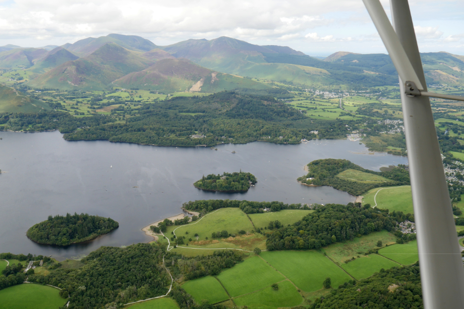
The islands of Derwent Water with Causey Pike, Eel Crag, Grisedale Pike and the North Western Fells beyond. We descended slightly for a better view of the lake.
Recognise the trees and the rock escarpment ? This was Walla Crag to our left.
Passing over the delta as the River Derwent enters the lake at Lodore.
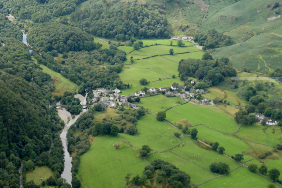
Grange Village with its double arched bridge over the Derwent.
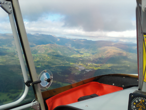
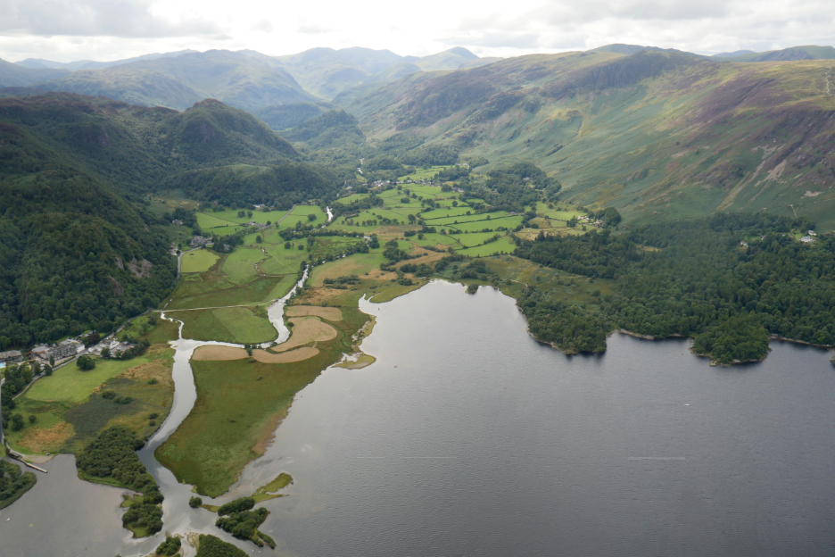
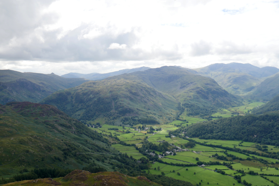
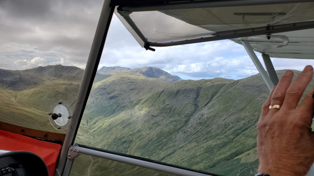
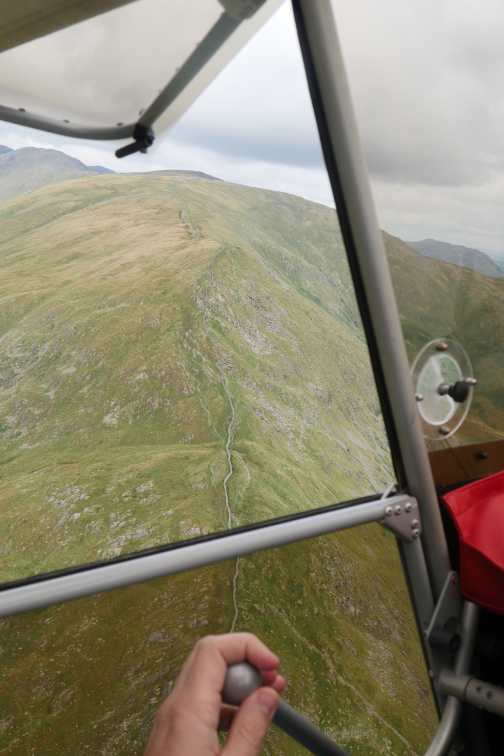
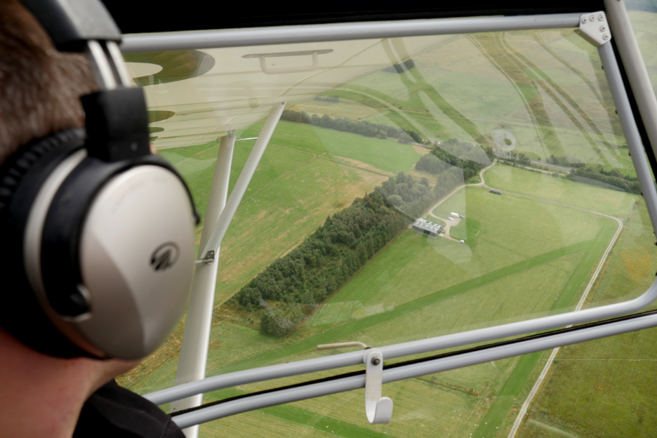
Rising slightly over King's How and approaching Rosthwaite. Pike O'Stickle can be seen to the left, Bowfell in the centre and Scafell Pike to the right.
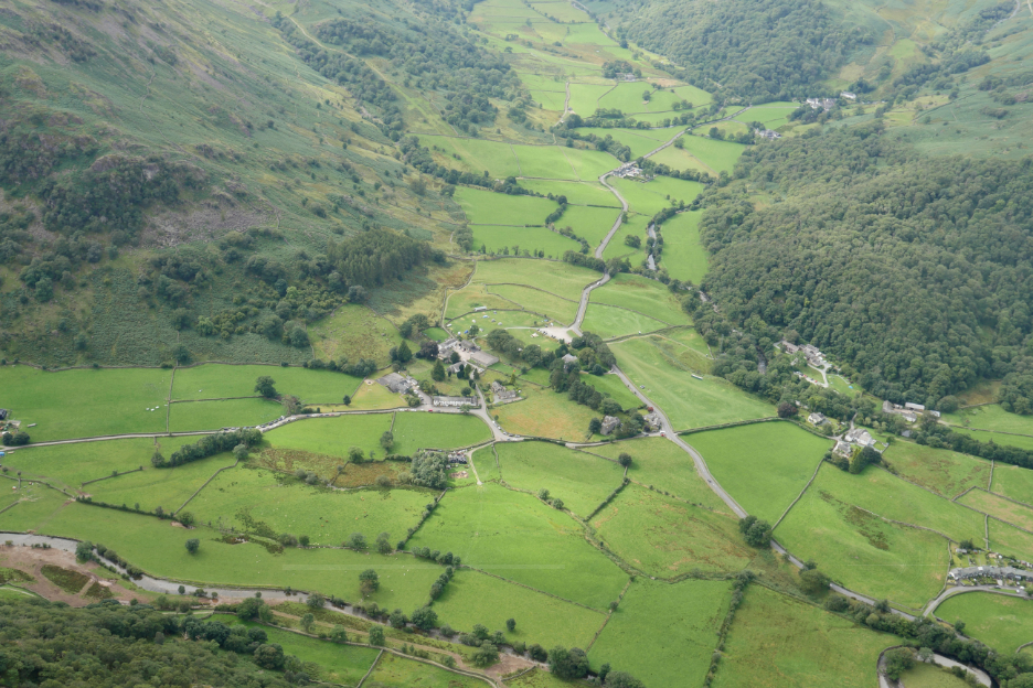
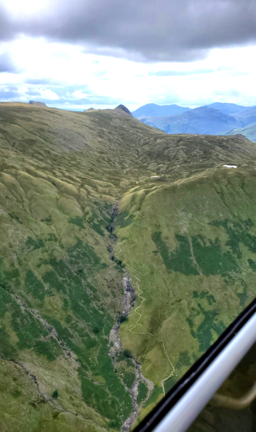
We bank left at Chapel Farm and head into the Langstrath Valley. Not too many tents on the campsite today.
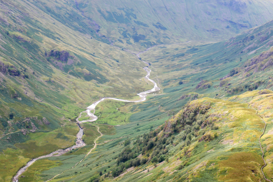
Into the long valley of Langstrath . . . the track below leading to Blackmoss Pot, a favourite swimming spot for many.
Looking out through the open window at Great End and Scafell Pike, the highest summit in England.
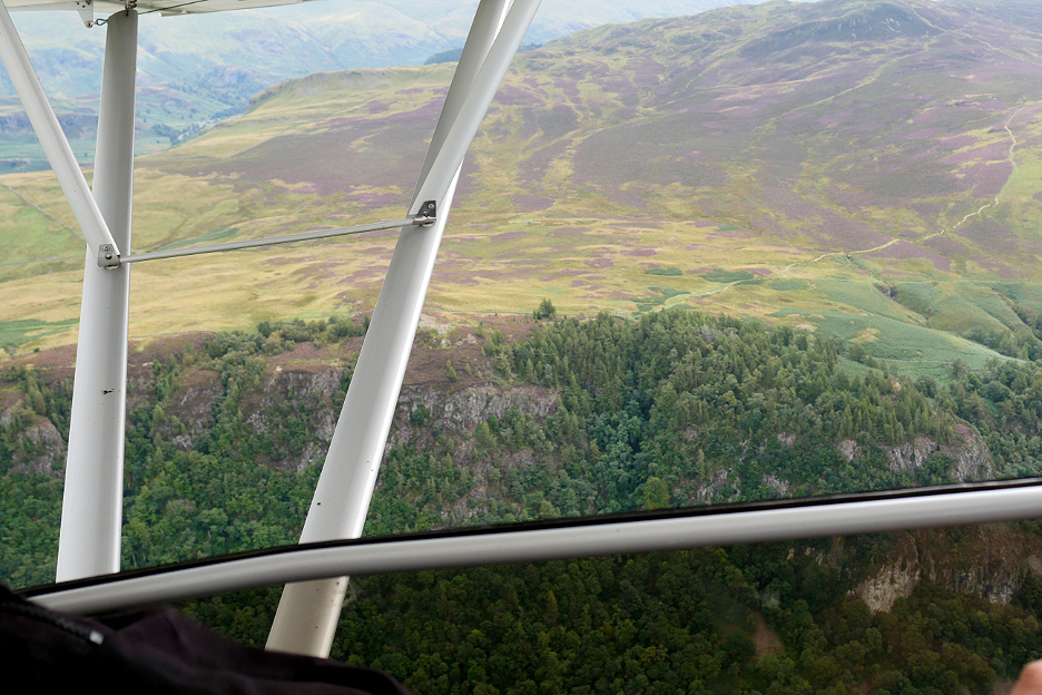
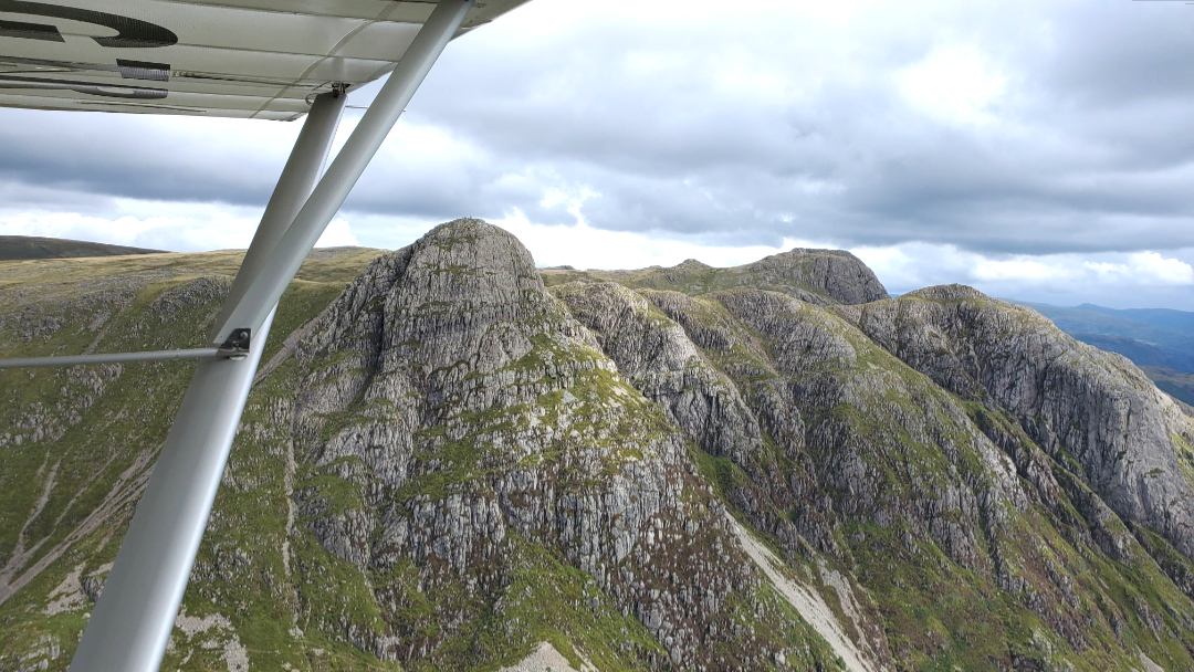
The unmistakable shapes of the Langdale Pikes . . . but seen from an unusual angle. We have to stay 500 feet above the ground below, but that does mean we can't fly lower than the summits.
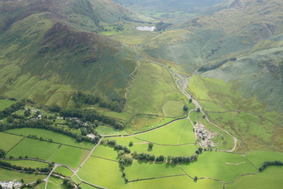
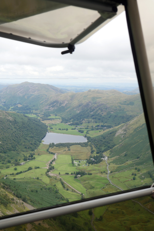
Looking down now as we fly towards Side Pike. Below is the National Trust campsite, the sprawling Wall End Farm and Blea Water on the approach to Little Langdale.
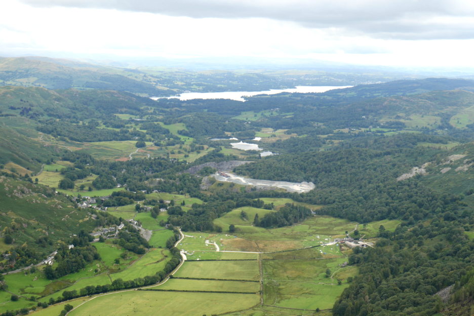
We flew down the main Langdale Valley and on towards Windermere. Chapel Stile is the housing seen on the left side of the valley, with Elterwater Quarry ahead.
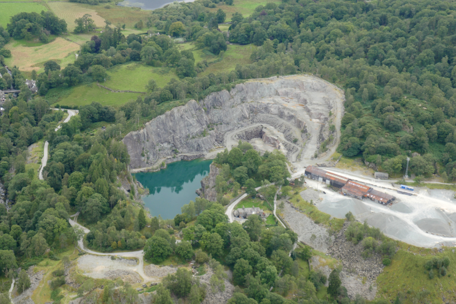
The deep azure blue of the pool of the now closed Slate Quarry, with our aerial view clearly showing the rock terracing of this deep fissure into the valley floor.
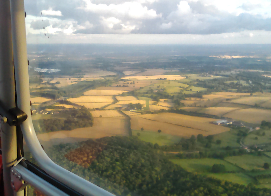
Our route was not planned in detail so as Ian and Mark had flown north over Grasmere and Dunmail Raise earlier in the day, Mark and I decided to continue more to the east, towards the Haweswater area.
Keeping an eye out for any low flying RAF planes, but then they would probably have flown below us anyway ! Marks real time navigation did warn of registered flying events such as hand gliders or military exercises, but there were none scheduled for here today.
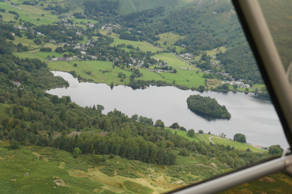
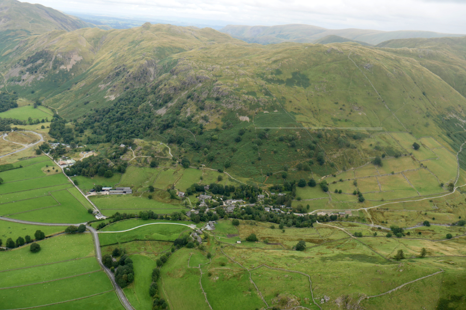
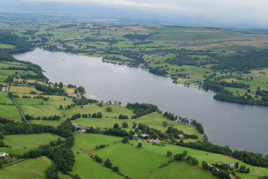
A slight change of route due to the time constrains, as we turn to follow the valley down to Patterdale. Below us was the village of Hartsop and its delightful old housing.
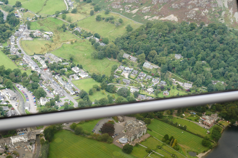
Glenridding and the road to the Greenside Mine through the open window with the 'Inn by the Lake' seen through the perspex below the bar.
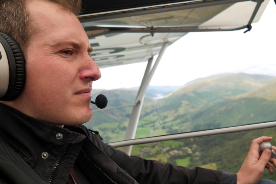
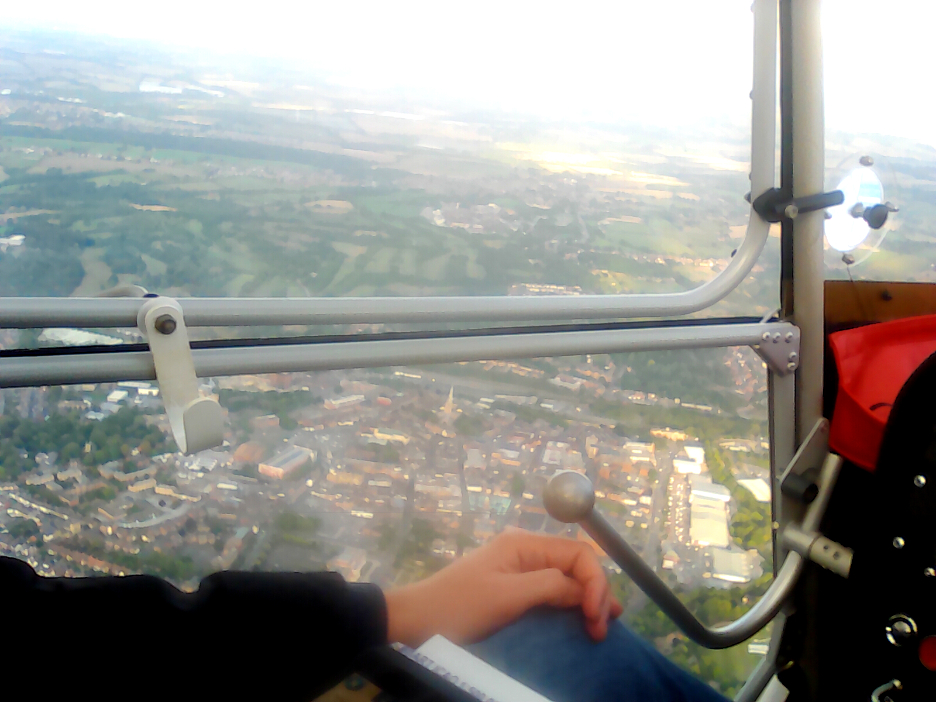
There was only one control stick but two sets of pedals, so I was able to have a turn at flying the plane. The co-pilot has the disadvantage of having to fly this aircraft left-handed, well at least that's my excuse !
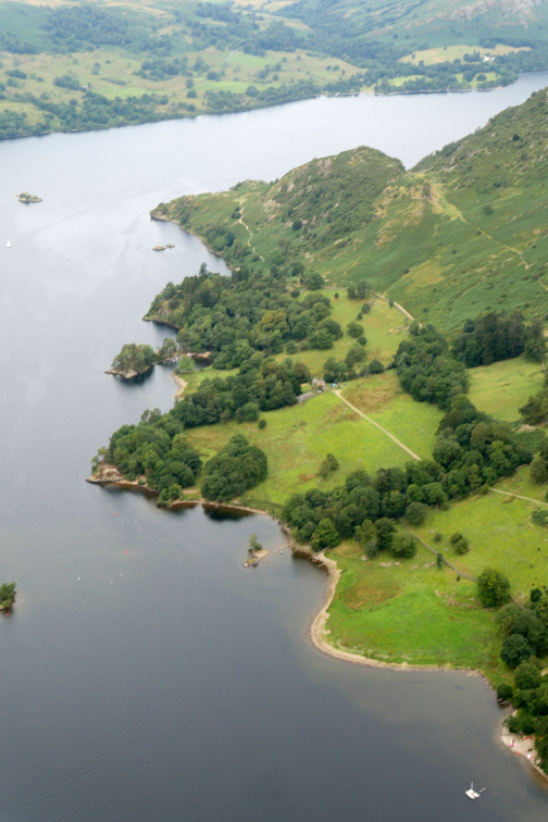
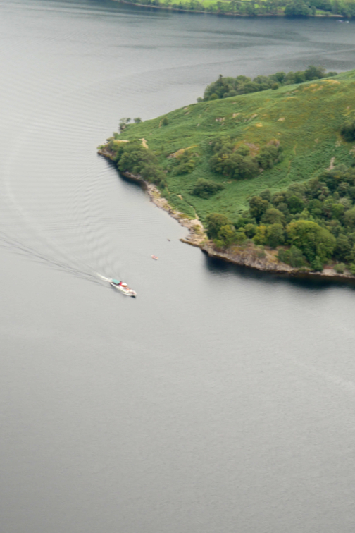
After flying over Silver Point and several of the Ullswater Steamers it was time to head north once again, leaving the lower reach of Ullswater to the yachtsmen and their boats.
Penruddock below . . . we could drop in for some bird food at Birds Bistro !
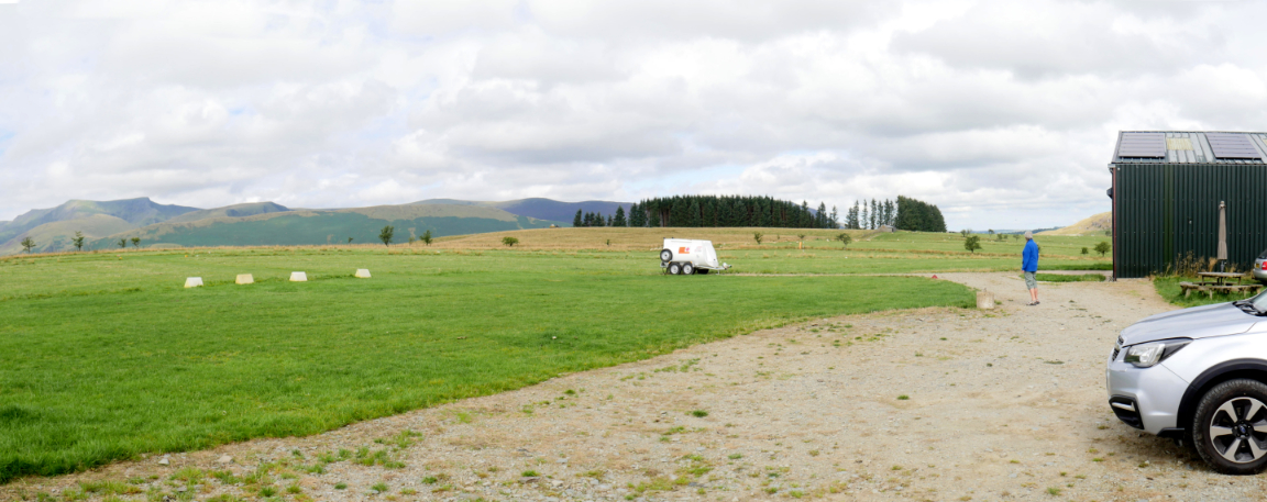
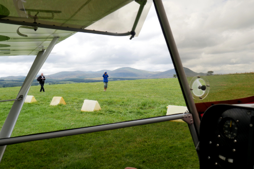
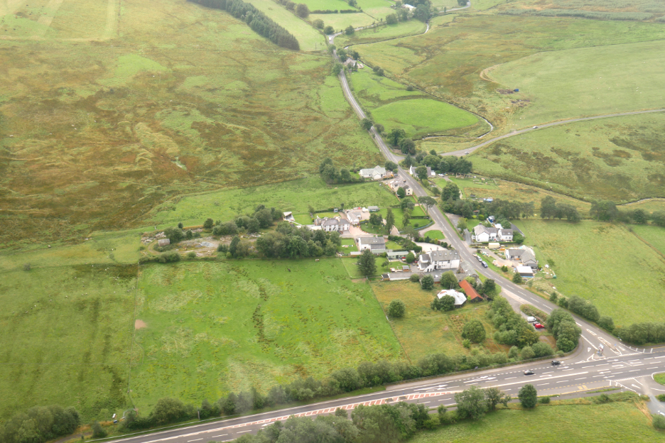
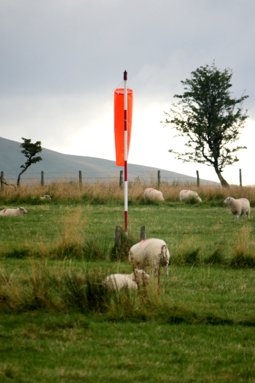
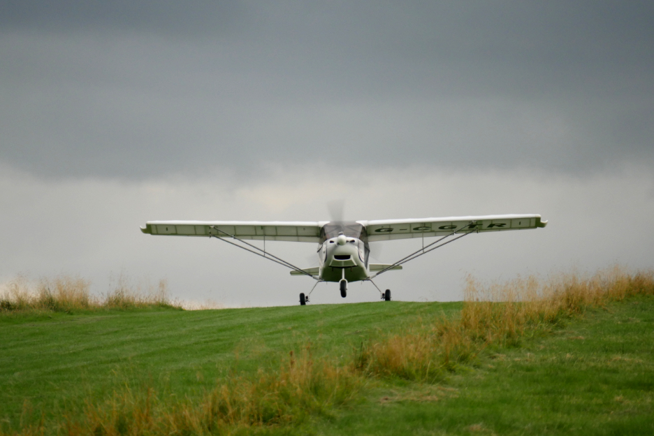
But no sooner than we reached it than we were flying quickly past, circling around Troutbeck on our approach to the airstrip.
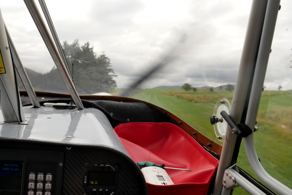
Mark checking the wind direction and making sure there were no sheep on the runway.
Another faultless touchdown . . . more seat-of-the-pants stuff than the Boeing 737's he more usually flies ! - - - o o o - - -
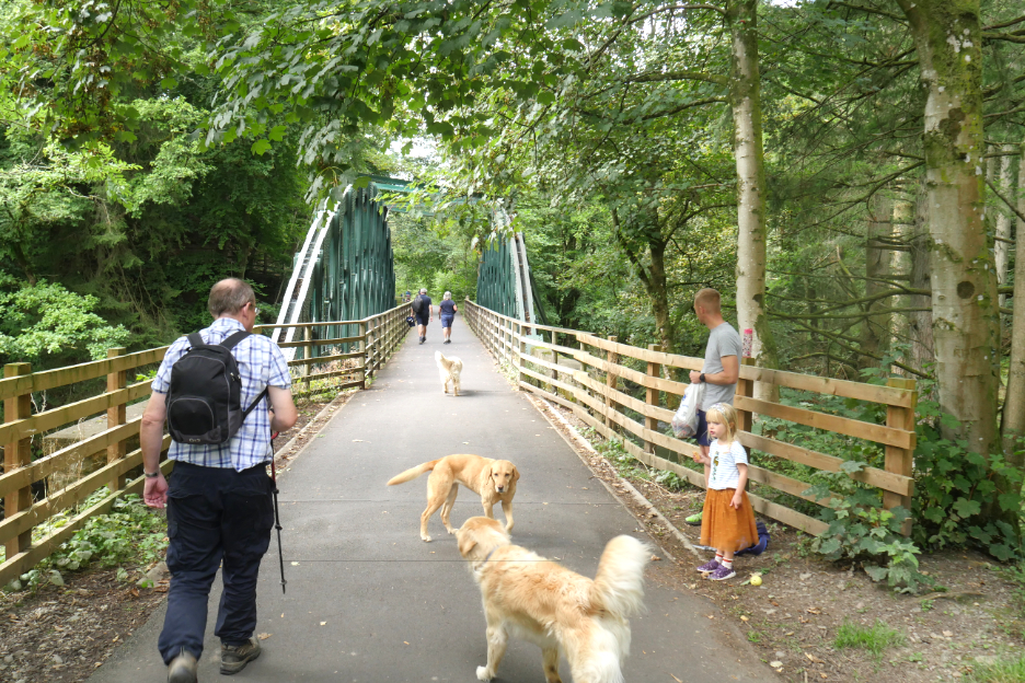
Loes preferred not to walk and she also had things to do in Keswick, so she dropped us at the railway path and headed off towards town. Here's Ian and Mark as we make a start on the old railway track down the Greta valley.
The railway closed at the time of the Beeching cuts in the early 1970's and now the track is a sustrans cycle route and all weather footpath from Threlkeld to Keswick. Three dogs ? . . . one belonged to the little girl and her dad.
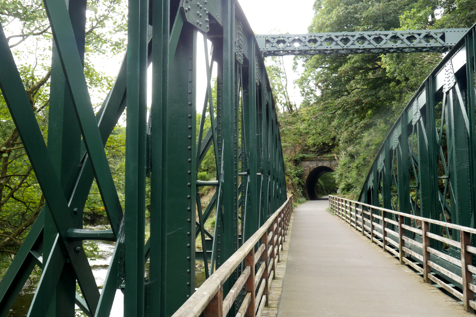
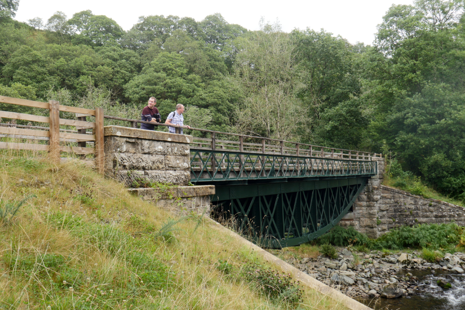
The bridges have been renovated since the devastating floods of Storm Desmond which played havoc with the old track bed and several of the bridges.
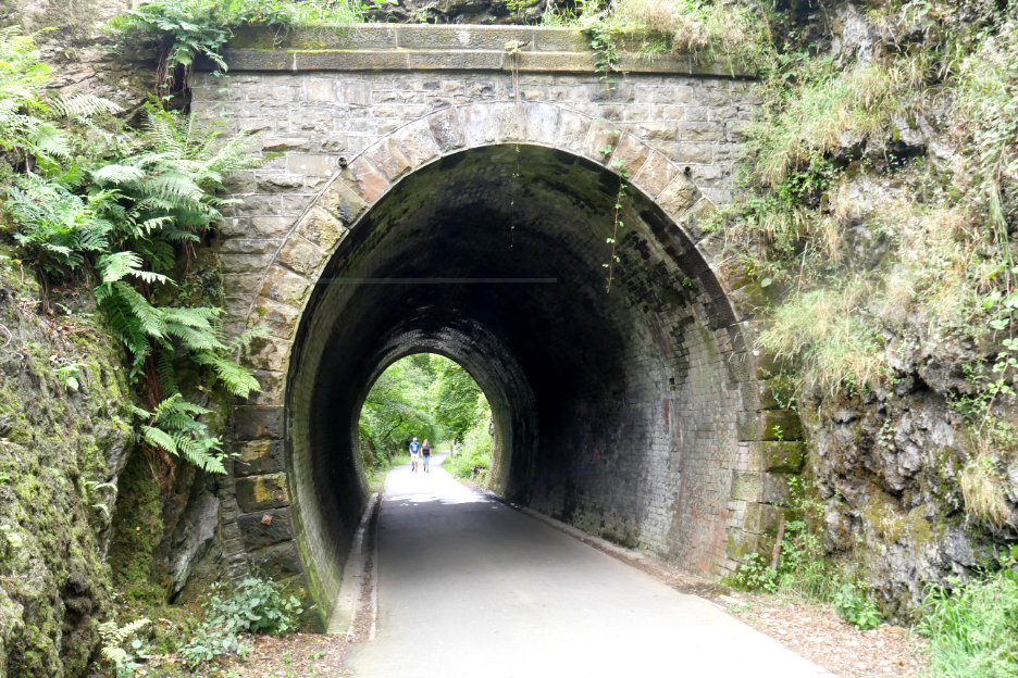
I had forgotten this short tunnel section on the way down the valley.
Some of the bridges that had sufficient height over the water were deliberately built upside down for stability and a better view.
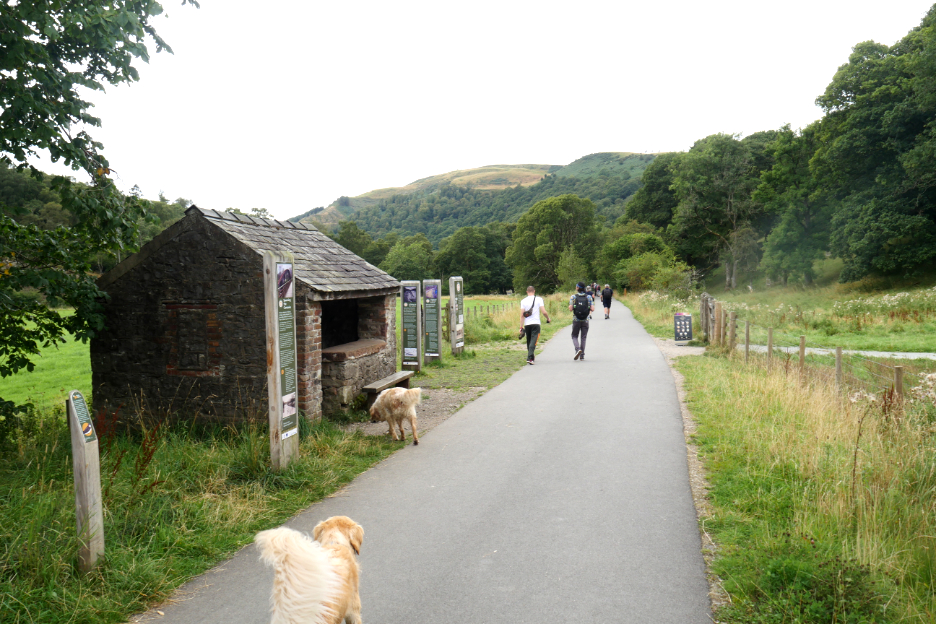
The track-side hut at Brundholme, familiar to those that walk the path. It would be where we leave the railway to start our climb up Latrigg.
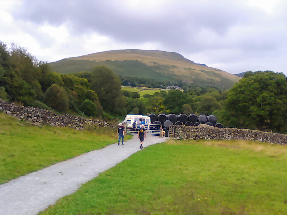
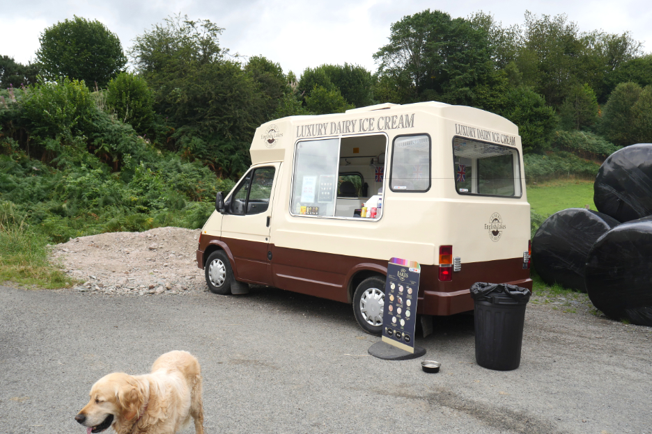
It was later than we thought but perhaps too early for lunch given the climb ahead . . . the answer was close at hand !
Refreshments courtesy of the Lakes 'Luxury Dairy' Ice Cream Van . . . strategically placed to catch the passing trade.
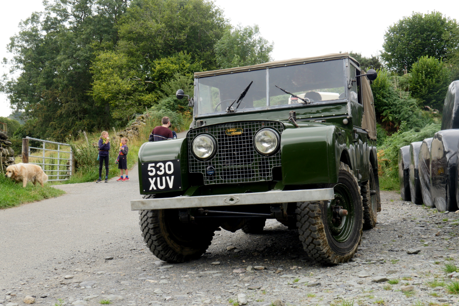
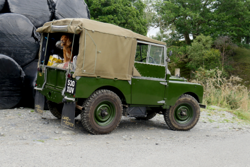
Another customer had travelled here by a beautiful Series one Land Rover, looking stunning in its classic green paintwork.
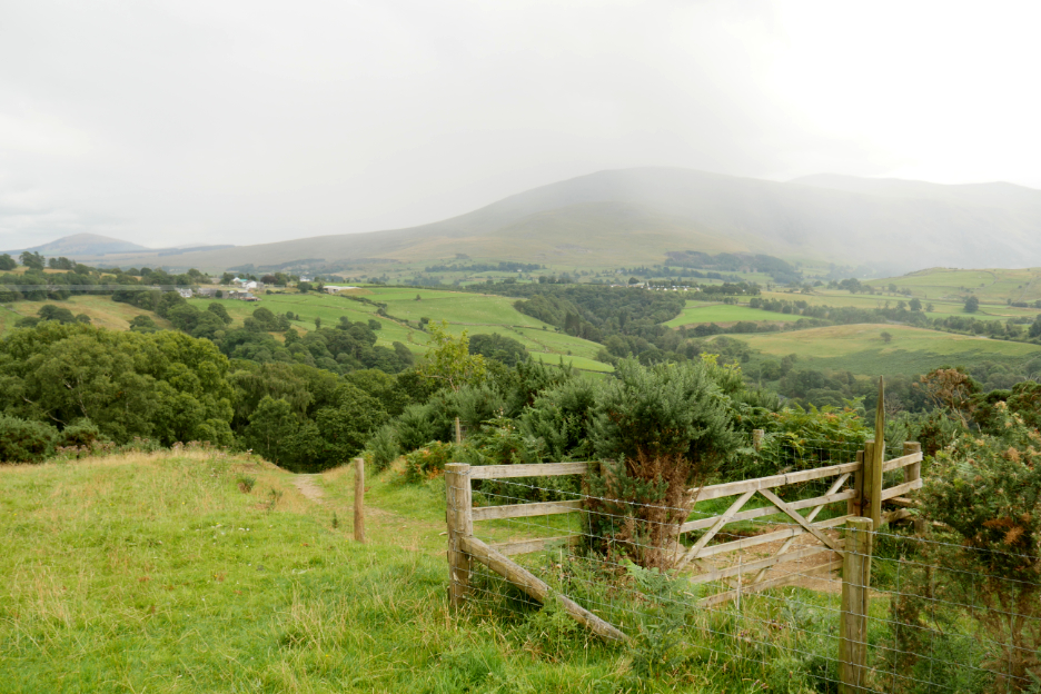
The eastern end of Latrigg is quite a steep climb, albeit on a track not footpath. As we climbed we could feel rain in the air.
Fortunately for us, it seemed to be passing by closer to Clough Head than us . . . and we hardly needed waterproofs.
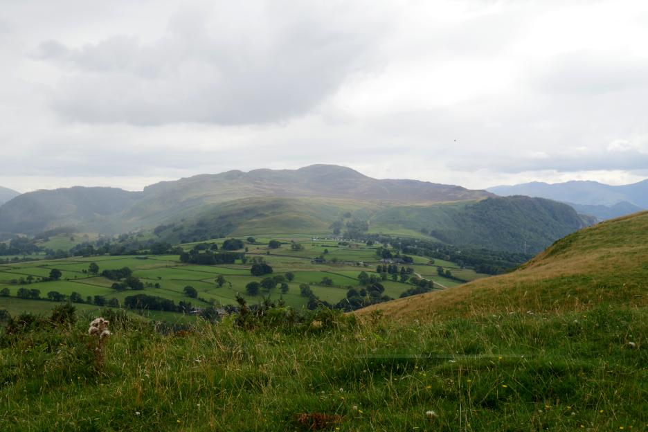
One last slope as we climbed past the Scots Pine, towards a summit that Ian had visualised all those weeks back. Okay it wasn't the summit he'd planned, but in view of the time, the weather and the great views on offer, it was perfectly acceptable.
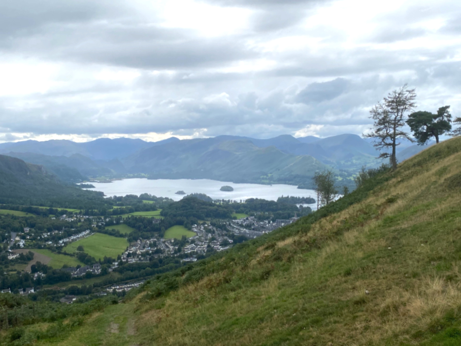
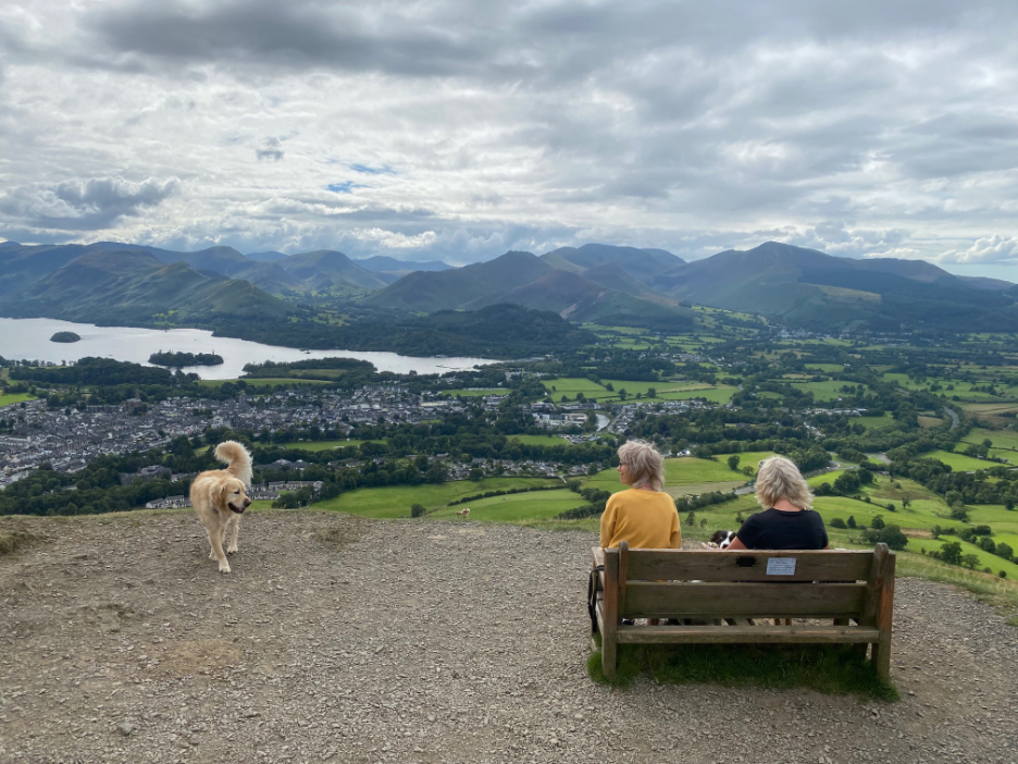
Summit achieved we felt we had earned some lunch. What better than a view down the length of Derwent Water, to calm the soul and rest the legs.
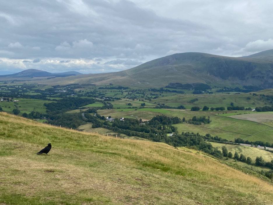
The rain shower had travelled on, leaving us clear views of Clough Head and Great Mell Fell away to the east.
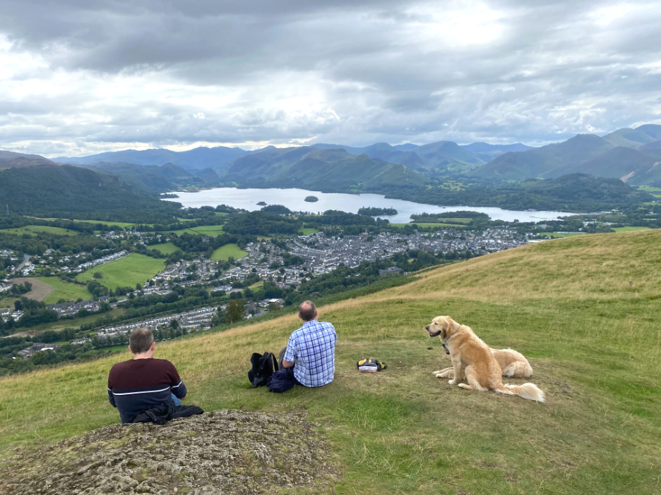
As we thought . . . the viewpoint seat was taken so we were happy that we had lunch close to the top. Time to head down now and meet up with Loes.
We followed the all terrain path and joined the Cumbrian Way as it descents through the woodlands to the base of the fell.
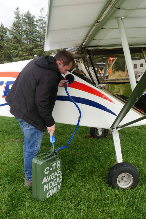
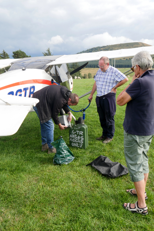
- - - o o o - - - After a trip into Keswick to buy petrol it was back to the airfield at Troutbeck.
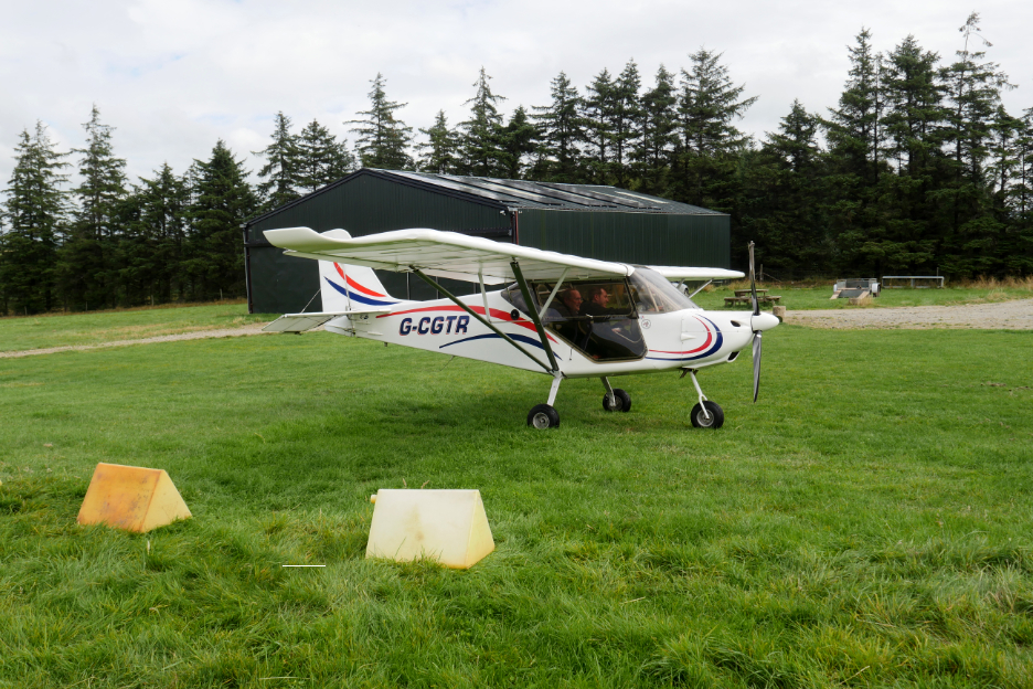
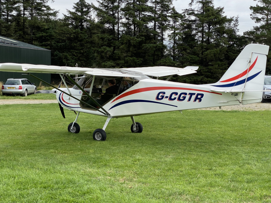
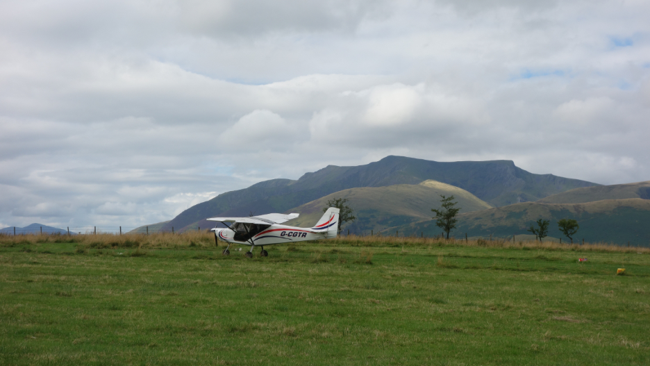
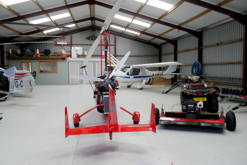
The Flying Club had really nice facilities and several stored aircraft and micro lights in the hanger. Mark paid his landing fees and signed the Visitor Book and spoke to the owner, then it was time to be leaving.
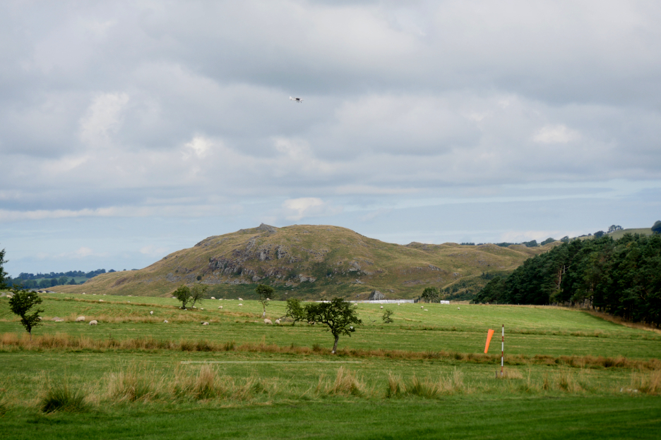
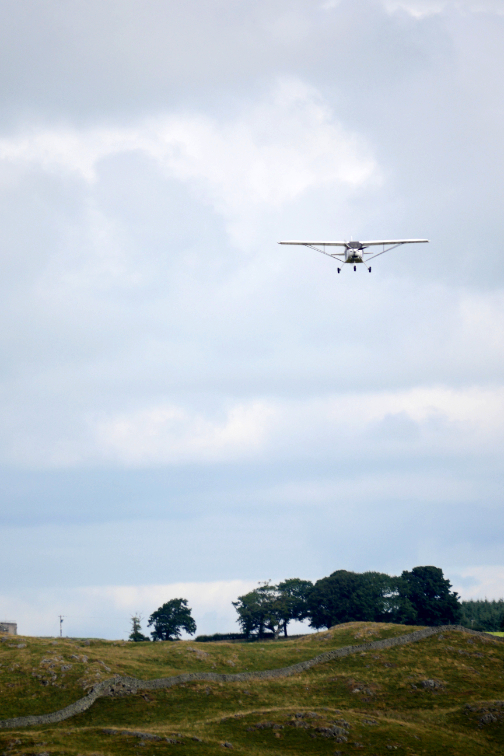
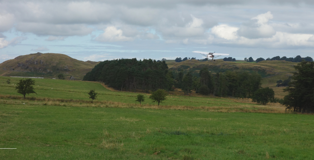
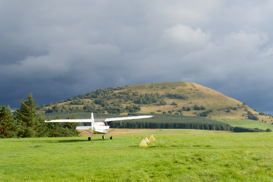
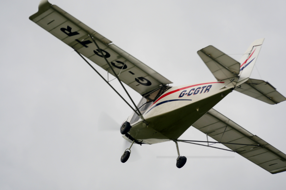
With brooding skies beyond Great Mell Fell, Mark prepared for take-off.
Taxiing along the skyline . . . yes, they are in there.
A burst of power and they were airborne.
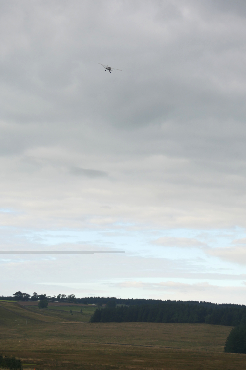
Ian sent me a few photos of their flight home . . . first via Windermere.
Passing over Chesterfield, with the crooked and leaning church spire.
. . . and finally home to the small grass airstrip near Nottingham where they had started their day. - - - o o o - - - |

Technical note: Pictures taken with my Panasonic Lumix Gx8 Camera.
Resized in Photoshop, and built up on a Dreamweaver web builder.
This site best viewed with . . . the concept of a day out in the Lakes.
Go to Home Page . . . © RmH . . . Email me here
Previous walk - 27th August - A Bog House Walk
A previous time up here - 13th April 2009 A Grand Tour of the Northern Lakes
Next walk - 4th Sept - Tim and Meile "Want to Climb"
 |
I am delighted to offer you the chance to buy The 2023 Loweswatercam Calendar. On sale now ! For the 14th annual edition of the calendar we have been looking back at the year to bring you twelve months of Loweswater pictures and Cumbrian scenes.
Click here or on either picture to see the full details. £12 a copy (plus postage + packaging if required) £1 of every calendar sold goes to support the Air Ambulance and Cumbrian Mountain Rescue.
|
 |