![]()

Remember: Press F11 for a full
screen view of this page.
|
|
|
Remember: Press F11 for a full
screen view of this page. |
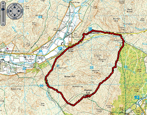
| " Harter Fell with Jenna " Date & start time: Monday 16th February 2015, 1 pm start. ( NY 213 011 ) Location of Start : Jubilee Bridge, Base of Hardknott, Eskdale , Cumbria, Uk. Places visited : Harter Fell, Deeming Crag, Hard Knott Pass, Roman Fort. Walk details : 5 mls, 2000 feet of ascent, 3 hour 55 mins. Highest point : Harter Fell, 2,140ft - 653m Walked with : Jenna, Ann and our dogs, Harry and Dylan. Weather : Overcast with sunny periods, changeable. |
© Crown copyright. All rights reserved. License number PU 100034184. |
|
On Monday Ann, Jenna and myself ventured down to Eskdale on the prospect of an improving weather forecast. Low cloud was possible but it should be brighter as the day went on ... we shall see! Harter Fell here we come.
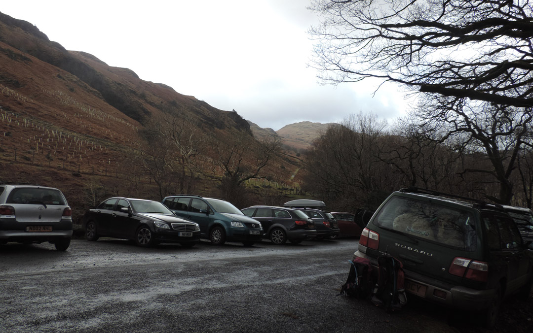
Parking at Jubilee Bridge, the wide tarmac area just above the cattle grid. It's fairly busy . . . must be half term . . . but then if it wasn't half term we wouldn't have Jenna with us today !
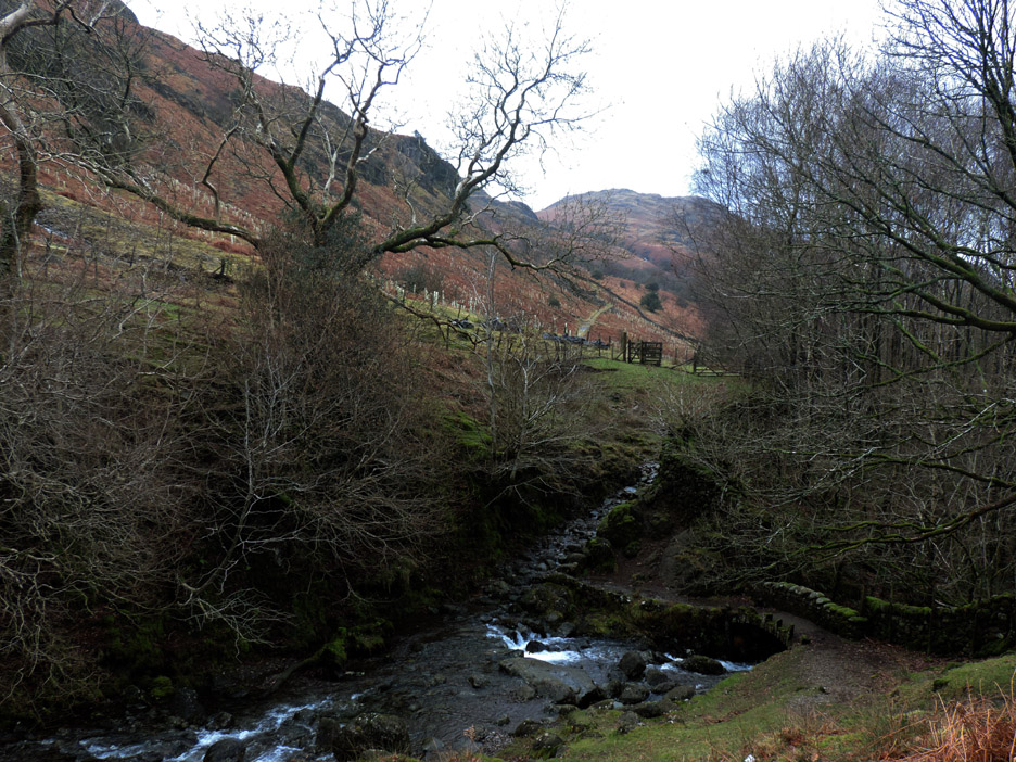
Down over the bridge and up the other side . . . our track heads off into the distance.
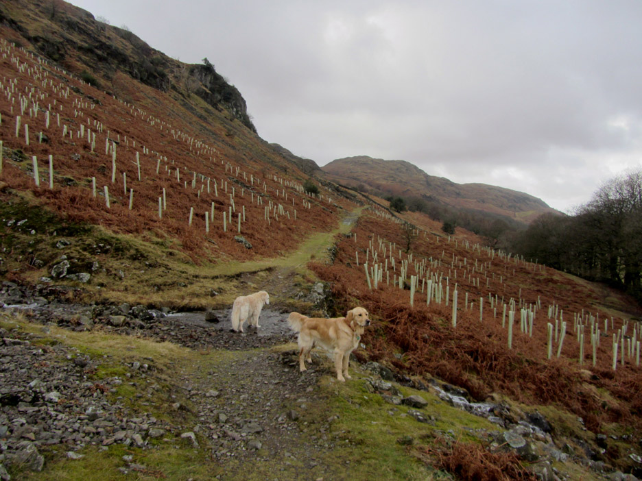
There has been a recent new planting of trees on either side of the track. In ten years time the start of the walk will be quite different if all that lot grow.
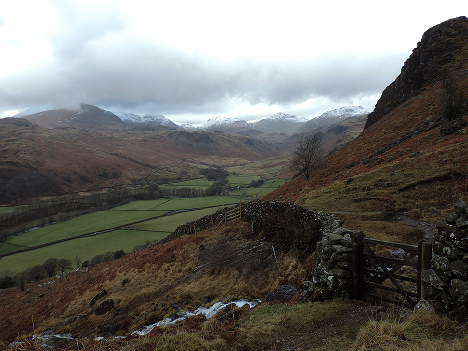
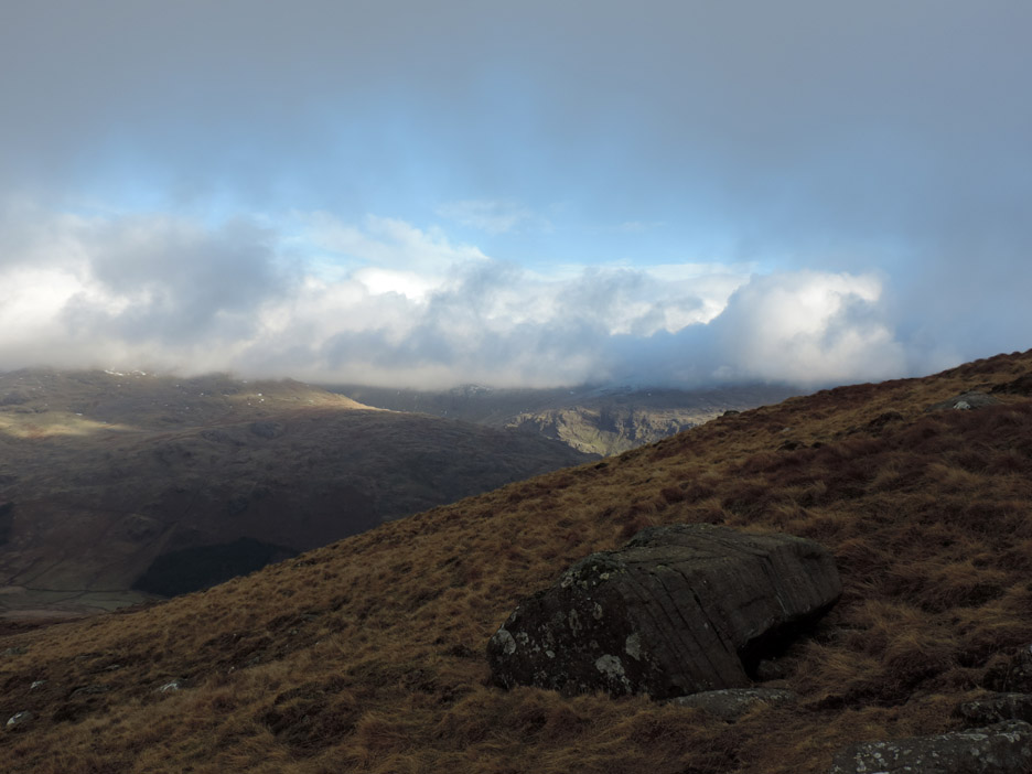
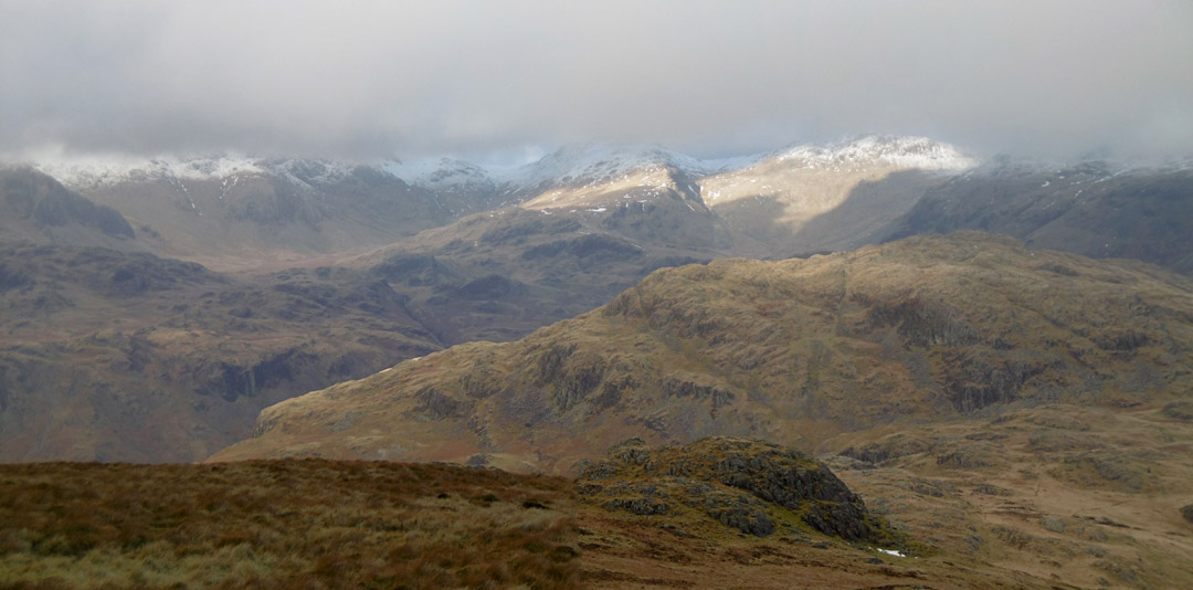
The old peat road track climbs steadily up and as we ascend, the view back of the Scafells, Esk Pike, Bowfell and Crinkles becomes more open.
Ahead . . . blue skies . . . physically and metaphorically. The old track has been worked on by the path fairies and offers a wide well drained path in places. Normally these paths are made oversize due to the machines used, but here the old track was probably that size in the first place.
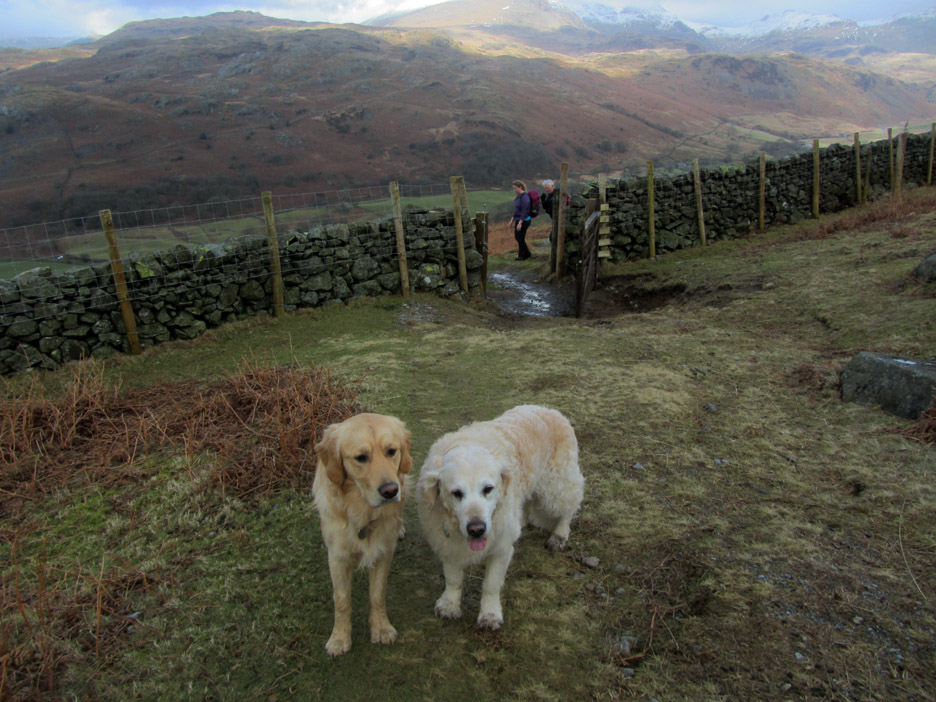
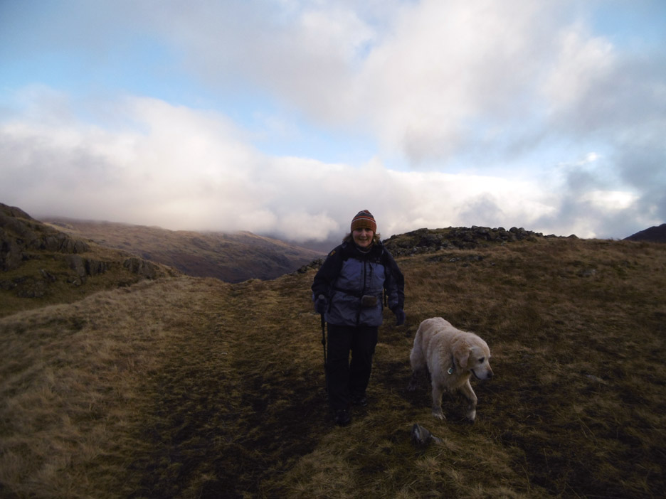
Dylan and Harry through the gate second and third . . . Ann taking the picture must have been first through. Why we are hanging back is not exactly clear to the author.
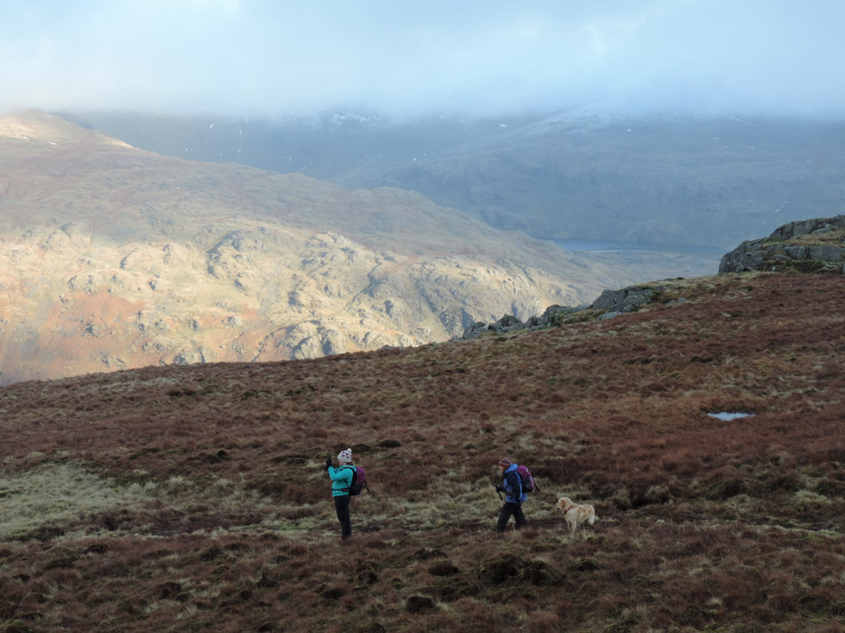
Having turned around the western end of Harter Fell we reach more level ground. Here's a last look back at the distant high fells before we round the corner and lose sight of them for a while.
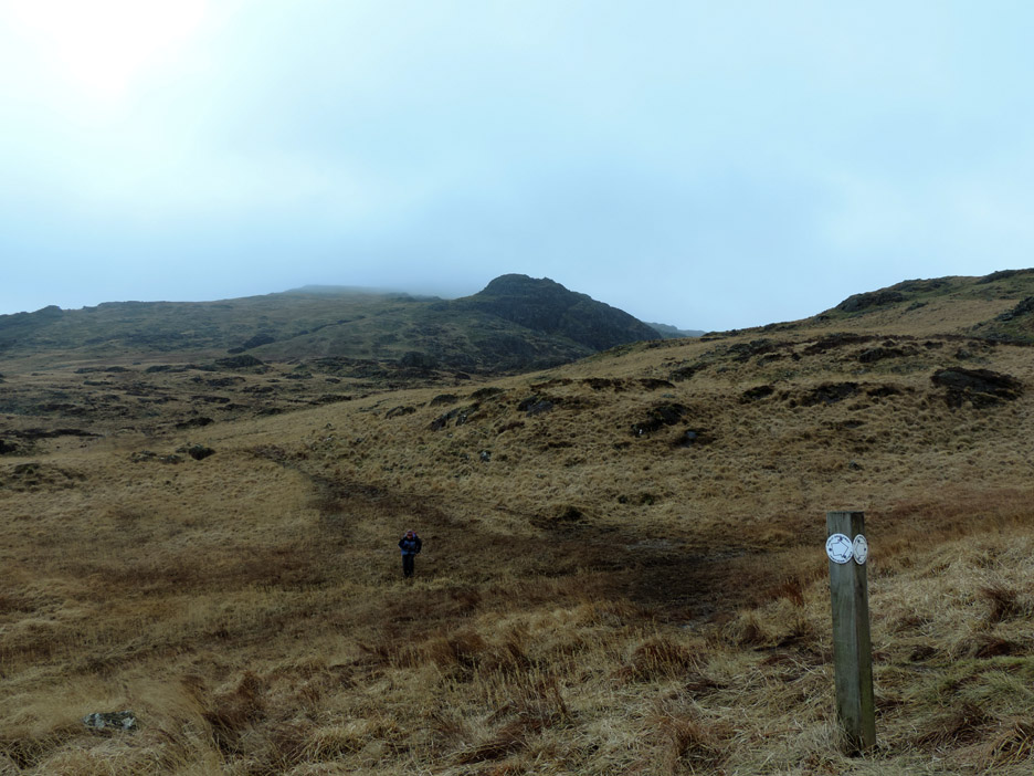
The path splits . . . straight on to Duddon, right to Green Crag or left here towards Harter Fell.
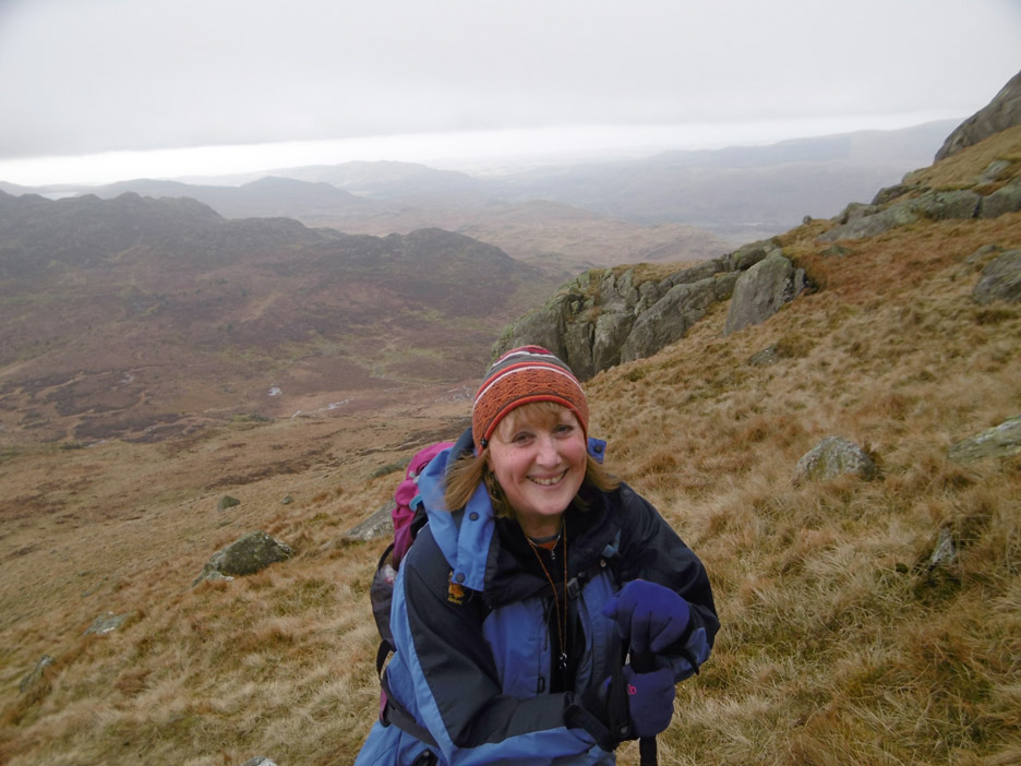
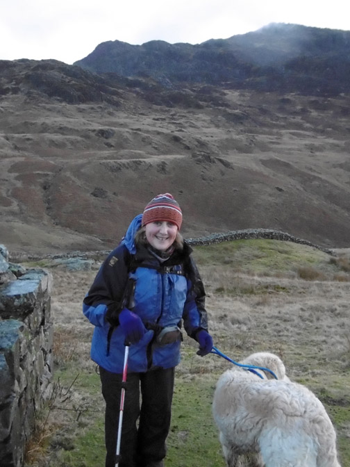
Happy Face . . . the pictures today have been taken by all three of us by the way. Guess who took this one . . . and it is not a selfie.
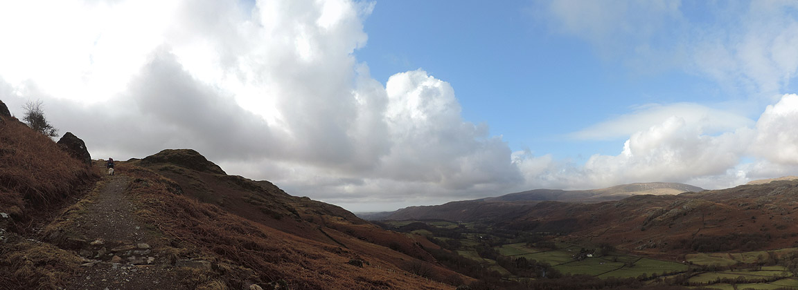
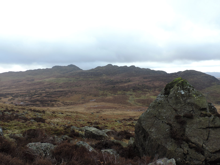
Across the way is the rugged granite ridge that ends with Green Crag as the highest top.
Looking south towards Caw and (pointed) Stickle Pike, with the Duddon valley in the foreground. These two were serious omissions from Wainwrights 214 list of fells as each are a delightful walk and can be successfully combined for a fine day out.
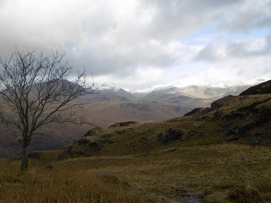
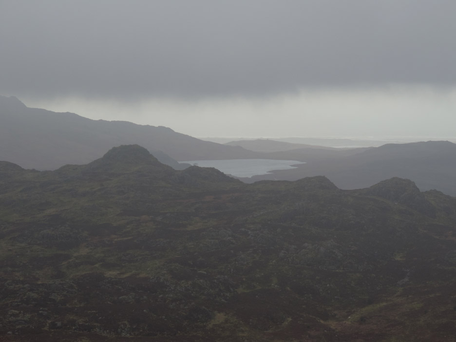
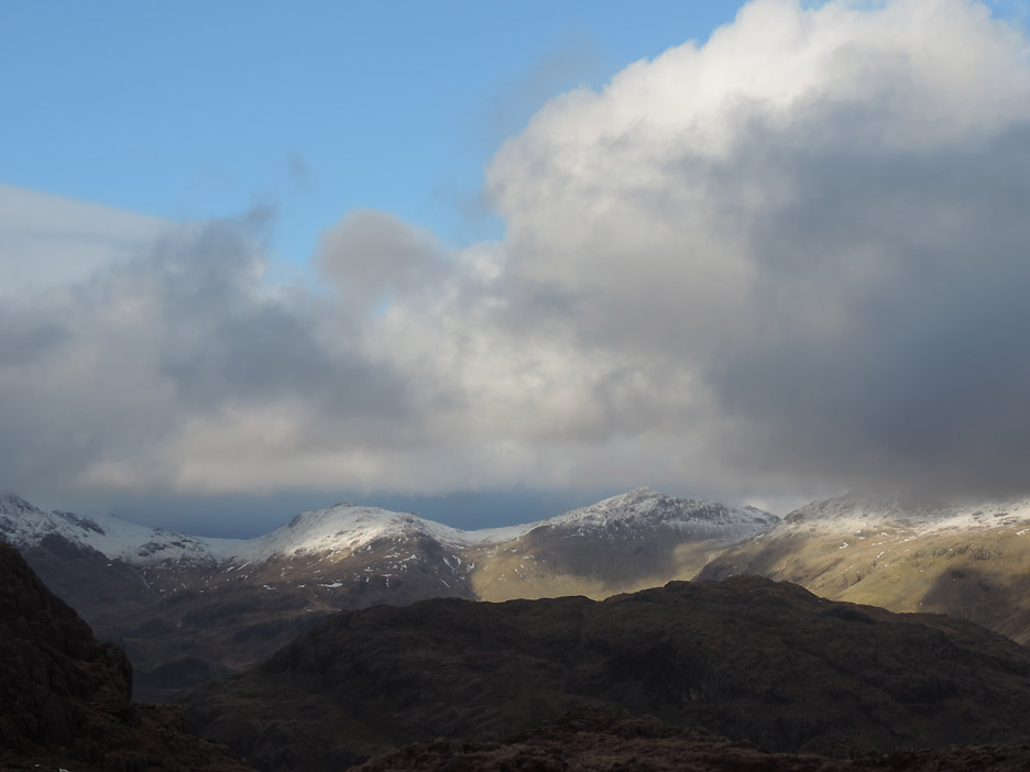
To the west it is looking distinctly grey . . . but through the greyness we can make out Devoke Water reflecting the brighter light of the distant sky.
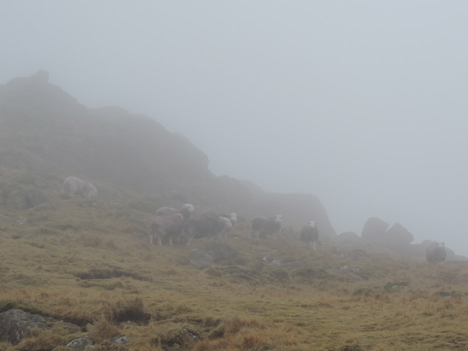
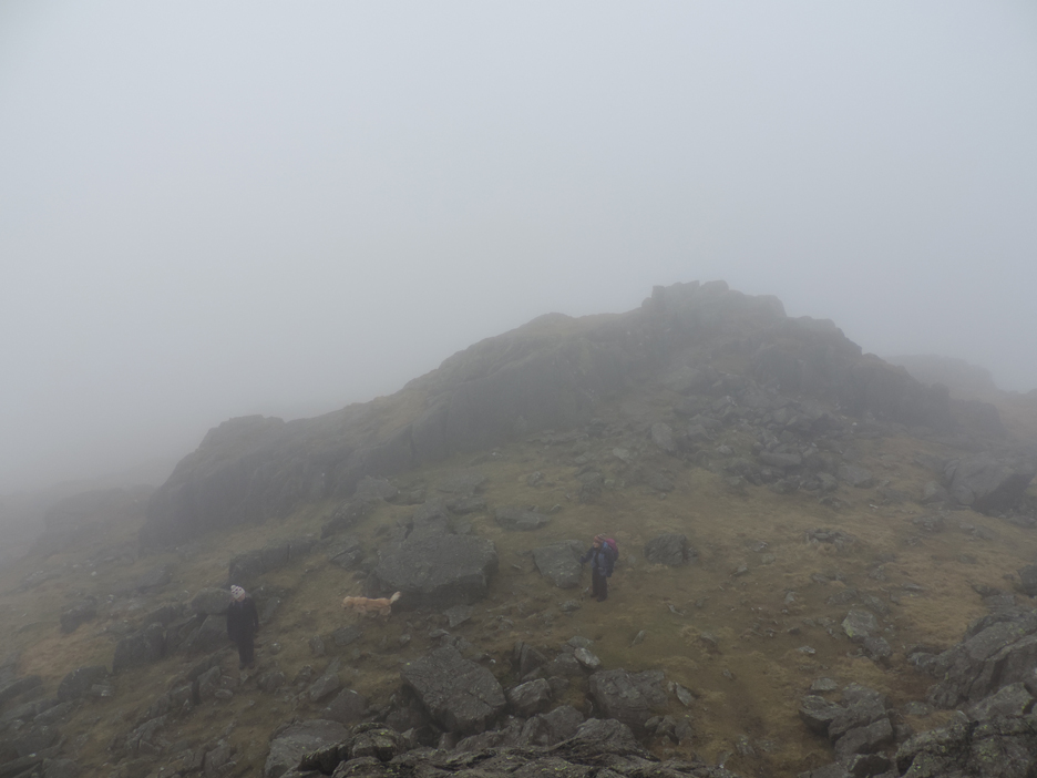
Too good to last . . . as we climb higher the cloud drops lower and we are enveloped in mist. Even though they are not far away, these Herdwicks with their grey coats just blend into the mist.
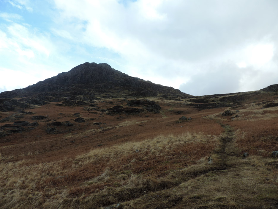
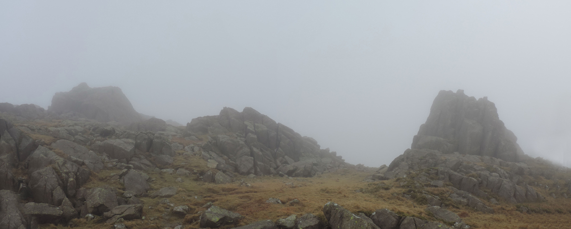
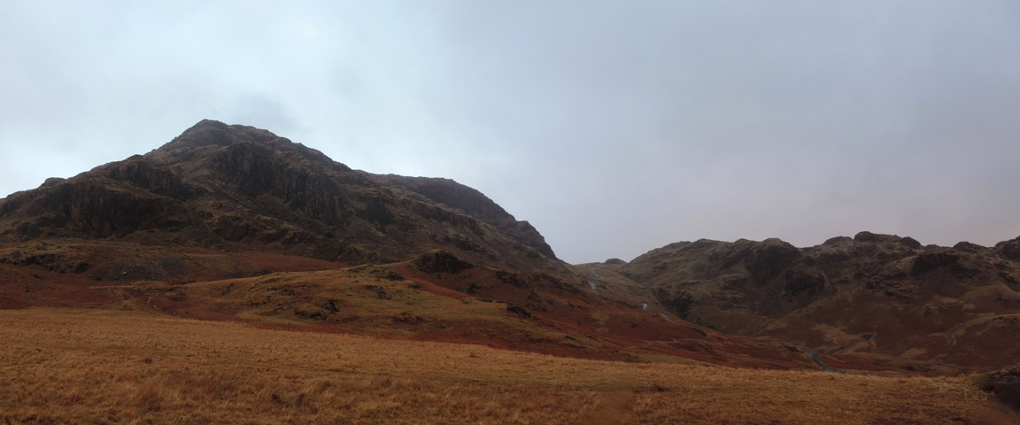
The 'hill fog' as the weatherman is keen to call it, is not too thick and as we round a corner the characteristic shape of Harter Fell summit is seen laid out before us.
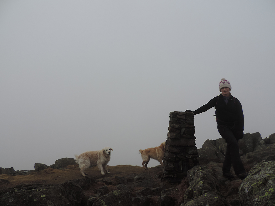
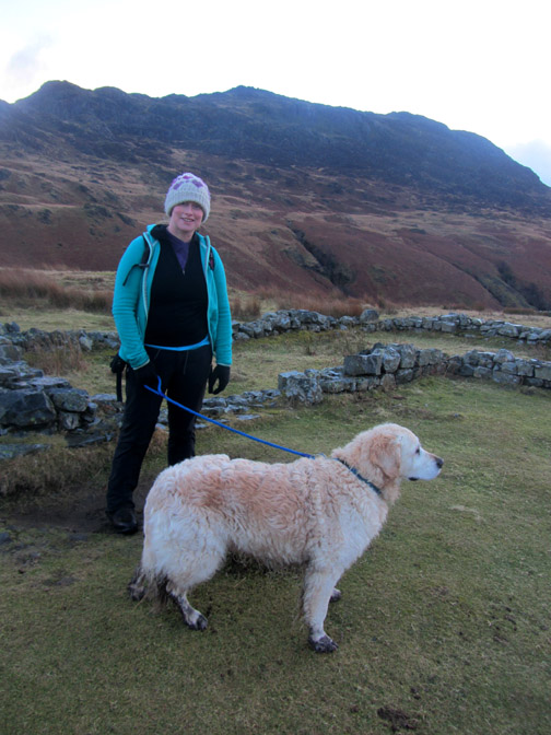
Valentine's hat on head, arm on trig point . . . Jenna claims the summit as her own.
" King of the Castle " . . . carefully climbing the damp rock I reach the true summit. Below, Ann and Jenna are heading back from the trig point, which on Harter is on the western side of this plateau. Time to find a sheltered spot for lunch as in the mist it is quite cold up here. - - - o o o - - - Time passes . . . and so do the clouds . . .
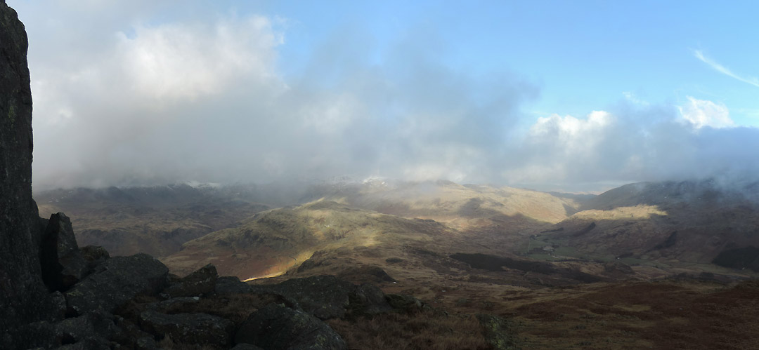
As we finish our lunch so the cloud breaks and Jen has a " view from the summit " The sun shines on Hard Knott Fell and Ulpha Fell . . . the higher fells are still slightly obscured.
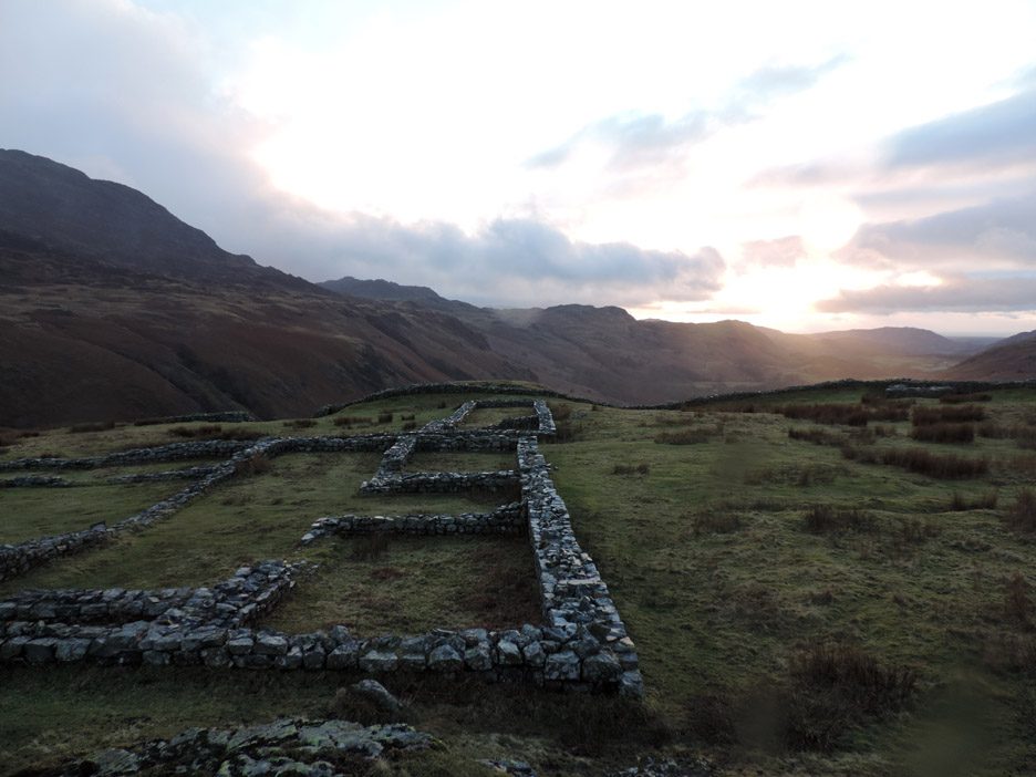
Peering through the cloud as it comes and goes . . . We get glimpses of snow on the high fells and the Roman fort, seen as a square of walls in the lower left of the photo.
Jen must have had the horizontal hold set wrongly on this one . . . or did I have that many items stuffed in my coat pockets ?
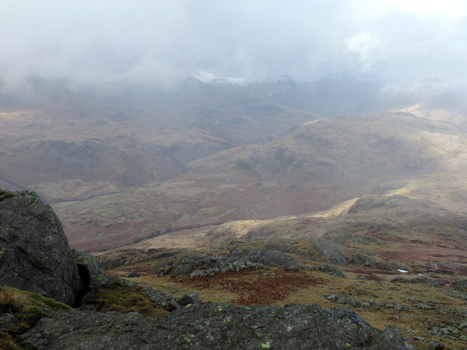
Sunshine towards Coniston Old Man . . . but it never did clear of cloud.
The mist did rise sufficiently for us to see Seathwaite Tarn . . . tucked into the side of the upper Duddon valley.
The sunshine spread up the valley till it illuminated Wrynose Pass away in the distance.
Over time the mist did seem to be lifting.
Zooming in on a clearer views of the high fells.
Yes . . . blue skies and sunshine on Esk Pike - Bowfell.
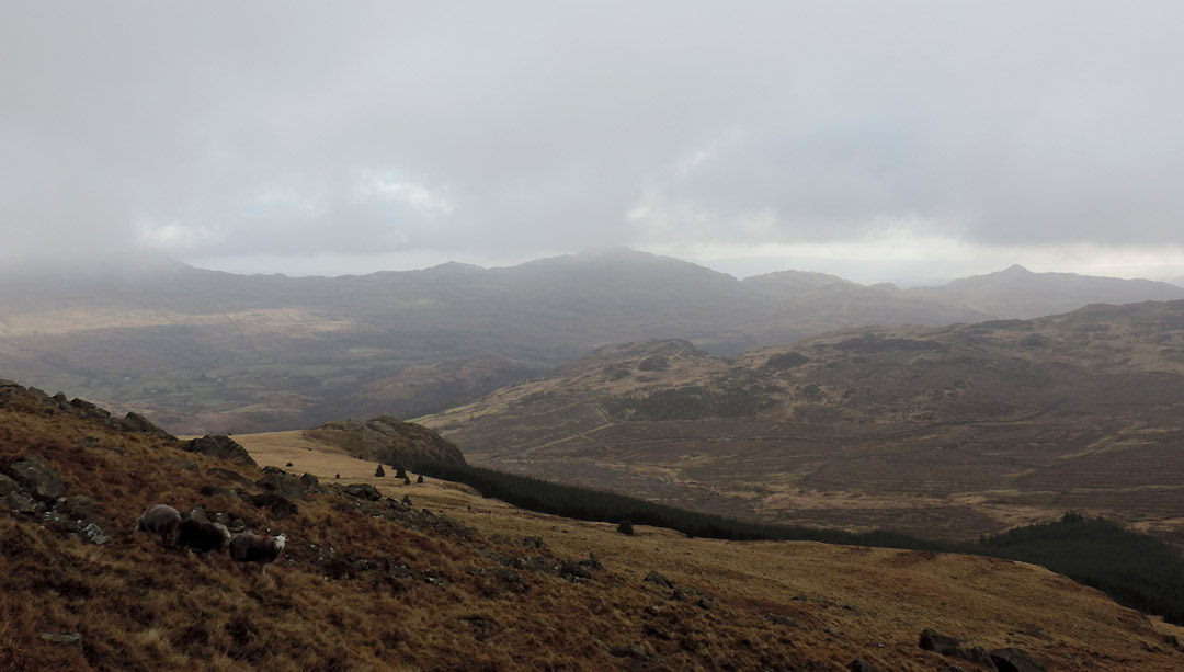
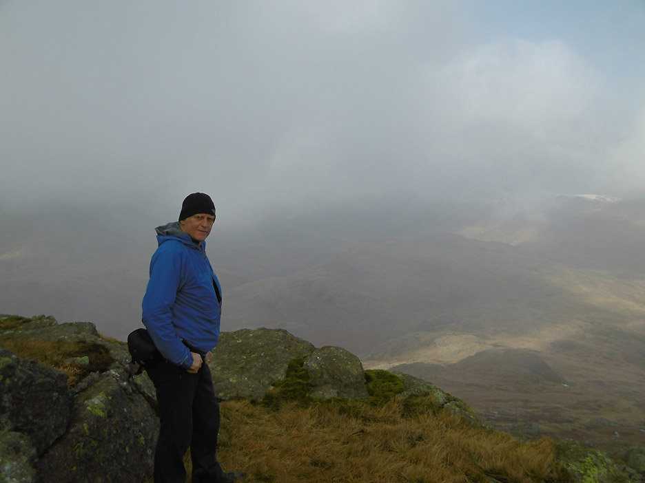
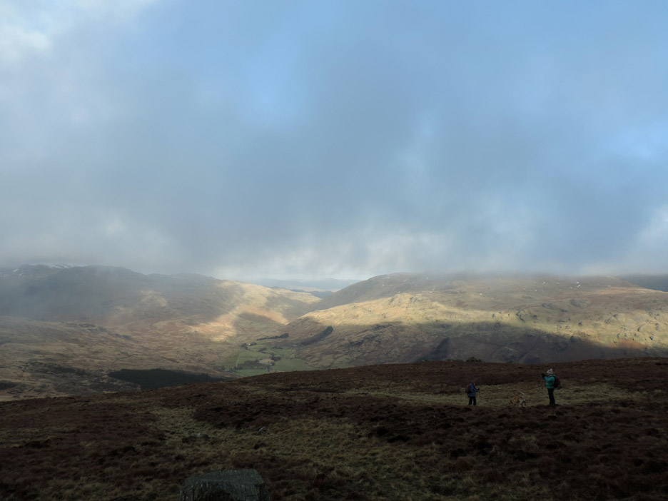
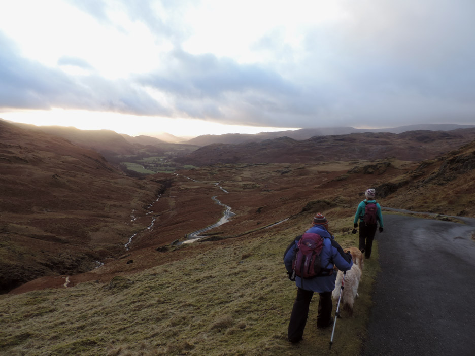
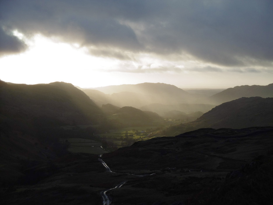
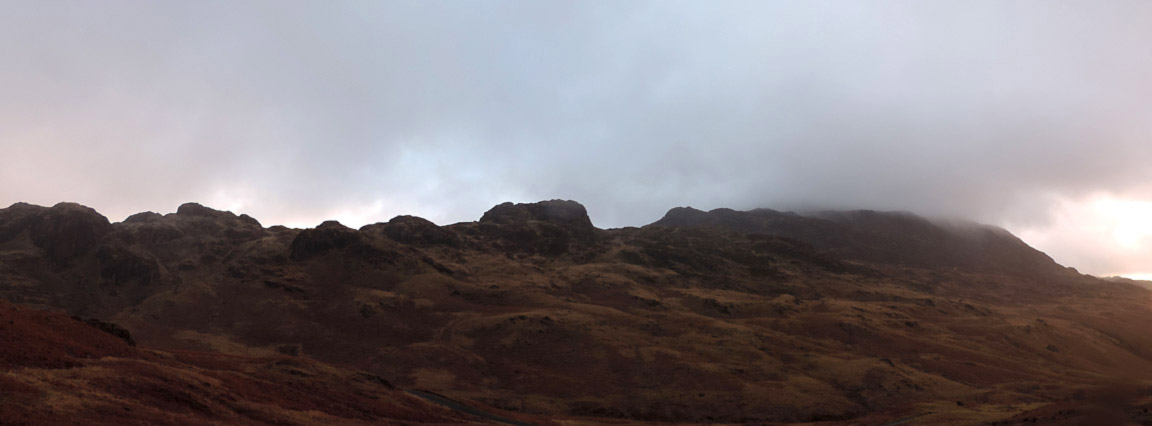
It didn't last however and the cloud gathered causing the visibility to drop off again. Behind us the summit of Harter is still cloud covered but the fell is receding nicely as we walk the soggy ground towards the road.
We've joined the official bridleway that has climbed from the valley below and head along the flat ridge keeping the old forestry on our right hand side.
Smiles again as we near the road . . . the tussock grass and bog walking nearly over.
The post signifies the start / end of the bridleway as we reach the top of Hard Knott Pass.
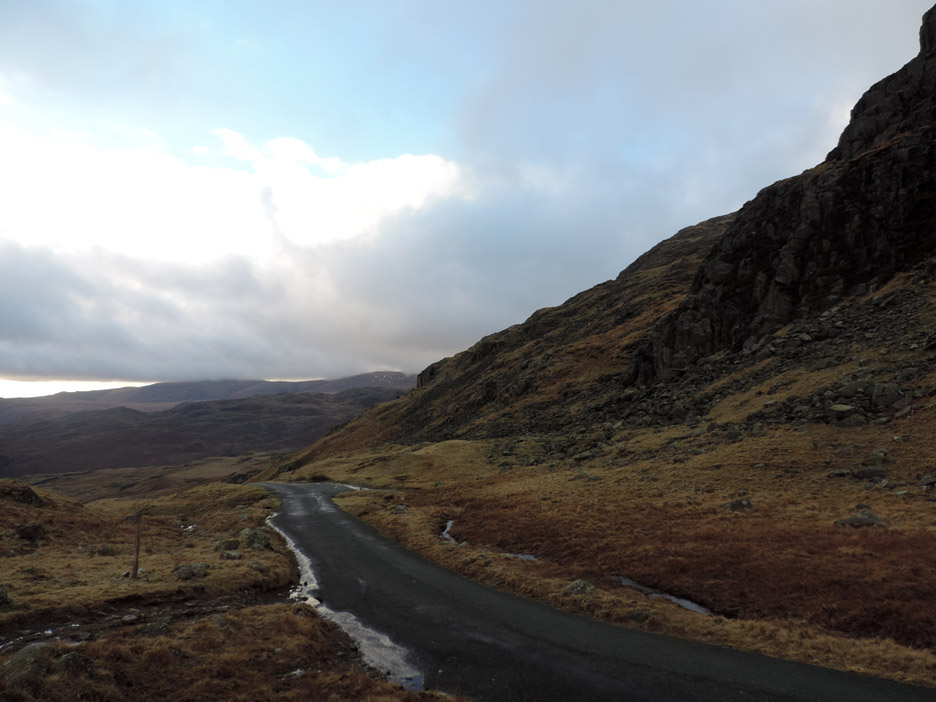
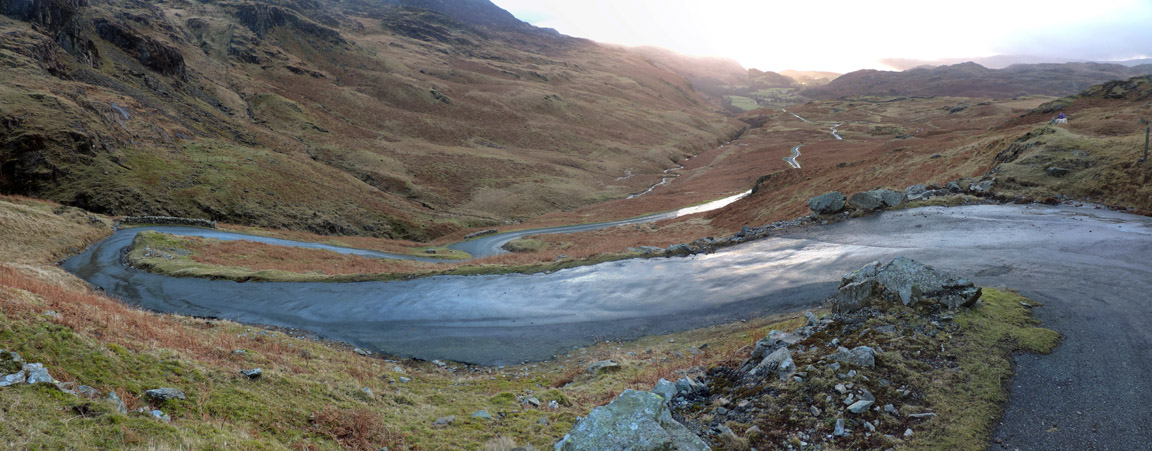
Down hill all the way now as we head for the Roman Fort. A short road walk brings us to the first hairpin bend . . . then we'll take the footpath straight ahead directly to the fort.
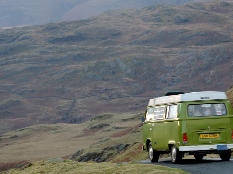
Cars, and this lovely old VW Camper, have to stick to the tarmac.
. . . and what a road ! Three photos stitched together were needed to include all the bends. It is single track with passing spaces and 1:3 on the steepest corners . . . add a little dampness and it could get interesting.
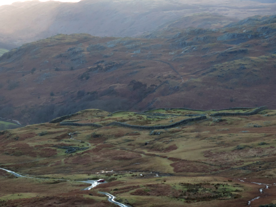
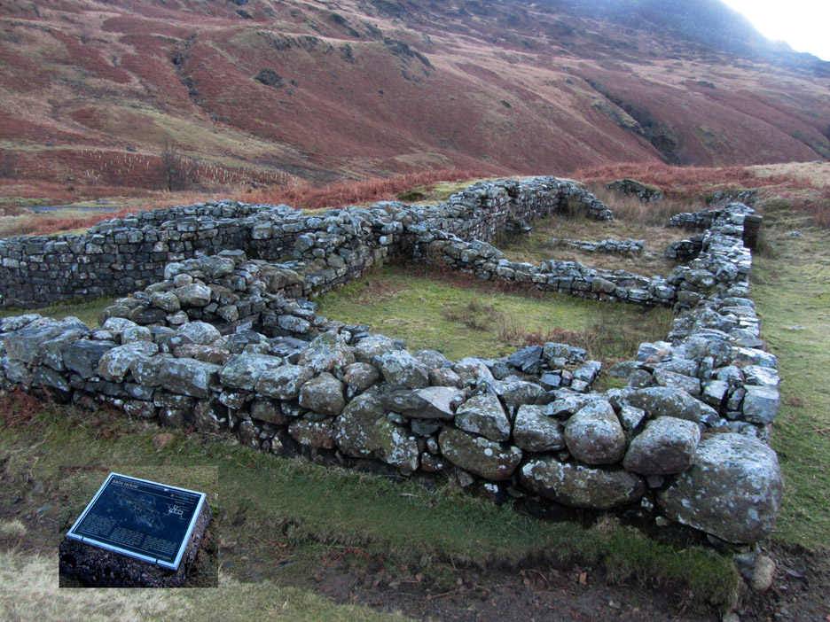
Zooming in on the Roman Fort which commands a lofty position high above the Eskdale Valley.
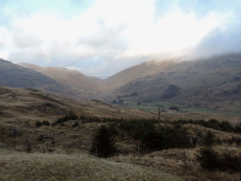
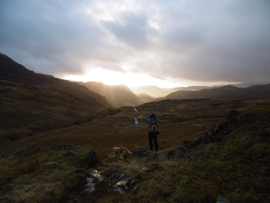
Another ten minutes and the weather has changed again . . .
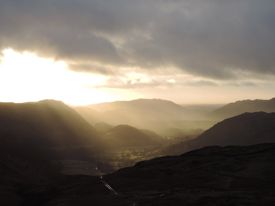
The sun bursts into the Eskdale Valley with dramatic effect.
. . . getting brighter as time progresses . . . but there's rain between here and there . . .and it's heading our way !
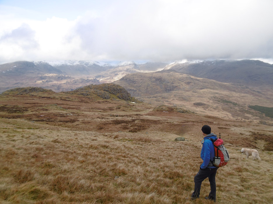
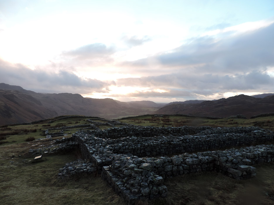
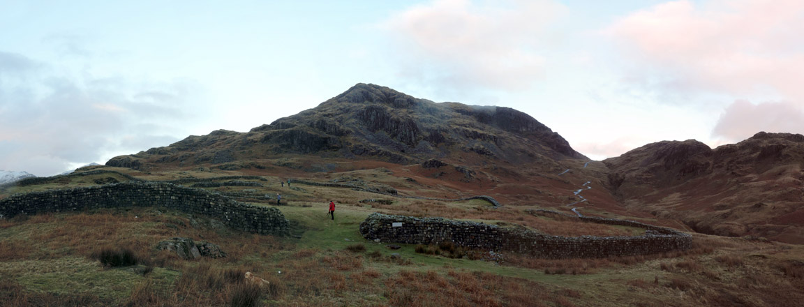
We've reached a large, relatively flat area above the fort . . . This is the old parade ground, one of the largest and best preserved examples in the whole of Europe. Behind it, Hard Knott Fell which gives its name to the area.
To the right, the rough ridge towards cloud covered Harter fell. Deeming Crag, seen earlier from the ridge walk, is the larger crag in the centre of the photo.
The path naturally takes you down to and through the old fort where the old foundations of the Roman buildings have been preserved to remind us of earlier occupation.
The barracks and Commandant's house as the sky clears and the brief rain shower moves away.
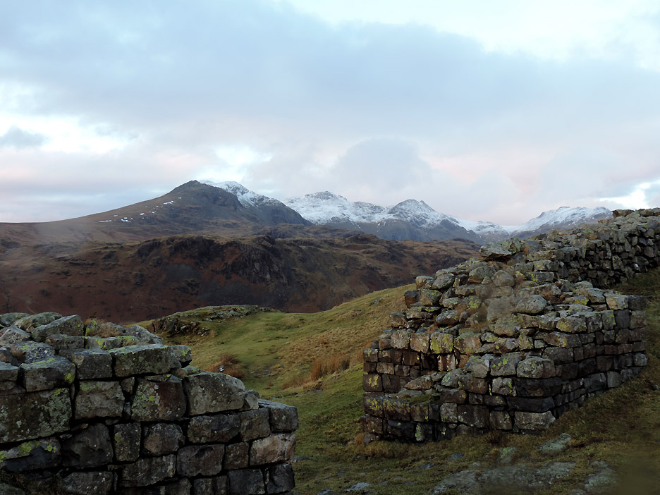
The classic view of the NW gateway with the distant Scafells now clear of cloud.
Sun shining on the wet rock of the old Roman Walls.
Below the fort is the old Roman Baths. The ruins are relatively well preserved as little of the stone was robbed for building elsewhere . . . it was too far to carry !
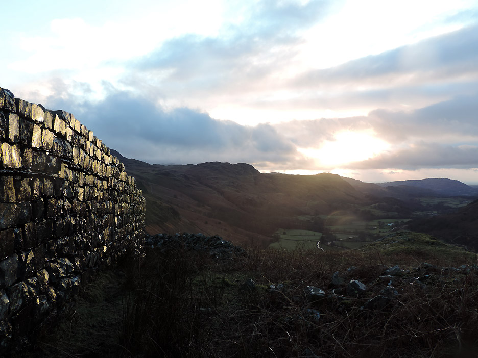
Last view of the fort and Hard Knott Fell as we walk down to the car. - - - o o o - - - At the end of the walk . . . chance of a short re-hydration stop ?
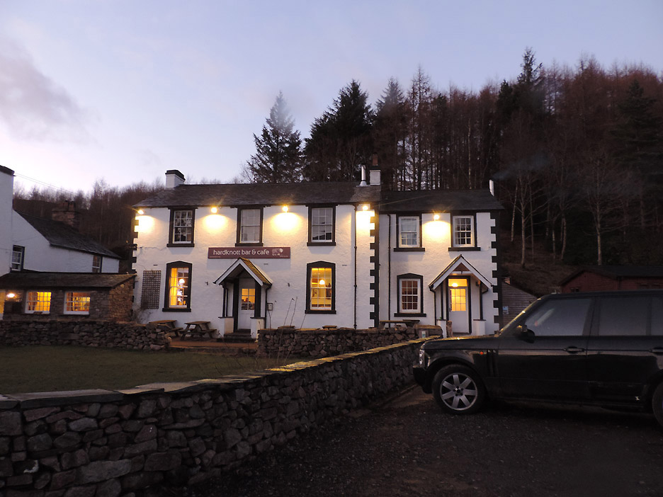
We called in at the Woolpack Inn . . . also known (now) as the Hardknott Bar and Cafe. A pint of Ennerdale 'Confused Badger' Bitter will do nicely thank you . . . Jen preferred a glass of hot mulled cider to end the day. - - - o o o - - - |
Technical note: Pictures taken with either Ann's Canon Sureshot SX220, Jen's Panasonic Lumix or my Nikon P520 digital camera (take your pick !) Resized in Photoshop, and built up on a Dreamweaver web builder. This site best viewed with . . . a little light refreshment before heading home. Go to Top . . . © RmH . . . Email me here Previous walk - 15th February 2015 - Rannerdale Knotts with Jenna A previous time up here - 25th December 2005 Christmas on Harter Fell Next walk - 21th February 2015 - Barrow Fell with Jenna
|