![]()

|
|
|
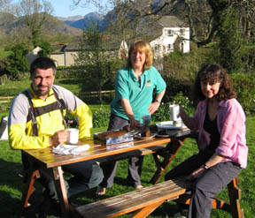
| Date & Time: Saturday 6th May 2006. 9.30 am start. Location of Start : The field car park in Kentmere Village ( NY 457 039 ) Places visited : The Garburn Pass, Yoke, Ill Bell, Froswick, Thornthwaite Crag, High Street, Mardale Ill Bell, Nant Bield Pass, Harter Fell, Kentmere Pike, Shipman Knotts, and back to Kentmere. Walk details : 13.1 mls, 3,750 ft of ascent , 8 hrs 30 mins. Walked with : Fellow members of the Online Fellwalking Club, including Ann and our dogs. Weather : Warm and dry. Blue sky but two high grey clouds which looked ominious but weren't. Hazy. Helmut, Ann and Jill relaxing over tea on Friday afternoon . |
|
|
Helmut, our Austrian visitor had completed the first three days of his week in Cumbria, the first day was the Coniston walk, second was his and John's Helvellyn bike ride, and yesterday he did a solo walk from Loweswater to Braithwaite via Grasmoor. I'll leave him to tell you about the latter two on his site Landschaftsfotos
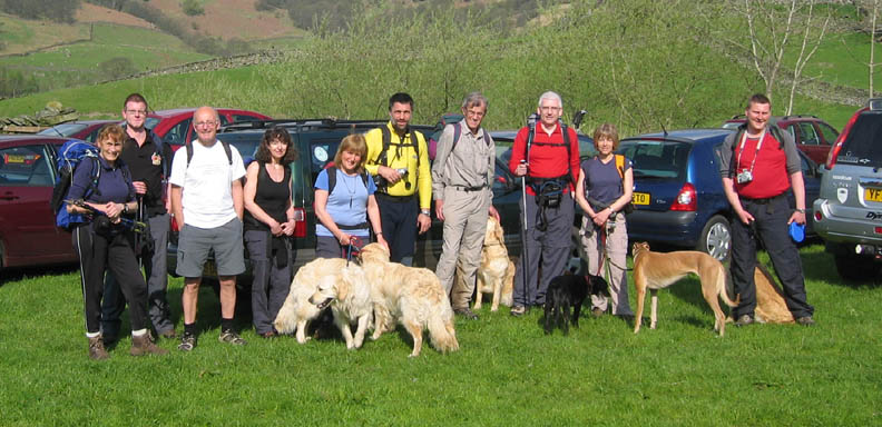
Today we had organised an OFC meet to walk the Kentmere Round, a collection of nine summits in the south east of Cumbria. Kentmere hamlet and Church, prior to parking in the field next to the bridge.
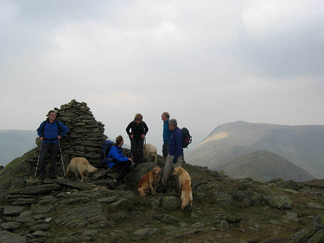
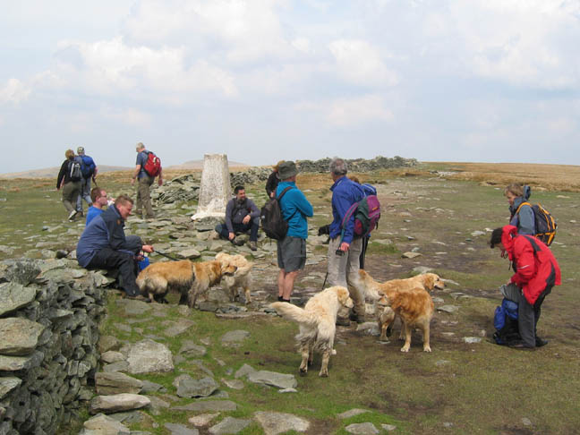
Todays walk gave Helmut chance to see a different part of the Lakes, and for OFC friends to meet and walk with him. ( l to r ) Frances (Linlithgow) David (Southport) Fred (Keswick) Jill (Humberside) Ann (Loweswater) Helmut (Austria) Peter (Keswick) Tim (Lincolnshire) Jo (York) ans Stephen (Blackpool) plus myself. A total of eleven members and seven dogs on the day.
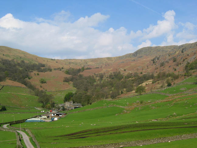
Kentmere Hall farm, with its Peel Tower nestles under the Garburn Pass. Our route will take us up the un-made road seen above the trees.
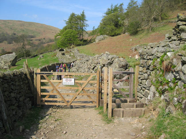
Thr Garburn Road, an old rural bye-way, technically open to wheeled traffic but over use by 4x4's in recent years has led to access being restricted. The small gate has stepped sleepers to discourage motorbikes but to allow horses to pass.
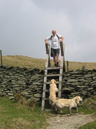
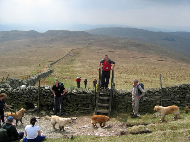
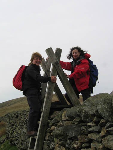
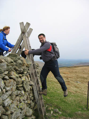
Tall ladder stiles featured on this walk as a method of crossing the substantial dry stone walls. Where the ground was sloping, real care had to be taken as they were quite steep to climb
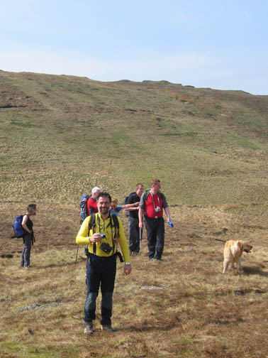
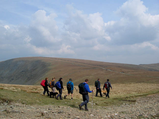
Our first summit of Yoke. Ahead our route was laid out along the sky-line. Tim parted company with us at this point, to return to the Garburn Road. He would climb Sallows and Sour Hows before meeting us again in the evening. Can't keep a good man from a meal and a pint.
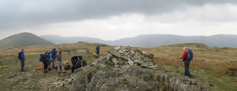
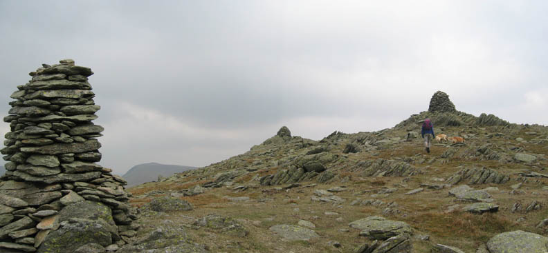
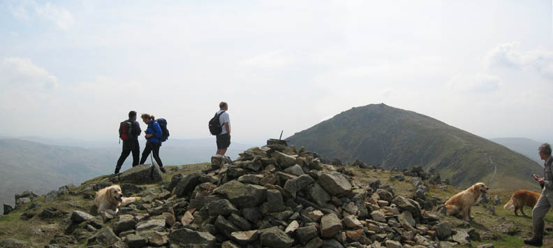
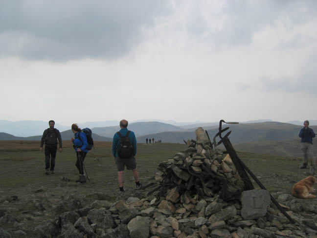
The characteristic three summit cairns of Ill Bell with a view on to Thornthwaite Beacon behind.
Frances in classic pose or is she trying to push over the first cairn ?
David, Frances (tired after her exertions?) Ann, Fred and Peter at the third. Behind a patch of sunlight illuminates Thornthwaite, but Froswick in front is not quite so blessed.
Positively balmy on Froswick The gentle breeze is warm and the sun is high in the sky We're on target for lunch at the Beacon.
Looking back along our route The old corner fence post highlights the place where the Kentmere circuit direct path turns to contour round the hill but we are including Thornthwaite summit, so we continue the extra quarter of a mile to the top.
High Fells and big skies up here Peter leads the way to the top, closely followed by Samba and Sophie, his retrievers.
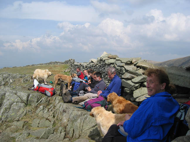
The wall shelter at the Beacon, closely followed by lunch !
The summit of High Street ahead of us now is known for two things, a broad flat top and the old Roman Road. Our last visit here was as a support team for the OFC Great Roman Walk (we boosted their moral if not their strength on that day) but due to the mist we kept to the Roman route and failed to make the summit. Today we encouraged everyone along to see the view from the top.. One down at this point as Peter diverted to Gray Crag summit further down the ridge from Thornthwaite. He is on target to climb all his Wainwright summits within the twelve months of 2006. If you have a moment, check out his site and encourage him with a charitable donation perhaps.
The Trig Point on High Street, a little cooler in the breeze on the open summit, so time for a windproof layer perhaps. Todays outing occasionally looked like an online Golden Retriever Dogwalking Club Meet as the five rushing round together looked more like fifty.
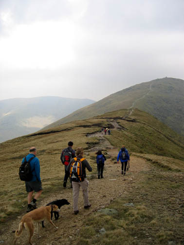
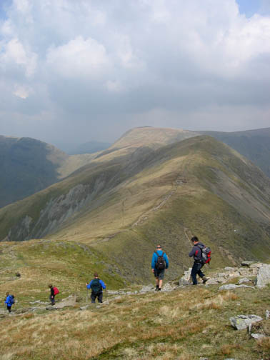
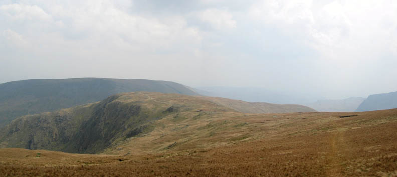
Open fells and short moorland grass as we turned the corner for home. Ahead was Mardale Ill Bell, Harter Fell, and then it was downhill all the way.
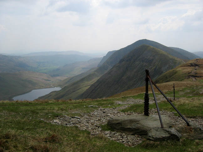
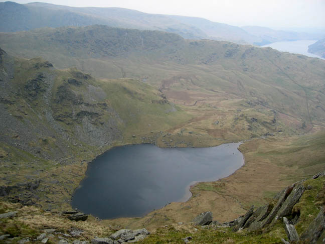
Small Water, looking down to Haweswater in the distance.
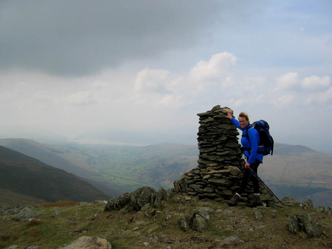
Rough ironwork of old fence posts adorn the summit cairn of Harter Fell. Frances encourages Helmut the last few yards, or should we say meters to the top.
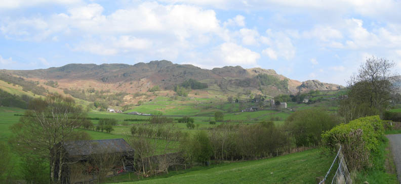
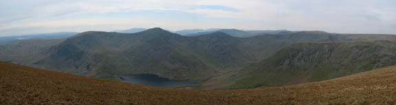
One of the great beauties of this walk is the ability at most points to see the whole of the valley skyline and to be able to appreciate not only where you have come from, but also where the route ahead is going to take you. I found myself likening the valley to a clock face, and as the day progressed our position on the clock moved round as we walked steadily onward. Click here or on the photo for a larger anotated photo.
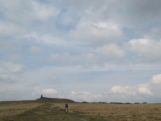
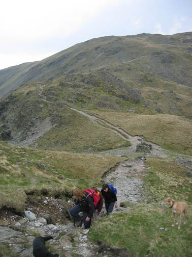
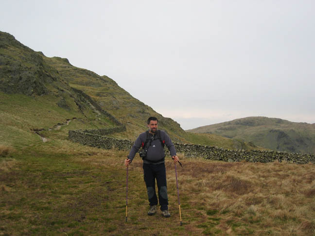
Can we say the exertions of the last few days might just be starting to catch up with Helmut ? He borrowed a pair of trekking poles just to help him down the last steep descent off Shipman Knotts.
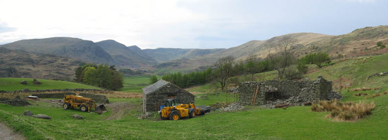
Nearly home now and back into the valley. It is nice to see these old barns being restored rather than being left to collapse beyond repair.
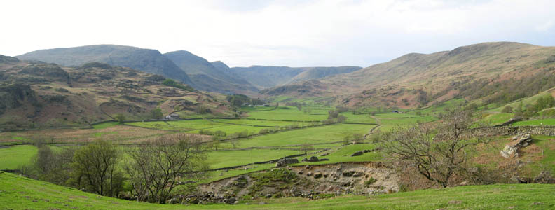
How green is their valley ! It was noticable how green the farmland was down here as we stopped to admire our route which had taken in all of the summits in this Kentmere sky line.
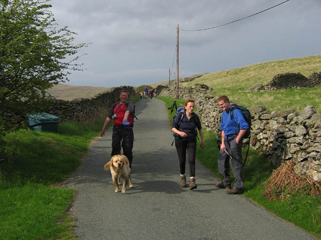
A short road walk out and Sam still has energy left to pull Stephen along.
Ahh . . . journey's end The Eagle and Child at Staveley.
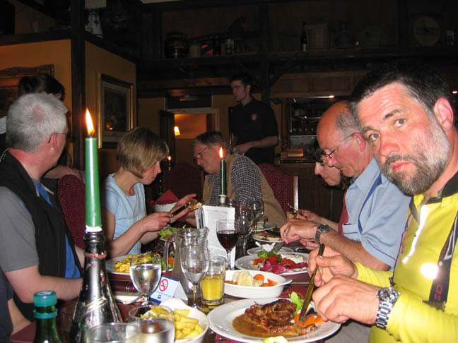
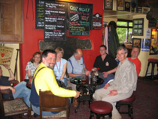
Liquid refreshment was followed by a meal upstairs in the pub.
where we were joined by John and Paul (out of photo) and re-joined by Tim after his shorter walk.
|
- - - o o o - - - Technical note: Pictures taken with a Canon IXUS 400 Digital camera. Resized in Photoshop, and built up on a Dreamweaver web builder. This site best viewed with . . . Nine more tops in the bag. Go to Top # © RmH # Email me here # Go to 2006 Archive Previous walk - 3rd May 2006 Helmut's World Tour of the Lakes - Coniston Previous time up here - 2nd July 2005 The Alternative Great Roman Walk
|

 ]
]