|
|
|
 |
Remember: Press F11 for a
full screen view of this page. |
Web Counter when published 2
133 360 |
|
" Grasmoor with the Mockerkin Mob " Date & start time: 7th January 2024. 10 am start. Location of Start : Cinderdale car park, Crummock Water, Cumbria, Uk. ( NY 162 193). Places visited : Cinderdale, Lad Hows, Grasmoor, Wandope, Whiteless Pike, Rannerdale Knotts. Walk details : 7.5 miles, 3050 ft of ascent, 6 hours including refreshments. Highest point : Grasmoor, 2,771ft - 852m. Walked with : Peter B, seven others, myself and Dougal (Loes & Dylan on light duties). Weather : Sunshine and blue skies, cold air but little wind, so warmer than predicted.
|
© Crown copyright. All rights reserved. Licence number PU 100034184. |

|
The local Mockerkin Mob, village walking group is out again and the weather has come up trumps, considering that the walk was planned two weeks ago. An 'A' walk up Lad Hows to the summit of Grasmoor is planned and at over 2,750 feet high, it should give us great views today. After the weeks of poor weather recently, the tables turned yesterday and a great day is in prospect for the walk today.
Parking at Cinderdale car park at the foot of the Lad Hows ascent means the day starts without any road walking. [ Loes and Dylan are on light duties today so will walk home via the lakeside path from here.]
Most of the group started out as I was taking a photo of Lad Hows. Pip held back to give the photographer a sense of perspective ! The taller peak behind Lad Hows is Whiteless Pike, which will be included on our return walk later in the day.
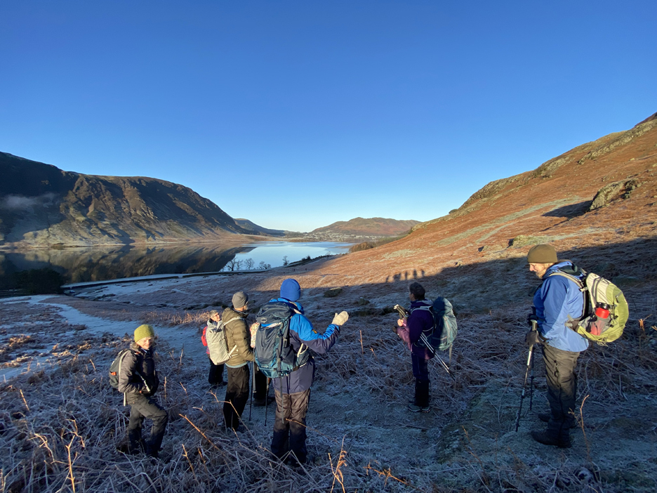
A quick stop to gather the group together and to discus the planned route. Most of the walk is straight forward but there is scope for a variation at the end . . . over Rannerdale or down the valley. We'll leave that decision till we see how we all feel at the time.
However the temperature is low enough for this Herdwick to really take advantage of its thick winter coat.
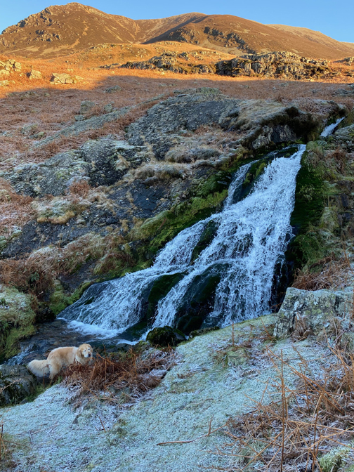
Part way up Lad Hows is the small holly tree so I encourage Dougal to sit next to it. I've used this location as wallpaper photo on my old laptop for years, so I take another photo today to spot the changes.
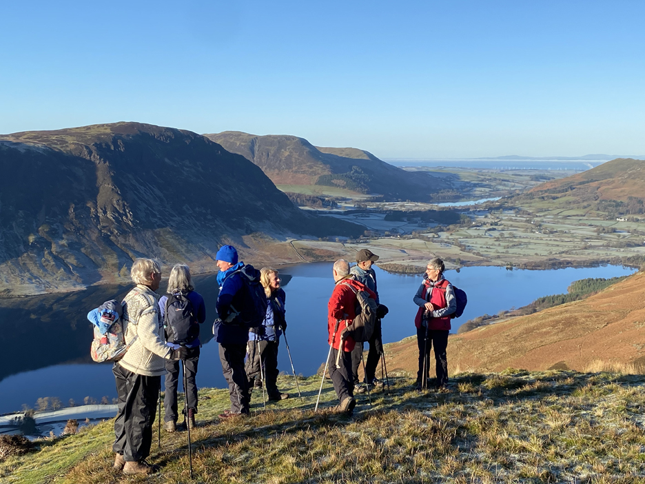
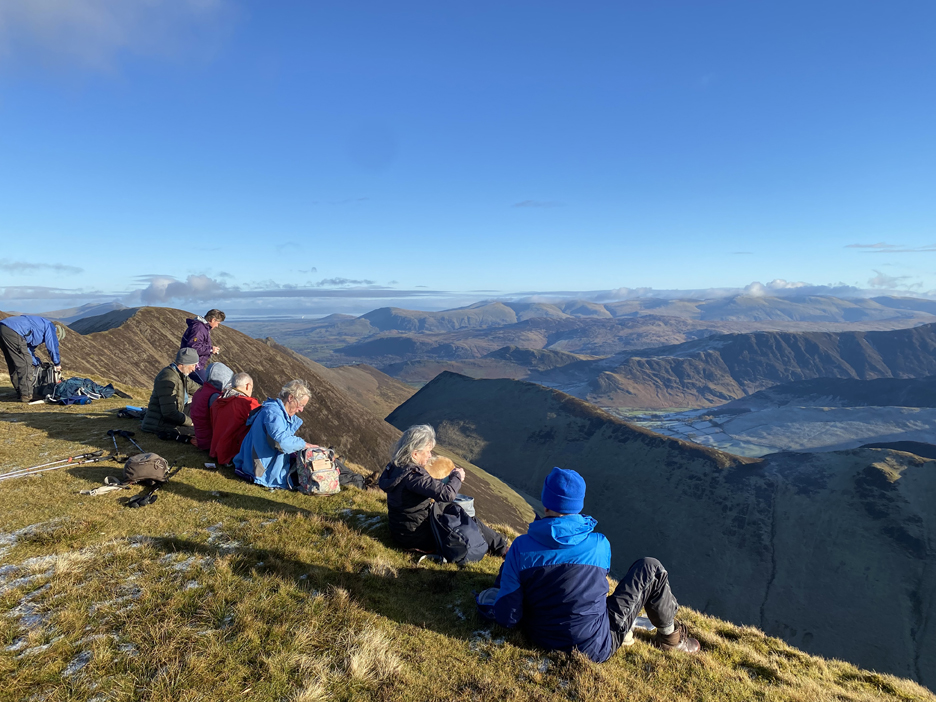
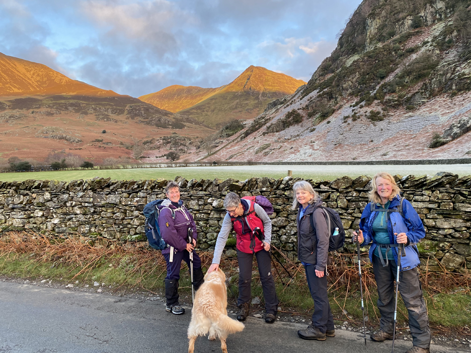
The steep part of the climb up Lad Hows is complete, so we take the opportunity to briefly stop and admire the view. Roll call for today: Ann, Sue, Peter, Julie, (Kathryn out of photo behind Julie), Chris, Hugh, Pip plus myself and Dougal of course.
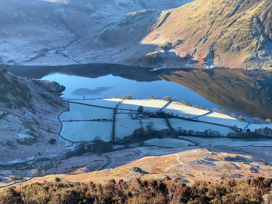
Looking down on a very cold Rannerdale Farm.
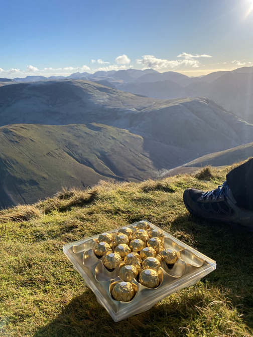
We felt a coffee and a flapjack was in order before the big climb but a stop at Lad Hows seemed to early for refreshments. A short time later, before the main climb, we paused to indulge ourselves and to gain an energy boost ! Several of us had shed a layer of clothing by this time as it was warm work climbing and there was no wind-chill effect.
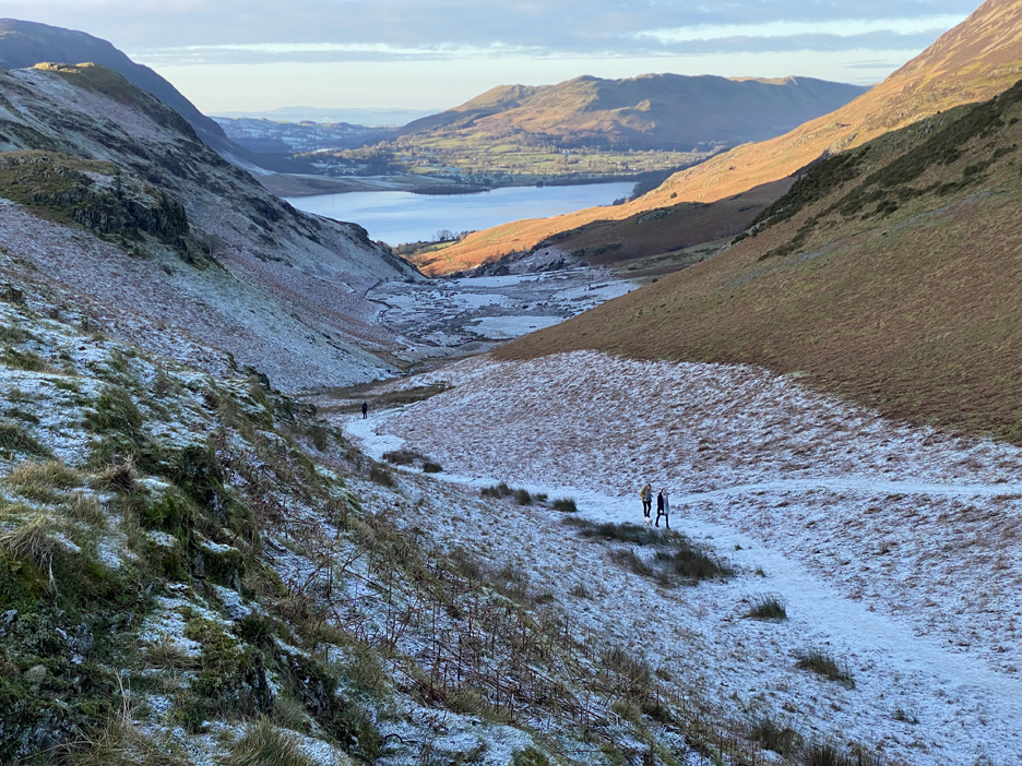
The upper section of the climb is steep enough to cause the path to zig-zag through the rock outcrops and scree. Up here we got a clear view of the Isle of Man, directly above the left hand (higher) summit of Mellbreak.
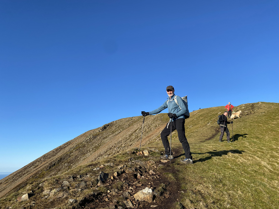
Mountain Man . . . happy to have completed the bulk of the climb.
So as not to appear sexist or biased in any way . . . Mountain Woman !
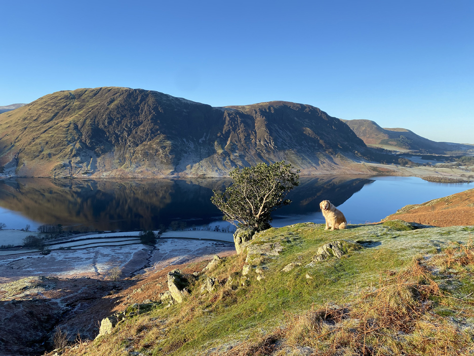
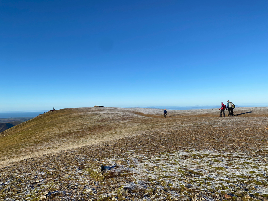
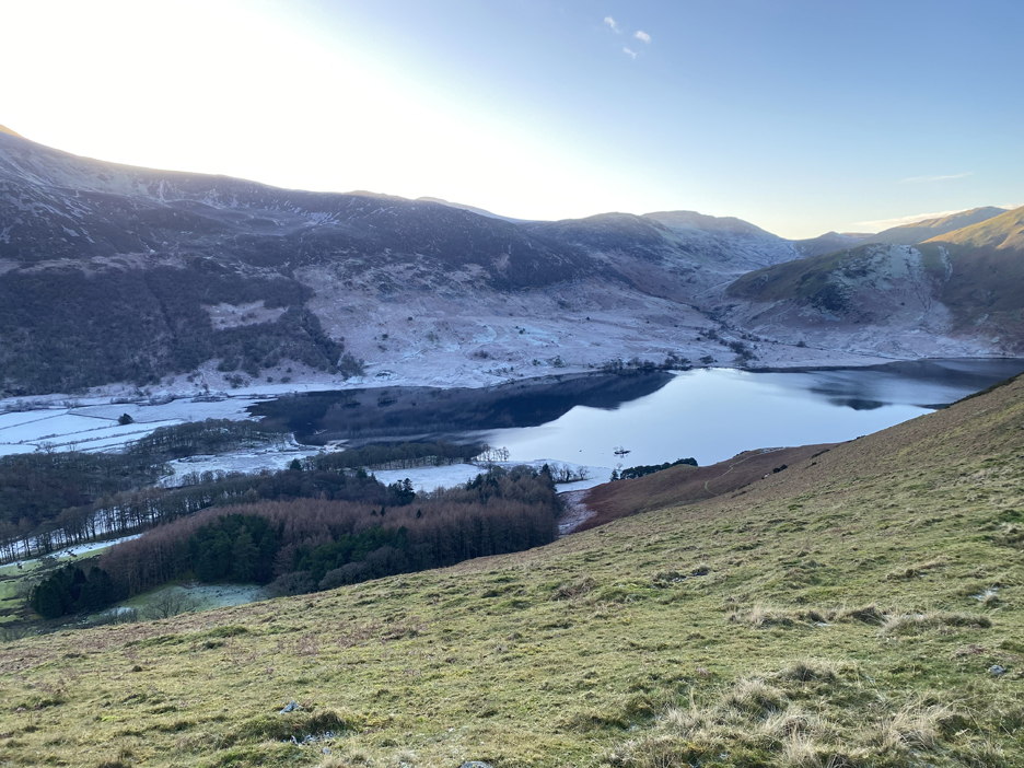
The last hundred yards to the ridge is a much easier stroll and we have time to appreciate the view to the full. Click here or on the picture for a slightly larger version with more detail.
The last doddle of the walk across the flat topped summit of Grasmoor. What always confuses people about Grasmoor is that the dramatic summit seen from below is about half a mile further on and some 300 feet lower than the summit cairn and shelters seen here in this photo. I did the extra walk to it a few years ago and it was a long way back up ! - - - o o o - - -
Whilst at the summit shelter I took this photo looking west to the Isle of Man, seen just right of centre this time. The two fellow walkers had just finished a coffee and headed off before us.
Time to retrace our summit steps along the ridge, then past the Lad Hows turning and on eastward towards our next objective.
This was the small cairn on the eastern end of the ridge which gave us a fine view of the central Scafell summits.
The descent to the hause at Wandope Moss was significantly steeper than I remember but no particular problem unless you are climbing up it after a long day on the fells. Ahead are the summits of Crag Hill on the left (not for us today as we were there recently) and for us, Wandope off to the right. We will aim for that diagonal path climbing directly for Wandope's summit.
On reaching the top we could look down into Addacomb Hole, This is a dry mountain corrie which looks as if it had a small tarn in the olden days. A breach in the moraine at the edge of the deep shadow has allowed any water to drain away.
The break of slope on the summit and an insulated sit mat adds comfort to our lunchtime seating position.
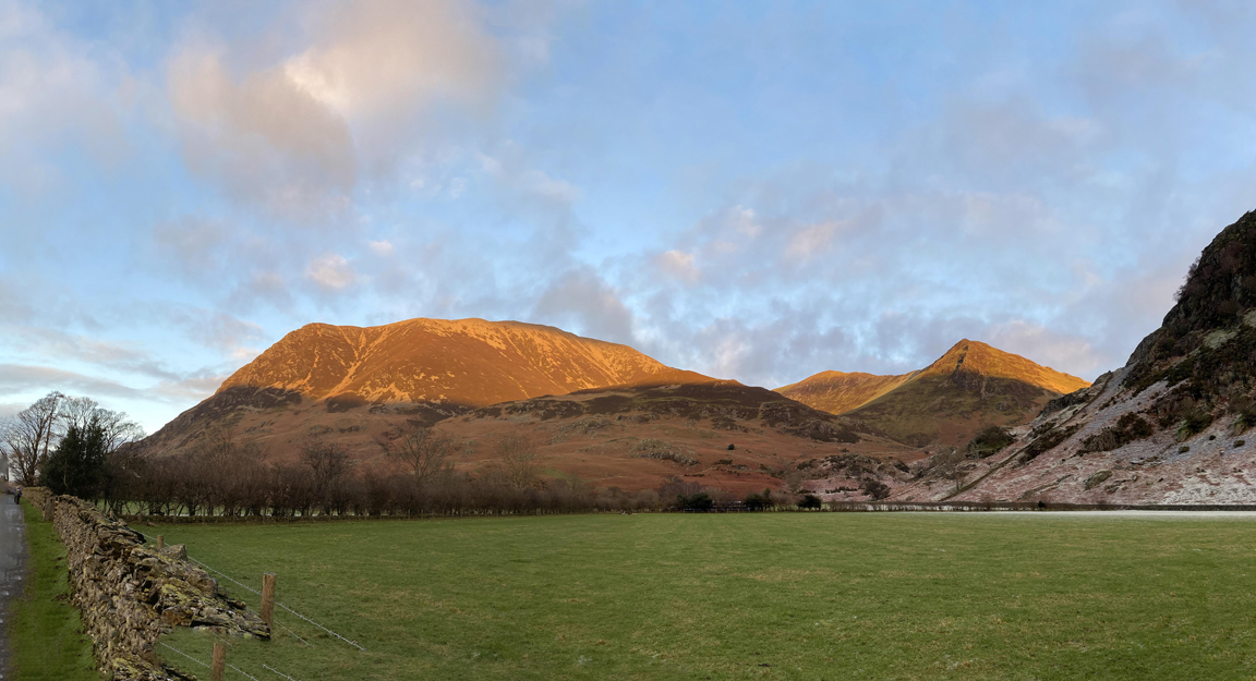
Suitably fortified by lunch and a crunch, we headed off on the homeward leg of our walk. Ahead of us was a view of the climb so far, with the Lad Hows ridge being the left hand slope of Grasmoor as seen from here.
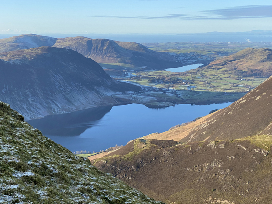
The ground rises slightly now to Whiteless Edge, where we regain the views of Crummock Water and Loweswater far below.
Third Gill Man Head takes its name from tributary stream to its left which flows down into Buttermere's Sail Beck / Mill Beck. It's a local summit name not shown on either of the O.S. maps I have seen.
Another slight rise along the ridge to Whiteless Pike gives more open views north and west to the Scottish coast.
Near the top we stopped briefly to admire the views across to the Helvellyn Ridge which appears to attract a little summit cloud across its snowy tops. However the sun continues to shine on Clough Head and the Dodds and the intermediate ridges of Maiden Moor and Ard Crags closer to us.
Sue leads off, down the slightly challenging zig-zag path from the rocky top of Whiteless Pike. Those areas shaded from the winter sun have retained a deep frost, both in Rannerdale Valley and across the way under Scales and Starling Dodd.
Looking towards Robinson and High Snockrigg as clouds now gathers over the summits of the Scafells.
A last view of the long ridge that joins Knott Rigg at this end to the pointed Ard Crags in the distance.
Time to decide on the final part of the route soon . . . Rannerdale valley or ridge. One will be cool and possibly icy, the summit will be further but remains in the sunshine. The descent off the far end should be clear of problems as it is also facing the sun.
Two schools of thought and with a party of nine we have the chance to offer folk the choice of route on this last part of the walk. Peter led the four who chose the valley descent and I nominally lead five of us who preferred the tops. As the Mob is a democratic bunch of 'fellow-walkers' rather than a formally led group it can offer this sort of flexibility on the day. Let me at this point offer a vote of thanks to Peter, technically our "leader" today as he has put not inconsiderable effort into planning and a reccy-ing the route prior to today's outing.
With the winter sun setting early, not all of the ridge is in direct sunshine, but five of us head out for the Rannerdale Knotts summits nevertheless. To our right the cold looking Squat Beck and Rannerdale Valley.
To our right the equally cold looking fields and slopes that surround the head of Crummock Water.
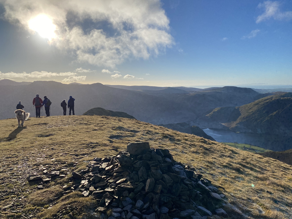
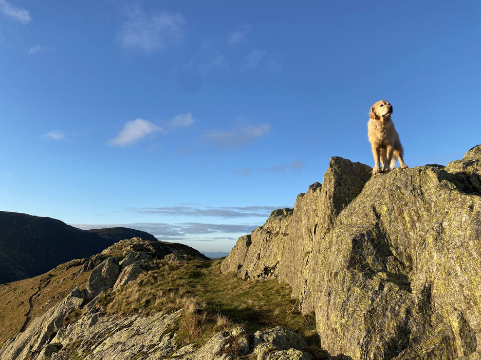
Summit dog on the first of the Rannerdale Knotts.
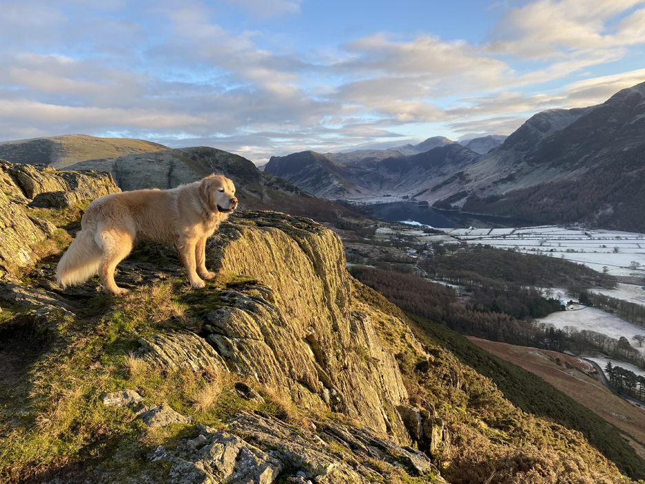
The view down from the second and higher summit of the Knott itself . . . anyone lost a bobble hat ?
It doesn't belong to my four companions on this part of the walk.
Dougal stops on the edge to enjoy the view down and to bask in the last of the direct sum today.
Looking down on Rannerdale Farm once again, but from a very different angle compared to that from Grasmoor earlier in the day.
It's a level walk from here on as we had a reasonable descent of the pitched path and have now reach the main road.
A final look over the wall and a look back at a fine walk. "We haven't had a better day in the hills than this for a very long time" was one of the comments made when we met up with the others at Cinderdale car park at the end of the walk. - - - o o o - - -
- - - o o o - - - Technical note: Pictures taken with my iPhone 11pro mobile phone camera. Resized in Photoshop, and built up on a Dreamweaver web builder. This site best viewed with . . . a change of the jet stream bring a high pressure weather system to the UK and with it, clear weather to the fells. Go to Home Page . . . © RmH . . . Email me here Previous walk - 6th January 2024 - Buttermere - Figure of Eight A previous time up here - 1st March - A Gentle March up Grasmoor with Martin Next walk - 9th January 2024 - Matterhorn Rock and Local
|