|
|
|
 |
Remember: Press F11 for a
full screen view of this page. |
Web Counter when published 2
093 990 |
|
" A Visit to see Hayeswater once again " Date & start time: 10th June 2023. 10.45 am start. Location of Start : Top car park at Hartsop Village, Cumbria, Uk. ( NY 412 129 ) Places visited : Hayeswater Gill and Hayeswater. Walk details : 4 miles, 900 ft of ascent, 2 hours 15 mins. Highest point : On the path above the lake, 1465 ft - 450m. Walked with : Myself and the dogs, Dylan and Dougal. Weather : Sunshine and blue skies, slight breeze but very warm.
|
© Crown copyright. All rights reserved. Licence number PU 100034184. |

|
Hayeswater is an upland lake that is often seen from the fells, occasionally visited if you have time when passing, but seldom circumnavigated. This day I fancied an upland walk in an area I hadn't been to for ages, somewhere for the dogs (and me possibly) to get a swim this hot day, yet it should have a specific reason to make this walk desirable over any other. That reason was that I wanted to see the effect of re-naturalisation of the lake and the valley after the old weir had been removed.
Parking was at the top car park in the village of Hartsop. I had my doubts about space because I had just driven through Glenridding whilst the 'Ullswater Way One-Day Challenge' was in mid-flight. The place was thronging with sponsored walkers, visitors, refreshments tents, extra facilities and marshalls. My saving grace was the fact that the Kirkstone Pass was shut for major road works and there were no visitors arriving from Ambleside. After all, a quiet parking area was something positive coming from the road closure, apart from hopefully an improved road !
A quiet car park and therefore a quiet track with few walkers, as I set off past the extensive sheep folds that would be full of 'pink' sheep at clipping time.
Decisions . . . left or right ? Left takes you up to the Water Board buildings and eventually Brock Crags and Angle Tarn Pikes or right which is the old farm and water board track to Hayeswater.
The old leat and water wheel foundations that supplied power to the Hartsop Mine, the entrance to which is hidden on the opposite bank, under the shadow of the lower of the two trees.
The old barn still exists and looks remarkably similar to when I last saw it some ten years ago
Dougal looks across to The old Water Board treatment house down in the valley. Hayeswater Lake ceased to be a working reservoir in 2004 and the property was emptied and sold to a private buyer. It was in use as a private camp house for a while, but it seems it is currently on the market if you want to buy it.
A new bridge has been constructed, next to the vehicle crossing point of the river.
Rather than crossing the bridge I stayed on this bank in order to check out the weir I spotted in the river bed. Here water flowing down the river will spill over into the hydro-pipeline collection point, but only once the main river supply has been ensured.
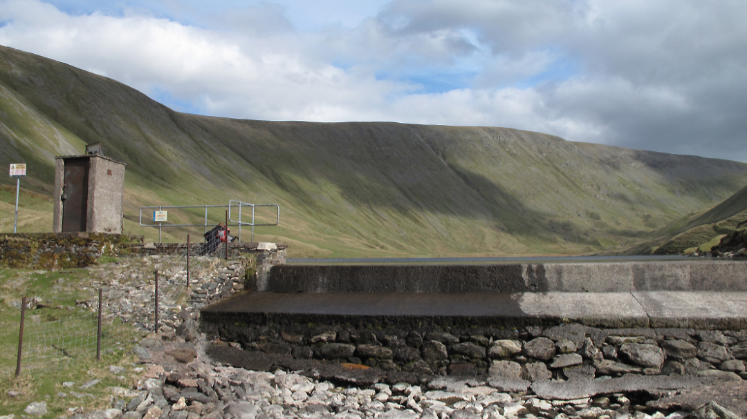
Up ahead is the gap where the old reservoir dam used to be. First built in 1908 to provide drinking water for Penrith, the dam had a long history but it was removed in 2014 when the lake became a natural mountain tarn once more.
This was my picture taken on a walk here in 2010
Now it is all cleared and the water level has dropped about 2 metres as a result. Still, it didn't stop five youngsters going for a dip, watched by the myself and the walker . . . and investigated by Dougal !
The drop in water level has left a noticeable scar but it has re-naturalised reasonably well in the last nine years.
The final water's edge is still subject to the rise and fall of the lake level during wet weather so is still clear of gravel, but the area behind has re-grown with natural vegetation.
The old path up the valley still exists and in places climbs high above the water.
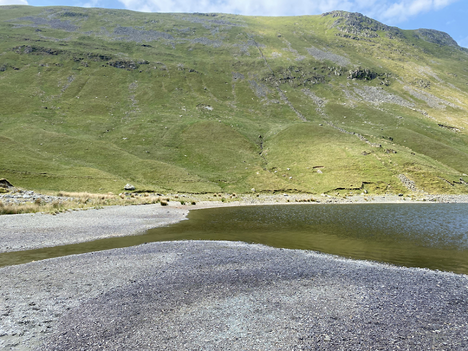
However one hundred years of being covered in water has meant the head of the lake has lost all its vegetation.
A panoramic shot from the old wall which enters the lake just left of the centre of the valley. The gravel area was reasonably firm but beyond the wall, where the Hayeswater Gill enters the lake. Here the bed of the old lake becomes a lot softer and more muddy, especially close to the water's edge.
Crossing the valley, the pools and water course of the river seemed full of minnows though to catch a good picture of these fast moving young fish proved slightly more problematic.
Back to gravel as I walk down the eastern shoreline. The dogs had another swim which cleaned them up nicely and I joined them as they said the water was nice and warm !
After an invigorating rub to warm up (never trust the dogs when they say the water is warm) we continue on . . . back to the foot of the lake.
After crossing the footbridge I head back down the track towards the car.
The weather was beautiful today which allowed clear views of the Helvellyn Fells across the wooded top of the Hartsop-above-How ridge.
That triangular peak is not Catstycam but Gavel Pike, just below the summit of St Sunday Crag.
The unique reason for me wanting to visit Hayeswater today ? I will say little at present, but point you at https://www.unitedutilities.com/crummock - - - o o o - - - |


Technical note: Pictures taken with my iPhone 11pro phone camera.
Resized in Photoshop, and built up on a Dreamweaver web builder.
This site best viewed with . . . a better idea of what a re-naturalised lake looks like.
Go to Home Page . . . © RmH . . . Email me here
Previous walk - 2nd June 2023 - Castles and Birthdays
A previous time up here - 9th April 2011 Rest Dodd and The Nab
Next walk - 14th June 2023 - Borrowdale Hydro