|
|
|
 |
Remember: Press F11 for a
full screen view of this page. |
Web Counter when published 2
064 666 |
|
" In Search of Snowdrops - Calder Valley " Date & start time: 20th February 2023. 1 pm start. Location of Start : The Village Hall,, Calder Bridge, Cumbria, Uk. ( NY 142 061) Places visited : Calder Abbey, Strudda Bank, Thornholme bridges, High Prior Scales Farm. Walk details : 6.5 miles, 625 ft of ascent, 2 hours 40 mins. Highest point : Needless Gill Bridge south of Thornholme, 525 ft - 161m above sea level. Walked with : Loes, myself and the dogs, Dylan and Dougal. Weather : Overcast but generally dry, wet underfoot at times.
|
© Crown copyright. All rights reserved. Licence number PU 100034184. |

|
Today's walk was Loes's idea . . . She remembered lovely snowdrops in the valley near Calder Abbey that she used to love to go and visit. The same valley was the location of a walk she did several times in years past and she said it would be nice to repeat that walk again. I'd walks part of the route, especially the river section behind Cold Fell, so this walk would be a nice change in what was familiar landscape.
From Loweswater we drove via Ennerdale Bridge, over the top via the Cold Fell Road to the village of Calder Bridge, ready for today's walk.
There is convenient parking at the Village Hall, next to Norman's "Mill Garage".
Across the road and adjacent to which our path started, was St Bridget's Anglican Church.
A brief walk through trees brought us to the river, but not to a clear view of Calder Bridge, which gave the village its name. With a bit of imagination you can see the bridge between the white Pub on one side and the house on the other side of the River Calder. [ For those with long memories, Calder Hall was the original name of the Sellafield Nuclear and Reprocessing Plant.]
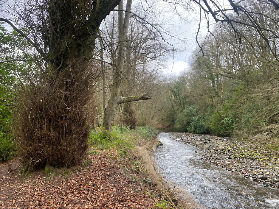
Our first clear view of the river as we walked along the raised bank on the left.
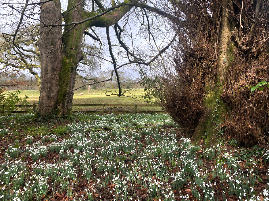
No false promises . . . there were snowdrops in the woods.
In fact there were lots of snowdrops in the woods.
Close up on even more . . . all in their prime in late February.
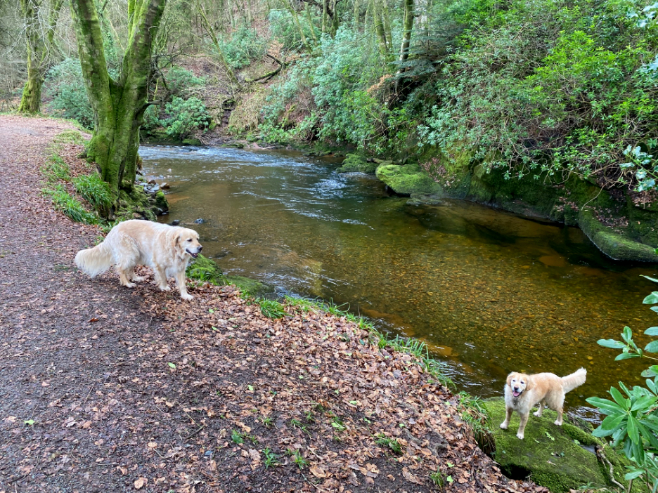
Don't want to spoil you with too many snowdrop photos . . . so here's some wild crocuses . . . and tame dogs.
Dougal wanting a stick or a ball to be thrown into the river so he could jump in and fetch it. He's a real water dog, Dylan having willingly passed him the title.
The riverside path leads up to Calder Abbey.
The grand frontage of the "Abbey" and several old cloister arches behind.
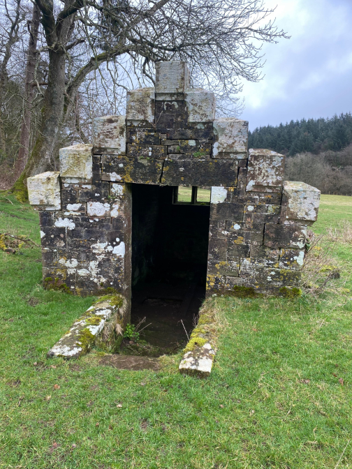
In the grounds of the old abbey were two old structures, one hidden under a grassy mound.
This beehive shaped structure was reputedly an ice house, though it seems to lack the usual deep, recessed hollow associated with such buildings.
This second building was almost certainly a water mill, with perhaps a modern turbine rather than a wheel, for generating electricity.
Behind it was a mill leat which would have brought water from the river to power the turbine. Wiki also mentioned that the Abbey would have had a water mill of its own, way back in the middle ages.
Bonus . . . more snowdrops at the top of the field. The green branches to the left was a pile of cut rhododendron bushes which had originally grown in or near the water leat. Someone must be taking an interest and looking after the place at least.
The first loop of this walk seemed quite short, so Loes offered a second loop, walking up the valley to the bridges behind Cold Fell and back down the other side. I had not done this walk before so off we went, leaving the road in favour of an old track that started near Stakes Bridge.
On old quarry on the left, probably the source of the nice stone use in local buildings like the abbey.
 The track ascended the valley side, crossing through farm land and woods . . .
. . . including this unnamed stream that had started on land near Beckcote Farm. A new-ish handrail helped navigate the very muddy steps down to the bridge.
More field walking, this time near Strudda Bank Farm, as the public footpath took us on up the valley. Turning to look back, we had views all the way to the coast.
Our slip-sliding climb up through the farmland now turned into a simpler grassy descent to the river. Fortunately conditions underfoot were a lot more respectable, as the previous section had been quite hard work !
Down by the river there's a sheepfold which was a great 'way mark' on our way to the bridges.
Through another section of old woodland and the footbridge over Worm Gill came into view.
This pool is the confluence of Worm Gill and the Calder so we had to cross not one but two bridges to get to the opposite side of the valley and to find our route back down to Calder Bridge.
Fortunately the second footbridge over the Calder was just a short distance up-river. I had last crossed this remote bridge with Ann on a walk to Cold Fell and up river to Matty Benn's Bridge back in 2009.
This time Loes and I would head south instead, here crossing over Worm Gill Bridge.
One last look up the Calder Valley before we headed south, down river.
After a rather tiring and muddy walk up one side of the valley, one which was a lot muddier than Loes remembered from old, we now had an equally long return walk, but this time on the minor roads which meant the going was easier.
Back at Stakes Bridge where our route diverged quite some time ago.
More of those white flowers adorn the hedgerows as we pass the grounds of the old abbey and its home farm. The dogs were looking a bit muddy and it appears that Loes was feeling the effect of what had been quite a hard walk today.
A few last photos, this one of the trees that rather hide the old abbey and the grand building that was constructed alongside it following its dissolution.
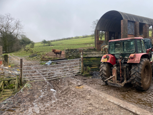
The view through the gate of the home farm next to the abbey grounds.
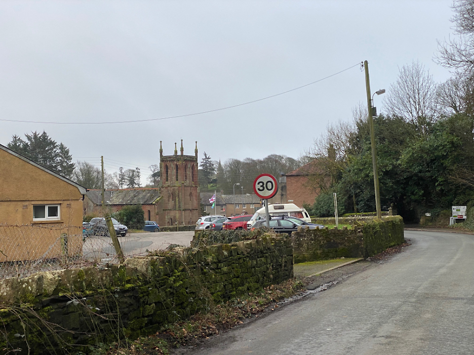
. . . and finally the welcome sight of the modern church, the village Hall and the car waiting in the car park, ready for our return journey to home. - - - o o o - - - |


Technical note: Pictures taken with my iPhone 11pro camera.
Resized in Photoshop, and built up on a Dreamweaver web builder.
This site best viewed with . . . the chance to visit old haunts . . . for both of us.
Go to Home Page . . . © RmH . . . Email me here
Previous walk - 19th February - Mellbreak with The Mob
A previous time up here - Sat 11th July 2009 Cold Fell and Matty Benn's Bridge
Next event - 28th February - A Cumbrian Wildlife Hedge Laying Course