|
|
|
 |
Remember: Press F11 for a
full screen view of this page. |
Web Counter when published 2
048 750 |
|
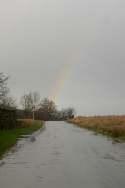
" Mob Walk to Hopegill Head " Date & start time: Sunday 8th January, 2023. 9 am start. Location of Start : Lanthwaite Green, Lower Buttermere Valley, Cumbria, Uk. ( NY 159 208). Places visited : Whin Ben, Whiteside, Hopegill Head, Sand Hill, Gasgale Gill. Walk details : 5.4 miles, 2475 ft of ascent, 4 hours 30 mins. Highest point : Hopegill Head, 2,525ft - 770m. Walked with : Peter, Julie, Richard and myself, plus the dogs, Dylan and Dougal. Weather : High winds and wintery showers forecasted.
|
© Crown copyright. All rights reserved. Licence number PU 100034184. |
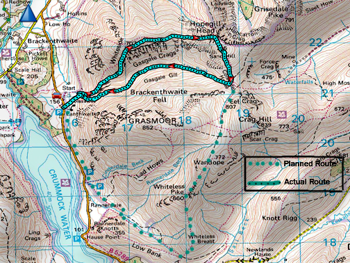
| The Mockerkin Mob, a local group of fell walking friends, are starting the New Year with a high level walk of the North Western Fells. The plan was to walk Whiteside, Hopegill Head, Sand Hill and then go on via Coledale Hause to Whiteless Pike and Rannerdale. However the weather seemed to have other ideas, as the morning forecast was for high winds and wintery showers !
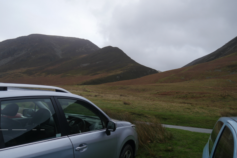
On arrival the weather didn't look as bad as forecasted, and as we kitted up there was a brightness about the sky. Our route would be up Whin Ben (the first summit) and then on to Whiteside and Hopegill, with several "safety options" along the way. Start point was at Lanthwaite Green . . . note the return of the repaired Subaru after its icy adventures :o)
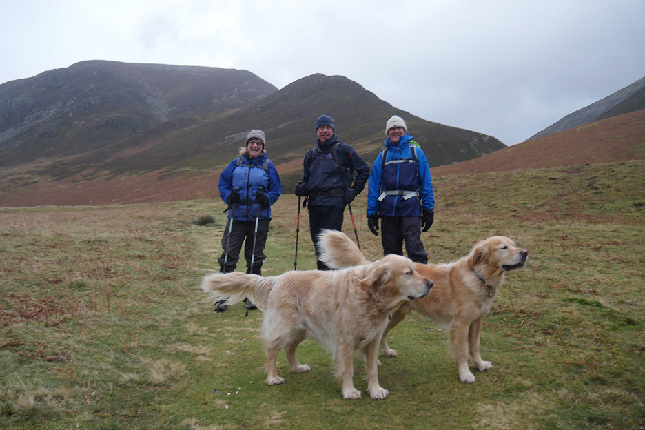
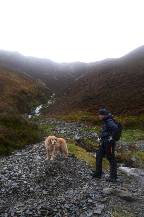
A hardy band of four walkers (including myself) and two dogs (Dylan and Dougal) were prepared to give it a go. Meet Julie, Richard and Peter.
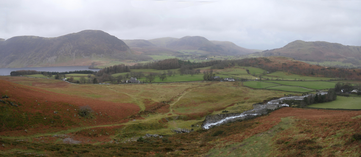
Looking back at Crummock Water, Mellbreak and the Loweswater Fells. The cars at Lanthwaite Green are receding into the distance now . . . but that forecasted wind is increasing as promised.
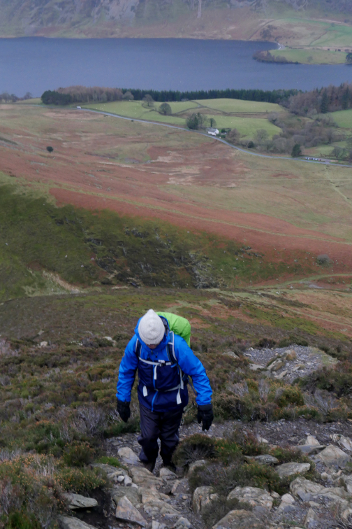
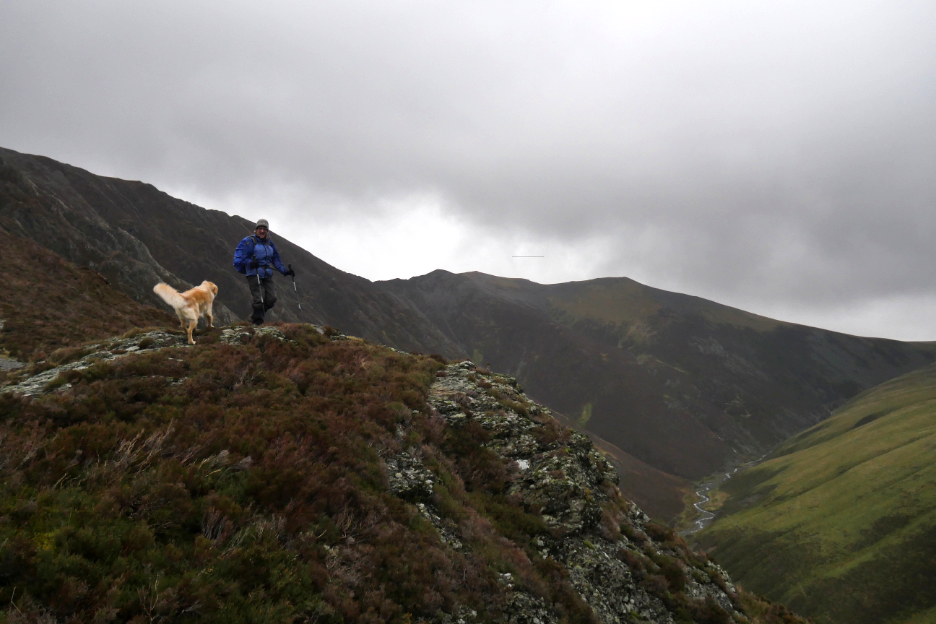
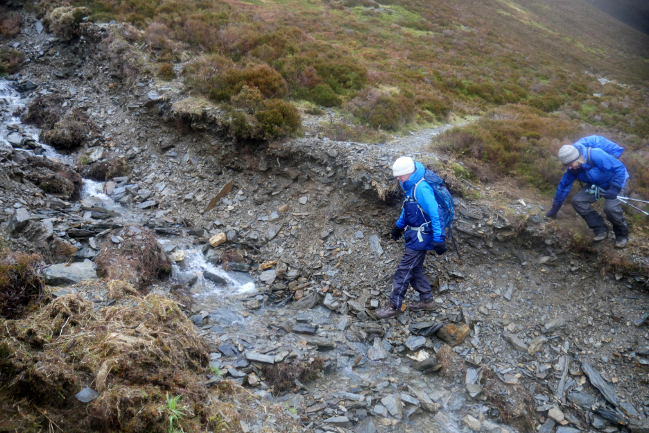
Richard choosing the trekking pole option to keep himself more level as we leave the minor Whin Ben summit behind us. I'm not sure of the exact calculation, but I believe it naturally cools about one degree for every 500 foot climbed. Today that statistic was enhanced by the wind chill factor.
Julie pauses on a rocky bluff, for me to get a photographic foreground to balance the long distance view to Hopegill Head.
The background seems to be getting greyer and less distinct now as one of those wintery showers starts to head our direction.
Dampness on the lens as I look across to the protective bulk of Grasmoor, not that it is protecting us much from the wintery weather.
The sleety shower hits us . . . as can be seem from the half closed eyes and swept back fur. Still the dogs seem to take the weather in their stride . . . how do they do that ?
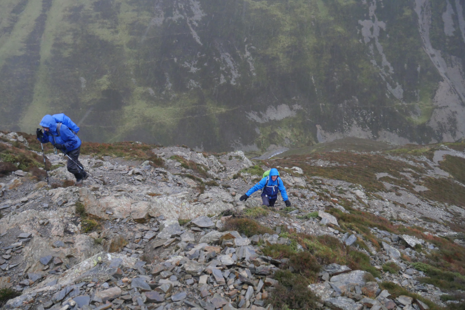
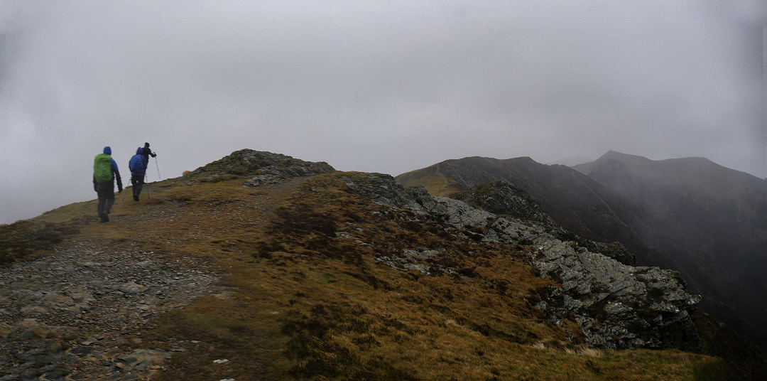
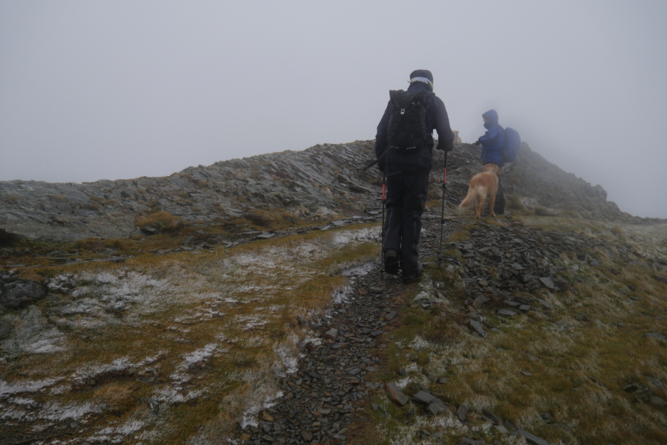
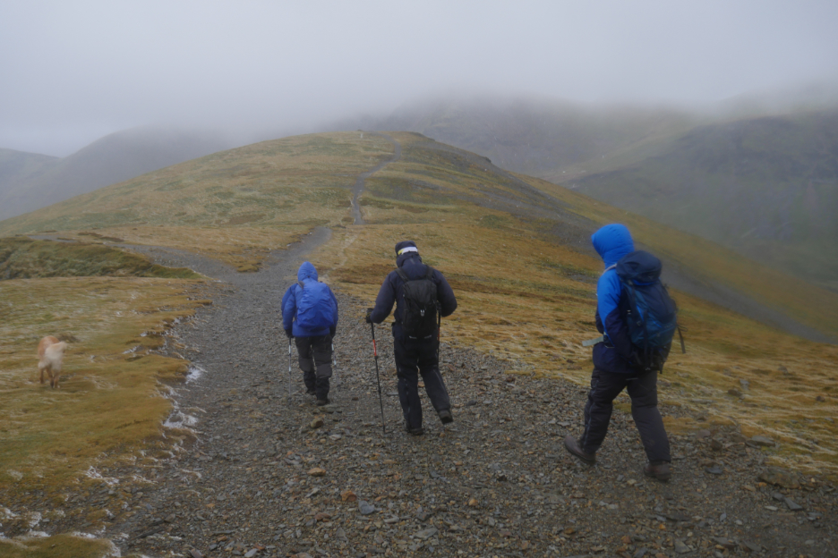
Successfully reaching the summit of Whiteside where the exposed position meant we were hit with the full force of any gusts.
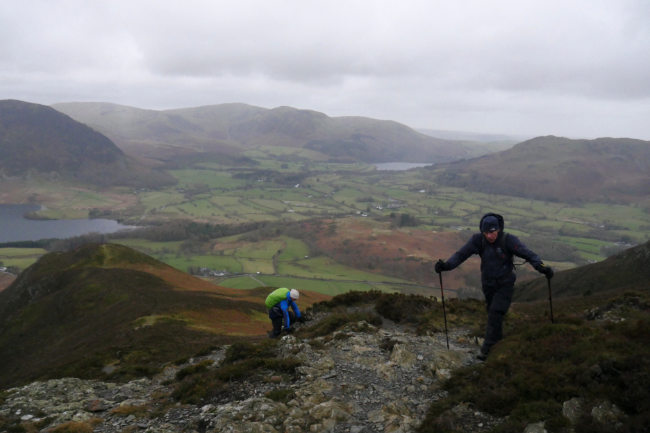
After an hour and a half of slightly slower climbing we hit the ridge. Thoughts of a coffee stop were put on hold as another squall headed our way.
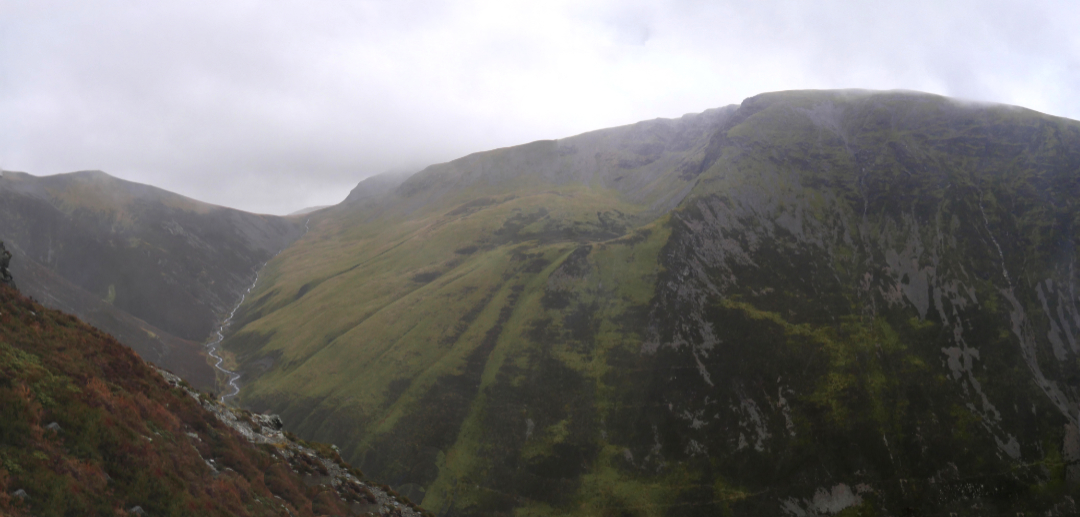
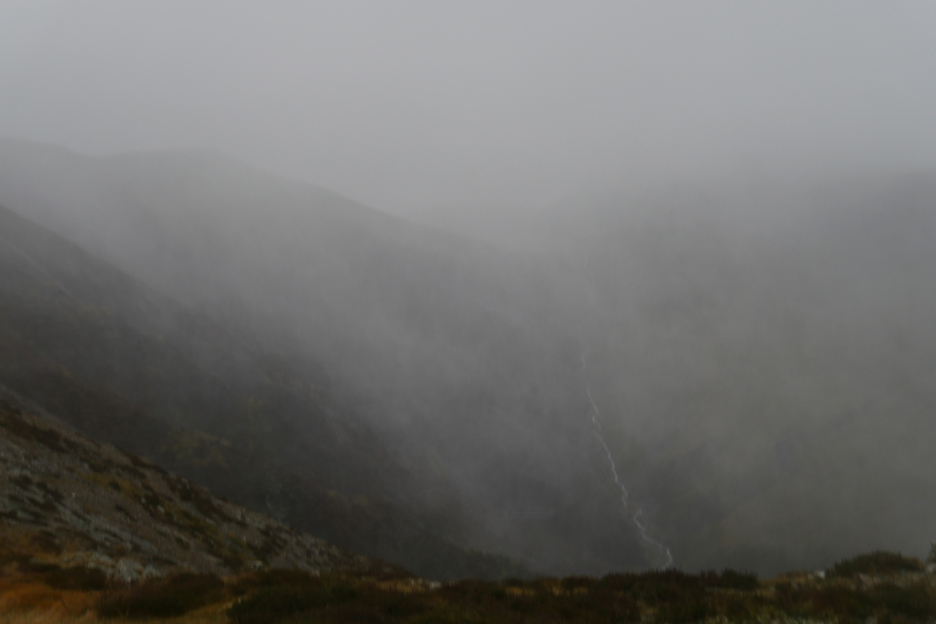
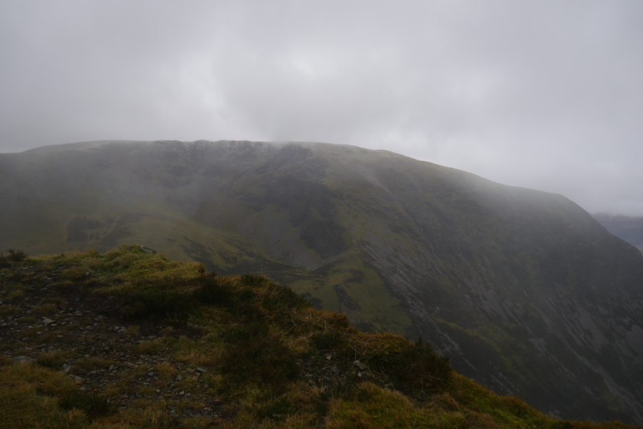
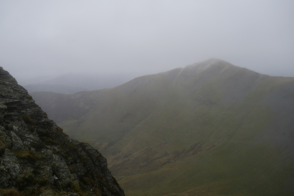
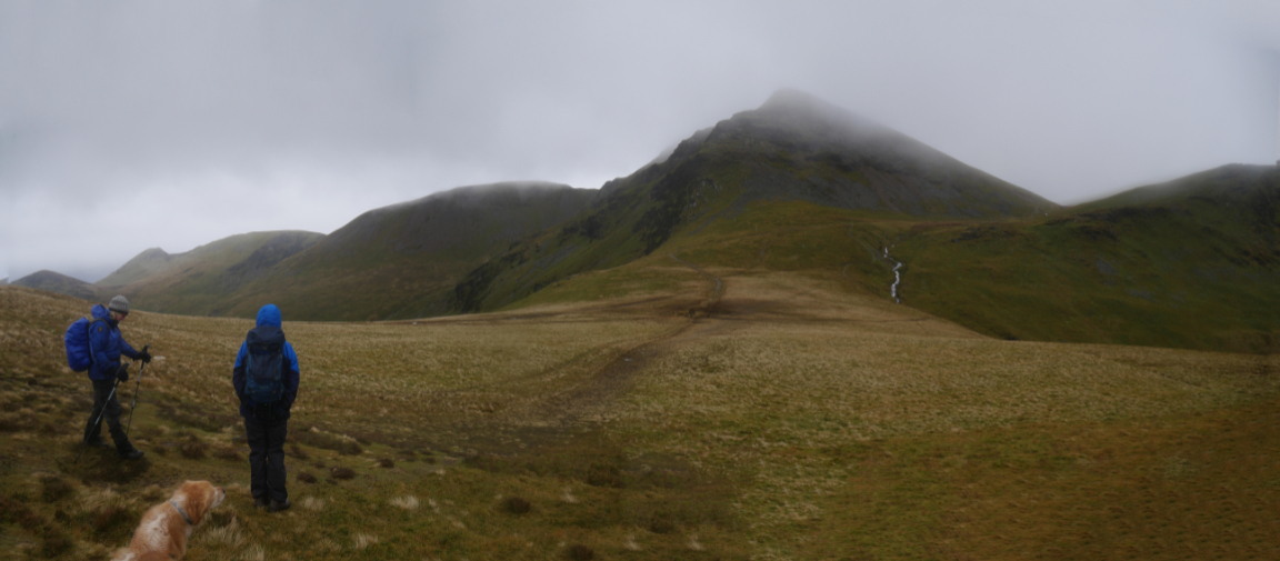
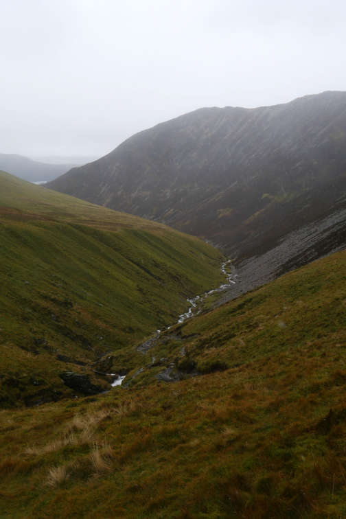
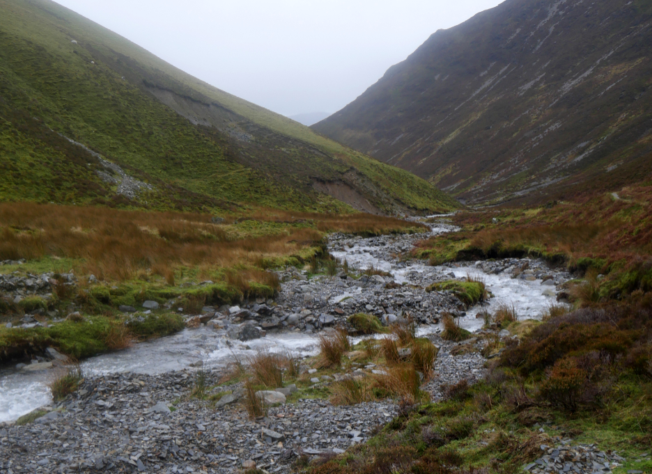
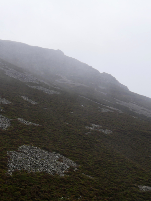
Looking down into Gasgale Gill . . . the peak in the gloom to the left is Sand Hill.
The option of an exit route down to Dodd and back to Lanthwaite was dismissed as despite the wind we were feeling okay about the conditions. That open crossing of the ridge needed care but otherwise it was not a problem.
After the squall had passed, Grasmoor has a light dusting of white on its summit.
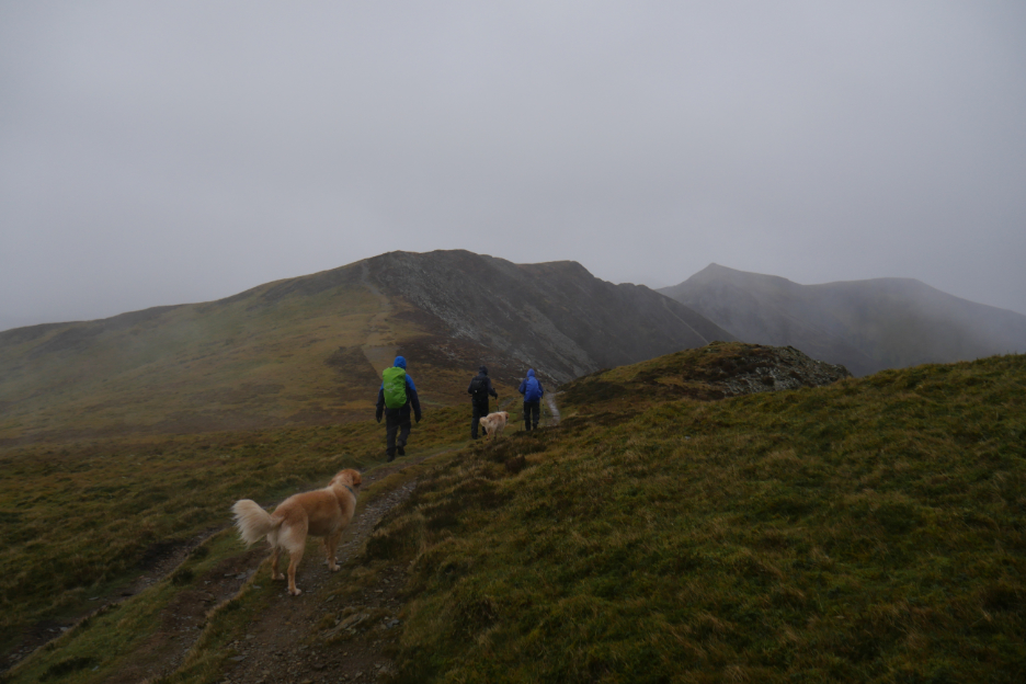
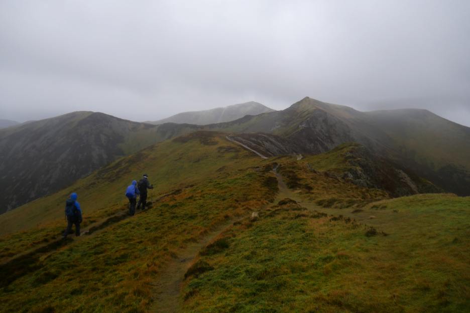
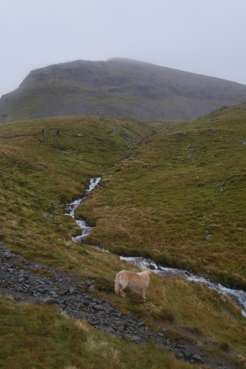
Our next summit is Hopegill Head. The reputation of the high level ridge being one of the best in the Lakes is quite true even today. It's been cold, its been wet, but the underlying temperature is above freezing so it was not unpleasant.
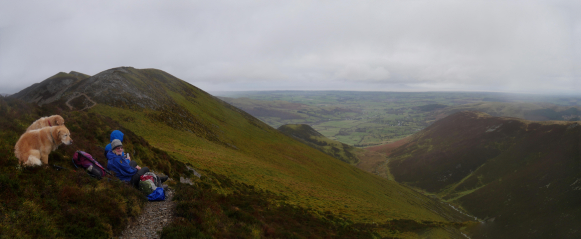
Not to say that a stop for coffee tucked under the lee of the ridge was not appreciated ! The latest squall had blown over and the long distance visibility returned . . . we could even make out Criffel across the Solway Firth.
Nothing stays the same for long in these conditions and another wintery shower blew through once again. You can even see the streaks of the sleet blowing across the photo, due to the slow speed of the shutter and fast speed of the wind.
Richard strides out for the summit . . .
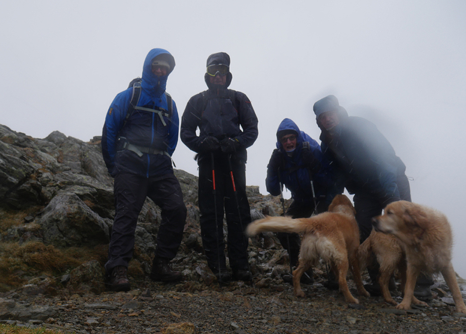
. . . as another shower leaves its mark on the summit rocks. Time for a quick summit photo if I can manage it.
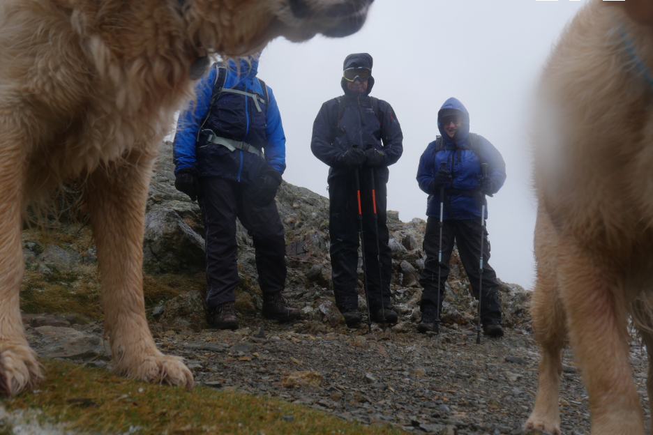
The group sheltered behind the giant dogs as I tried to set up the 10 second delay on the camera using a rather cold hand.
Sorted . . . time to get myself and the dogs in the picture as well.
No time to hang about, so a quick picture of Grisedale Pike before we head on.
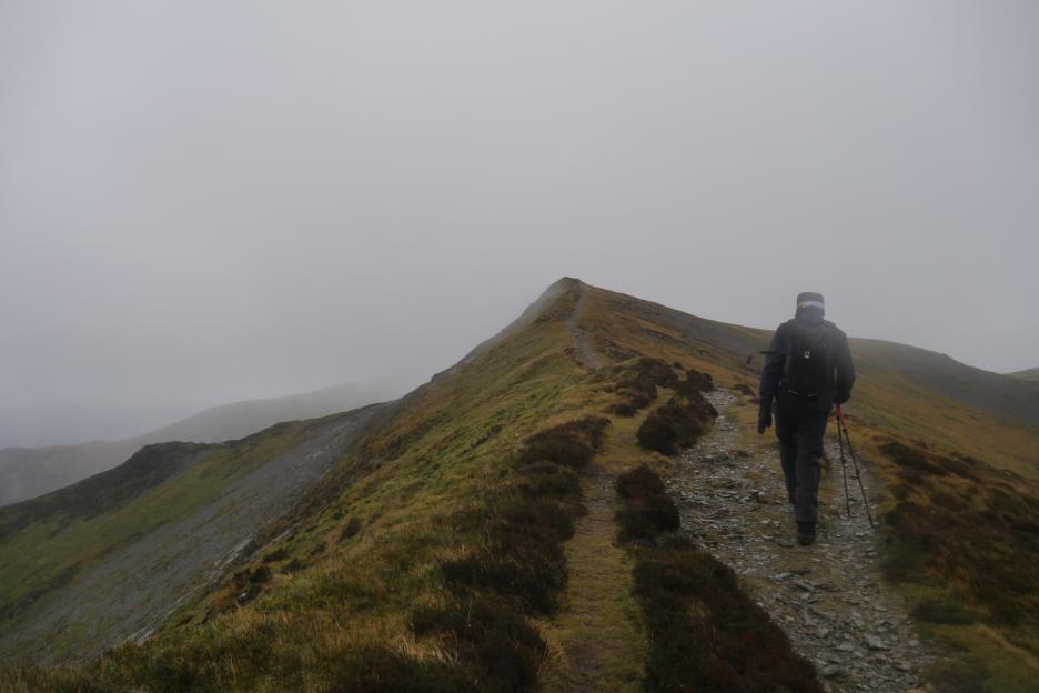
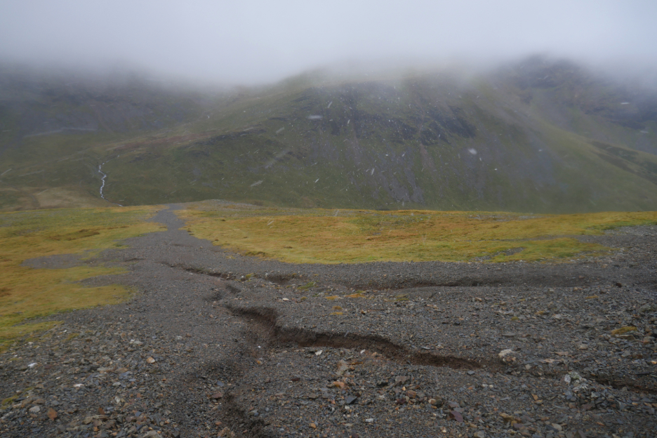
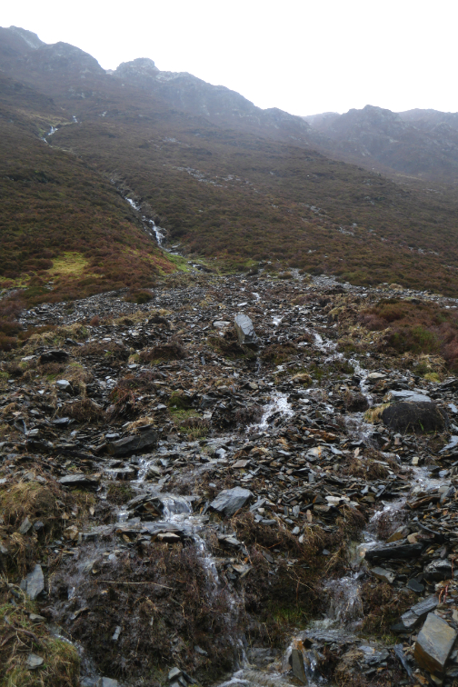
The track to Sand Hill.
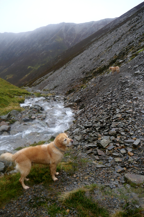
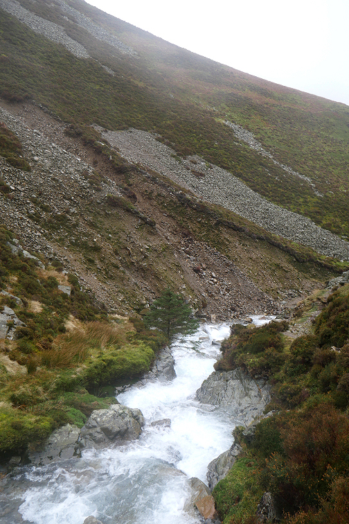
Another squall as we drop down to Coledale Hause. Recent rains have caused several deep gullies on the "Sand Hill" scree.
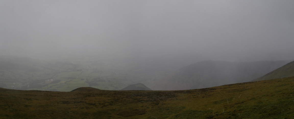
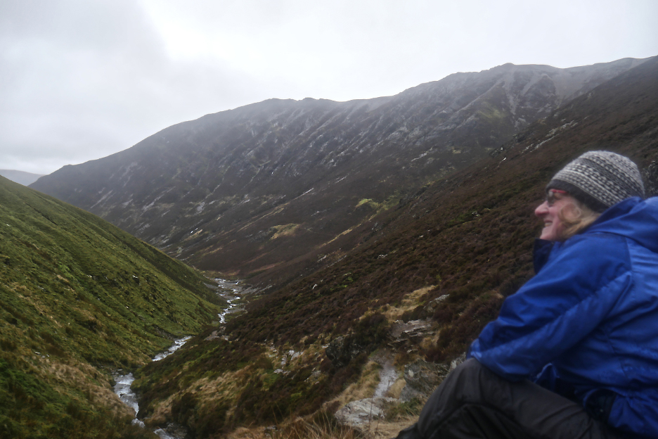
The skyline ranged from Causey Pike on the left to Sail and Eel Crag ahead. Given the time taken to here and the state of the weather we decided on a change of plan. To go on would involve a long walk, so to drop down Gasgale Gill would be a suitable alternative route for us today. We spoke to two young guys who were aiming for Grasmoor summit . . . we wished them well.
A flat patch and a lull in the weather on the way down where a quick coffee and the eating of the remaining lunch sandwiches seemed a good idea !
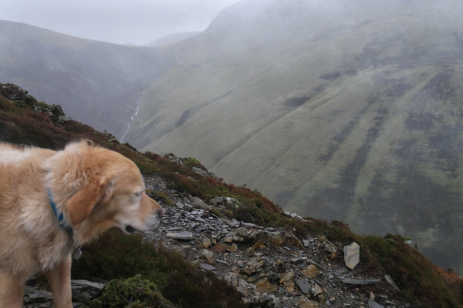
Gasgale Gill as it changes to a more gentle descent angle. Even up here in this wintery weather I spotted a dipper flying low across the water . . . a sturdy creature for sure. - - - o o o - - - Around here we met the only other couple of the day. They looked young, inexperienced and lightly clad, with only one pair of gloves between them. We gave them some hopefully positive advice including which was their mountain (Grasmoor !) and other possible options for them.
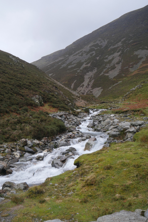
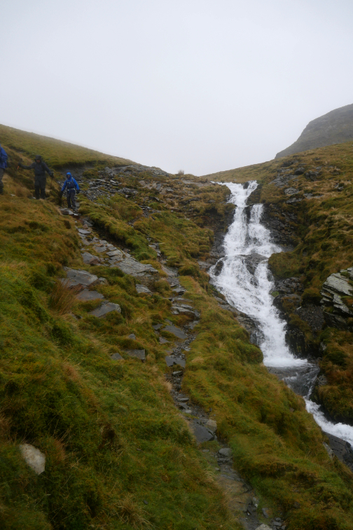
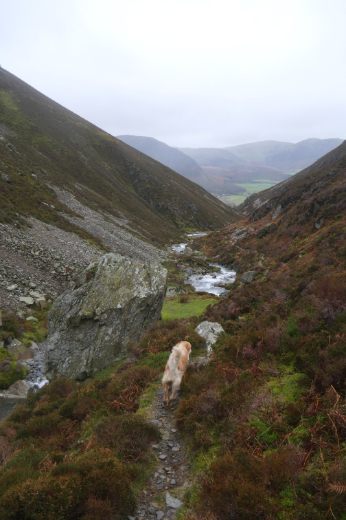
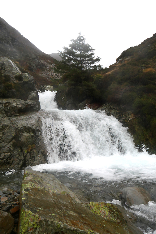
One of the streams falling from Gasgale Crags had eroded a four foot trench, cutting the footpath in two. It was so recent that a replacement path hadn't yet developed.
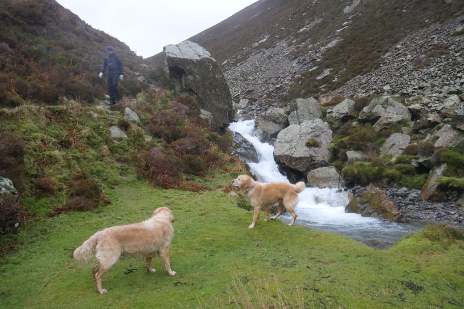
Peter commented on the nice camping spot . . . it would need fine weather and ear defenders from the noise of the water.
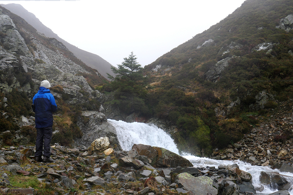
Peter stops for his own photo of the falls. The normal path climbs down over three or four large steps next to the falls, but an alternative traverse path can be taken when the rock is wet and slippery (like today).
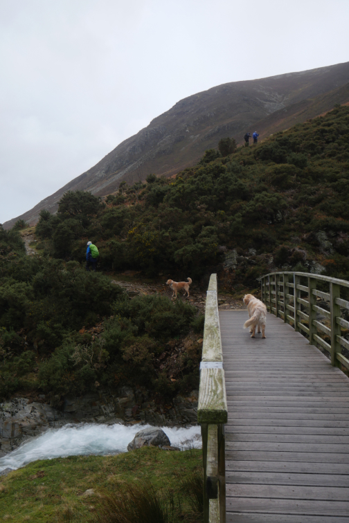
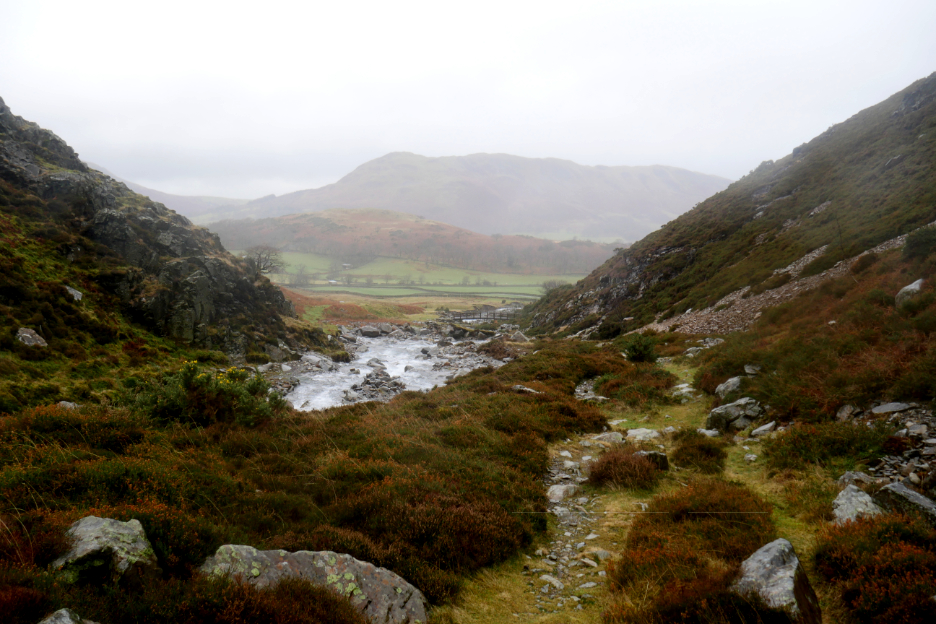
The footbridge and Lanthwaite Green are in sight ahead.
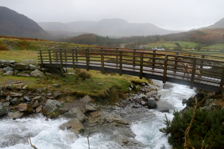
I think this is where we came in. It's just a short walk back to the car parked next to the main road.
- - - o o o - - - |


Technical note: Pictures taken with my Panasonic Lumix Gx8 Camera.
Resized in Photoshop, and built up on a Dreamweaver web builder.
This site best viewed with . . . a warm flask of coffee and waterproof gloves.
Go to Home Page . . . © RmH . . . Email me here
Previous walk - 25/26th December - Harewood for Christmas
A previous time up here - 1st January 2009 Winter Whiteside and Hopegill Head
Next walk - 15th January 2023 - Whinlatter's Seldom Seen
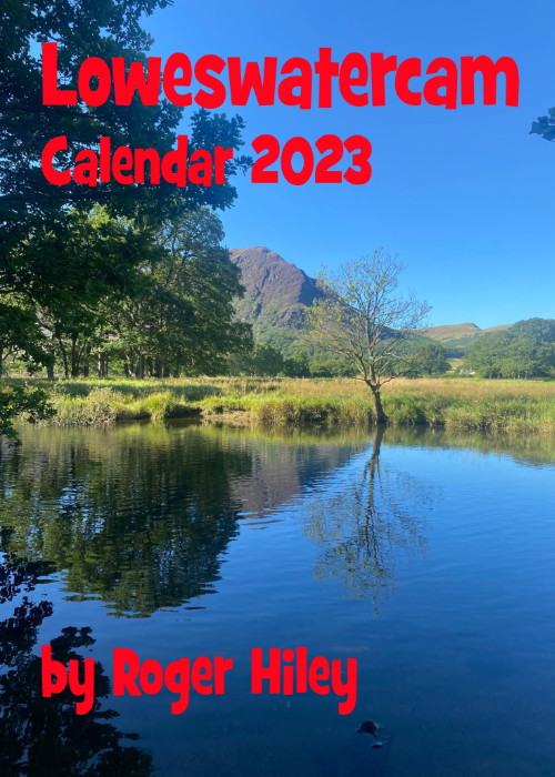 |
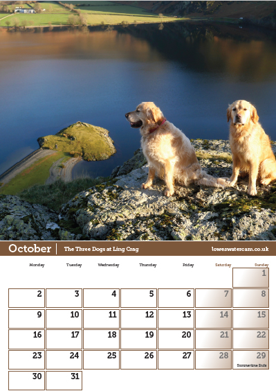
"Sale Now On" . . . as they say in the best retail shops ! The 2023 Loweswatercam Calendar Half Price in the January Sale ! For the 14th annual edition of the calendar we have been looking back at the year to bring you twelve months of Loweswater pictures and Cumbrian scenes.
Click here or on either picture to see the full details. £6 a copy (plus postage + packaging if required) Anything you add above the £6 goes to support the Air Ambulance and Cumbrian Mountain Rescue.
|
 |