|
|
|
 |
Remember: Press F11 for a
full screen view of this page. |
Web Counter when published 1
929 430 |
|
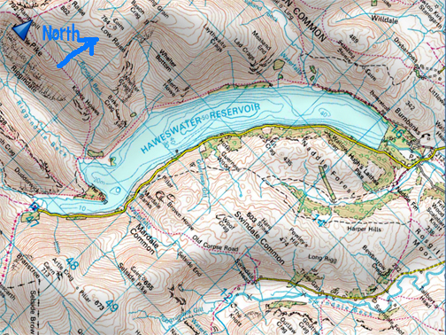
" The Haweswater Drought - 2021 " Date & start time: Several visits during September 2021. Location of Start : Haweswater Reservoir, Mardale, Cumbria, Uk. ( NY 471 118 ). Places visited : The old Mardale Village. Walk details : Several visits and walks around the southern head of the reservoir. Highest point : Watching the old village re-emerge from the water. Walked with : Chris and Jeff Goode, and Chris's brother, Dave Whalley. Weather : Fine and dry . . . and has been for a while.
|
© Crown copyright. All rights reserved. Licence number PU 100034184. |
|
Loweswatercam viewers Christine Goode, her husband Jeff and her brother Dave Whalley, enjoyed their visits to Haweswater during the drought. Not only did they re-visit several times but they also send me pictures of their walks and the old flooded village that they found. I was unable to join them but have tried to convey the story of their visits and some of the area's history by adding additional maps, photos and facts that I've gleaned from W R Mitchell's Book "The Lost Village of Mardale".
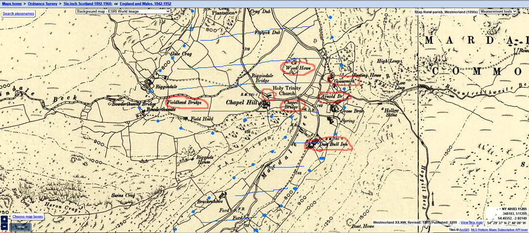
The 1897 Map (courtesy of the O.S. Six Inch series) shows the houses, church and pub that would be lost to the new reservoir. My blue dots along the 800m contour outline the approximate extent of what was to become the new lake.
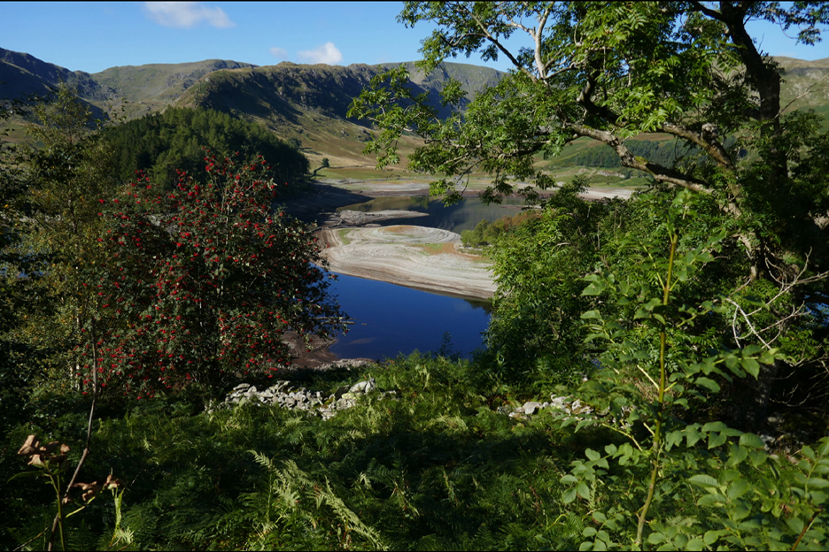
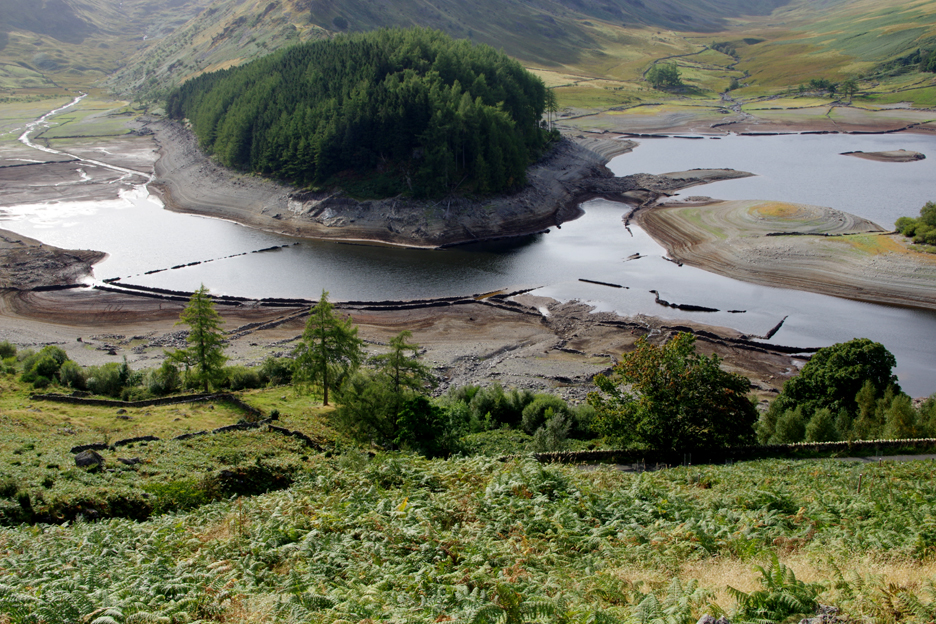
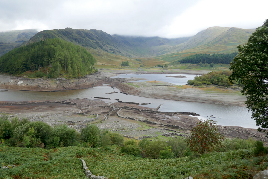
The late summer drought and the heavy use of water by the Midlands population had led to the newspapers featuring pictures of the valley as the old walls of Mardale began to emerge from their sunken isolation. Amongst the people who visited to see the sights were Chris, Jeff and Chris's brother David. Their pictures form the basis of this web page.
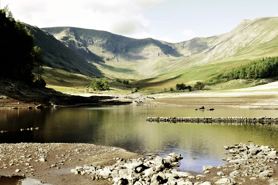
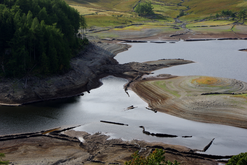
Sunny and dry weather during the summer has led to falling water levels in the reservoir as the rainfall failed to keep pace with the water extraction.
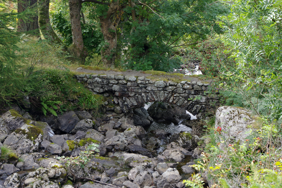
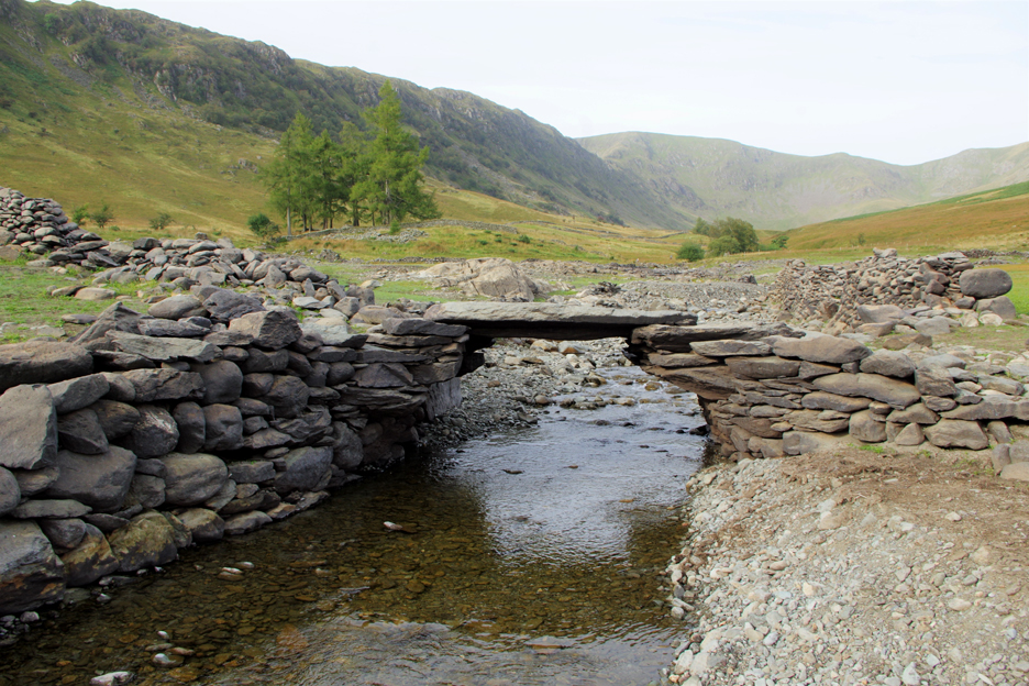
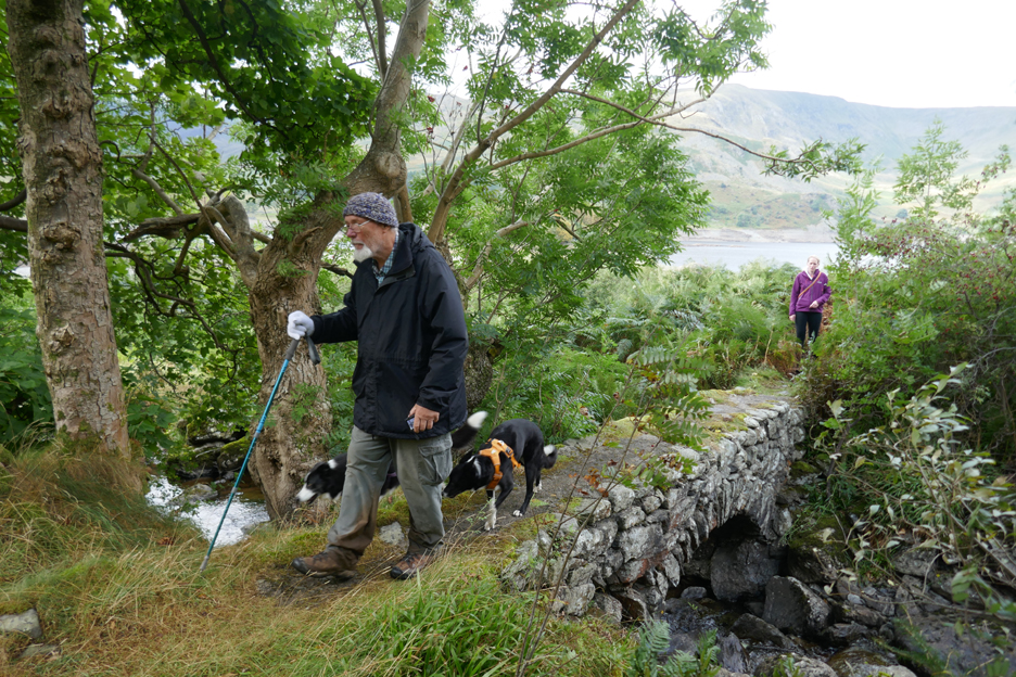
One of the ways down to the lake shore is via the old footbridge over the delightfully named Rowantreethwaite Beck.
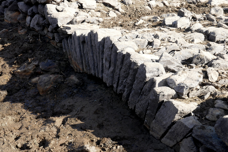
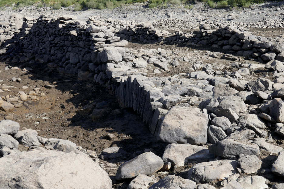
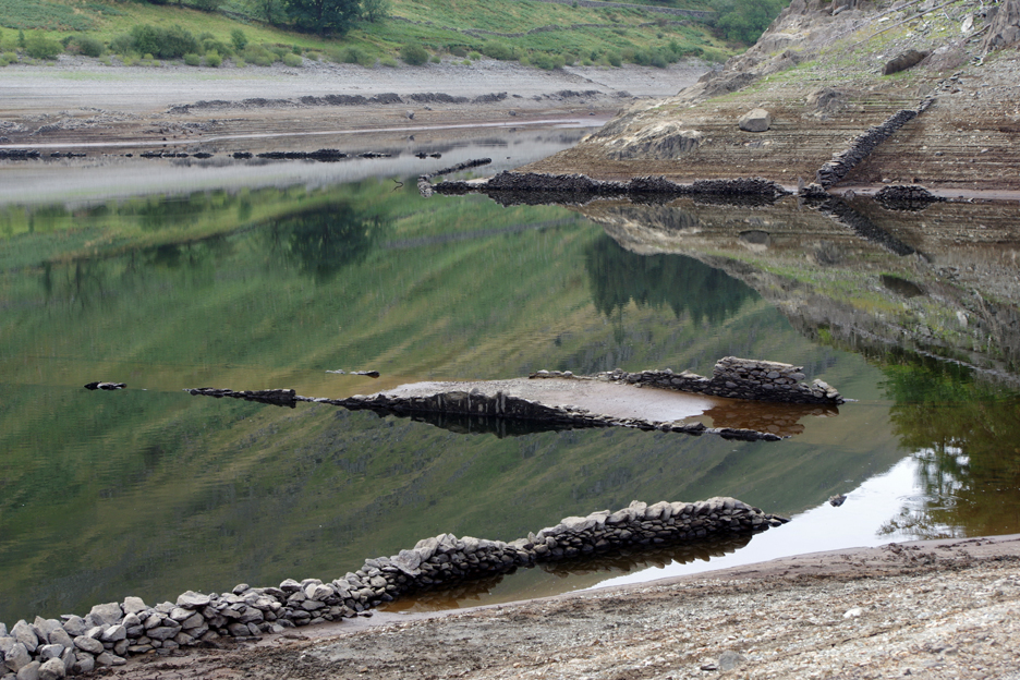
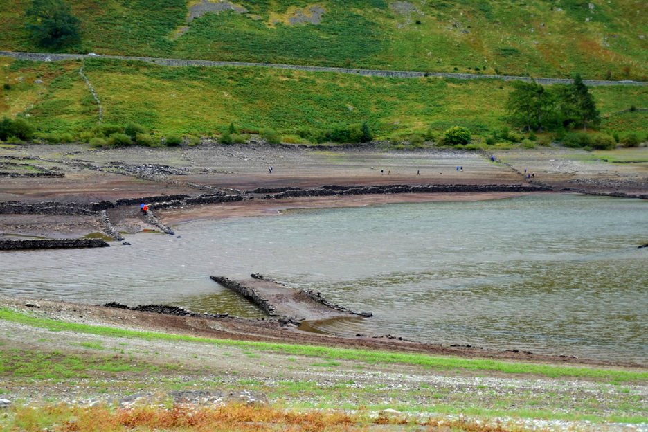
Looking across the wider part of the head of the lake. Beyond is the Riggindale Valley with Rough Crag to the left and Kidsty Pike to the right. The old walls of the valley were never demolished and so are first to appear from underneath the water.
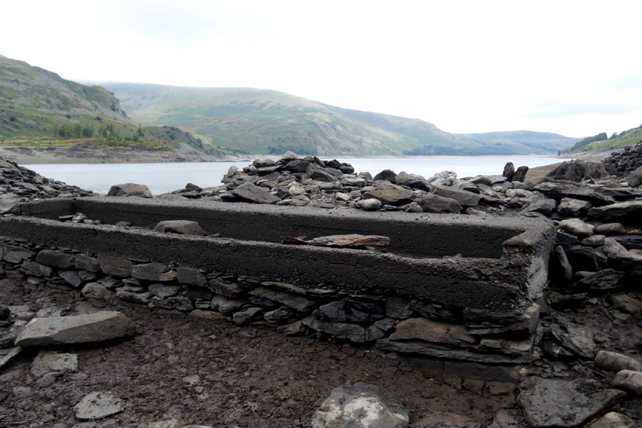
A relatively modern cement trough that would have served the animals of the old farms of Goosemire or Grove Brae.
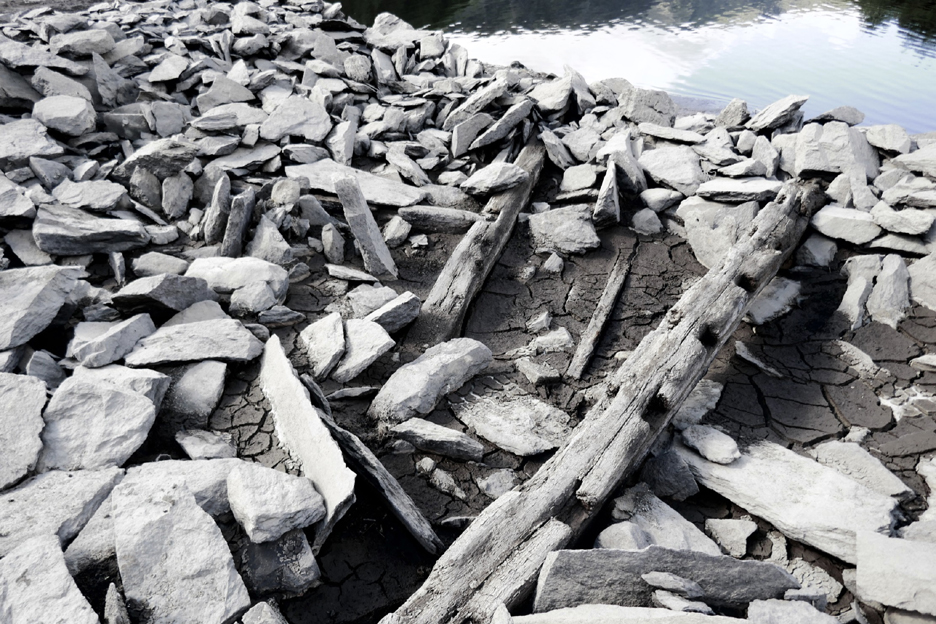
The buildings of the old village were deliberately flattened before the water flooded the area. It was reportedly the task of the local Home Guard, which give them wartime practice in handling explosives. In the ruins were some of the old wooden beams that would have been included in the structurer of the houses or barns.
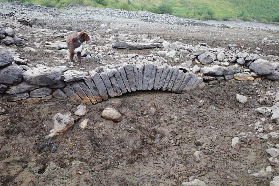
A low arch, now only just visible above the mud was the old Arnold Bridge that crossed the now silted up Rowantreethwaite Beck, seen in the earlier photo.
A close up of the old arch.
A wider shot showing some of the old walls that lined the old lane to Goosemire.
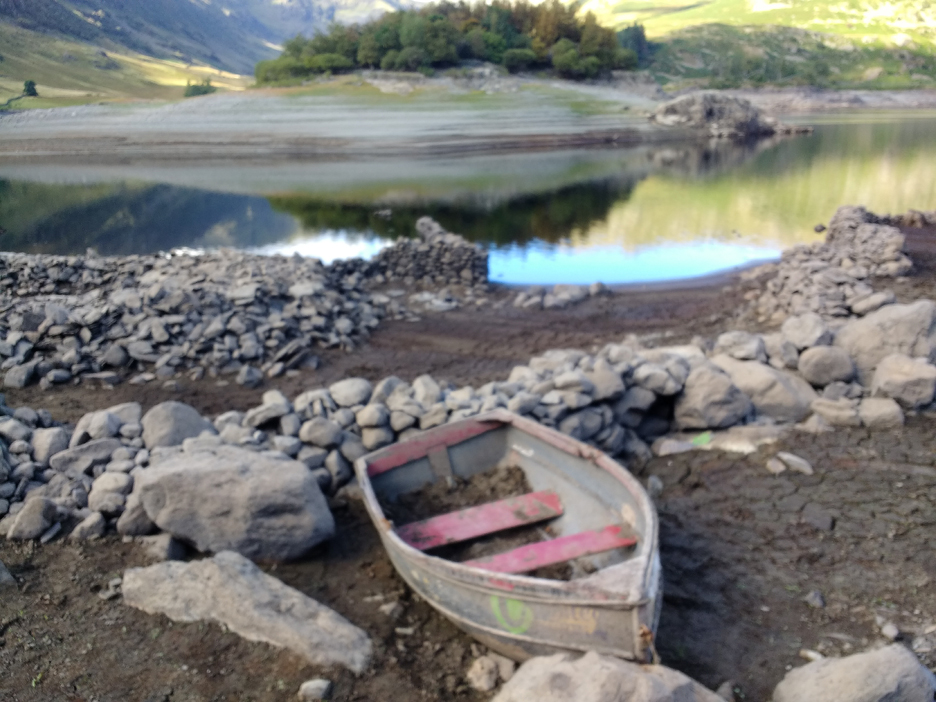
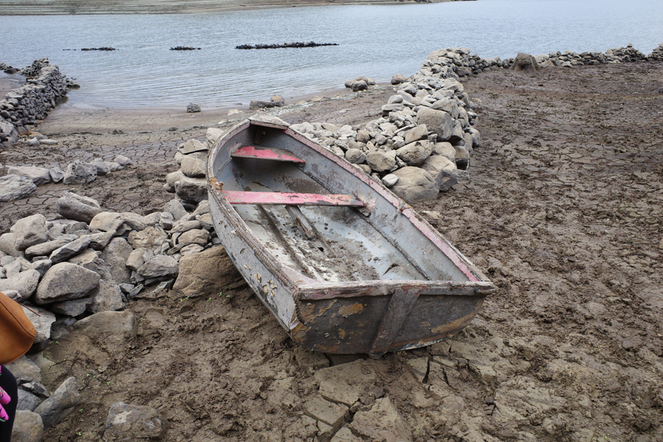
An old boat that had been underwater for a while. The floor of the boat had a good covering of mud. The green paint was apparently part of an United Utilities logo, so it post-dates the reservoir by several decades.
On a subsequent visit the mud had been partially cleared and the boat moved, but it was presumably too heavy to carry very far and there were no oars, so would have been impractical for a visitor to float on the water.
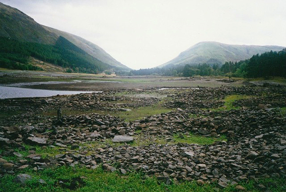
Several photos over time, from higher up by the new 1940's road, the only access now as the previous road up the valley was flooded by the lake.
The water level continued to fall as Chris, Jeff and Dave visited over time. All that remains of the site of the old church is the pile of stones to the left of the yellow grass on what is now an island. The larger pile of stones nearer to The Rigg was the old Chapel Hill Farm.
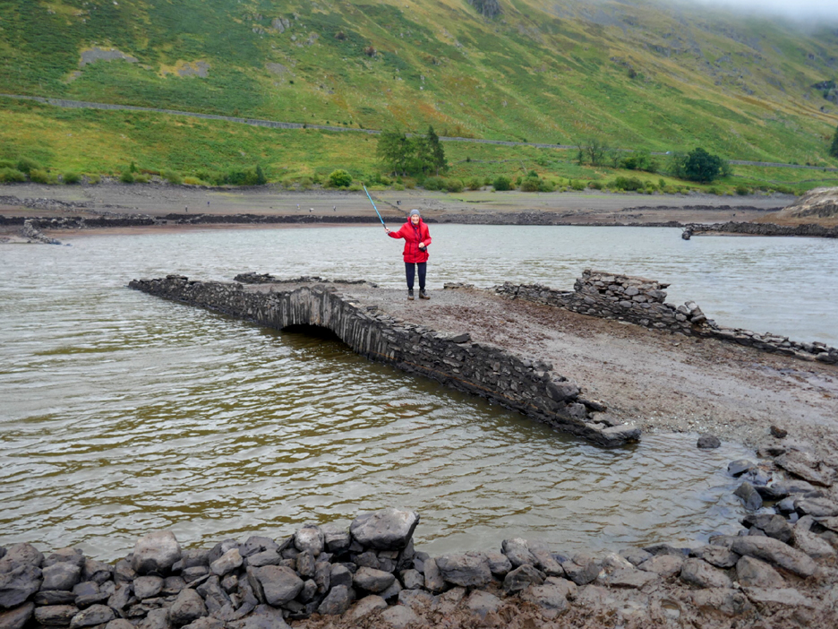
We're looking down on the site of the old Dun Bull Inn and Grove Brae Farm. Across the way are the wooded headland of The Rigg (to the left) and Wood Howe (to the right). As the water level fell, the old Church Bridge become exposed to view to visitors.
When our photographers walked around the opposite of the lake they could walk past the site of the church and look down on the bridge.
As the time went on the submerged grass has started to re-grow and the bridge could now be reached dry-shod.
Christine on the old Church Bridge.
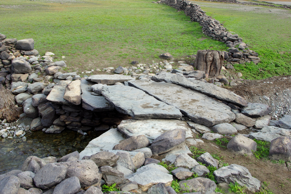
Whilst still on the opposite shore of the lake they went over to view the old Fieldhead Bridge close to Bowderthwaite Farm in the Riggindale Valley.
The clapper bridge is still in good condition and continues to provide a crossing of Riggindale Beck. As well as the church, all the farms were also demolished as the small population was gradually cleared from the valley.
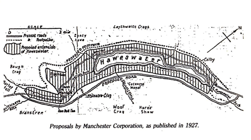
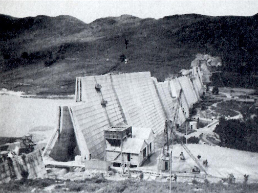
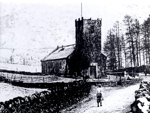
Dave returning to the car by crossing the upper Rowantreethwaite Bridge once more. - - - o o o - - - The plans for Manchester Corporation to drown the valley were first proposed in the 1920's. Work on the scheme was delayed by the 1930's depression but finally it was completed and the valley flooded by 1941. A final service at the church in the valley was attended by the last of the residents, politicians, members of the Manchester Water Board and a crowd of visitors, so many that the service had to be relayed by loudspeaker to the people outside. Some of the stones from the old church were incorporated into the Discharge Tower of the new reservoir.
- - - o o o - - -
- - - o o o - - -
- - - o o o - - - |
Technical note: Pictures generally taken cameras or phones of unknown origins.
Resized in Photoshop, and built up on a Dreamweaver web builder.
This site best viewed with . . . kind web site contributors.
Go to Home Page . . . © RmH . . . Email me here
Previous walk - 15th September Loweswater's Matterhorn with Loes
A previous time up here - 31st July 2004 Rough Crag, a Wainwright and OFC walk
Next walk - 27th October Stocks Res. Trough of Bowland