![]()
Remember: Press F11 for a full
screen view of this page.
Web Counter when published 1 879 500
|
|
|
|
Remember: Press F11 for a full
screen view of this page. |
Web Counter when published 1 879 500 |
|
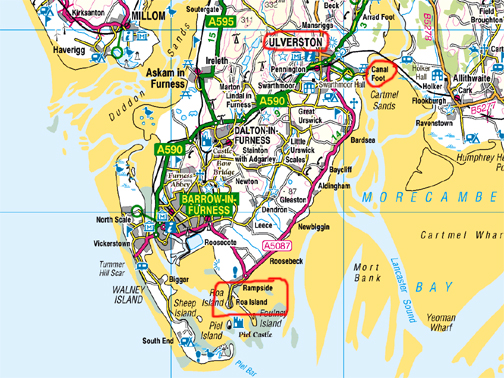
" Ulverston and Roa Island " Date & start time: 3rd April 2021. Half a day plus travel. Location of Start : Ulverston, South Cumbria, Uk. ( SD 295 791 ) Places visited : The Hoad, Canal and Canal Foot, Rampside and Roa Island. Walk details : Local walks, un-timed. Highest point : Hoad Hill Lighthouse, 430ft - 133m. Walked with : Just myself (dogs on holiday in Lamplugh for the day). Weather : Overcast but okay. |
© Crown copyright. All rights reserved. Licence number PU 100034184. |
|
During this time of fine weather and superb Easter fellwalking comes a very different day when I find myself down in the south of the county. In between commitments and appointments, I have chance to enjoy a walk and visit a few places steeped in history. Rural landscapes make way for urban and post-industrial views on today's outing.
Ulverston is a busy commercial town famous for Cumbrian Crystal Glass, as the birthplace of Stan Laurel and home to the unique Laurel and Hardy Museum.
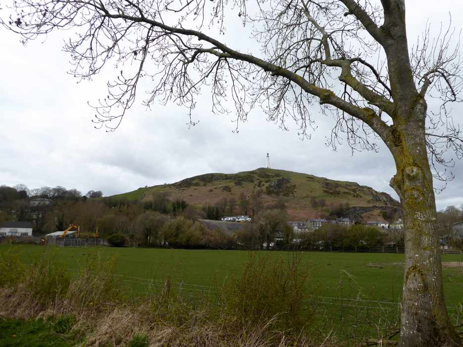
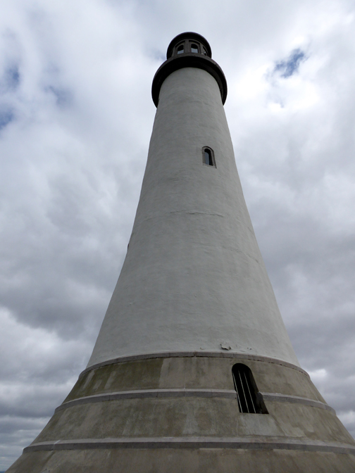
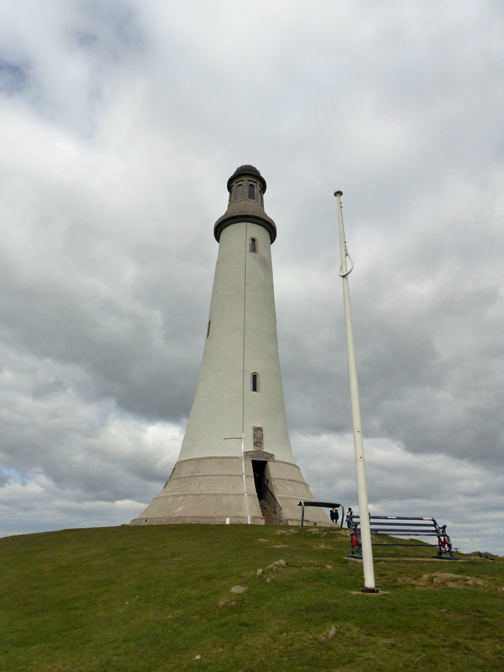
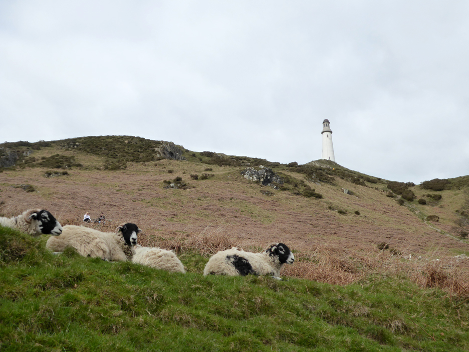
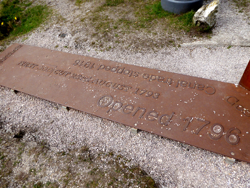
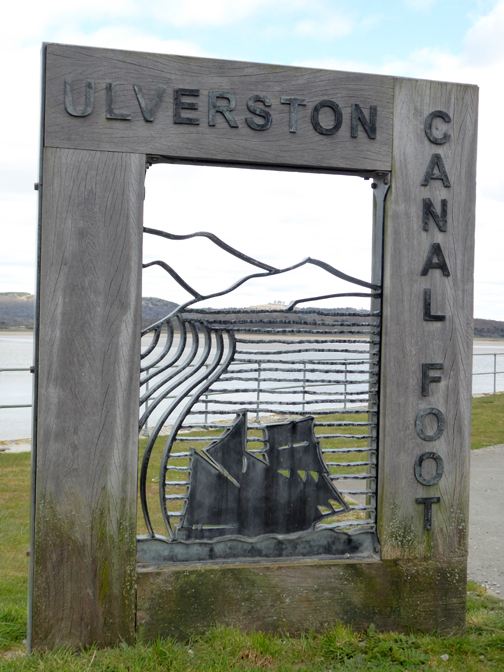
At one time it has the world’s "shortest, widest and deepest canal", just a mile and a half from the sea of Morecambe Bay. You may also know it for the lighthouse on the hill, a strange place to build a light, a stucture more suited to a wilder, seaside location.
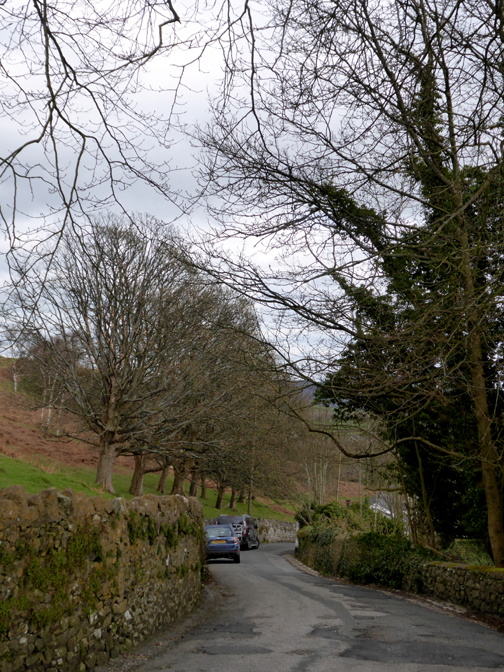
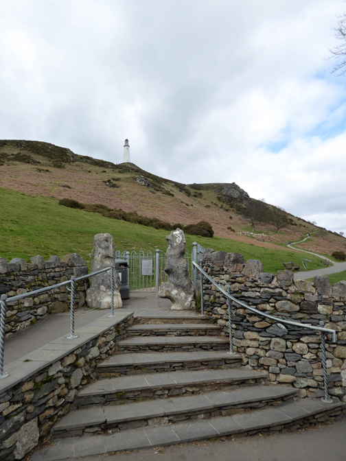
However the landmark is well worth a visit and I park on the minor road that climbs Hoad Hill at a point close to the road end. There I found the gates onto the hill, flanked by two bulwarks of local limestone, a throwback to the limestone quarries that once graced the area.
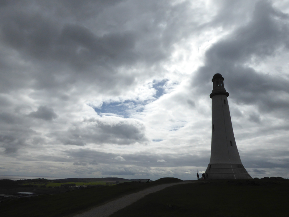
The monument is a copy of the third Eddystone Lighthouse, the base of which can still be seen 9 miles south of the southern coast of Cornwall. [ It was demolished when the current Eddystone light was built and the upper portions of the 3rd light were re-erected in Plymouth as a monument]
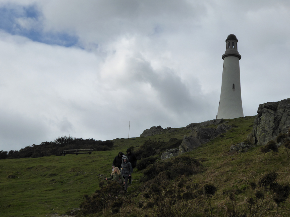
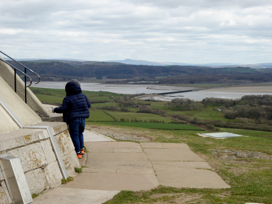
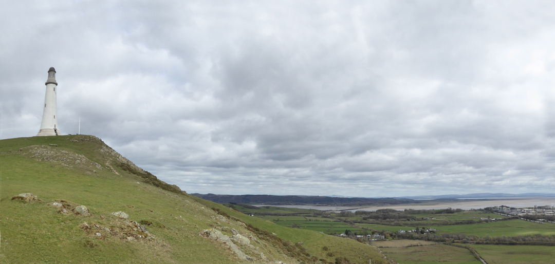
The path to the top gradually winds its way up the hill and the views over the surrounding lands improved as I climbed.
A dramatic sight up close, particularly as here when it is backlit by bright sunshine.
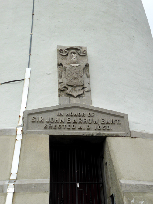
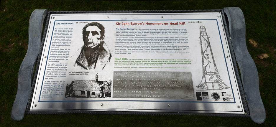
It is rare to be able to get this close to the base of such a building, as they are usually situated on dangerous offshore reefs. This one however was built to commemorate one of Barrow's famous citizens, Sir John Barrow who was born locally in 1764.
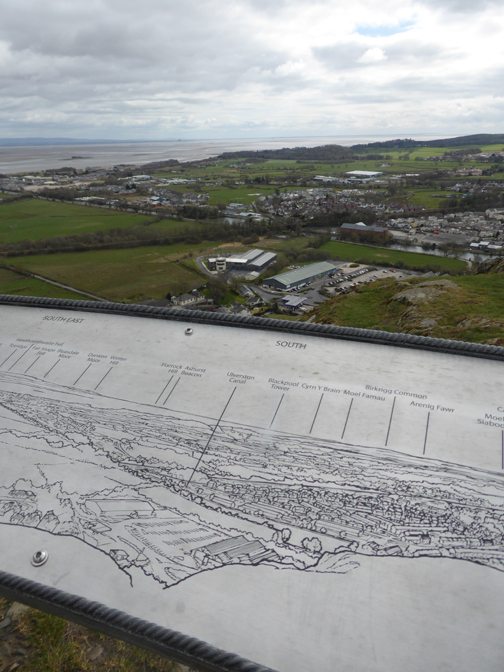
He was in his time Secretary of State for the admiralty and actually shook hands with Lord Nelson aboard HMS Victory. He oversaw the Battle of Trafalgar, helped establish the Royal Geographic Society, spoke fluent Mandarin and was a skilled navigator. Click here or on the photo above for a larger more easily read version of the signboard.
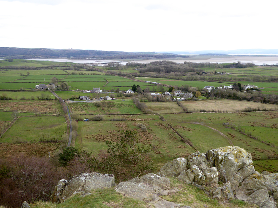
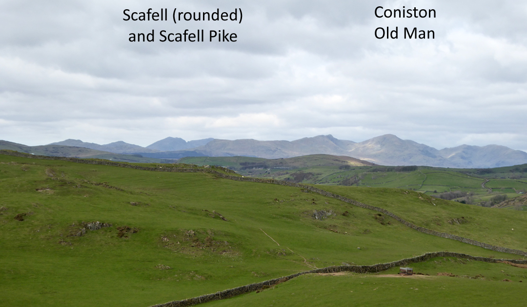
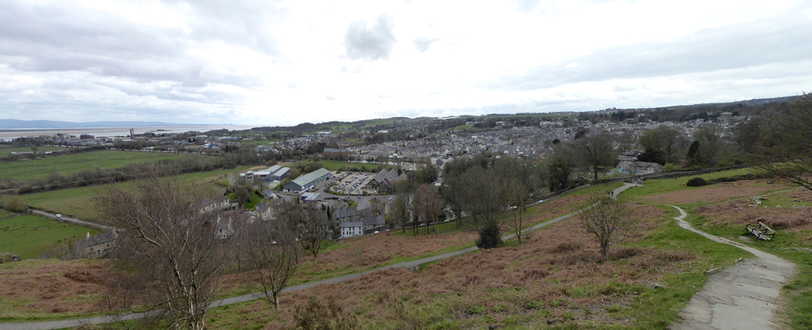
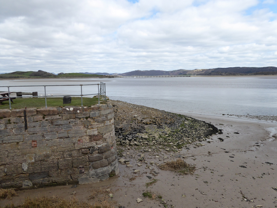
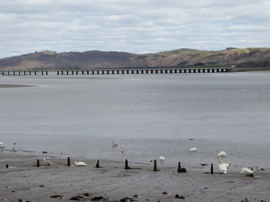
The view from Hoad Hill includes the viaduct of what is now the the Cumbrian Coast line. To the west is Morcambe Bay and to the east, views of the Yorkshire Peaks.
To the north there are good views of the southern Lakeland summits.
See how many you can match up.
Leaving behind the cool breeze on the top, I drop down the hill back to the car.
. . . leaving the locals to take care of the place.
The view down over Ulverston . . . the lower path was my route up.
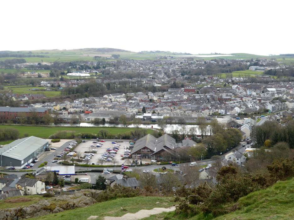
The car park below is at Ulverston's Booths Supermarket (that will save me shopping elsewhere tomorrow) but the waterway above it was once the world’s shortest, widest and deepest canal . . . and that is my next objective today.
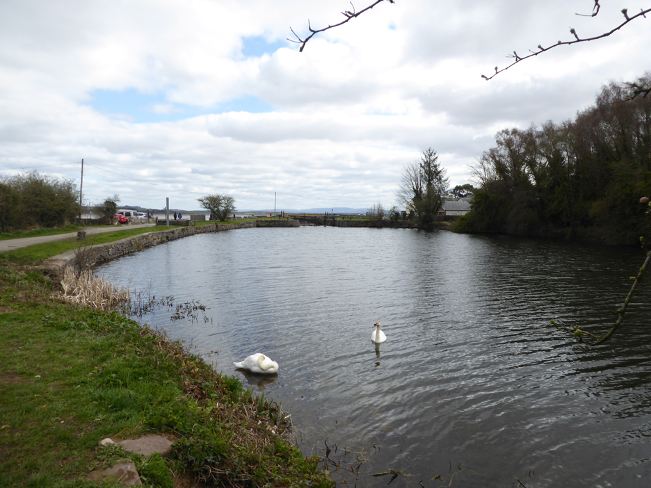
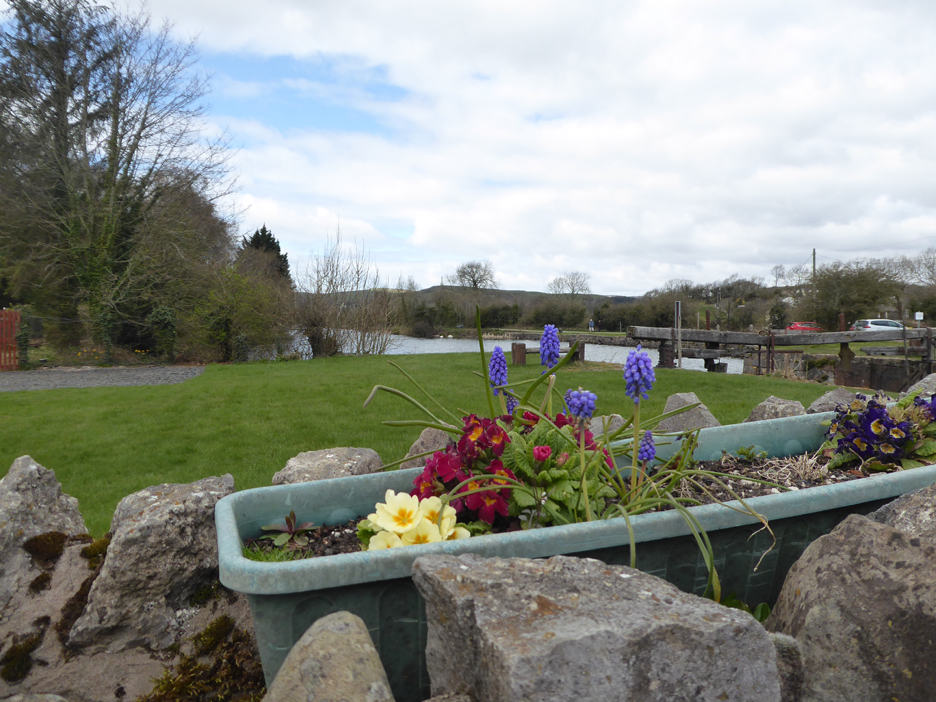
The northern basin of the canal reaches close into town.
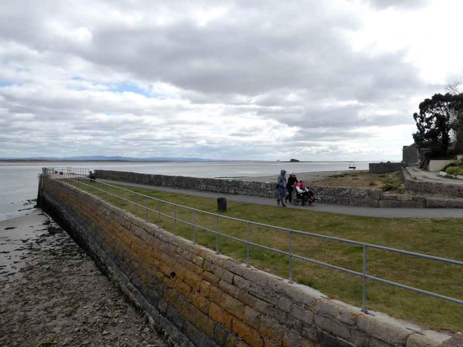
The southern end has the tidal lock connecting the canal (in its day) to the open sea.
The coming of the railways saw the decline of the sea trade and the canal finally closed to shipping in 1918.
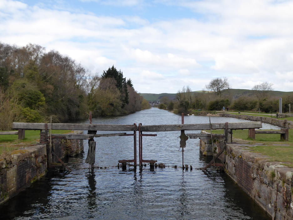
The final lock gates were re-made in concrete and consequently no longer open.
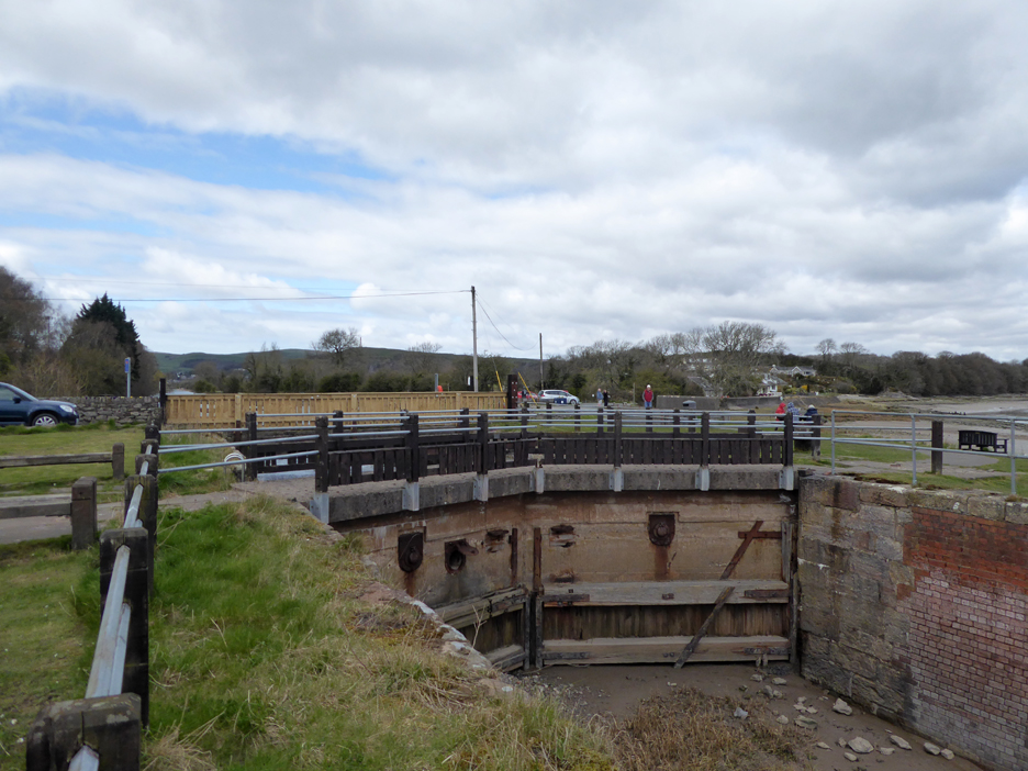
The old sea wall entrance to the canal is still well maintained.
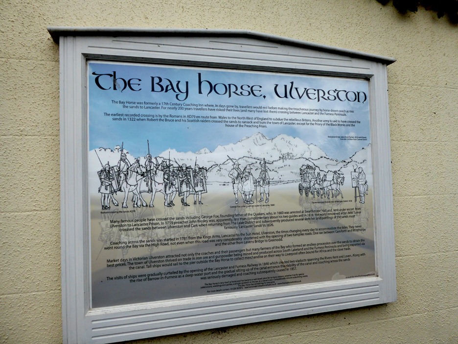
More of the early history of the area is recorded in the information sign at the Bay Horse Inn, down on the seafront. Click here or on the photo above for a larger more easily read version of the sign board.
Not only the railway but the gradual silting up of the sea channel finally contributed to the canal's closure.
The Leven Viaduct in close up, also seen in the photo before.
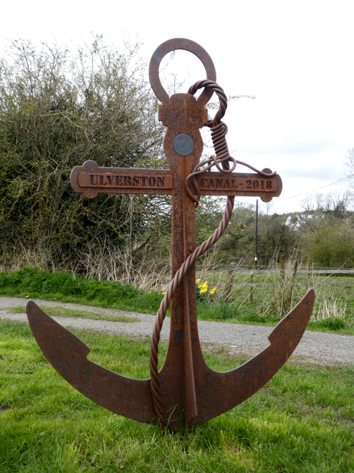
A very old and seemingly very loved resource for the town. - - - o o o - - - After leaving Ulverston I drove south down the coast road, past the golden roof of the Buddhist Temple at Conishead Priory, past Ulverston Sands (the Chill and Grill seaside cafe is recommended - take away service only at this time), on via Baycliff and Newbiggin, finally to Rampside Village close to the southern end of the peninsular.
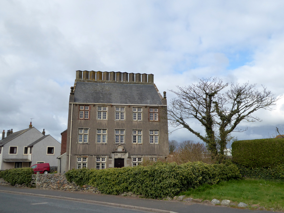
The twelve Apostles of the 17th Century Rampside Hall One local I met told me of the legend that there was one chimney for each of the owners daughters !
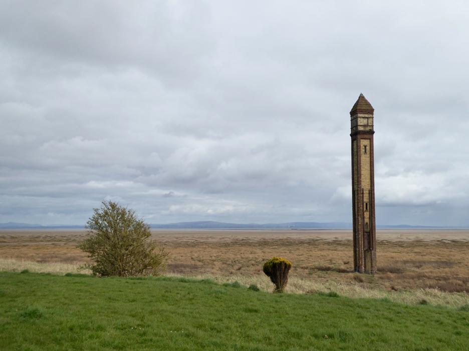
Across on the foreshore is the Rampside Lighthouse, affectionately known as The Needle. It was built in the 19th century as a navigation mark, one of thirteen for the port of Barrow. When lined up with another it indicated safe passage into the Piel Channel and the port of Barrow itself.
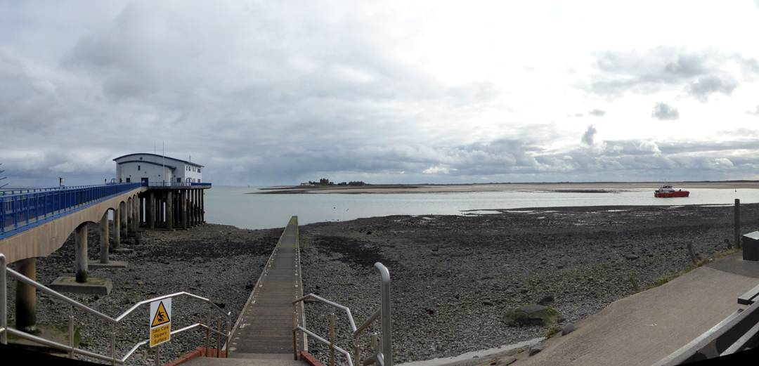
At the end of the peninsular is Roa Island, now connected by a causeway and road. At the seaward end of the island is the modern Barrow Lifeboat Station and the jetty for the summer ferry to Piel Island, seen opposite.
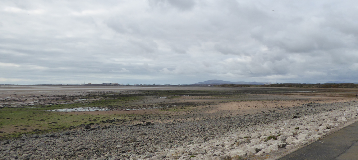
From Roa Island you get a distant view of Barrow Docks and beyond it Black Comb, the most south westerly of the Cumbrian fells. I must be heading north now . . . it will be an hour and a half along the twisting West Cumbrian coast roads before I reach home ! - - - o o o - - - |
|
Technical note: Pictures generally taken with my Panasonic Lumix TZ60 camera. Resized in Photoshop, and built up on a Dreamweaver web builder. This site best viewed with . . . a lunchtime coffee and chocolate brownie overlooking Ulverston Sands. Go to Home Page . . . © RmH . . . Email me here Previous walk - 5th April - Mellbreak before We Go A previous time up here - Wed 15th July 2009 Blawith Fell with Connie Next walk - 9th April - Grisedale and Hopegill Head
|