![]()

Remember: Press F11 for a full
screen view of this page.
Web Counter when published 1 748 755
|
|
|
Remember: Press F11 for a full
screen view of this page. |
Web Counter when published 1 748 755 |
|
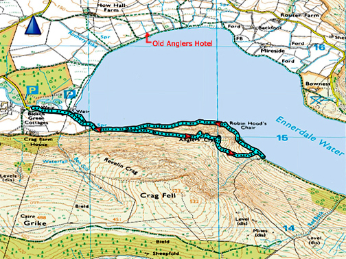
" Anglers Crag and a Gather " Date & start time: 6th March 2020. 12.30 pm start. Location of Start : Bleach Green Car Park, Ennerdale Lake, Cumbria, Uk ( NY 085 153 ) Places visited : Ennerdale Weir, Anglers Crag, Robin Hood's Chair and back. Walk details : 3 mls, 675 ft of ascent, 2 hours 30 mins. Highest point : Summit of Anglers Crag, 770 ft - 237 m. Walked with : Ann and our dogs, Dylan and Dougal. Weather : Fine and dry but visibility and cloud base varies during the walk. |
© Crown copyright. All rights reserved. Licence number PU 100034184. |
|
With the arrival of several fine days in a row we head over to Ennerdale for a walk to ring the changes. Actually the forecast was for fine weather earlier rather than later, so a midday start was going to be best. Pack a small drink and a biscuit and aim for lunch afterwards.
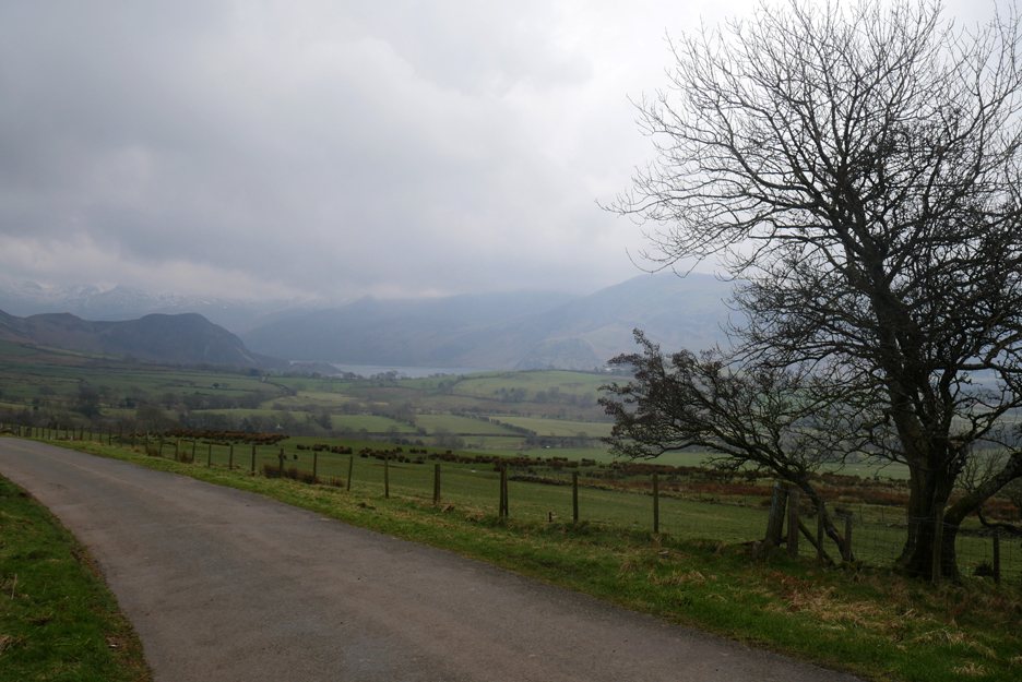
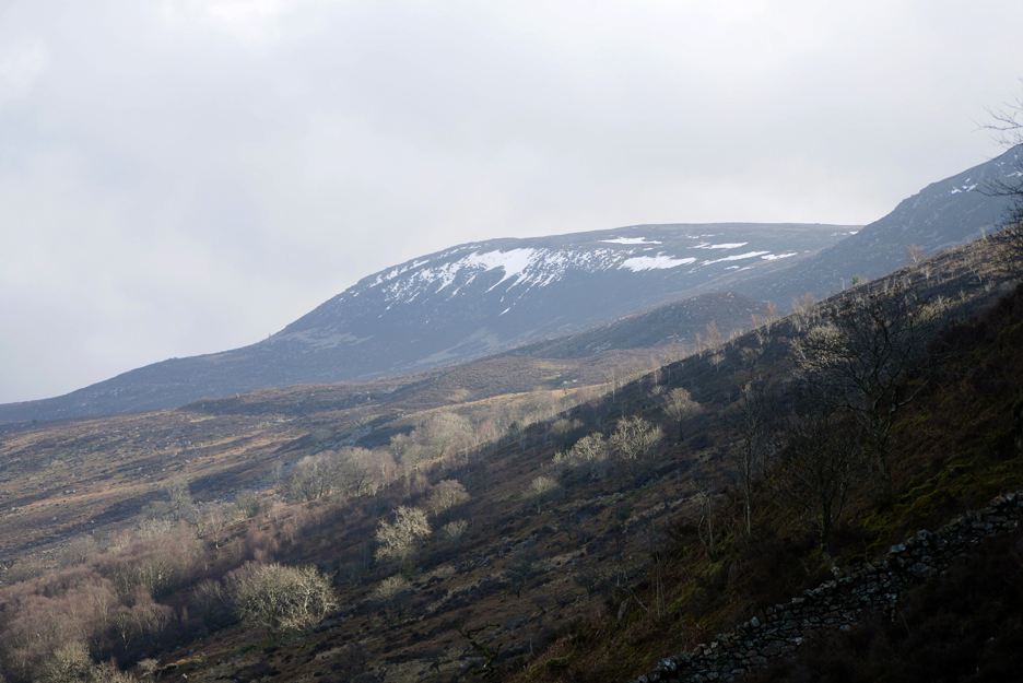
After enjoying the sun in our valley, we rounded the western Cumbrian hills and looked down on a much more overcast Ennerdale Valley from Cauder Brow.
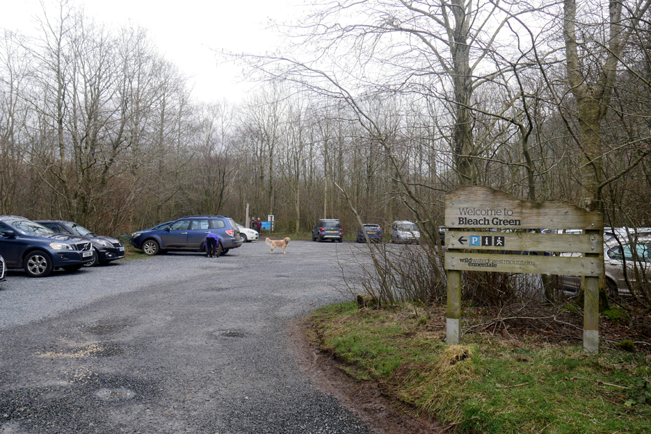
Despite the seemingly poorer weather the car park at Bleach Green was really quite full.
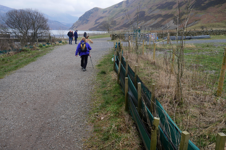
The old footpath to the lake has now been incorporated into the wider water board track. Most of the United Utilities encampment and pumping equipment used during the water problems has now gone but odd items remain. Can anyone explain what these small fabric fences are all about and why they are still here ?
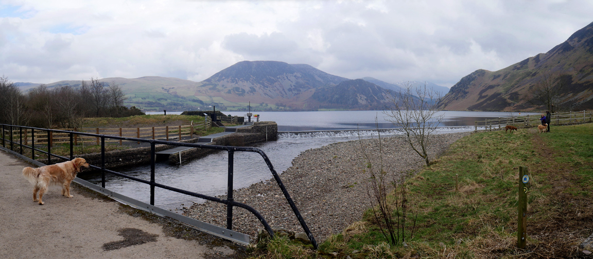
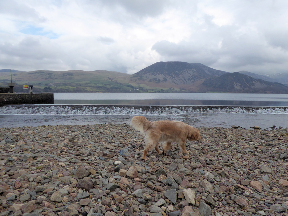
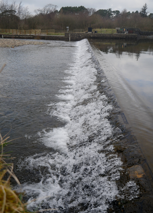
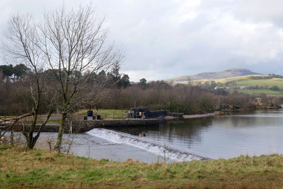
All the pipe work at the weir has been removed and the place is looking reasonably tidy at last.
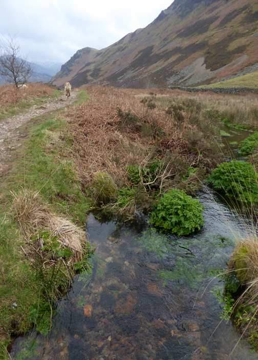
The water levels are low but the water still spreads across the full width of the weir. The bank of stones in the foreground have been disgorged from the new Ben Gill water way.
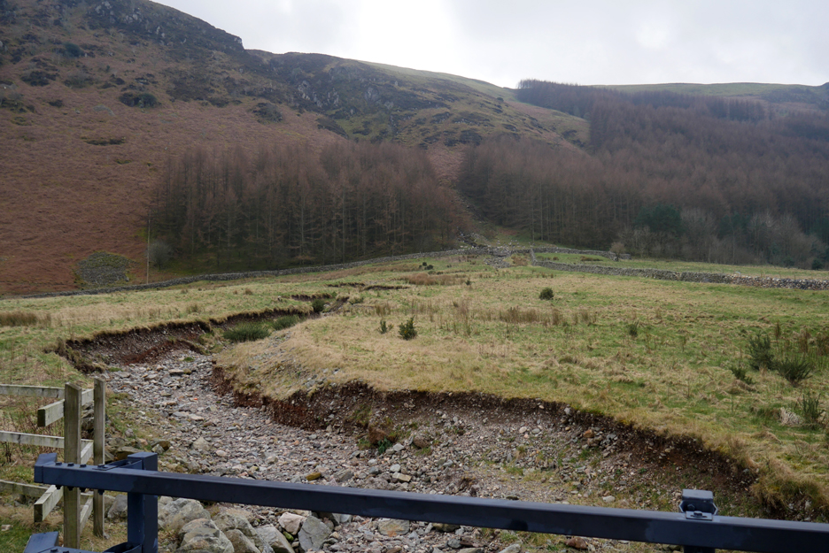
On the other side of the bridge you can see where they have come from. When the lake was first used for drinking water Ben Gill was diverted towards the lake. In recent years the beck has been re-aligned and now flows directly into the river in order to add pebbles to the river and improve the fish spawning environment.
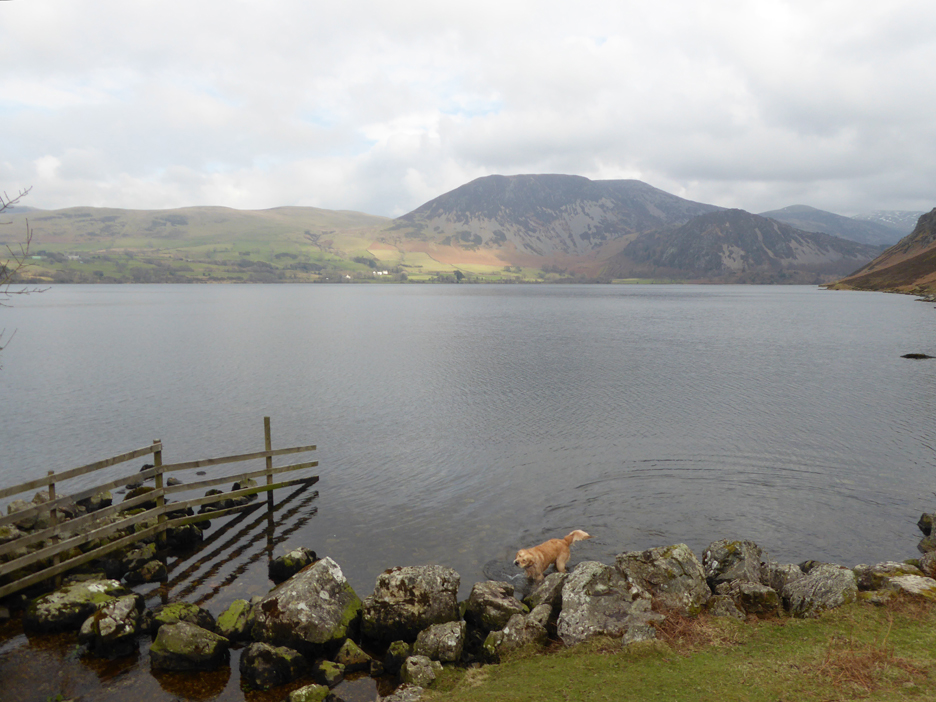
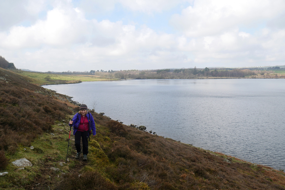
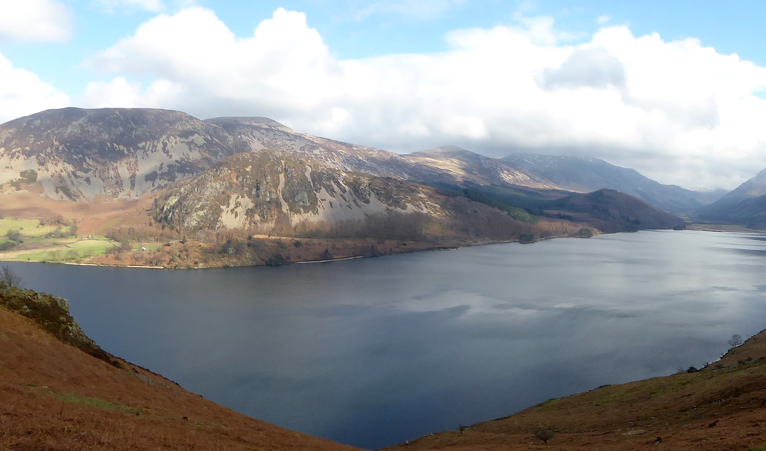
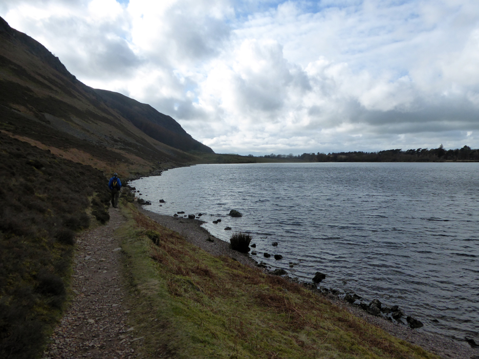
Out onto the open fell and the weather is staring to show signs of improvement, albeit later than forecasted. There's even a patch of sunlight on the opposite shore.
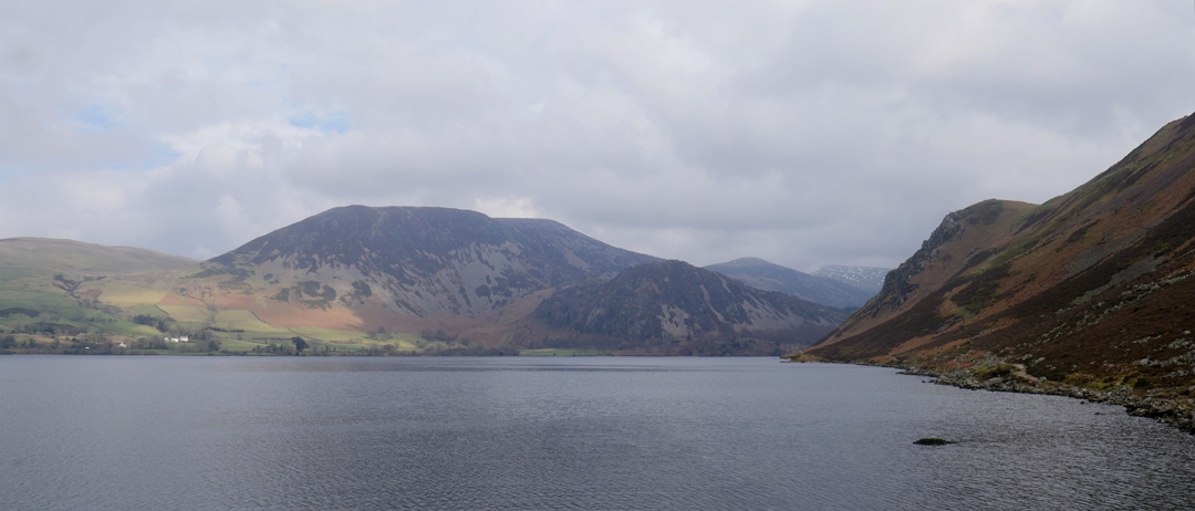
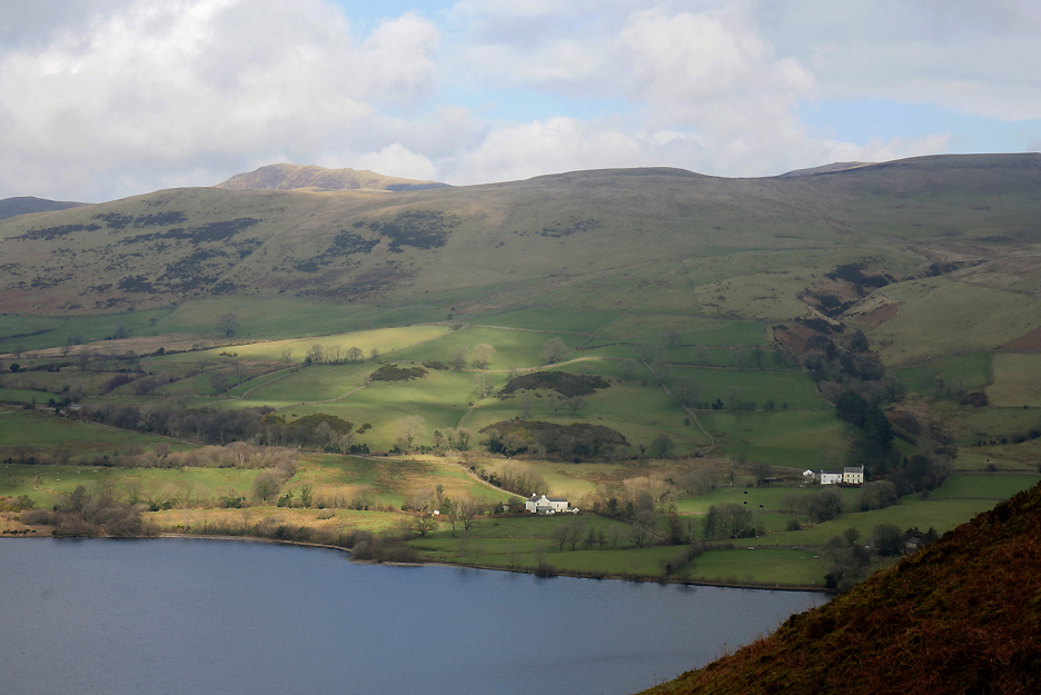
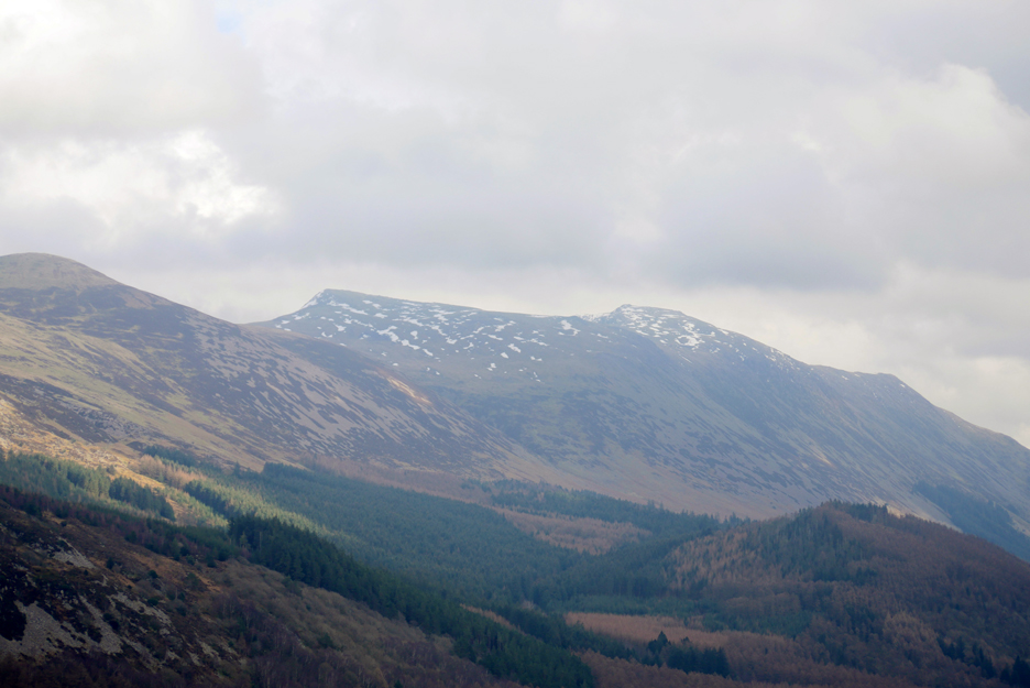
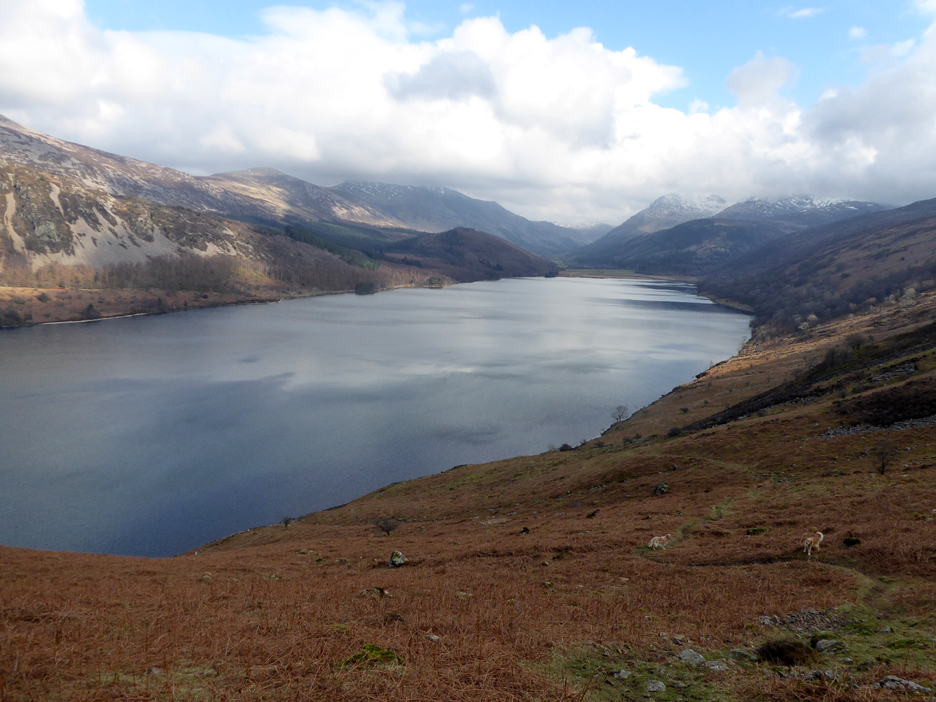
A wider photo showing Great Borne ahead and Anglers Crag to the right.
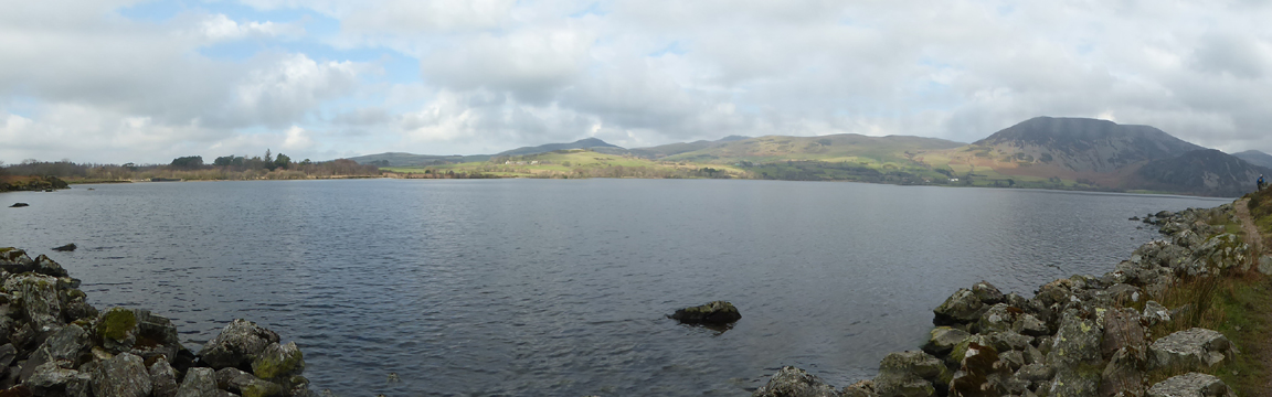
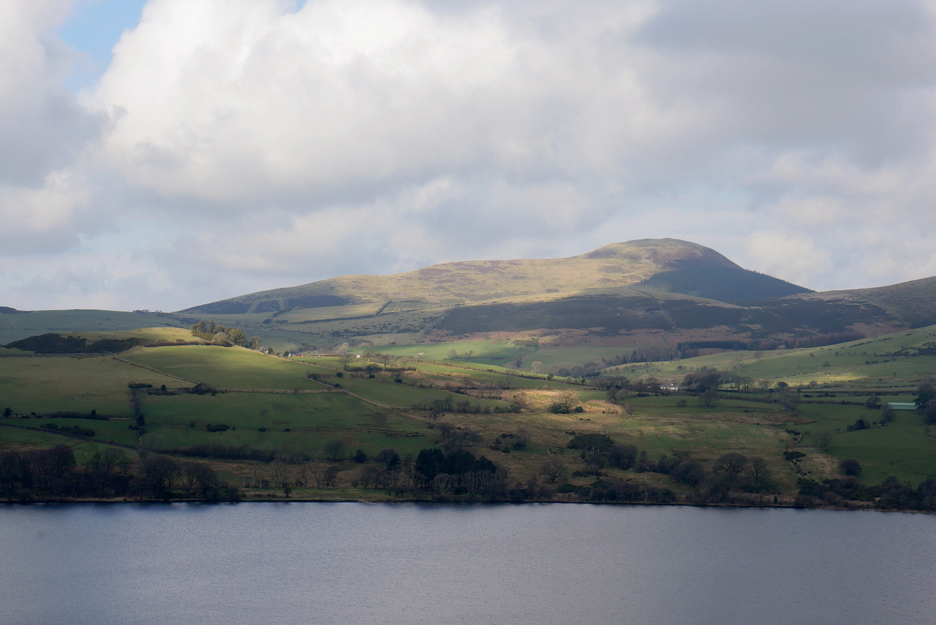
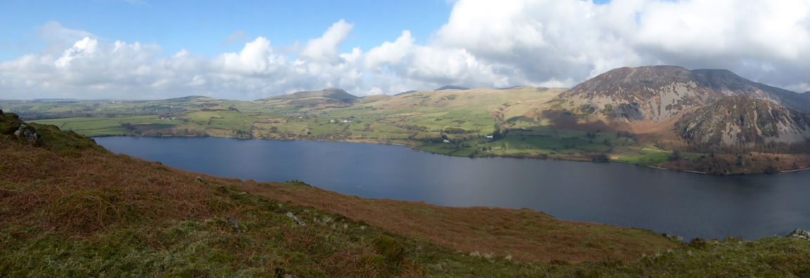
Ann's camera panorama takes in much of the opposite shoreline, including Knock Murton set further back in the centre.
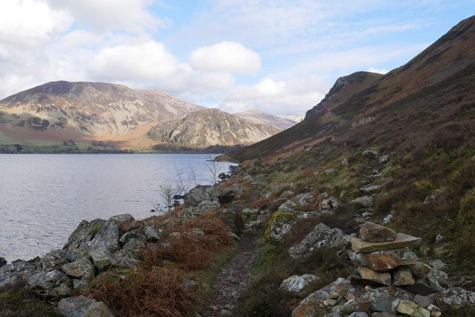
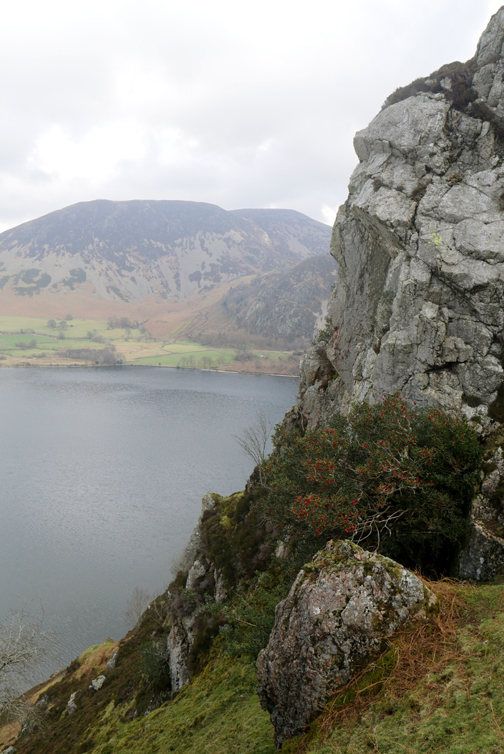
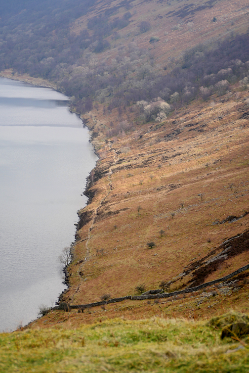
A cairn marks the start of the small track leading up from the lakeside towards the top of Anglers Crag.
A gently rising but often narrow track, hardly bigger than a sheep trod.
The gradual nature of the climb makes our ascent easy.
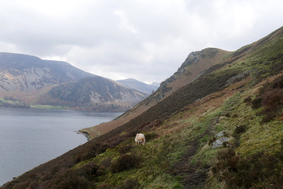
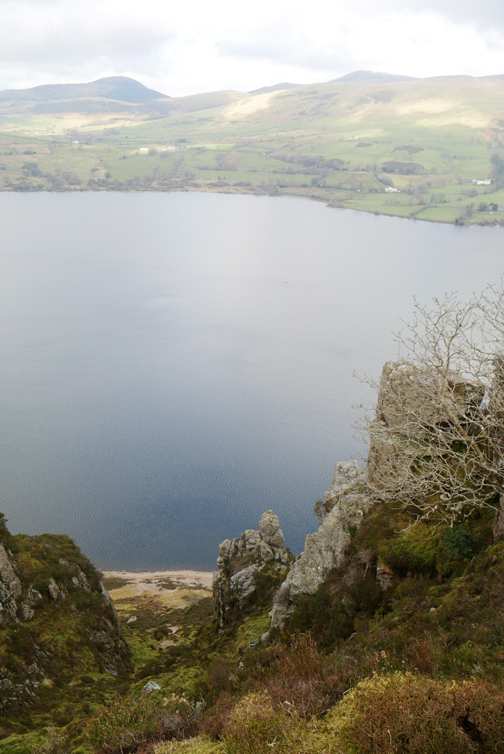
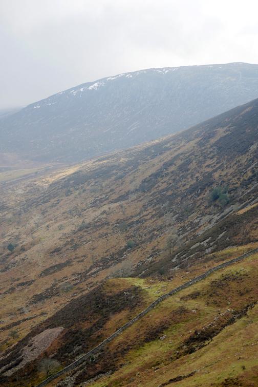
As we rise above the lake we can look across and see Knock Murton more clearly.
Blake Fell rises above the skyline now . . . as more patches of bright sun highlight Beckfoot Farm and other properties on the Bowness Knott road.
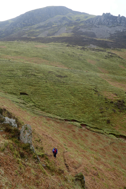
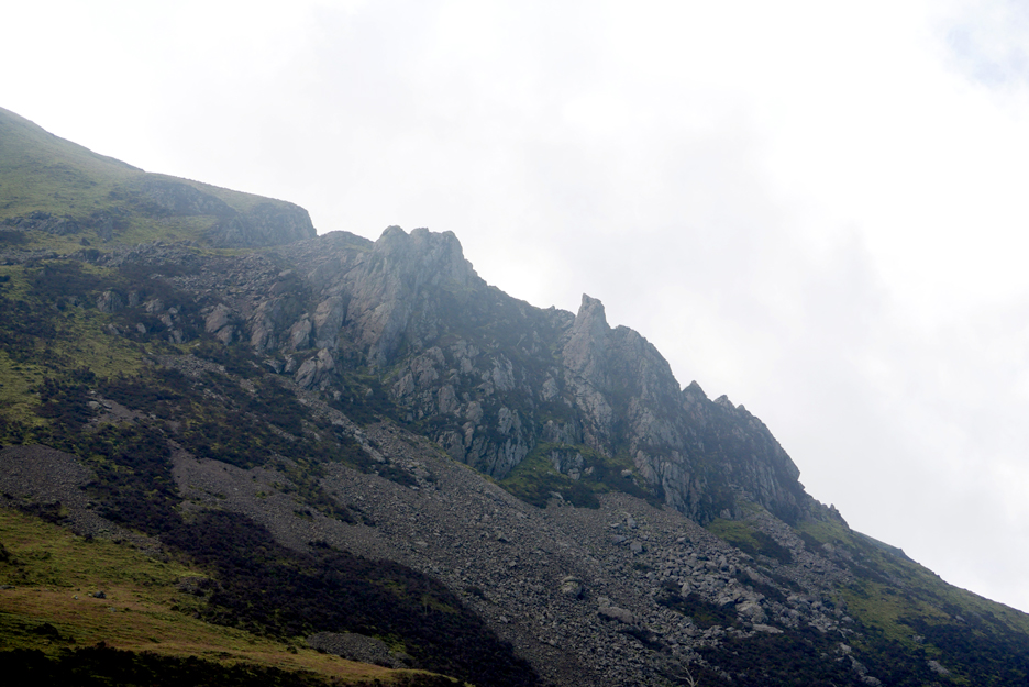
Behind us were the upper pinnacles, a worthy climb up through the grassy paths and heather on a nice day.
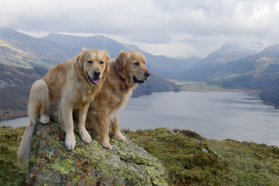
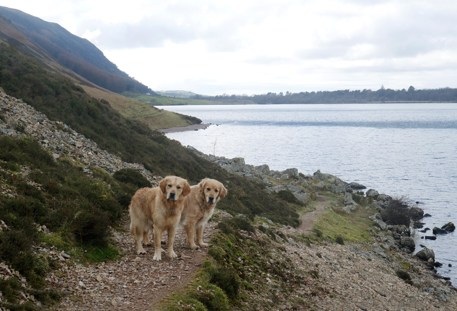
"Confused of Ennerdale" . . . the dogs just wouldn't look at the camera for a photo for some reason.
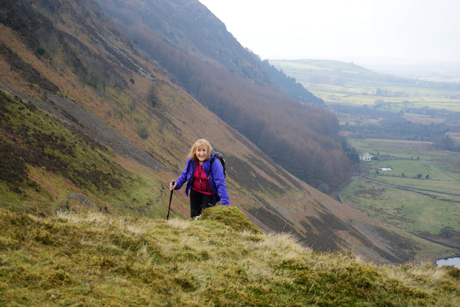
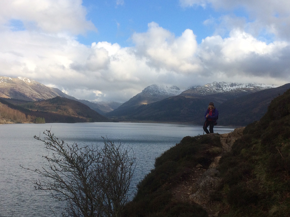
Ann topping out on Anglers Crag . . .
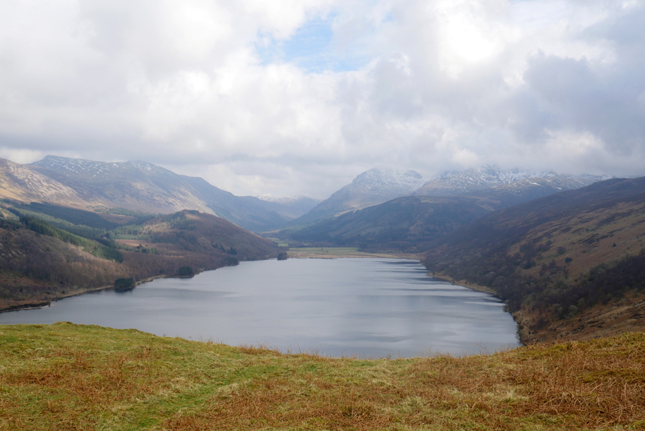
. . . and being rewarded with a sunny view up the Ennerdale Valley.
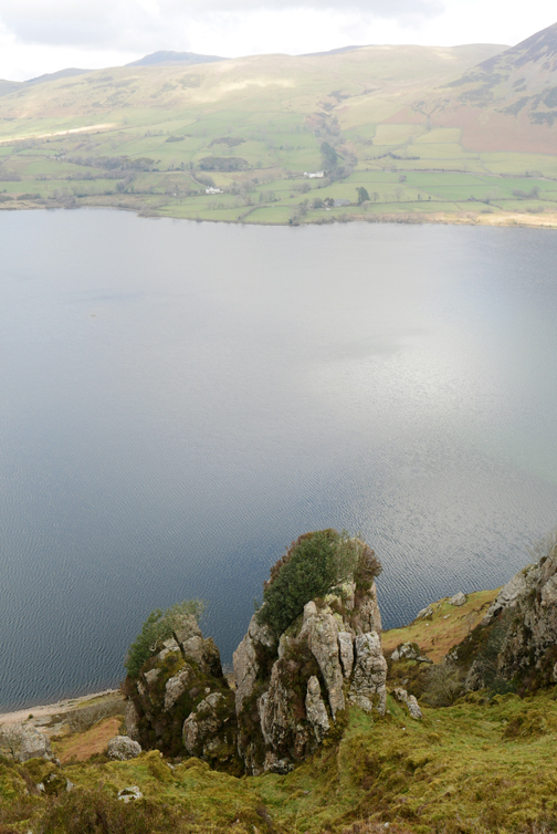
The view as we cross the top of the crags, looking over to Great Borne and Bowness Knott.
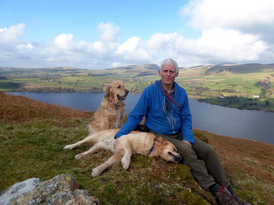
I made it to the top as well . . . time for a quick snack in lieu of a deferred lunch.
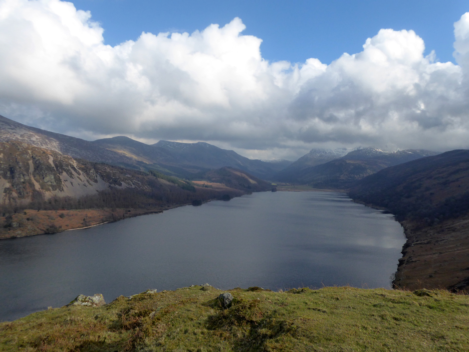
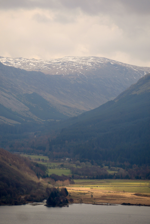
From the eastern side of the high ground we can see all the fells surrounding the upper Ennerdale Valley. The summits here are Starling Dodd, Red Pike, High Stile, distant Brandreth, Pillar, Steeple and down this right hand side to the slopes of Haycock and Iron Crag.
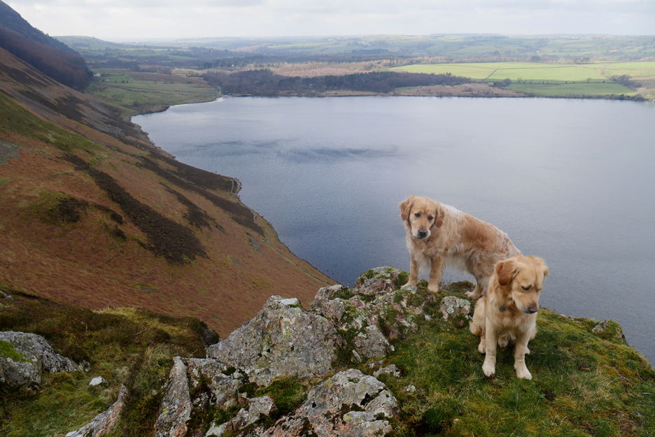
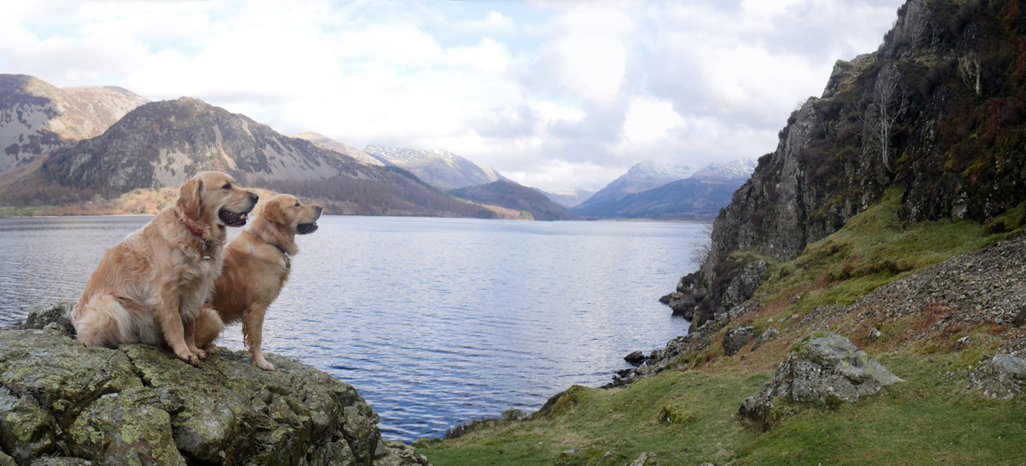
Dougal and Dylan making photographic use of a summit boulder.
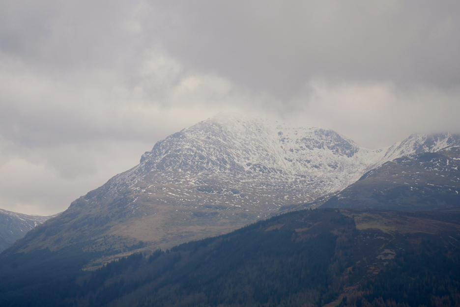
A quick change of lens as I zoom in on the snow-capped top of Pillar.
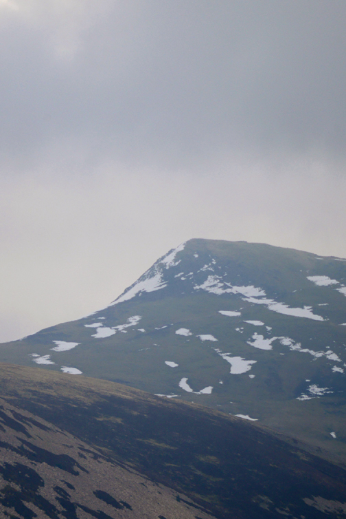
Zooming out to see the whole of the High Stile Ridge . . . Red Pike, High Stile, High Crag. The wooded fell in the foreground is Ennerdale's very own Latterbarrow.
It has turned into quite a nice day as we start our descent down the back of the crag, down to lake level.
The dogs take the lead as usual, heading down the curved path to the lake.
The rays of the afternoon sun catch the top half of the trees on the ancient woodland on the side of Boat How.
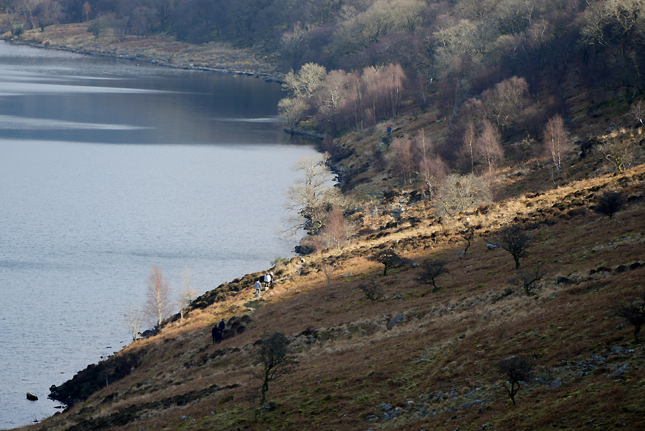
Some of the folk whose cars filled the car park at Bleach Green are walking the lakeside path into the same sunshine.
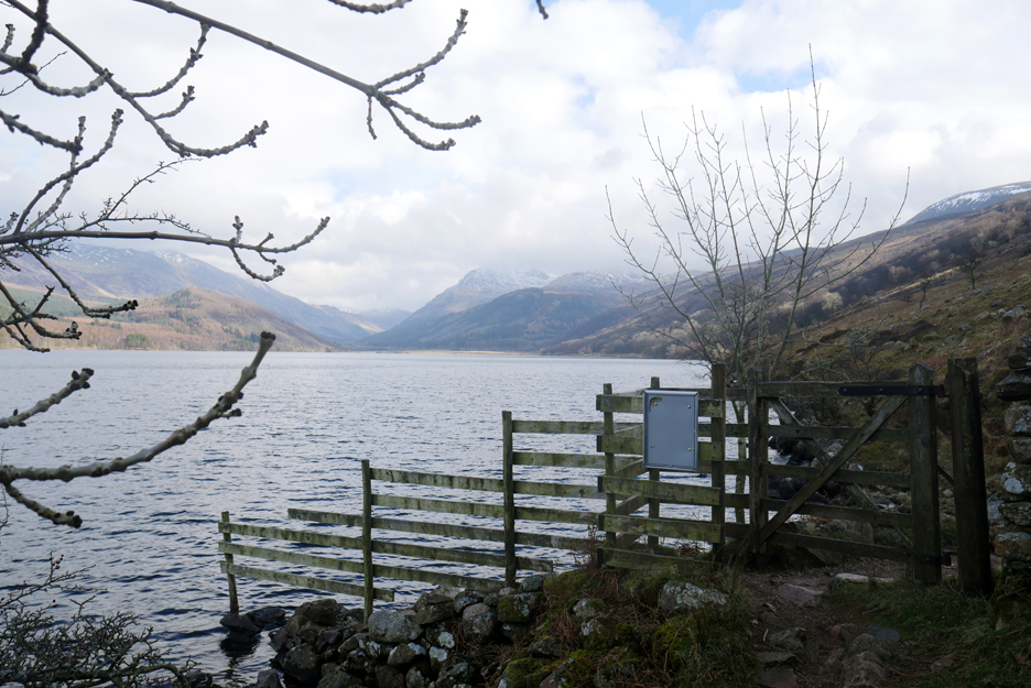
We reach the lower path but we'll turn left and head back under Anglers Crag, rather than follow them on through the gate on the 'round the lake' footpath.
Ann tops a slight rise as the path starts a short climb above the water.
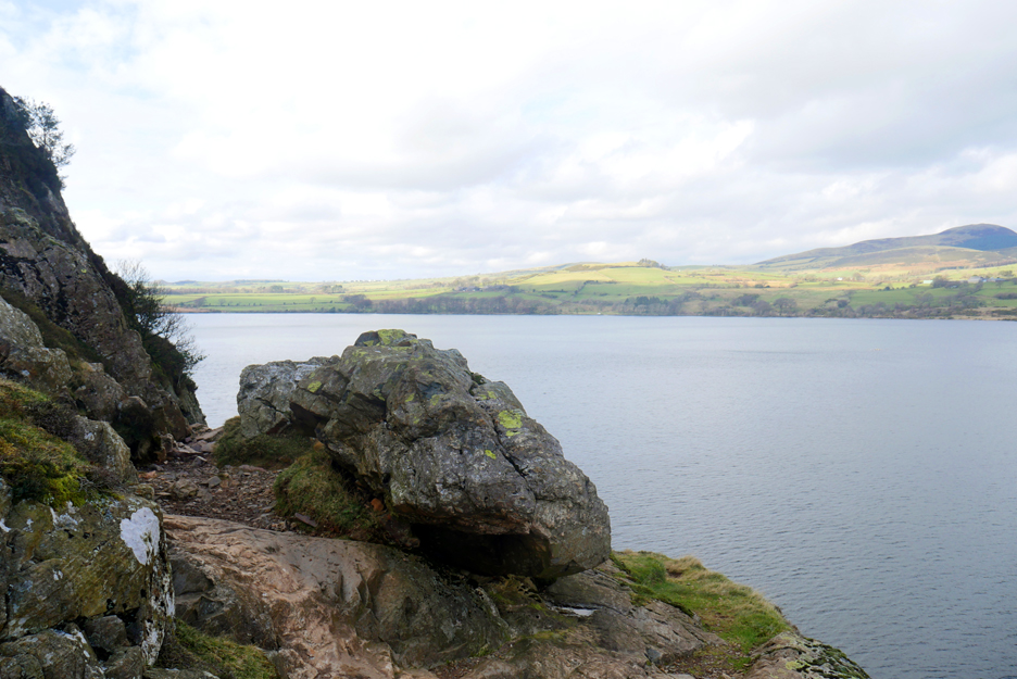
A fallen boulder makes the path split in two . . . most walkers take the left hand option.
Take your pick . . . all routes lead the same way . . . down through a reasonably simple rocky descent back to the lakeside.
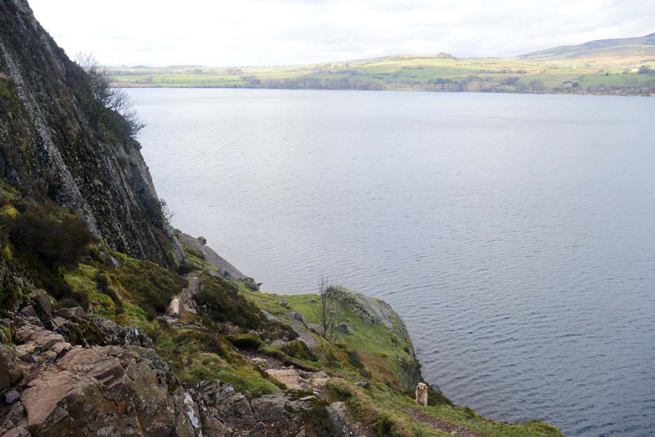
The dogs are watching Ann on the final section of the gentle scramble. Behind them is what will be the last view directly up to the top of the valley for us this afternoon.
From now on our sights are headed towards the car park . . . still a fair way off in the woods ahead.
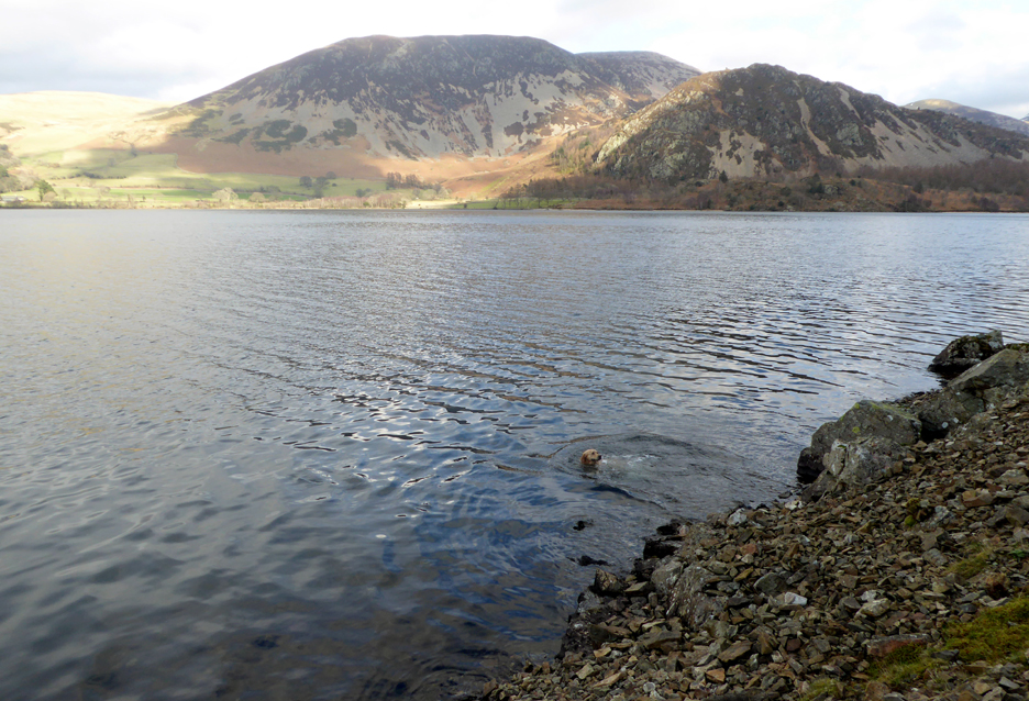
Dougal has turned out to be a keen swimmer, but there are few sticks to swim for here.
All of the ascent and descent has been done for the day . . . soon we'll complete the circle and re-join our outward path.
Back to the weir and soon the car . . . less people now as we put the dogs in the car and head for Ennerdale Village.
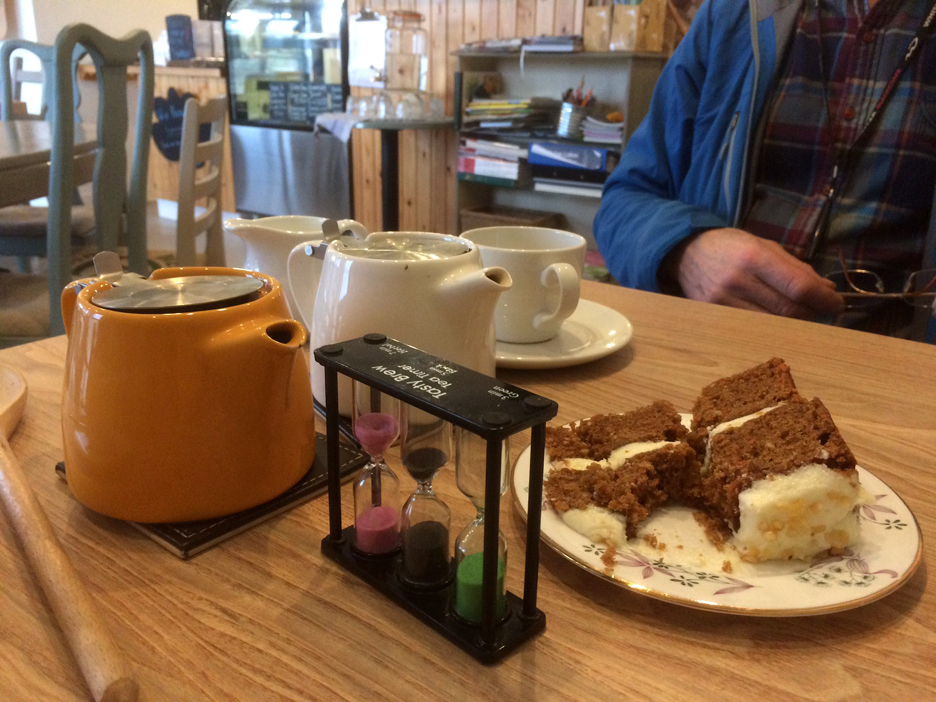
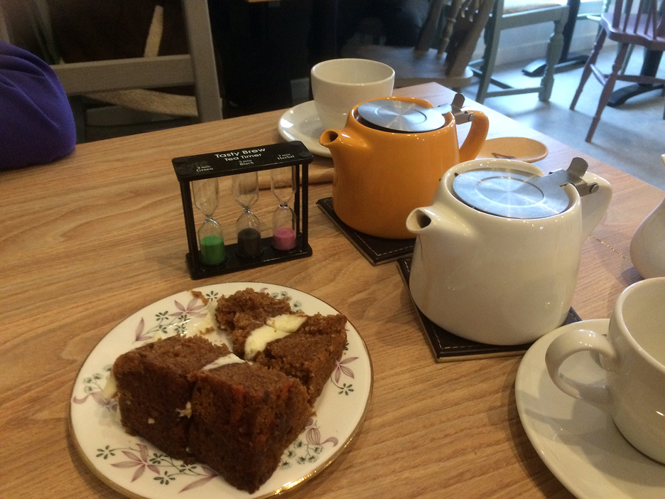
It's late for lunch but there was still soup and scones, carrot cake and tea on offer at The Gather. . . so we indulged ourselves. After all their free Wi-fi code was encouraging us to "tryourcakes".
Oh well . . . time is up . . . and we must head home after our lovely (late) lunch. - - - o o o - - - |
Technical note: Pictures taken with either Ann's Panasonic Lumix TZ60, or my Panasonic Lumix Gx8 Camera. Resized in Photoshop, and built up on a Dreamweaver web builder. This site best viewed with . . . Lunch at The Gather in Ennerdale Bridge Go to Top . . . © RmH . . . Email me here Previous walk - 1st March 2020 - Pottergill and Whinny Ridding A previous time up here - 20th August - Helen's Visit - Loweswater Walk Next walk - 13th March 2020 - A Day Out at Brockhole
|