![]()

Remember: Press F11 for a full
screen view of this page.
Web Counter when published 1 735 411
|
|
|
Remember: Press F11 for a full
screen view of this page. |
Web Counter when published 1 735 411 |
|
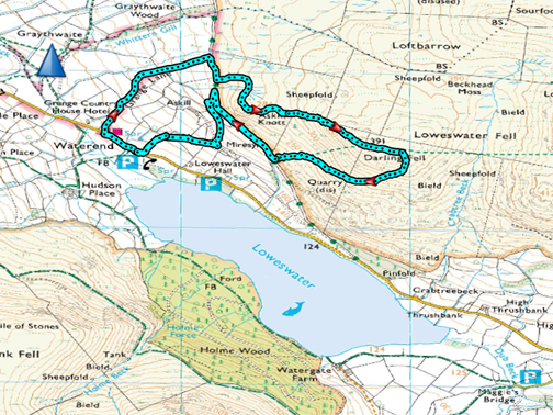
" Askin Knott then Darling " Date & start time: Sat 18th January 2020. 12.10 pm start. Location of Start : By the silver phone box, Loweswater, Cumbria, Uk. ( NY 118 225 ) Places visited : Waterend, Mosser Track, Askill Knott, Darling Fell, Askill Farm track. Walk details : 2.8 mls, 975 ft of ascent, 2 hours 30 mins. Highest point : Darling Fell, 1270 ft - 391m. Walked with : Jo, Ann and our dogs, Amber, Dylan and Dougal. Weather : Sunny with partial cloud especially on the high fells. |
© Crown copyright. All rights reserved. Licence number PU 100034184. |
|
Jo is in Loweswater for the start of her weekend and on Saturday we decided to walk locally to save her any extra driving. We headed for Askill Knott, which she had never visited, then we could see where we want to walk after that. Should we walk to the next summit this nice afternoon . . . the answer was yes, with no regrets.
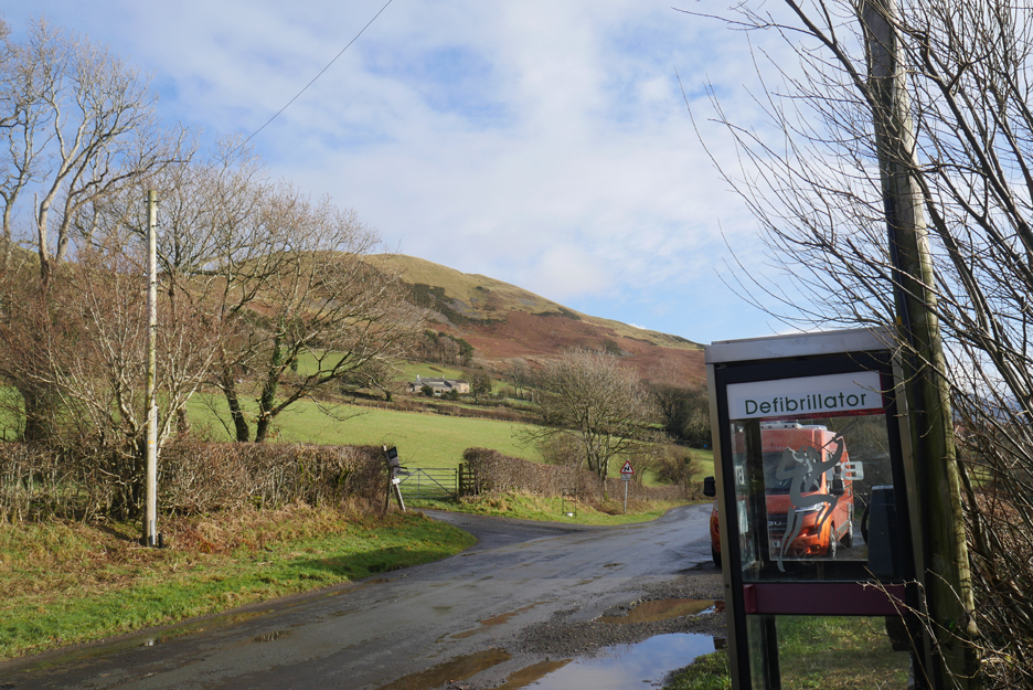
Parking by the silver phone box at the far end of Loweswater (not the red one this end !) The local First Responders have marked the phone box as a defib location but due to technical reasons it is in a cabinet just down the road.
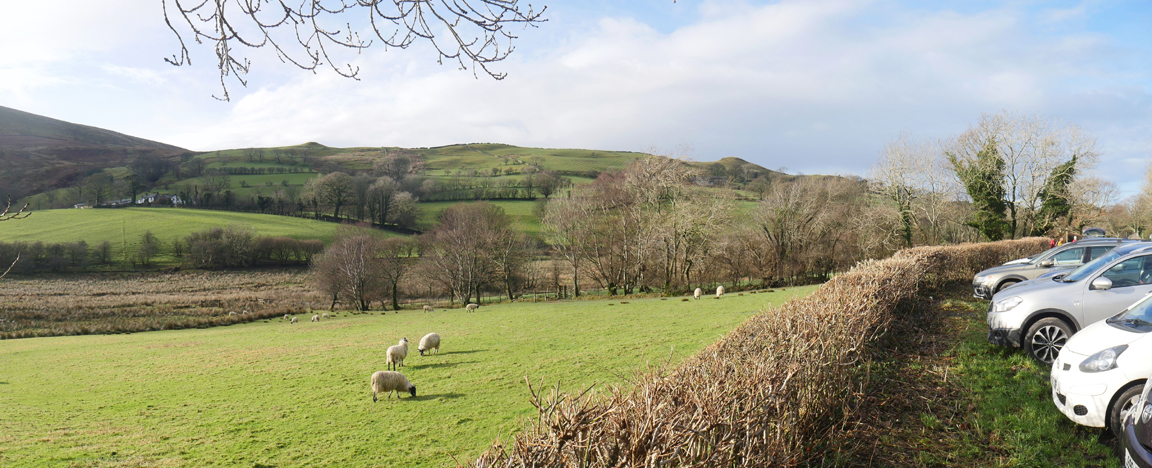
Plenty of roadside parking here as it a favourite starting point for a walk to the lake shore. [ It is also a starting point for a complete circuit of the lake. . . however the latter does include some road walking.]
The actual public defibrillator box is down here at Swallow Barn, Waterend (on the wall facing the road). But, hey I digress . . . on with the walk.
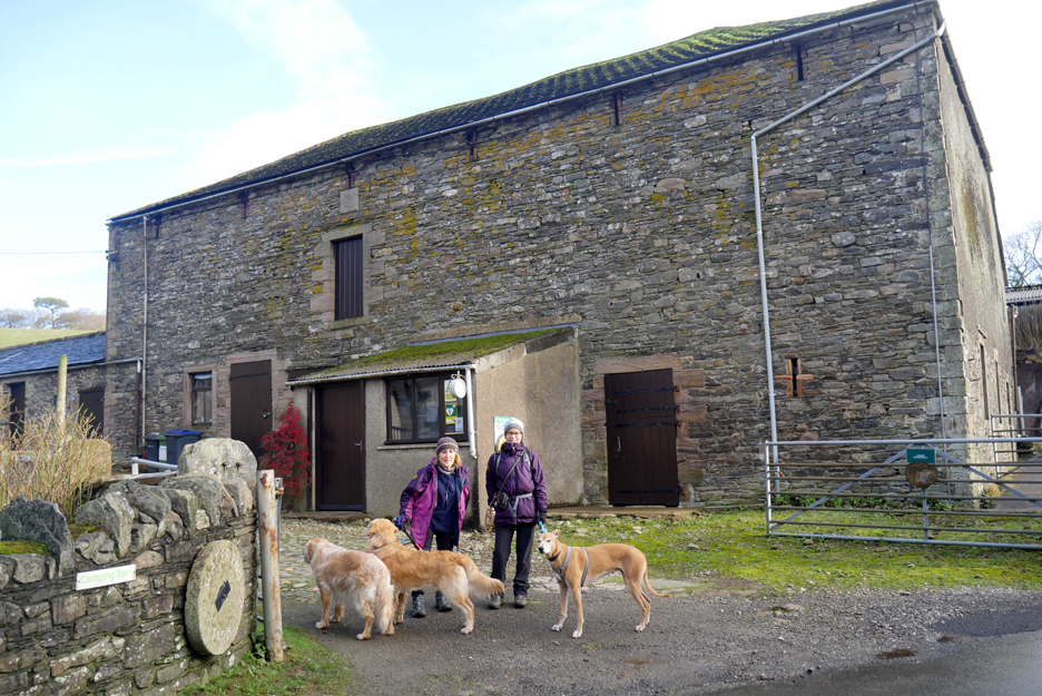
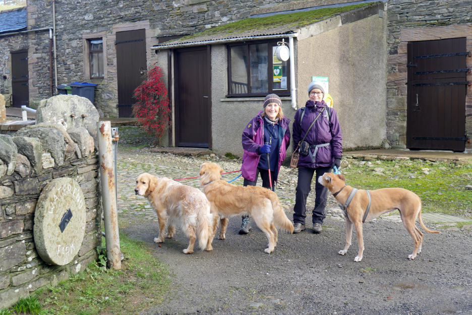
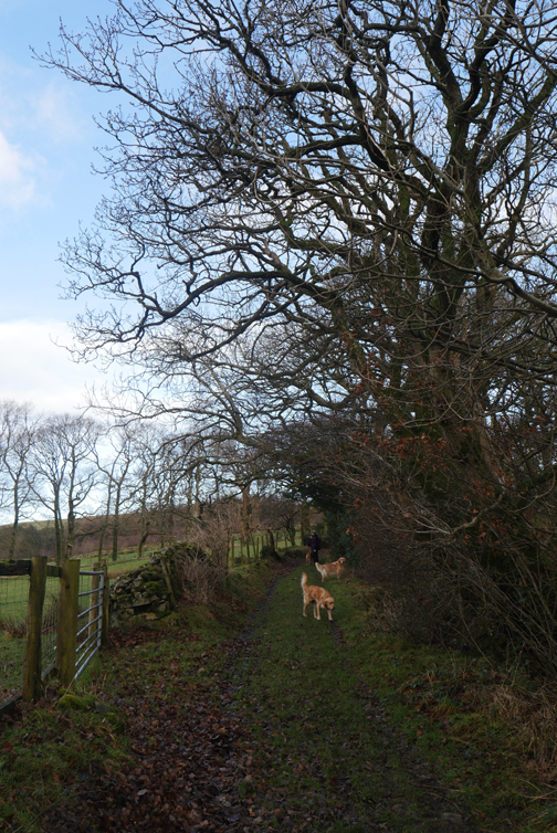
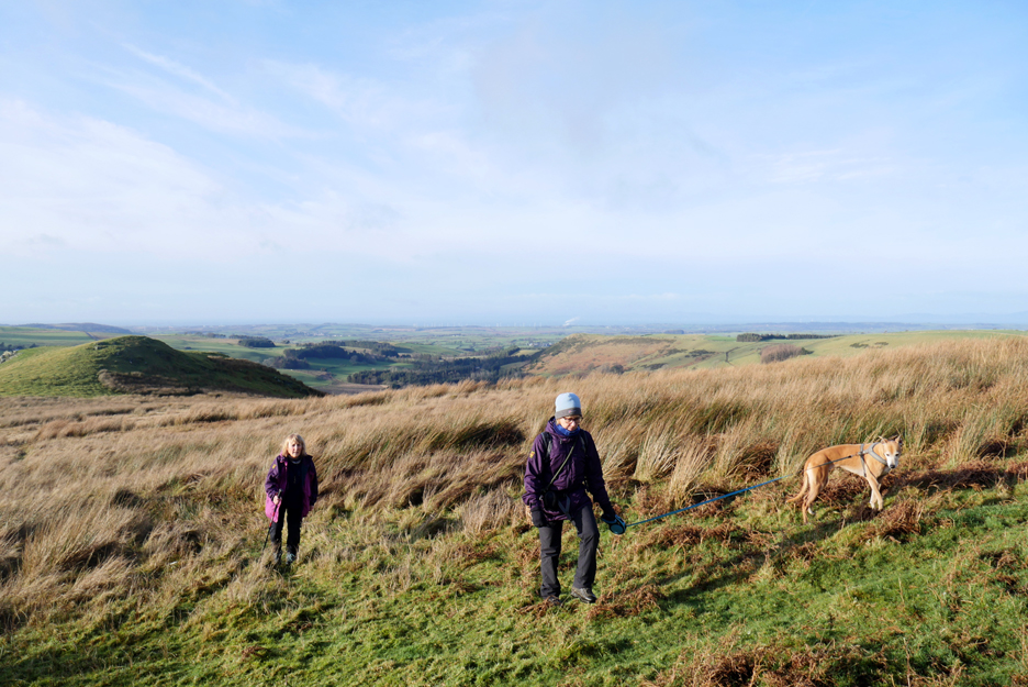
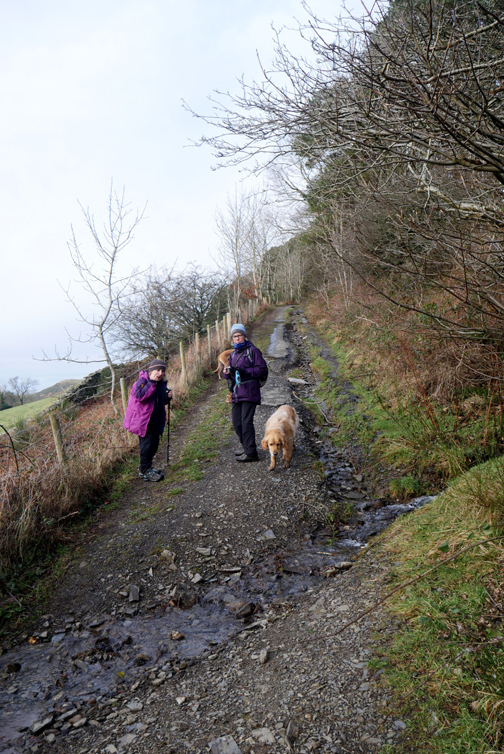
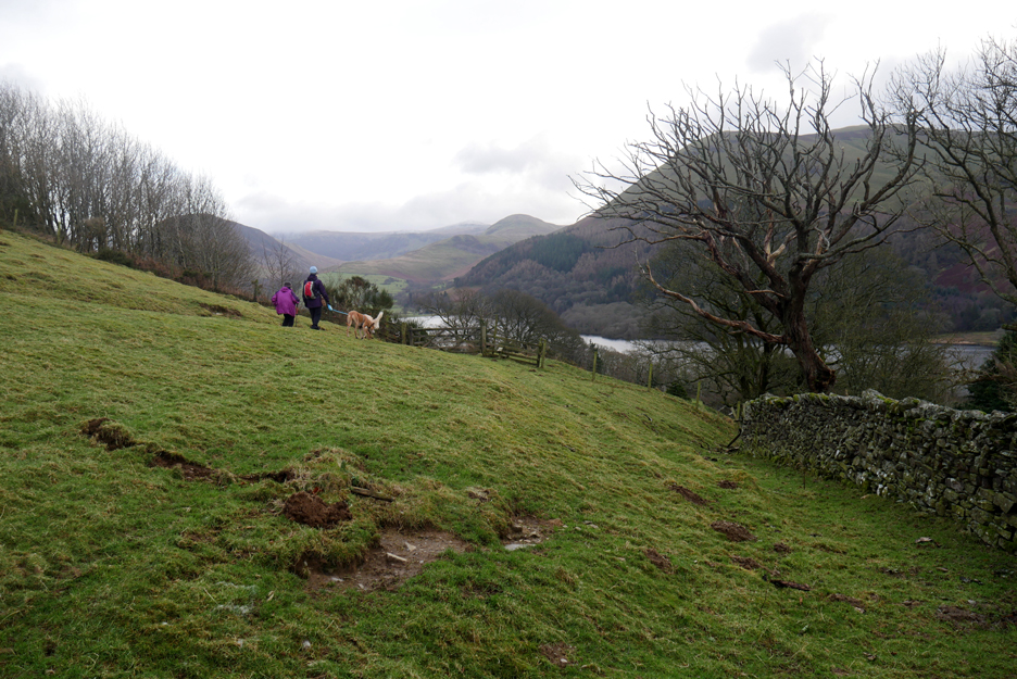
Our small, select party today is Jo, Ann and myself plus the dogs. After a hundred yards or so of road walking we turn left and head into Grange Lane, through the cobbled yard and up the hill.
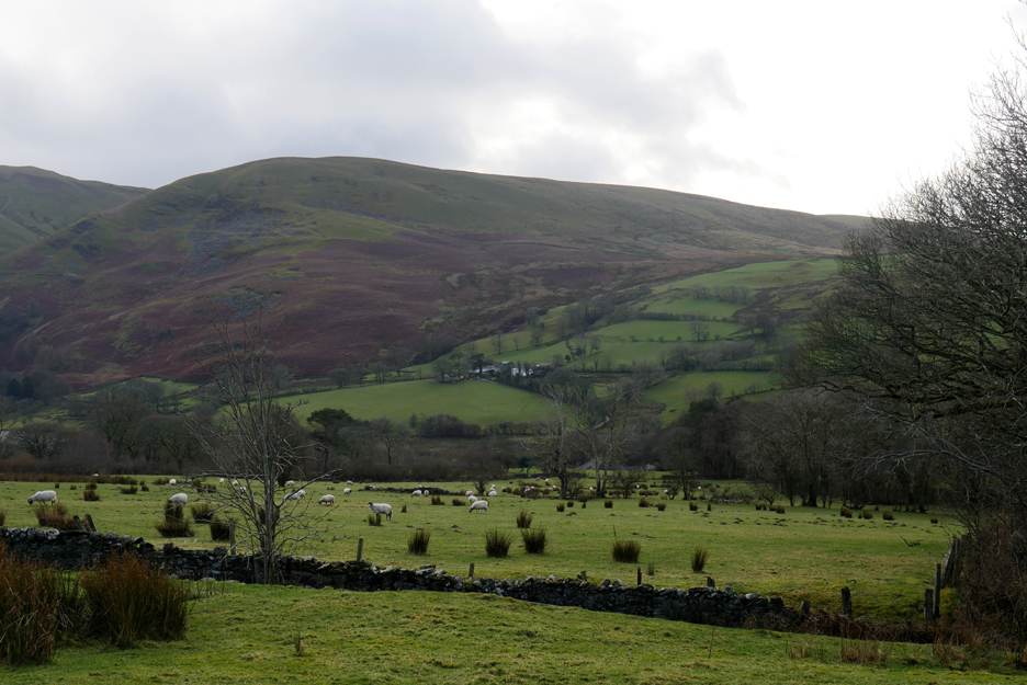
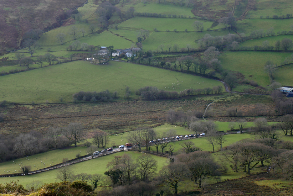
It leads out from the trees to a more open section, from where we get a clearer view of Burnbank Fell. Across the way is Place Farm, available for you to buy or lease shortly as the farmer is retiring.
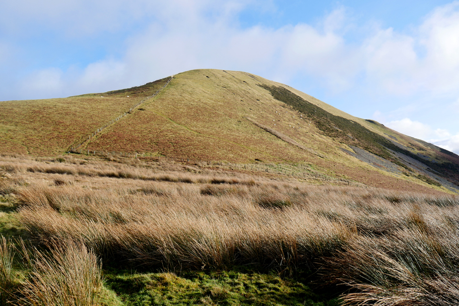
The view this side of the valley is of Darling Fell and Askill Knott. Coincidentally, Askill Farm is also up for sale. A farmhouse and 30 acres (I believe) would also make a good home for someone.
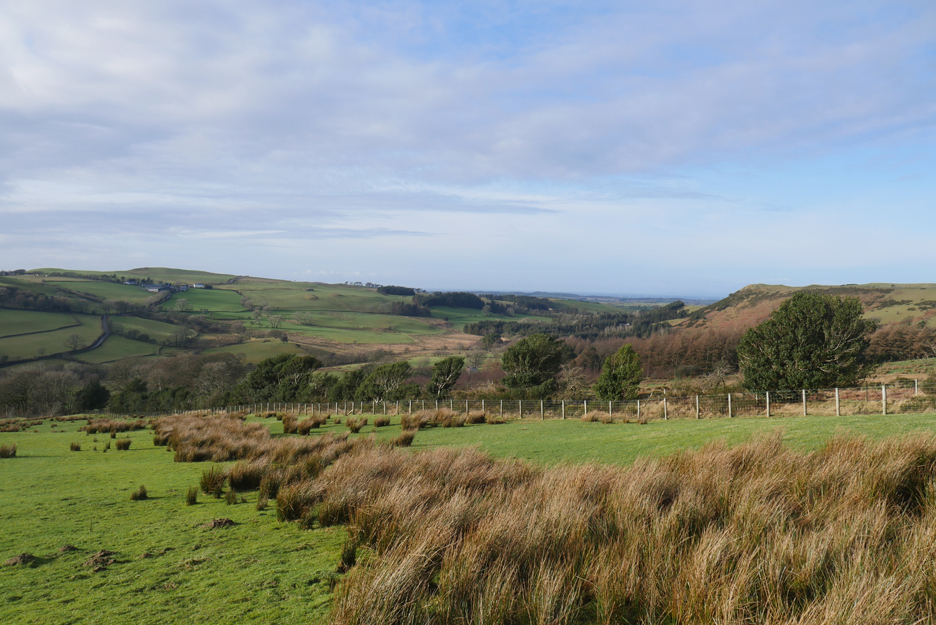
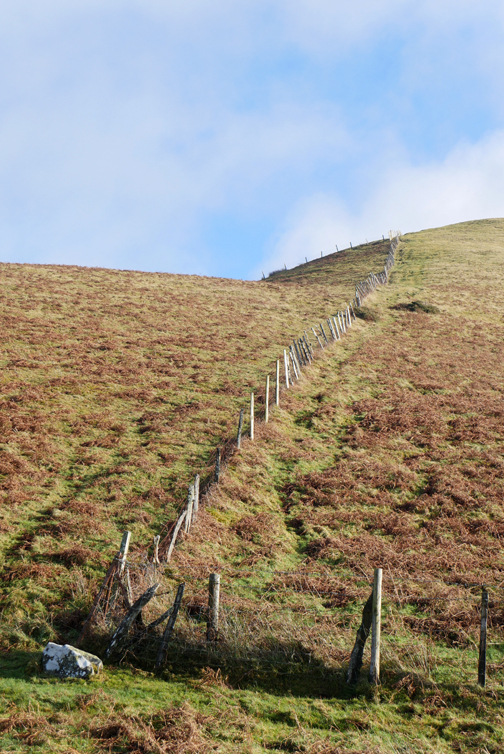
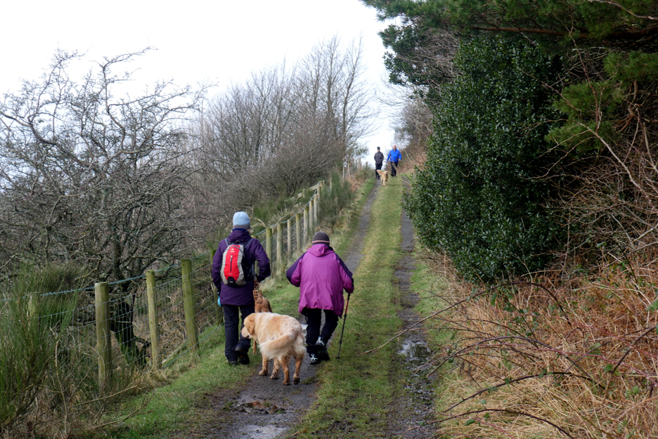
We're up on the old Mosser track now, looking back to the fence line that borders Grange Lane that we have just completed. Here we're looking north west to the Solway Coast, to the sea beyond Mockerkin and Pardshaw.
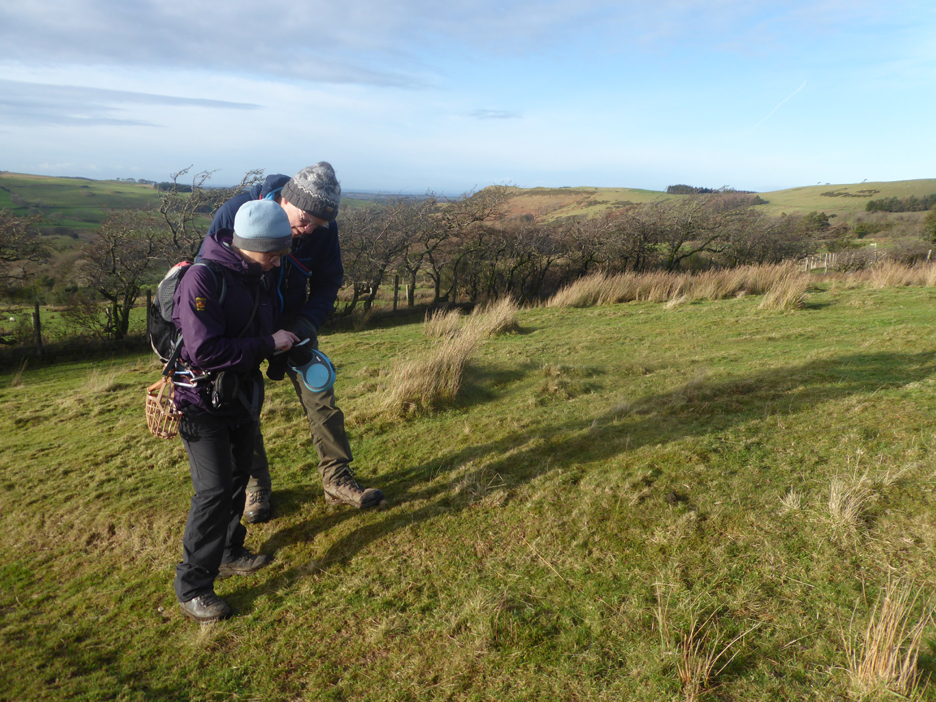
Jo checks out her new Ordnance survey phone app (a Christmas present) which gives her a local 1:25k map and shows her position on it. We've just turned off the Mosser track and heading up towards Askill Knott . . . spot on !
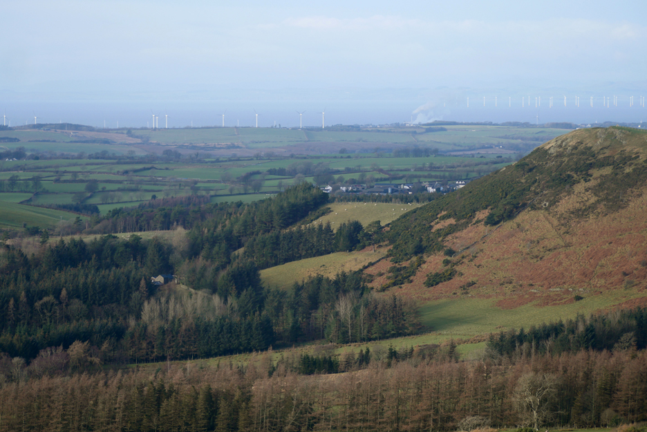
As we gain height the view of the coast opens up further. The land based turbines are clustered around Workington and the smoke and/or steam is from the Iggersund Biomass power station at their paper mill just out of town.
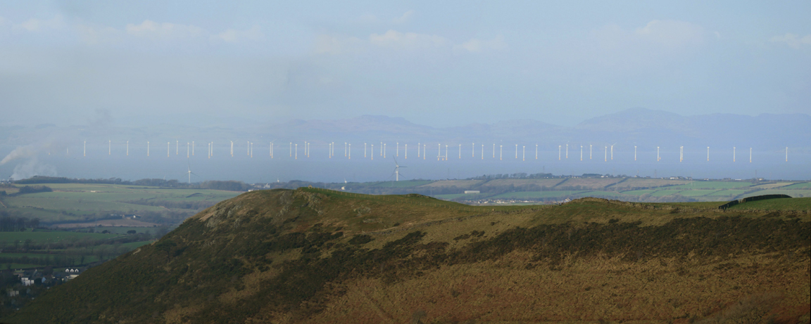
Above Wilkes How and Bramley Seat (private land with a footpath through at one point) we can see the coast more clearly. Out in the Solway there's a much larger wind farm . . . wouldn't fancy sailing through that area in bad weather !
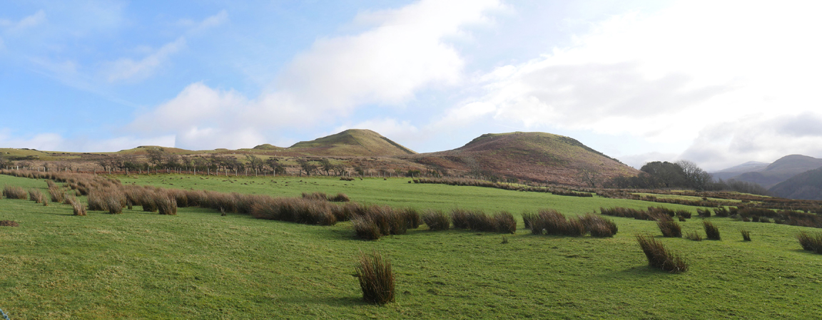
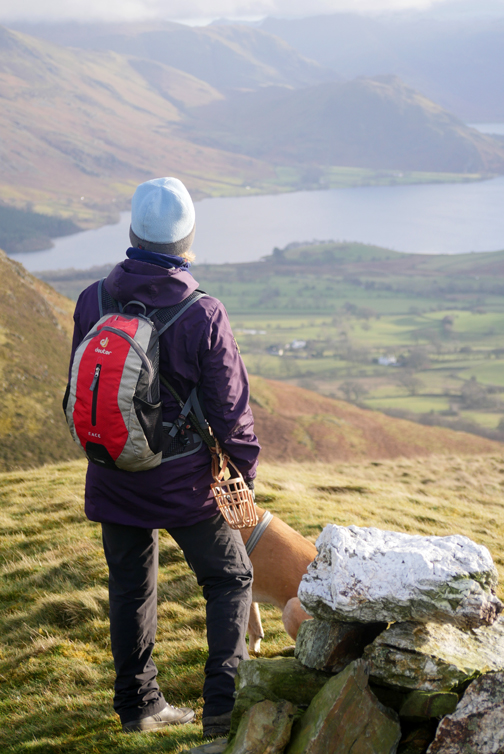
We turn our sights inland now as we near the top of Askill Knott. In the distance the high fells have a slight covering of cloud. Long distance viability is good but not brilliant.
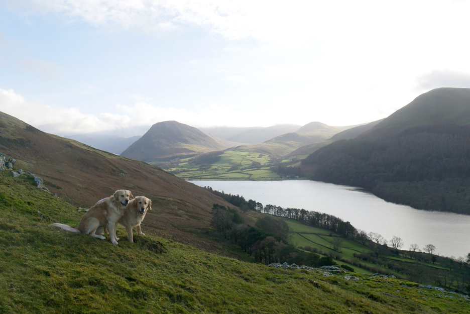
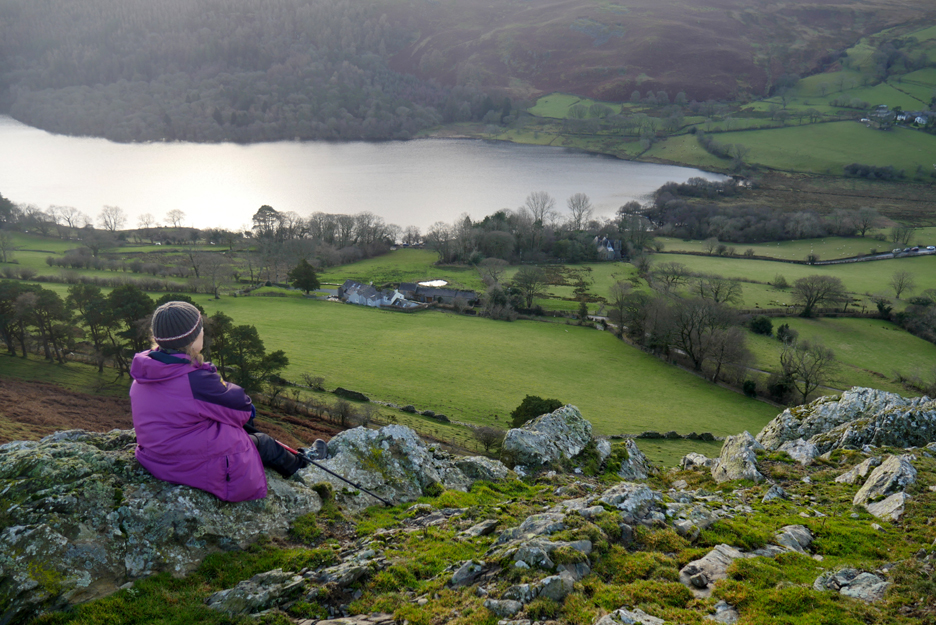
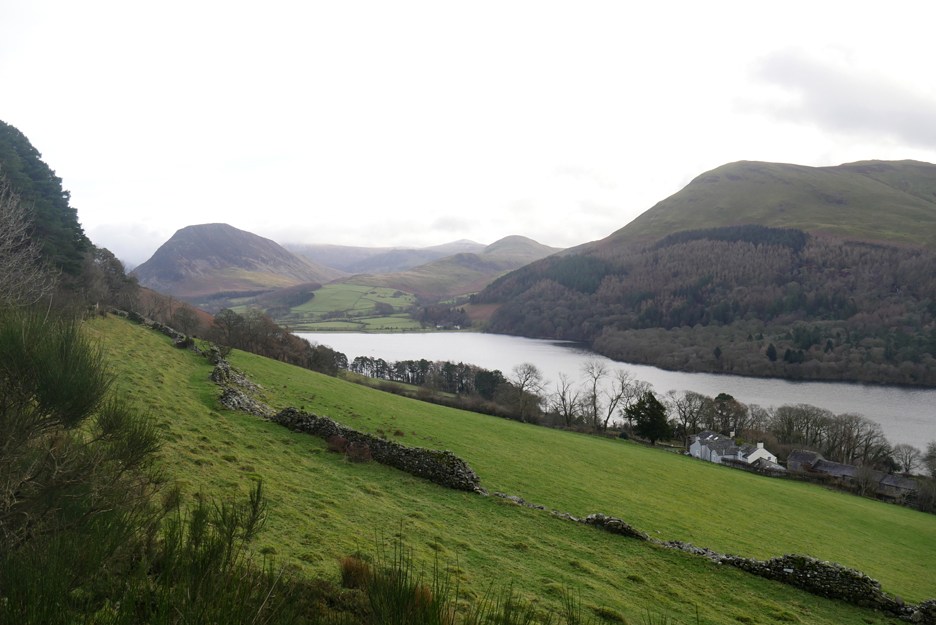
Ann stops to appreciate the view down to Myresyke and the western end of Loweswater.
Ours is one of the many cars parked by the phone box.
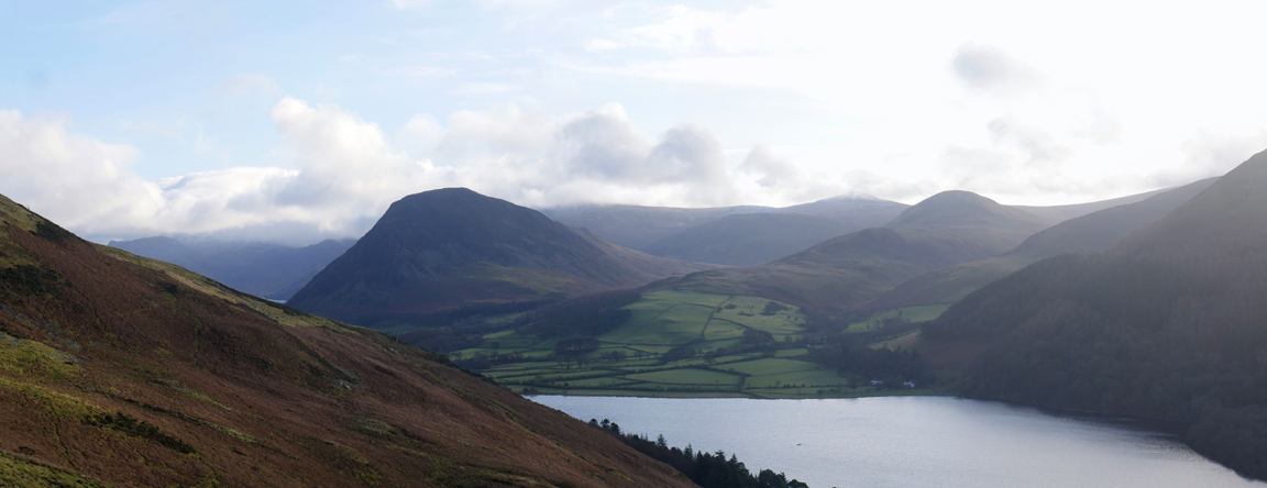
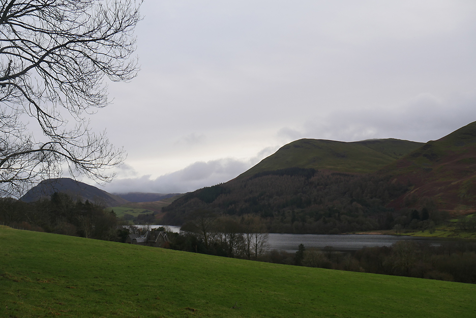
Watergate at the eastern end of the lake, Mellbreak and Hen Comb being the two local fells.
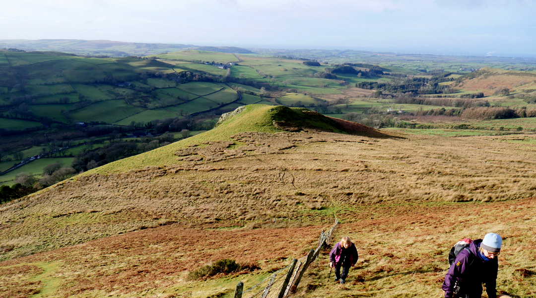
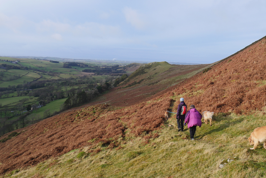
It's a nice day, do we fancy climbing the steep slope to Darling Fell ? Okay . . . Darling Fell it is then . . . darling !
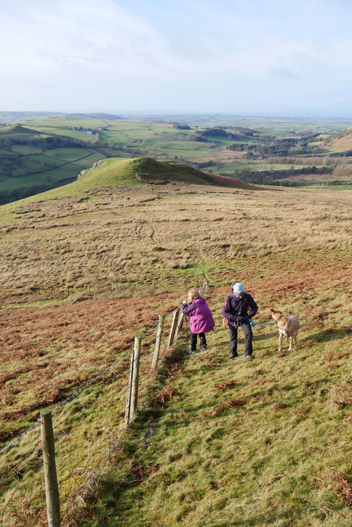
We cross the tussocky grass and 'seives' (reeds) on the flat ground between the Knott and the fell.
Leaving Askill Knott below now, the strong sunshine on the grassy top contrasting with the shaded valley beyond.
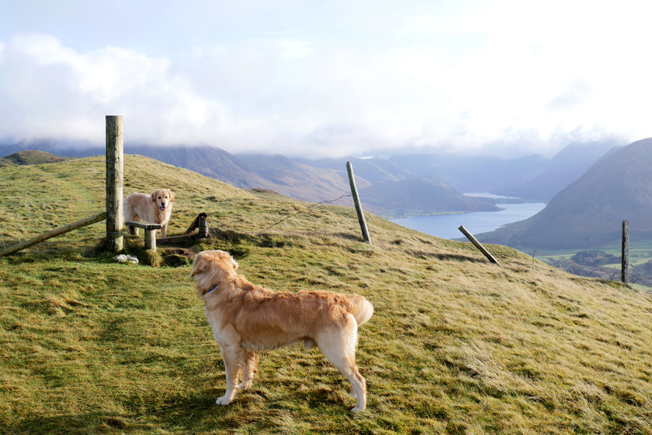
Dougal on the wrong side again . . . but it means he's probably found a place to cross the fence.
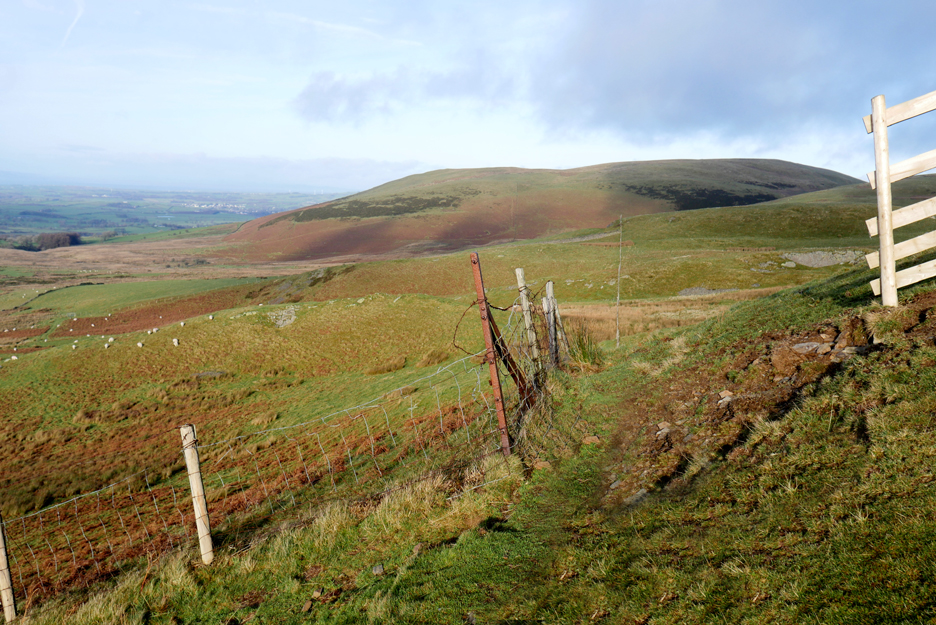
The view from the top corner of the fence, north to Fellbarrow.
This is one fence there's absolutely no problem crossing. [ The link at the bottom shows Dylan jumping back and fore across the old fence less than four years ago.]
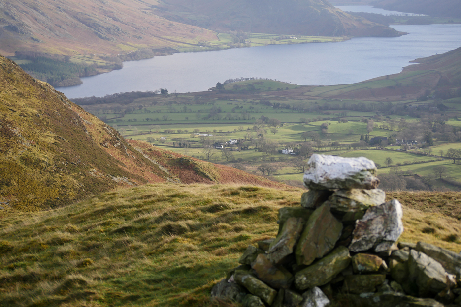
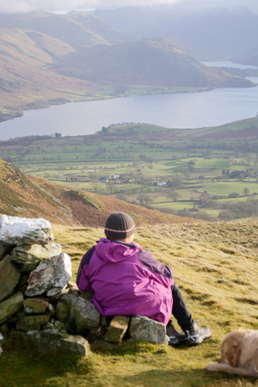
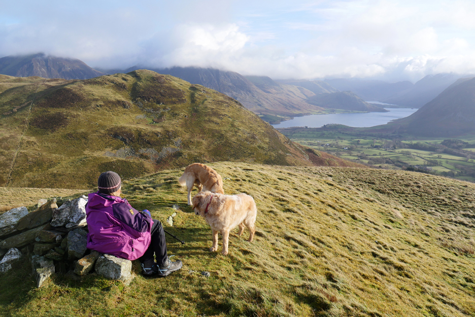
Though not the highest spot, the cairn on Darling Fell makes a great place to stop and check out the view.
It's a lovely day but that cloud is sticking to the tops of the high fells.
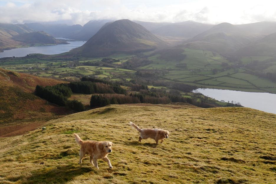
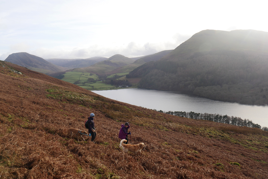
Time to head back . . . we'll drop down from the cairn and then circle back under the front of the fell.
Part way down we fine a path that seems to be rather more than a sheep track. It takes us in exactly the right direction.
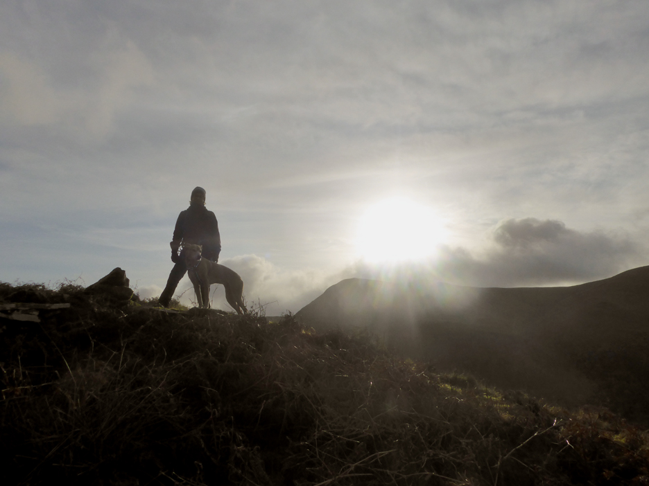
Jo takes the high ground, a small outcrop next to the path, and is silhouetted against the sun.
Onward and downward . . . the path may be more difficult to find with tall summer bracken, but today it is easy going.
Below us, on the other side of the line of trees, is the old Mosser Road.
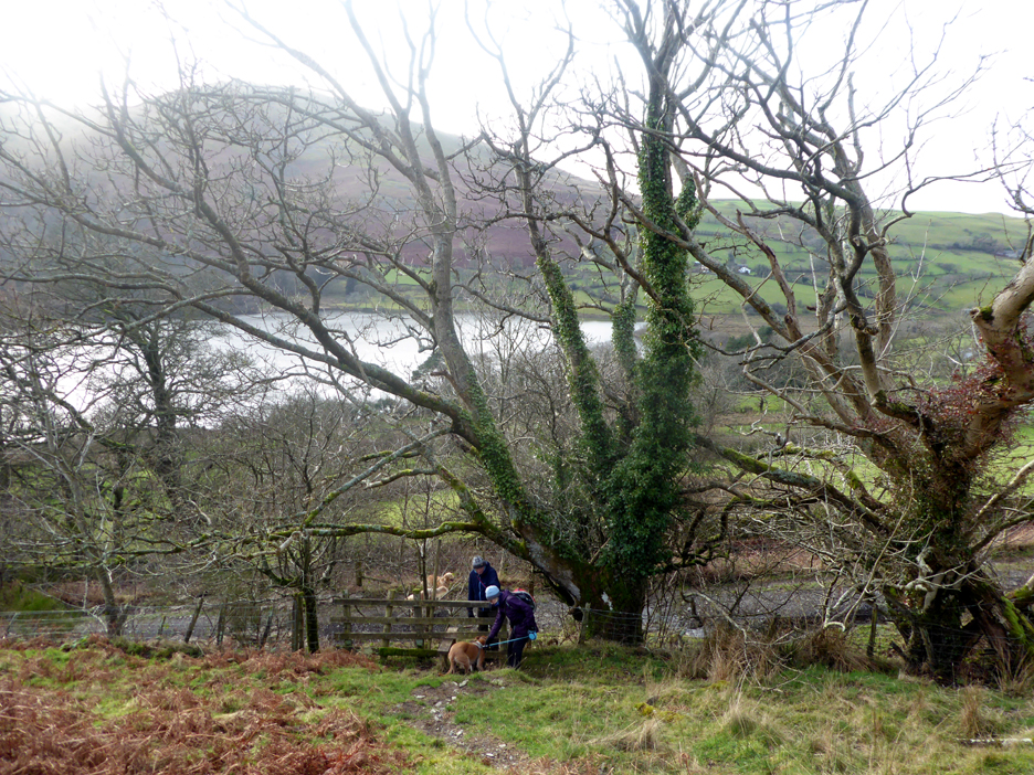
Just one last stile to get across . . . in fact the dogs crept underneath the bottom rail.
Dougal goes ahead to see if the other walkers have a dog to talk to.
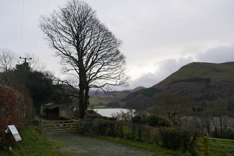
From the top of the lane we get the classic Renee Zellweger view of Loweswater as seen in the "Miss Potter" film.
I often move sideways here to get a picture of the old grass harvester fading slowly into oblivion, but with the pending sale of the farm, sadly the old piece of machinery has been removed.
We've followed the bridleway track down from the top road, passing the entrance to Myresyke along the way.
Just the short road walk now back down to the car waiting at the bottom.
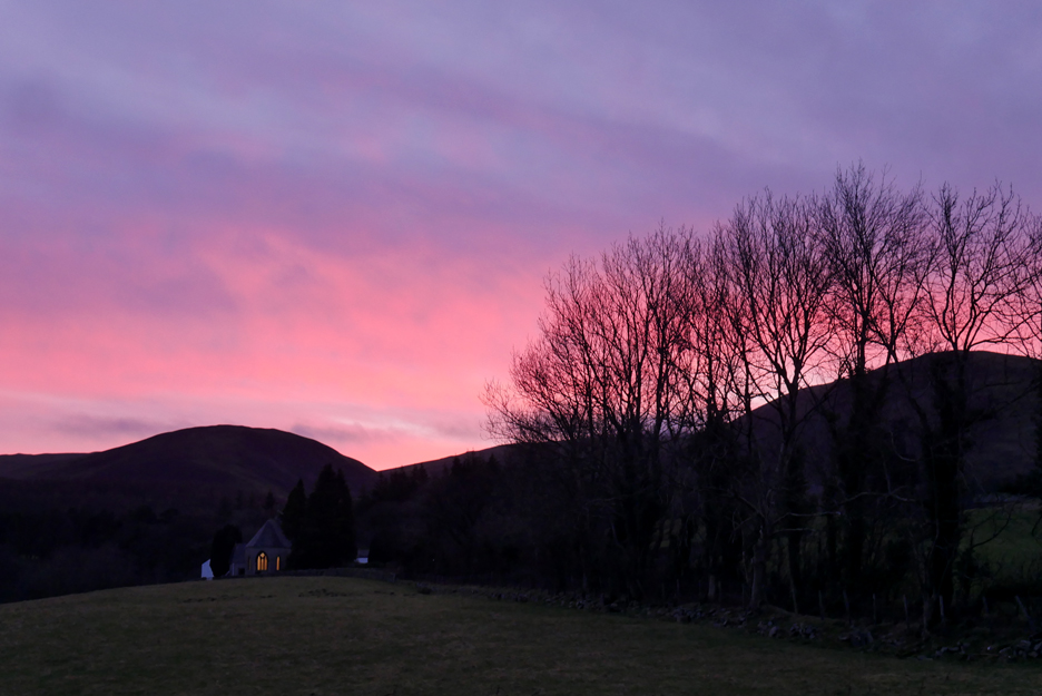
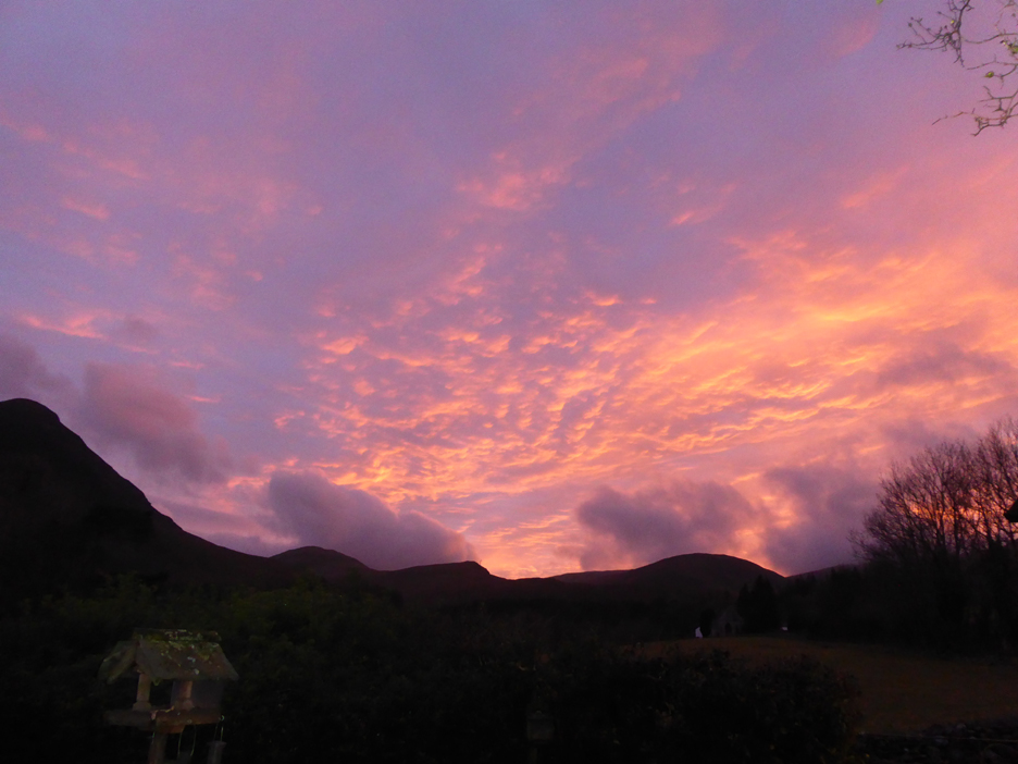
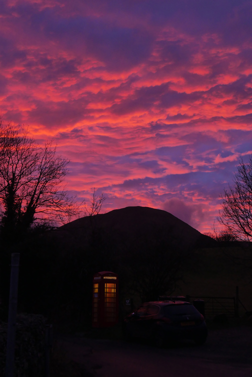
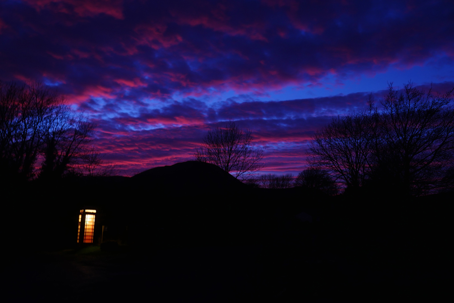
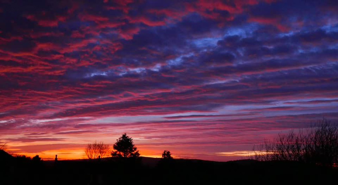
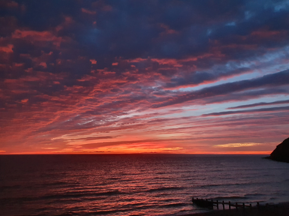
At the end of the afternoon we were treated to a brief but delightful red sunset, seen here from our cottage. Time to put the kettle on Jo. - - - o o o - - - The high cloud was still in evidence next evening. As the sun set through that cloud over the Irish Sea to the west of us, the sky started to colour up again and this time it was even better than the night before.
Multiple layers catching the sunlight as the rich sunset colours start to illuminate the underside of the highest cloud.
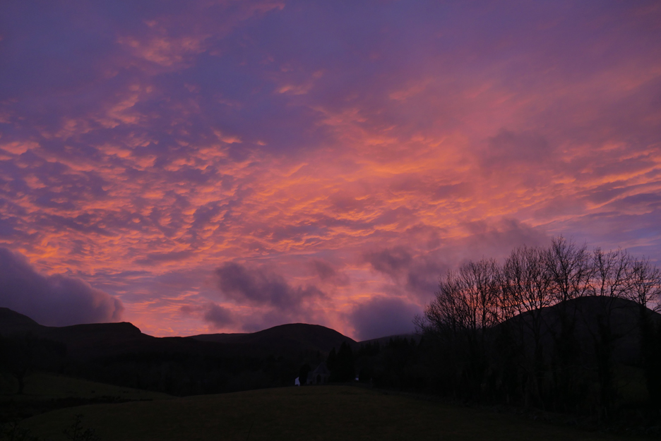
A gradual change is taking place . . . less bright but more intense colours.
The clouds became bright pink now . . . it must be a lovely sunset from the other side of the hill.
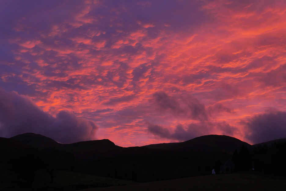
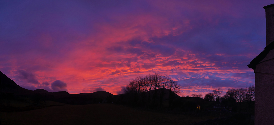
A panorama of five vertical pictures, stitched together to catch the whole show.
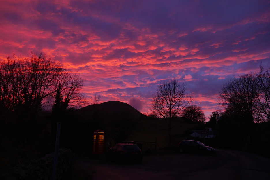
The phone box appears brighter as the daylight fades.
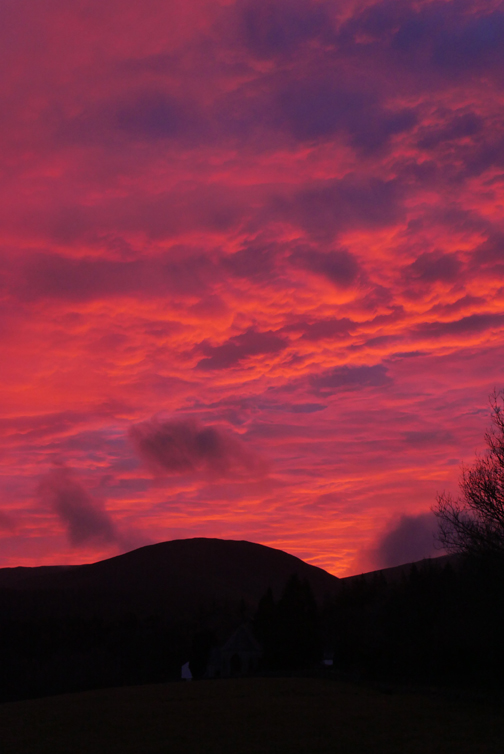
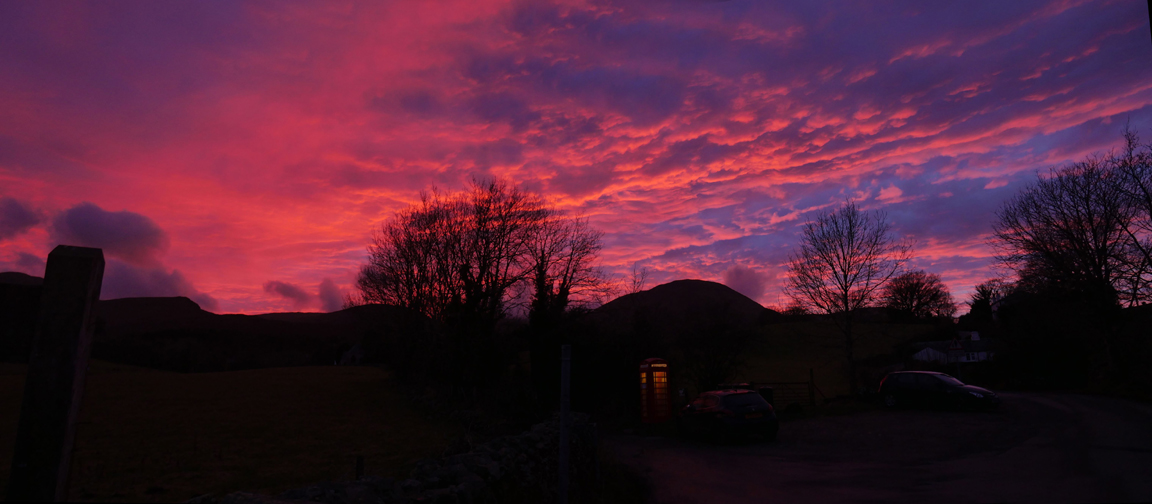
Another panorama this time taken from out on the road.
That's it folks . . . the final countdown as the deep fading pinks contrast with the deepening blue of the sky behind. One of the most impressive sunsets of the winter. - - - o o o - - - [ Note: all these picture were live exposures - no post production filters at all.] - - - o o o - - - Unsurprisingly we were not the only ones to notice the sunset . . .
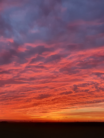
Cheryl Quine " We have the same view over Mockerkin tonight but we’re just a bit higher up so we get the yellows too." . . . and sent by friends from Whitehaven :
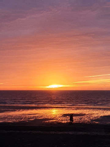
We were at Ravenglass doing a bit of a coastal walk, and seeing the sunset develop as we left, we stopped at Seascale and St Bees on the way home.
Wasn't it just glorious, superb colours, and absolutely magical! I only had my phone with me but managed to get some lovely snaps. Seascale was really busy as more and more people stopped to see the sight! We watched it set, then jumped in the car and went to St Bees to watch it getting darker. (The peaks of Isle of Man could be seen) Like you say, it was one of the best we have seen! Love Amanda n Bill
|
Technical note: Pictures taken with either Ann's Panasonic Lumix TZ60, or my Panasonic Lumix Gx8 Camera. Resized in Photoshop, and built up on a Dreamweaver web builder. This site best viewed with . . . another pleasant surprise from nature when you are least expecting it. Go to Top . . . © RmH . . . Email me here Previous walk - 12th January 2020 - Cogra Moss New Path A previous time up here - 13th March 2016 - Askhill Knott with Sherran and Bill Next walk - 29th January 2020 - Dylan's Birthday and a local walk
|