![]()

Remember: Press F11 for a full
screen view of this page.
Web Counter when published 1 716 367
|
|
|
Remember: Press F11 for a full
screen view of this page. |
Web Counter when published 1 716 367 |
|
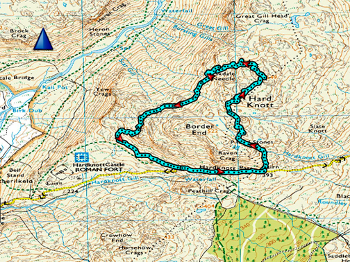
" Hard Knott with Jenna " Date & start time: 28th October 2019. Early morning in the garden, a drive to Eskdale with the walk starting at 1pm. Location of Start : Hard Knott Pass, Eskdale, Cumbria, Uk. ( NY 231 015 ) Places visited : Dalegarth, Hard Knott, Eskdale Needle, Stickle Barn afterwards. Walk details : 3.75 miles, 1025 feet of ascent, 3 hours 10 mins, including lunch. Highest point : Hard Knott summit, 1,784ft - 549m. Walked with : Jenna, Ann and our dogs, Dylan and Dougal. Weather : Superb sunshine and blue skies, great visibility. Cool to start. |
© Crown copyright. All rights reserved. Licence number PU 100034184. |
|
What started as a desire to walk on the high fells developed into a full day out for Jenna and ourselves. She wanted classic fellwalking views but not necessarily the classic summits. Our walk up Hard Knott would suit the bill as it is nicely surrounded by loads of well known summits.
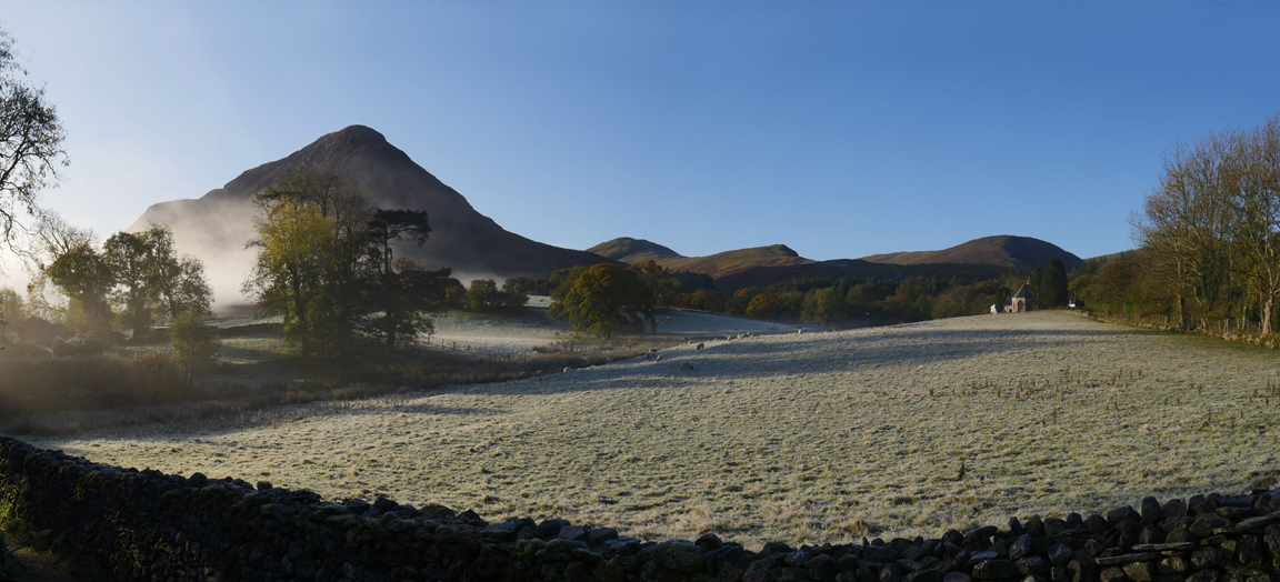
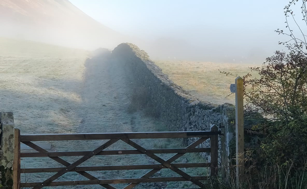
The day started with a cold but fine autumnal morning with temperatures below freezing overnight and virtually no breeze. The fields are covered in a silvery mantle of frost and nature is blowing theatrical smoke in from the wings.
The morning's temperature inversion has filled the valley with mist, leaving the summits clear. In the sunshine it will be warmer up on the fells than down here in the valley . . . inverted temperatures !
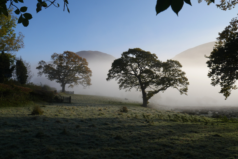
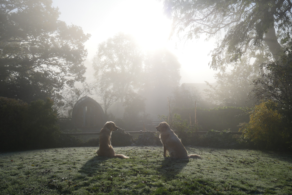
The mist is drifting about the valley . . . Oh . . . where did he come from ?
The view over Dougal's head into the field across the road . . . as the mist drifts ever so gently around the valley.
It is getting thicker rather than evaporating, probably as the low lying mist drifts down the valley by virtue of gravity. What had formed at the head of the valley, is moving slowly in our direction as the morning progresses.
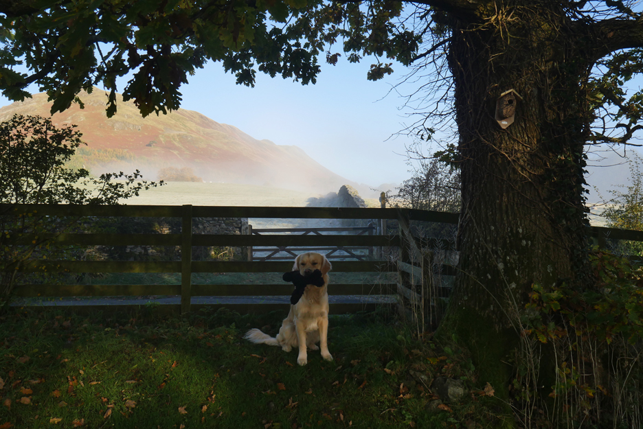
The earlier view of Mellbreak has misted over but the sun will cause it to evaporate whilst we indulge in a little breakfast, make a few sandwiches for our walk and pack a rucksack for the day. - - - o o o - - - Time to be heading off in the car . . .
Time to head on down towards Eskdale. - - - o o o - - -
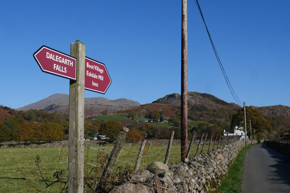
Forty minutes later and we've stopped for another photo ! If it is Dalegarth Falls that way and Boot Village the other, we must be somewhere near the railway station.
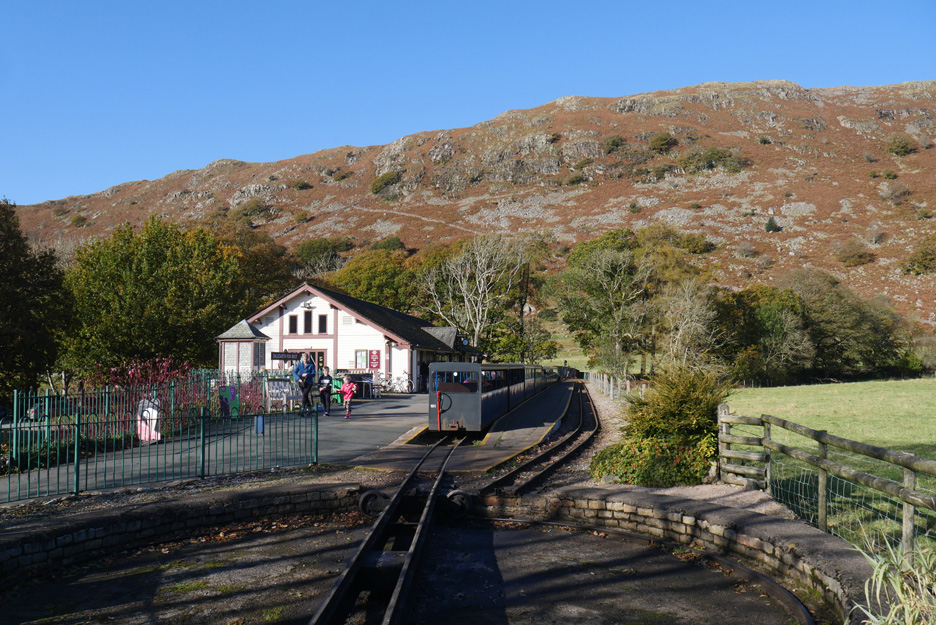
Yep . . . told you (but then I knew in advance). The morning train from Ravenglass has arrived and already prepared itself for the journey back down the valley.
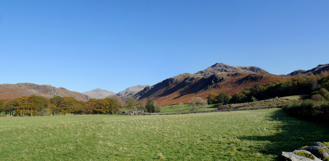
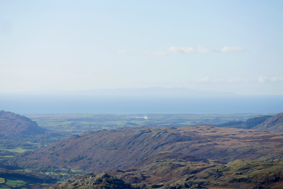
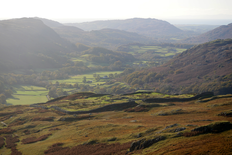
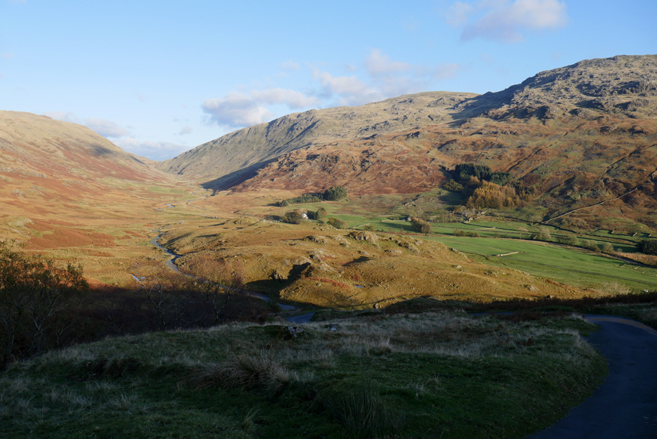
On the other side of the road is Brotherilkeld Farm, the path from which gives access to Upper Eskdale and the Scafells. As for the summits, there's Bowfell and Crinkle Crags in the distance, with Border End, the outlier of Hard Knott, closer to the camera.
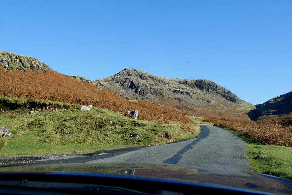
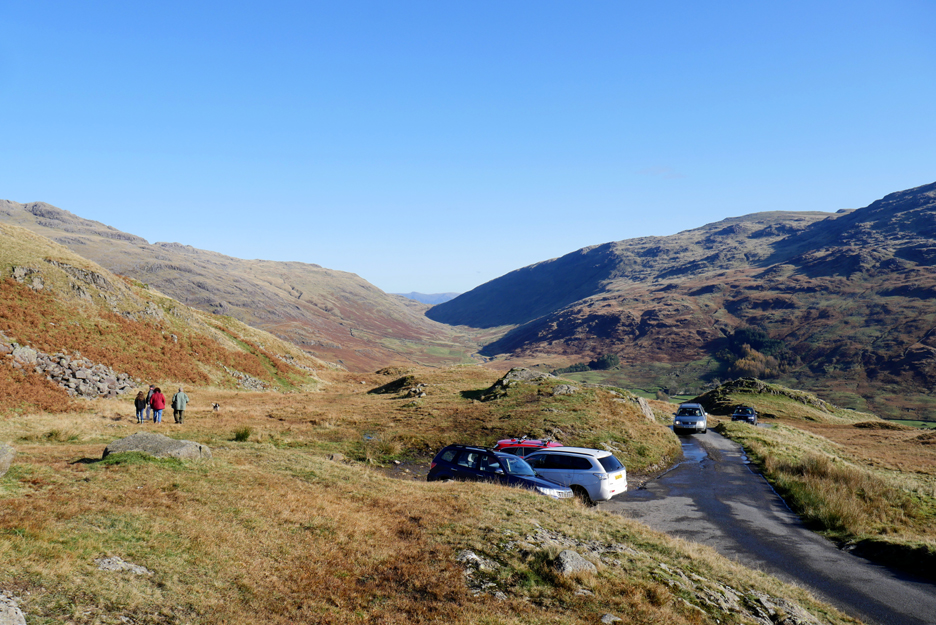
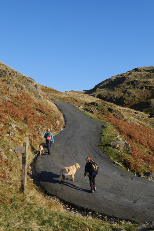
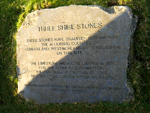
We make light of the big climb . . . by driving up Hard Knott Pass. The small plaque is an indication that the path starting here is one of the ones that leads up to the Roman Fort.
The first part of the climb done but the steepest part of the road still lies ahead of us.
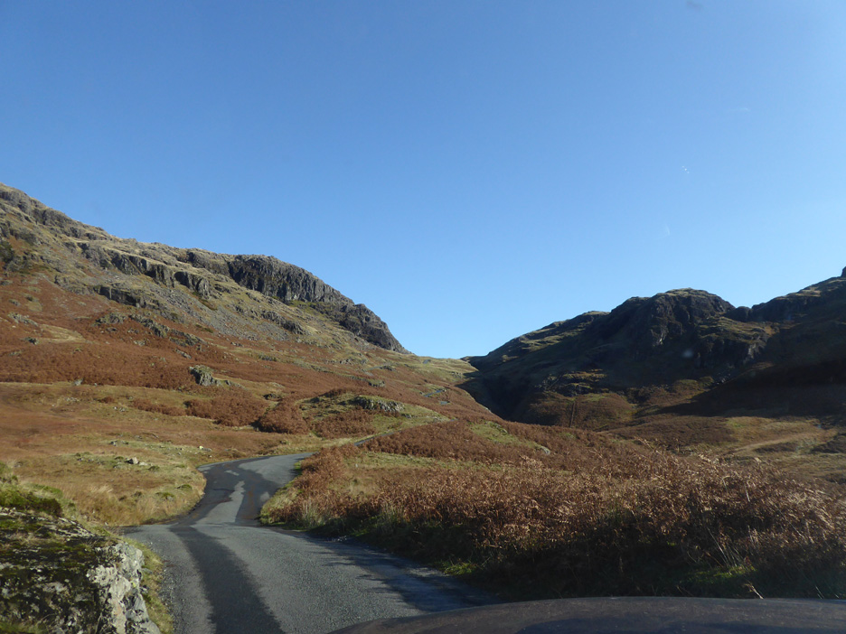
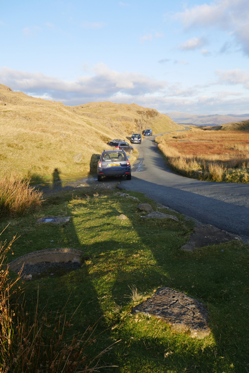
We stop near the top. A quiet day for traffic . . . I think we've only seen one or two cars on the Pass so far . . . but then it is a Monday.
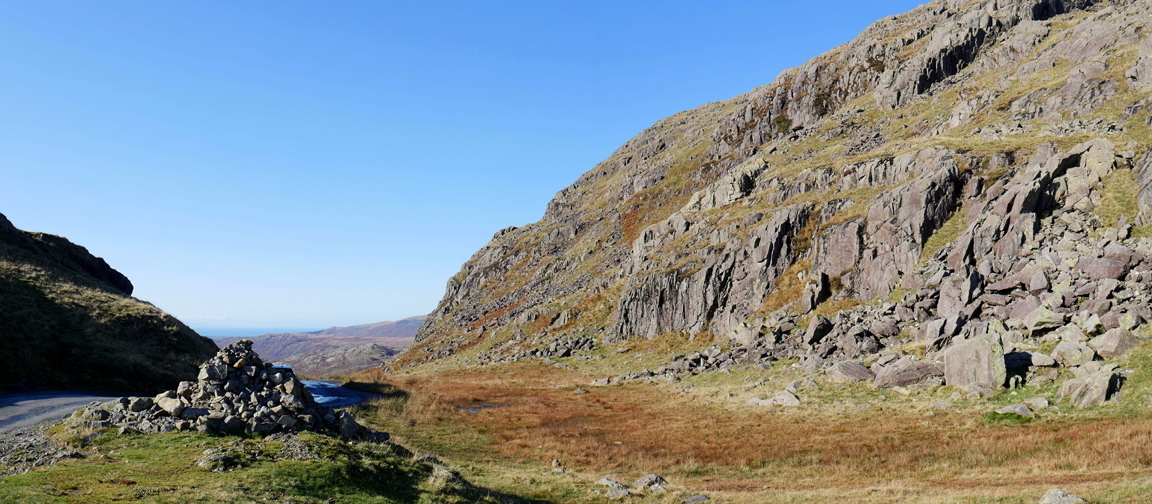
The actual top of the pass is marked with a reasonably sized stone cairn.
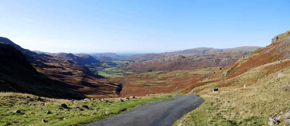
There's room for three or four cars just over the brow. Another family draws in alongside but they'll not walk far as they are only out to stretch their legs.
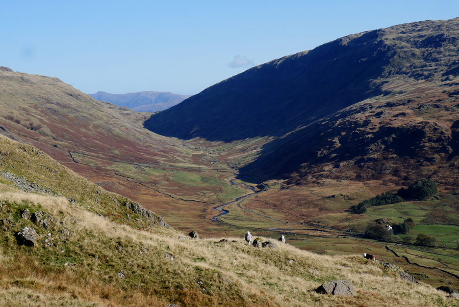
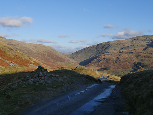
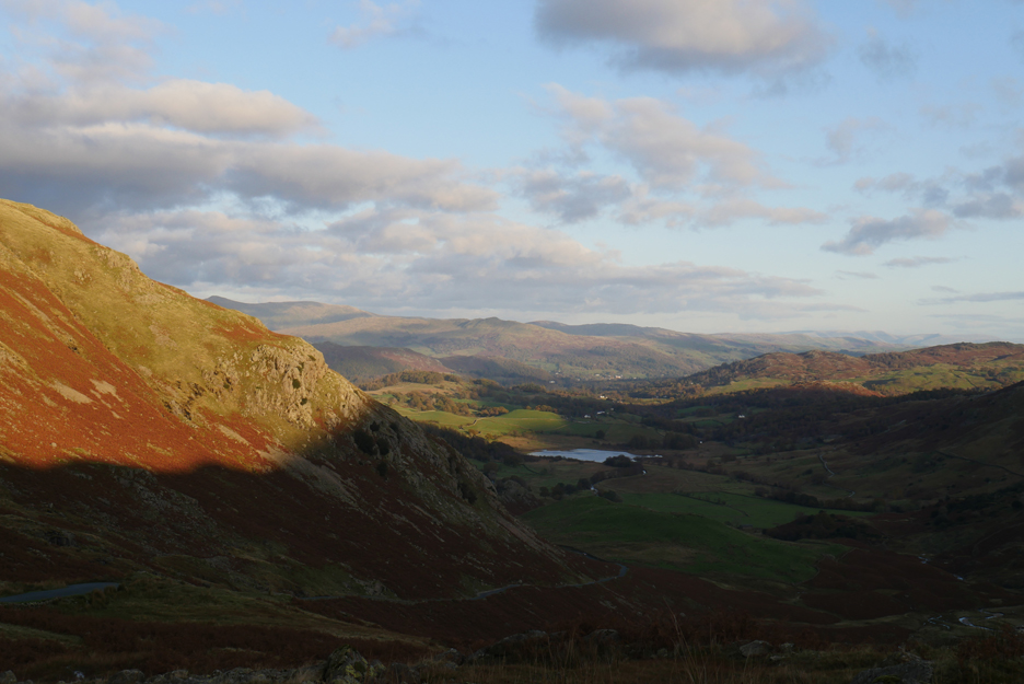
The view along the Upper Duddon Valley . . . better known perhaps as Wrynose Bottom.
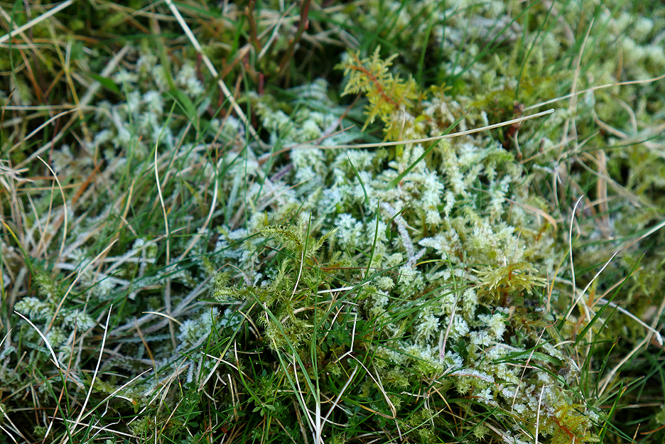
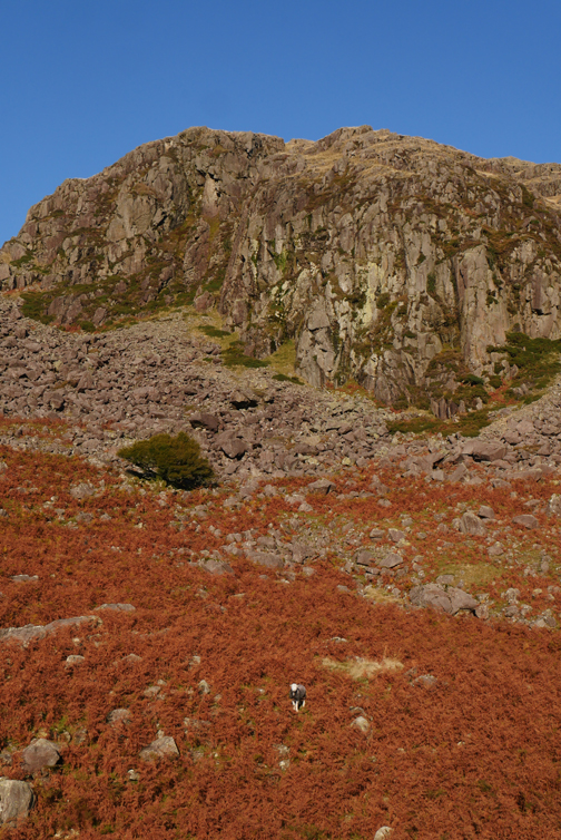
Climbing up around the crags, the frost of last night is still evident on the vegetation that is out of the direct sunlight.
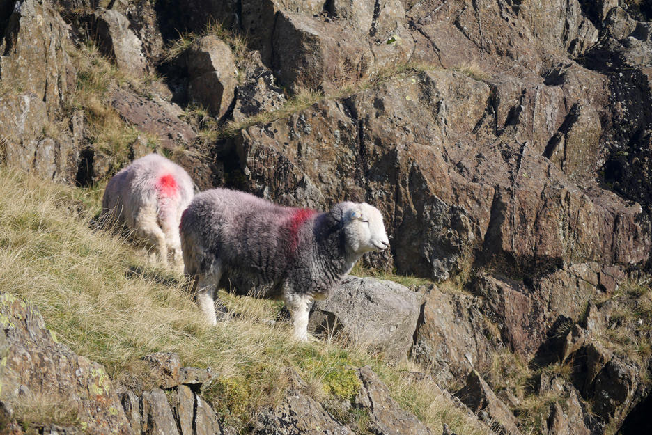
Herdwicks . . . Masters of the Fells.
More on the rocks further up, beautifully set against an azure blue sky.
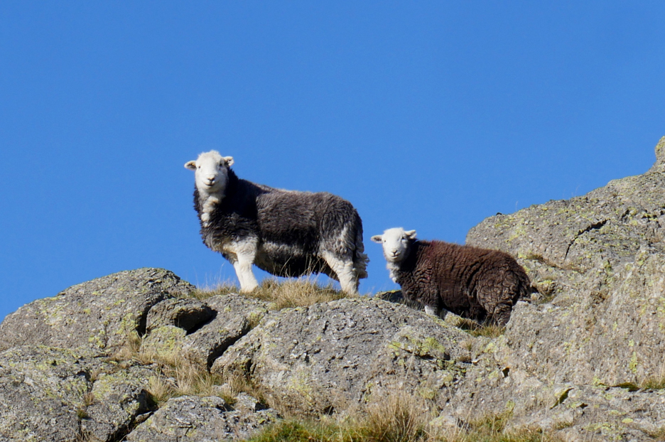
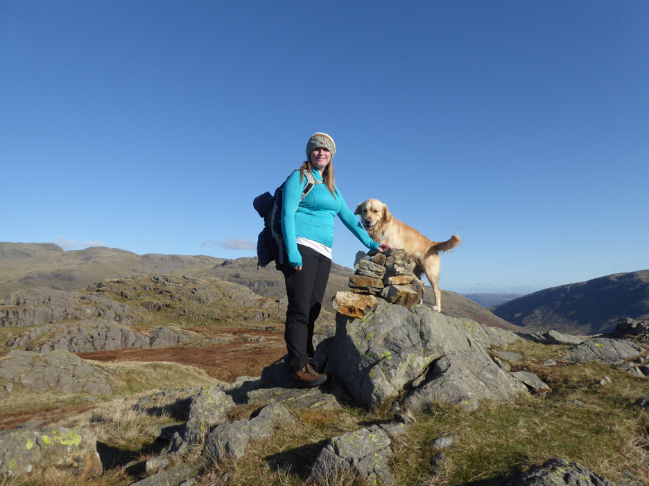
More on a summit rock . . . no . . . they're ours !
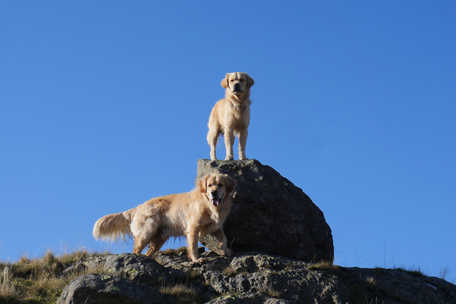
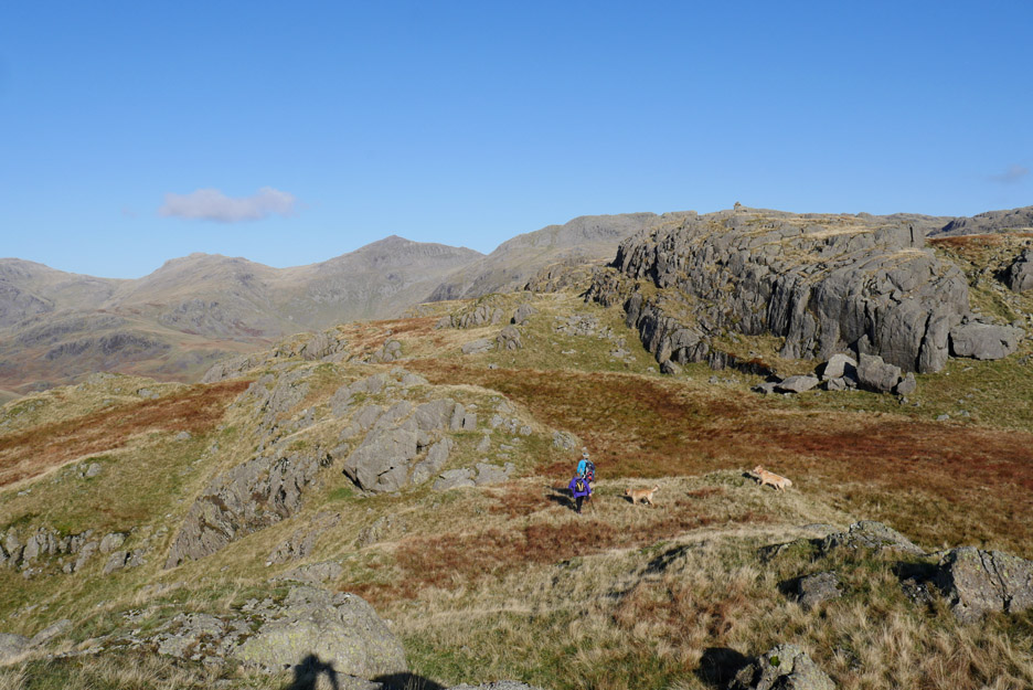
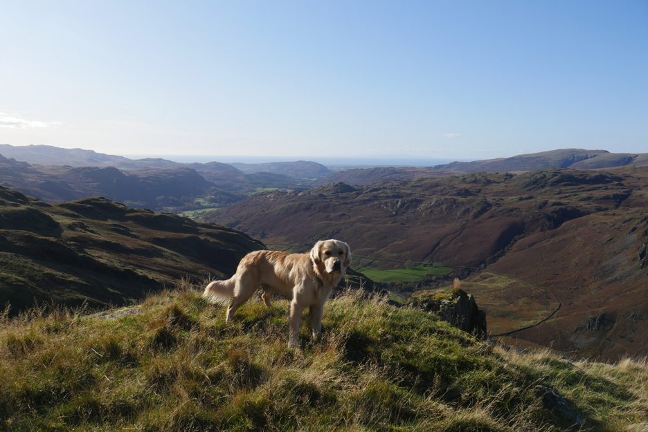
Dylan's chance to be top dog as we end the first part of the climb. Ahead is the undulating summit of Hard Knott . . . but the highest point is away in the distance.
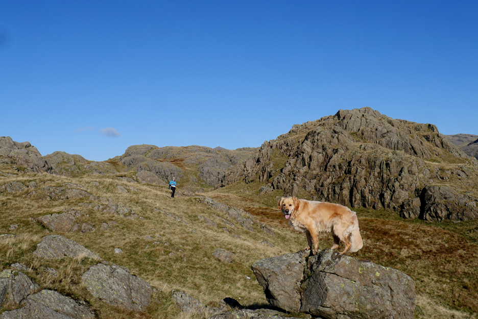
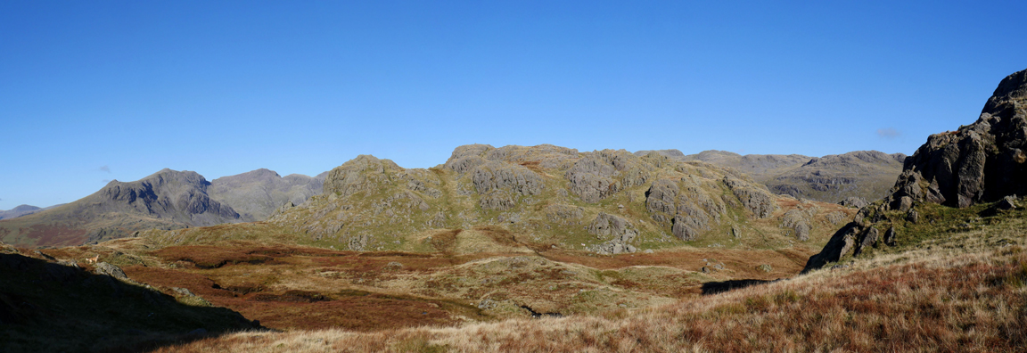
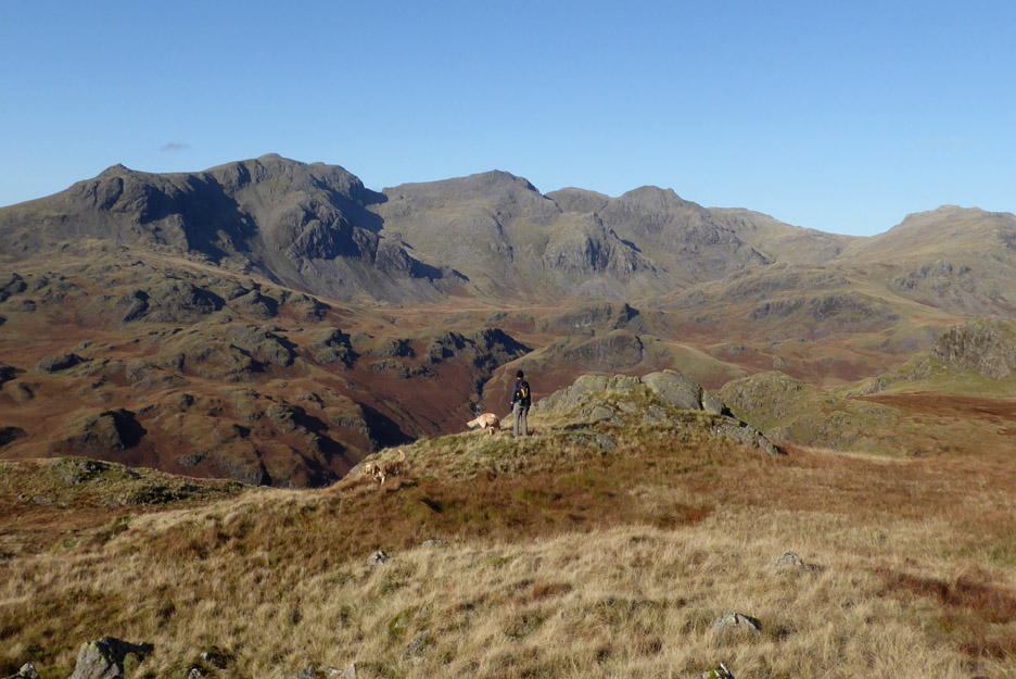
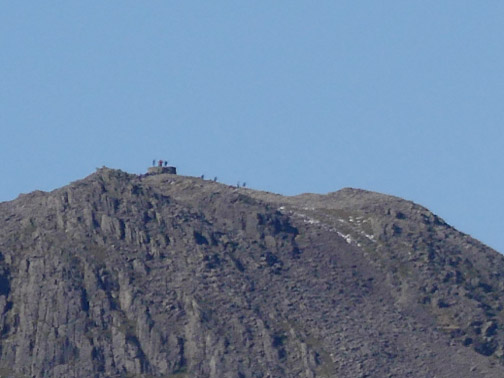
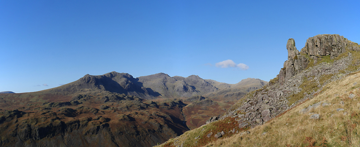
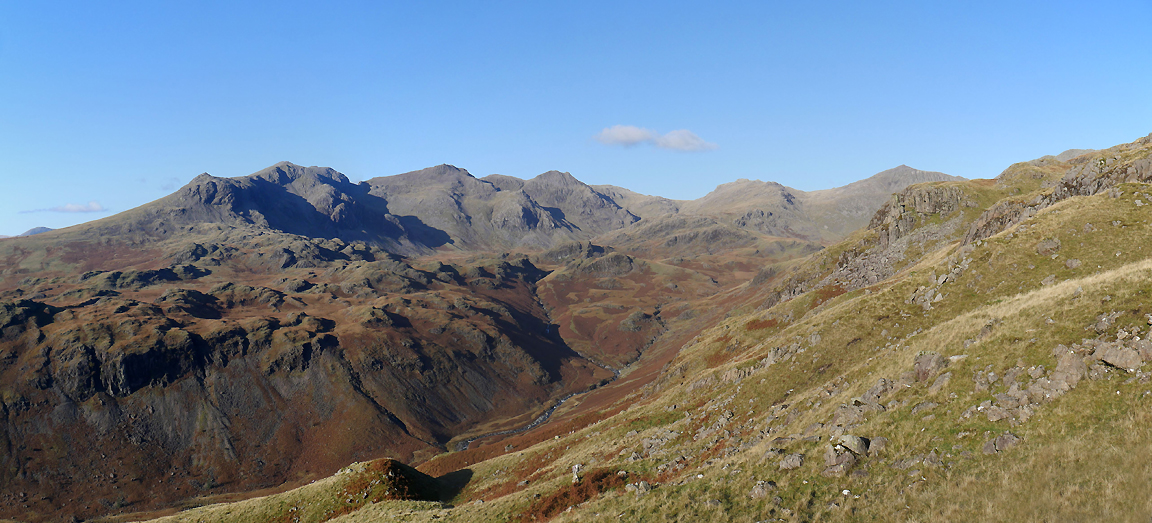
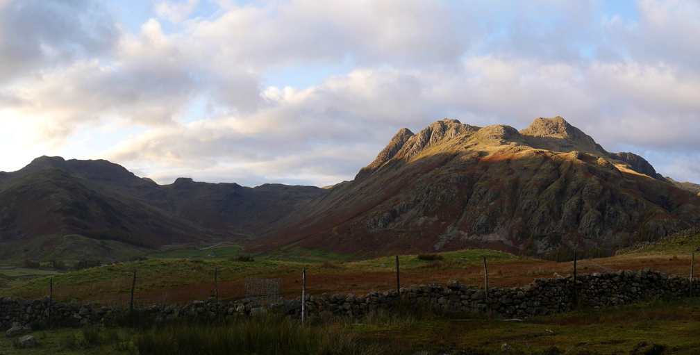
Over the next brow we get our first view of the high fells and a full appreciation of the complex nature of this particular summit. There are not one but two ups and downs before we make the highest cairn on the grassy crags ahead.
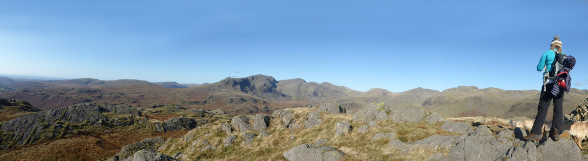
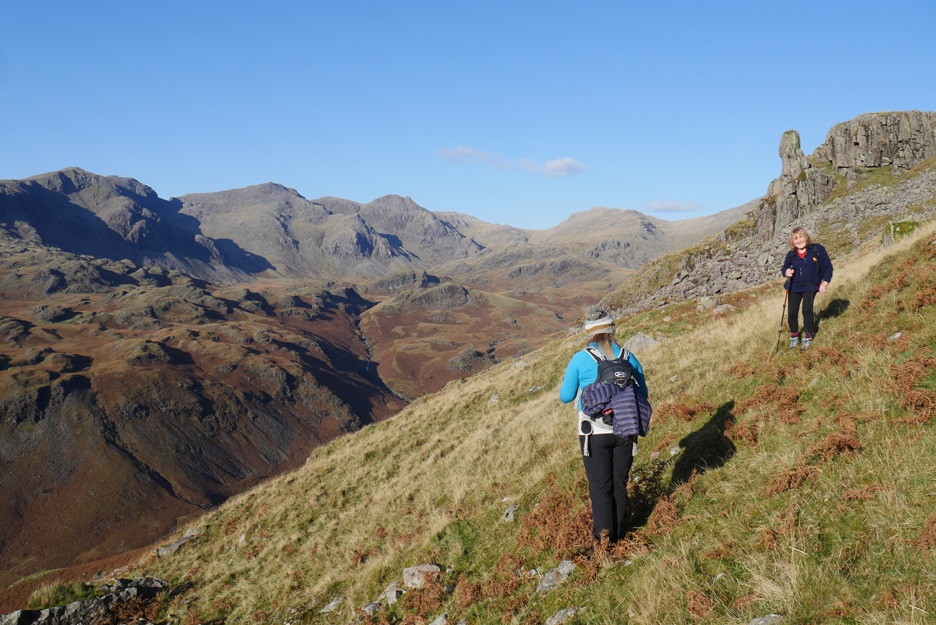
I stand on the first of the high rocks, as Ann points out the fells behind to Jenna.
Not yet the true summit but an excellent viewpoint nevertheless.
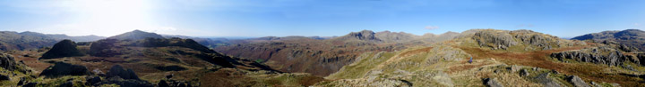
Click here or on the photo above for a full 360 degree Loweswatercam annotated panorama.
The true summit is one more step away, a small step for man but a bigger one for us mere mortals.
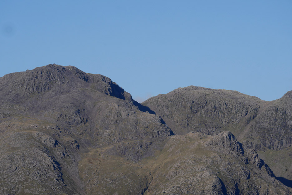
This time the next highest ground going forward is the top of England itself . . . Scafell Pike.
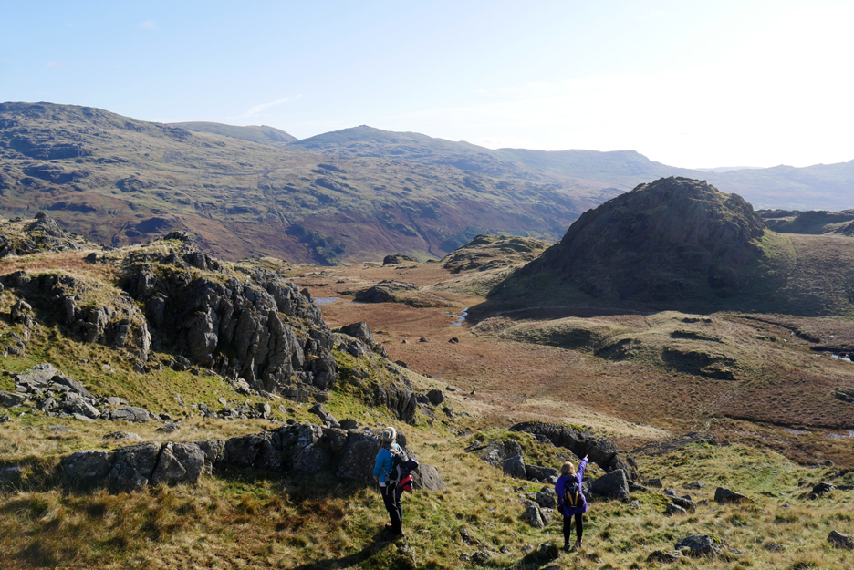
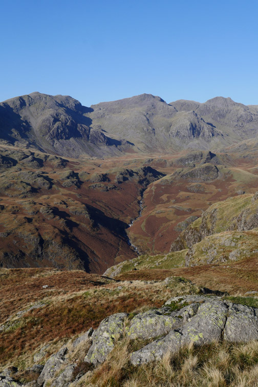
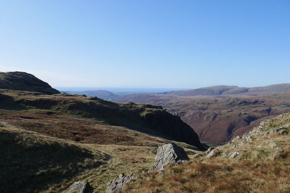
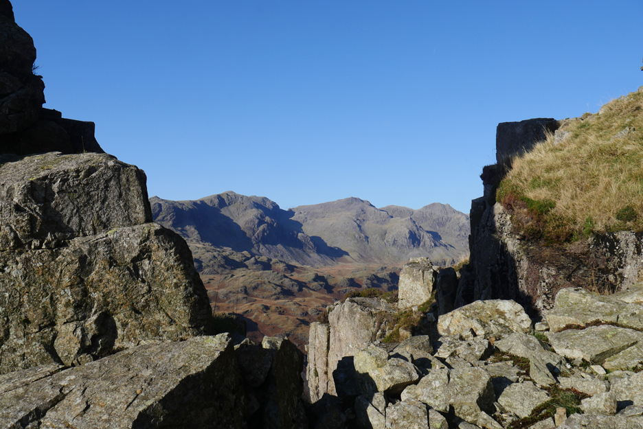
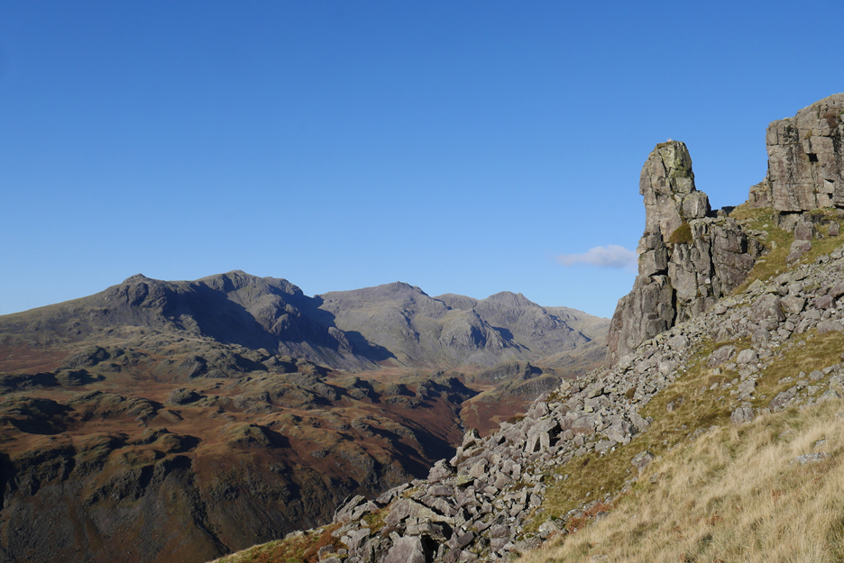
The upland view that Jenna was looking for today. From the fells of Wasdale we look right to Slight Side, Scafell and Scafell Pike, Broad Crag, Ill Crag and Great End. To the right of them are all the big ones, Esk Pike, Bowfell, the Crinkles and round to Swirl How and the Coniston fells . . . quite a view.
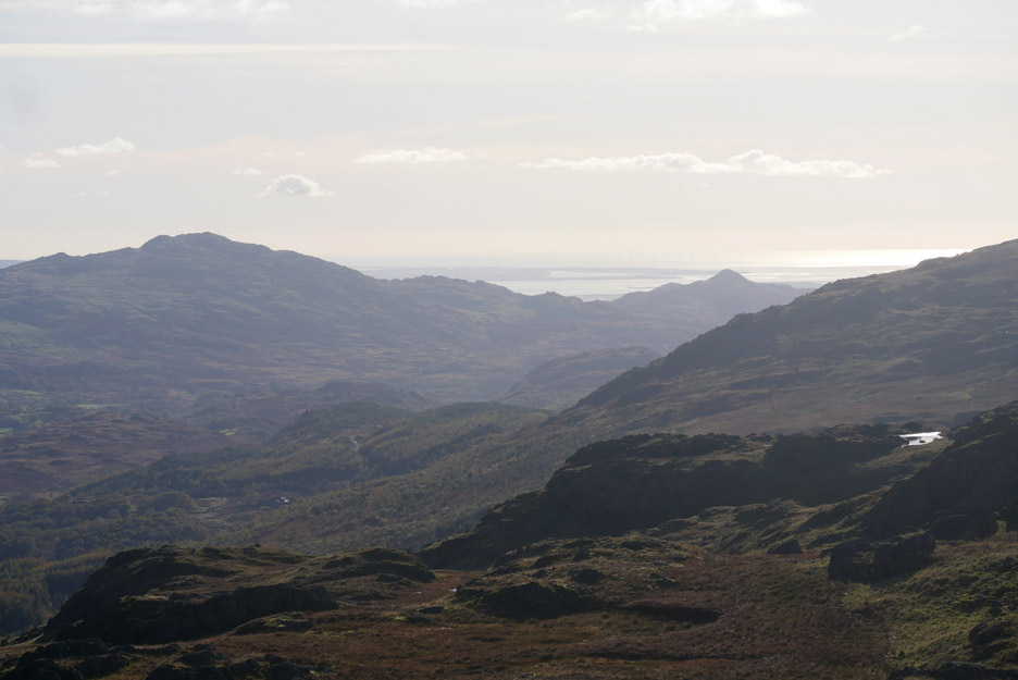
Looking south to Duddon's triangular Caw Fell.
Across to Devoke Water, always a delightful place to visit.
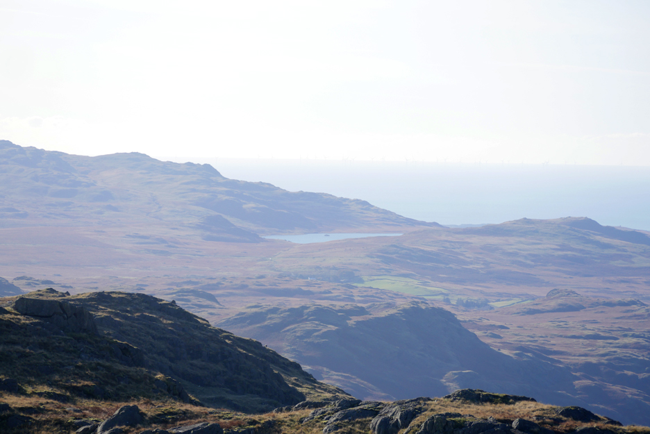
Out west to a hazy Isle of Man. [ In fact my mobile phone received a roaming message welcoming me to the Isle of Man mobile phone service today]
I drop down a little to start our search for the next objective, the Eskdale Needle.
Still no sign of the Needle as we continue to look down into the valley.
The bridge at Lingcove Beck. This is a classic packhorse bridge, tall and narrow with low parapets. A bridge of this size must have meant that the route west-east over Esk Hause towards Keswick was an important one for trade.
" Have you found anything yet ? " came the cry from the others. No . . . but I'm just going to investigate that strange looking clump of grass on that boulder.
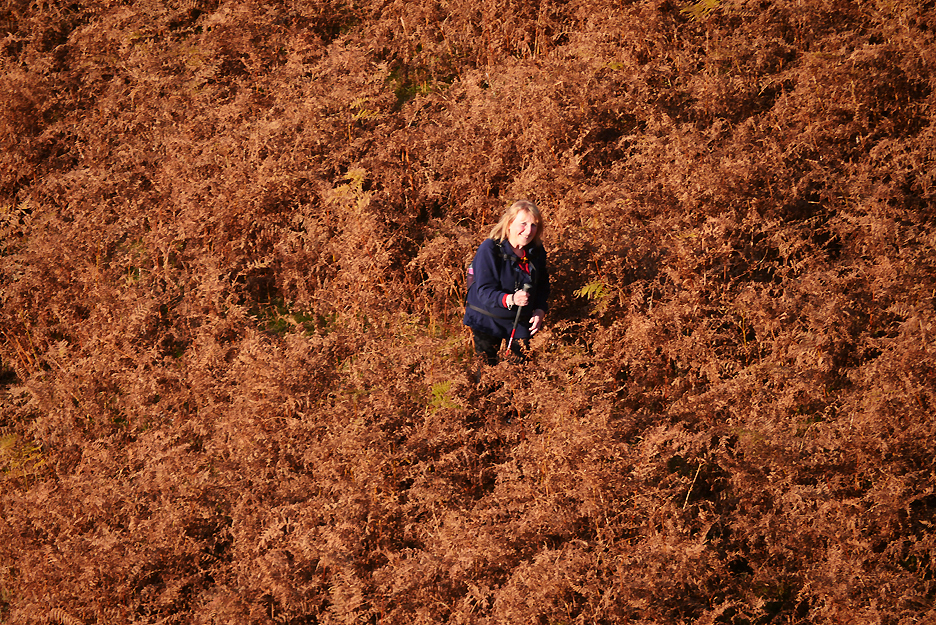
Jenna's virtual silhouette graces the picture, her position just a little forward of where I was standing with Dougal.
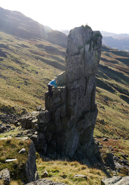
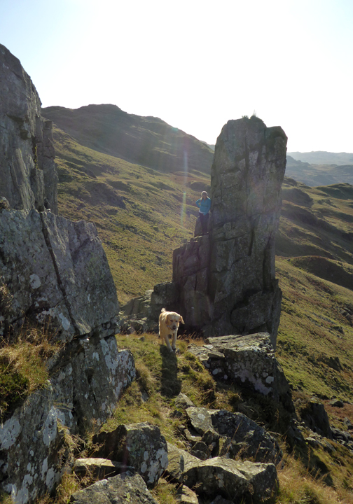
Dylan leads the way down to "thread the Needle" . . . that is to pass through the gap between it and the rock.
She ventures so far but wisely retraces her steps as the adverse camber of the slabs makes it too risky for amateurs to climb further.
Far better just to sit at the foot of the obelisk and enjoy a late lunch.
We could have sat the other side and enjoyed the excellent view, but we would have been in the shade.
Ann's photo of me becasue I had been hanging back and taking pictures.
Time to leave this lovely place.
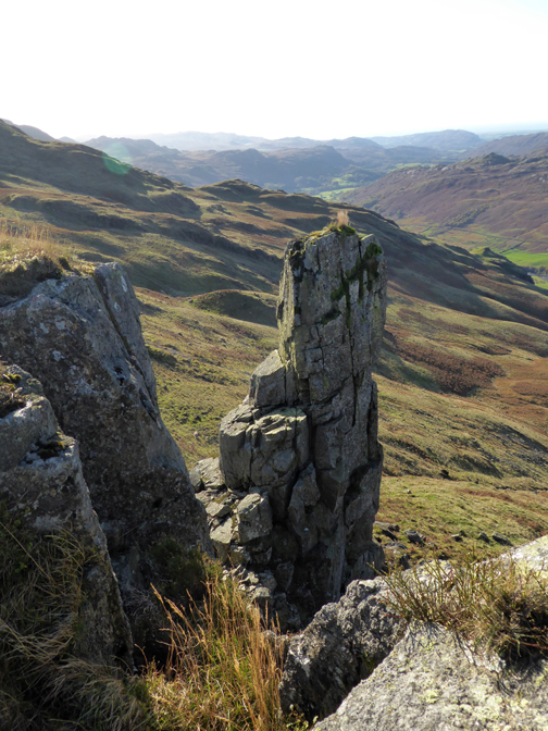
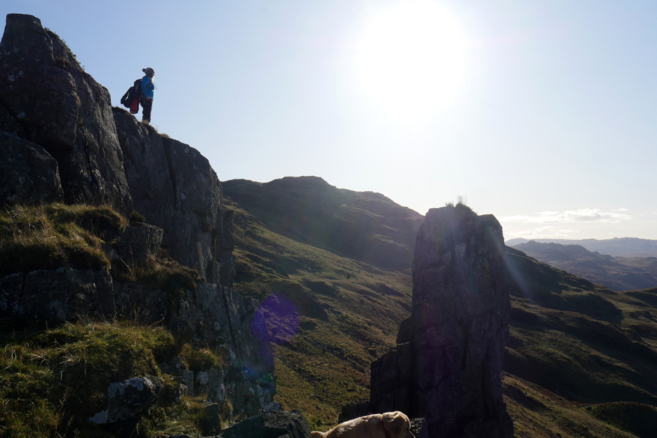
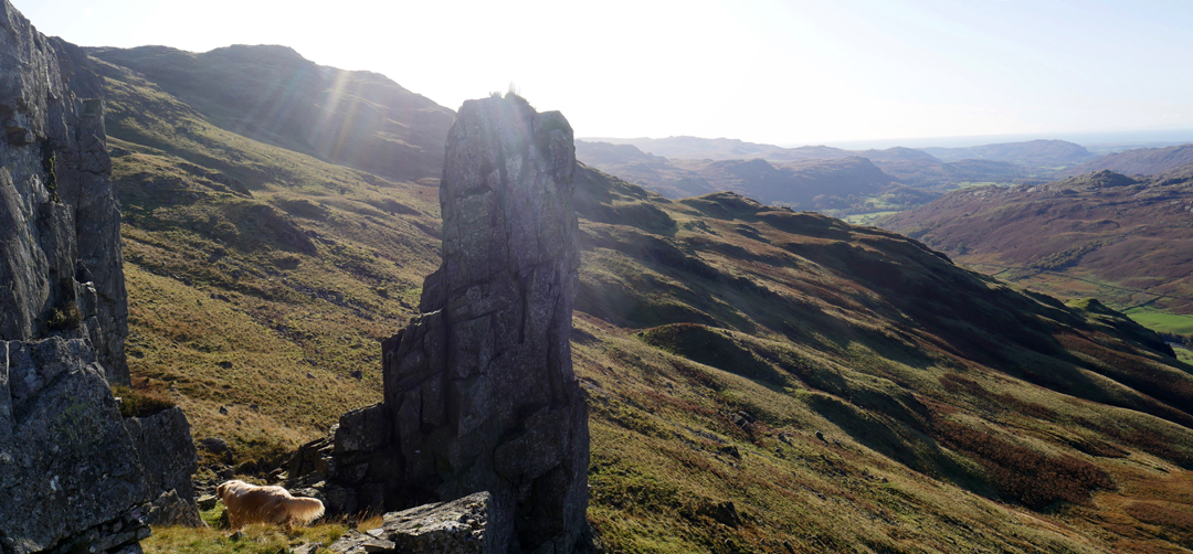
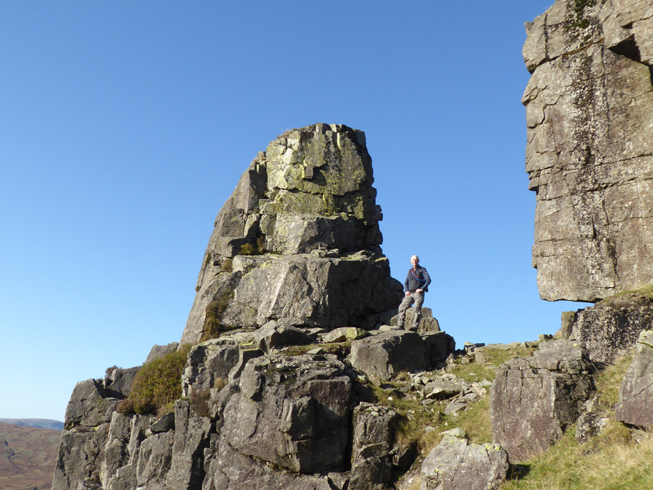
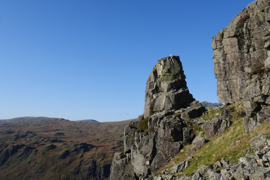
The debris of the collapsed cliff is all around . . . providence allowed just one stack to remain un-toppled.
It commands a fine view of the high fells.
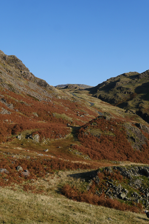
Rather than return to the summit of Hard Knott we begin a traverse that will take us gradually down the side of the fell.
Suddenly we look back and the Needle has gone. It has not fallen over . . . it has just blended into the fellside . . . ready for the next person to explore and seek it out.
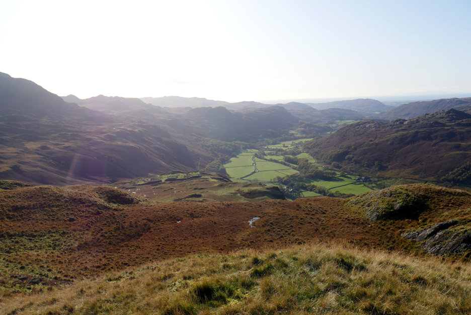
Our gentle descent brings us down towards the Roman Camp and Parade Ground.
You can see the walls of the camp and the foundations of some of the internal buildings.
We'll not visit it today . . . instead we'll head around the fellside and stay high in order to rejoin the road.
The bracken is a riot of colour this year . . . the only time of the year it looks nice !!!
- - - o o o - - -
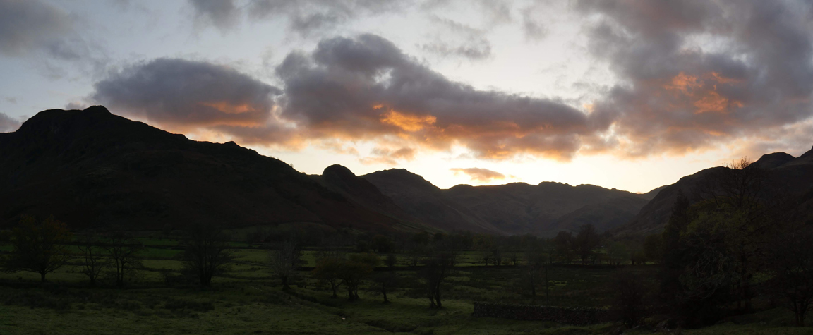
Our walk is over . . . which way shall we go now ? Rather than re-trace our steps back up the west coast, we'll head inland and drive home via Langdale and Grasmere.
Onward towards Little Langdale with views of Wansfell Pike above Ambleside taking centre stage.
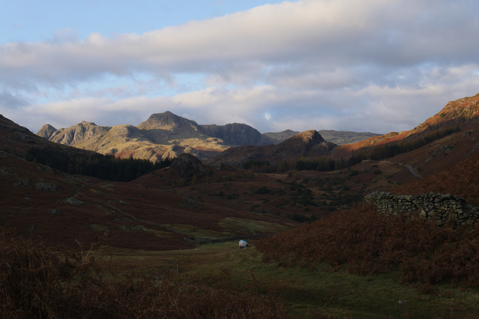
The famous Langdale Pikes come into view through the valley which is home to Blea Tarn. The rather pointed fell in the middle distance, with the sun catching the top, is Side Pike.
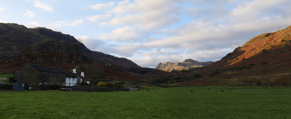
Fell Foot Farm . . . one of the classic old farms of Cumbria.
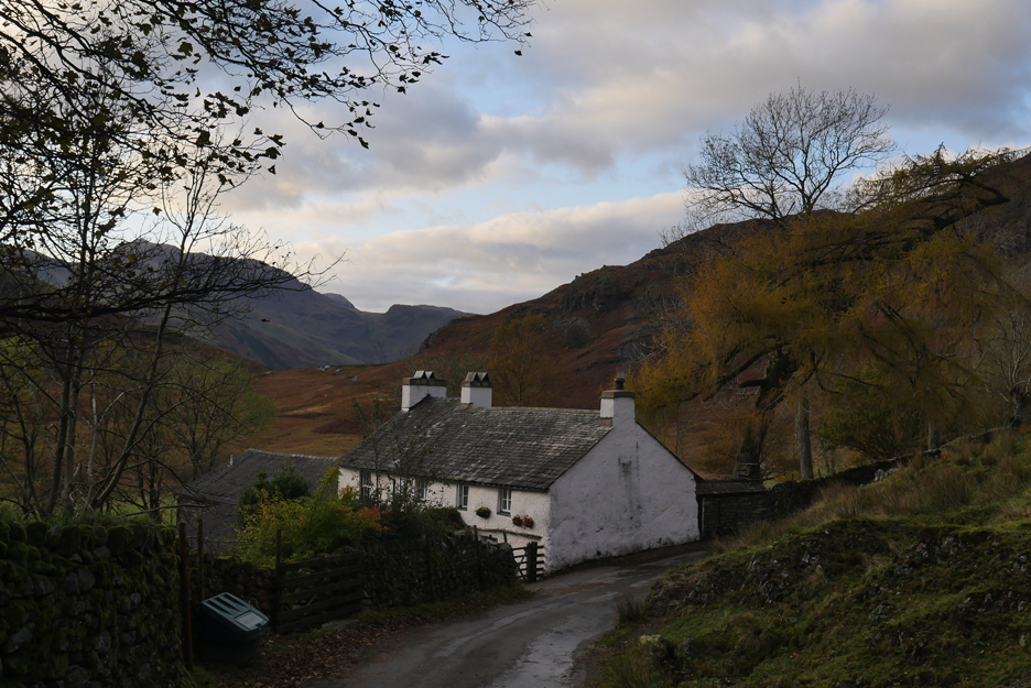
A sharp left turn and we head over towards Great Langdale, passing the picturesque Blea Tarn House.
From the hause we look down into Greater Langdale and the flat valley known as Mickelden. The late afternoon sun is illuminating the tops of the Pikes, all four are in the picture, Pike O'Stickle, Loft Crag, Harrison Pike and Pavey Ark.
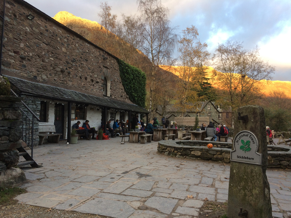
Wanting to include all the delights, we stop off at Stickle Barn for some light refreshment. We have had our lunch and it is too early for supper, so after a little re-hydration we move on.
We must have spent longer there than we thought as by the time we were ready to head up and over Red Bank the sun was setting. It would be dark by the time we returned to Loweswater. - - - o o o - - -
|
Technical note: Pictures taken with either Ann's Panasonic Lumix TZ60, or my Panasonic Lumix Gx8 Camera. Resized in Photoshop, and built up on a Dreamweaver web builder. This site best viewed with . . . a comprehensively good day from dawn to dusk. Go to Top . . . © RmH . . . Email me here Previous walk - 26/27th October - Jenna's Visit - First Walks A previous time up here - 5th October 2008 Eskdale Falls and Hard Knott Next walk - 29th October - Middle fell with Jenna
|