![]()

Remember: Press F11 for a full
screen view of this page.
Web Counter when published 1 678 840
|
|
|
Remember: Press F11 for a full
screen view of this page. |
Web Counter when published 1 678 840 |
|
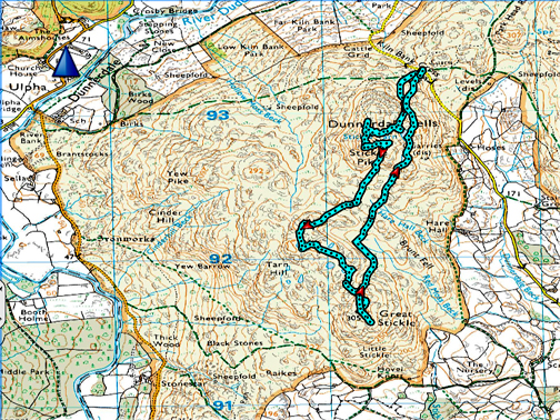
" Stickle Pike and Great Stickle " Date & start time: Wednesday 3rd July, 2019. 1.45pm start. Location of Start : The Kiln Bank road above Duddon, South Cumbria, Uk ( SD 215 933 ) Places visited : Stickle Pike & Great Stickle ( both AW outliers) out and back via Stickle Tarn. Walk details : 3.7 miles, 1000 ft of ascent, 3 hours 15 mns including lunch. Highest point : Stickle Pike, 1219 ft - 375 m. Walked with : Ann and our dogs, Dylan and Dougal. Weather : Sunshine and blue skies. |
© Crown copyright. All rights reserved. Licence number PU 100034184. |
The forecast was for a lovely day so Ann and I set off for a drive south . . . aiming for a leisurely walk to two "Outlying Fells". The west coast road is not the fastest and we also pick the mountain routes where possible, so the views even before we took to the fells were extensive. After the drive it was with sandwiches and extra drink in the rucksack that we headed for the first summit of the day . . . allowing us lunch with a view.
First, the view north from the Lamplugh Fell road after leaving Loweswater and before reaching the village of Mockerkin. The visibility is good but not brilliant, but we can see Scotland on the opposite side of the Solway Firth.
On the Cold Fell road now . . . looking west to Dent Fell and Flat fell with the Irish Sea through the gap to the left.
Just visible in the Irish Sea, between here and Northern Ireland, is the Isle of Man.
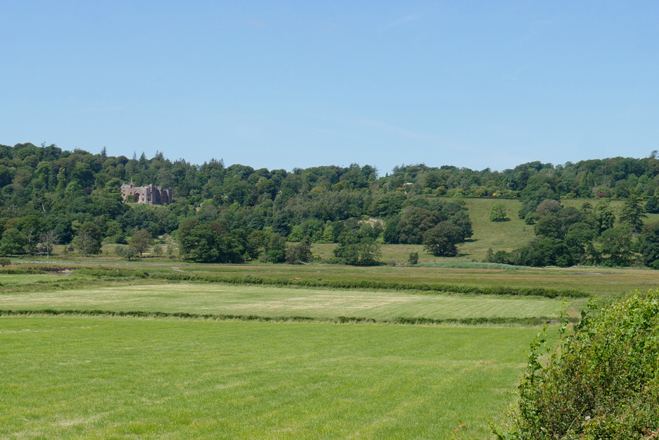
A more local view this time as we cross the valley beside Muncaster Castle
The small summit with the stoney side is called . . . Stoneside Hill . . . it deserves a photo just for being true to its word. To the left are the slopes of its larger neighbour, Black Combe.
We're on the Corney Fell mountain road now . . . on the other side from Stoneside Hill.
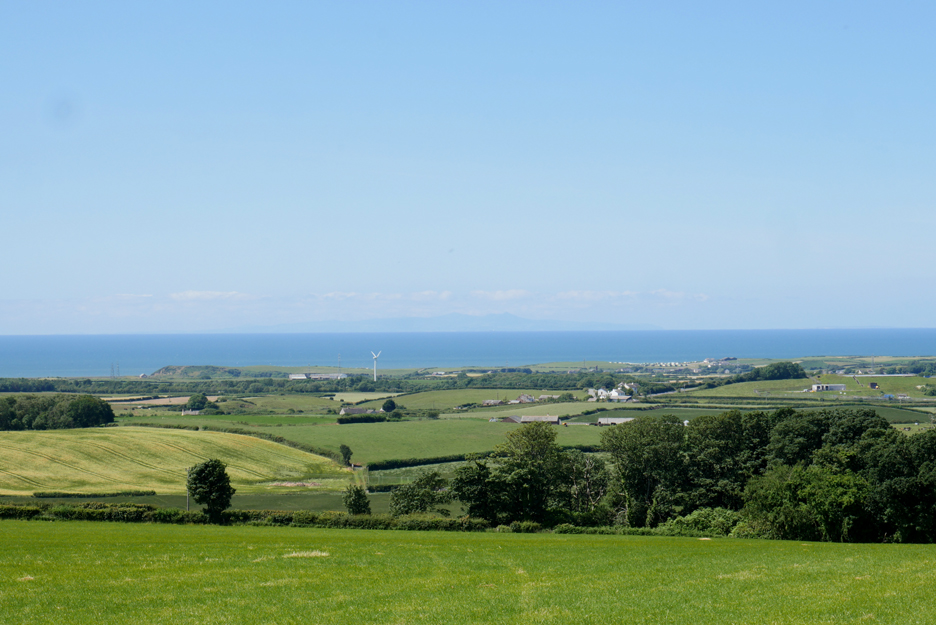
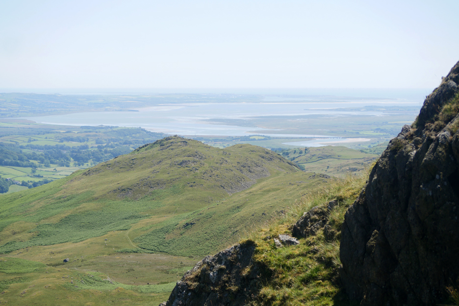
A brief stop for our first view of the Duddon Estuary . . . a stop which gives the dogs a short run away from the car.
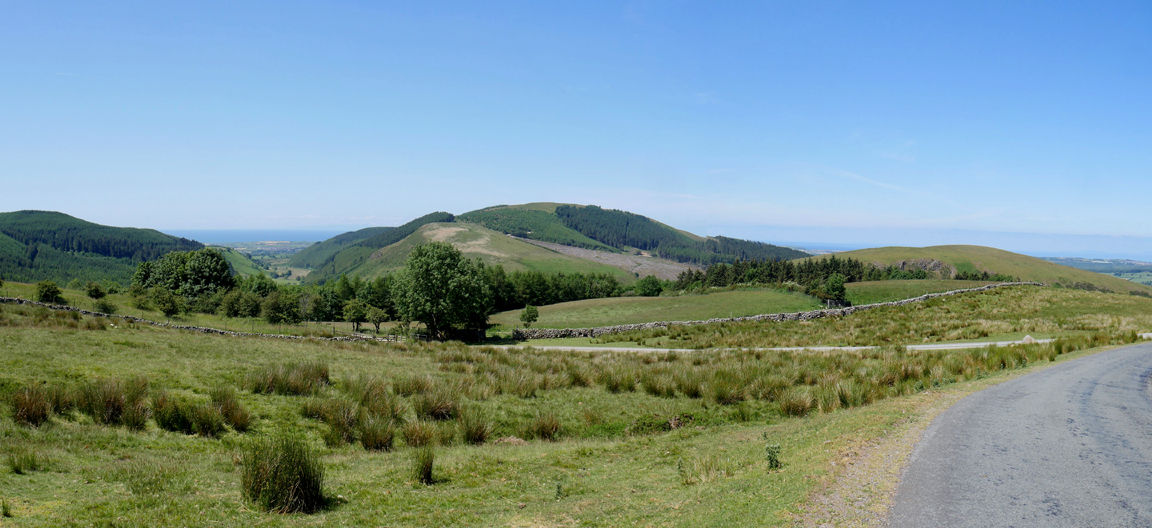
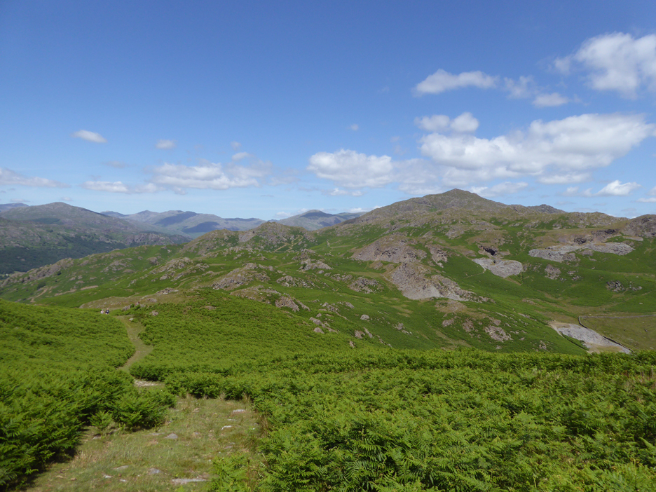
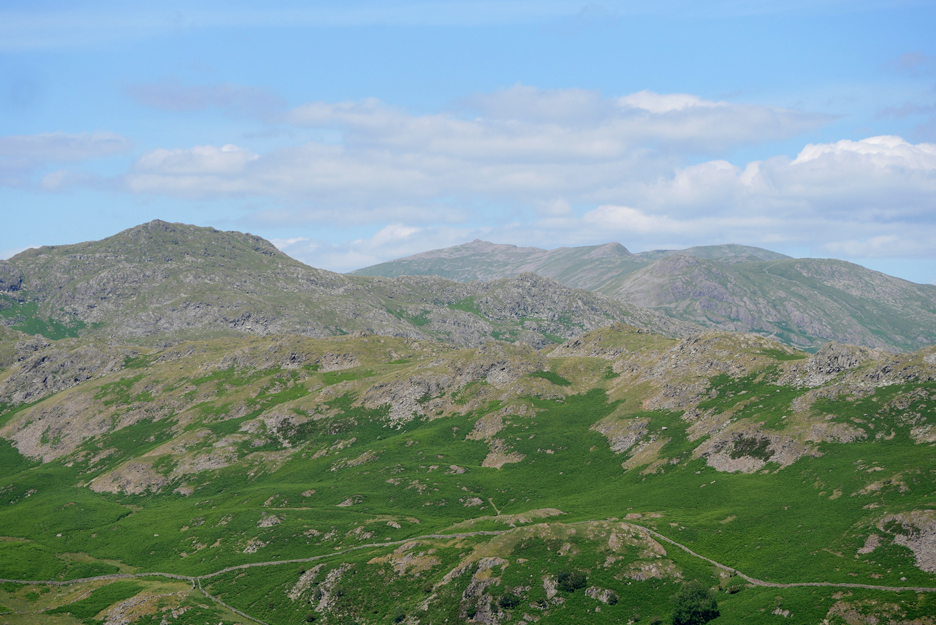
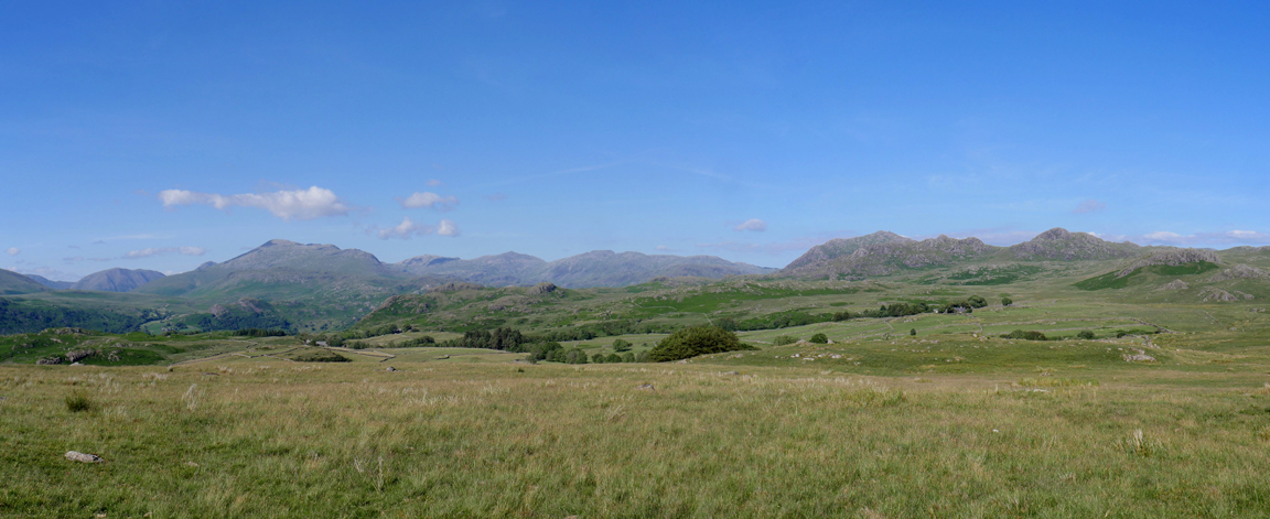
From my vantage point I turn and look inland to the high fells. All the southern classics are there, from Scafell and Scafell Pike, to Esk Pike, Bowfell, the Crinkles and the Coniston group.
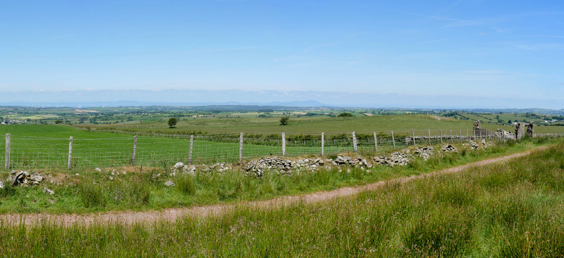
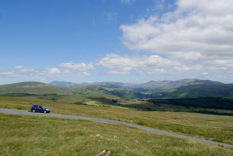
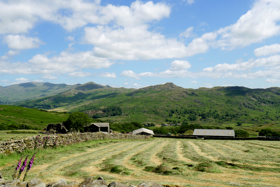
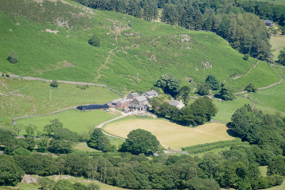
Rather than go right down to the 'bridge' at Duddon Bridge, we turn left after Corney Fell and head on the scenic route to Ulpha. The farmer here was busy haymaking (while the sun shines) and across the way is our objective, Stickle Pike.
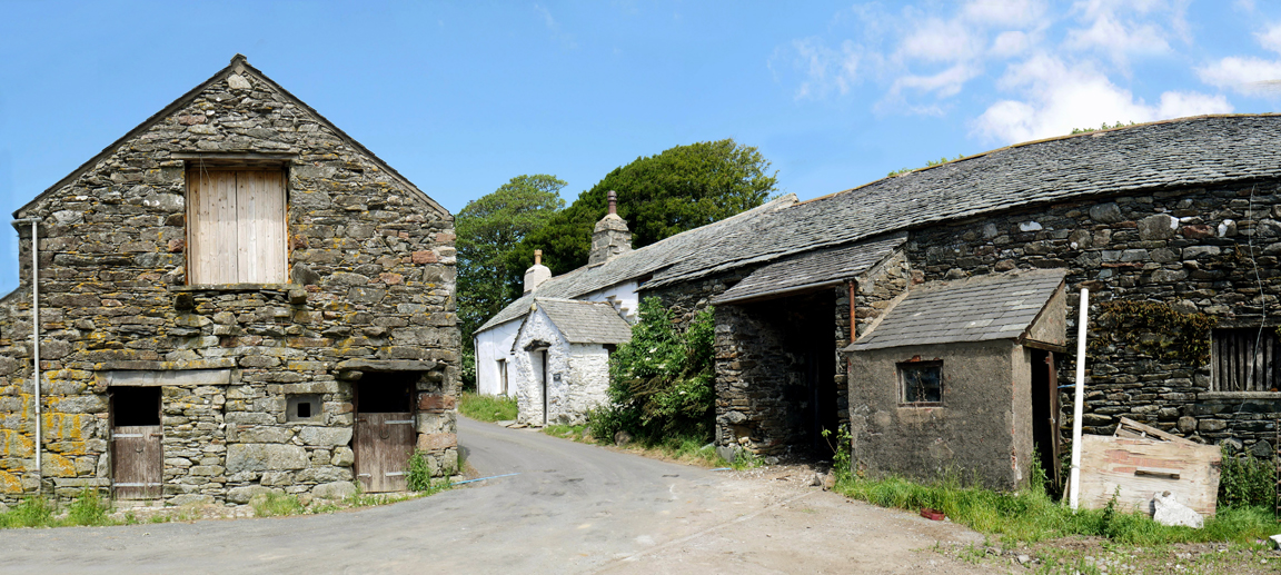
Through the farmyard at Loganbeck Farm . . . the road is narrow and the corner is tight so real care must be taken. Someone has come up with the bright idea of creating a 'bypass' through the field to the left, so by the time you get here it may all have changed.
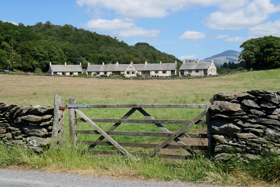
Unchanged for many years are the Alms Houses at Ulpha. This type of example of social housing is unusual in such a rural place . . . but full marks for the people who instigated the idea.
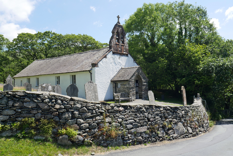
From the same layby it was a short walk back, a whole 25 yards, to picture the St John the Baptist Church at Ulpha. - - - o o o - - -
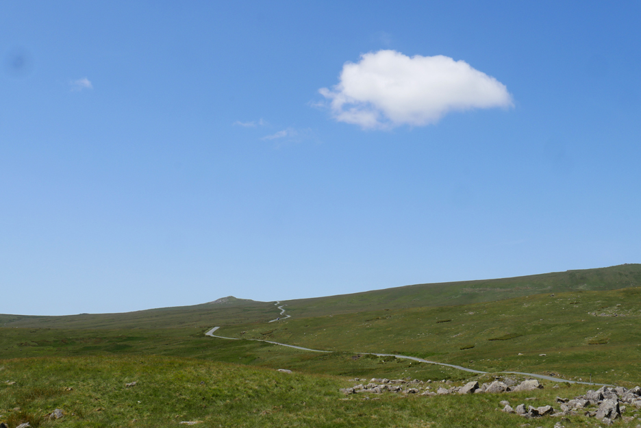
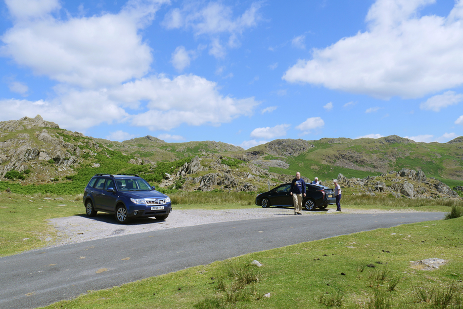
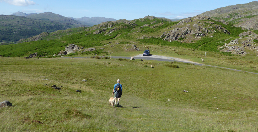
Up the valley to Hall's Bridge and back down the other side a short way in order to take the Kiln Bank mountain road. We stop at the highest point where there is plenty of parking for the expected crowds . . . that is us and a couple of others.
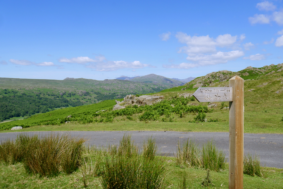
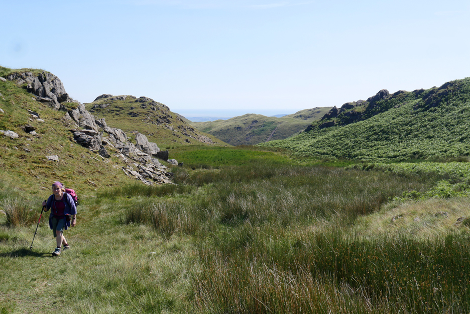
The signpost to the Stickle Pike actually nominated Ulpha as a destination. The public bridleway would contour under Stickle Pike . . . we would leave it soon and head for the top.
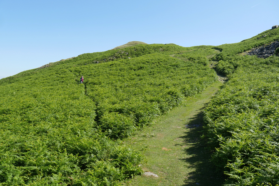
Up through the summer bracken, looking back at the old slate workings on the flanks of Caw Fell.
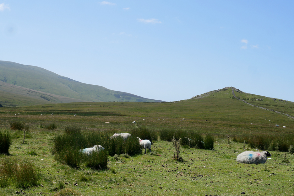
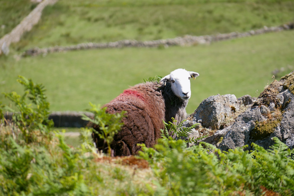
This lovely Herdwick was blocking the path for a while as we approached . . . but he deferred to our advances and walked off to the safety of the bracken, turning at one point for a rather nice portrait.
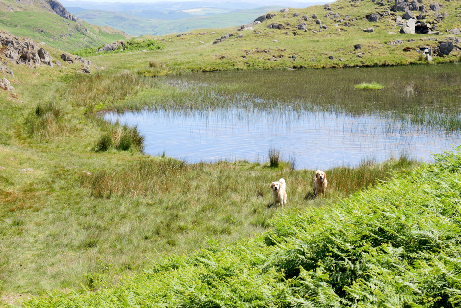
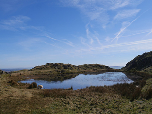
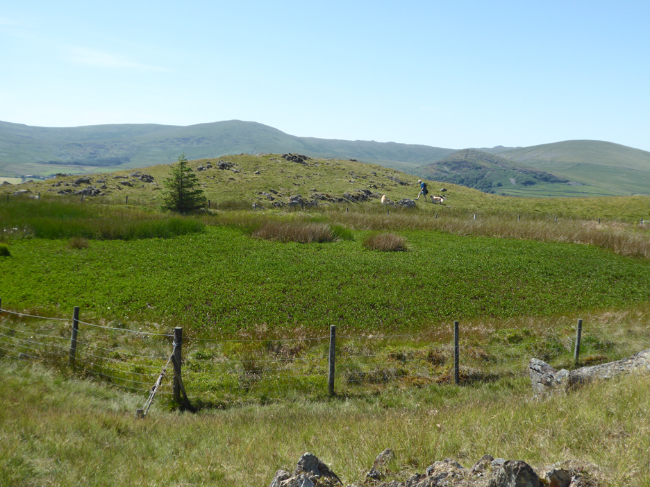
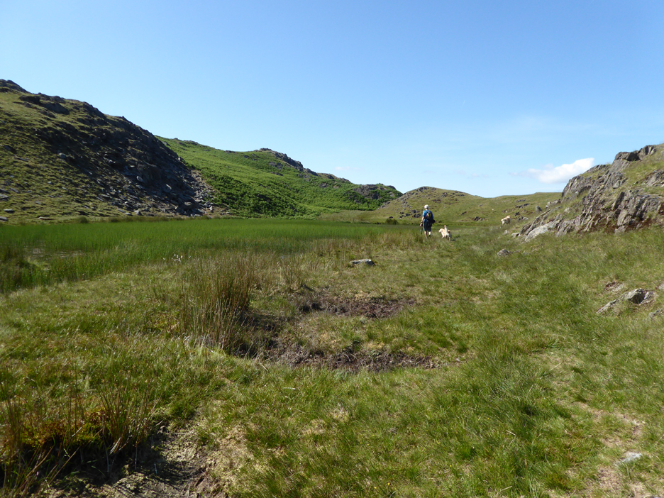
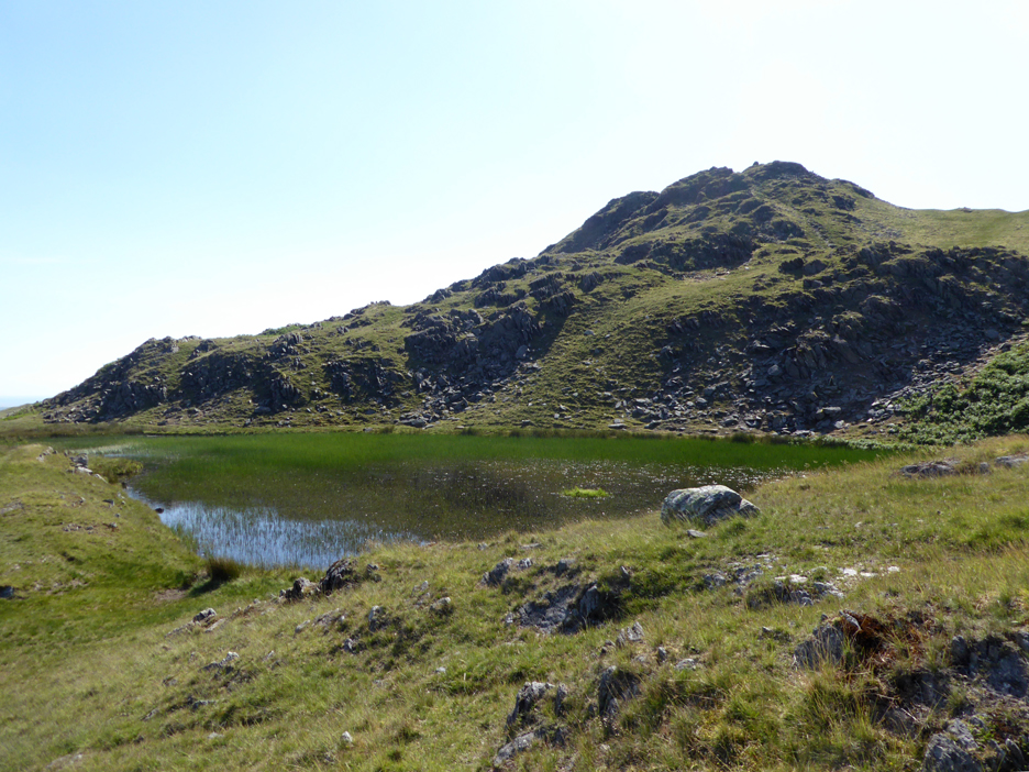
On the way up to Stickle Pike you pass close to Stickle Tarn . . . so the dogs manage a quick dip in the water. What surprised us was the amount of vegetation in the tarn itself . . . which led us us to look back at photos of previous visits.
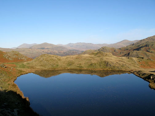
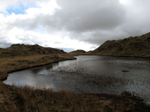
Give or take the time of year, it seems that the tarn is becoming increasingly filled with vegetation.
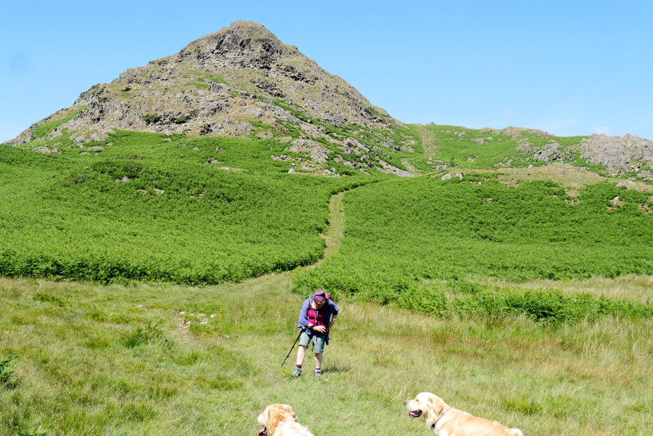
Rather than the direct ascent on an eroded, almost vertical path, we zig-zagged up the fell, diverting on one occasion to the perched boulder on the outlying rampart.
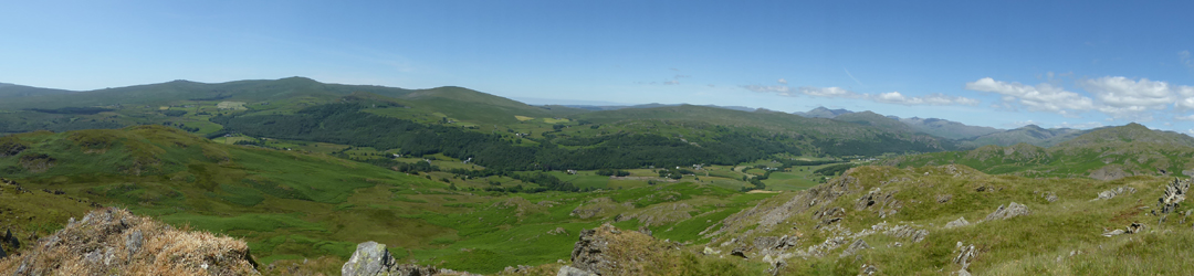
Here we enjoyed a fine panorama to Scafell Pike and all the classic Southern high fells.
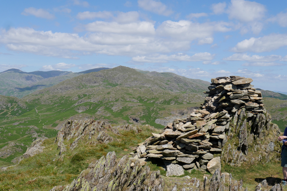
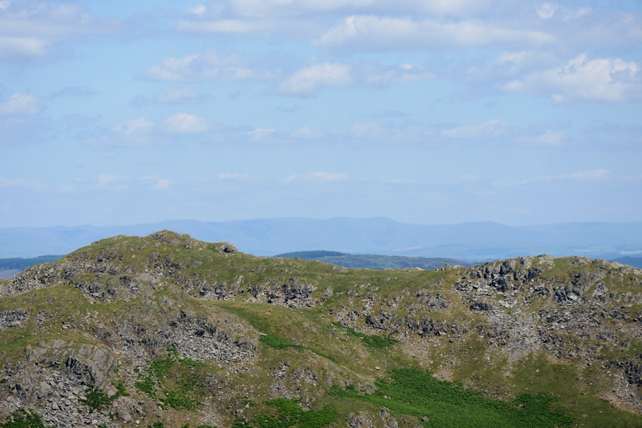
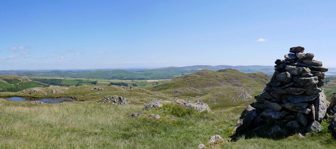
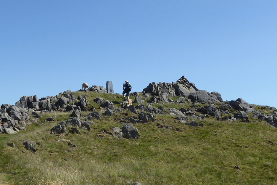
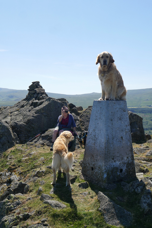
The summit cairn on Stickle Pike seems to have suffered a slight collapse, but previous photos hold no clues to its original shape.
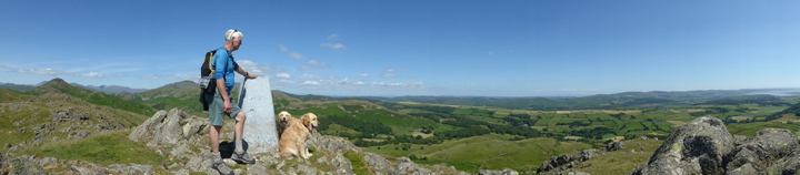
From the northern viewpoint Ann took a wide panorama to the north and west of Stickle Pike. Click here or on the photo above for a complete 360 degree annotated panorama that I took from the top.
During a rather enjoyable lunch in the sunshine there was plenty of time to look around. This was the Duddon Estuary looking south west from close to the summit.
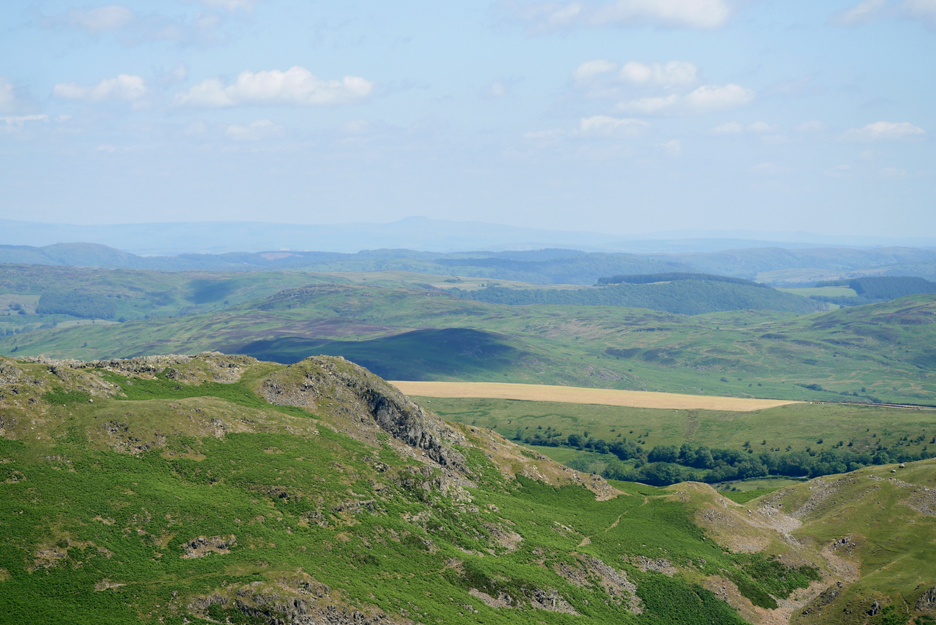
Hay making is in full swing in the many fields down below us. Above, in the distant haze, is one of the Yorkshire three peaks, possibly Ingleborough.
Further round is another . . . Whernside . . . though it was difficult to tell one from another in the long distance haze. - - - o o o - - -
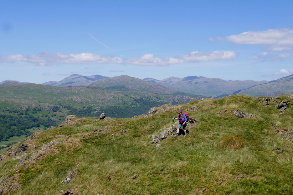
Stickle Pike is just that . . . quite a sharp pike and so care was needed on the descent.
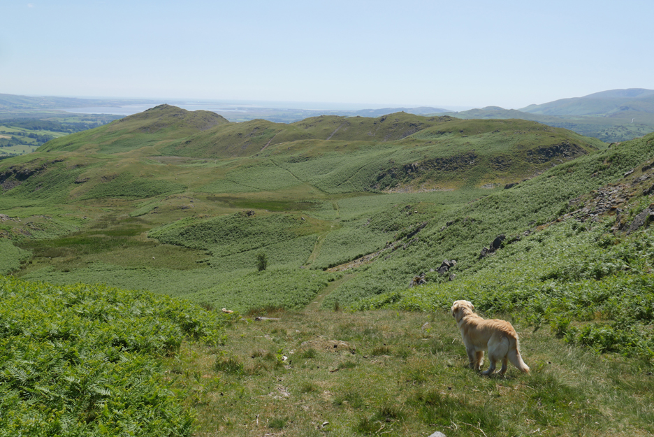
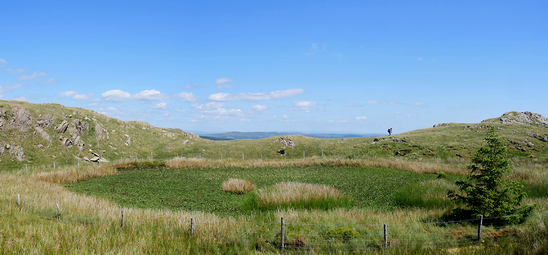
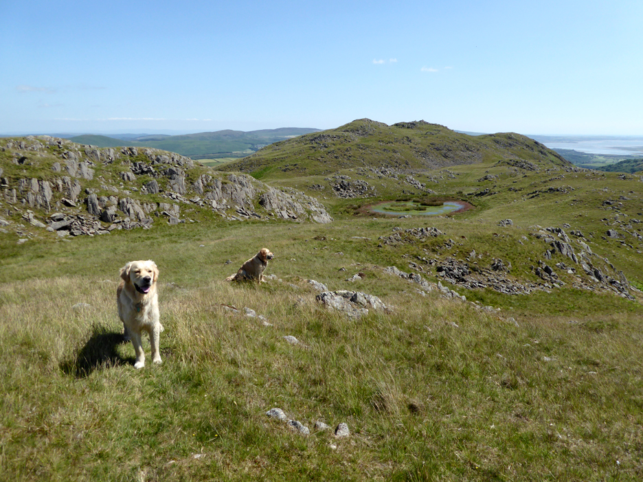
After finding an alternative route back down towards the tarn, we turned right and headed out towards Great Stickle. We'll take the low level route for a while but climb back onto the curved ridge on that first prominent path to the right through the bracken.
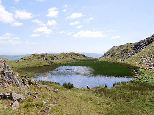
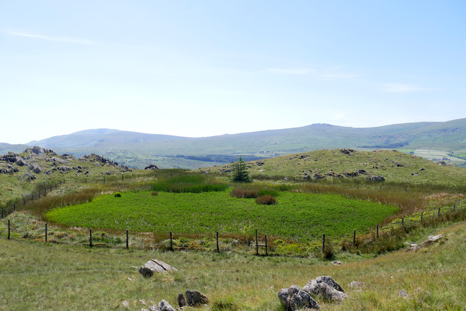
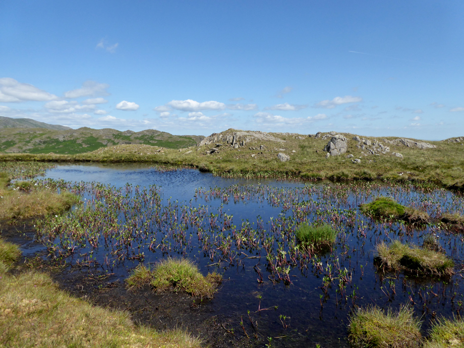
The ridge is known as Tarn Hill, as it supports many small tarns within its undulating landscape. This is one of the larger ones . . . but just like Stickle Tarn, it is getting very overgrown.
I divert around the other side . . . for old time's sake.
Ann stays on the direct path. . . . to give us differing photographic opportunities.
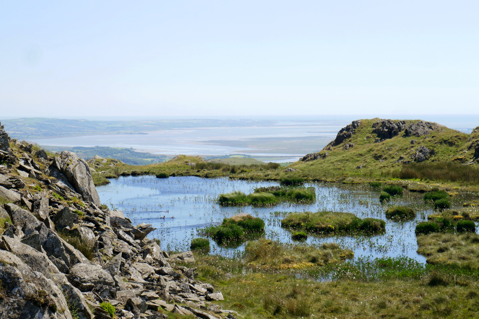
The next tarn along allowed a lovely view of Duddon across an infinity pool. Small grassy islands at this end . . . and a scurry of ducks on the left.
Towards the far end . . . more open water and bog bean plants.
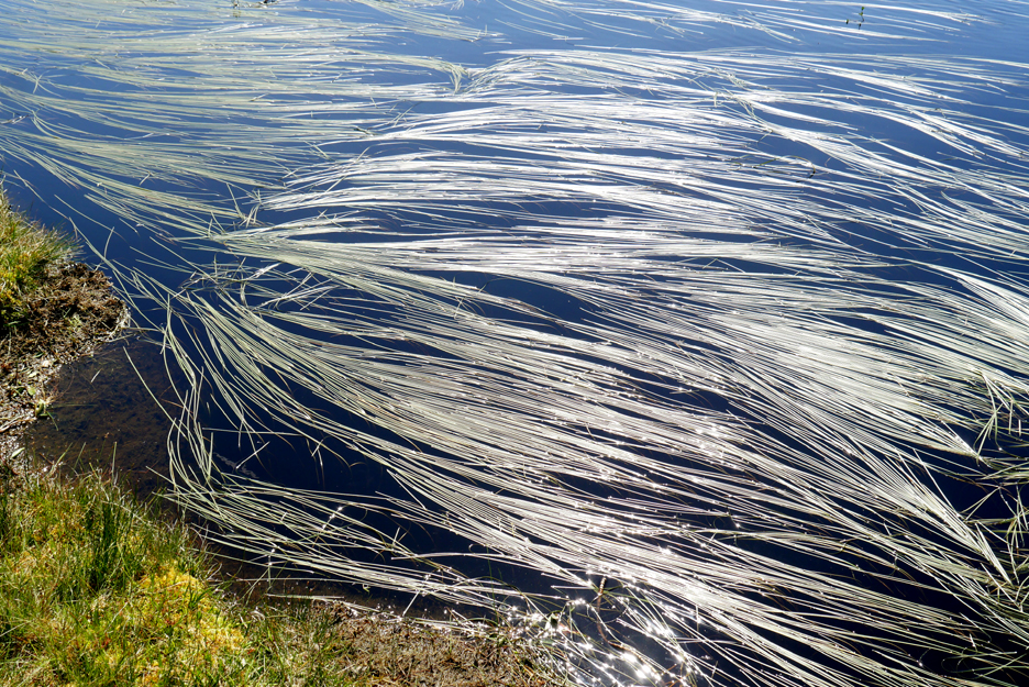
Rather nice water grasses laying flat and silvery on the surface of the water, reflecting the bright light of the sun.
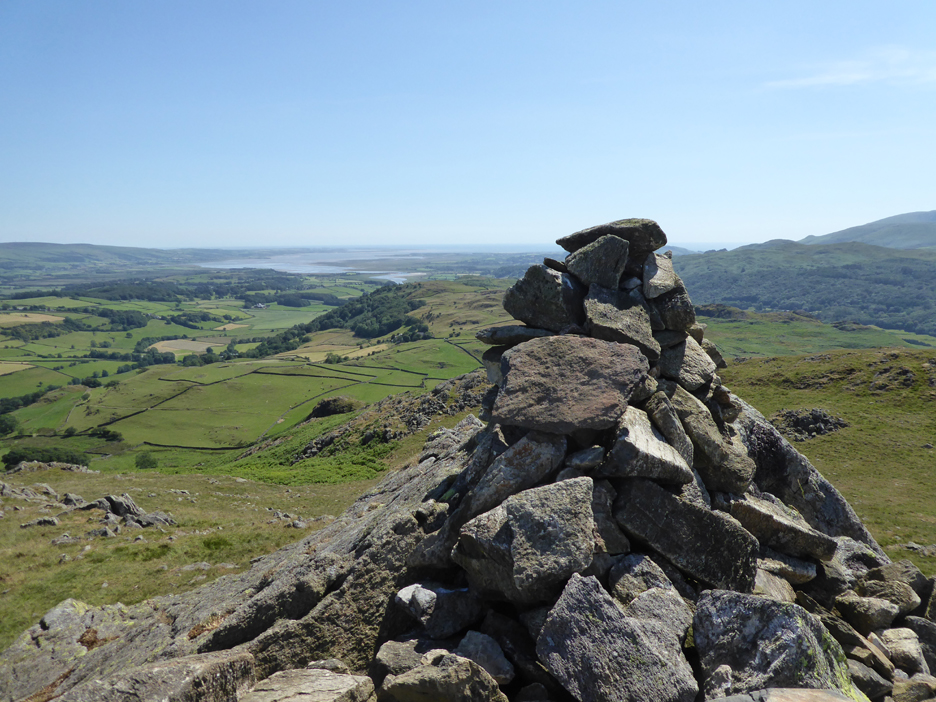
Tarn Hill boasts quite a good cairn . . . if you look closely you can see Ann and the dogs who have walked in from the left.
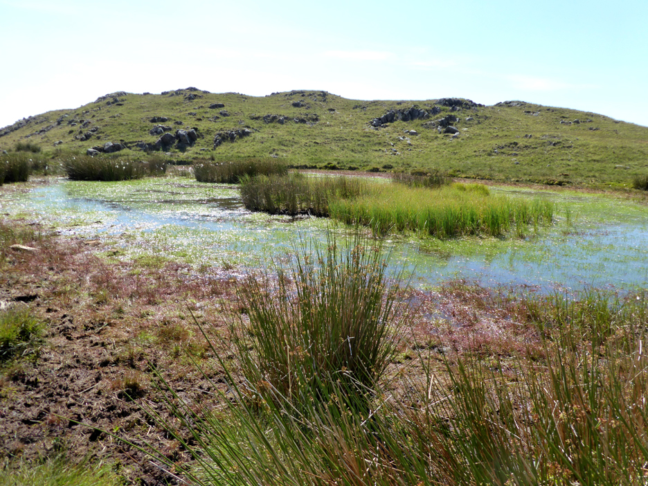
The tarn she passed boasted a fine display of bog bean plants too.
Re-united we head across to our next objective . . . Great Stickle.
Another tarn suffering from a lack of running water. After all they are just dew ponds in the hollows of the extended moorland.
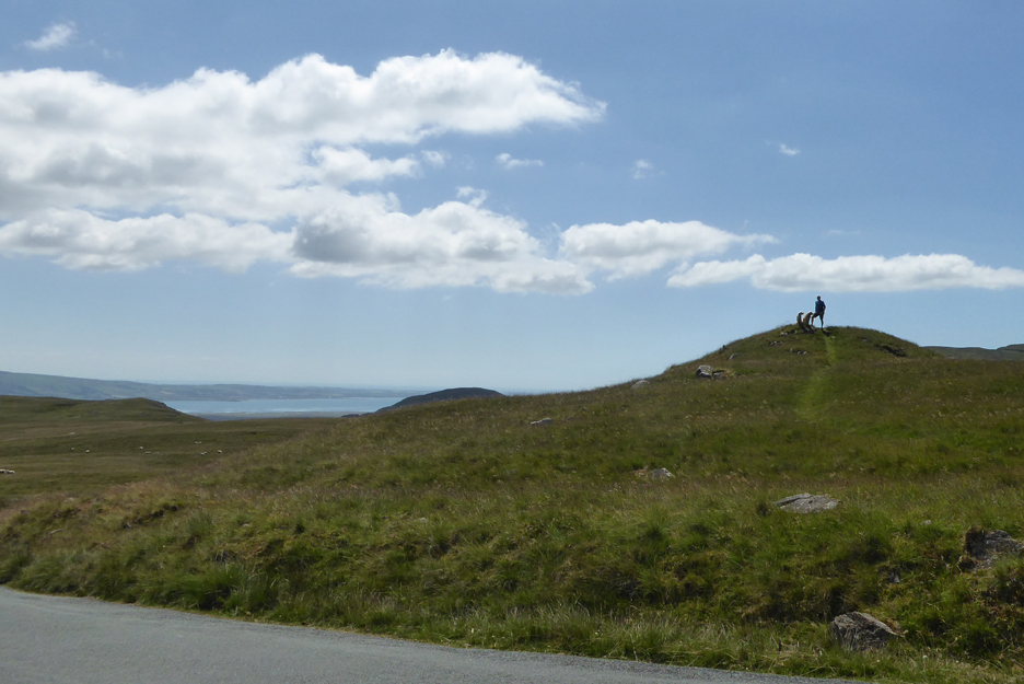
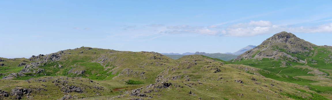
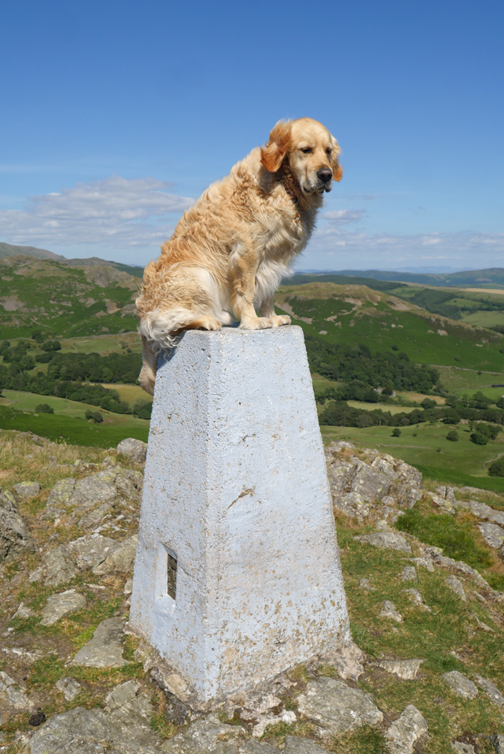
A craggy summit with both trig and summit cairn lies ahead.
Time to finish that last sandwich as we admire the view down towards the sea.
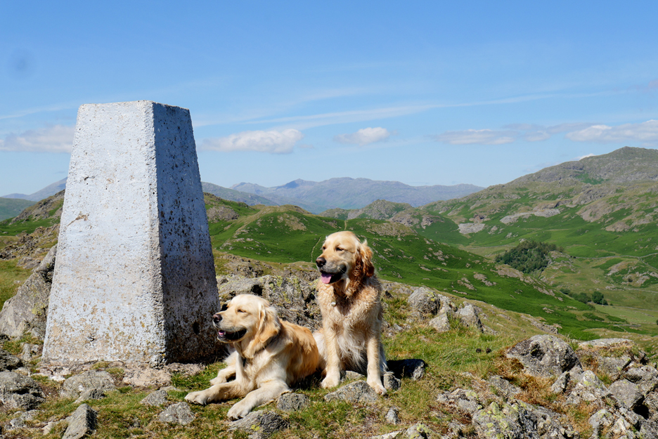
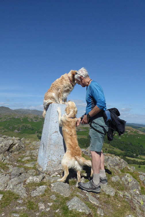
Another treat or two encouraged Dylan and Dougal to sit quietly next to the summit trig point.
Ann's photo again as we look around from the top. Click here or on the photo above for my complete 360 degree annotated panorama from Great Stickle.
Relaxing in the sunshine as we look down on Knott End Farm. The rows of black plastic covered bales to the left mean they have collected their hay early and it is now maturing into winter silage for the animals.
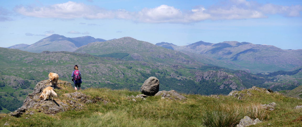
Above them the view is to Caw fell and the more distant Coniston fells. You can see Dow Crag summit but Coniston Old Man top rather blends in with the slopes of White Pike on the Walna Scar Ridge.
A northern view now as we contemplate our return route. We'll take the direct route back, to the right of Stickle Pike, and so avoid a return to Tarn Hill and its summit cairn on the left.
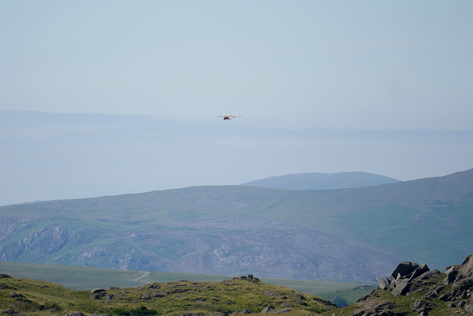
Suddenly a Kestrel flies into view . . . the camera auto-focus choosing to lock onto the distant fells rather than the bird. By the time I changed to manual focus and re-positioned the camera, it was too far away for an improved photo.
This turns out to be Stickle Tarn 2 . . . an almost dry bog that must have been open water at some point.
Onward and upward to Stickle Tarn itself . . . viewing it from this side it looks very overgrown.
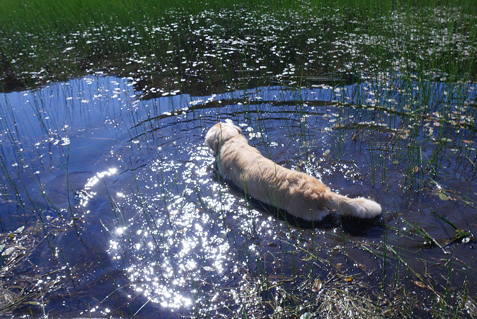
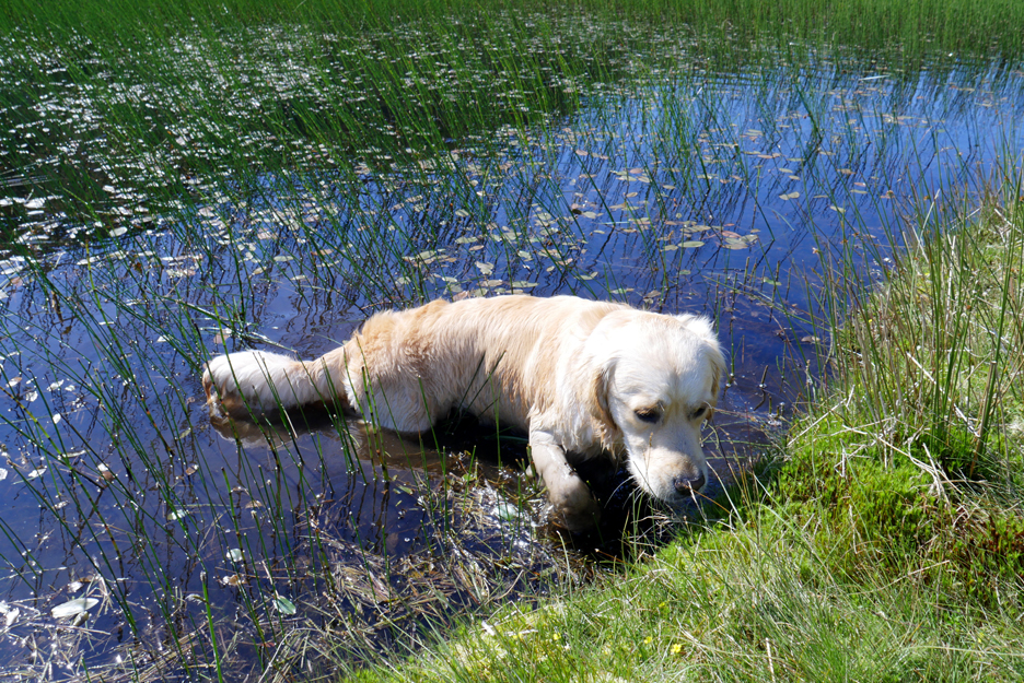
However there is open water for Dougal, enough to have a paddle if not a swim.
Humph . . . don't fancy all this water weed.
Looking back at the three colours of the small tarn. Blue water reflecting the sky, dark green reflecting the fell and the light green of new growth within the tarn itself.
Completing the circuit . . . as our return route meets our ascent route climbed before lunch.
Just a short walk down now and we're back at the car. - - - o o o - - - It may be quarter past five, but the sun is still high in the sky . . .
We take the Birker Fell mountain road north which gives us more panoramas of the high fells. Scafell Pike is hidden by Scafell and Slightside but Harter Fell stands out, as does Green Crag on the right.
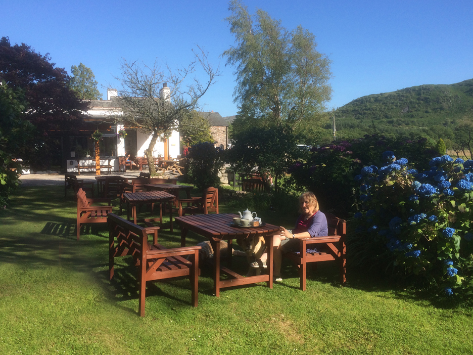
It has been a lovely warm day and to counteract the possible effects of dehydration we stop off at the Bower House for a pot of afternoon tea. They were not serving cakes at this time, so we sneaked back to the car and found the one we bought at Crosbythwaite Farm. You never know when a nice piece of Victoria Sponge will come in handy ! - - - o o o - - - Technical note: Pictures taken with either Ann's Panasonic Lumix TZ60, or my Panasonic Lumix Gx8 Camera. Resized in Photoshop, and built up on a Dreamweaver web builder. This site best viewed with . . . free range eggs and cake from the local farms along the way. Go to Top . . . © RmH . . . Email me here Previous walk - 28th June - Brackenthwaite with the N.Trust A previous time up here - 16th January 2007 Stickle Pike and Caw with Sean Next walk - 9th July - Pin Mill in 2019 |