![]()

Remember: Press F11 for a full
screen view of this page.
Web Counter when published 1 677 032
|
|
|
Remember: Press F11 for a full
screen view of this page. |
Web Counter when published 1 677 032 |
|
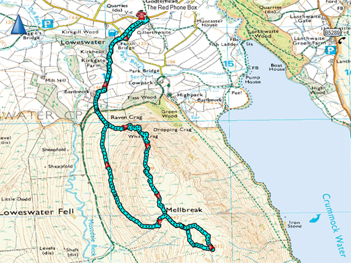
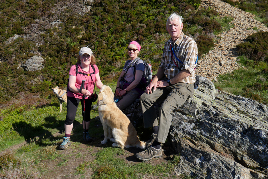
" Mellbreak on the Longest Day " Date & start time: Friday 21st June, 2019. 4 pm start. Location of Start : By the red phone box, Loweswater, Cumbria, Uk. ( NY 143 211 ) Places visited : Mellbreak direct (north & main tops) back via traverse path Walk details : 4.75 miles, 1600 feet of ascent, 3 hours 55 mins. Highest point : Mellbreak, 1,676ft - 512m Walked with : Jo, Neil, Ann and our dogs Amber, Dylan and Dougal. Weather : Sunshine and blue skies, a warm afternoon. |
© Crown copyright. All rights reserved. Licence number PU 100034184. |
|
The weather the last few days has been gloriously sunny with summer clouds and deep blue sky. Following a busy Friday morning, Jo and Neil arrive for an afternoon walk and to stay on for a meal in the evening. Despite the hour there's bags of daylight left so we set off to climb the northern end of Mellbreak. Once on top we extend the walk to conquer the true summit. - - - o o o - - -
Let's take you back a day or so to the start of the really nice weather.
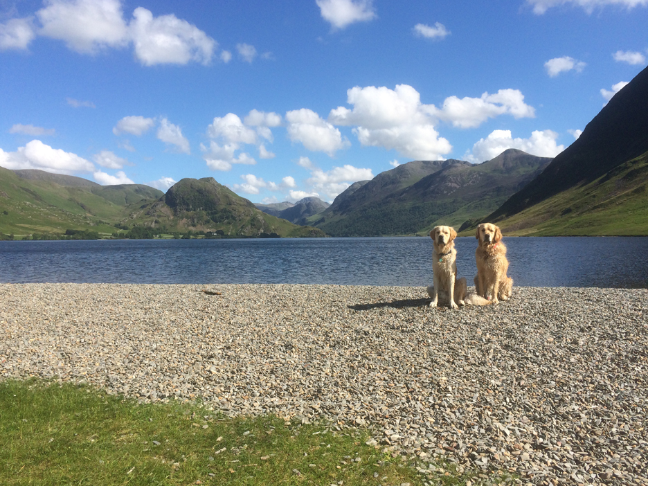
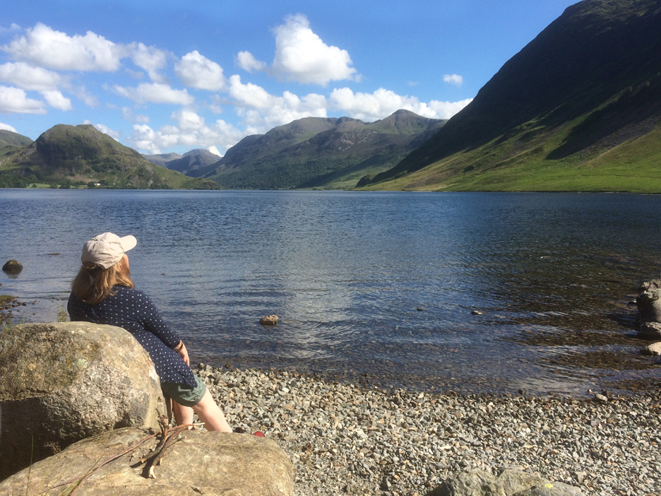
Phone pictures taken on a quiet afternoon walk down to the shores of Crummock . . . and Sandy Yat beach. - - - o o o - - - It was with this settled weather in place that we started our Friday afternoon walk Did you notice the start time today . . . yes 4pm . . . a time that lots of people think about ending a walk.
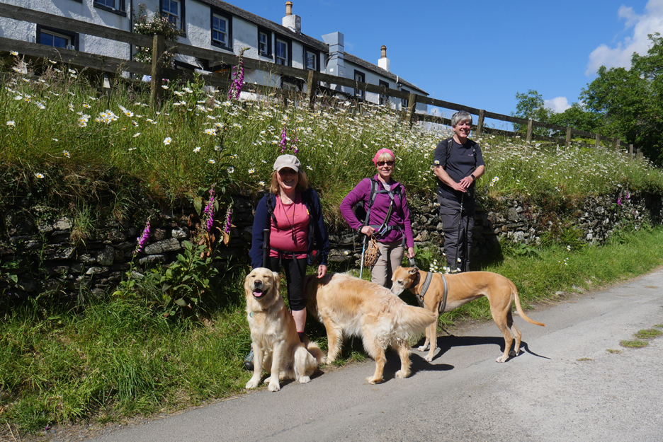
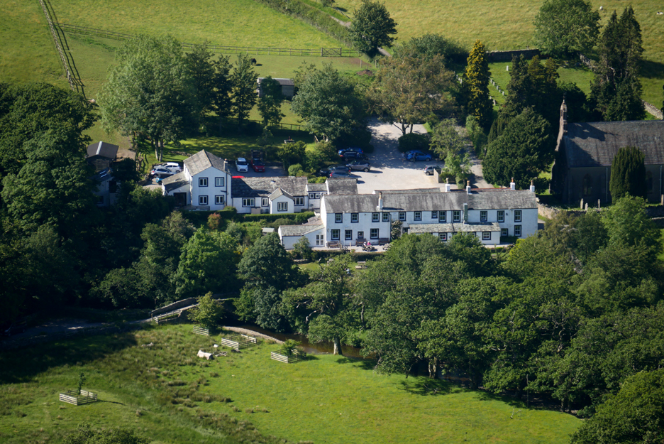
Group photo below the Kirkstile Inn . . . where they have a lovely wild display of wild ox-eye daisies.
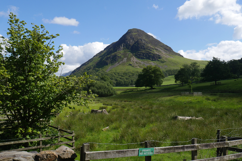
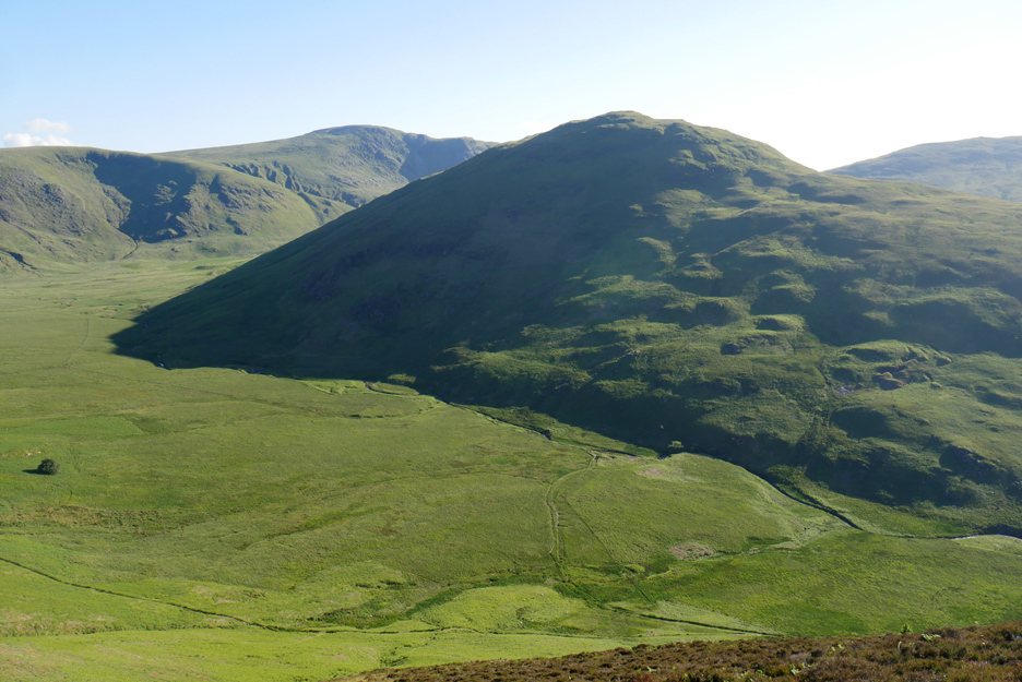
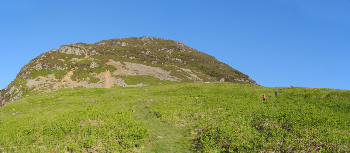
The object of our desires . . . Mellbreak and the northern ascent up through the crags.
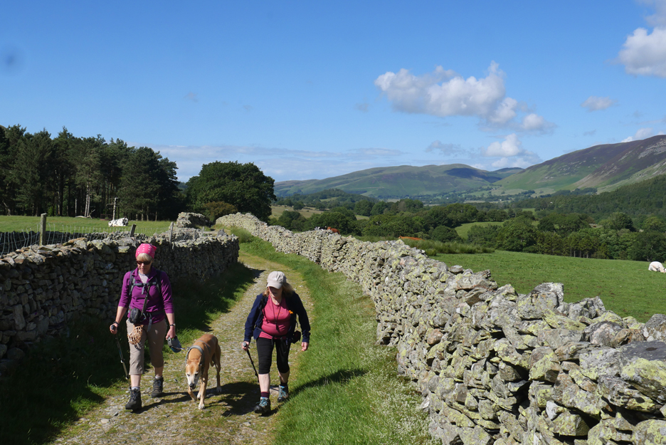
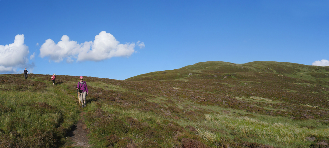
Travelling light for a fell walk, we set off up the Kirkhead Farm track, the bridleway that eventually would take you over to Ennerdale if you stayed on it for the full distance.
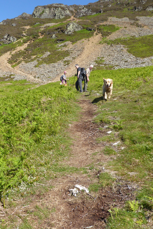
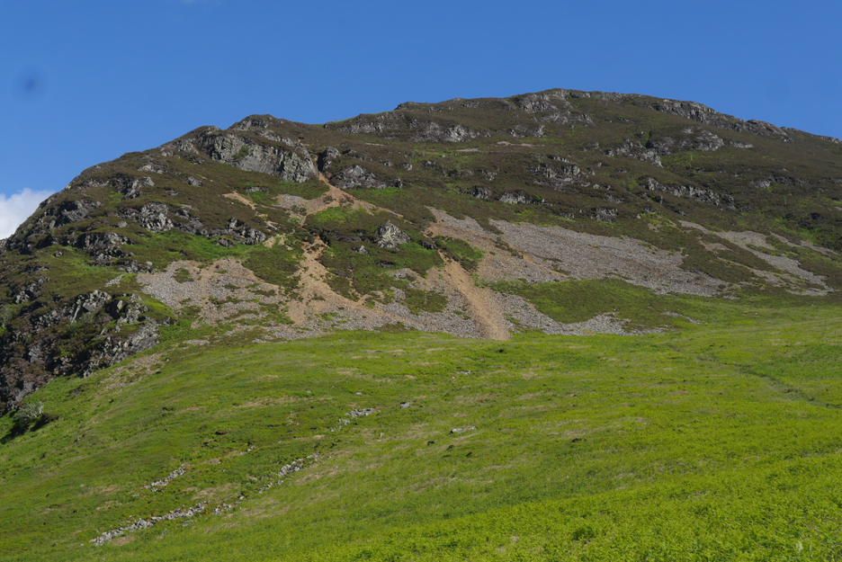
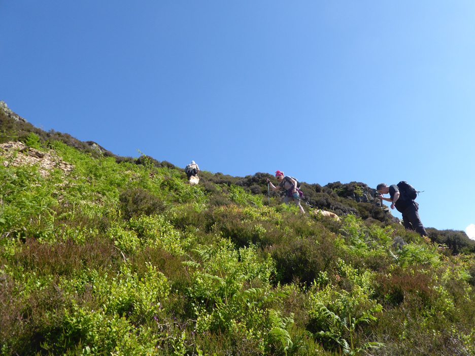
The route climbs up through the crags, avoiding the scree as far as possible. In this view from above the firebreak the prospect of the climb is not quite so daunting as that from the pub earlier. Hold your cursor over the picture to see the approximate route up (may not work on all computers)
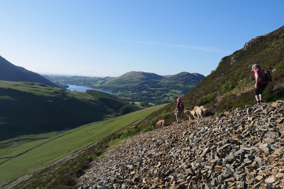
The view down the Lorton Valley from the start of the diagonal path that crosses the first scree slope.
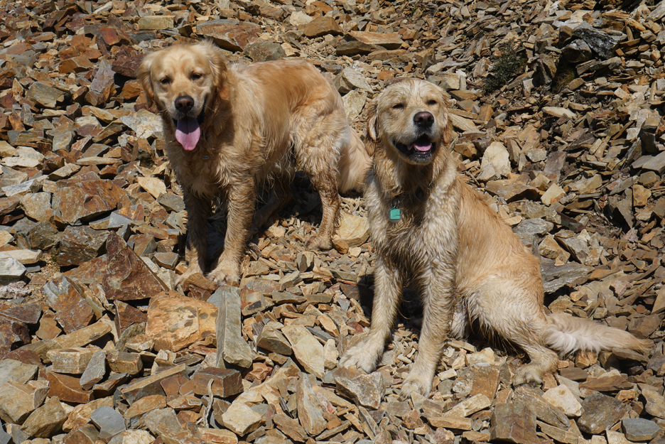
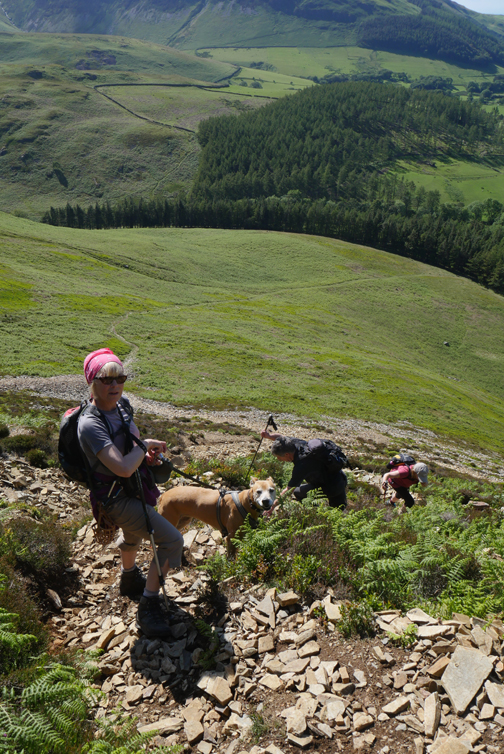
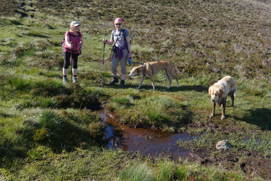
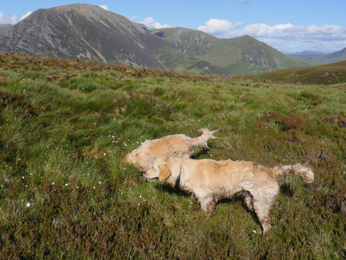
The dogs had already found a muddy pool further down, in which to cool themselves so their darker colour blend well with the stones.
Life on the edge . . . the crags have two or three of these short, false trails. They look well used but that's because people (and dogs) walk out to see the view and then walk back, doubling the wear factor.
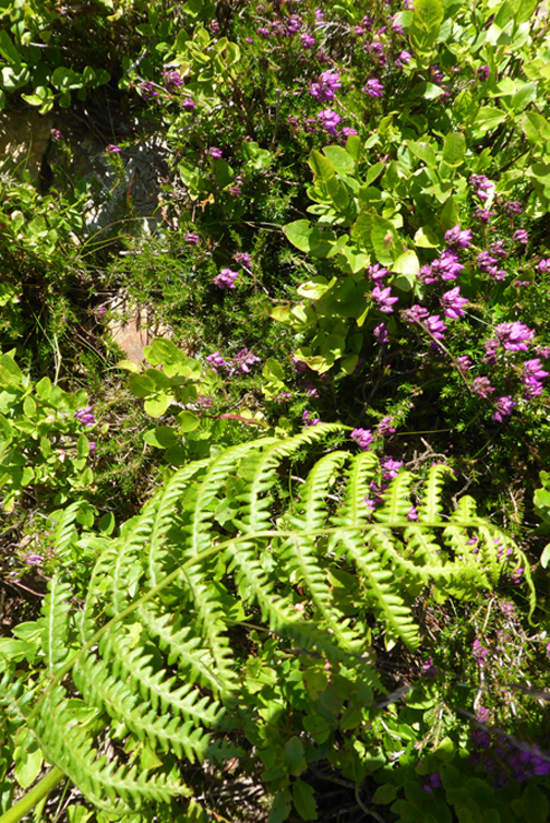
In this mountain environment we have heather, bilberries, bracken and a selection of more delicate ferns and flowers.
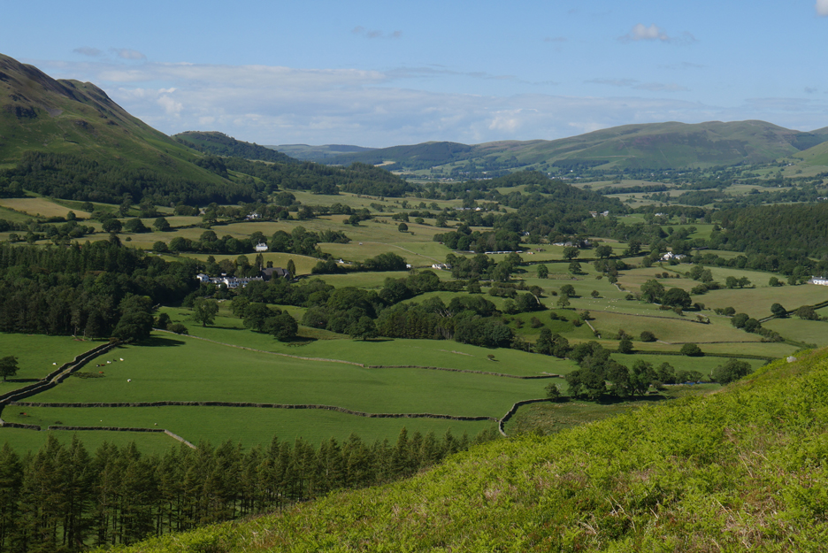
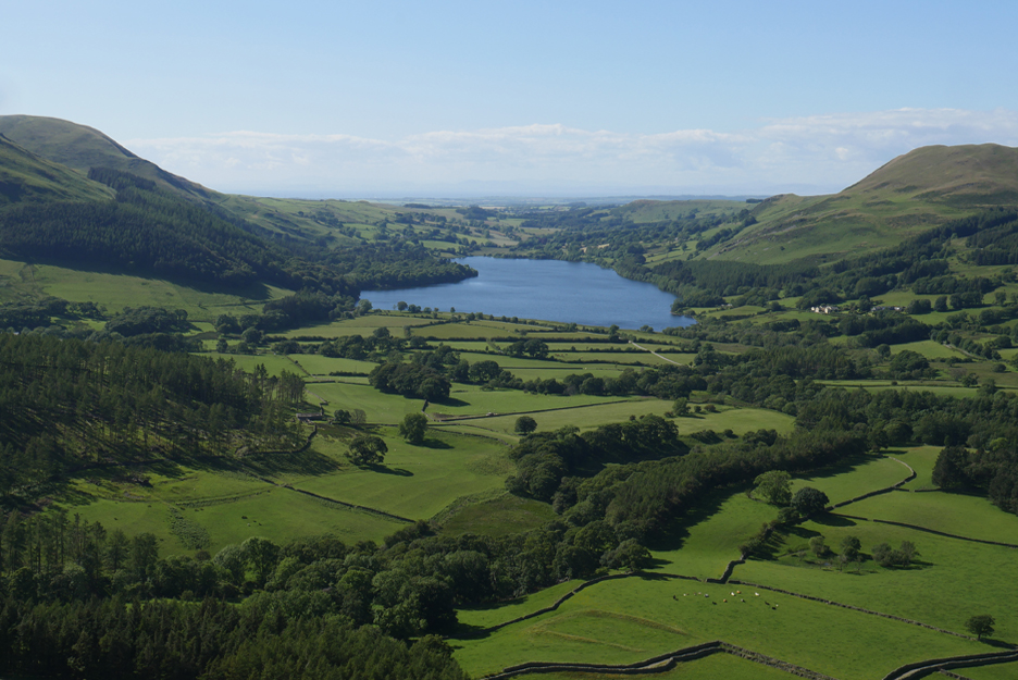
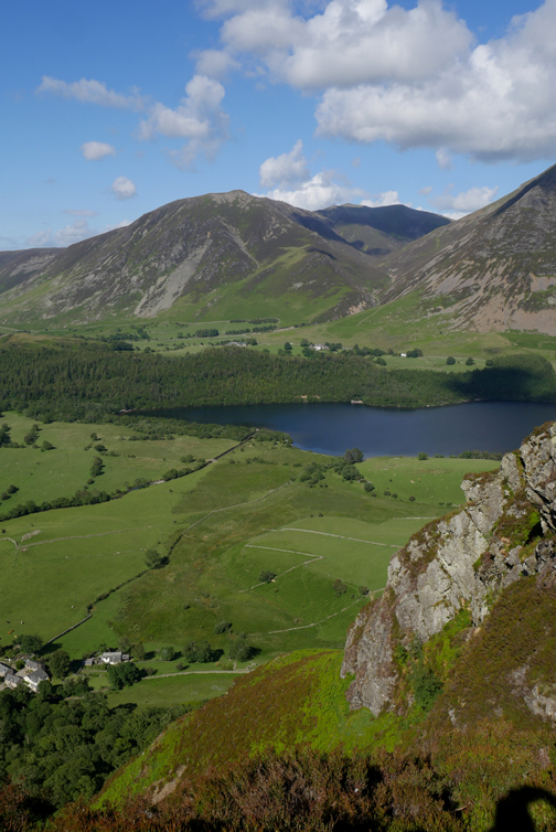
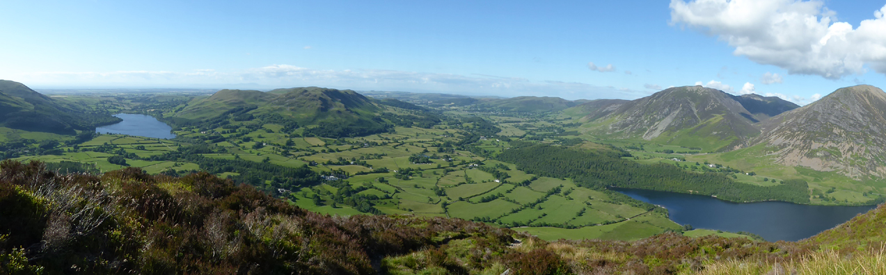
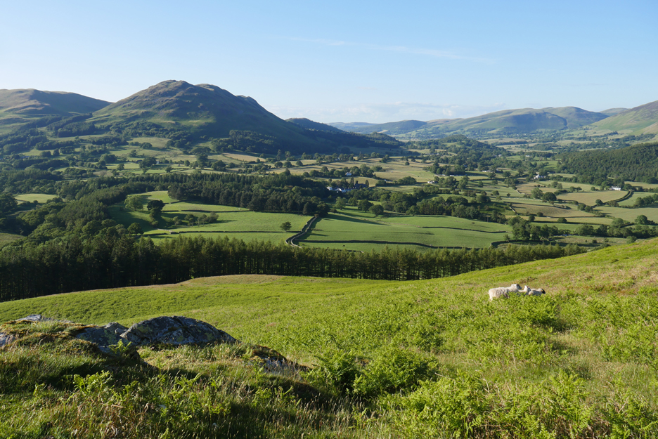
An elevated view looking down on Loweswater . . . and beyond it to the Solway Coast. Notice the old medieval earthworks in the field with the cows . . . it is thought to be an old stockade or fortified enclosure.
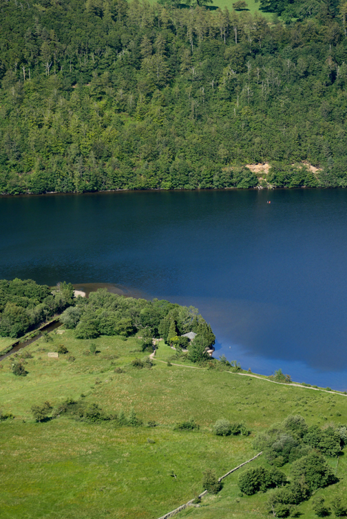
[ The small orange dot seen in the water towards the far side is a long distance swimmer towing a marker float.]
A change of lens solves that problem . . . do you suppose there is anyone looking up at us from the beer garden ?
A pause for breath and a photo . . . the perspective of which makes me look a giant !
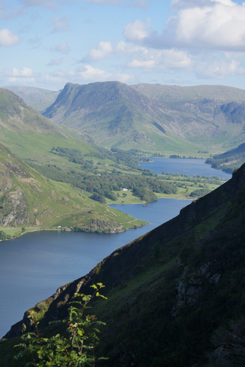
This is Wainwright's "Peep round the Corner" to Buttermere and Fleetwith Pike at the head of the valley.
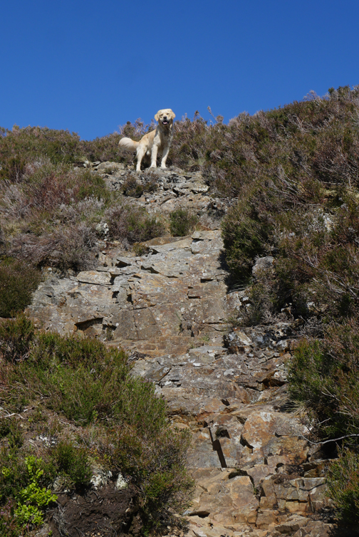
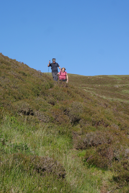
Nearing the top and the slope eases after the steep climb. It is a favourite way up, defined as a light scramble, because sometimes you use your hands to balance or for a quick pull up.
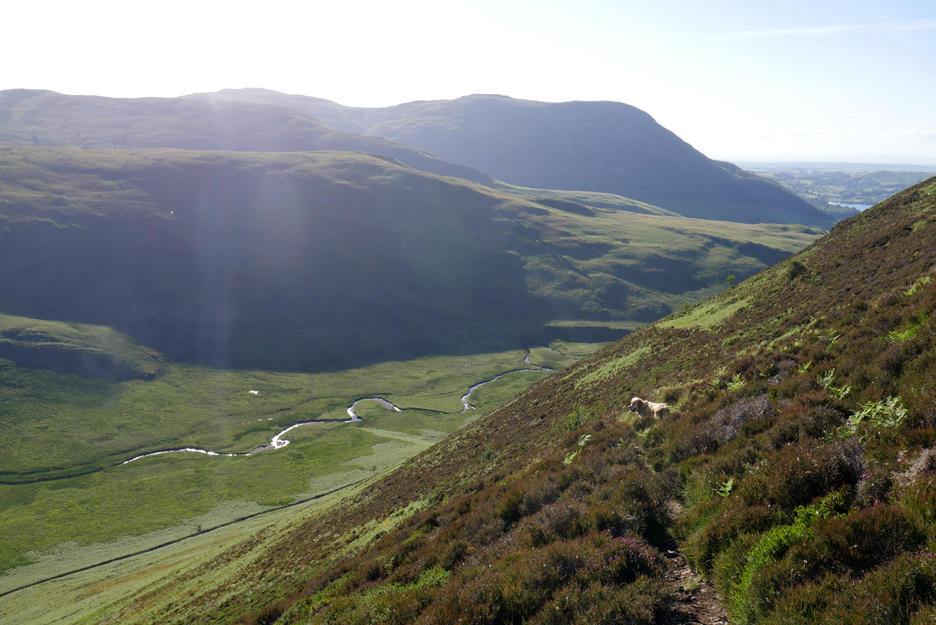
From near the top the views north include the two lakes plus Low Fell and the Lorton Valley. Scotland is visible over Loweswater . . . but it is rather hazy to see it clearly.
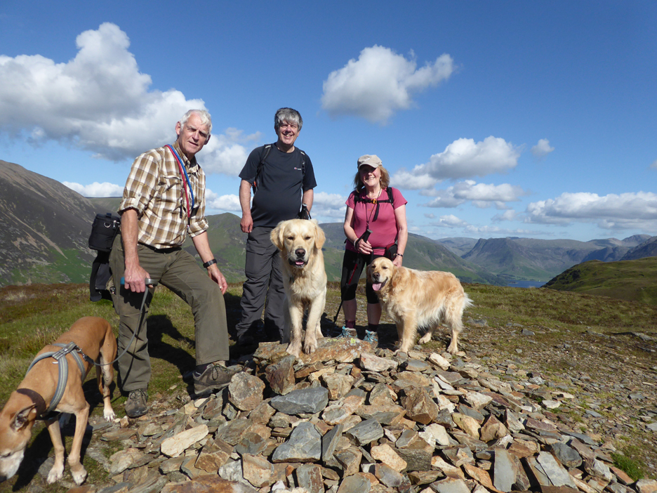
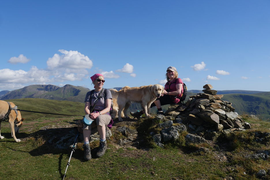
" It's the first cairn you meet and looks a worthy top but is this the highest point ? " Jo wanted a summit photo for herself . . . so afterwards she was roped into taking one with my camera too !
Move across to the second cairn and the first does looks lower. I picture Ann and Jo on the true northern summit . . . and to reciprocate the earlier favour I took a second and similar photo on Jo's camera.
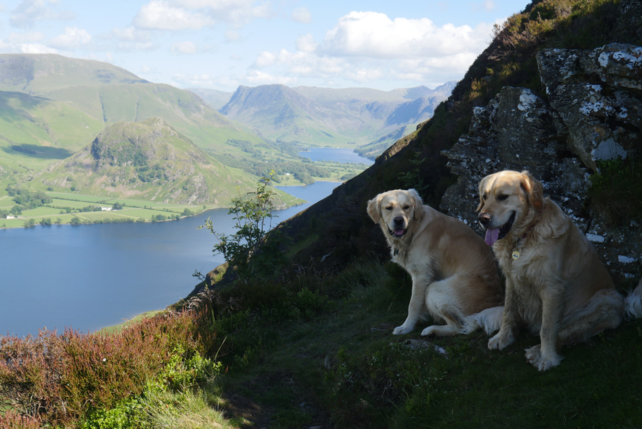
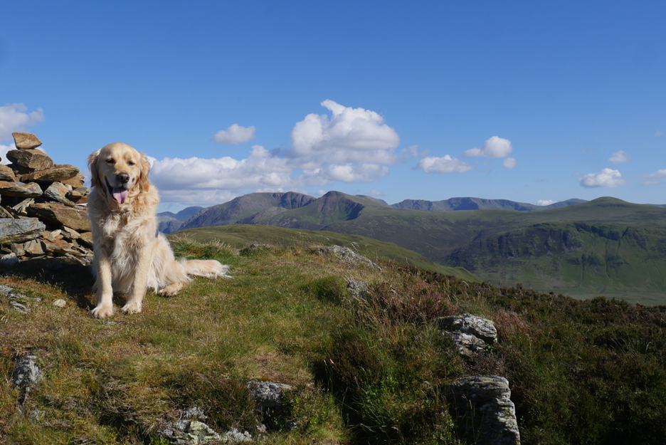
Dylan with a backdrop of the High Stile Ridge and the Ennerdale fells of Pillar, Steeple, Scoat Fell and Haycock.
It is ten to six and time most folk would be heading down . . . but the weather was good and the sun was a long way off setting. We decide to add the southern summit to our agenda . . . time wise it should take an extra half an hour or so on top of the planned walk. Height wise it is just 3 metres taller and so qualifies as Mellbreak true summit but there's a 50m (150ft) drop in between !
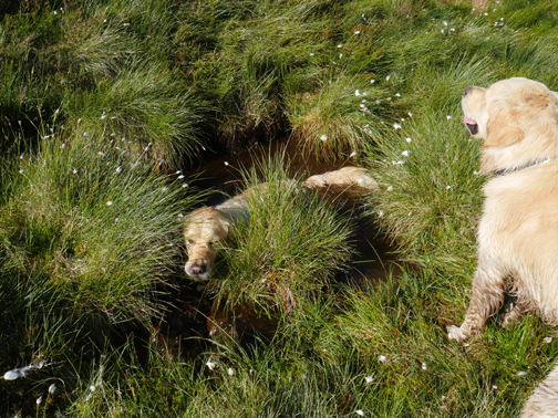
It looks like Dougal's found another pool to cool down . . . this time it was a lot more muddy.
The grassy summit of Mellbreak after crossing the coll and climbing up other side.
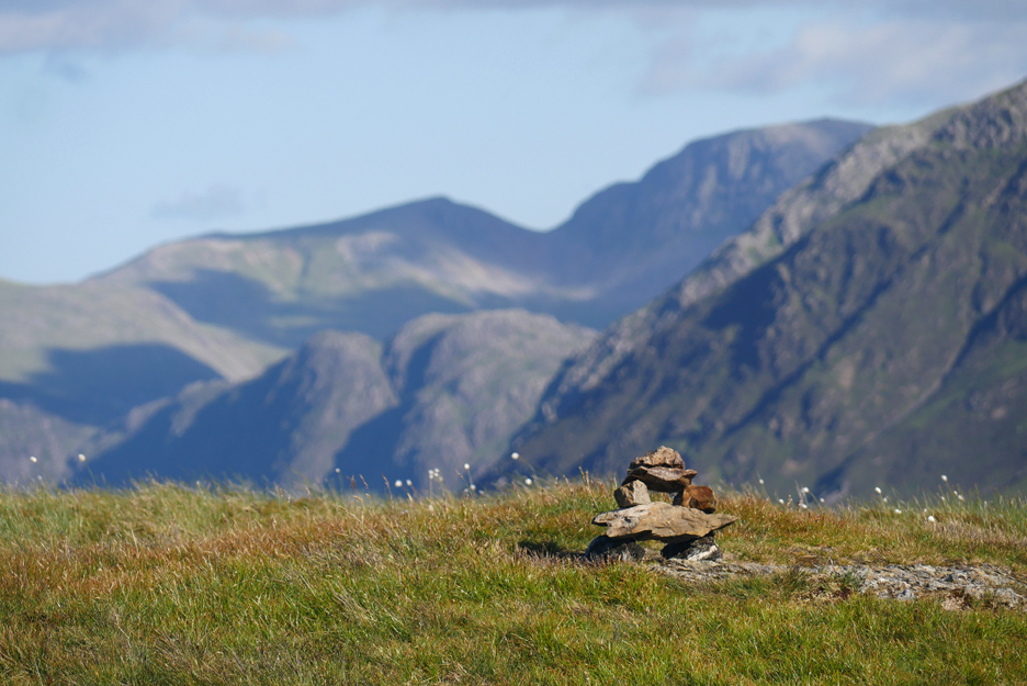
A few stones mark the top of the fell Again an adjacent rock outcrop (seen on the previous photo) confusingly competes as the highest point.
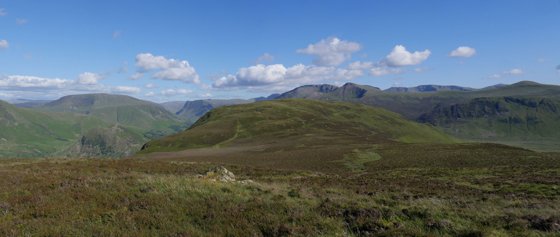
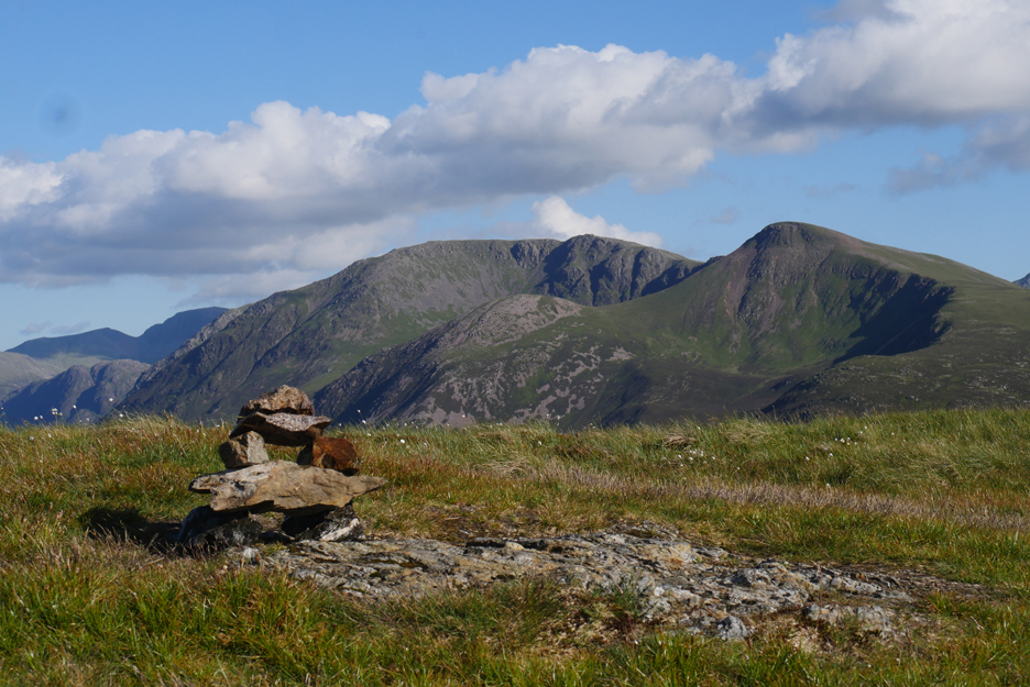
An arty shot of the summit cairn against the backdrop of Haystacks, Green Gable and Great Gable.
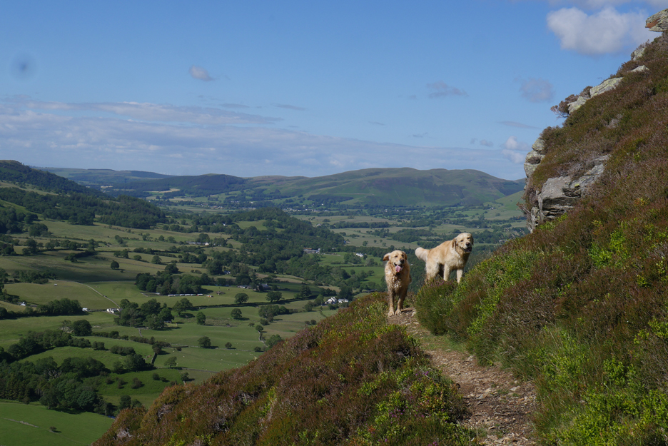
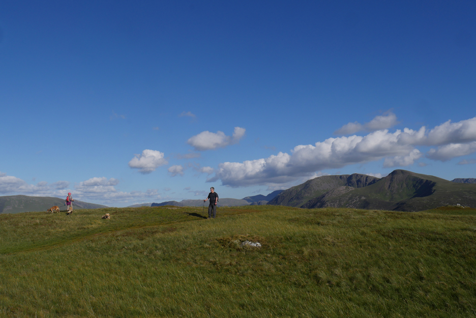
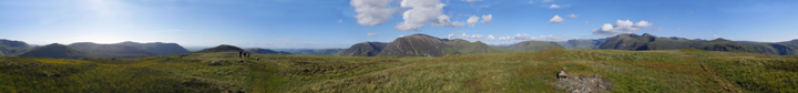
While my back was turned . . . the others have started for home . . . but they looked this way for the photo. Click here or on the photo above for a larger 360 degree annotated panorama
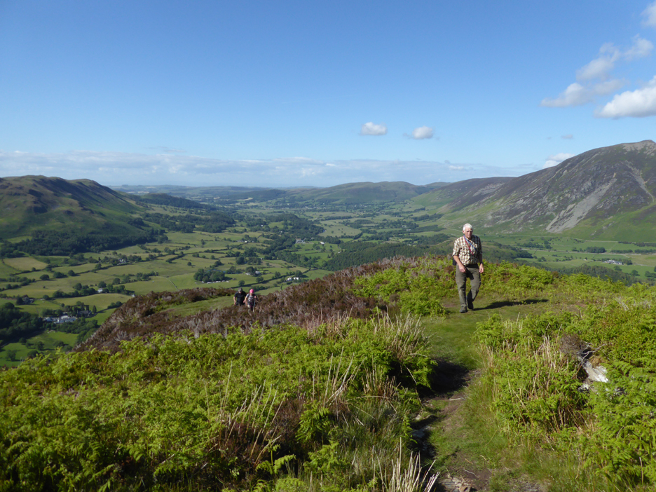
Back on the original planned descent route. Our walk back from the summit took advantage of a new short cut that avoided the peaty section on the old footpath up to the top.
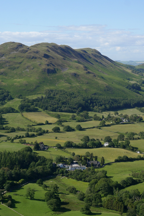
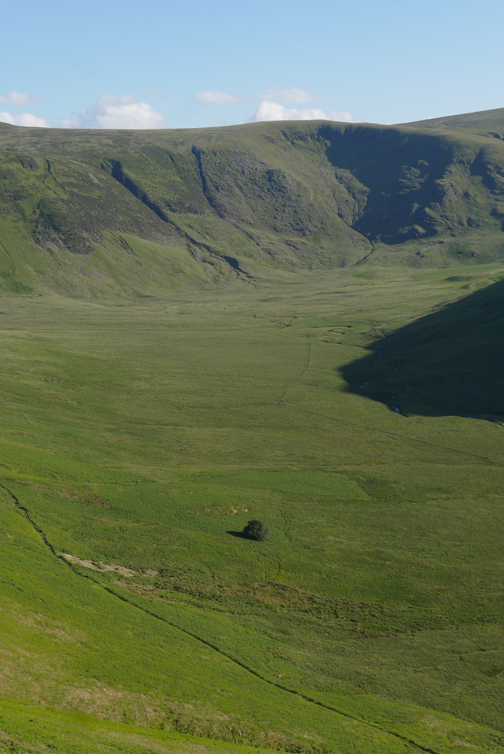
Sunlight and shadows on the lumps and bumps of Hen Comb.
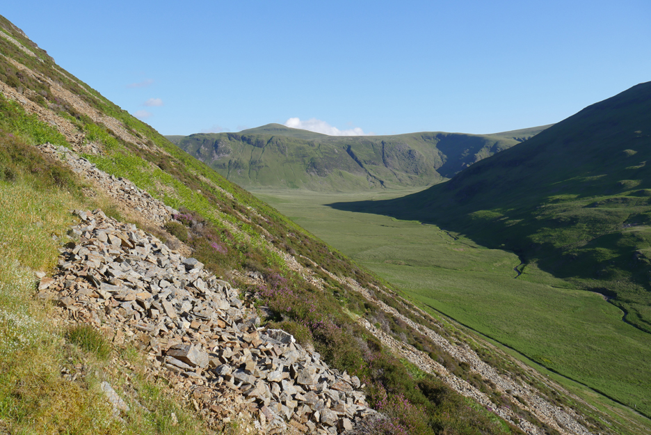
Our path gradually descends, following high above the valley at present. It will traverse the side of the fell and only gradually reach the valley, as that is slowly descending at the same time.
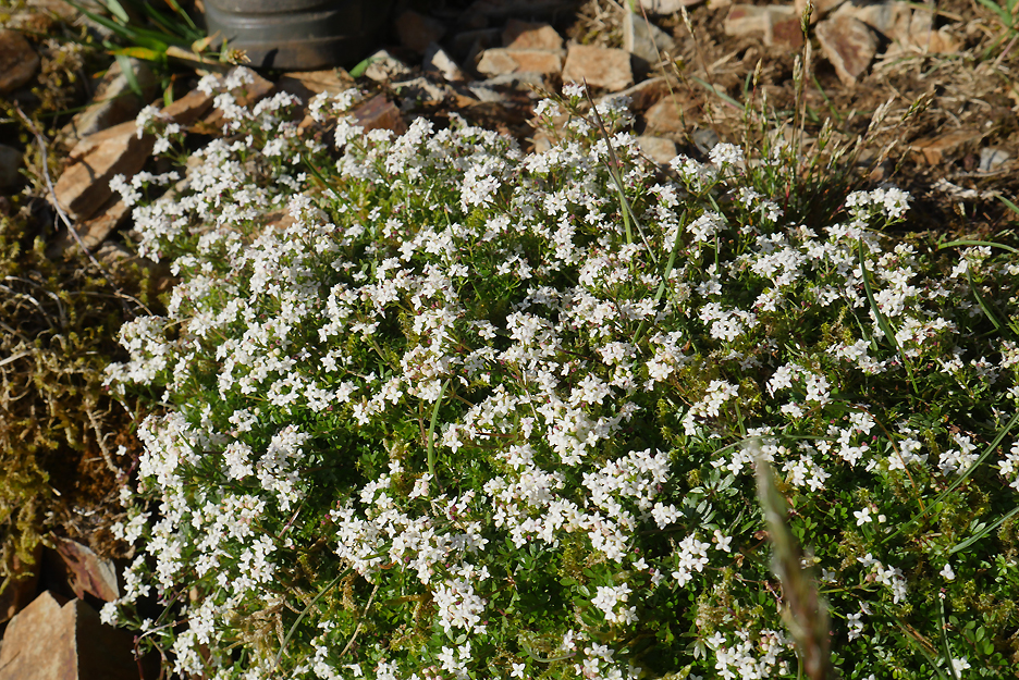
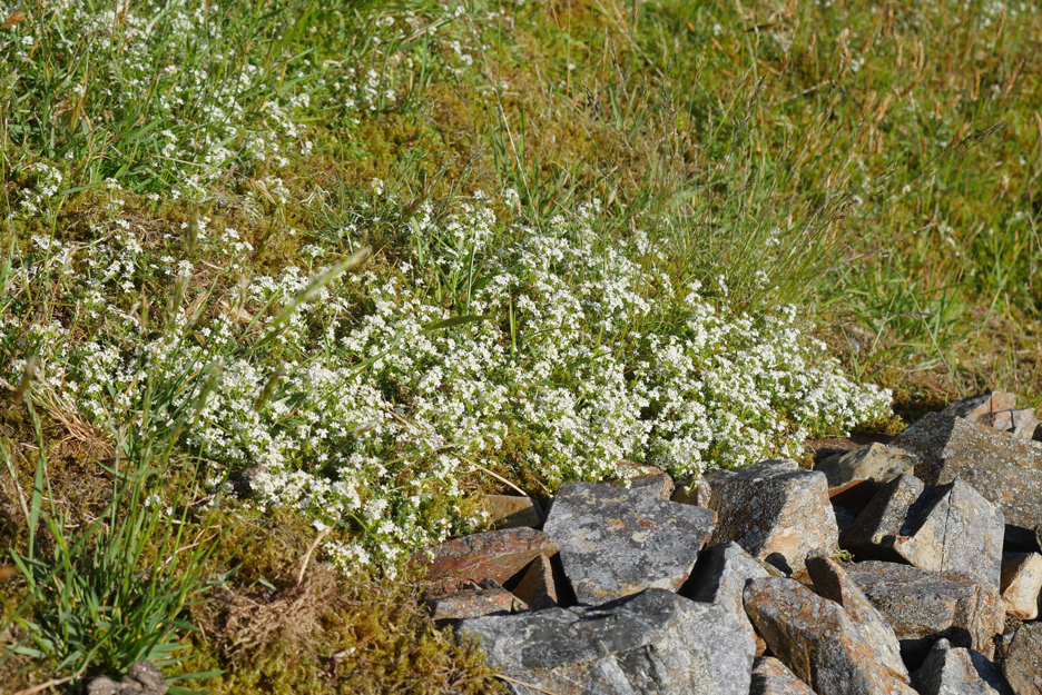
Beautiful displays of a tiny white, four petalled flower . . . possible one of the mountain thyme family.
Our path works its way across and down . . . through the areas of scree on the side of Mellbreak.
Looking back as the shadows lengthen alongside Hen Comb and gradually start to shade the valley.
More of the same flowers growing well on the poor soil.
The stoney sections are passed. Most of the year you can cut down to the valley track now, but the summer bracken is starting to make that a poorer option.
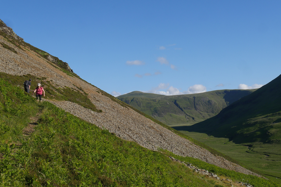
We stay high and head back for the path junction on the Mellbreak ascent route.
Almost full circle as we reach what could be termed a "reverse burfication" . . . where the path joins rather than splits.
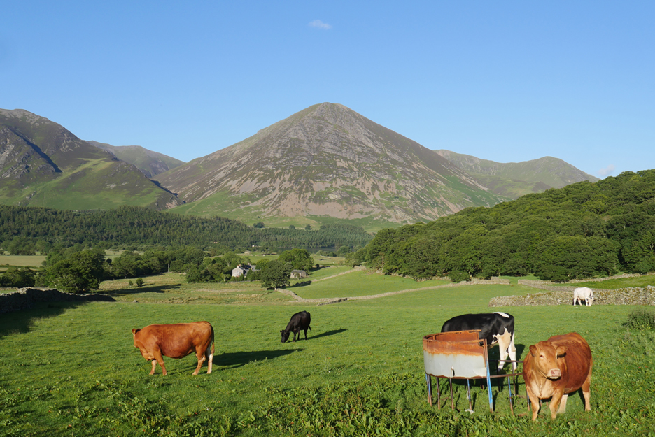
Fine summer weather . . . long evenings and a good growth of grass for the farm animals . . . the feeder has been empty for a while. - - - o o o - - - Technical note: Pictures taken with either Ann's Panasonic Lumix TZ60, or my Panasonic Lumix Gx8 Camera. Resized in Photoshop, and built up on a Dreamweaver web builder. This site best viewed with . . . evening supper already prepared. Go to Top . . . © RmH . . . Email me here Previous walk - 14th June - The Railway Children Event 2019 A previous time up here - 12th Dec 2009 A frosty ascent of Mellbreak 2009 Next walk - 28th June - Brackenthwaite Hows with the National Trust
|