![]()

Remember: Press F11 for a full
screen view of this page.
|
|
|
Remember: Press F11 for a full
screen view of this page. |
|
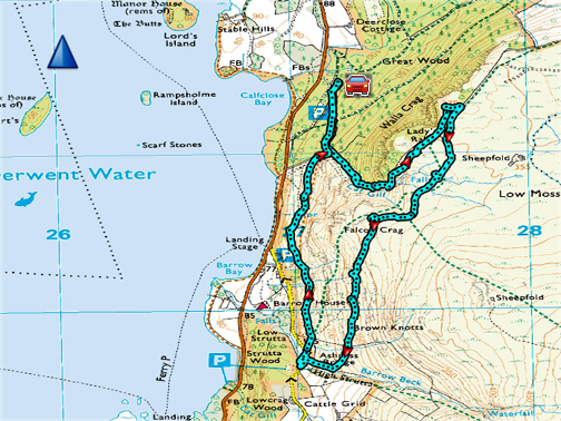
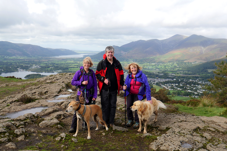
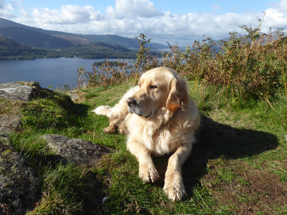
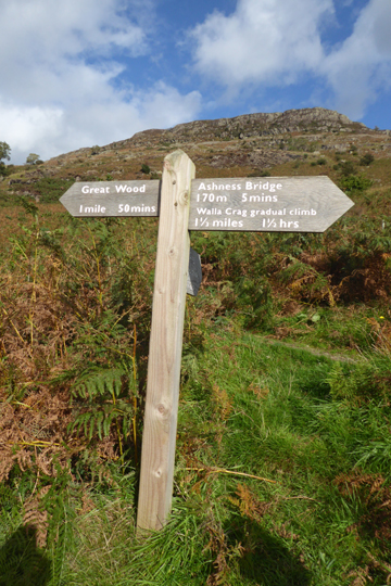
" Walla Crag and Ashness Bridge " Date & start time: Saturday 22nd September, 2018. 1pm start. Location of Start : Great Wood NT car park, Borrowdale, Cumbria, Uk. ( NY 272 214 ) Places visited : Cat Gill, Walla Crag, Ashness Bridge and back under Falcon Crag. Walk details : 3.9 miles, 1150 feet of ascent, 3 hours 20 mins. Highest point : Walla Crag, 1230 ft - 379m. Walked with : Jo and Neil, Ann and the dogs, Amber and Dylan. Weather : Overcast to start, improving nicely as the day went on. |
© Crown copyright. All rights reserved. Licence number PU 100034184. |
|
A seemingly brief moment between our Scottish holiday and the arrival of our new little bombshell. Both Jo and Neil are in the area so we take the opportunity to stretch our legs Cumbrian style and head out on a circular walk overlooking Derwent water.
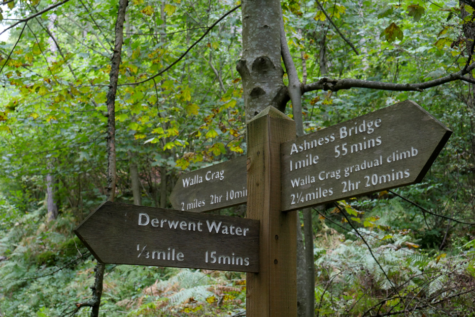
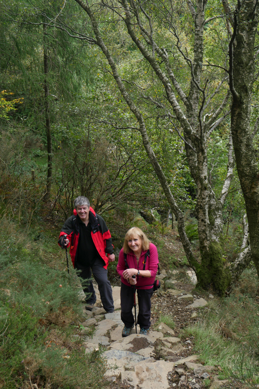
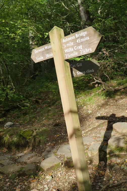
After a Friday evening "Celebration of Simon & Garfunkel" concert in Loweswater we met Neil and Jo for a second time at the car park in Great Wood, just out of Keswick, for a walk to Walla Crag. Our exact route was not signposted as we plan to take the more direct Cat Gill route up to the summit.
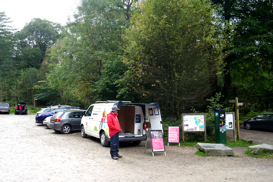
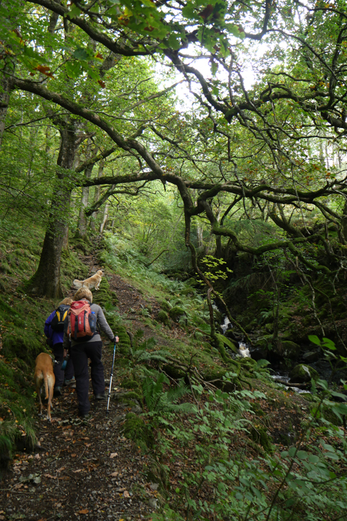
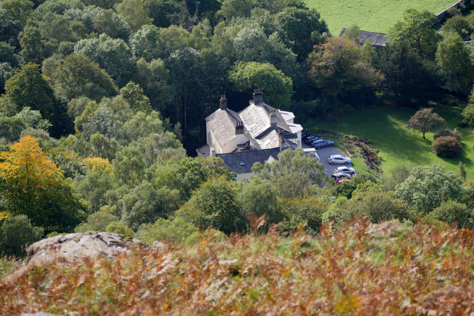
Parking in Great Wood . . . on this busy day we just managed to find three car parking spots as we had all arrived from different directions. Interestingly, the warden asked us to each take a free parking ticket via the machine (free for NT members) as it records the car park usage and also allocated money to the Cumbrian area of the Trust from National funds, bringing them more money for local projects.
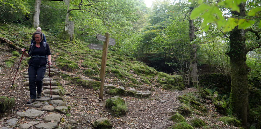
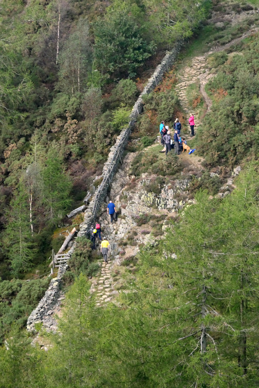
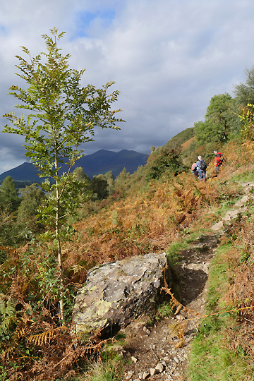
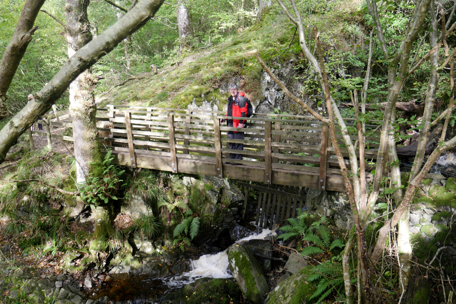
The start of the steeper climb up Cat Gill . . . on our return we would walk back to the car park via the bridge on the right.
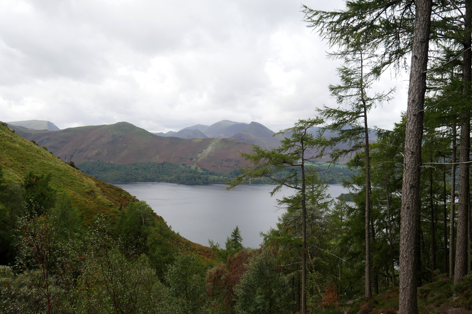
As we climb and leave the wooded ravine the views widen to include Derwent Water, Catbells and the NW Fells.
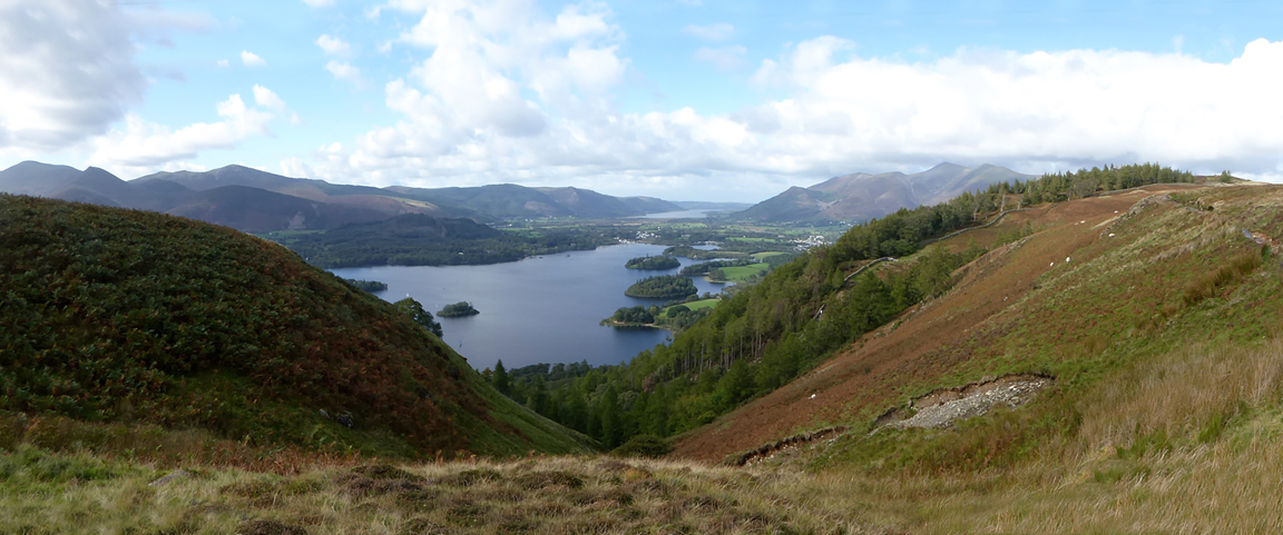
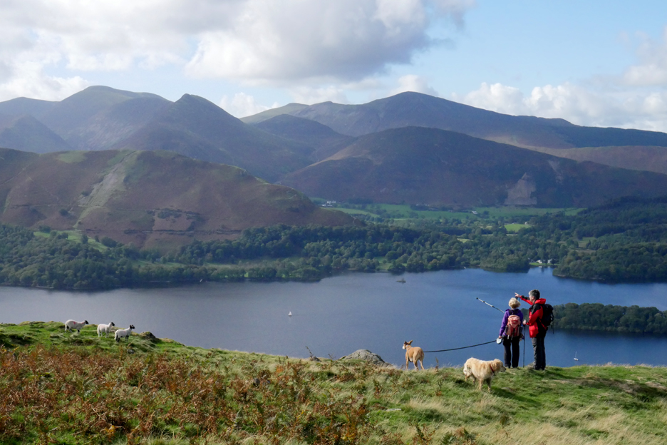
On the more level ground the panorama widens even more. The visibility is good and we can see all the way to Great Gable and Scafell Pike (left) at the southern end of Borrowdale. In the background (centre and right) are Robinson, Ill Crag and Grisedale Pike behind Catbells and Barrow Fell.
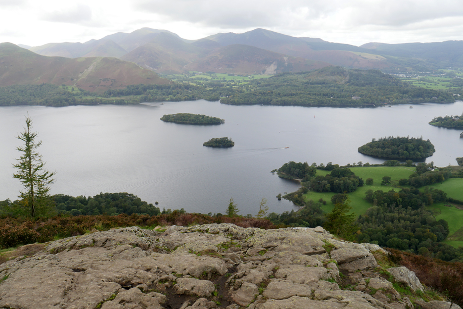
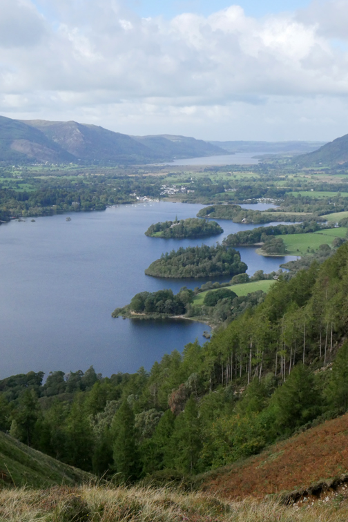
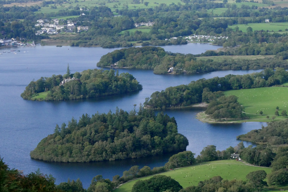
The top of Walla Crag and we peer over the precipice, down to the many islands of Derwent Water.
Derwent Isle, with Lingholm House, Nichol End and Derwent Water Marina on the far shore.
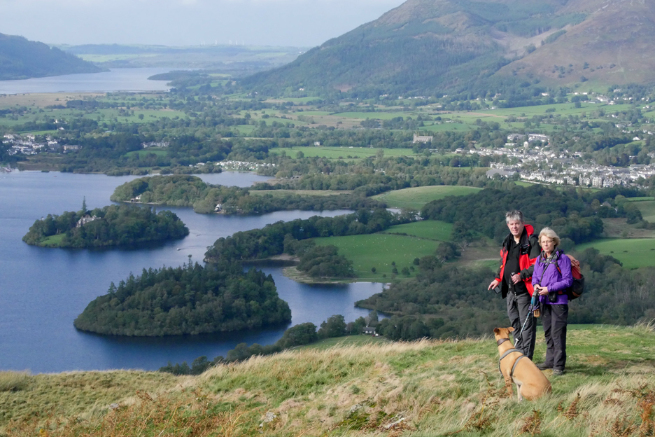
A group photo on the true summit, set back fifty yards or so from the edge. You don't need to be introduced to Jo and Amber, Neil, Ann and Dylan do you ?
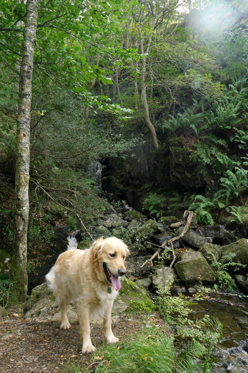
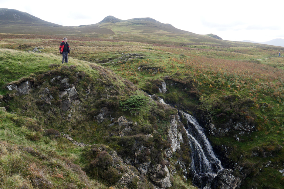
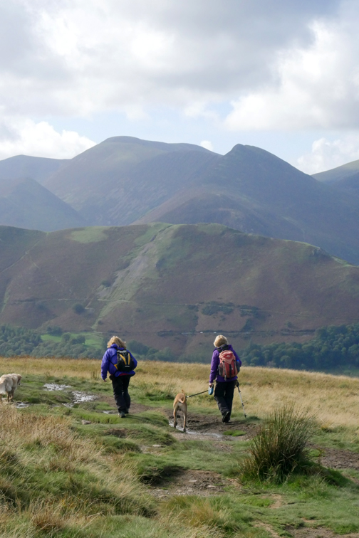
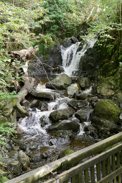
Today we extend the walk over to Ashness Bridge so take the track across the top of Cat Gill admiring the small waterfall as the stream leaves Low Moss.
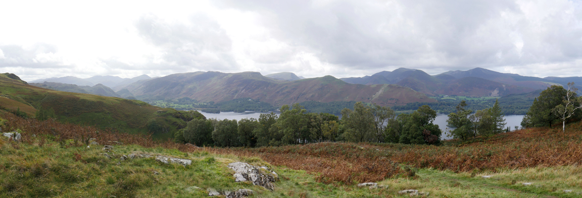
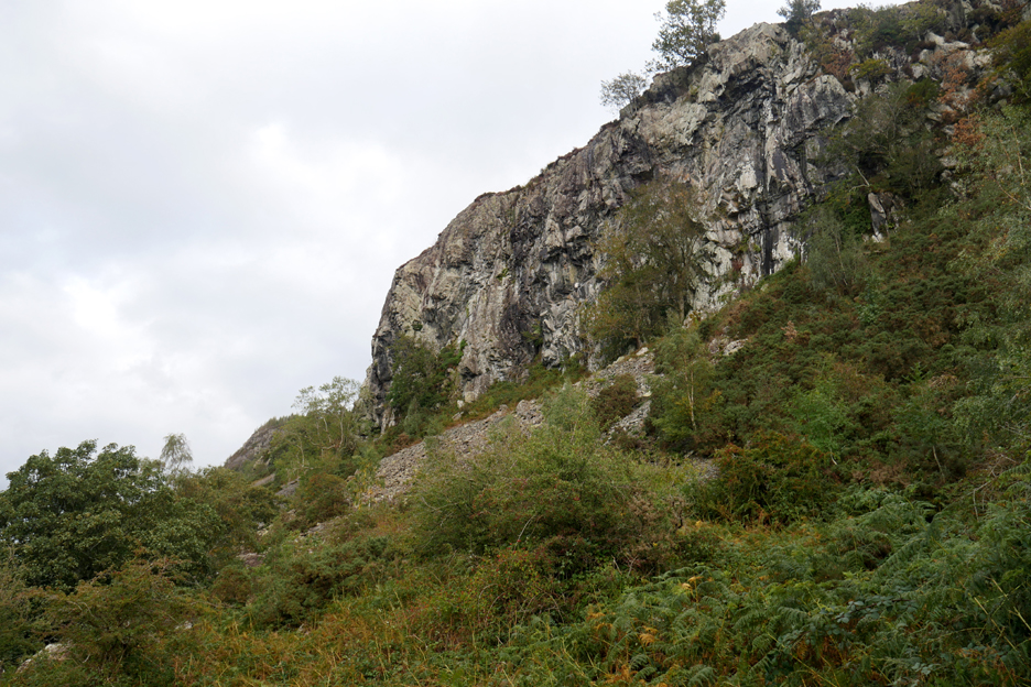
The wider symmetry of Falcon Crag on the left and Walla Crag on the right, with an island filled view across to Portinscale and Keswick.
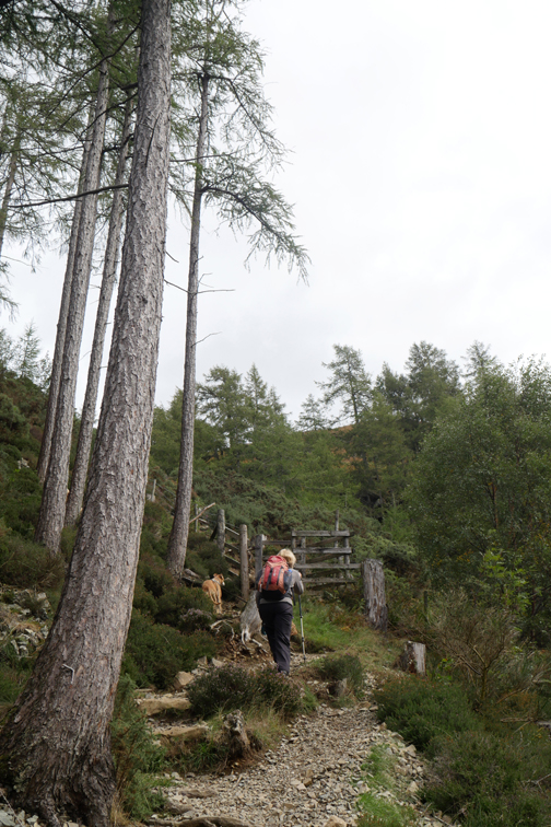
We walk out onto the moorland above Falcon Crag.
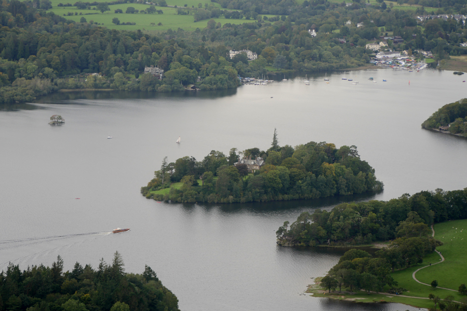
Looking down on Lords Island, Derwent Island and the Peninsular out from Crow Park. The Keswick campsite is sitting near the waters edge at the bottom end of the lake.
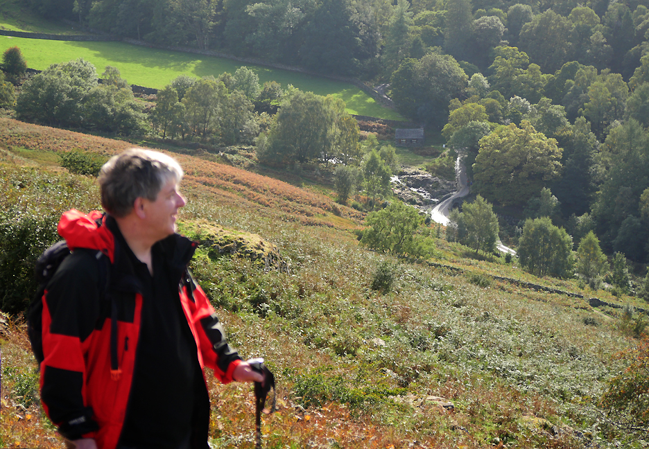
Jo and Neil discussing the walks they've done and how the geography of the fells ahead of them ties in with what they remember.
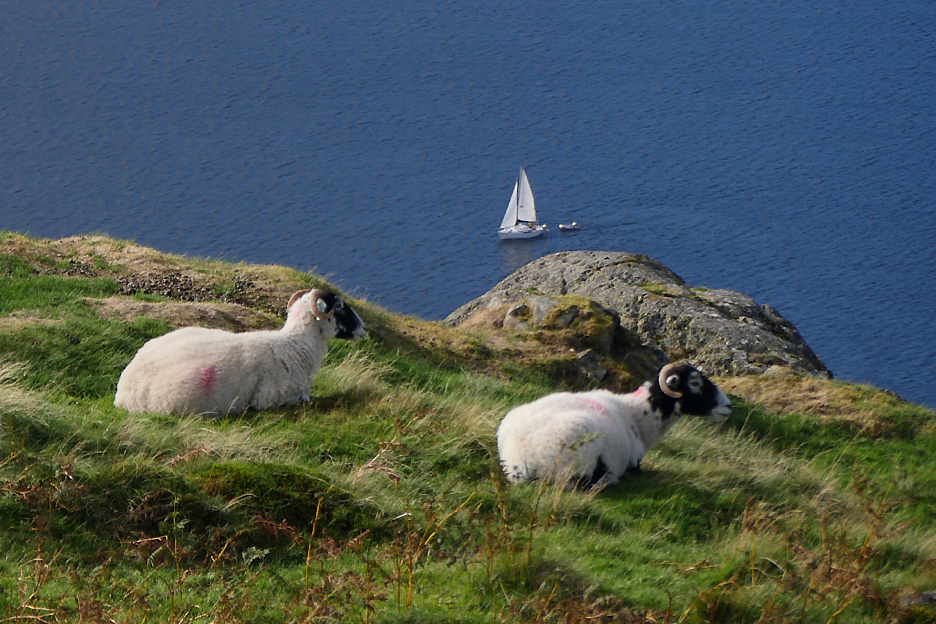
An alternative leisurely pursuit or two . . . sitting and sailing.
Dylan leads us on towards Ashness and the view is now of the top end of the lake. Great Gable is seemingly the highest peak . . . but we know the one behind is taller !
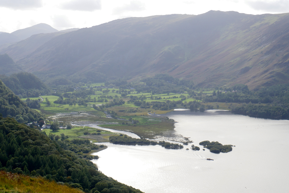
A ferry leaves the Lodore landing stage close to the river. The water level in Derwent Water seems to be high, as there's a lot of standing water on the marshland at the head of the lake.
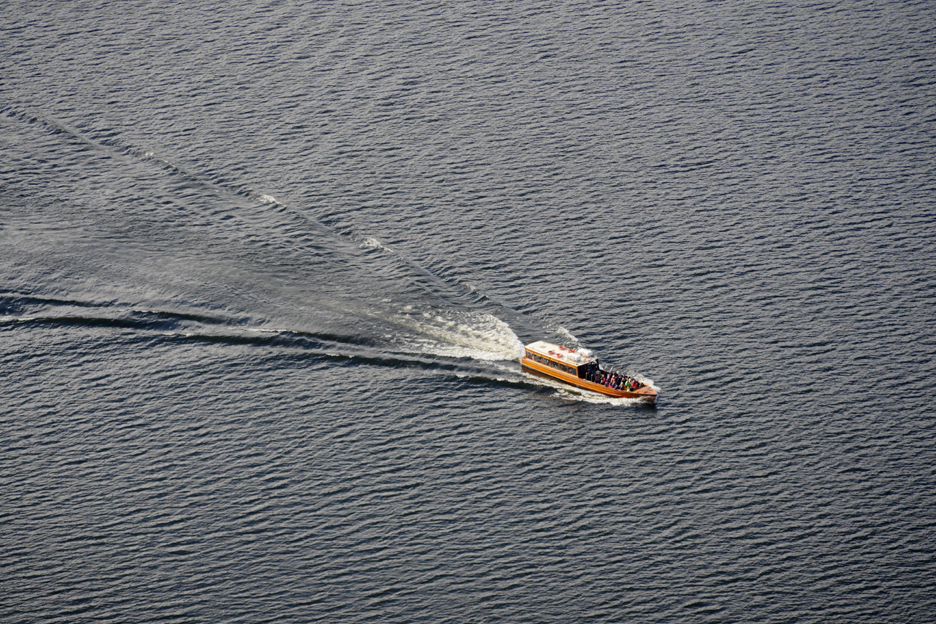
The Keswick Launch breaks through the ripples like an arrow head.
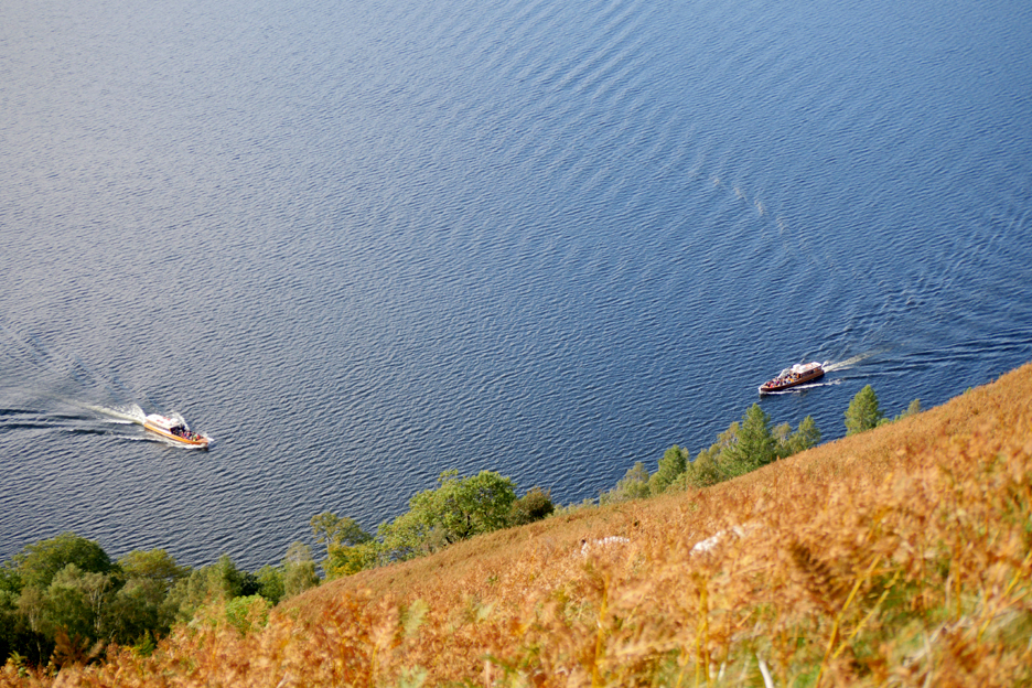
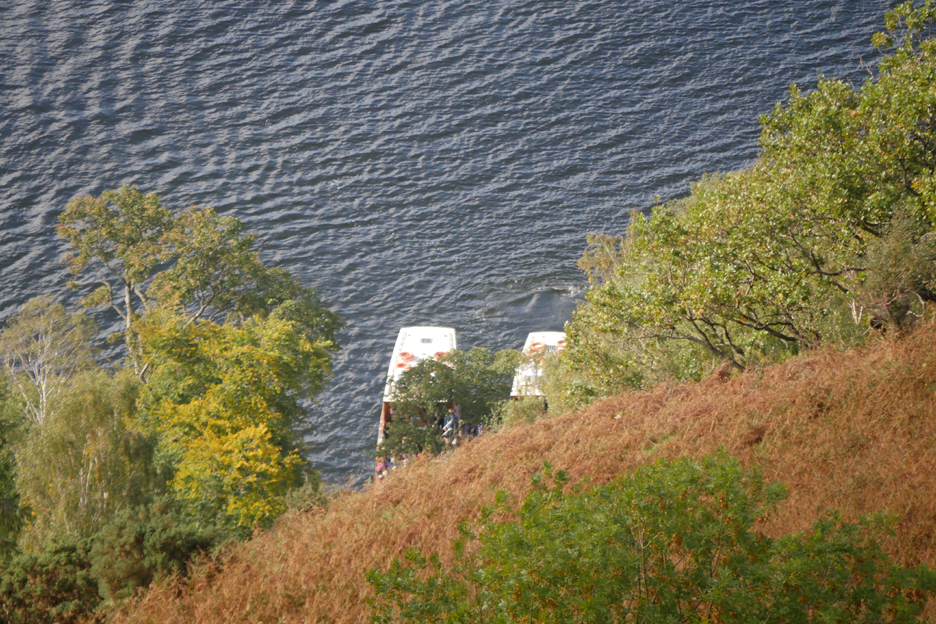
A competition emerges . . . who will reach Ashness Pier first ?
We'll class it as a dead heat . . . the first time I can remember seeing clockwise and anti-clockwise ferries arriving at the same pier at the same time.
The sunshine encourages everyone to sit and enjoy the view.
When the fly they move fast but when they hover they are absolutely stationary. They flutter or quiver their wings characteristically fast and their body vibrates in time but if you look carefully at one actually hovering, you notice that their heads are absolutely still.
Looking down we see the Derwent Water (independent) Youth Hostel below us.
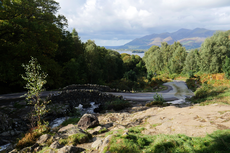
. . . and shortly afterwards the narrow road that crosses Ashness Gill at a rather famous spot.
The 'chocolate box' or 'biscuit tin' view of the iconic Ashness Bridge. The last tin I saw with this view on the lid had significantly less trees than there seem to be now.
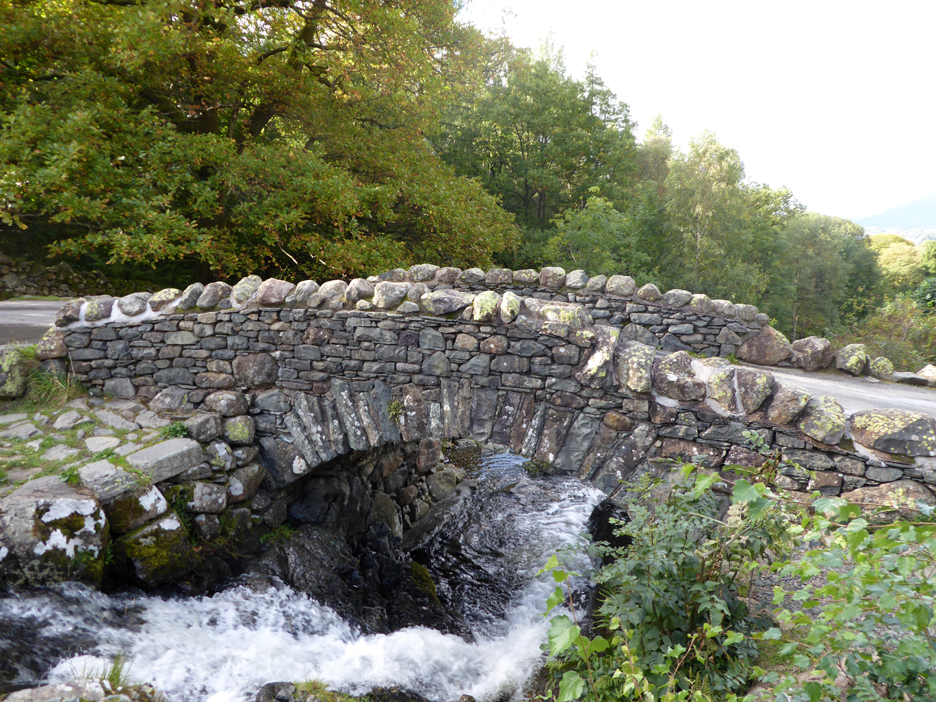
The classic, narrow packhorse bridge. [ I'm sure that right hand side has been modified recently looking at the new cement ?]
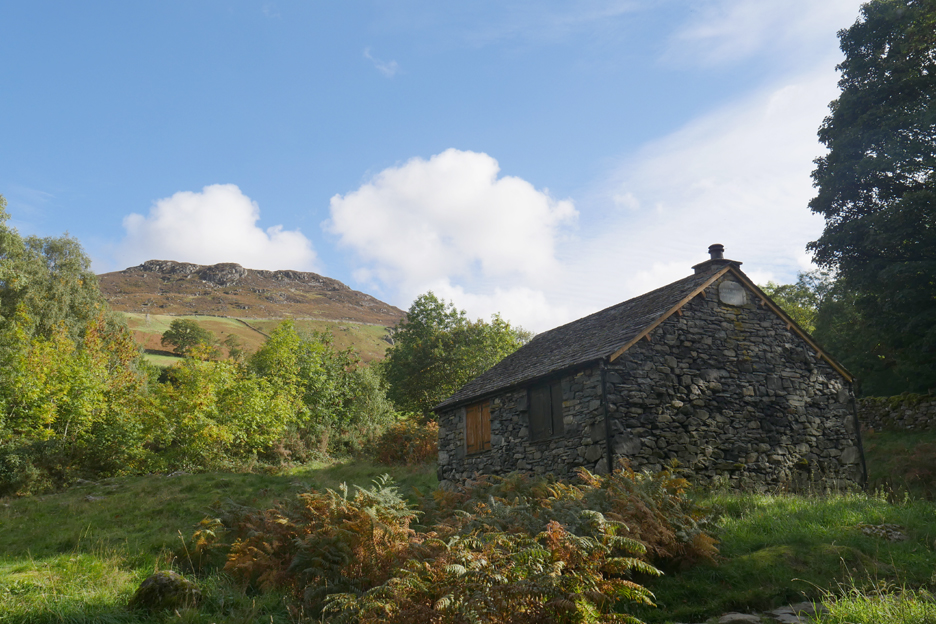
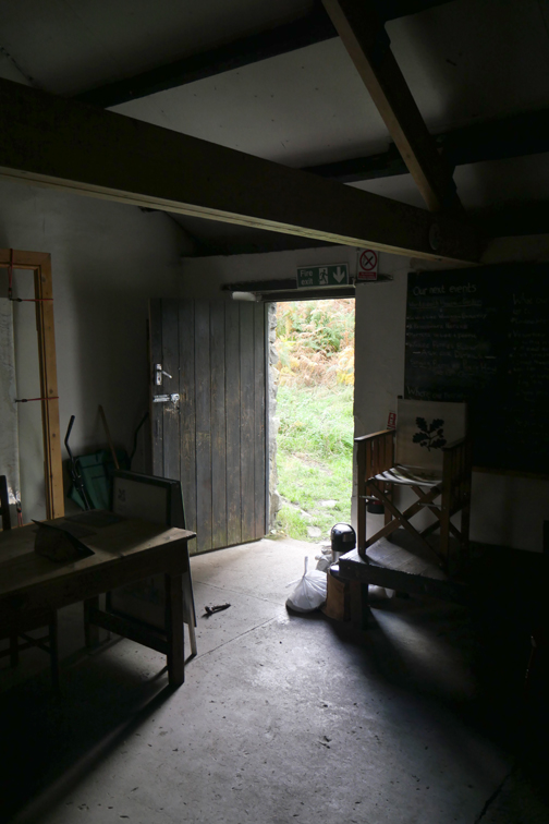
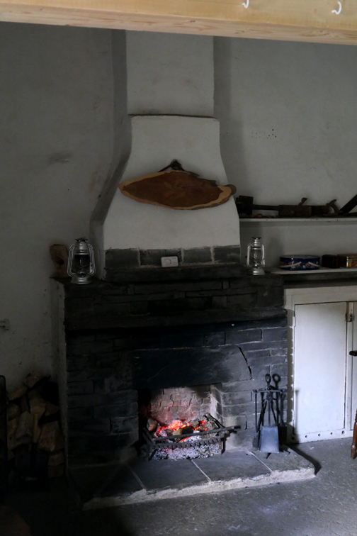
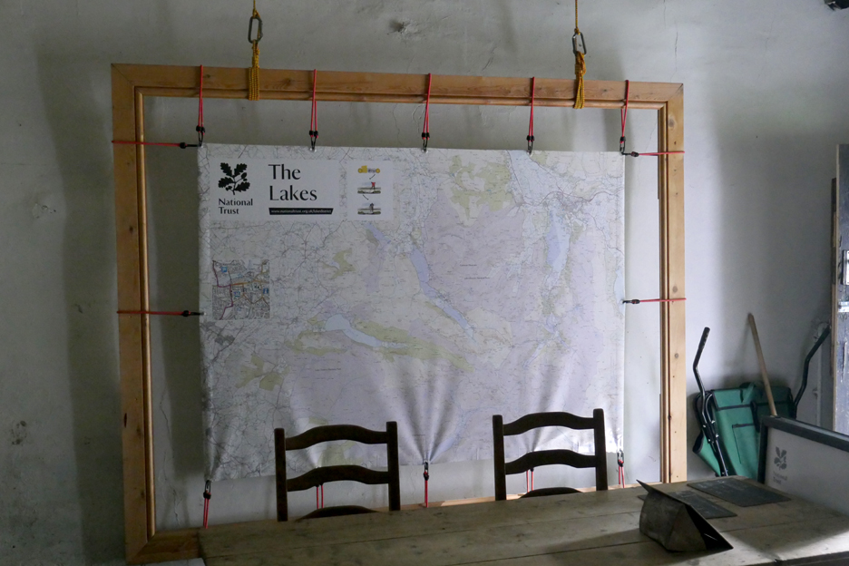
Above the bridge is the old 'Scout Bothy' which has now been converted to a National Trust Information Centre It also serves informal teas and coffee on high days and holidays till late afternoon. They were open until four o'clock . . . and as luck has it . . . it was just closing !
and a large table to sit around and chat if you want.
Falcon Crag from below . . . on cue about half way back.
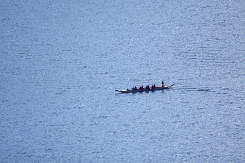
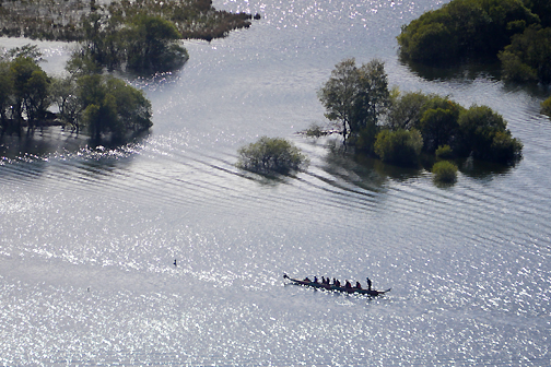
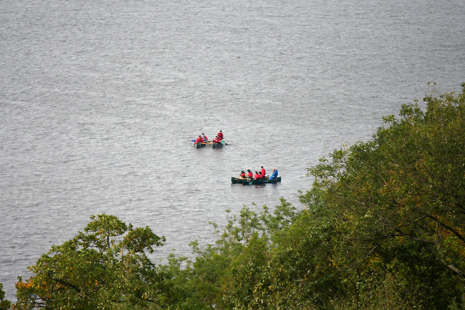
Down on the lake more visitors are afloat . . . this time paddling under their own steam.
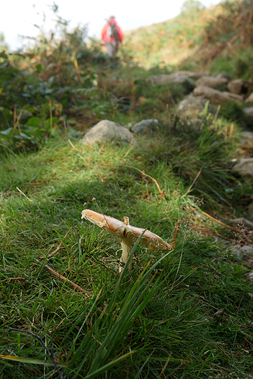
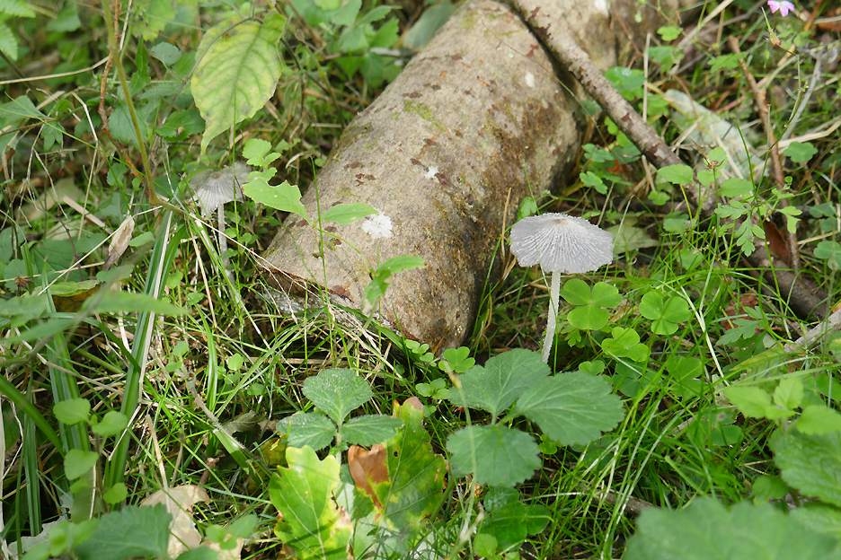
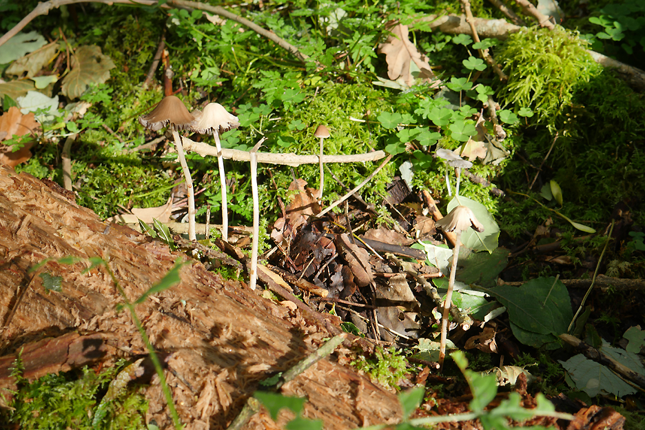
The later section of this walk becomes more wooded and with it the environment for mushrooms and toadstools improves.
These delicate ones are growing out of an old pine log.
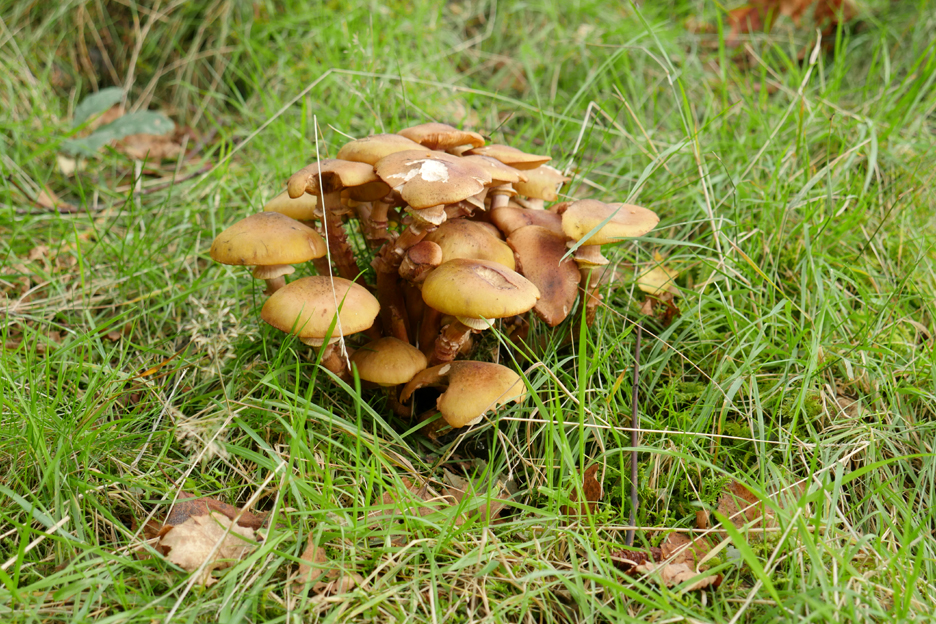
This interesting bunch are more of a grassland variety.
Back to Cat Gill . . . and wearing red helps to get you into a photograph when all around is generally green or brown.
- - - o o o - - - A short walk brought us back to the car park and then we all headed back over Honister Pass to Loweswater to enjoy a cup of tea to make up for the one we didn't get at Ashness Bridge. This one had home made Loweswater fruit cake with it . . . a real bonus ! - - - o o o - - - |
|||||||||||||||||||||||||||||||||||||||||||||||||||||||||||
Technical note: Pictures taken with either Ann's Panasonic Lumix TZ60, or my Panasonic Lumix Gx8 Camera. Resized in Photoshop, and built up on a Dreamweaver web builder. This site best viewed with . . . a choice of activities for all. Go to Top . . . © RmH . . . Email me here Previous event - 14th - 19th September - Scotland - the Mull of Kintyre A previous time up here - 6th April 2011 Calvert Trust and Walla Crag Next walk - 26th September - Dougal of Loweswater
|