![]()

Remember: Press F11 for a full
screen view of this page.
|
|
|
Remember: Press F11 for a full
screen view of this page. |
|
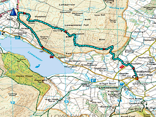
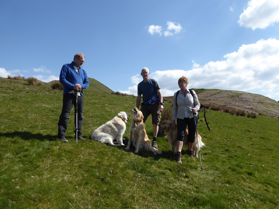
" Darling Fell to home with Trevor & Gill " Date & start time: Thursday 4th May 2017, meet for lunch then a walk afterwards. Location of Start : The Mosser Road end, Loweswater, Cumbria, Uk ( NY 127 218 ) Places visited : Askill Knott, Darling Fell, back under Low Fell via Foulsyke. Walk details : 3.2 miles, 1000 ft of ascent, 1100 ft of descent, 2 hours 45 mins. Highest point : Darling Fell, 1263 ft - 391m. Walked with : Trevor and Gill, Ann and the dogs, Finlay, Harry and Dylan. Weather : Sunshine and blue skies ... a very strong easterly wind on the summit. again. |
© Crown copyright. All rights reserved. Licence number PU 100034184. |
|
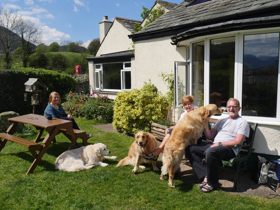
Trevor and Gill arrived after lunch for a walk on another day of perfect weather. Harry and Dylan were pleased as out of the car tumbled their friend Finlay of Borrowdale. "No great plans for where to walk" gradually morphed into a linear walk from Mosser Road back to the cottage. We'll climb Askill Knott and Darling Fell along the way.
The sunny weather continues and with it a busy morning in the garden. When Trevor and Gill arrived we had a relaxing start to the second half of the day.
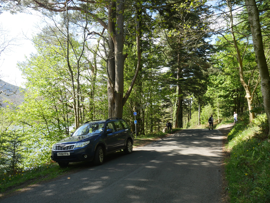
Various options emerged about where to walk but the winner was an extended version of a favourite local walk. We parked the car at Mosser Road end and would collect it later.
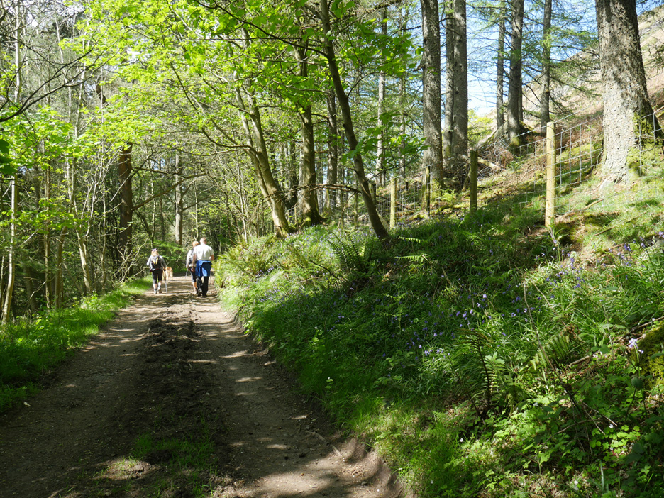
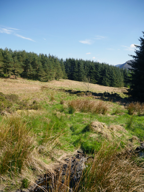
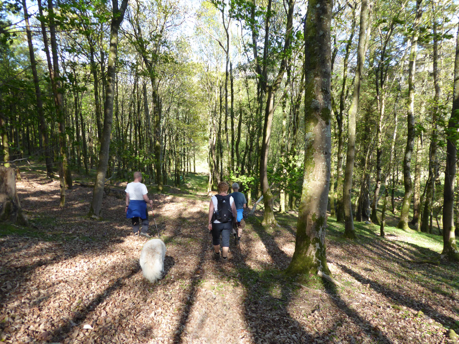
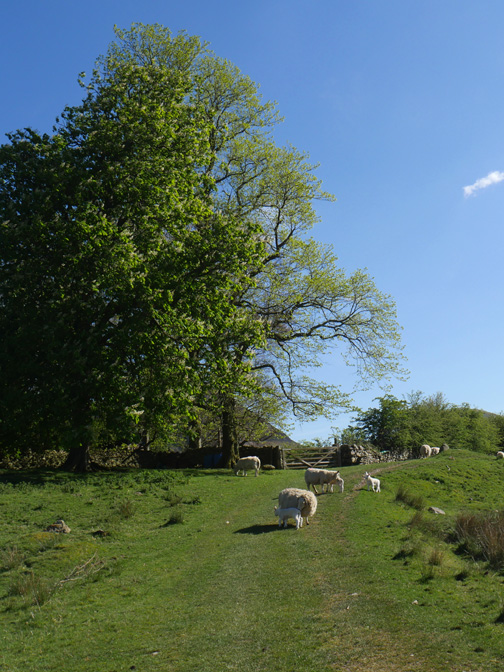
Into the mixed woodland and following the Mosser track. There are a few bluebells about but not nearly as many as in Holme Woods on the opposite side of Loweswater.
The track used to be tarmaced but the surface has deteriorated badly over the years. Still, nature has softened the sharp edges . . . and the local Council has recently put a "Do not follow Satnav" sign at the other end.
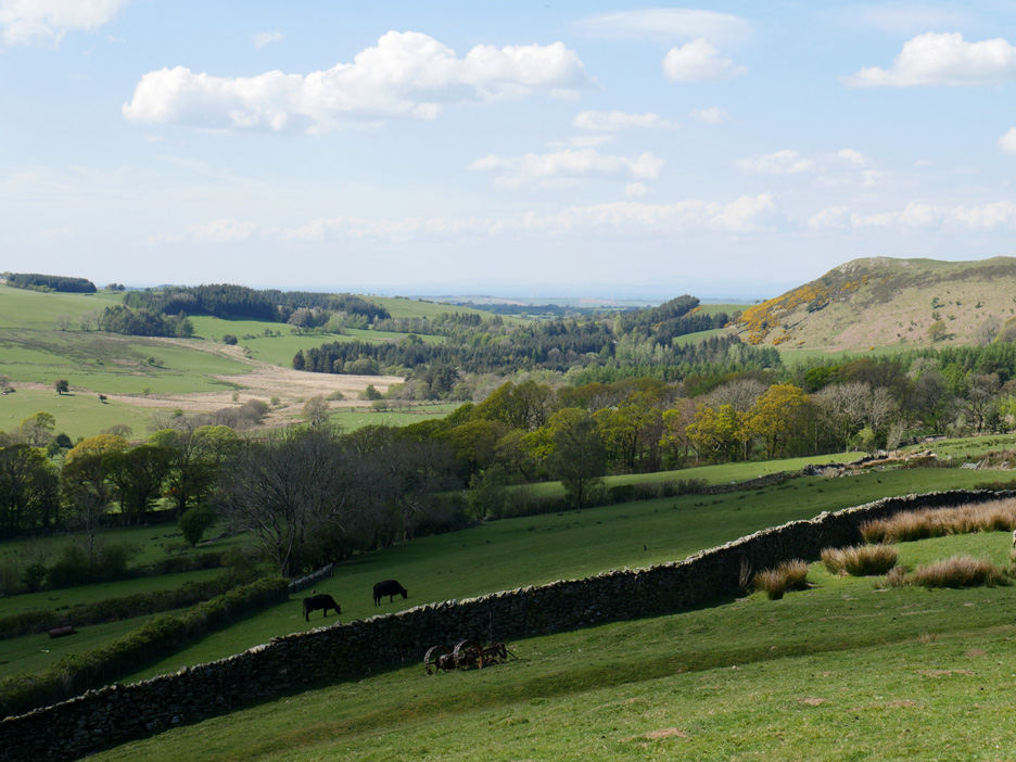
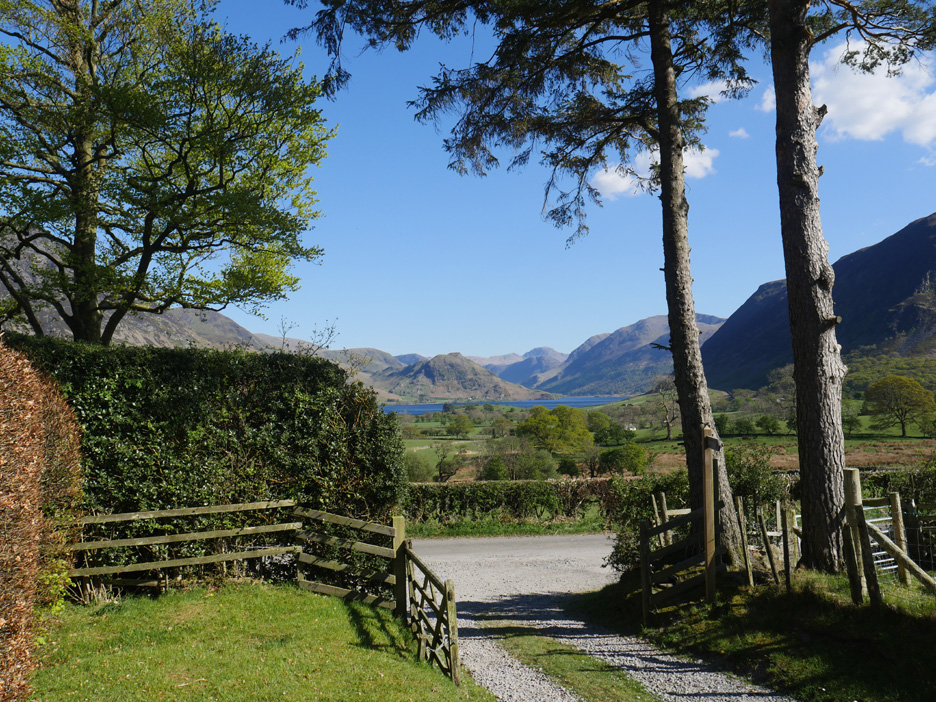
Lovely views over Loweswater as we gradually gain height.
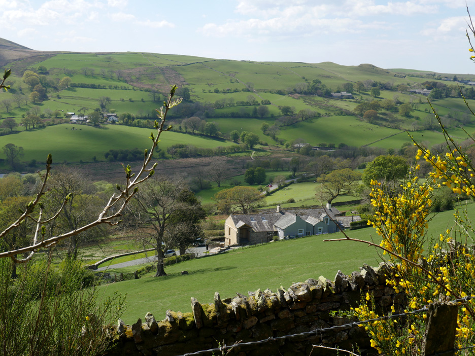
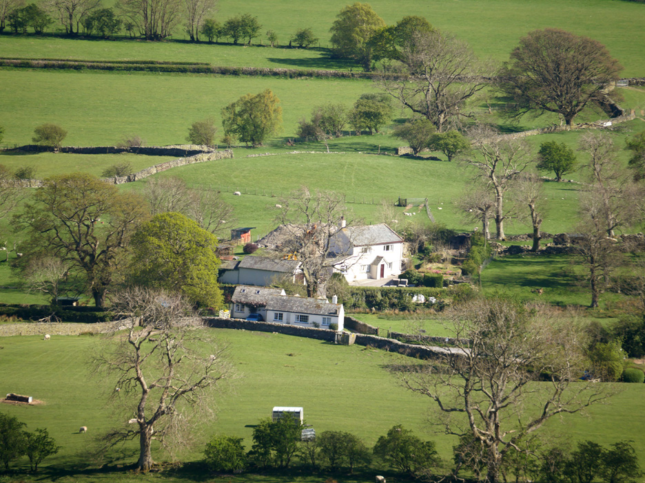
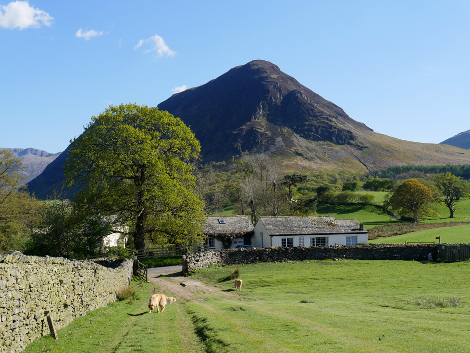
Down below us the large (ex-farm) house known as Myresyke, with the valley road seen beyond.
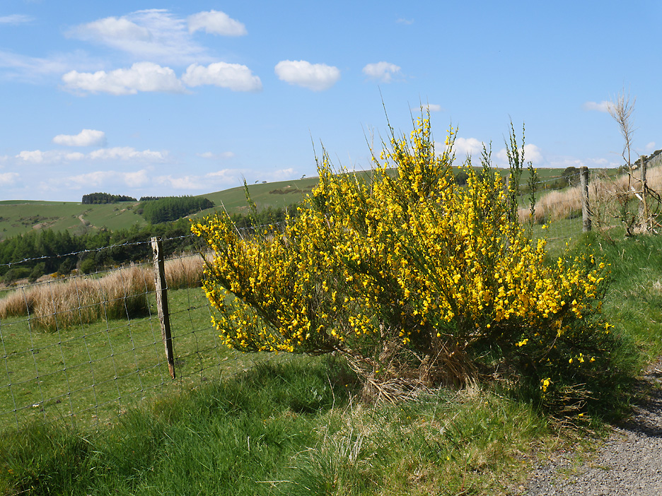
The track is renowned for fine display of yellow broom at this time of year. The sunshine today really makes it stand out against the background.
To the north west we look over to the distant Solway coast, slightly hidden by the long distance haze.
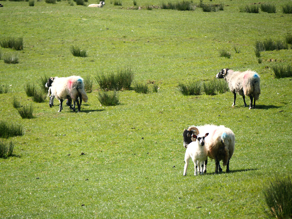
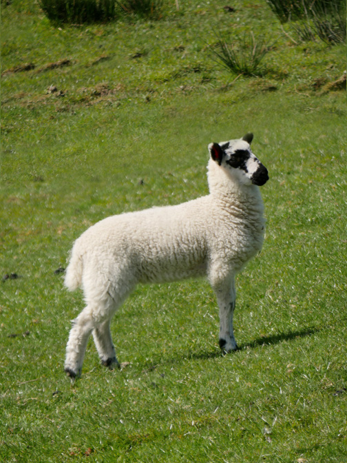
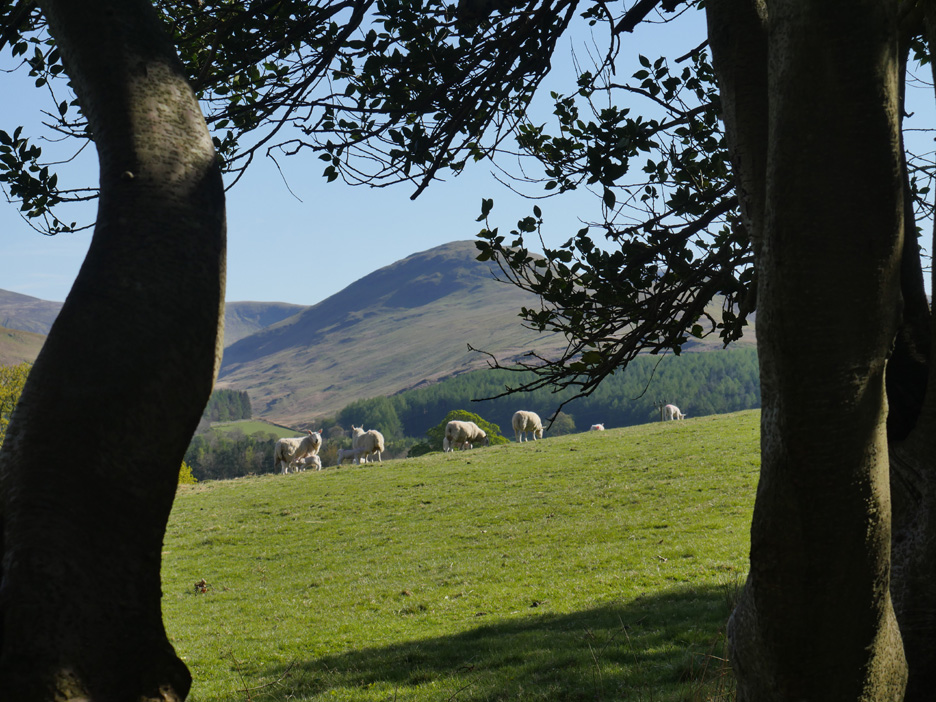
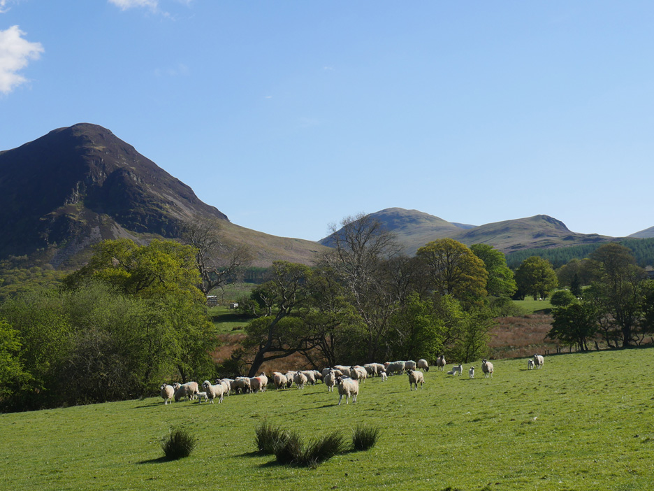
The lambs on Askill Farm are growing fast, but this exceptionally dry weather is not letting the grass grow fast enough for them and the farmer has been giving them extra feed.
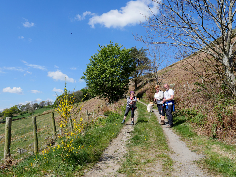
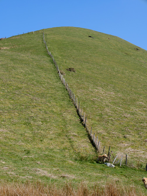
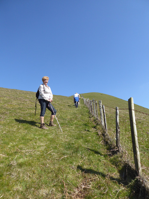
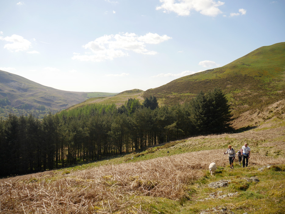
Pause for a photo part way up the slope. We're heading up towards Askill Knott . . . that's the one on the right behind Gill.
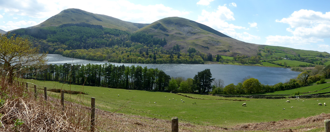
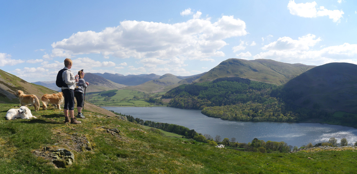
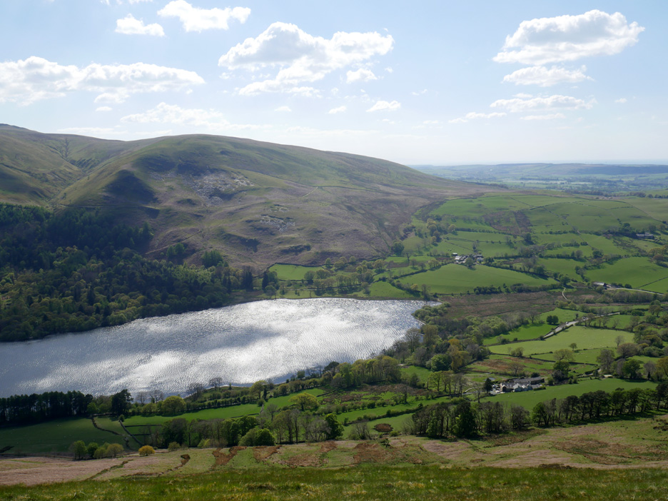
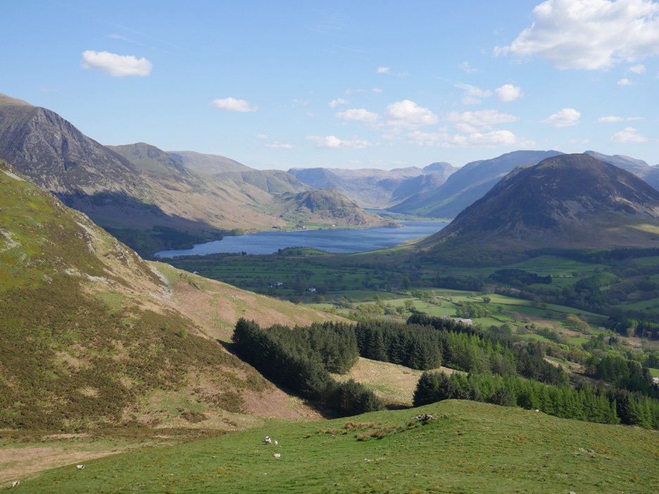
From the top there's a lovely panoramic view down onto the lake and across to the surrounding fells.
" Over that way you can just about see Scotland."
Gathering our strength ready for the brisk climb ahead . . .
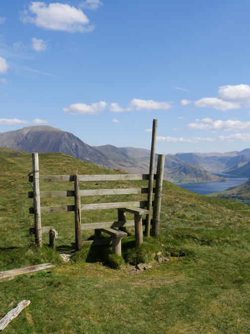
Standing on the top step of the stile you are actually higher than the summit, but the dog gate is broken and the fence is down next to it, so we bypass it and bag the true summit as our highest point of the day.
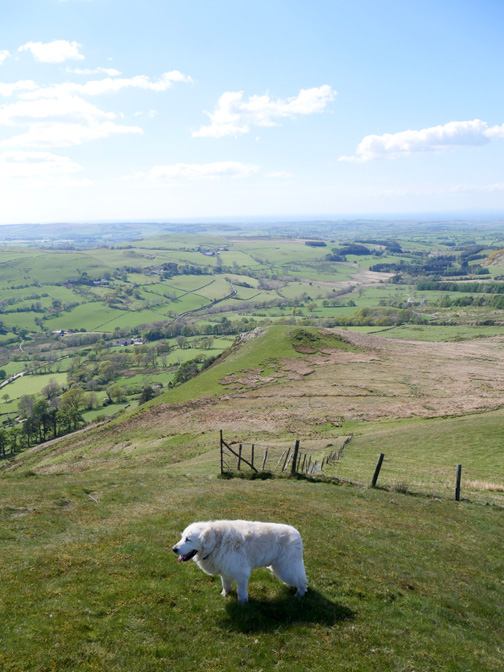
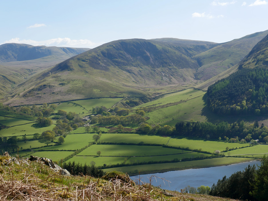
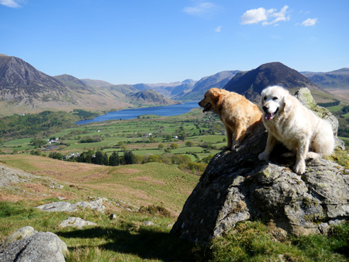
From the summit there's a great view down to Loweswater, enhanced today by the shimmering sunshine which is reflected from the surface of the lake.
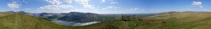
Once the rest of the group has moved on I was able to take a summit panorama without distractions. Click here or on the photo above for a Loweswatercam 360 degree annotated panorama. [ Right click on the photo if you wish to open it as an alternative window.]
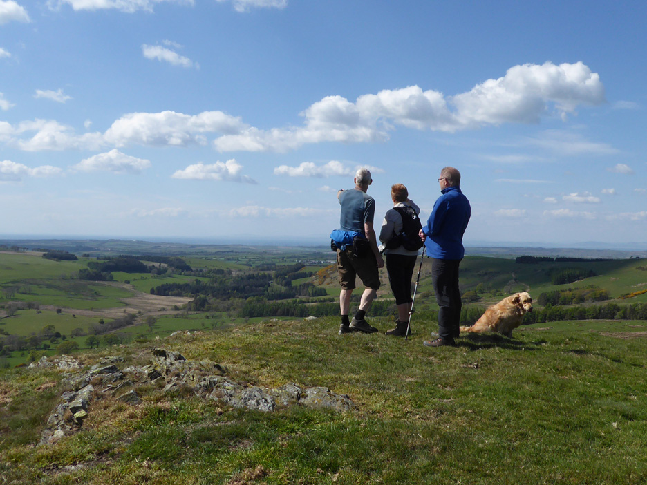
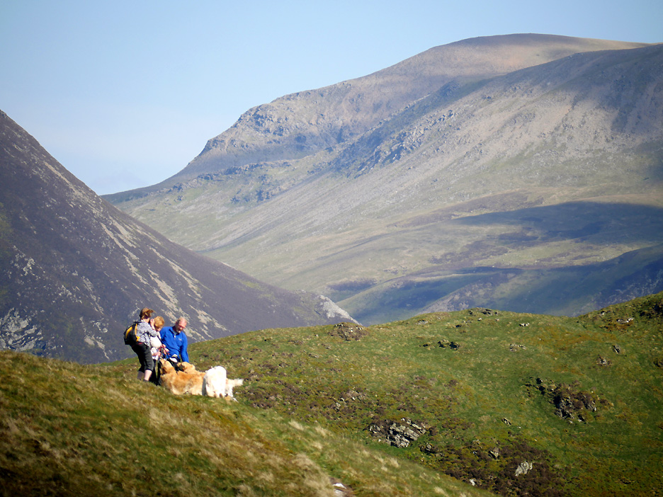
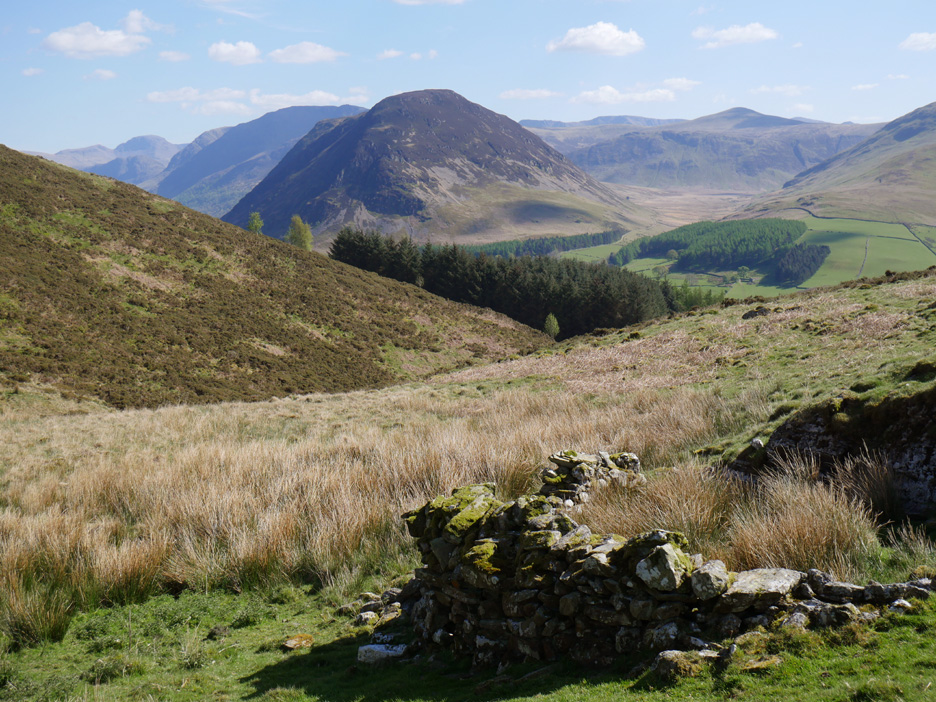
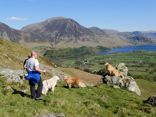
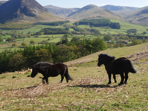
With everyone else so far ahead I change lenses and the world looks fore-shortened, quite different. They're on Darling Fell, then there's the green grass of Low Fell (southern end) is behind them . . . they look as if they are joined. Further behind is the low rock outcrop of Whin Ben leading up to purple Whiteside, with Grasmoor and Eel Crag to the right.
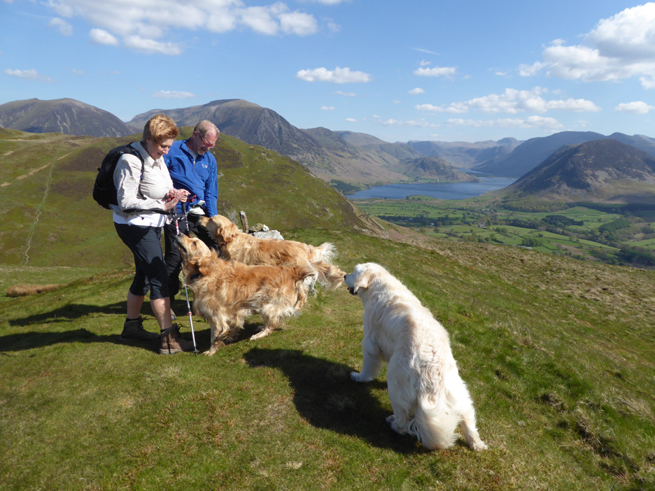
Ann, standing next to Trevor and Gill gets a more normal view of her companions. Finlay and Dylan are looking very alike, Finlay (with Gill) is just a few months older.
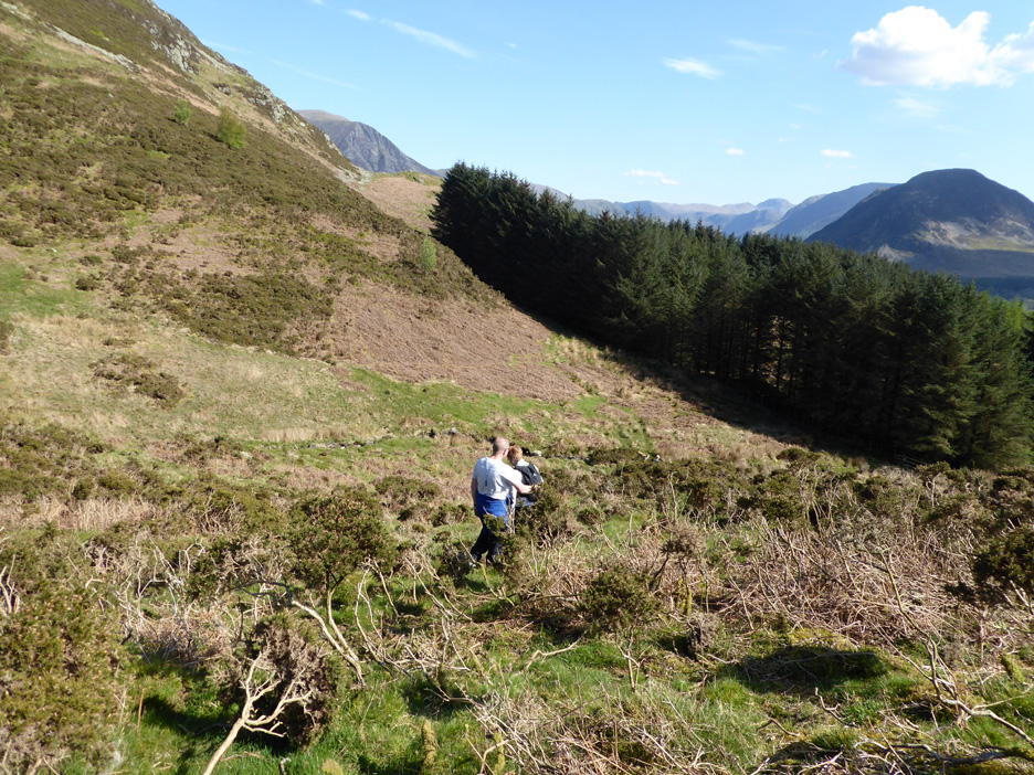
Time for a new route . . . down the end and across to the lower slopes of Low Fell. The path we need drops then climbs gently alongside the trees, heading around the base of the fell to our famous Loweswater Pine.
In the lower section of Crabtree Beck Valley we find an old sheepfold . . . it is marked on the 1:25k map if you have one.
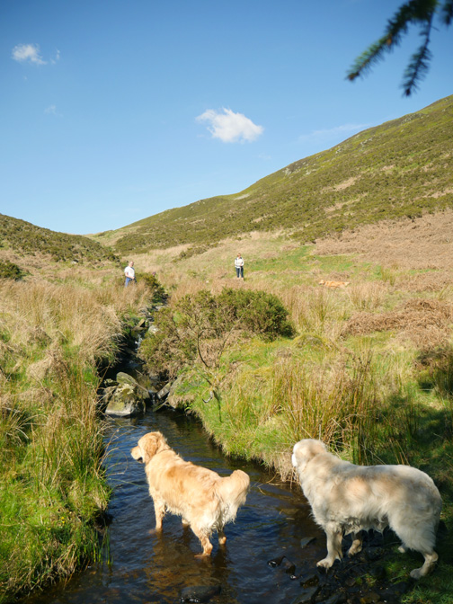
A patch of scrub gorse later and we reach the trees and the stream crossing.
The water from the beck was partially diverted around Low Fell to power a water wheel at Loweswater lead mine. It is getting on for 170 years ago now so the leat is very overgrown. Hold your cursor over the picture too see the route. Click (or right click) here for a link to the detail as reported at the Lorton History Society Exhibition (item 4).
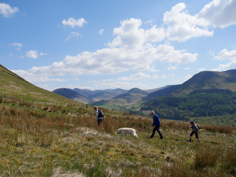
A gentle climb sees us leaving the woodland behind.
To the right we had a fine view across to Black Crag . . . with High Nook Tarn nestled beneath.
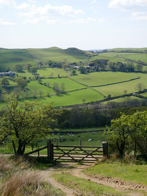
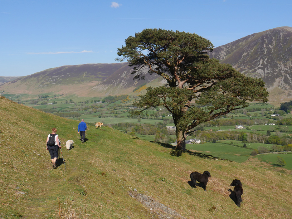
Reaching the high point of the path the view ahead now opens up. On a day like today, in fact every day this week, it has been a wonderful view.
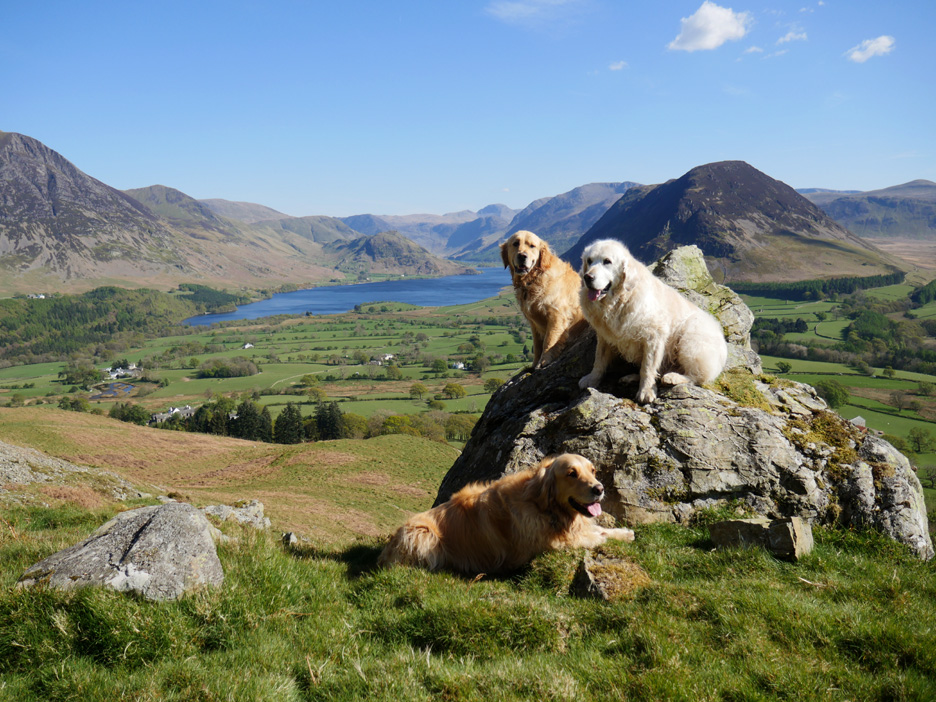
Somehow we managed to catch all the dogs sitting still at the same time for the doggy photo of the day !
On with the walk as they've all jumped off the rock . . . now where were we ? Oh yes, a change of lens again to catch a close up of the wildlife pond at Godferhead Farm.
. . . and also a view of Oak Cottage plus the big yellow digger, still sitting on the pile of earth alongside Gillerthwaite.
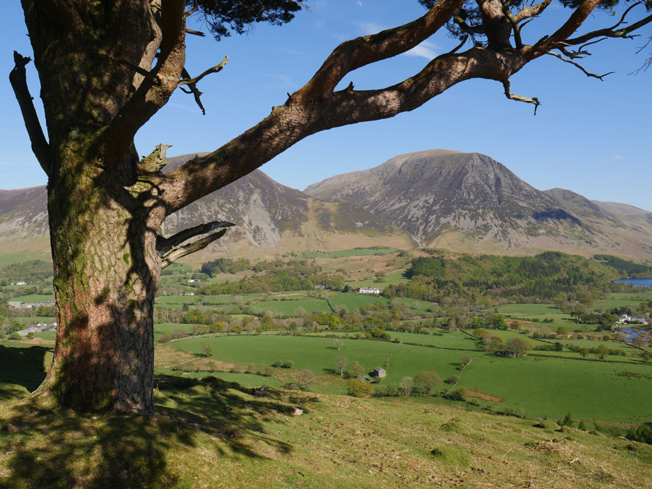
The path from Crabtree Beck continues on and we reach the pine tree on the Lorton Valley side of Low Fell.
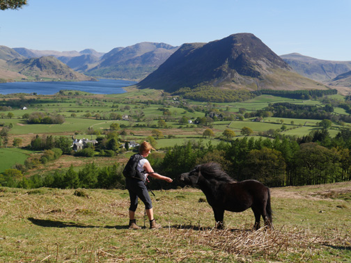
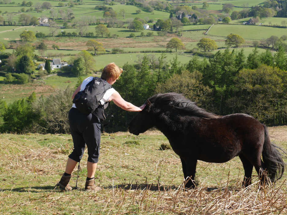
. . . so the pony has to content himself with a rub on the forehead today.
Last view from the tree as we head down the path to the woods below.
The mixed woodland of Whinny Ridding . . . unusually dry underfoot due to the weather.
Out in the adjacent field the sheep graze on undisturbed by our passing.
The woodland track takes us across to Woodend house and Foulsyke.
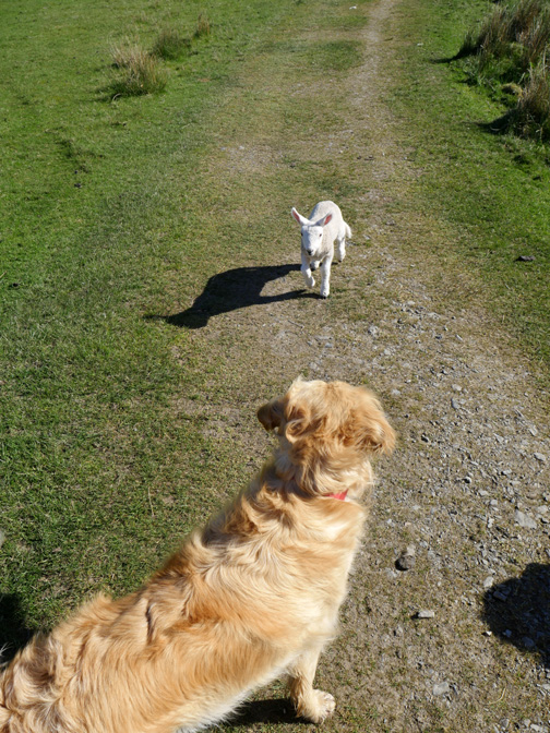
Confused and seemingly disappointed it returns to its real mum bleating away a short distance ahead.
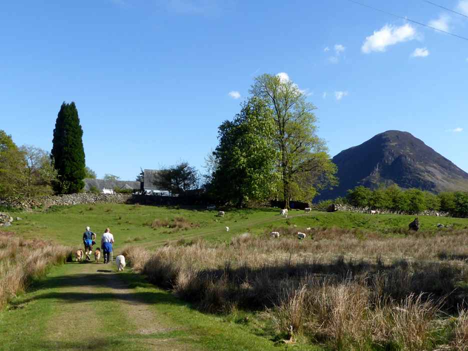
The view down the drive of Woodend house . . . not far to home now . . . I think I am beginning to even taste the cake !
This flock has had a bonus afternoon tea of the farmer's sheep cake too, that's why they are all lined up in a row.
The final gate and we're home . . . someone put the kettle on ! - - - o o o - - - |
Technical note: Pictures taken with either Ann's Panasonic Lumix TZ60, or my Panasonic Lumix Gx8 Camera. Resized in Photoshop, and built up on a Dreamweaver web builder. This site best viewed with . . . someone called Polly . . . to put the kettle on. Go to Top . . . © RmH . . . Email me here Previous walk - 28th April 2017 - Visitors, Weddings, History and Walks A previous time up here - 10th February 2014 - Darling Fell Walk Next walk - 4th May 2017 - Staveley and Retson Scar
|