![]()

Remember: Press F11 for a full
screen view of this page.
|
|
|
Remember: Press F11 for a full
screen view of this page. |
|
" Darling Fell with Jo " Date & start time: Monday 10th October 2016, 1.45 pm start. Location of Start : The Mosser Road end, Loweswater , Cumbria, Uk ( NY 128 217 ) Places visited : Jon's seat, Darling Fell and back around the front of the fell. Walk details : 2.1 mls, 800 feet of ascent, 1 hour 45 mins. Highest point : Darling Fell, 1270 ft - 391m. Walked with : Ann and Jo, plus our dogs, Harry and Dylan and Amber. Weather : Sunny with blue skies and clear views. |
© Crown copyright. All rights reserved. Licence number PU 100034184. |
|
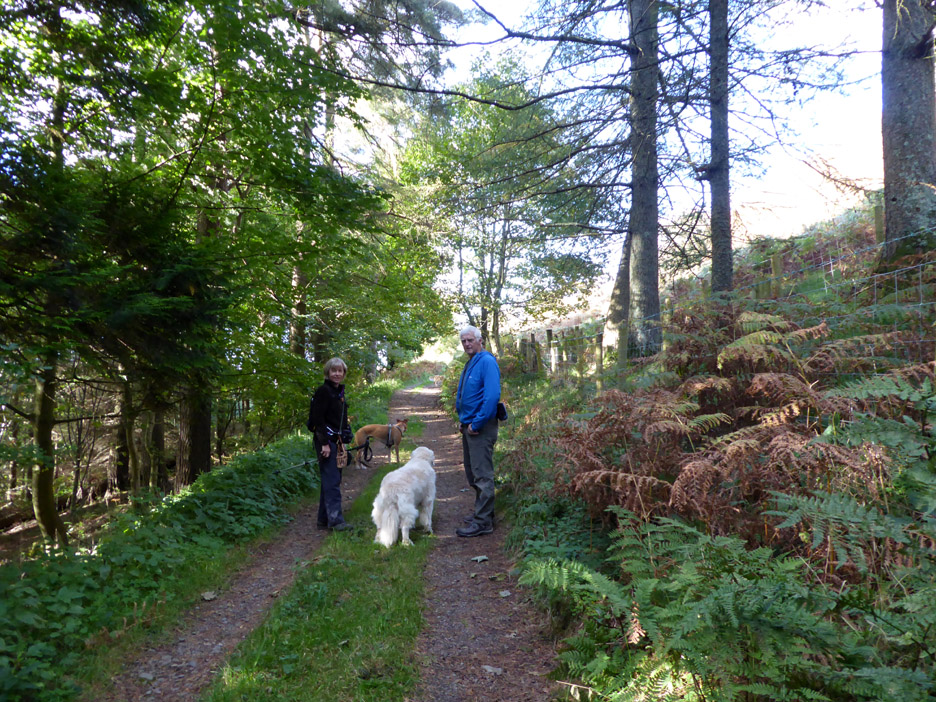
This time Jo came over to us for a walk today. It was a beautifully sunny day and so one with good local views was needed. With the changing colours of the season it was decided that a climb up Darling Fell through the woods would be just about right.
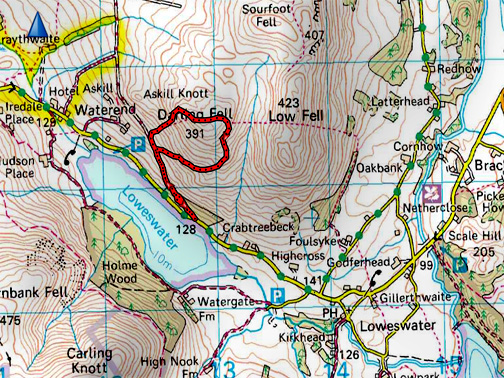
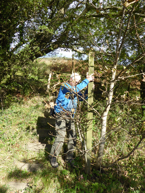
The old Mosser Road . . . looking older and more overgrown with the passage of years, the lane that is . . . hopefully not us !
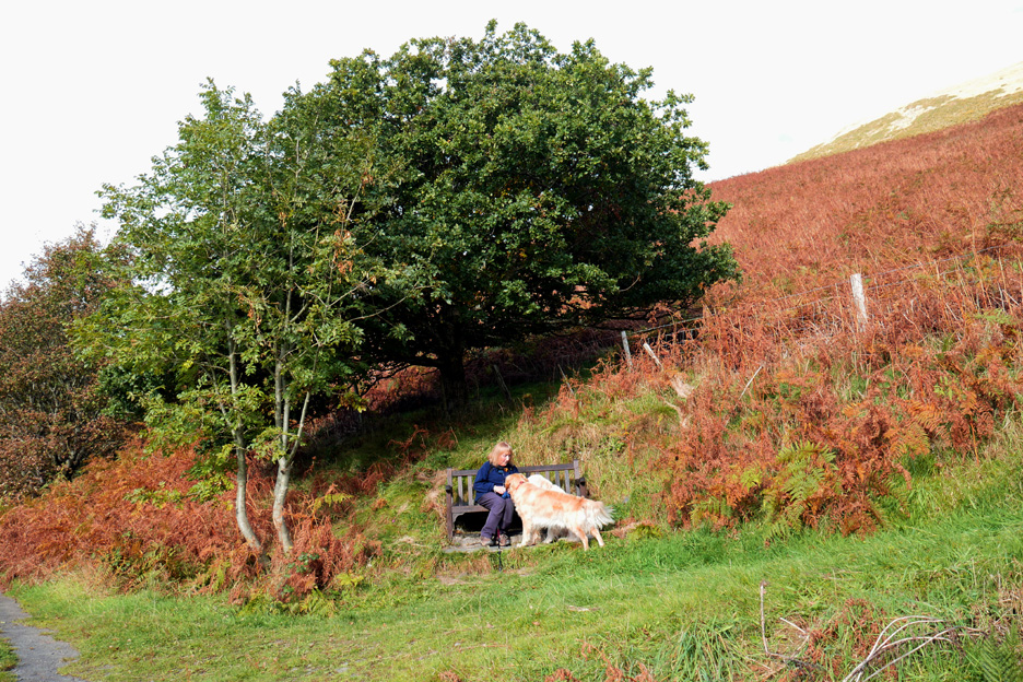
Up at Jon's Chair . . . convention has it that it is time and place for a dog-treat . . . for the dogs that is !
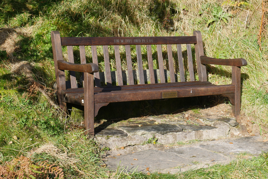
Local enquiries have failed to find information on who Jon W and Enid G (Micky) Duff were, but they have a very well maintained memorial seat in a delightful position overlooking the lake.
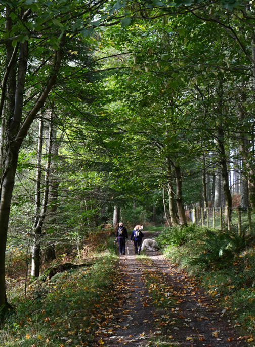
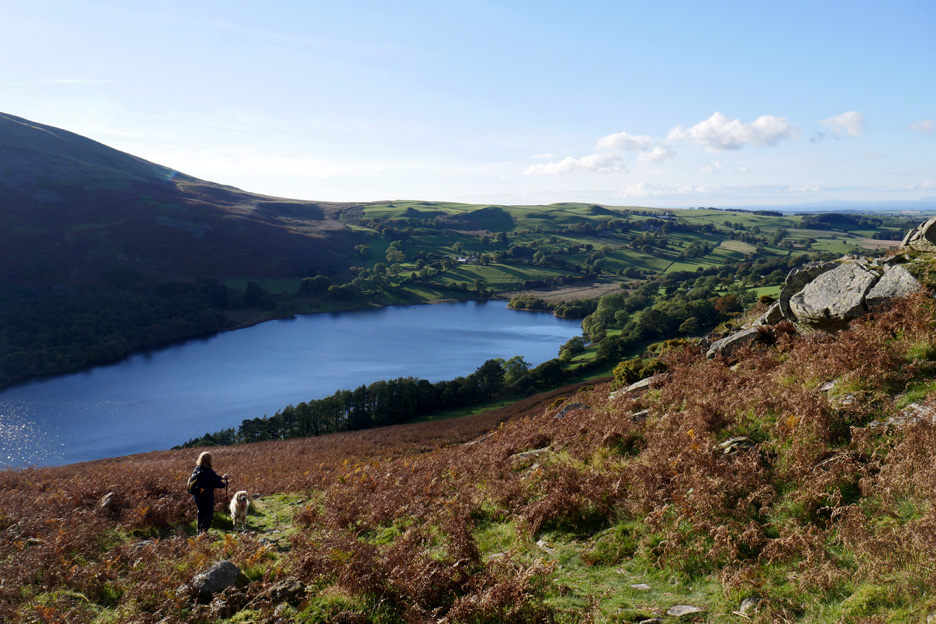
The views open out as we start the climb.
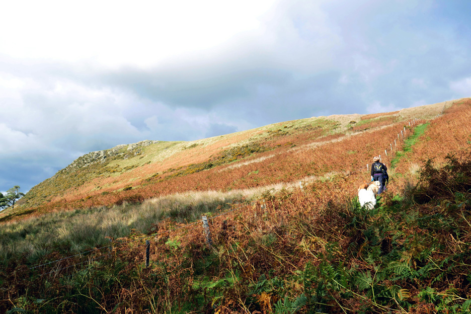
This is the popular ascent of Darling Fell from this side . . . but it gets steep towards the top. To the left is the rocky outcrop of Askill Knott.
Today the view to the north is very clear, to the extent that we can make out the colours of the fields on the Scottish Coast.
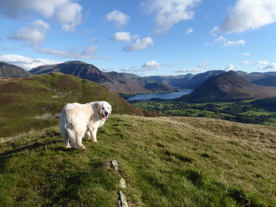
Levelling out as we reach the top. Darling is a lovely grassy fell and consequently good grazing for the local sheep . . . give or take a bit of bracken on the lower slopes.
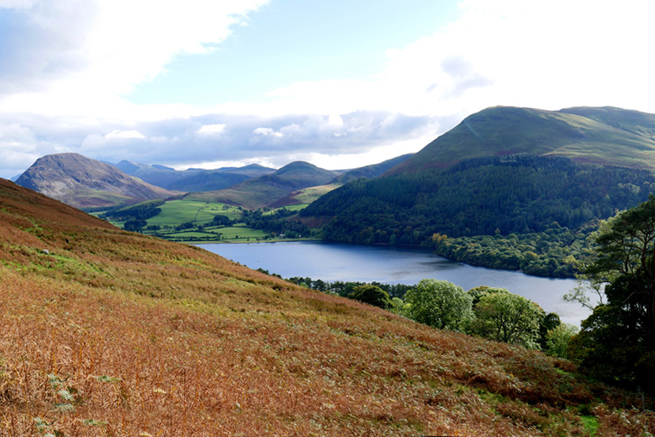
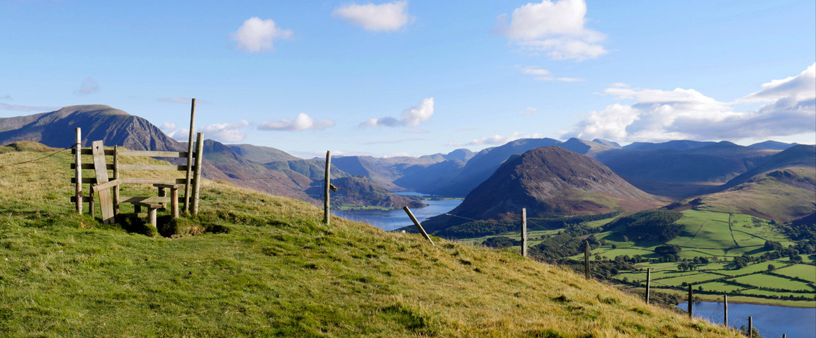
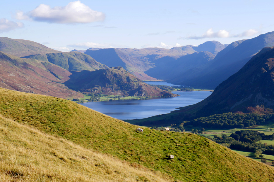
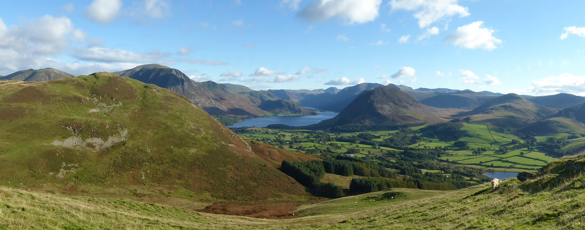
The view down the Buttermere Valley. This could be sub-titled " the view of High Stile from the high stile" but that would be a little misleading as the High Stile Ridge is almost hidden behind the heather covered bulk of Mellbreak.
For the bigger view and to see where the various stiles fit in the picture . . . Click here or on the picture for a Loweswatercam 360 degree annotated panorama.
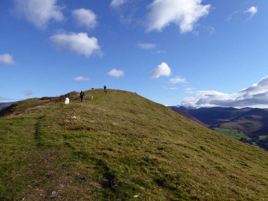
The summit cairn of Darling Fell is in fact not on the summit at all. It lies 100 yards east, on the highest part of the fell when viewed from the Buttermere direction.
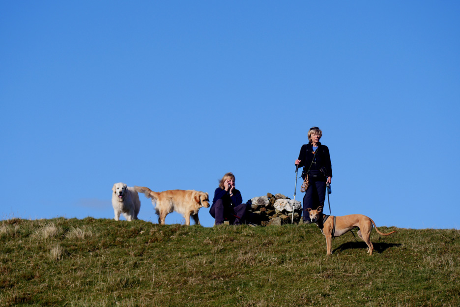
The rest of the party stands by the cairn as I go in search of a photo. Please note, Ann is not on the phone, she rarely caries one !
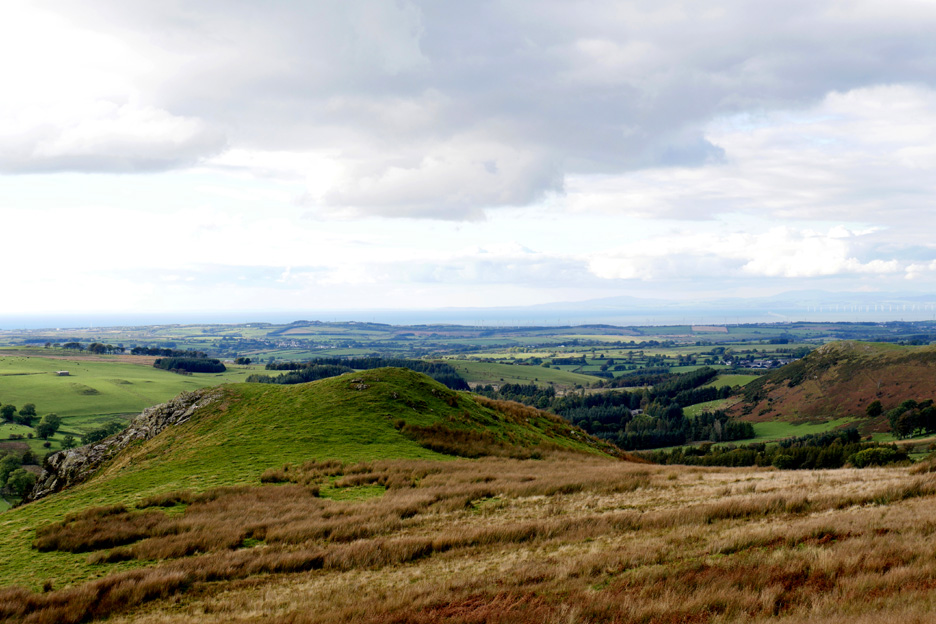
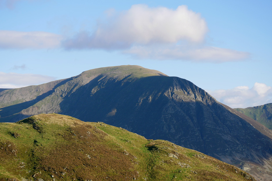
Grasmoor looking across the southern cairn and viewpoint of Low Fell. Here's another fell where the summit is set back from the "top" of the fell when viewed from the valley.
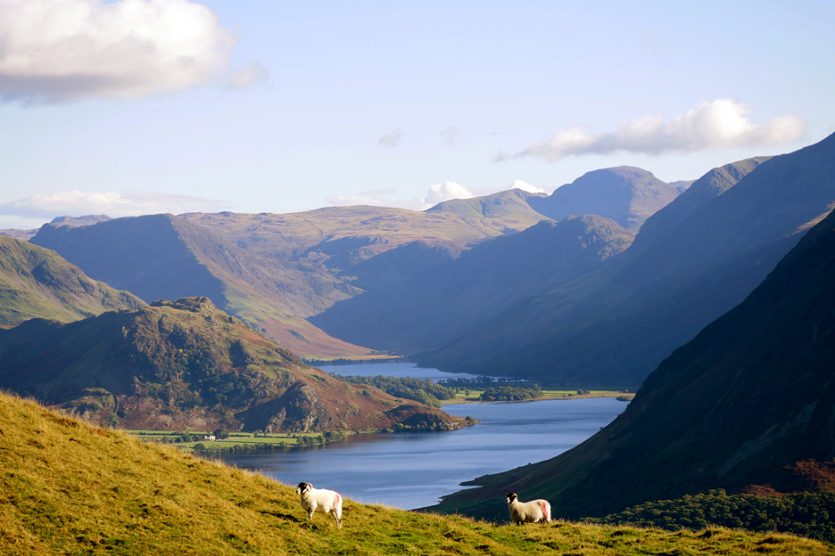
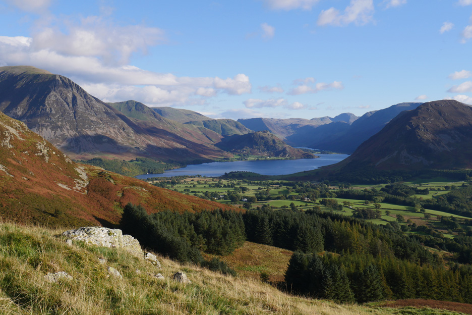
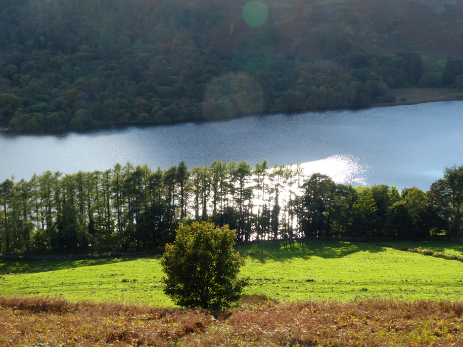
Picture postcard view of Crummock and Buttermere.
Zoom in and add a couple of "Derry Brabbs" He always said that a couple of sheep in the foreground adds depth and interest to the photo.
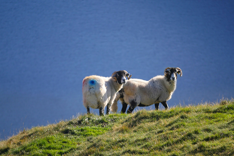
Centre stage this time . . . two of the Swaledales against the backdrop of Loweswater this time.
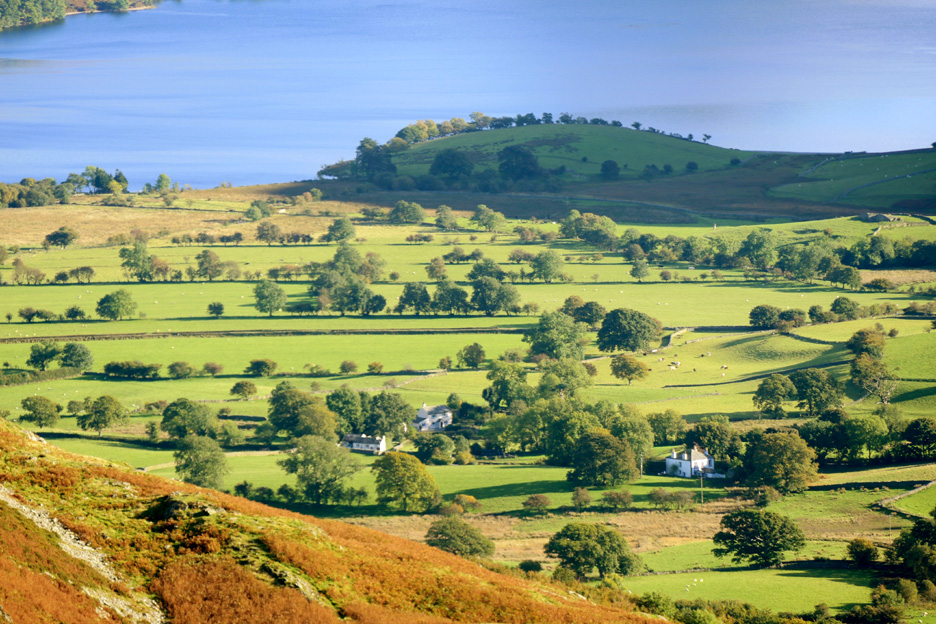
Loweswater hamlet with a well known cottage and the larger, square-built Vicarage. The headland behind is known as The Pele or Peel and has an old historic but ruined farmstead and is surrounded by prehistoric earthworks suggestive of a moat and promontory fort, possible Bronze or Iron age in origin. [ The whole area of the headland is a scheduled ancient monument according to the National Trust, Local History Survey.]
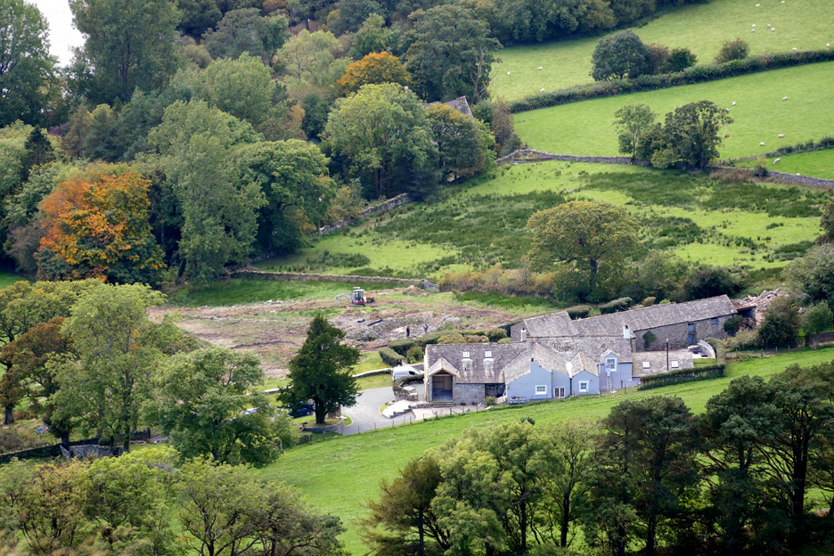
A newer development . . . that of the old Myresyke Farm immediately below Darling Fell . . . a mere three or four hundred years old. They are doing some drainage work in the front field by the look of it.
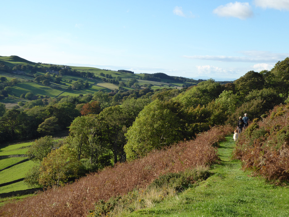
Onward and downward now . . . descending by the eastern side in a gradual circle around the front of the fell. There are no paths here just open grassland and a few odd sheep tracks.
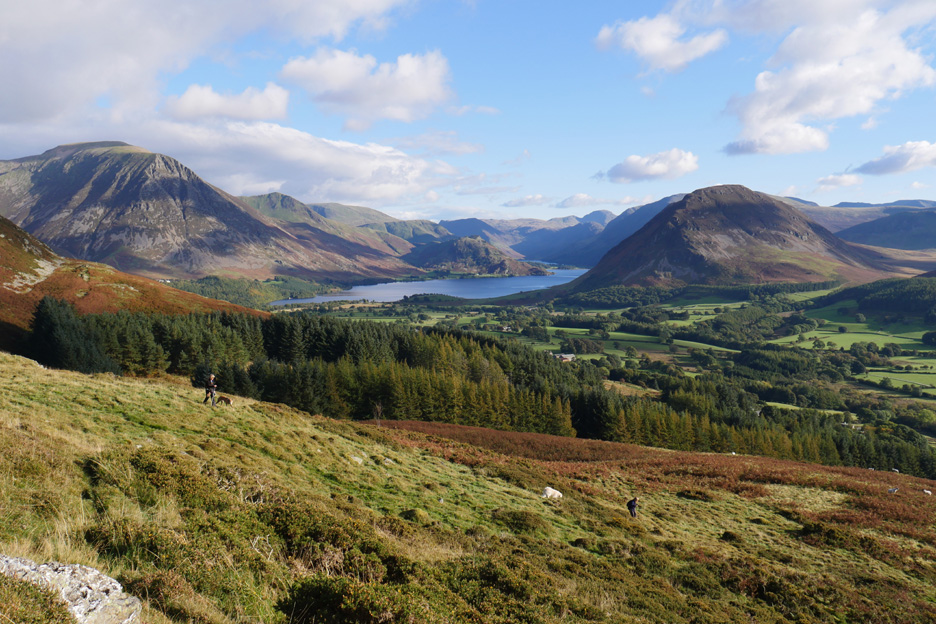
Mature coniferous woodland flank the Crabtree Beck as it emerges from the valley between Darling and Low Fell. Ahead, the classic view of Crummock, more often seen from the viewpoint on Low Fell itself.
Ann and Jo take a slightly lower track . . .
. . . but we all end up on the same path that leads down to the old quarry.
Nearly down at Jon's seat once again . . . does that mean two lots of bonus dog treats in one day ?
The view down to Loweswater . . . where the bright sunshine sparkles on the lake. Home now for tea and hopefully a piece of cake if we are in luck. - - - o o o - - -
A nice day deserves a nice sunset and so it turned out. Hope you've been able to take advantage of the nice weather recently. - - - o o o - - - |
Technical note: Pictures taken with either Ann's new Panasonic Lumix TZ60, or my Panasonic Lumix Gx8 Compact System Camera. Resized in Photoshop, and built up on a Dreamweaver web builder. This site best viewed with . . . more lovely weather including an orange sky sunset. Go to Top . . . © RmH . . . Email me here Previous walk - 8th October 2016 - Pikeawassa and a Sunset A previous time up here - 10th February 2014 - Darling Fell Walk Next walk - 19th October 2016 - Knock Murton with Trevor and Gill
|