![]()

Remember: Press F11 for a full
screen view of this page.
|
|
|
Remember: Press F11 for a full
screen view of this page. |
| " Whit Beck 16 months On " Date & start time: Wednesday 27 th January 2016 2.45 pm start. Location of Start : The Whitbeck Bridge, Lorton, Cumbria, Uk ( NY 158 250 ) Places visited : A local walk following the new river down to the River Cocker. Walk details : 1 mile, approx 40ft of ascent/descent, 1 hour. Highest point : Whitbeck Bridge over the river at the start ! Walked with : Myself and our dogs, Harry and Dylan. Weather : Cold and damp with an extra passing shower. |
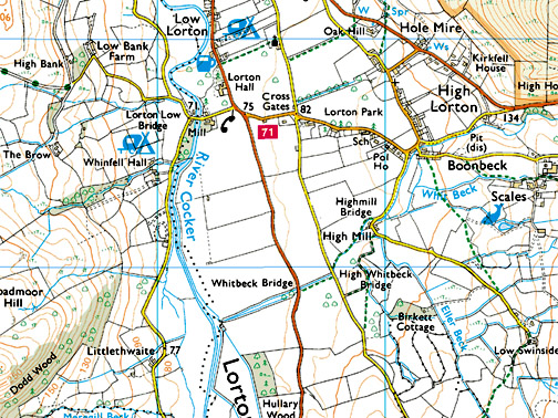
© Crown copyright. All rights reserved. Licence number PU 100034184. |
|
Back into a very consistently wet period of winter weather in the Cumbrian Fells and walking most places, high or low has to be done with waterproof footwear. Today I 'increased the anti' and donned wellington boots for a walk in Lorton Valley
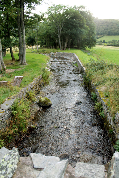
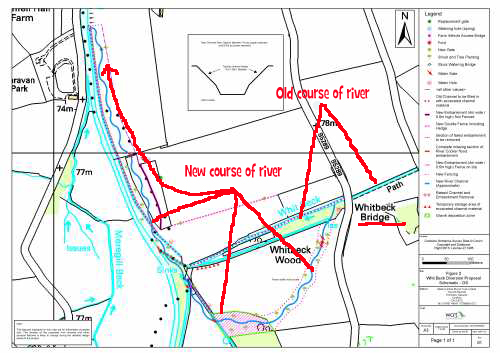
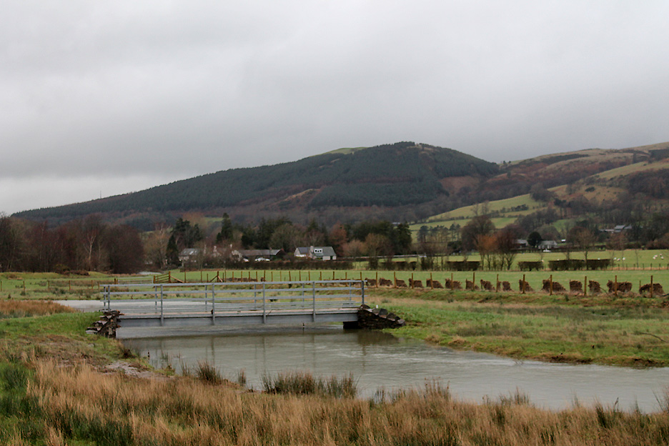
The Whit Beck Scheme was designed and constructed two years ago now and its purpose was to re-naturalise the canalised river into a more natural line of flow. The purpose was to dissipate the flood effect of Whit Beck (Boon Beck) by allowing it to flood and to spread its gravel load before it reaches the main river. Hopefully a more wildlife-friendly environment will follow.
The rainfall in recent days has risen again and the water levels are up after a relatively dry spell, relative because it seems to have rained every day since the snow of early January.
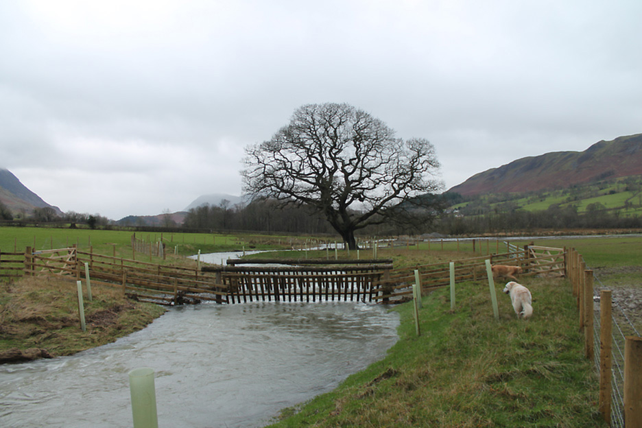
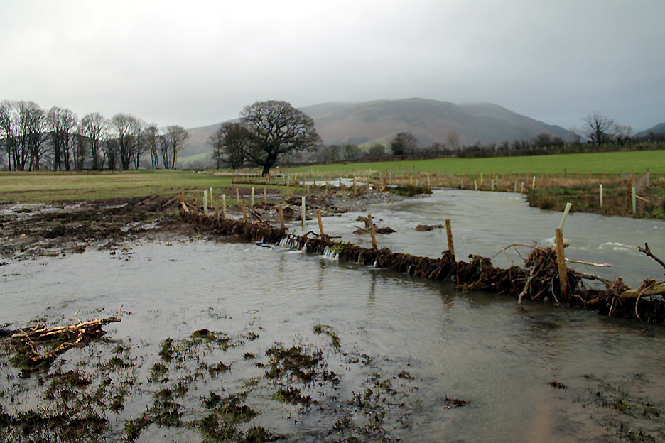
The flooded Whit Beck has overflowed in a dramatic and damaging way. Hold your cursor over the picture to see that change
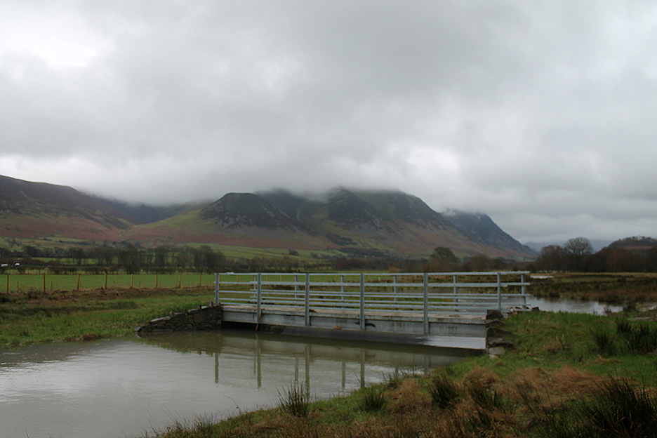
Today it is at a level that allows it to leave the bed of the river. It has been at least a foot or so higher according to the "tide line" on the field.
The little pond on the inside of the bend has been overwhelmed. Hold your cursor over the picture again to flash back over four months.
The fence around the watering locations for farm animals has survived due to it's streamlined shape. However it has been inundated and subjected to a lot of river flotsam.
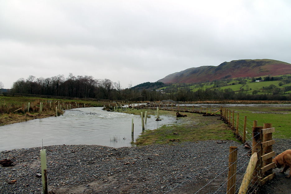
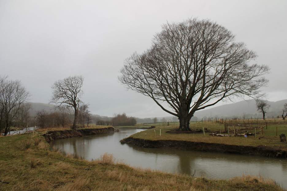
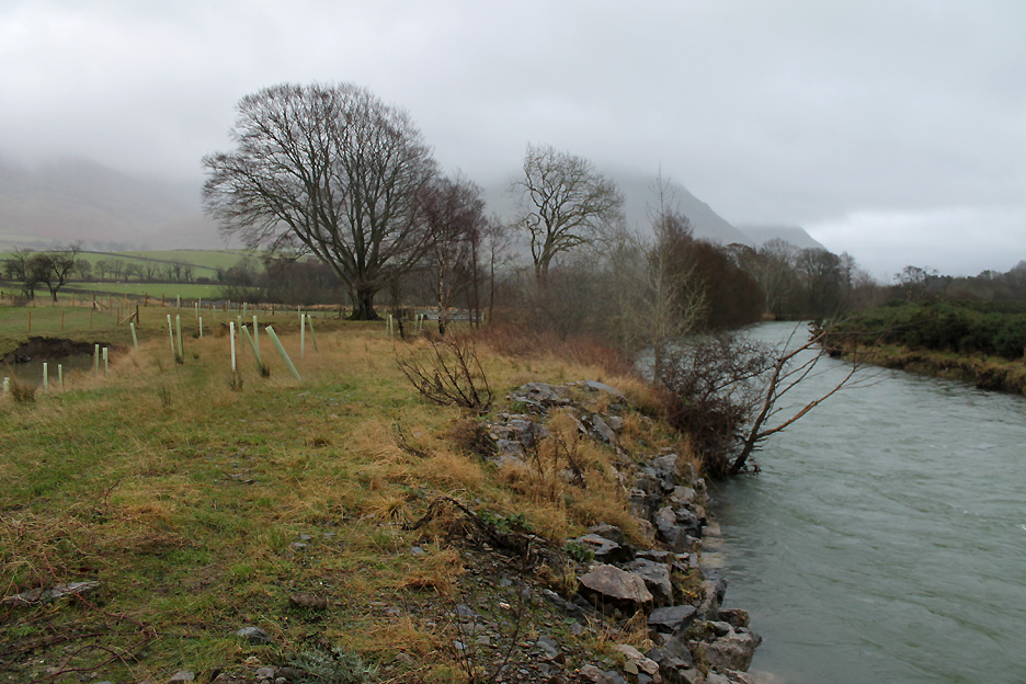
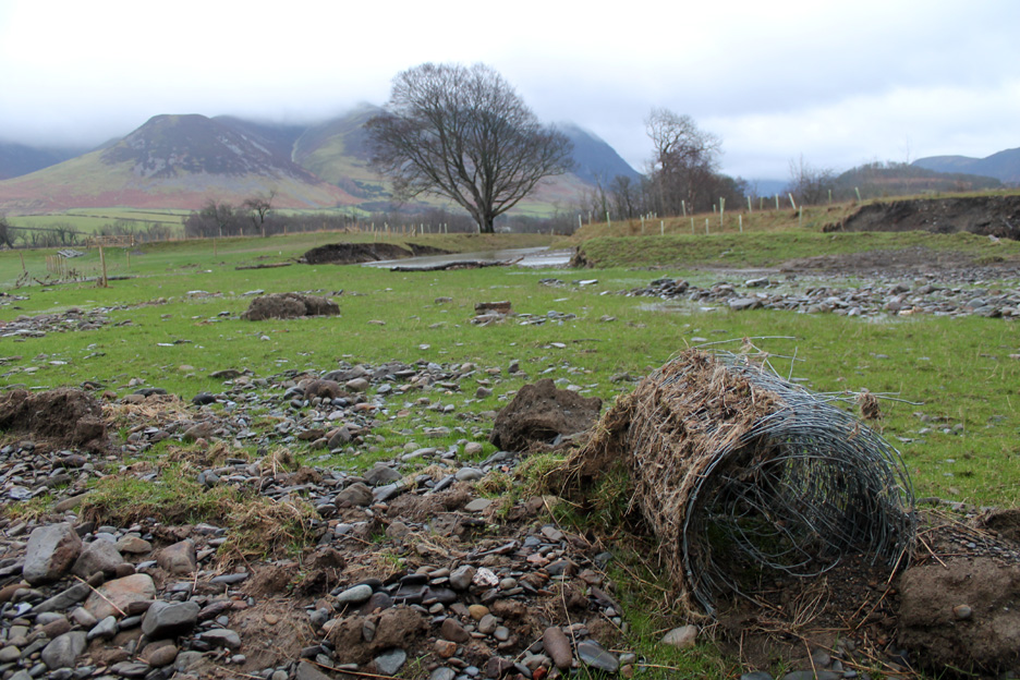
The large Beech Tree still dominates . . . but that area has changed as the river has heavily eroded the outside of the bend. The main river is just the other side of a narrowing river bank.
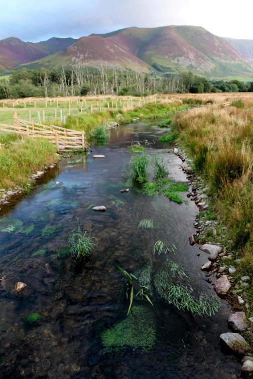
Looking back at the same tree and the stone faced River Cocker channel.
More erosion further down as the graduated banks have been undercut.
The meandering course has allowed the gravel to settle out . . . as expected . . . but perhaps not in the quantity expected. Oh yes . . . and another rain shower is passing overhead !
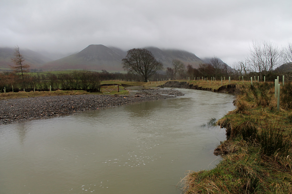
The main river is also nearing the top of its bank. The pool this side of the tree and the fence debris tells of previously higher water levels.
Looking across the main river to the Whinfell Chalet Park.
Most sheep around here are white but the flood has brought out a brown flock from somewhere. Only joking . . . the sheep outlines are more debris clinging to the fence of the adjacent pasture.
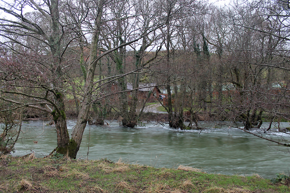
The end of the road as the Whit Beck reaches the River Cocker.
It has stopped raining and I turn, cross over the bridge and walk back up the other side.
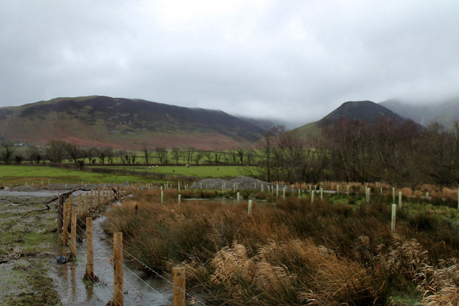
Keeping to the fence line as the river edge is muddy and the adjacent scrape is flooded out.
A problem that many farmers in Cumbria are faced with once again . . . gravel everywhere. Not having Ian from the Rivers Trust I can't ask if this was designed to happen here.
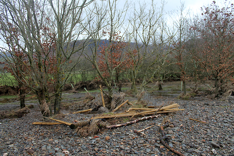
The water has damaged fences and new gate structures, now washed up and caught by the trees alongside the river.
The debris tells of more problems . . . washed out field drains and plastic sleeves from newly planted vegetation.
The scheme was designed to slow the flood water, deposit the gravel away from the main river and protect the land and townships lower down the Cocker valley. It was also designed to improve wildlife habitat. The jury is out as to whether it has worked. Has the damage here had a long term, negative effect . . . I hope not. - - - o o o - - - Home now and time to clean and dry the muddy dogs.
An "afterwards" picture . . . he wasn't allowed in here "before" he was cleaned. Occasionally on walks I mention and even recommended the gear we use. Can I say that a recent purchase of this BTM Dog Hair Drier has been brilliant . . . think powerful vacuum cleaner in reverse It just blows the water out of the dog's hair . . . preferably done outside or in the front or back doorway . . . with a big reduction in the need for dog towels and the consequent laundry. A quick wash with a garden hose, a warm blow dry with this machine . . . and we have two clean and dry dogs. - - - o o o - - -
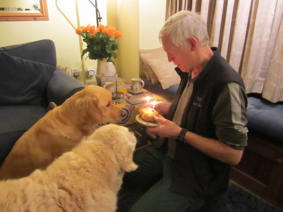
Another special event. Harry was 12 years old a few weeks ago . . . this week it was Dylan's turn . . . just two candles for him however ! - - - o o o - - - |
Technical note: Pictures taken with my Canon 1100D Digital SLR. Resized in Photoshop, and built up on a Dreamweaver web builder. This site best viewed with . . . a good pair of wellies. Go to Top . . . © RmH . . . Email me here Previous walk - 16th January 2016 - Sale Fell in the Snow A previous time up here - 15th September 2015 - The Whit Beck Project One Year On Next walk - 29th January 2016 - St Bees and Whitehaven in a Blow
|