![]()

Remember: Press F11 for a full
screen view of this page.
|
|
|
Remember: Press F11 for a full
screen view of this page. |
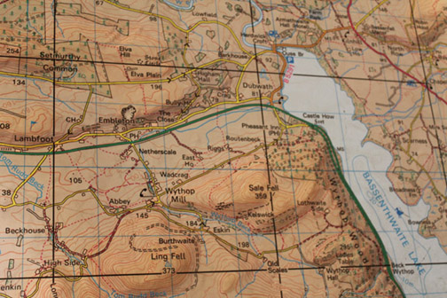
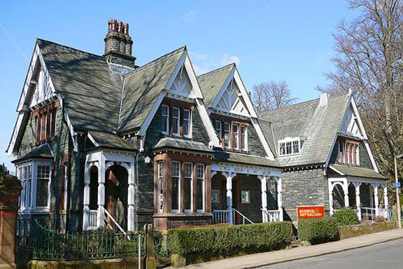
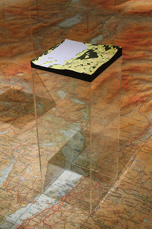
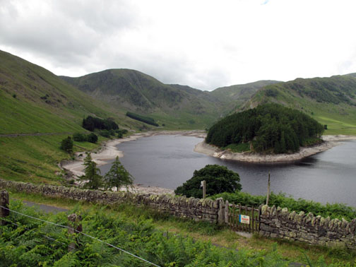
| " 3D Maps in a Digital Age " Date & start time: Wednesday 18 th March 2015. Location of Start : The Keswick Museum and Art Gallery, Cumbria, Uk ( NY 269 239 ) Places visited : The Museum in Keswick - a special evening invitation. Walk details : Did that this afternoon (see reference at the end) High point : Viewing the displays and the work that went into them. With : Ann, Tricia Kerr, Sue Mackay, Cllr Lorraine Taylor, Dr. Gary Priestnall and invited guests. Weather : A nice evening . . . but we were indoors so weather was not so relevant. [ (right) . . . a section of floor map of our afternoon walk today ] |
© Crown copyright. All rights reserved. License number PU 100034184. |
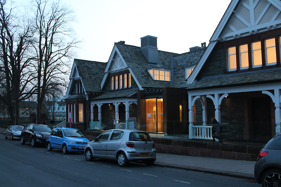
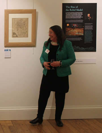
So . . . it was at 6.30 pm , washed and brushed up after our Sale Fell walk, that we found ourselves entering the door of the Museum in Keswick.
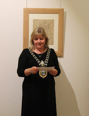
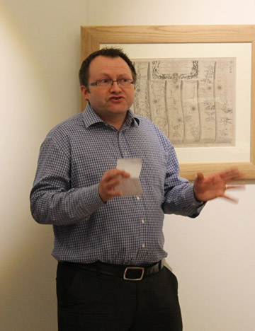
The evening started with a few brief words of welcome and explanation from . . .
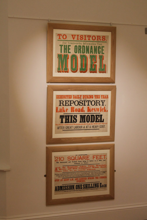
In the mid-Victorian Age, the 1865, the new railway to Keswick was opened and visitors to Keswick were encouraged to visit the Mayson's Store in Lake Road to view the wonderful new 3D map of the Lake District. This was early days of mapping and the widespread use of maps by the public, as we have today, had not even been contemplated.
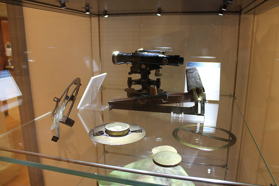
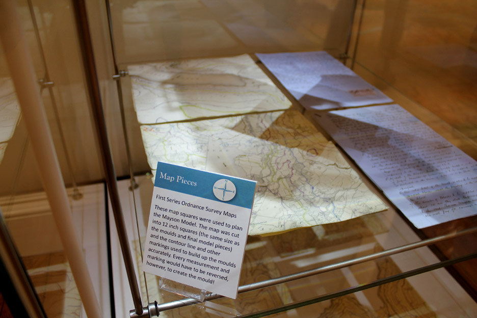
The government Ordnance Survey Department had however mapped the country in fine detail (6 inches to the mile) using basic map, compass and theodolite like those displayed.
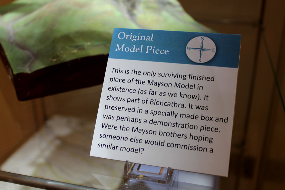
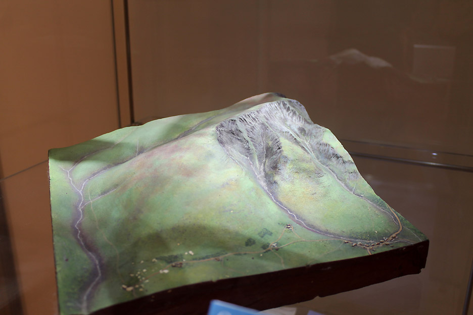
The model makers were commissioned by Maysons to create a scale model of the Lake District for visitors to come and view, so that they could gain an appreciation of where Keswick was and what they might see on their holidays.
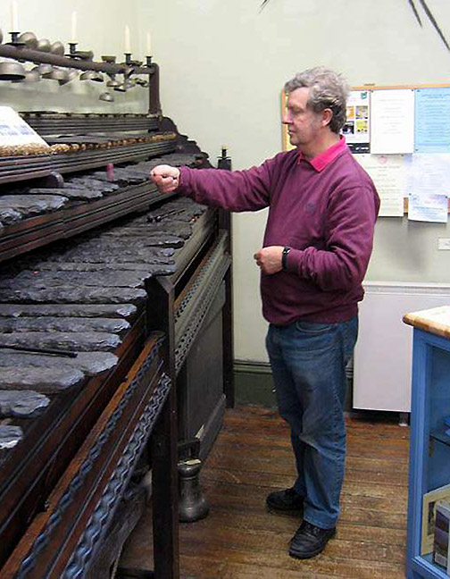
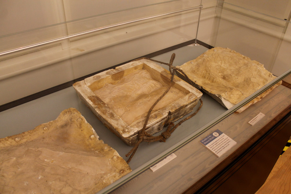
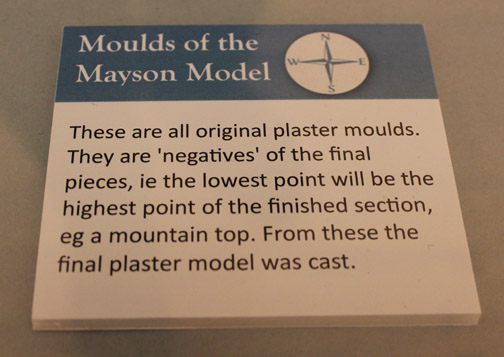
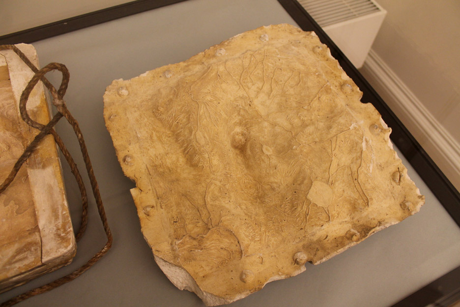
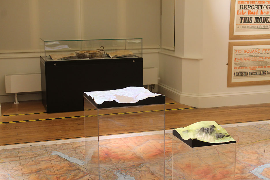
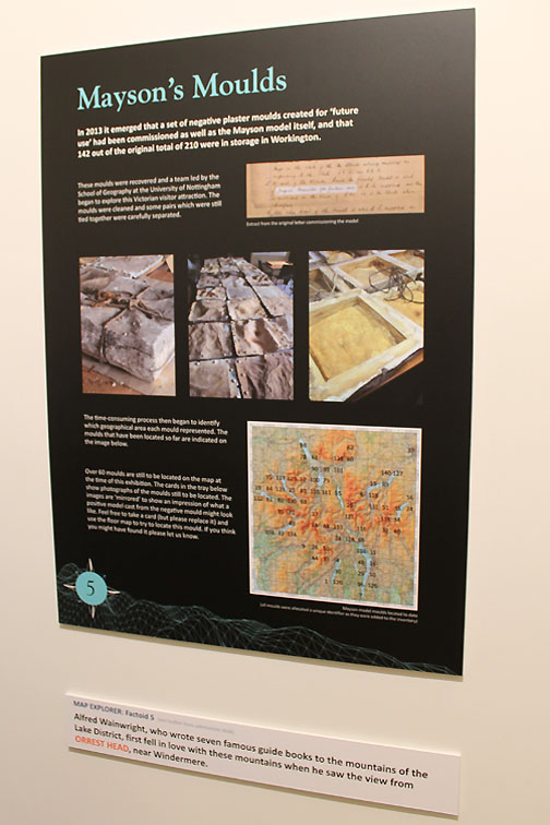
Plaster Moulds of the original Lake District model.
We were challenged to look at the moulds and try and work out which 2 mile square of the Lake District it represented. The clues here are the river-like lines and the flat patches that would represent lakes or tarns. Think reverse image - downs are ups ! Bold lines, especially double lines could represent roads or tracks. No houses are shown, they were added at a later stage. Can you have a guess . . . don't move on until you want the answer . . .
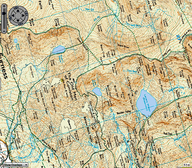
The mould represented the Coniston area with the three tarns being Levers Water, Low Water and Goat Water. North is off to the right and the map is turned to match the aspect of the mould in my photo.
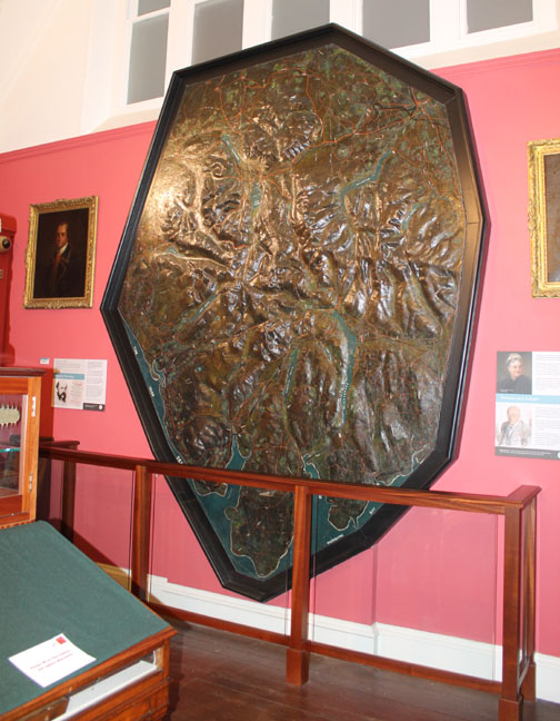
This is part of what the visitors would have seen . . . the 3D map complete with hand modeled and hand painted buildings.
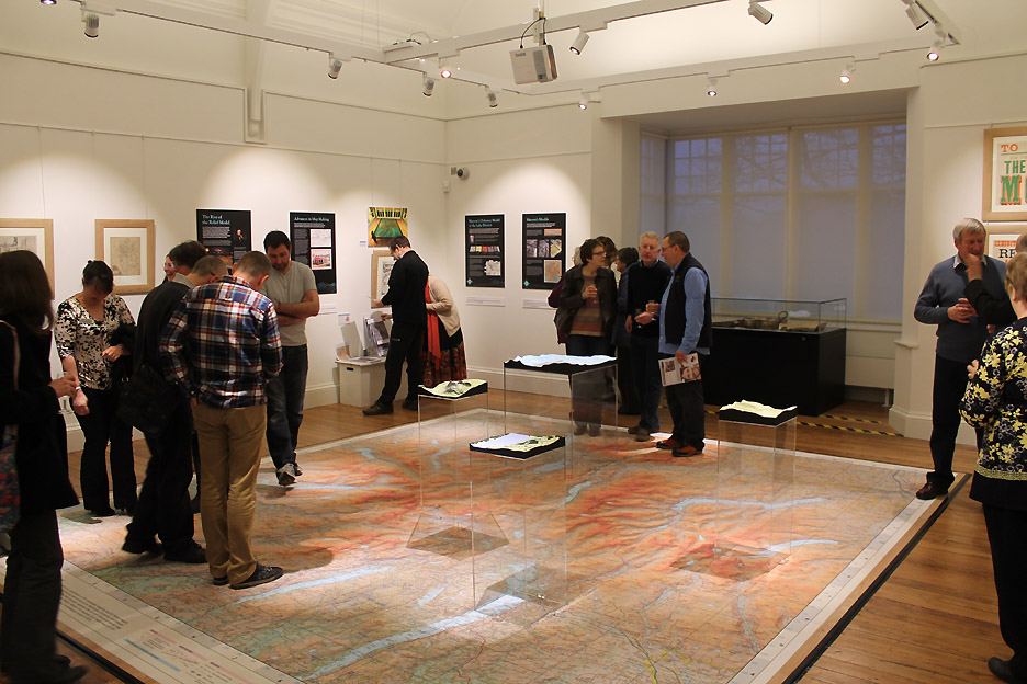
After the introduction we had chance to wander around the Lakes on the large 6 inch to the mile floor mat.
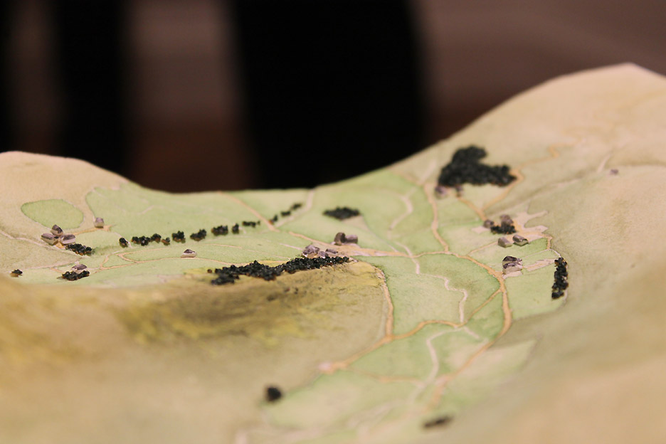
His second tile was of the Mardale Valley and the old Dun Bull Inn, before the 1930's flooding of the area by the Haweswater Reservoir.
Looking south west past the old pub, towards Harter Fell. The trees at the centre would be on the Rigg, the start of the climb up Rough Crag to High Street and Mardale Ill Bell. The valley to the right would therefore be Riggindale.
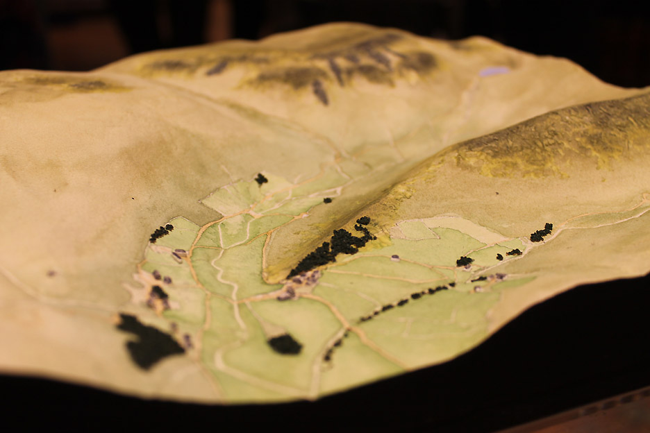
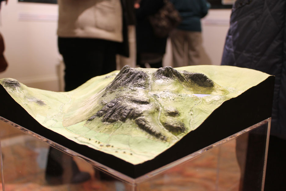
The third completed tile represents . . . well it looks like the Langdale Pikes to me ! Gary estimated that if he was to recreate the whole model using these techniques it would cost around £80,000. It would take a year to complete all the tiles to the original Mayson's standard.
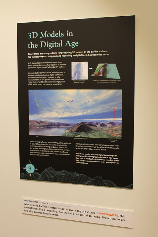
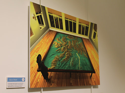
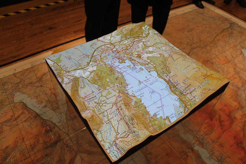
One alternative is to create a model using new computer technology . . . after all the exhibition was called "Mapping in the Digital Age". Here between the plaster moulds and the finished square is the fourth relief model, showing the landscape in the Keswick and Derwent Water area.
With a simpler relied base tile, created by scanning the old moulds or by reading the 'digital' Ordnance Survey data, one can then ask a computer-controlled milling machine to create a basic relief model. This allows you to overhead-project whatever map detail you wish onto the tactile relief background. Here an early twentieth century map is projected onto the model.
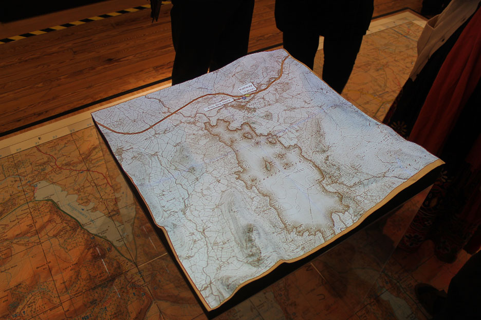
Now it has been changed to a late twentieth century O.S. 1:50k (the inch and a quarter) map. Hold your cursor over the picture to change the map again to the up-to-date 1:25k scale. Using modern technology and a simpler base outline one could recreate the Mayson's relief map without such great expense. - - - o o o - - - . Hit the start button to hear some of the thoughts of our speakers in this 2 minute introduction to the evening.
Our assembled guests tonight matched five possible tiles to the Maysons map but there are still many more to be recognised A trip to the Keswick Museum and Art Gallery could not only be informative, it could also be rewarding for Gary and all concerned. If you are in Keswick why not give it a try ? - - - o o o - - -
- - - o o o - - - |
|
Technical note: Pictures taken with either Ann's Canon Sureshot SX220, or my Nikon P520 digital camera. Resized in Photoshop, and built up on a Dreamweaver web builder. This site best viewed with . . . an understanding of maps and appreciation of the modeller's art. Go to Top . . . © RmH . . . Email me here Previous walk - 18th March 2015 - Wythop Mill and Sale Fell A previous visit to Mardale - 3rd July 2010 Selside, Branstree and Harter Fell
|