![]()

Remember: Press F11 for a full
screen view of this page.
|
|
|
Remember: Press F11 for a full
screen view of this page. |
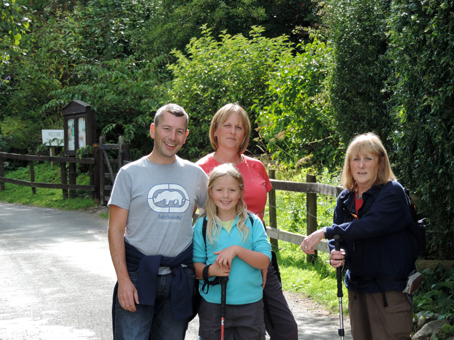
| " Fellbarrow with Paula, Al and Abi " Date & start time: Saturday 23rd August 2014, 2.45 pm start. Location of Start : Roadside at Thackthwaite, Cumbria, Uk ( NY 148 238 ) Places visited : Thackthwaite, Fellbarrow, Low Fell, down via the Old Pine to home. Walk details : 4.3 mls, 1460 feet of ascent, 3 hours 3 mins. Highest point : Fellbarrow, 1,363ft - 416m. Walked with : Paula, Al, Abi, Ann and our dogs, Harry and Dylan. Weather : Sunshine and blue skies but with gathering clouds, gentle NW breeze. |
" Fellbarrow with Paula and Al " at EveryTrail [ Alter the settings to zoom or change the Map, use Everytrail to download the Gps route ] |
|
We have family staying and after three days walking the Cumbria Way, Paula decides on a shorter walk but one no less beautiful on this sunny August day. Al is up for the Bank Holiday weekend and with Abi we set off to climb two local fells.
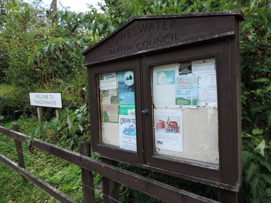
Role call today, Al, Paula, Abi and Ann . . . Tom the missing grandson is away in Switzerland with the Scouts. We start our walk at Thackthwaite after parking just outside on the Lorton side of the village.
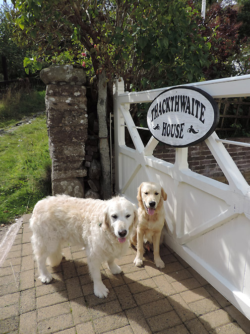
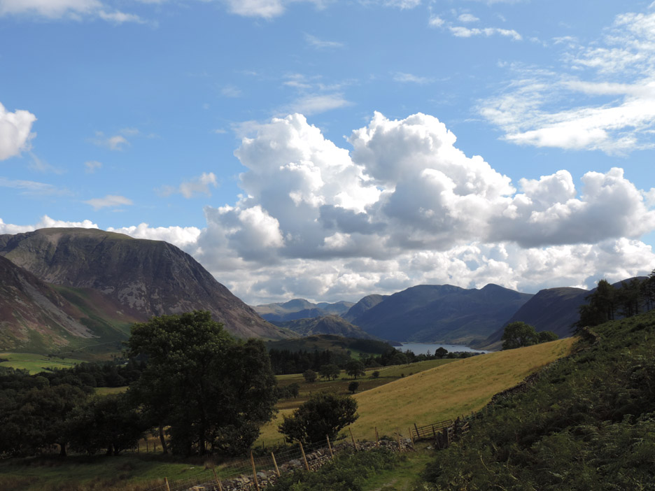
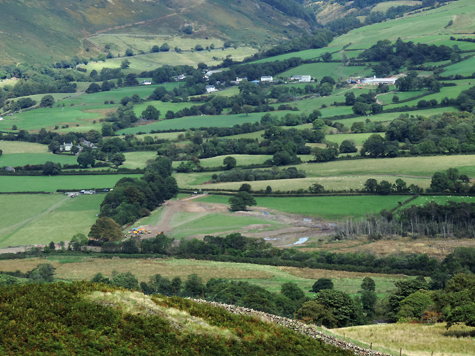
We set off up the lane alongside Thackthwaite House and soon climb up into the open fields above the village where we start to enjoy the views of the high fells on a day that is offering perfect long distance visibility.
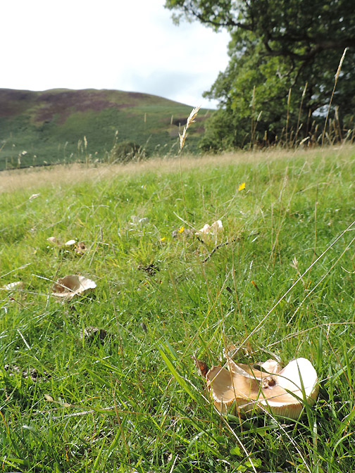
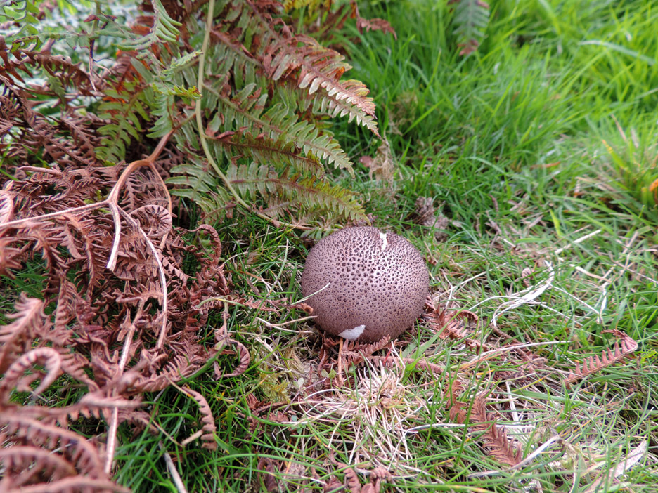
Not great on names but this one is a puff-ball.
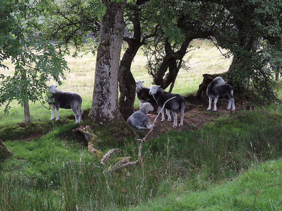
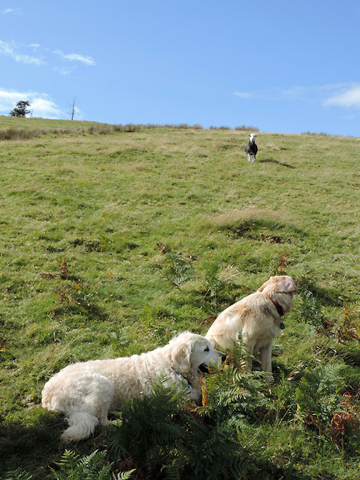
The sheep were certainly not eating them. They gathered together across the other side of the slightly muddy dyke as we progressed up the fell.
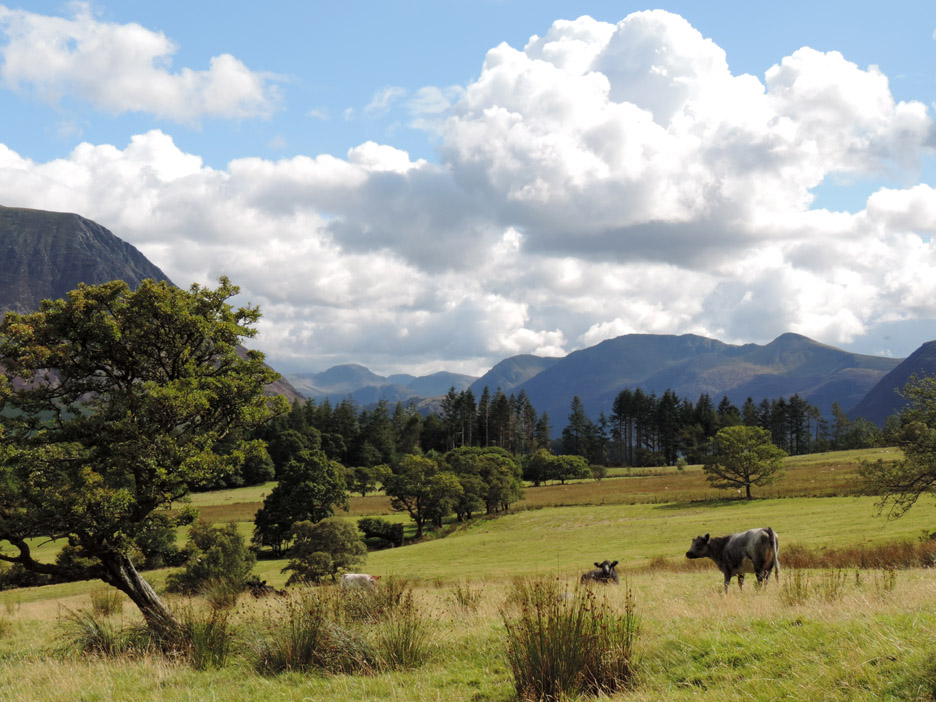
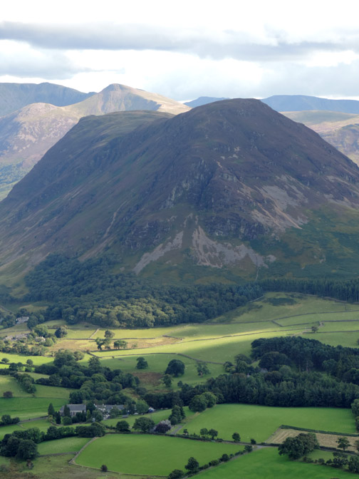
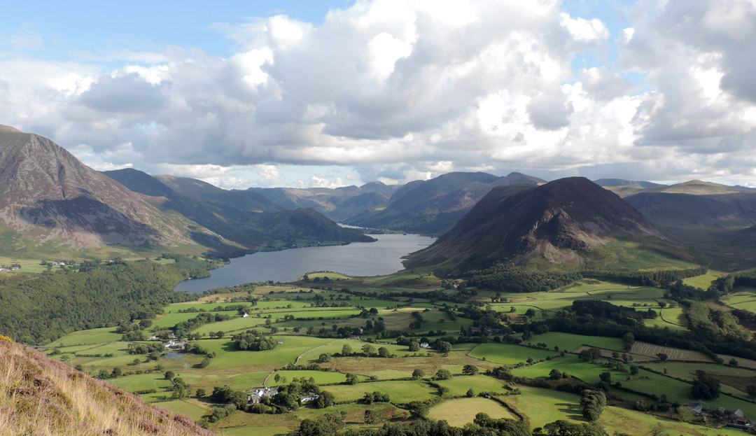
Out above the intake wall now and the long distance views up the Buttermere Valley are improving as we ascend.
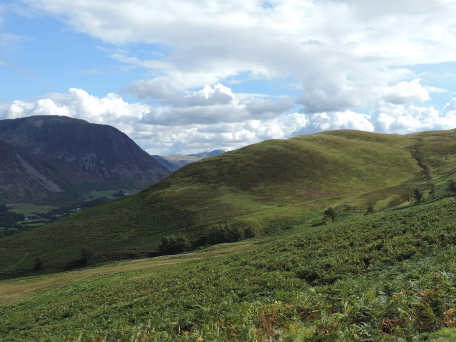
The direct path climbs on the old coffin road across the bracken covered slopes of Low Fell. We have diverted slightly to climb Fellbarrow as our first summit of the day.
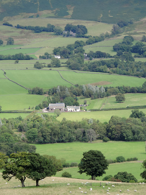
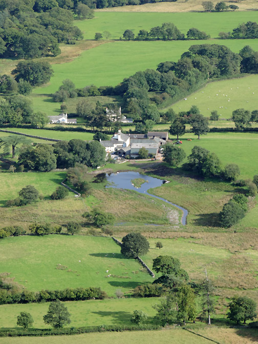
New House Farm is the location of the 2014 Loweswater Show Make a note in your diaries for the first Sunday in September . . Sept 7th . . . see you there.
In the field below is the new Whit Beck Restoration Scheme where the Rivers Trust is diverting the 350m direct drainage stream into a 1200m naturalised river landscape to aid wildlife and help prevent flooding of the River Cocker with gravel and silt. Whit Beck is the river that drains the Whinlatter fells and is known higher up as Aiken Beck.
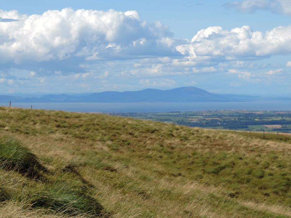
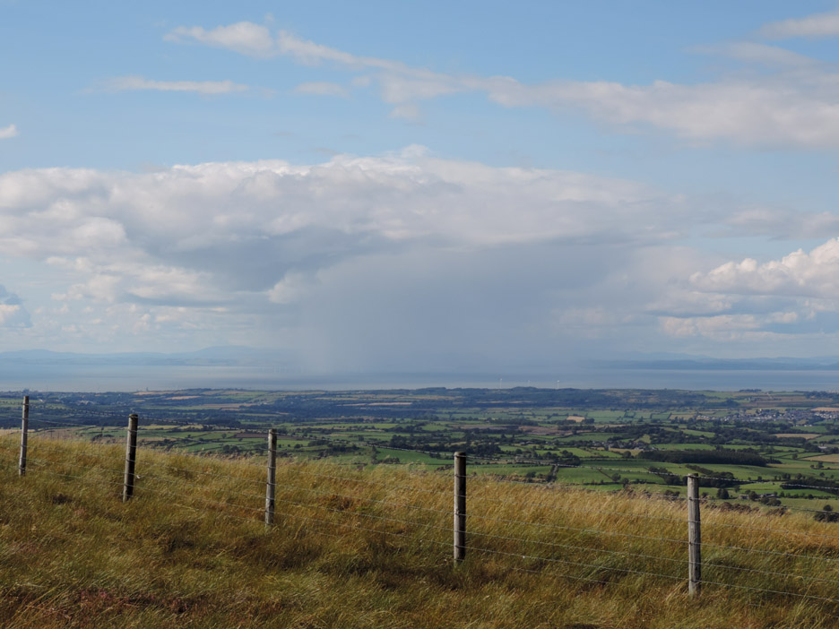
Scotland . . . the distinctive outline of Criffel seen over the Solway Estuary.
The clear visibility allows us to see a large rain shower out in the channel away to the north. The gentle breeze is a north westerly so it shouldn't be a problem for us today.
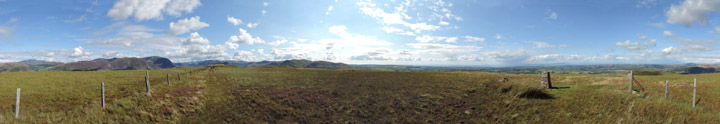
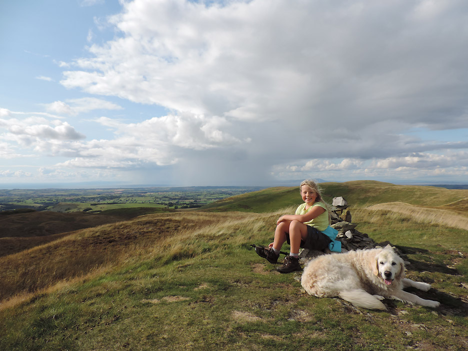
As the family strolls on toward our next objective, I take the opportunity for another famous Loweswatercam look around.
Click here or on the photo above for a Loweswatercam 360 degree annotated panorama from the summit of Fellbarrow.
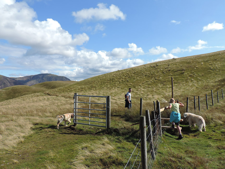
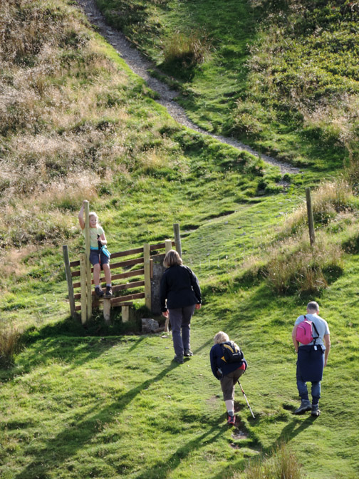
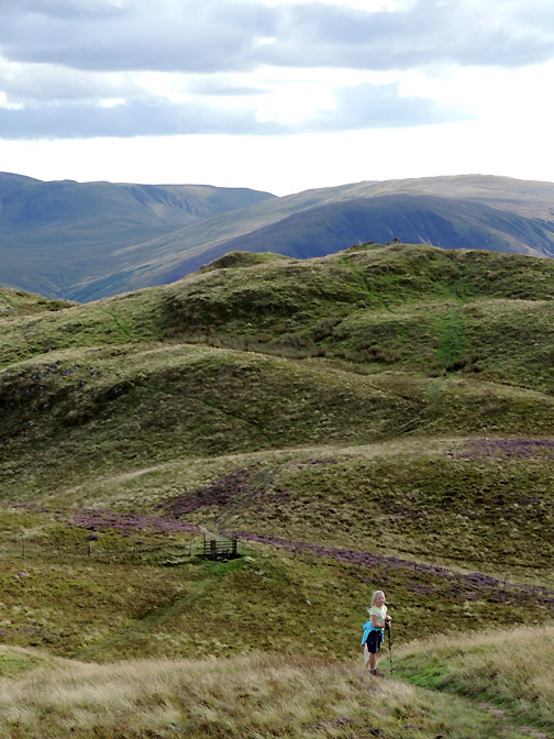
Today we'll skirt around Smithy Fell rather than go over the top. There's a new stile and a redundant gate. Abi uses one, Dylan sensibly ignores the other.
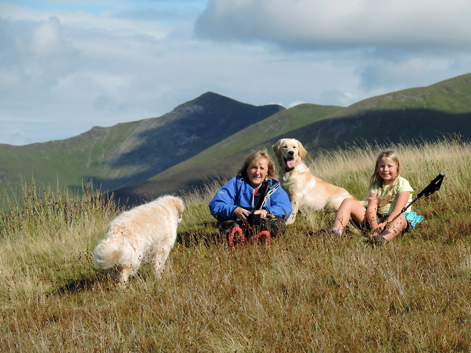
Watching on Watching Crag. We sit for a moment and enjoy the views . . . that's Hopegill Head behind.
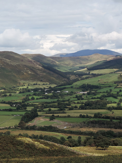
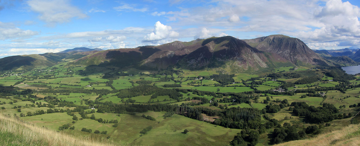
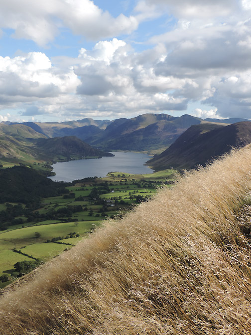
On the other side of the grassy knoll the views are extensive, taking in the whole of the Lorton Valley . . . no wonder it is called Watching Crag. Here the panorama extends from Lorton (with Skiddaw behind), right round to Crummock Water and encompasses the whole of the NW Fells.
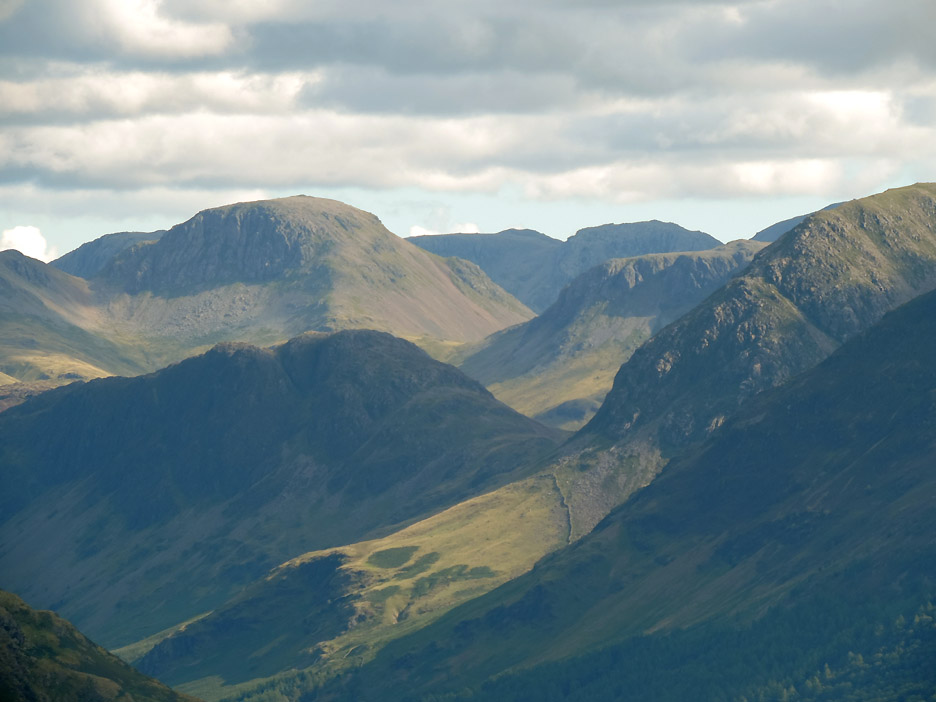
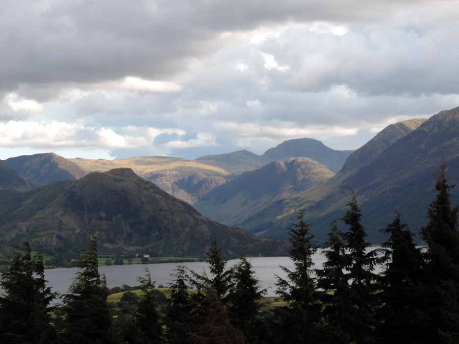
Round further we can see the Central and Southern Fells, with Mellbreak leading to High Stile, leading on further to Great Gable and Scafell Pike.
Closer in now and those individual fells stand out in the clear air.
Folds in the landscape . . . Mellbreak. High Crag, Haystacks, Kirk Fell, Great Gable, Broad Crag and Scafell Pike.
Fell number two, number four of Abi's holiday week with us. For those with an eye on the weather, that cloud defies nature, moving due south towards us despite the north westerly breeze.
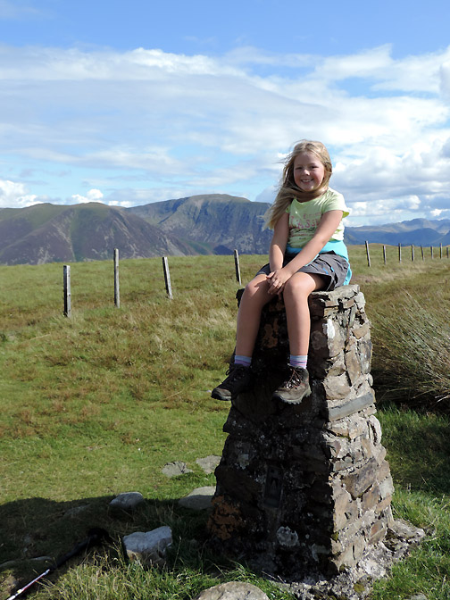
It's that girl again gracing the summit of the southern top this time.
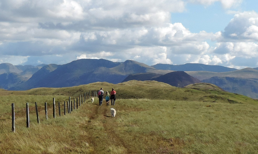
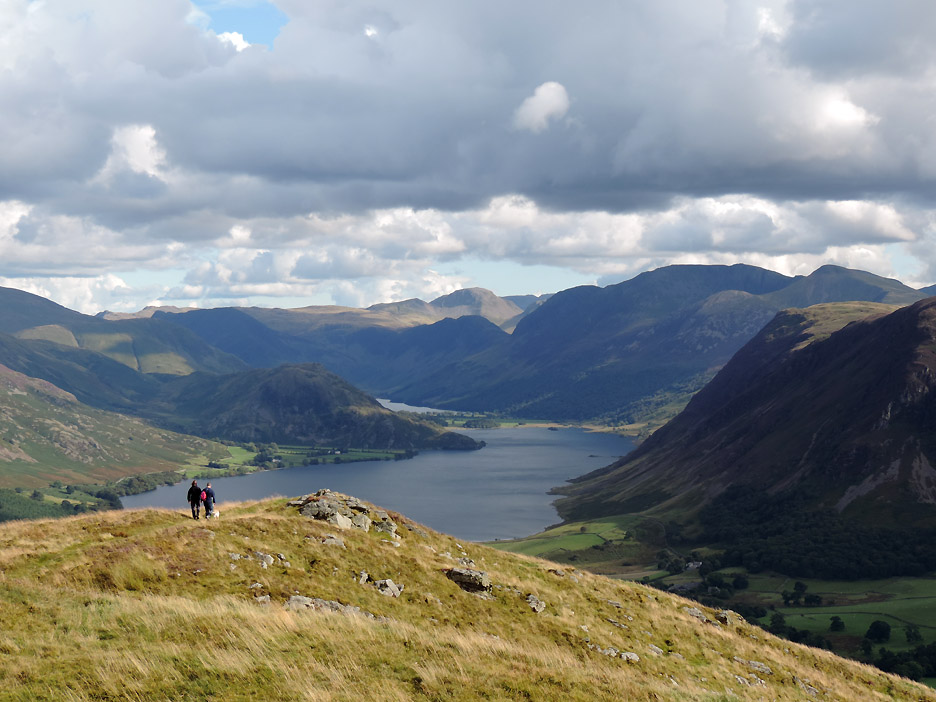
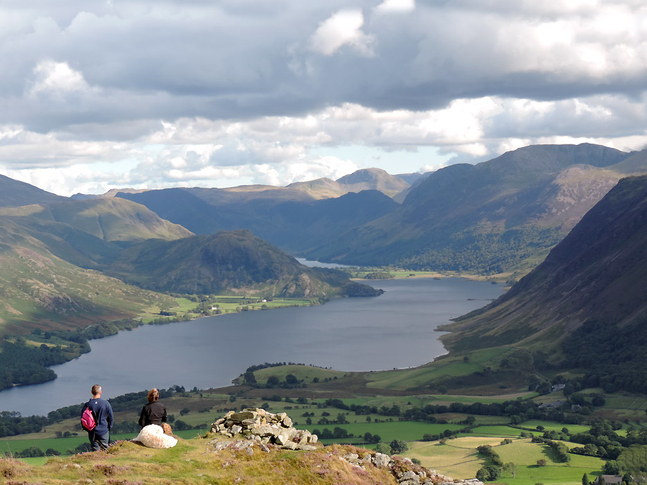
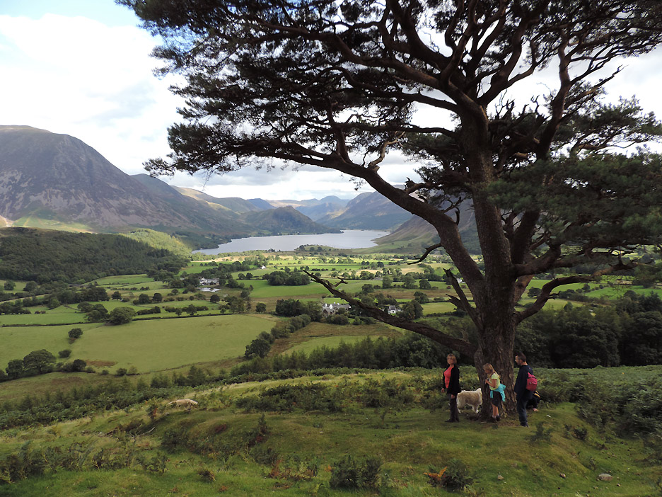
The best view however is from a little further on . . . so Paula and Al lead the way.
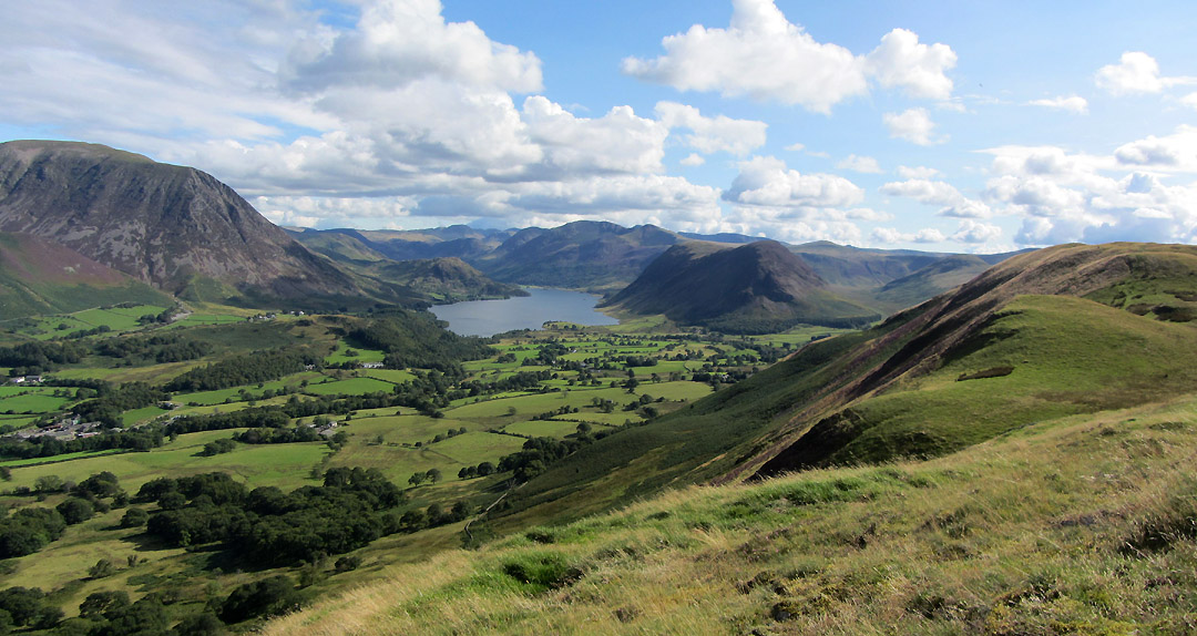
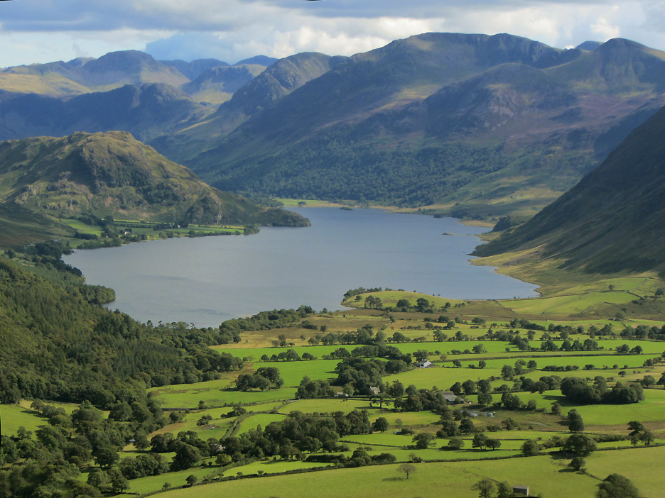
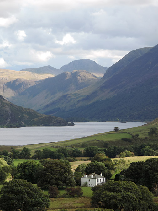
A rival to "Britain's favourite view" of Wast Water and the head of Wasdale. This is Crummock Water and the head of Buttermere. Technically Great Gable is at the head of Ennerdale Valley, the next one round, but who's counting.
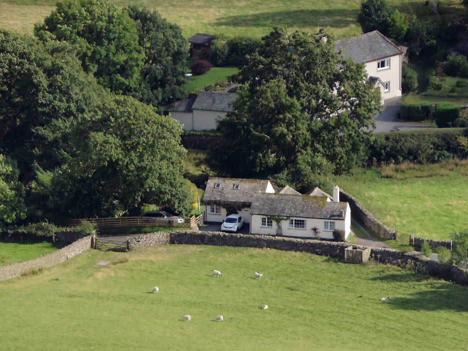
Zooming in our cottage from Low Fell. Our car isn't there as it's down in Thackthwaite at the start of the walk.
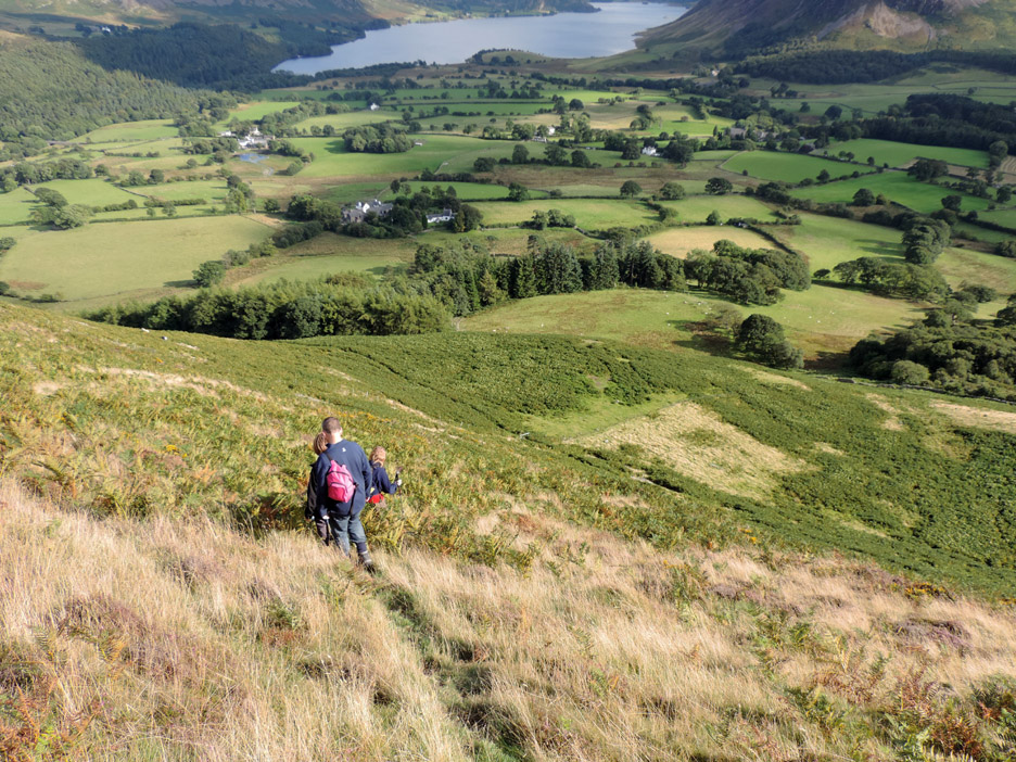
Time to think about heading down.
The path off the end is steep and slippery when the grass is very wet or, for that matter, very dry. Taking it slowly and carefully and following the sheep tracks avoids the main problems.
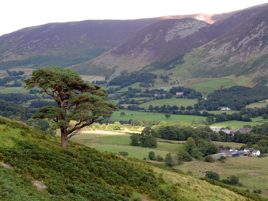
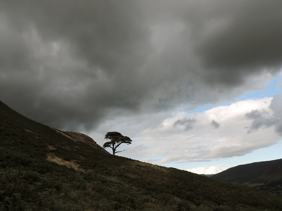
Down to the Old Pine Tree.
By the time we get here the cloud is building and the sun has gone in, making everything a little darker and cooler.
Like a great space ship in a wide screen movie . . . that dark rain bearing cloud has crossed the Solway Plain and has now caught up with us and now covers the sky above.
We'll look the other way and pretend we haven't seen it . . . perhaps it might not rain before we get home ?
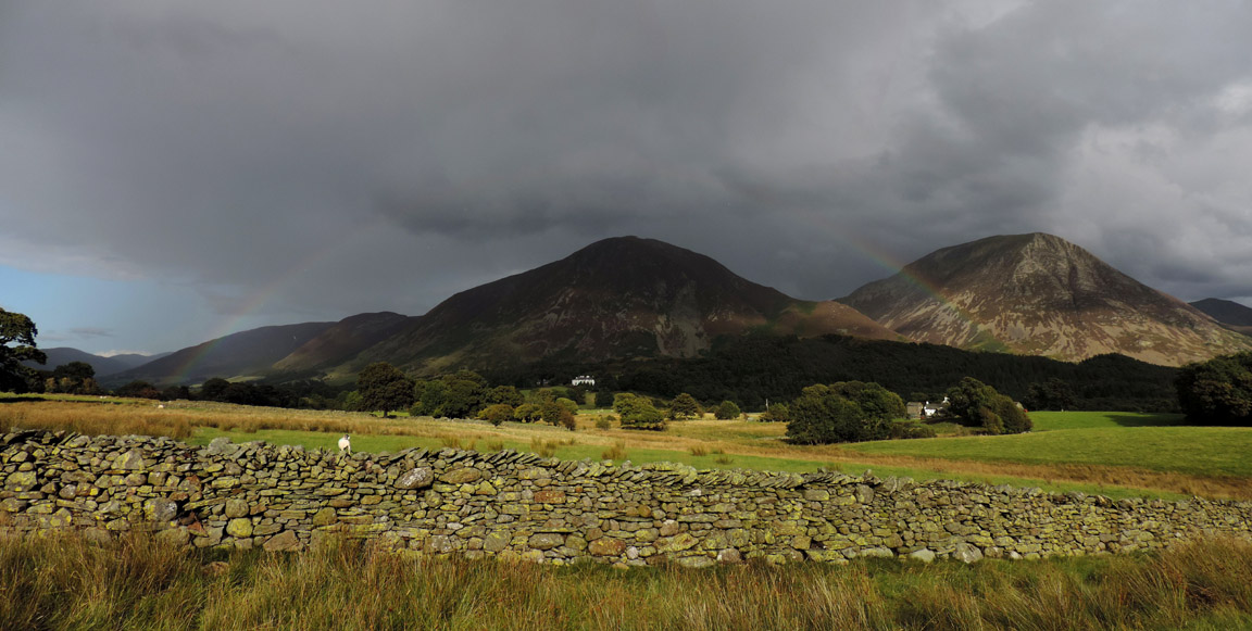
We have escaped the apocalypse . . . a few drops fell on our heads but the main shower has moved away over the Grasmoor Fells. If you look carefully you can see the rainbow less than a mile away.
Rain . . . what rain . . . we return to the cottage . . . home and dry. Just look at that sky, it is clear again as if nothing untoward had happened at all. - - - o o o - - -
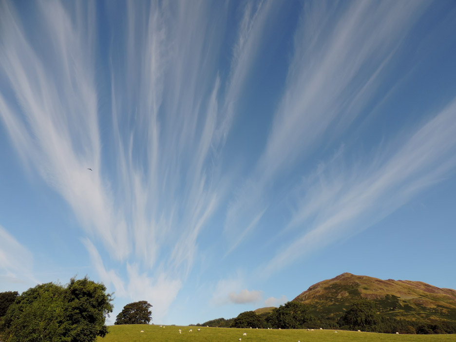
Just had to include this one . . . next morning the same view . . . with those same north westerly breezes which have set up a completely different cloud pattern, filling the sky from horizon to the heights. - - - o o o - - - |
Technical note: Pictures taken with either Ann's Canon Sureshot SX220, or my Nikon P520 digital camera. Resized in Photoshop, and built up on a Dreamweaver web builder. This site best viewed . . . without a rain cloud that defies the rules of the compass. Go to Top . . . © RmH . . . Email me here Previous walk - 19th August 2014 - Hen Comb with Mark & Gill A previous time up here - 19/21st December 2010 Family in Cumbria Next walk - 30th August 2014 - An Ullock Pike Round with Neil
|