![]()

Remember: Press F11 for a full
screen view of this page.
|
|
|
Remember: Press F11 for a full
screen view of this page. |
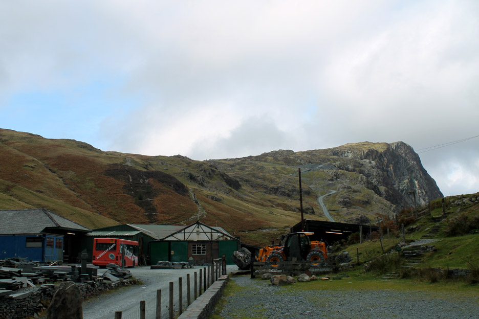
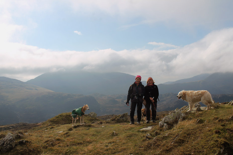
| " Fleetwith Pike with Jo and Neil " Date & start time: Saturday 12th October 2013, 11.50 am start. Location of Start : The Honister Slate Mine, Cumbria, Uk ( NY 225 135 ) Places visited : Bell Crags, Black Star, Fleetwith Pike, Dubbs Hut and the Drum Road. Walk details : 3.8 mls, 1320 ft of ascent, 3 hours 40 mins including lunch at the summit. Highest point : Fleetwith Pike, 2126 ft, 648 metres. Walked with : Jo, Neil, Ann and the dogs, Jodie, Amber, Harry and Bethan. Weather : Hill cloud but clearing to blue skies and sunshine at times, a cool breeze. |
" Fleetwith Pike with Jo and Neil " at EveryTrail [ Alter the settings to zoom or change the Map, use Everytrail to download the Gps route ] |
|
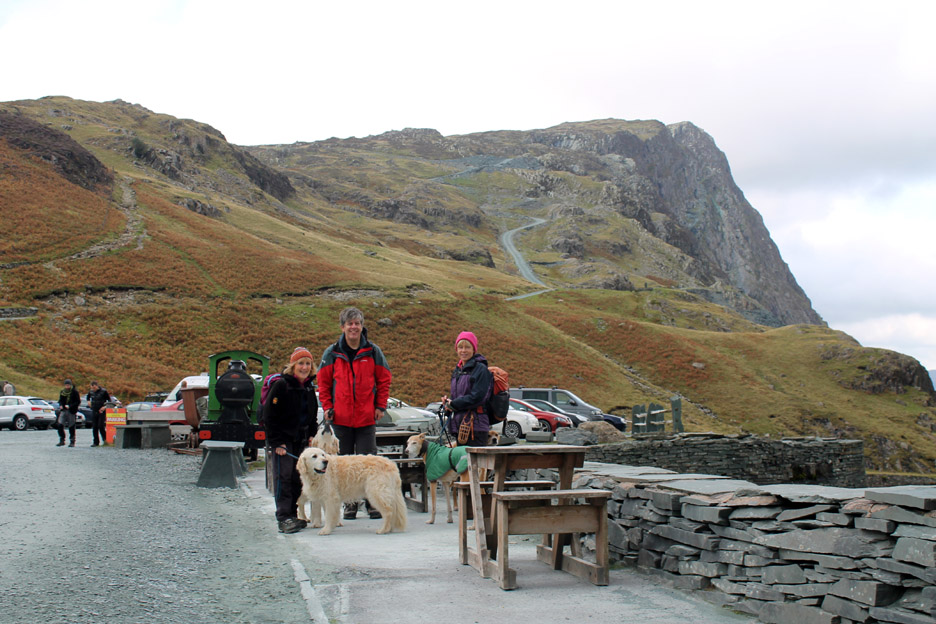
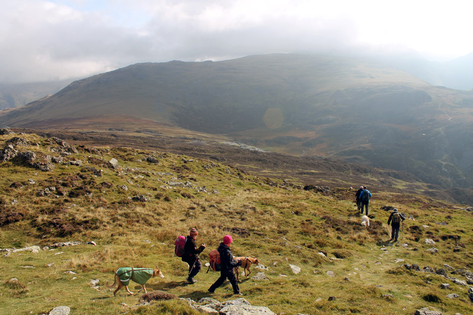
Jo was over at the weekend, Neil was in the area too and was asking after a walk, so after a combined theatre visit Friday night, the four of us joined up again to enjoy a day out at the head of our valley ... Saturday on Fleetwith Pike.
After a dull start to the day, with even a light drizzle early on, the sky showed signs of clearing. The forecast was for better weather in the west and we thought of the Loweswater Fells as about as far west as we could reasonably go. Gradually the head of the Buttermere Valley started to clear . . . and by the time we drove to Honister there was even a little blue sky to be seen. Our change of plans was going to work out after all.
Sunshine on the Honister Crags as we start the walk. Ann, Neil and Jo with the dogs outside the Mine Shop and Cafe.
All the high fells were still in the cloud but underneath, the visibility was good . . . lets hope it clears further.
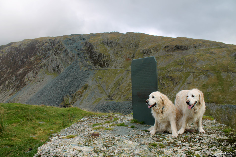
By the plaque dedicated to Celia Weir by her family. It is inscribed with Rudyard Kipling's poem "IF" The plaque is not a memorial as Celia is still very much part of the Honister Story.
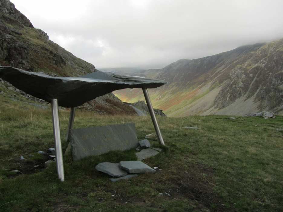
The slate unveiled by the Duke of Edinburgh on his visit to the mine in 2001. It was about the time of this Royal recognition that the tourist side of the mines really started to take off. Mark, his family and colleagues saw the company come of age, building on the heritage of the mine and continuing the development the mine tours and Via Ferrata.
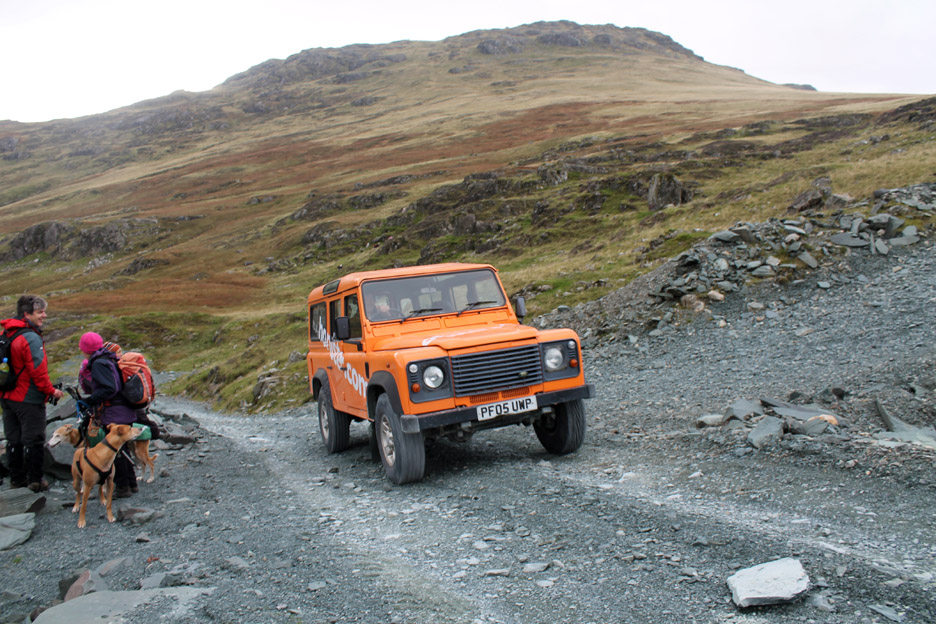
Joe Weir drives the distinctively coloured Land Rover up to one of the mine entrances.
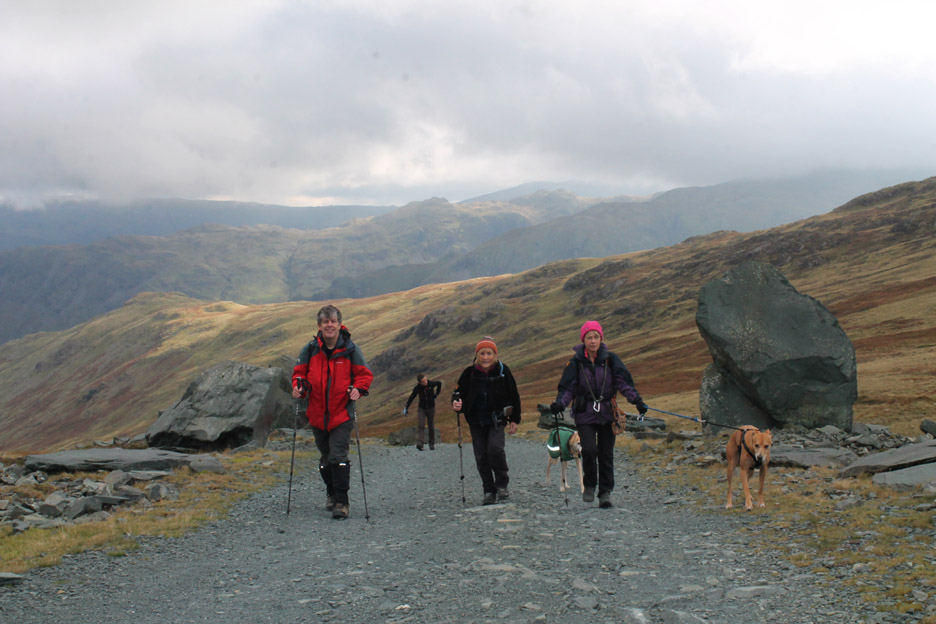
We continued on the top mine road heading for the top of Black Star, the summit at this end of Fleetwith Pike.
Looking across to the old Drum House stonework and to the Moses Trod path It leads on towards Great Gable and eventually Wasdale, two valley to the west.
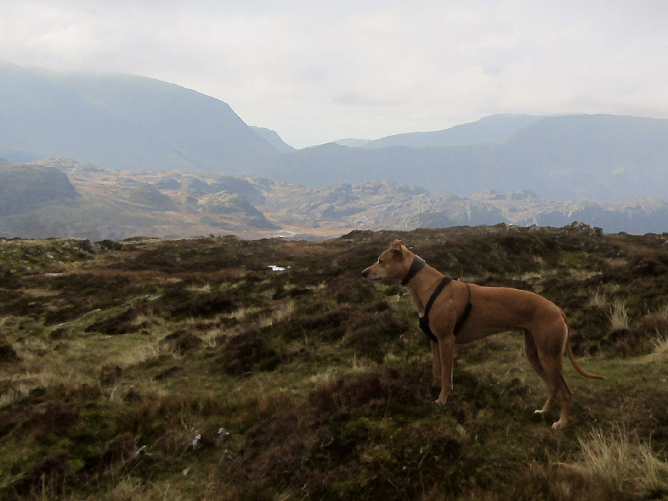
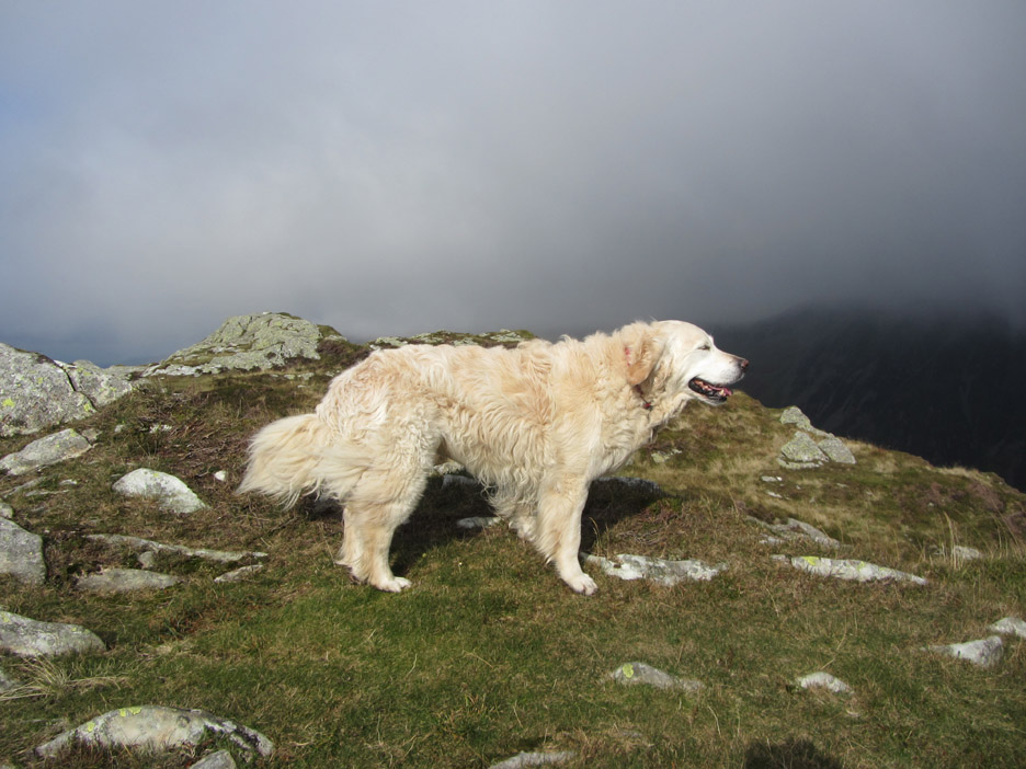
Amber concentratating on something away to the left . . . I think it was me. I had been challenged to go and take a picture of a rock . . . chose one, any one . . . there are lots to be had !
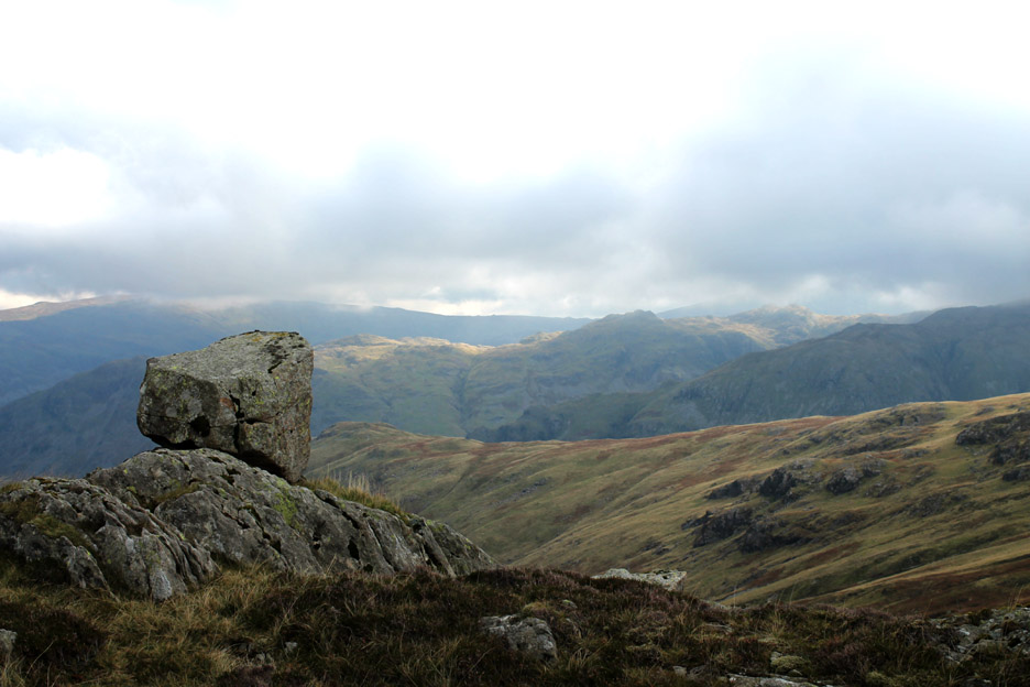
Okay . . . they are not all as unusual as this erratic boulder perched on the rock and looking across to the sunshine on Glaramara.
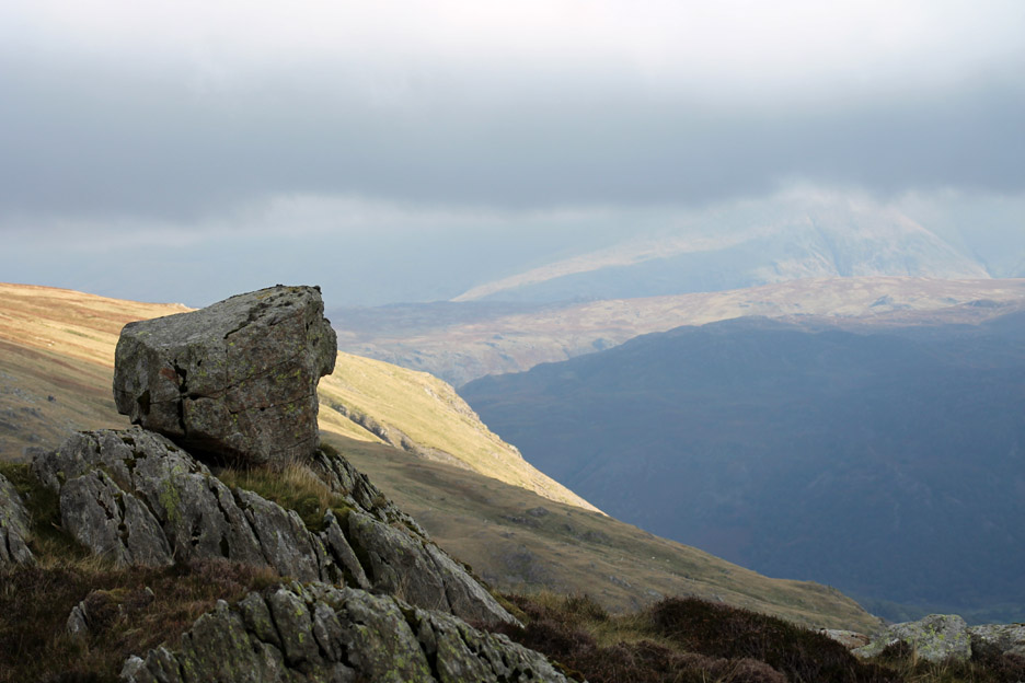
It was so photogenic that I took a second photo with the sunshine on Browncove Crags in the distance. Browncove Crags are three valleys away and are passed on the final ascent to Helvellyn summit, still hidden in the cloud.
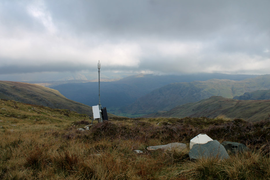
One for the techy folk . . . the rain gauge and weather station high on the side of Honister Crags.
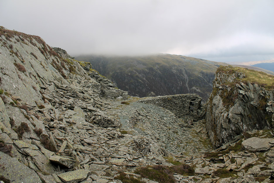
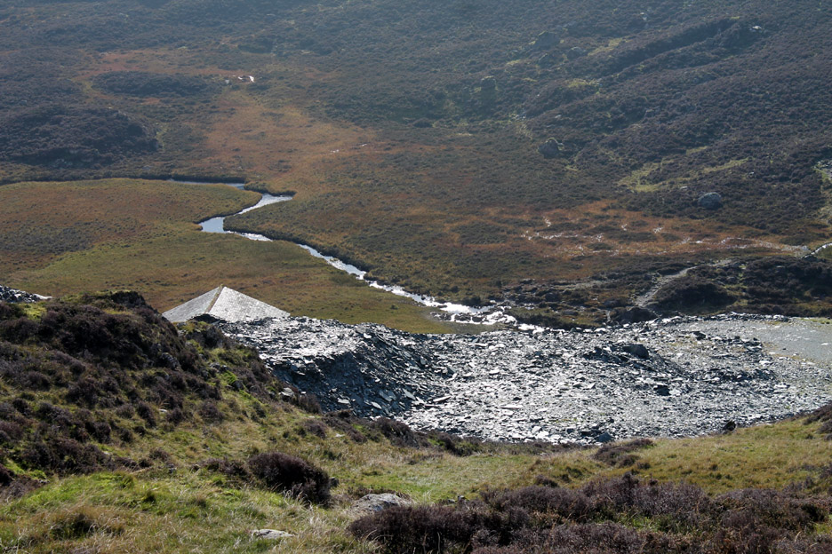
The top Ash Crag Quarry . . . an open quarry with little clue to the many miles of underground slate mine tunnels that exist beneath our feet.
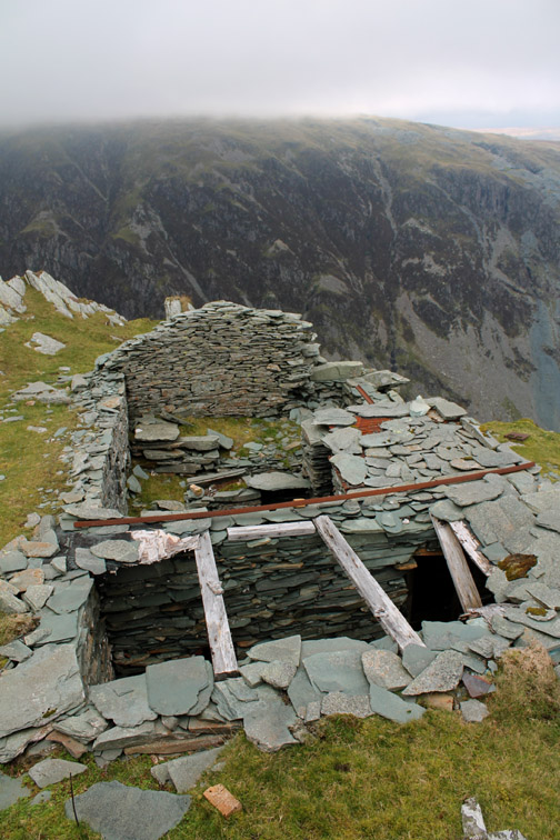
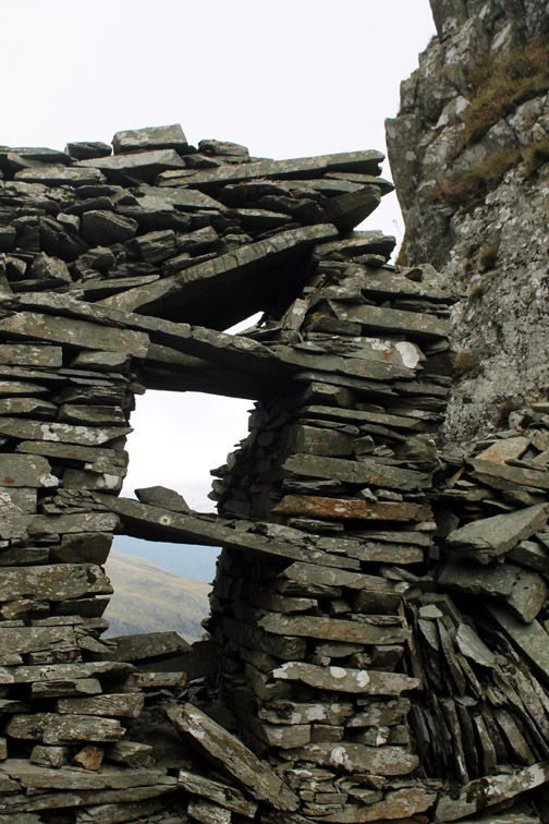
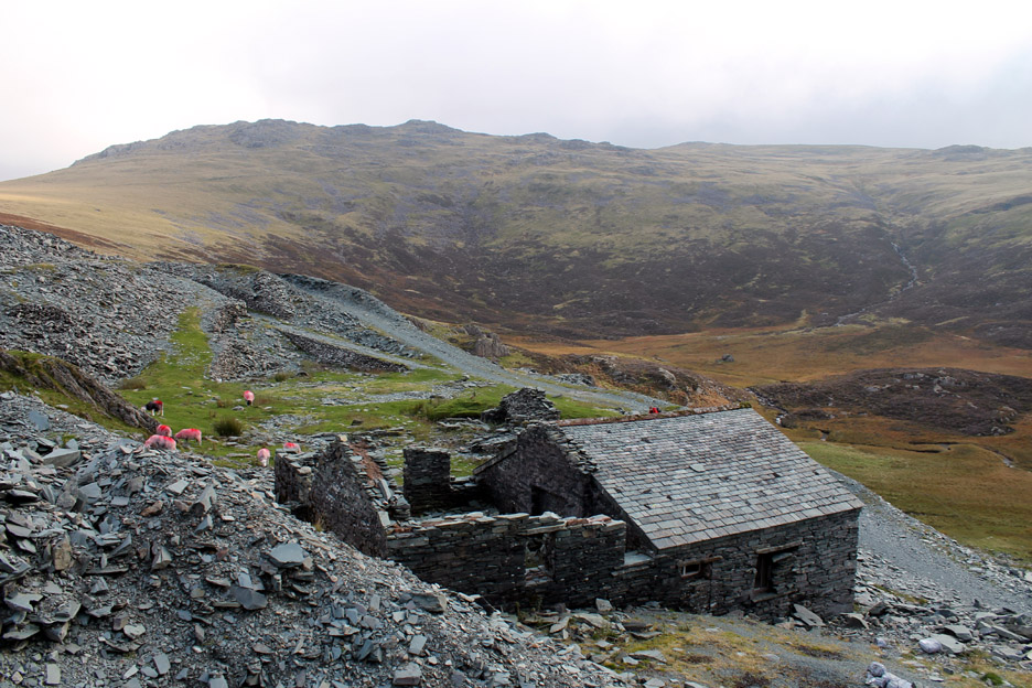
Neil looks down on an old quarry hut on the fell side above the workings. It used to be well roofed and dry when we first came here but is now no longer usable as a bothy.
The elevated ramp across the end of the quarry, seen in an earlier photo, collapsed many years ago.
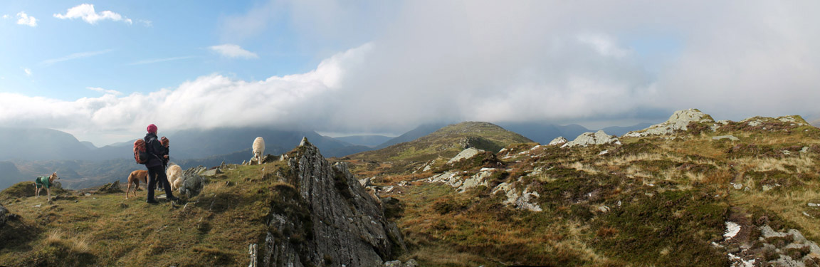
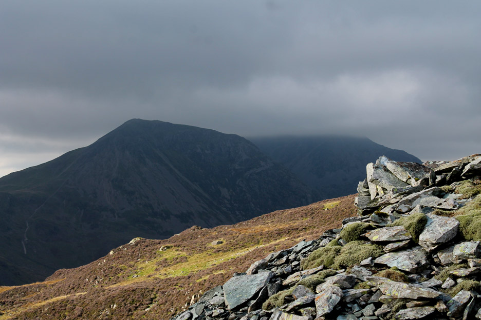
Nearly at our first summit now. The sunshine has really broken through and the summit of Pillar has less cloud on it than earlier.
A wider panorama from the same spot . . . swinging round to include Black Star top.
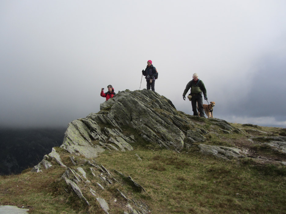
Soon after, Neil stakes his claim to the summit rocks. He's about 25 peaks short of climbing all the Birkett Tops in Lakeland . . . but this is one he's already done before. Still there's no reason why he can't celebrate in style.
Did I say it was slightly breezy up here ?
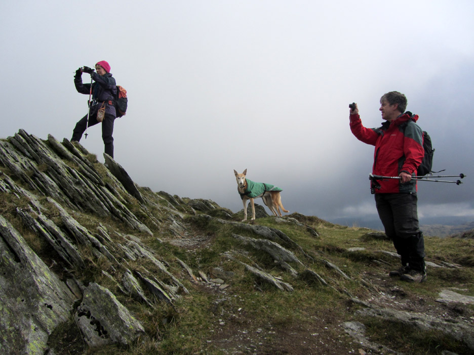
Must be an easterly if Bethan is facing head into the wind.
I hold onto Amber to allow Jo to climb to the top. There's not a lot of ground on the other side and the last thing she wants is to be overbalanced by any sudden jerk on the lead.
Jodie poses for this photo by Ann . . . the others are busy taking pictures of something else.
. . . to be fair, there is a superb view from up here !
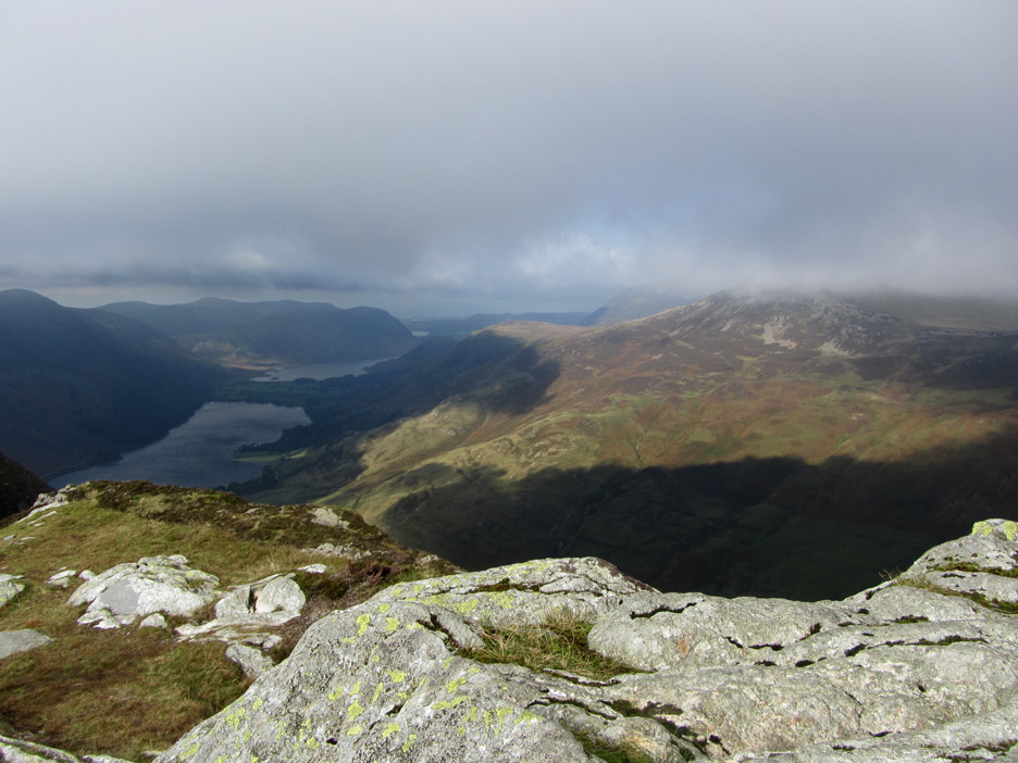
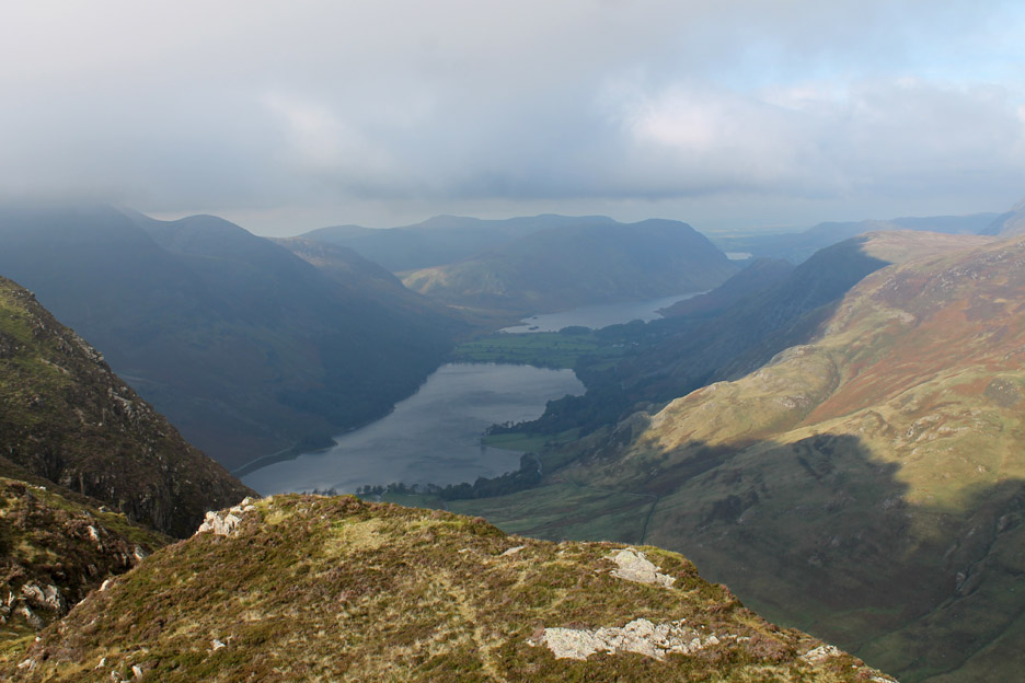
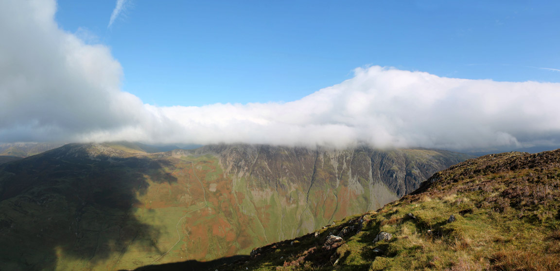
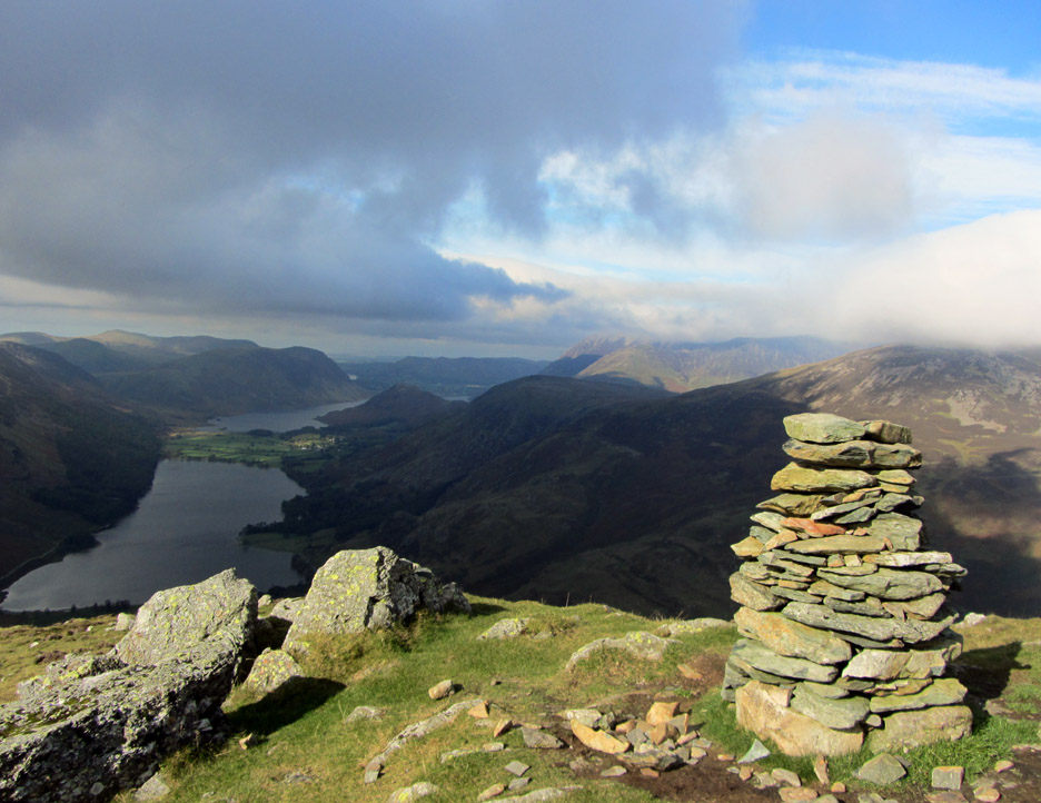
Looking down into the Buttermere Valley from Black Star.
The cloud shadows were rushing across the fellside below and eventually the sunshine spread right across to illuminate Gatesgarth Farm down there in the valley.
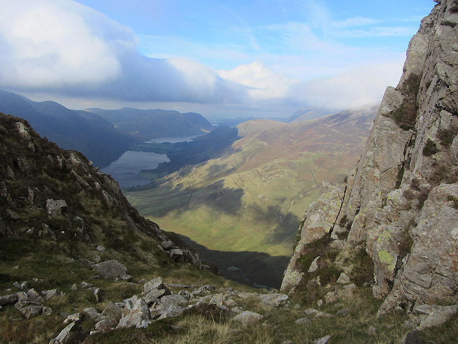
The view down between the rocks . . . a little further along the ridge.
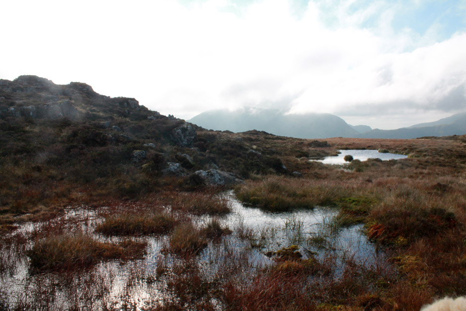
A view across one of the minor summit tarns at cloud-covered Great Gable. Sometimes, like today, the presence of some cloud actually adds to the atmosphere of the fells.
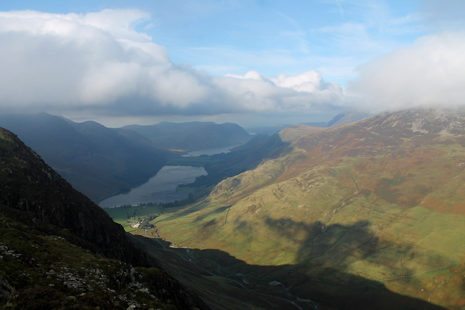
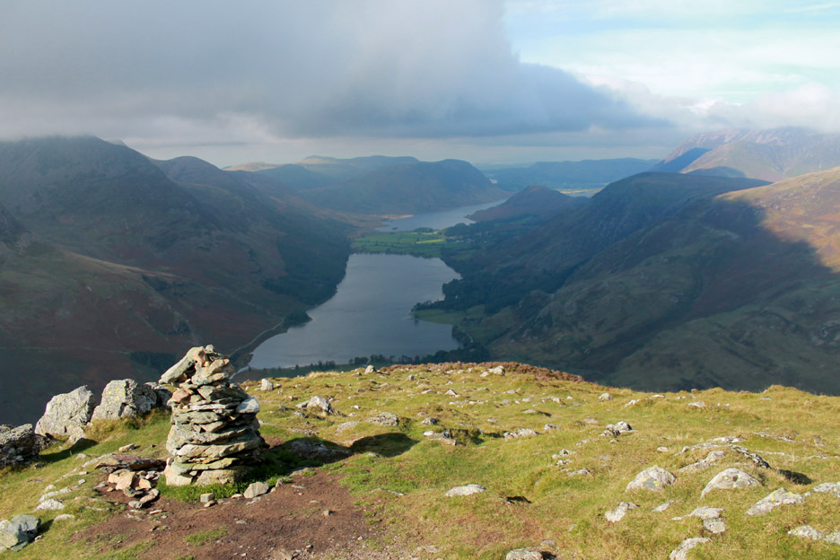
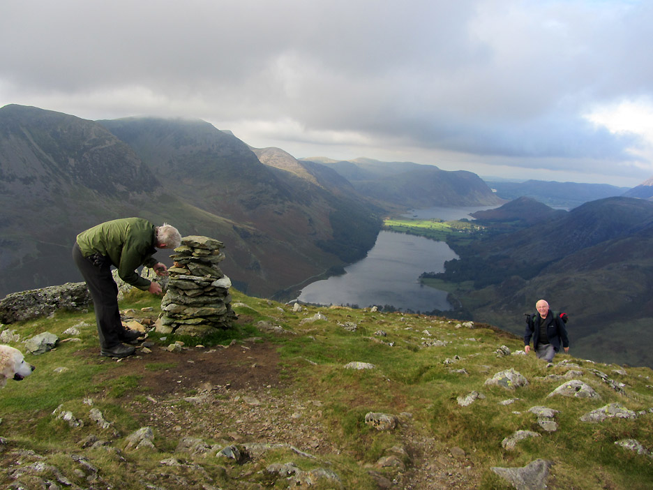
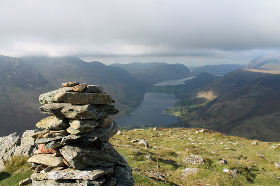
Fleetwith Pike summit . . . looking down at that eye-catching view once again. [ Oh dear that cairn looks a little sad ! ]
Time for a quick repair . . .
That's better . . . but maybe those last few small stones were extra to requirement ;o)
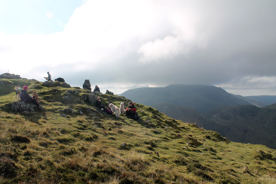
We stopped for lunch slightly away from the top and as a consequence we could get further away from the slightly cool edge of the breeze.
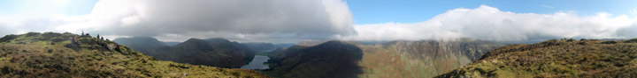
The sun really came out strongly now and the grey clouds over Dale Head were turned to white. Time for a little spin round with my finger on the shutter . . .
Click here or on the photo above for a Loweswatercam 360 degree annotated panorama
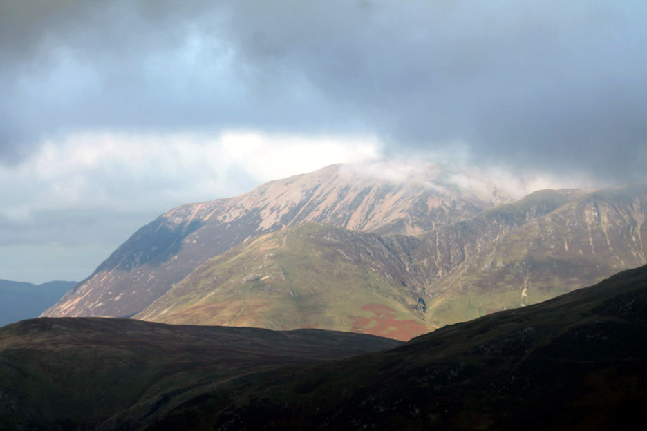
With the telephoto lens . . . a close up of Grasmoor . . . the summit did briefly make an appearance.
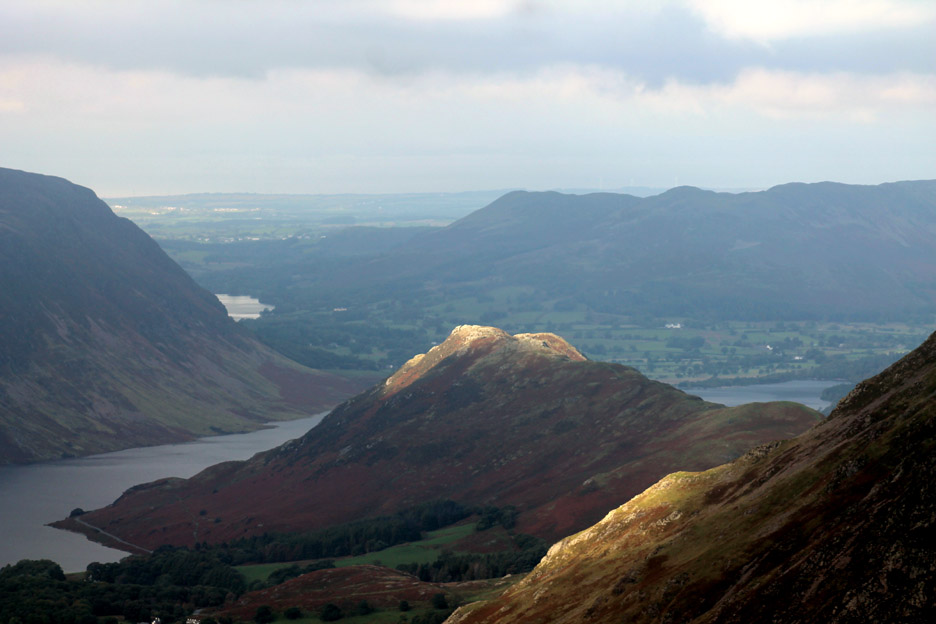
Rannerdale Knotts catching the sunlight. The distant lake is Loweswater and in the hazy distance we could just make out the Dumfries and Galloway coast of Scotland.
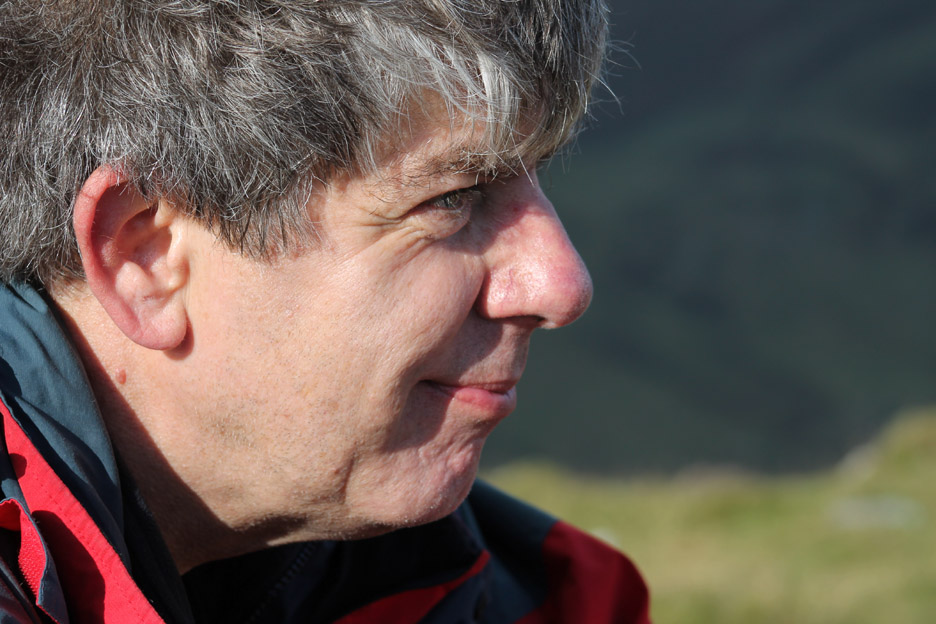
Zooming round further with the big lens on, this bloke got in the way ! Hang on . . . leave it in . . . this may kick-start my career in mountain-based portrait photography. Thanks Neil for being there . . . and for permission to use it !
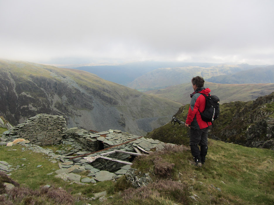
Time to turn our back on the view down the valley . . .
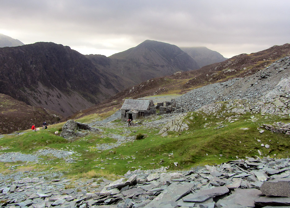
. . . and head off down the fell side to the Dubbs Quarry hut.
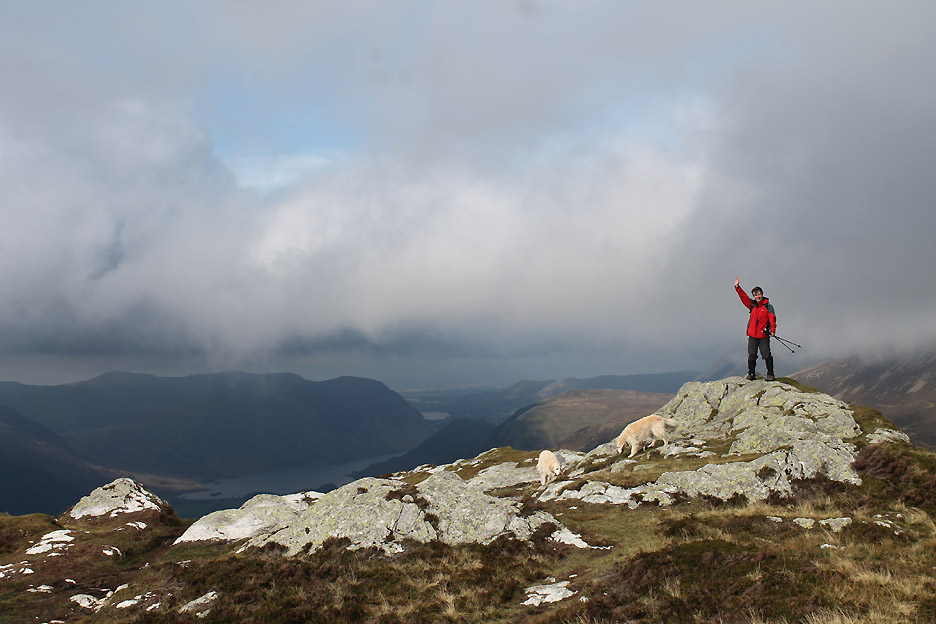
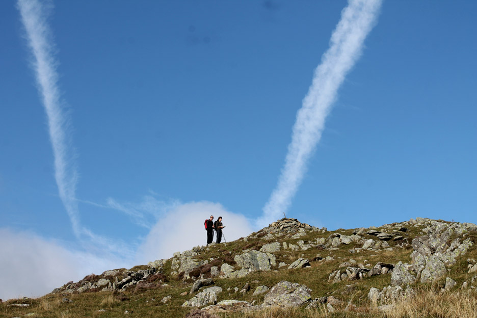
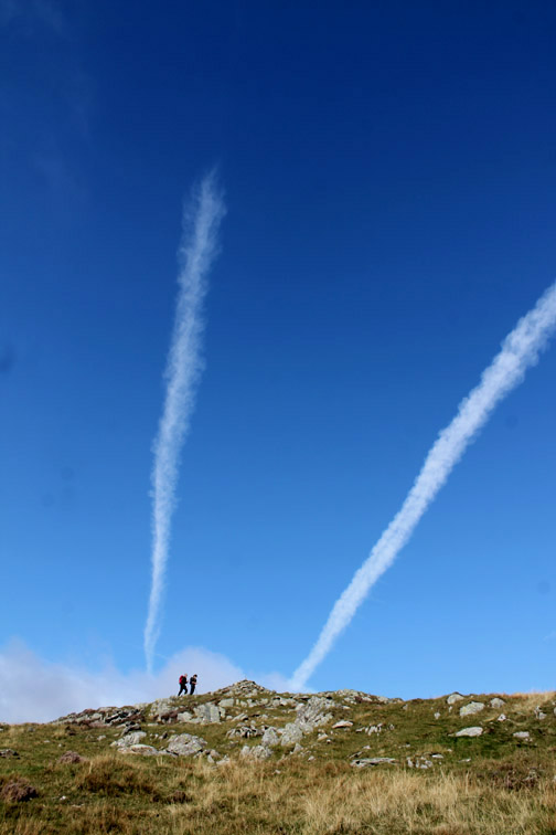
Two new visitors reach Fleetwith Pike summit just as the sky above really clears.
Three brilliant white vapour trails fill the azure blue sky.
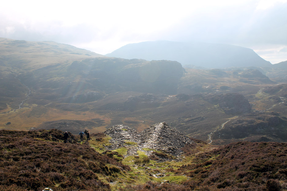
Two old mine spoil heaps fan out like ancient piers on the fell below us.
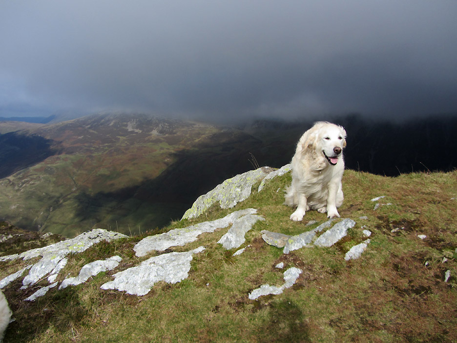
From alongside the spoil tip I look across to see the cloud gathering once more on the High Stile Ridge.
Below an extensive tip alongside the square roof of the bothy. Honister Mine has been gradually removing many of the 20th century tips, crushing the waste for road stone and garden path coverings.
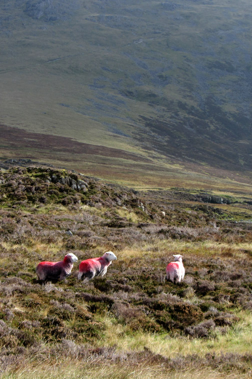
More sheep scraping a living off the last of the summer grass between the stones.
That's me down by the hut, checking out the little stream that feeds a water pipe.
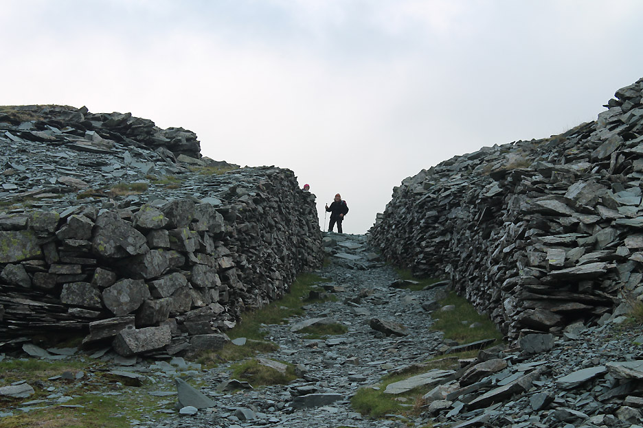
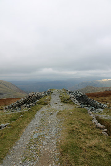
Ann, camera now back in her pocket, views me from above as I climb the start of the Drum Road. This is the old railway track that connected the Dubbs Quarry system with the mine buildings at Honister Hause. This is a perfectly straight track that extends up one side of the fell and down the other for almost a mile. Set your compass at 83 degrees but mind the steep drop at the other end !
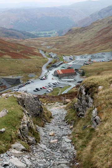
At this point the modern path takes a detour and descends more gently to the buildings below. We're almost home but a gentle roar is heard as a whole string of motor bikes slowly cross the pass.
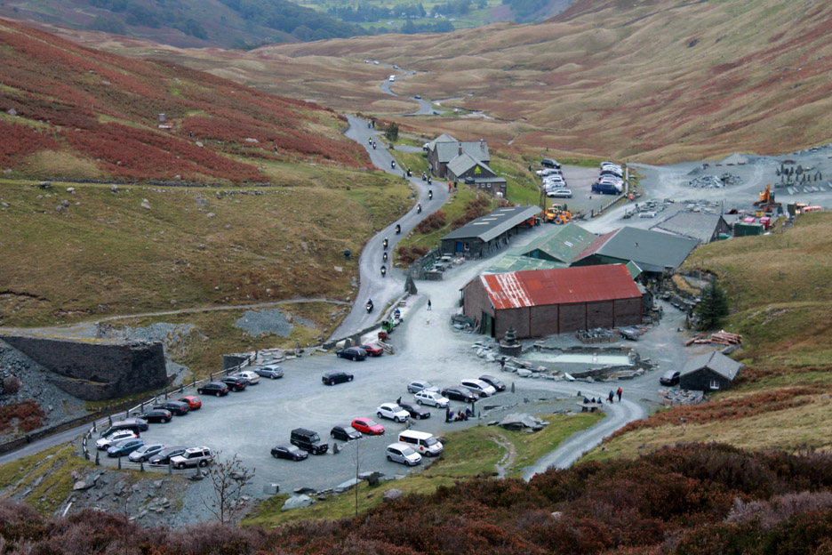
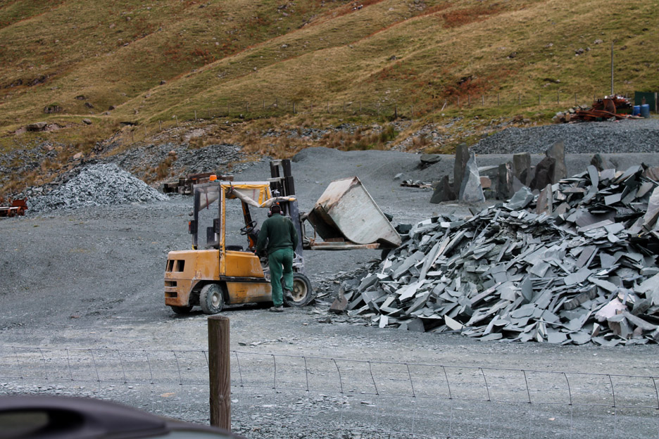
Back at the car park . . . another gentle rumble as the guy tipping waste stone at the start of the day is back tipping another . . . life goes on. " Fill 'yer Boot " anyone . . . "all you can fit in the car from this waste pile for just £20".
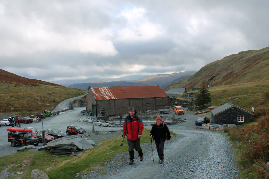
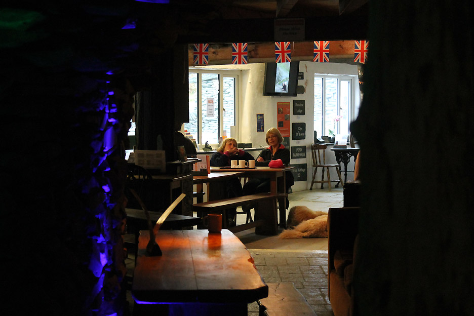
Having quite enough stone at home but in need of a little re-hydration after the walk, we adjourn to the Sky High Cafe for tea and biscuits . . . a very civilised end to the day. - - - o o o - - - |
Technical note: Pictures taken with either Ann's Canon Sureshot SX220, or my Canon 1100D SLR digital camera. Resized in Photoshop, and built up on a Dreamweaver web builder. This site best viewed with . . . a copy of the Loweswatercam Calendar 2014, now on sale at the Sky High Cafe. Go to Top . . . © RmH . . . Email me here Previous walk - 27th/29th September 2013 - Local Autumn Sunshine A previous time up here - 25th December 2008 A Christmas Walk up Fleetwith 2008 Next walk - 10th to 15th October 2013 - A week in the Life ...
|