![]()

Remember: Press F11 for a full
screen view of this page.
|
|
|
Remember: Press F11 for a full
screen view of this page. |
|
" Three People ... Four Stones " Date & start time: Saturday 3rd August 2013, 3 pm start. Location of Start : The red phone box, Burnbanks, Cumbria, Uk ( NY 508 161 ) Places visited : Burnbanks, Burn Banks (hill), Four Stones Hill, Measand Beck and back. Walk details : 4.5 mls, 750 ft of ascent, 3 hours 3 minutes. Highest point : Four Stones Hill, 1348ft - 415 m. Walked with : Jo, Ann and the dogs, Amber, Jodie, Harry and Bethan. Weather : Sunshine and summer clouds (some a bit grey) and generally windy. |
"
Three People ... Four Stones " at EveryTrail [ Alter the settings to zoom or change the Map, use Everytrail to download the Gps route ] |
|
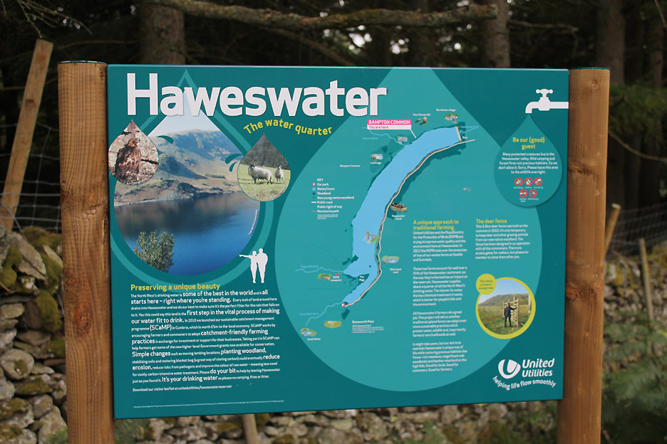
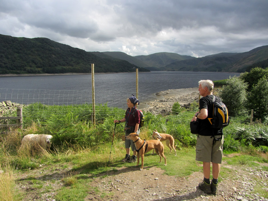
An afternoon walk for Jo and ourselves as we drive over to Haweswater to visit a slightly new area for the first time, new to Ann and I that is. The gentle nature of the walk meant that all four dogs were able to come along on this lovely shorter walk along the northern flanks of Haweswater.
We start at the top of the map and stay on the right hand side of the lake . . . in the area of the pink label . . . Bampton Common.
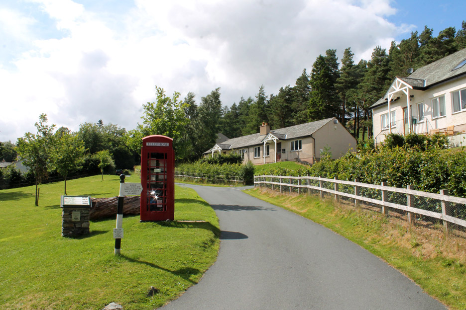
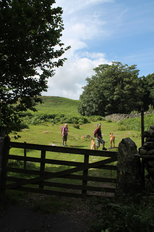
Our starting point is the village of Burnbanks . . . look another red phone box. Did you know that there are about a dozen or more old red phone boxes in the Lakes that have been classified as "Grade two listed buildings". [ That means that their iconic appearance is protected for the future and any change or disturbance needs planning department consent ]
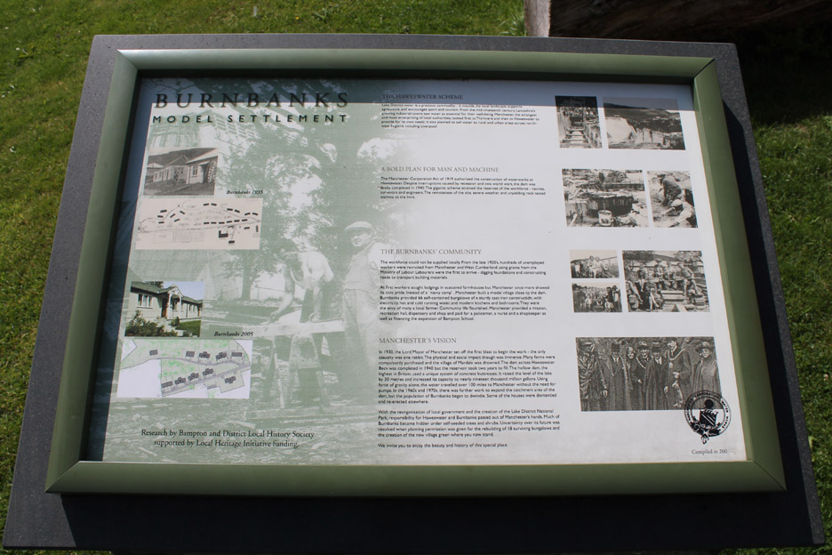
Burnbanks Village started life as an administrative centre and dormitory village for the workers building the nearby Haweswater reservoir. After the work was completed (1940's) the Manchester Corporation was persuaded not to demolish the site but to sell the buildings to locals and thereby create the " new village " of Burnbanks at the foot of the lake.
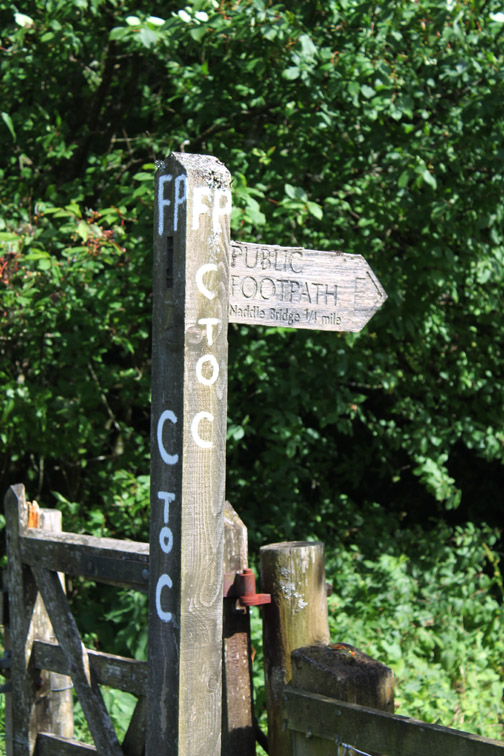
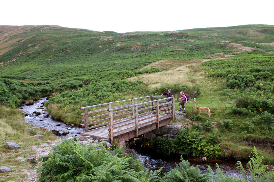
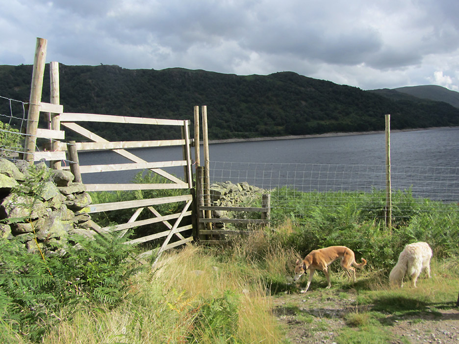
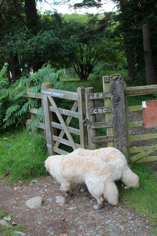
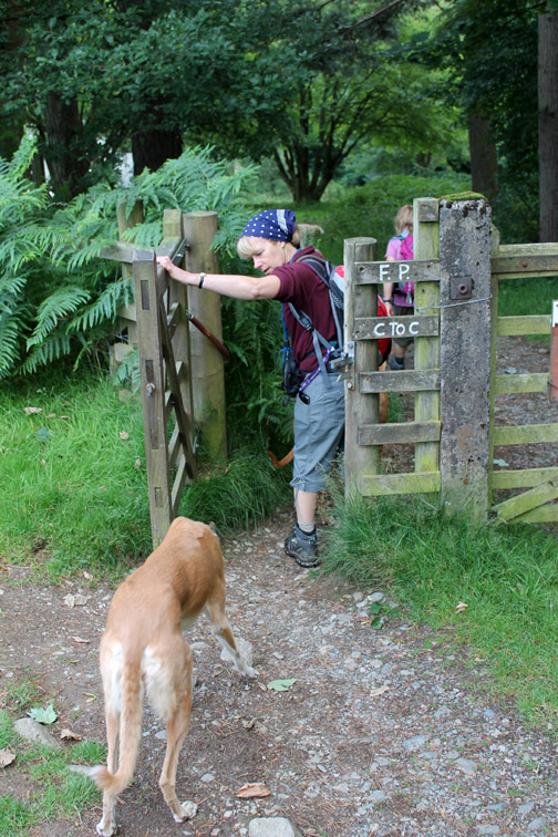
Wainwright's Coast to Coast long distance footpath passes through the village after leaving the Haweswater lakeside and heading on towards Shap. We walk a hundred yards out of the village, back the way we had come, and take a left through a gate onto the open fell. We would return to the village on the track alongside the lake, thereby walking a very small part of the C2C route later today.
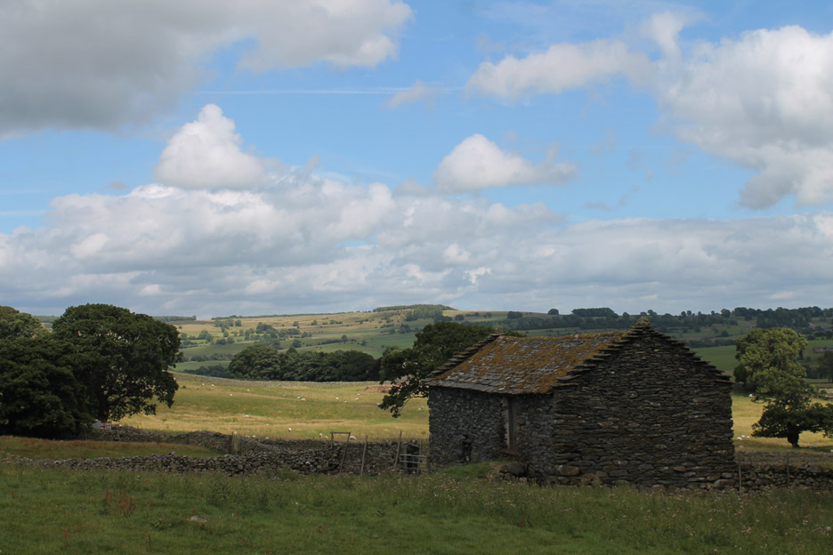
An old barn and a lovely view out over the Bampton area to the east of the village.
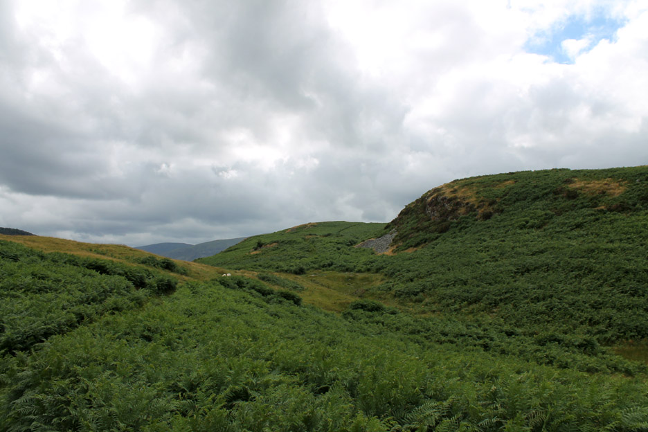
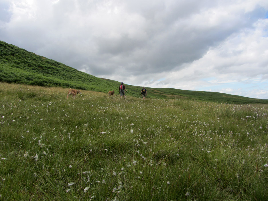
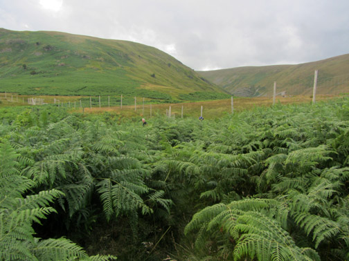
All too soon we are walking the narrow paths between the summer bracken but we are gaining height as we go. Route finding is a bit hit and miss in these conditions as there is little difference between a footpath and a sheep trod.
However, head on up and keep the lake on the left is a good rule .
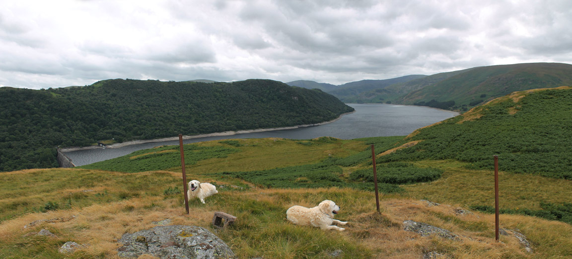
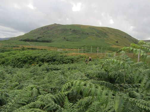
The map shows an old radio mast on the hillside . . . but all that remains are a few old fence posts and foundations Harry and Bethan are a temporary additions to the scene.
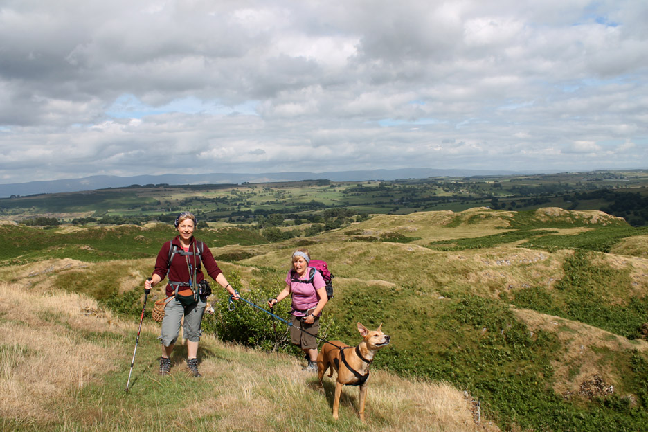
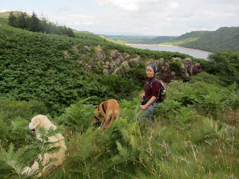
The undulating nature of the fells is evident here. The girls appear from below after climbing a short scramble up onto this new ridge.
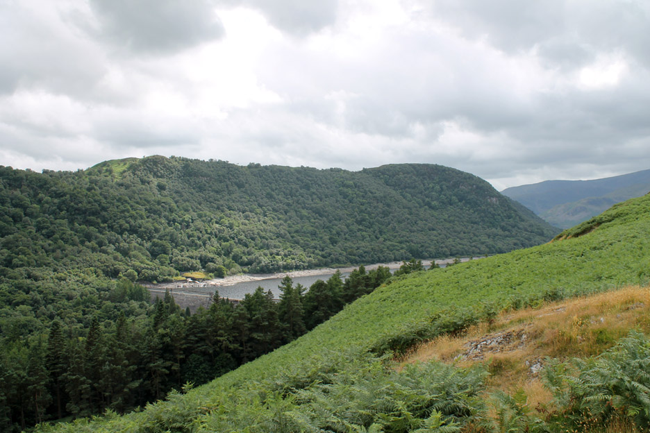
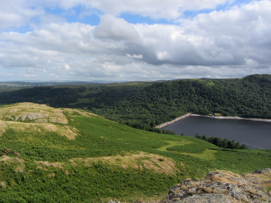
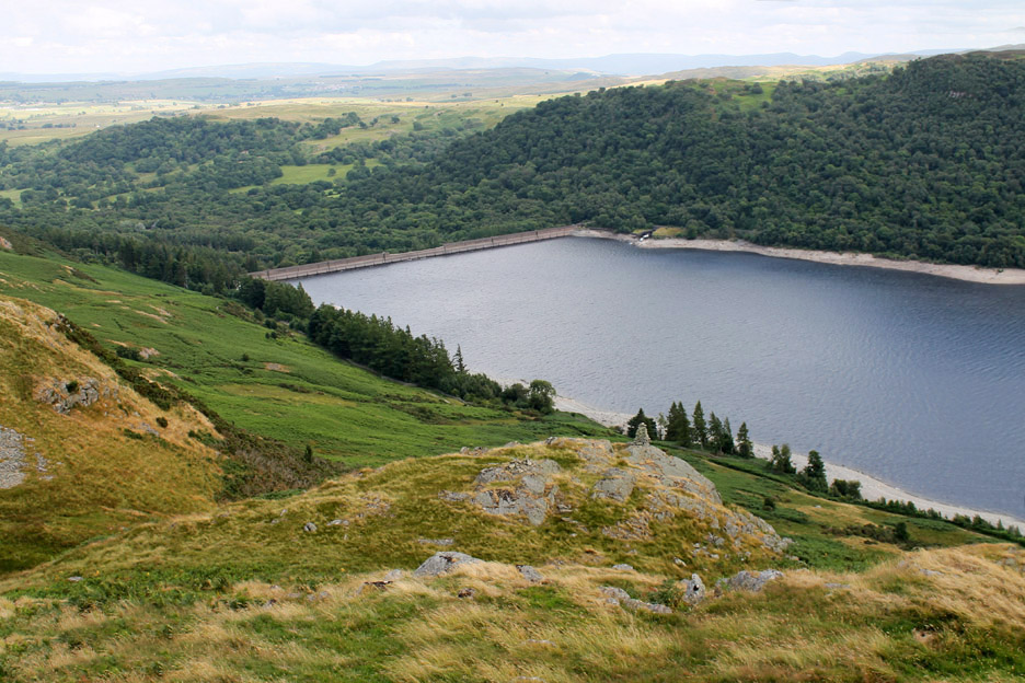
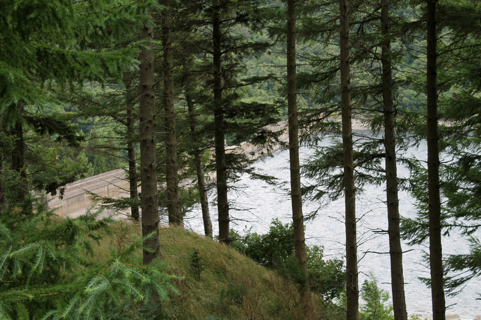
The radio mast hill is off to left . . . and our view of the reservoir dam is much clearer now.
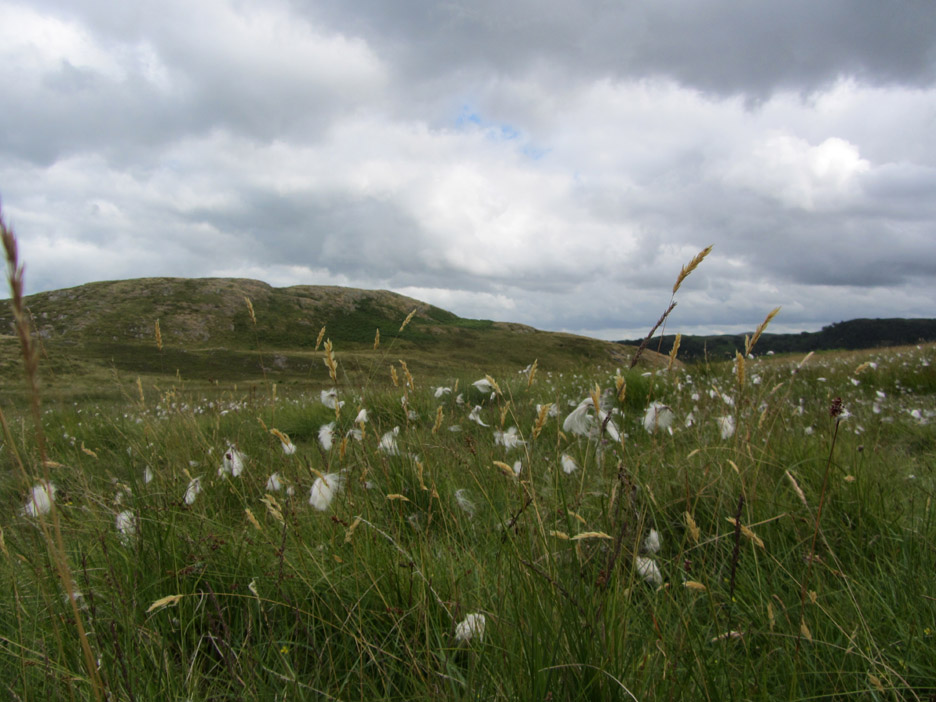
In between the summits were the inevitable areas of damp ground and with them comes the wispy cotton grass, characteristic of the summer and far more attractive than that of bracken.
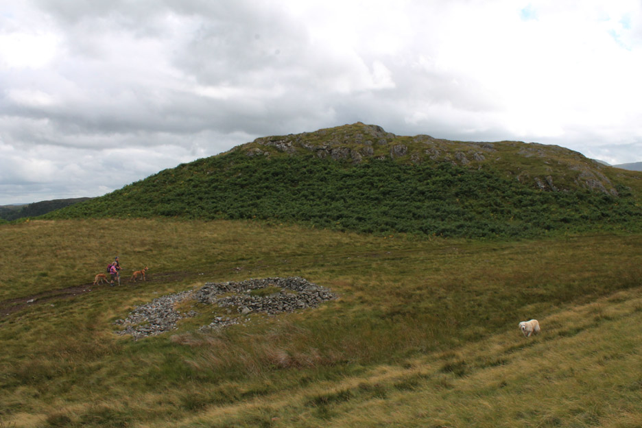
A clear track ahead as we walk around the back of Little Birkhouse Hill.
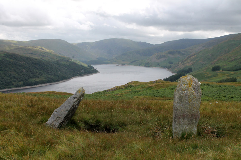
Difficult to identify from below but this cairn on the ground below me means that the summit opposite is the object of desire for today . . . Four Stones Hill.
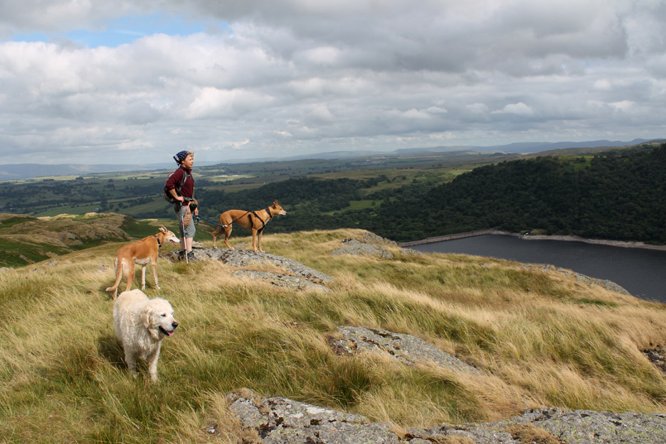
The reason for the name is unclear . . . even after counting all the rock outcrops. Jo admires the view from the summit .
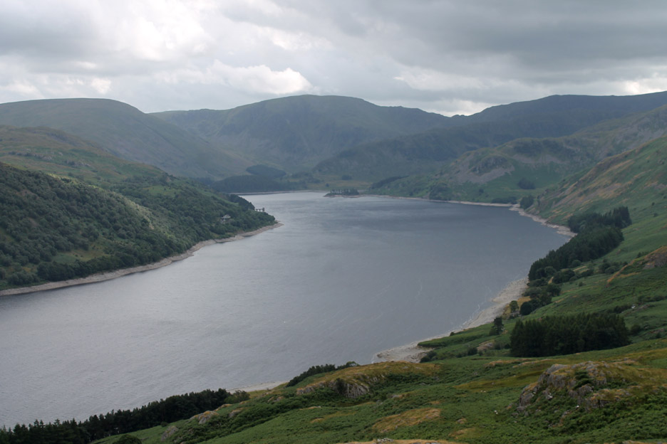
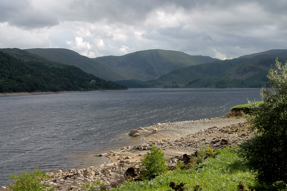
Even today with slightly dark skies we get a fine view of the high fells at the head of the lake.
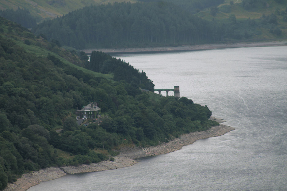
With the zoom lens I can see the Haweswater Hotel and the Outlet Tower in greater detail. The tower marks the start of the water pipeline from Haweswater all the way down to Manchester.
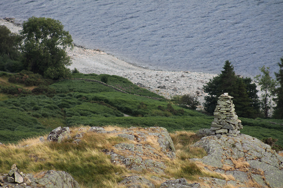
With the bigger lens still on, I catch the view down to a small but perfectly shaped cairn further down the hillside towards the lake. Below the cairn is the track that we hope to use on our return.
Standing back to get the bigger picture, the cairn is seen below, almost lost in the outline of the trees.
Behind the summit of Four Stones is a small pool which Harry just has to investigate.
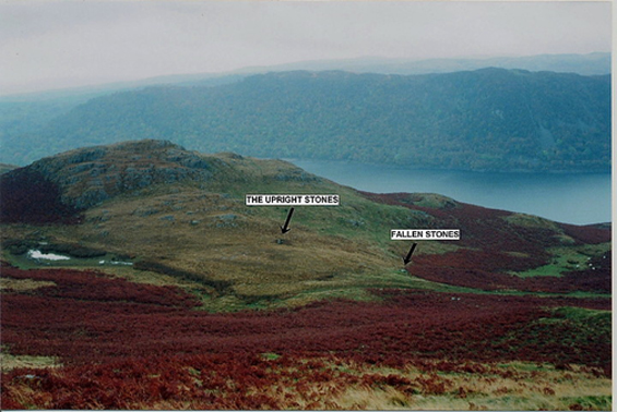
One possible reason for the name is the Standing Stones just to the north west of the high ground, but if that was the case then there should be another pair somewhere. The reason for the stones is unknown . . . lost in the history of time.
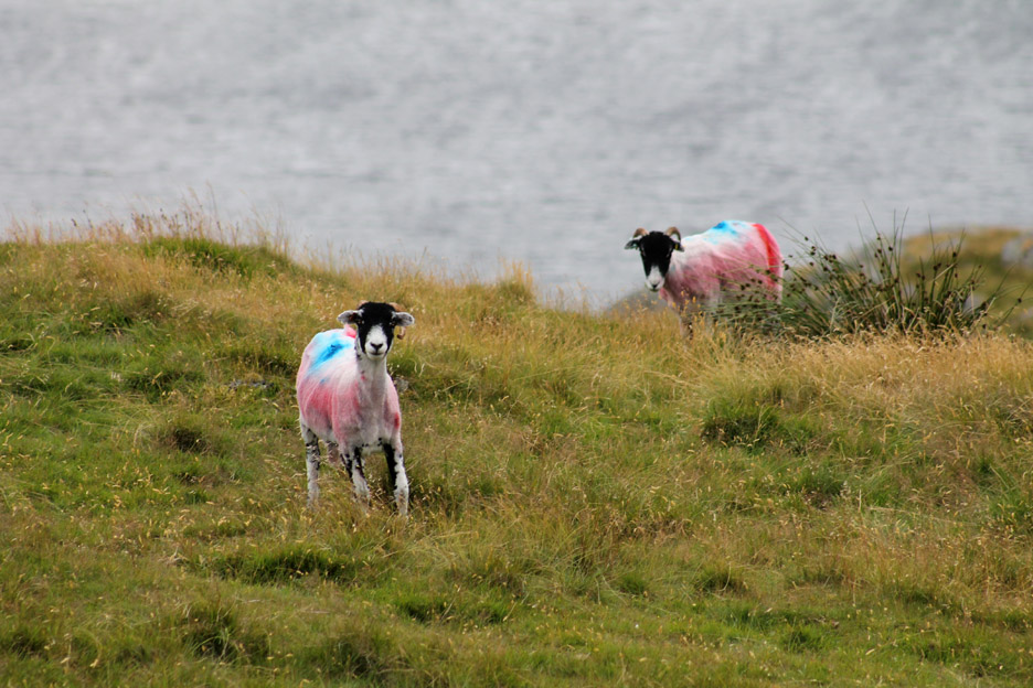
These guys are very much of the present . . . and very colourful too.
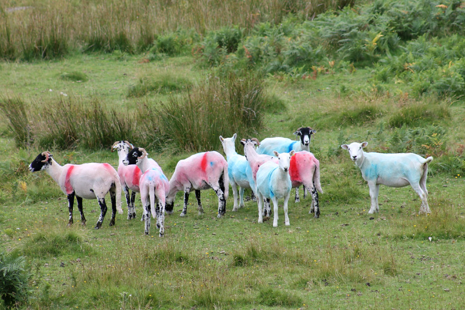
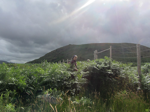
A little further down . . . a few more of their mates . . . looking very patriotic in their red, white and blues. - - - o o o - - - There now follows a slight vegetation break and a slight miscalculation of route. There's a deer fence surrounding an area of new woodland and we head for the nearest gate to get through it. Unfortunately it leads into a seldom walked area with abundant growth of bracken.
In there somewhere are the heads of Jo and myself . . . taken by Ann from the occasional clearing within the ferns.
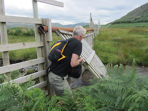
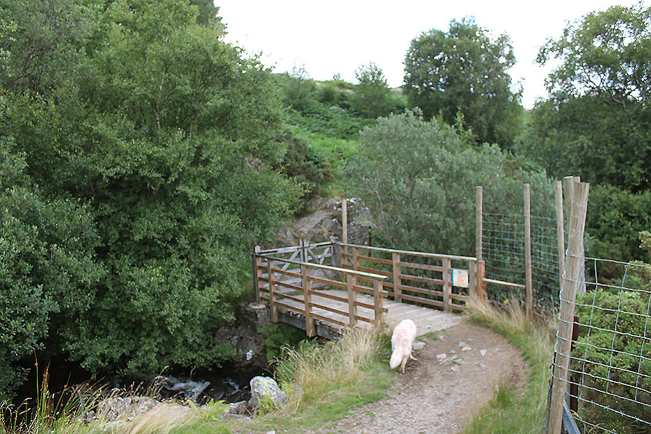
Once we met the difficult-to-cross Measand Beck we decided that the best plan of action was to retreat and walk along the outside of the fence until we reached the footbridge over the river. A swing-fence designed to keep the deer and sheep out was our means of escape back out onto the open fell.
That's better . . . but then behind us we saw the path that should have brought us down from Four Stones Hill. Moral of the story . . . ignore the first gate and head for the second one by the bridge.
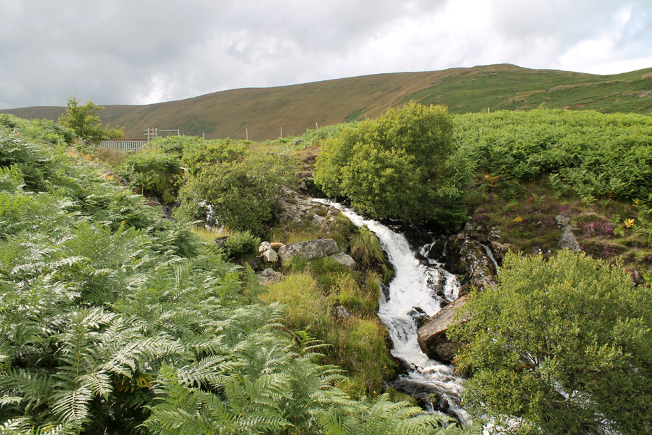
Following the beck downstream on the right hand side meant we found a reasonable path. This is one of the optional routes off Kidsty Pike / Low Rise that can bring Coast to Coasters down to the lakeside.
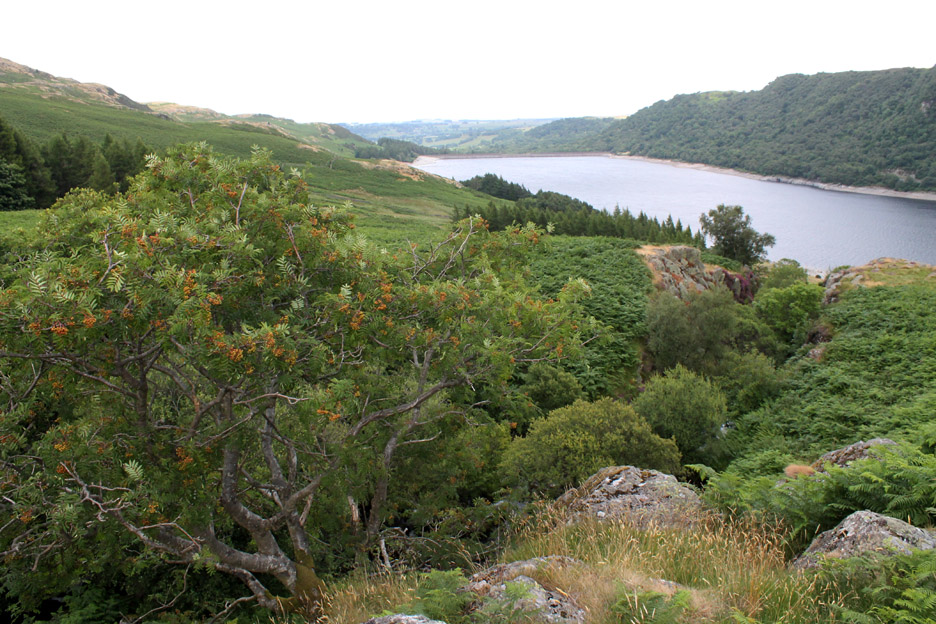
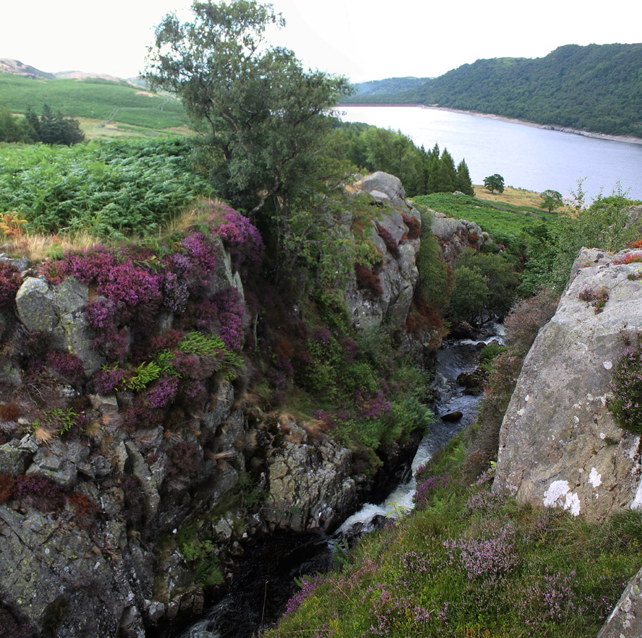
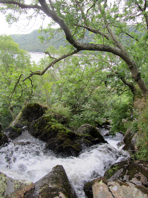
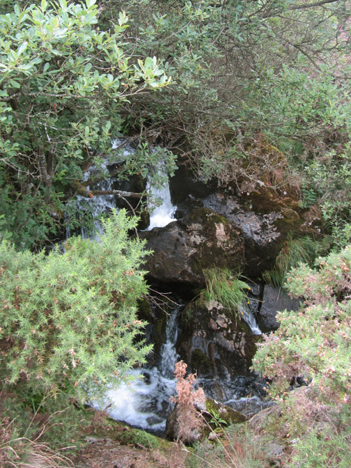
The Measand Beck plunges down to the lake and in so doing cuts a deep little gorge. On the side of the cliff . . . a fine Rowan tree with yellow berries . . . I have a suspicion that it is "Joseph Rock" variety.
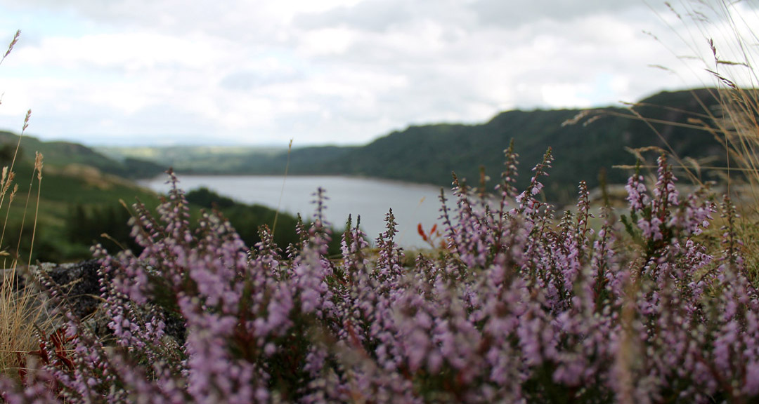
Jo takes life nearer the edge in order to appreciate the gorge and the rich display of heather on the opposite side.
Big picture . . . big gorge . . . nice colours.
" From the perspective of the heather "
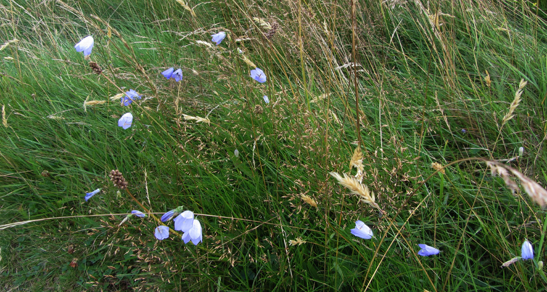
Delicate blue harebells and grasses line the path down.
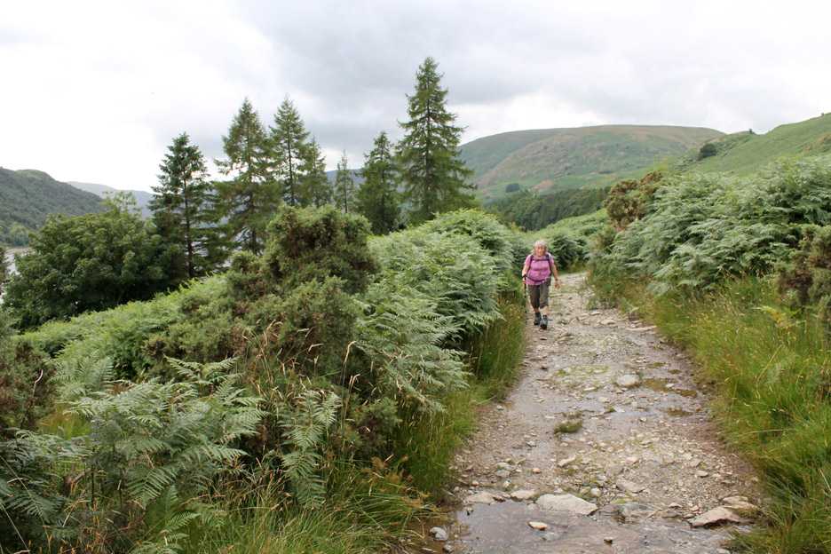
Down on the lakeside path at the bridge back over the Measand Beck. Before the reservoir was built, this track may have been the main road out of the valley for the old community of Mardale.
What the photo can only hint at is the strong breeze. A bright burst of sunshine contrasts with the dark skies . . . as reflected in the distant reaches of the lake.
Something unusual catches the eye . . .
. . . and extremely tall and slightly 'Heath Robinson' double gate built to match the deer fencing. It towered above us all and looked ever so rickety, not helped by the odd angles of the spars.
Back towards Burnbank along the old road.
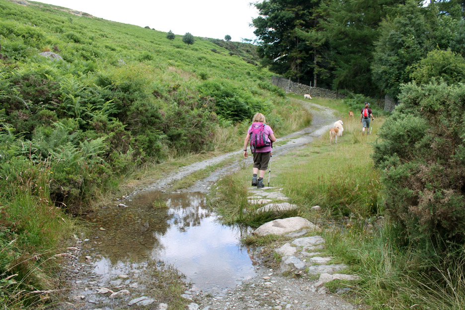
Ann takes to the stepping stones as we pass a minor stream below Four Stones Hill.
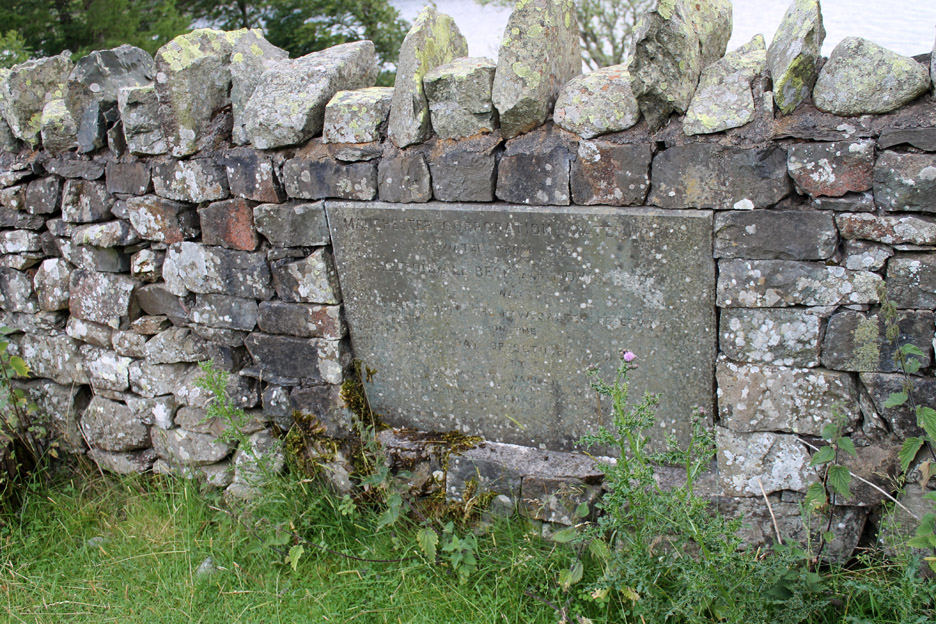
A plaque on the wall indicates something of importance. Don't try too hard to read it as we found it impossible . . . and we were there ! The top line reads " Manchester Corporation "
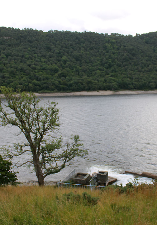
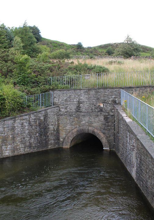
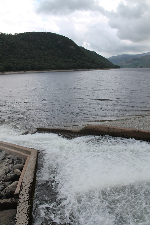
There's a pipeline through the hill supplying Haweswater with a top-up supply of water from the Ullswater in the next valley over.
Technically there is also a piped supply from Swinside, the next valley south, so the catchment of the lake is in fact bigger than first imagined. [ the sluice can be seen in earlier photo from the old radio-mast hill ]
Close to the dam wall, one of the largest stone structures of its type in the UK.
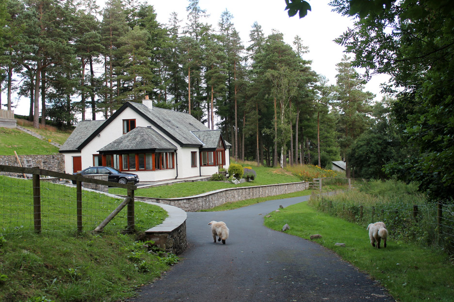
The village underwent a major improvement in recent years. Some of the houses have been renovated . . and others look to be new-build.
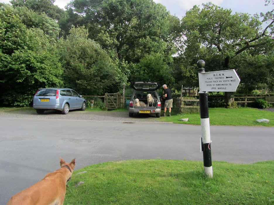
Back at the car at the end of the afternoon . . . what a great 3 hour walk . . . and well suited for our oldest dog Jodie. It was nice to see her out on the fells with us again. - - - o o o - - - Mmmm . . . where shall we go now . . . how about a pint and a meal at that nice pub in Askham.
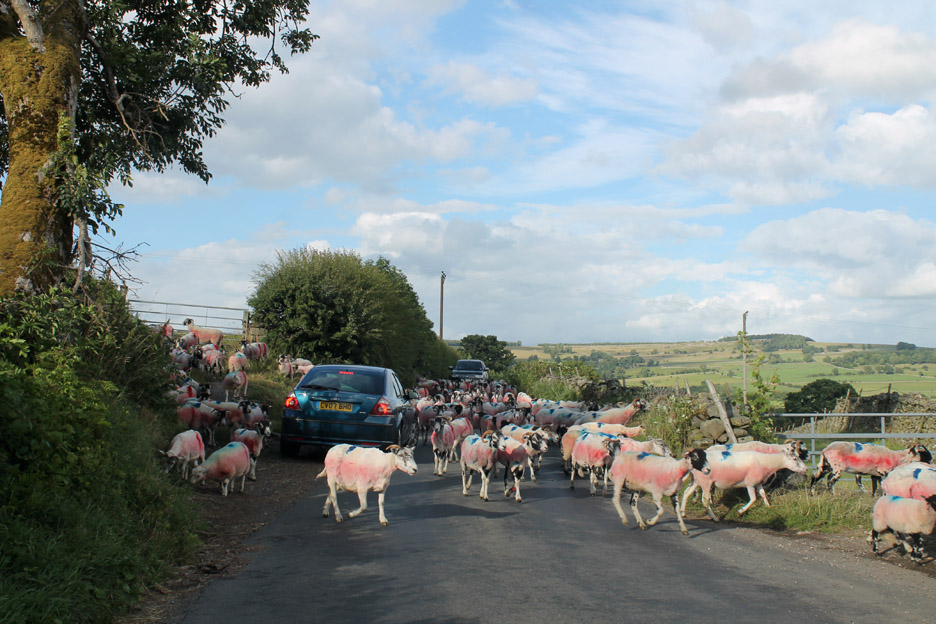
Oh no . . . rush hour in Bampton . . . the pint will have to wait a short time. Hold your cursor over the picture to appreciate the problem.
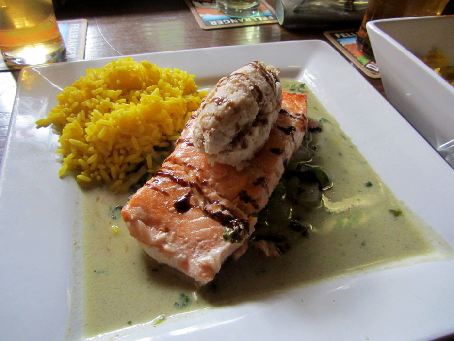
Salmon on a Green Thai Curry base (with a prawn mousse topping) . . . courtesy of The Punchbowl in Askham.
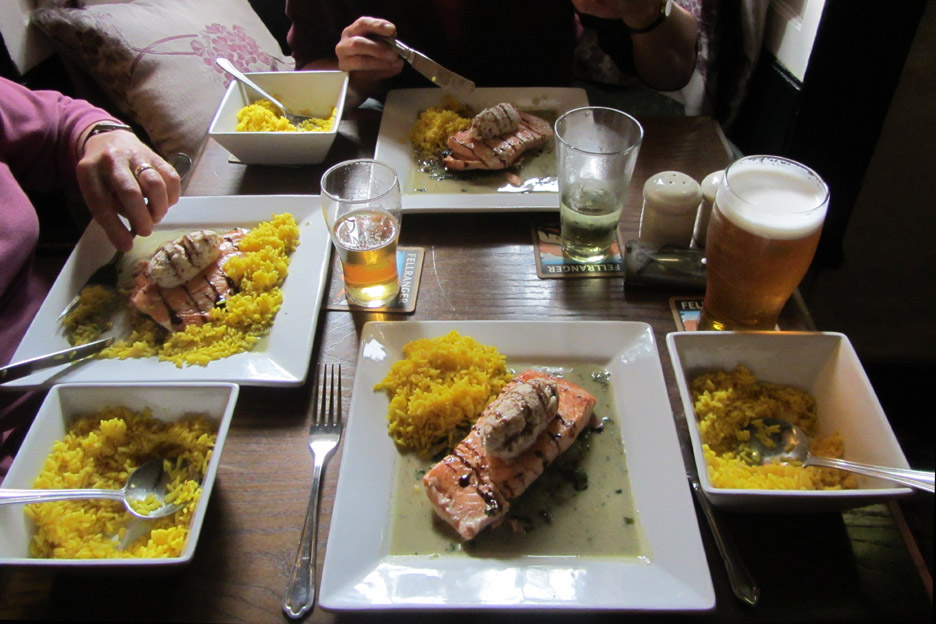
That looks nice . . . we'll have three please ! - - - o o o - - - |
Technical note: Pictures taken with either Ann's Canon Sureshot SX220, or my Canon 1100D SLR digital camera. Resized in Photoshop, and built up on a Dreamweaver web builder. This site best viewed with . . . a professional chef in the kitchen. Go to Top . . . © RmH . . . Email me here Previous walk - 31st July 2013 - Local and Hen Comb with Paula A previous time near here - 3rd July 2010 Selside, Branstree and Harter Fell Next walk - 11th August 2013 - Loweswater - over the Rainbow
|