![]()

Remember: Press F11 for a full
screen view of this page.
|
|
|
Remember: Press F11 for a full
screen view of this page. |
| " Dale Head in the Snow " Date & start time: Thurs 28th March 2013, 2.45 pm start. Location of Start : Honister Hause car park, Honister, Cumbria, Uk ( NY 225 135 ) Places visited : Dale Head and return by the Yew Crag Quarries. Walk details : 3.1 mls, 1425 ft of ascent, 2 hours 10 mins. Highest point : Dale Head, 2473 ft - 753 m. Walked with : Myself and the dogs, Harry and Bethan. Weather : A glorious winter day in March . . . more suited to January ! |
" Dale Head in the Snow " at EveryTrail [ Alter the settings to zoom or change the Map, use Everytrail to download the Gps route ] |
|
The current winter high pressure continues . . . but the weather's slightly better today with more sunshine and less wind. I had the opportunity to take the dogs for a longer walk and chose Dale Head from Honister. A great walk . . . and a fine cup of tea at Honister to round off the afternoon . . . just brilliant.
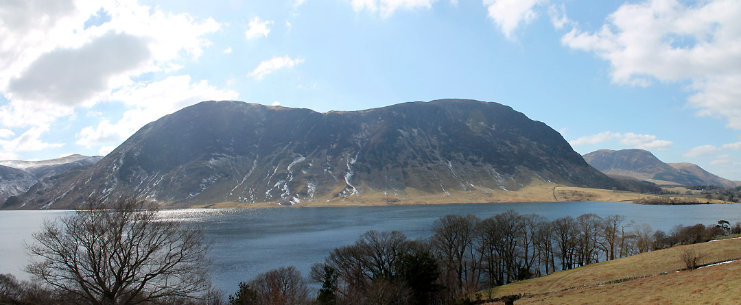
Crummock Water from the Lanthwaite Green Road. The snow down here is clearing reasonably quickly but on the high fells the conditions are definitely still wintery.
Mellbreak from the same spot.
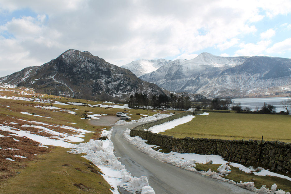
Cinderdale car park . . . the road was blocked by snow for a short while along this section but was quickly cleared, probably by the local farmer.
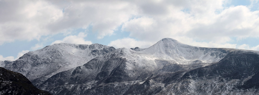
" I lift my head to the hills . . . " The High Stile Ridge including the shapely Red Pike . . . which is looking a distinctly white peak at the moment.
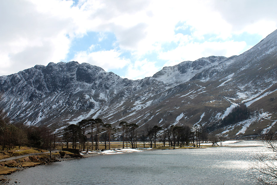
" He's taking pictures of the Buttermere Pines again ! "
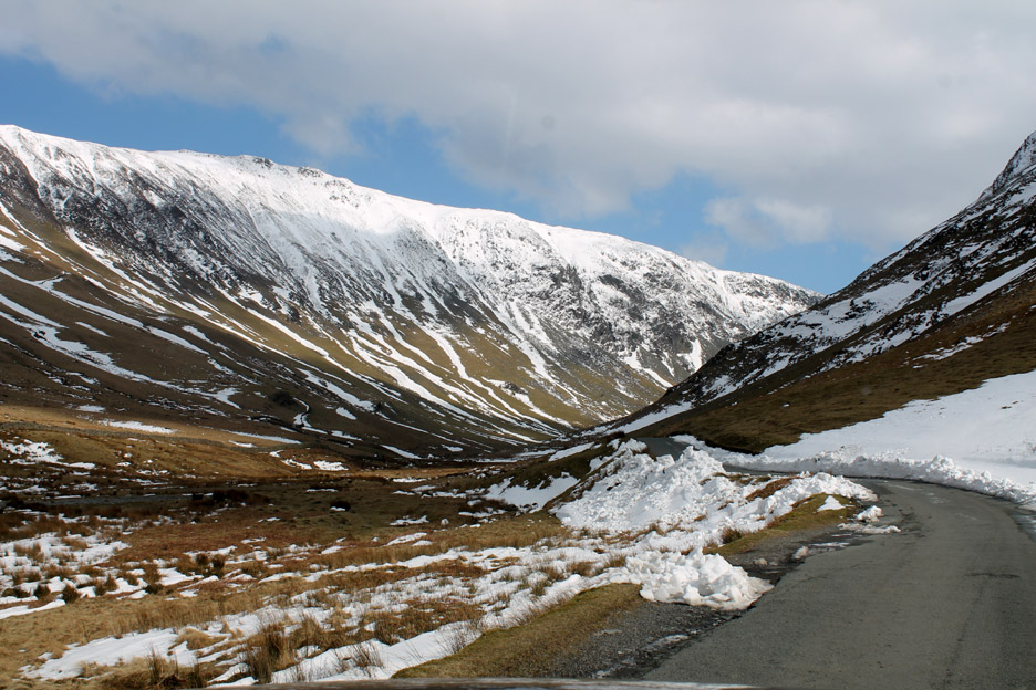
Heading on through Gatesgarth into what is technically known as Gatesgarthdale.
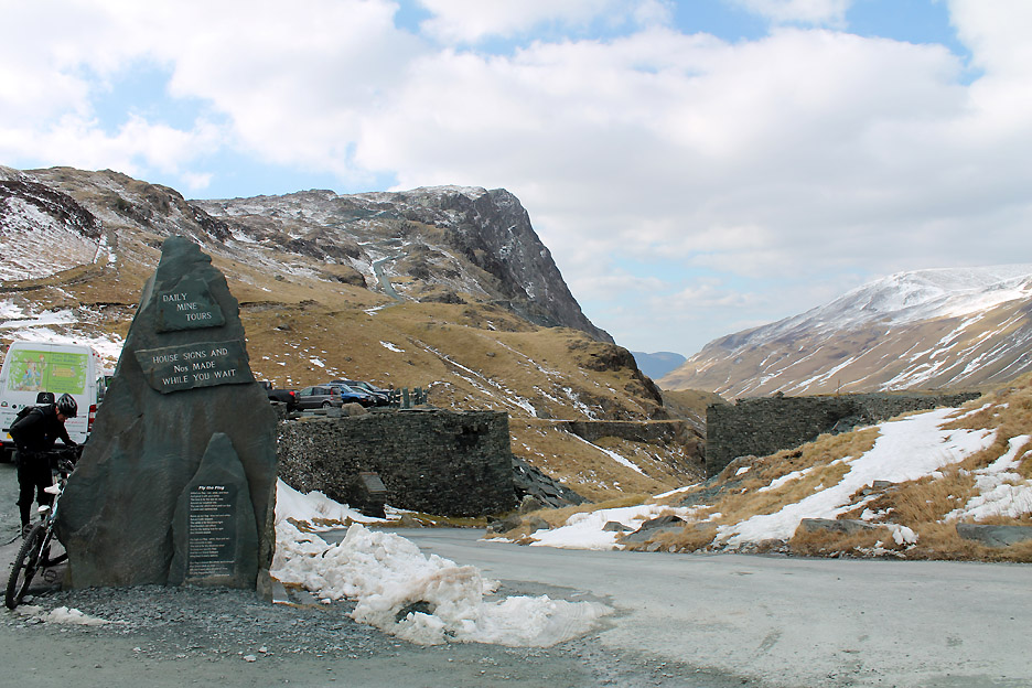
To you and I it is more often referred to as Honister Pass.
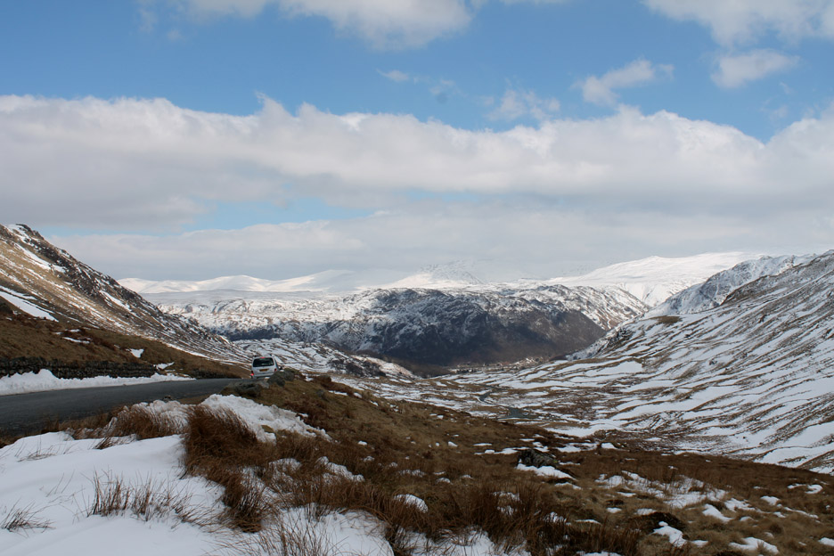
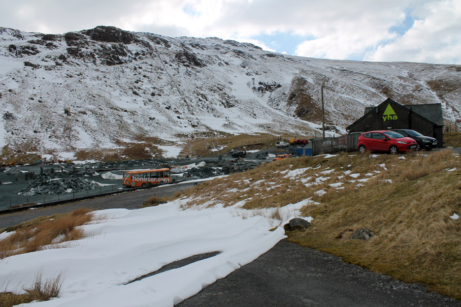
Clear roads and no ice means an easy drive to the top. At the brow of the hill, next to the Youth Hostel, I stop to admire the view over to Borrowdale and beyond.
I was going to park in the National Trust car park but those drifts of snow seem to say " perhaps it would be better to park somewhere else !"
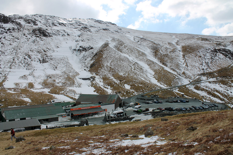
Fortunately there's the Mine car park as an alternative.
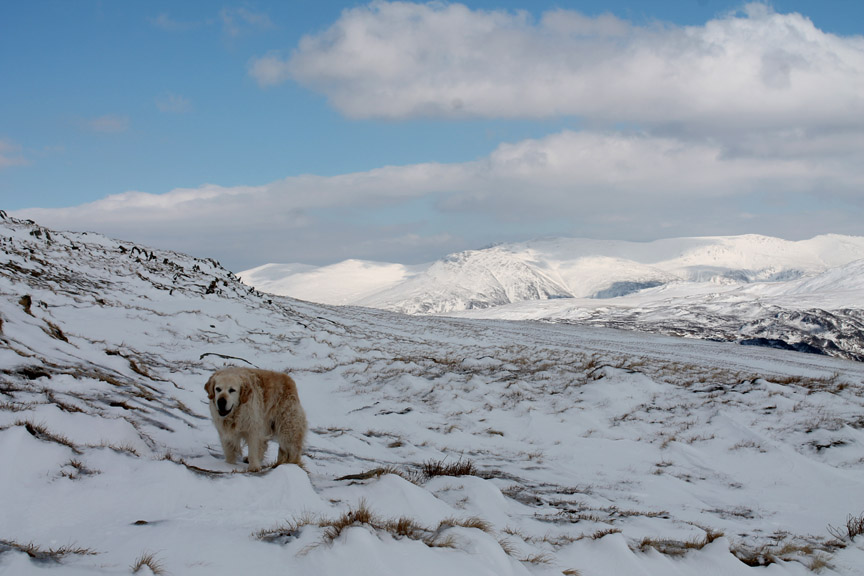
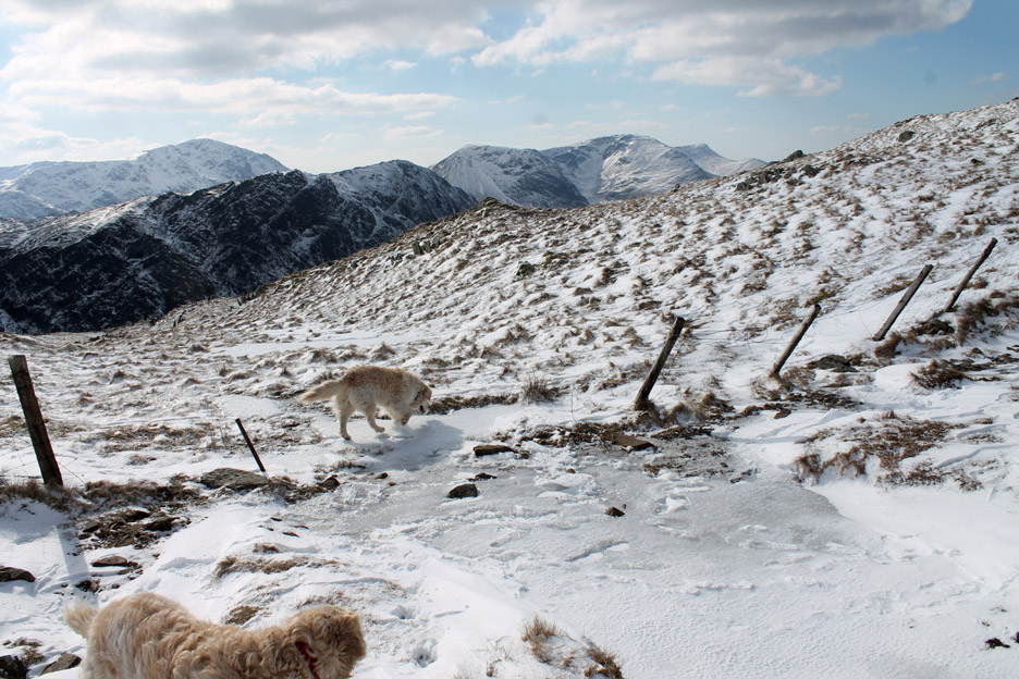
With a warm coat and thicker gloves in a small rucksack, I set off up the fells with Harry and Bethan.
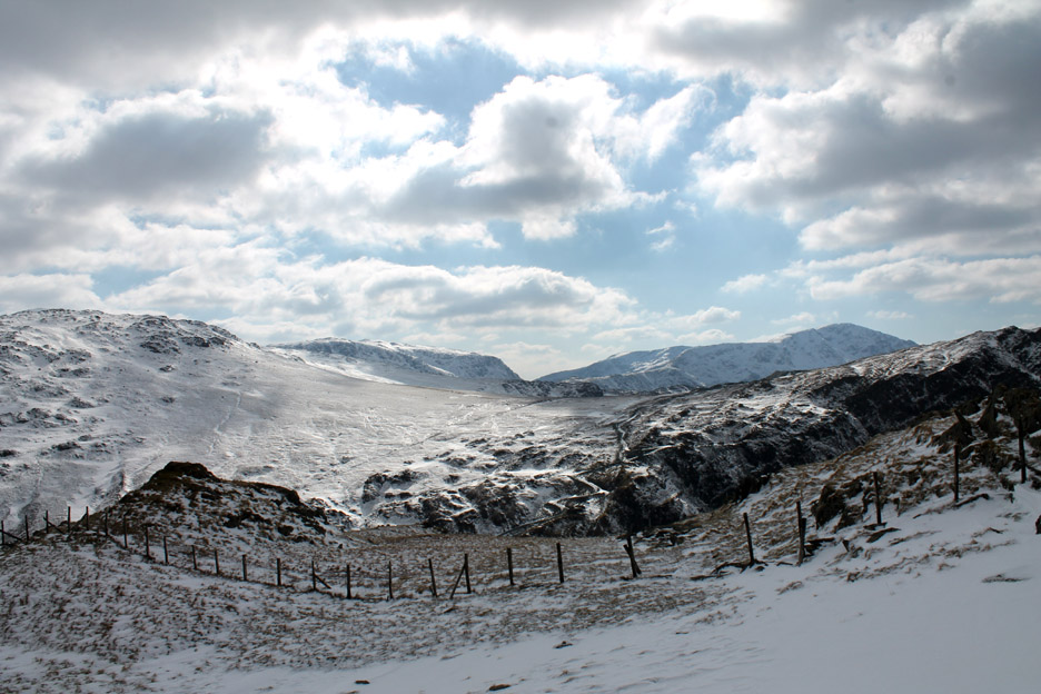
The view over to Helvellyn . . . from the sheepfold just a short distance up the fell.
What amazing weather . . . the clarity is superb . . . and the light and shade gives the snow some real contrast. Note the horizontal bands of snow on the side of Seatoller Fell opposite . . . I put that down to the strong wind blowing the snow sideways.
As I climb the more distant fells make an appearance . . . Kirk Fell, Haystacks and mighty Pillar to the west.
Harry pretending to be a polar bear again !
Ullscarf has a deep covering, but the crags of Bessyboot and Glaramara are showing through the snow.
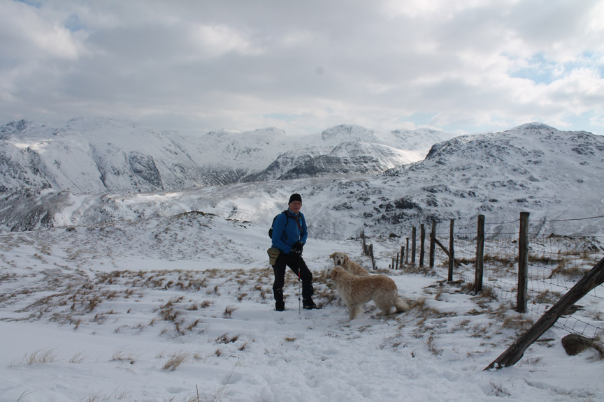
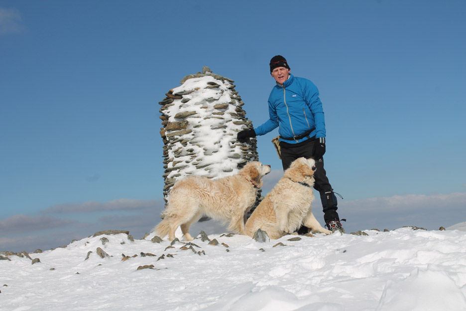
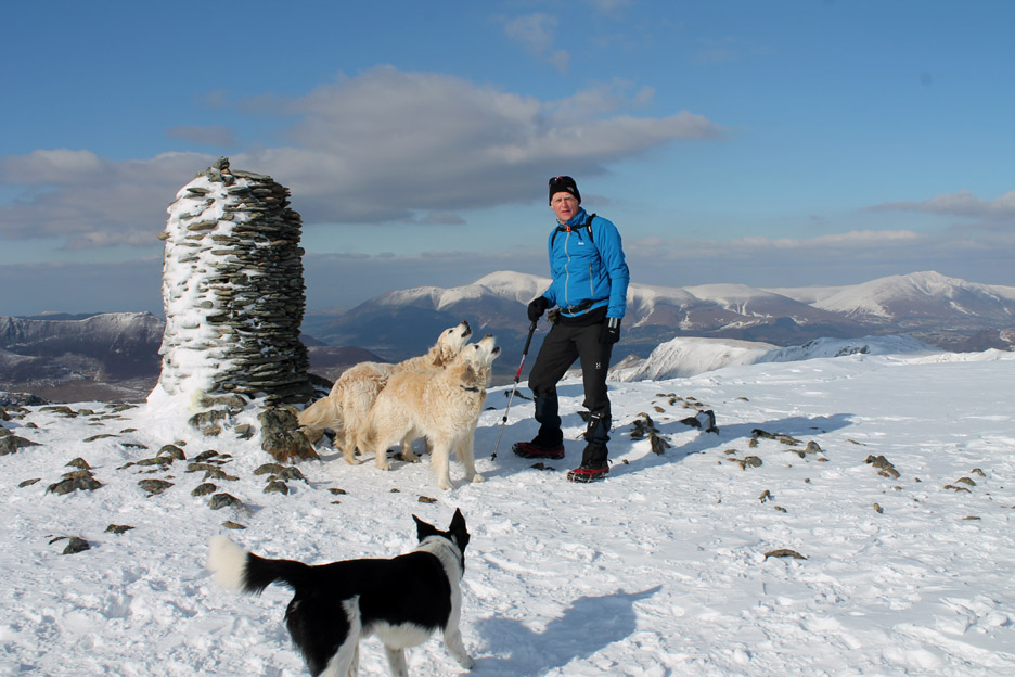
One for the record . . . myself and the dogs part way up. Roger is wearing . . . a test jacket from work . . . a Rab Vapour-Rise-Lite jacket. It is a lightweight pertex windproof jacket with a thin fleece lining . . . let's see if it keeps the wind out today !
The peaty bog half way up is frozen today and crossing it is no problem.
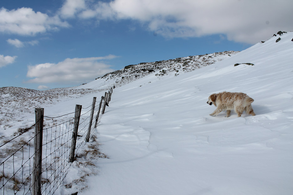
In the lee of one of the crags the snow has drifted quite deeply but it was no problem to cross the fence through one of the gaps and walk on the grass to the side.
Stunning sunlight on Blencathra in the distance.
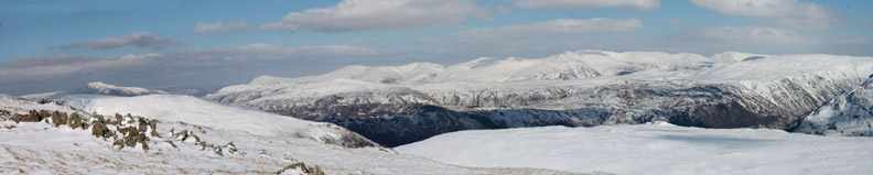
In fact as I climbed the view got better and better. Click here or on the photo above for a larger Loweswatercam annotated panorama
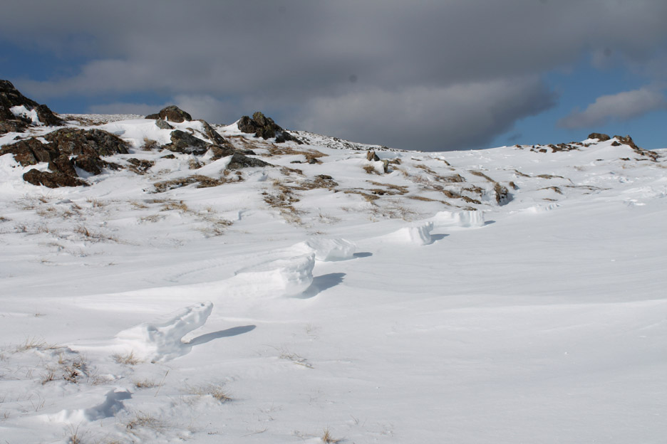
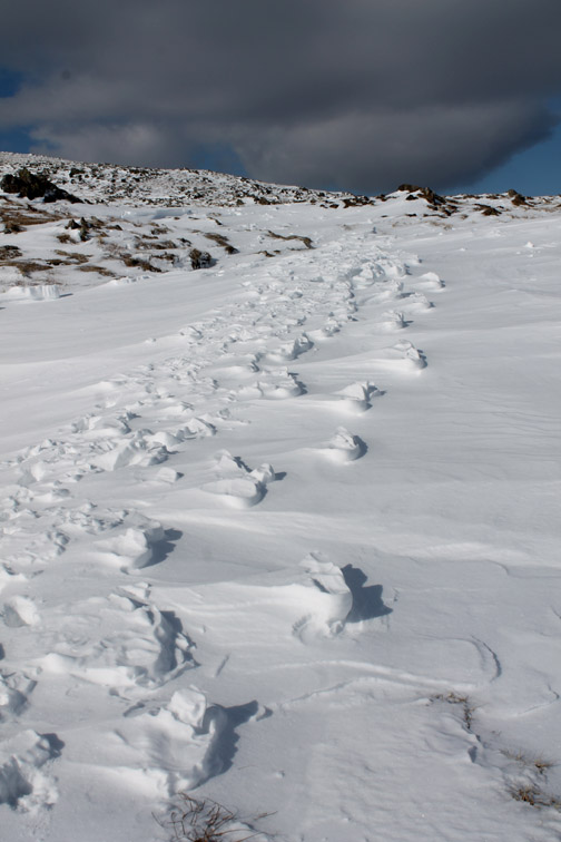
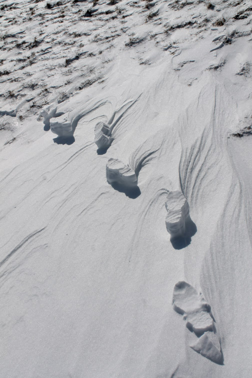
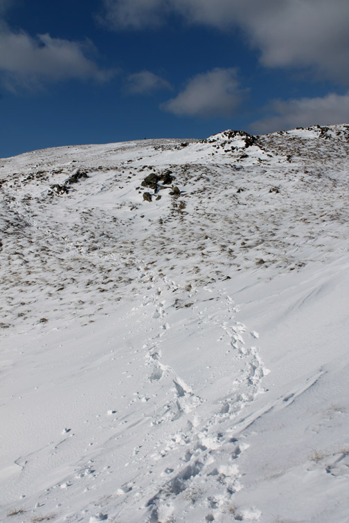
Have you ever seen lumps in the snow like this ? They were about a foot long and raised up out of the snow, about a yard apart . . . any ideas ?
The raised snow was due to a someone walking on the snow in the last few days, compacting it into solid footprints. The strong breeze has then blow away the soft snow from around the indentations causing them to stand proud above the reduced snow level. Looks like about a size ten or eleven set of boots to me !
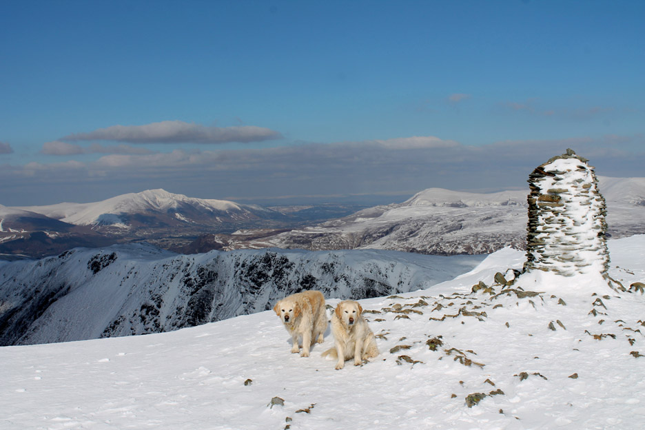
In what seemed no time a all I was here at the top and the view from Dale Head was as stunning as I had hoped. Clear skies, clear air, clear as far as the eye could see.
Another self-timer shot, this time with the camera perched on the rucksack. A cool breeze up here but the jacket is toasty warm . . . if perhaps one size too small . . . . . . or perhaps the coat is the right size and the body inside the coat has had one too many slices of toast !
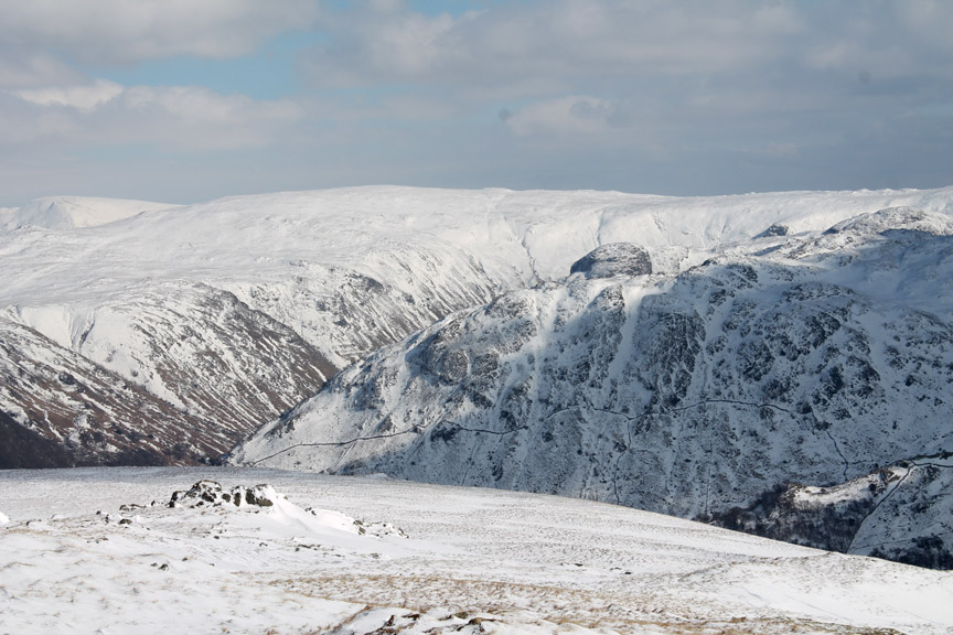
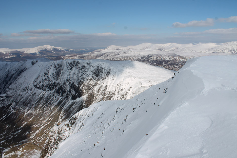
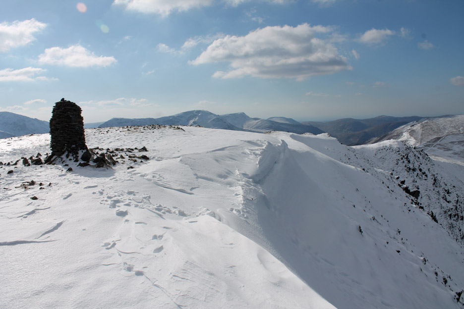
Time to turn round and enjoy the view, here looking over the cornice towards High Spy and Clough Head.
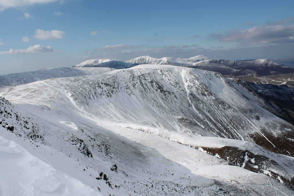
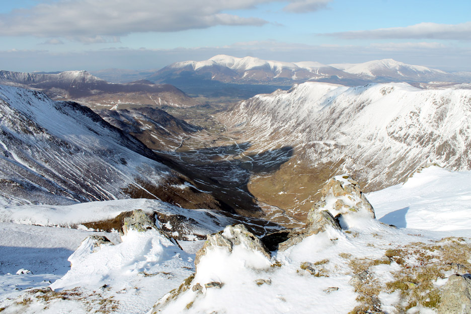
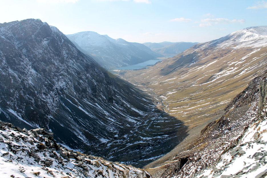
Ahead is the classic view of the Newlands Valley . . . a classic 'U' shaped glacial valley for all you budding geographers out there. [ It would take a lot more snow than this to re-start the glaciers.]
Looking around to the north-west with Hindscarth, Robinson and the distant North Western fells.
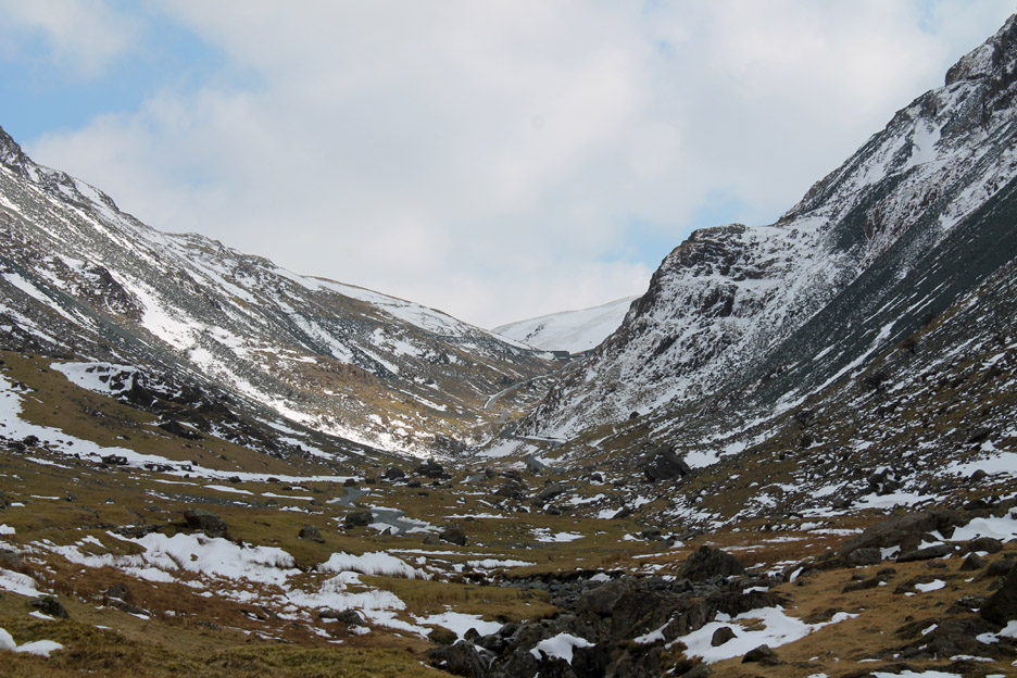
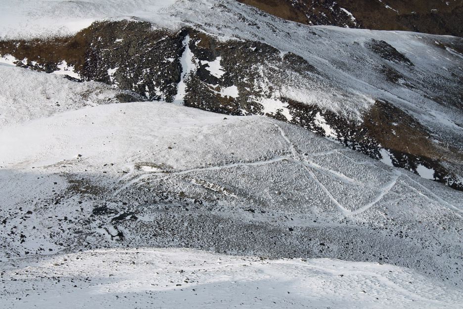
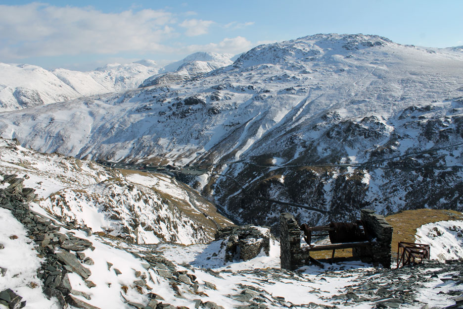
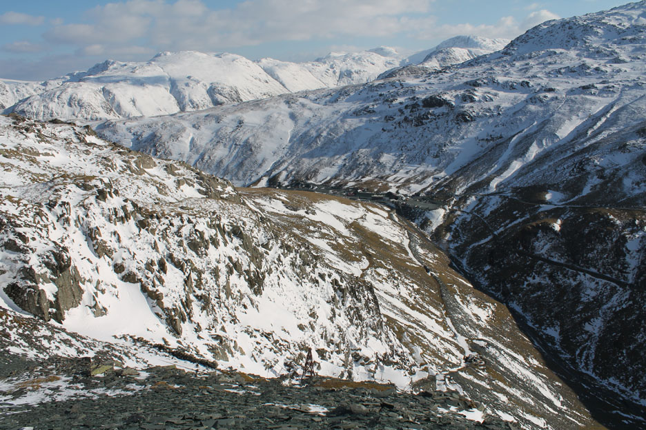
" Tracks in the snow " There is an ascent route up Dale Head from the north using the old mine track which zig-zags up the fell side. The remains of the mine workings can be made out in the snow some 700 feet below.
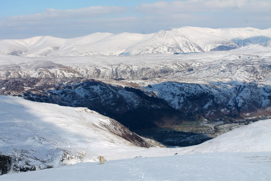
You can't see down into Borrowdale from the summit cairn so I walk a short distance east to look down into a different valley.
The darker colours of the valley floor close to Rosthwaite . . . although the village itself is still out of sight.
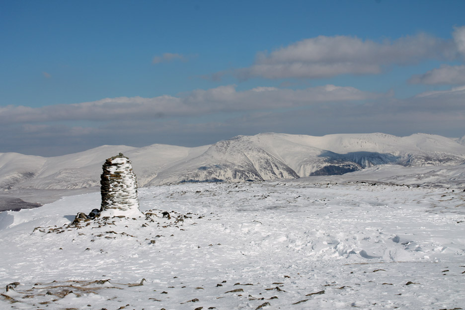
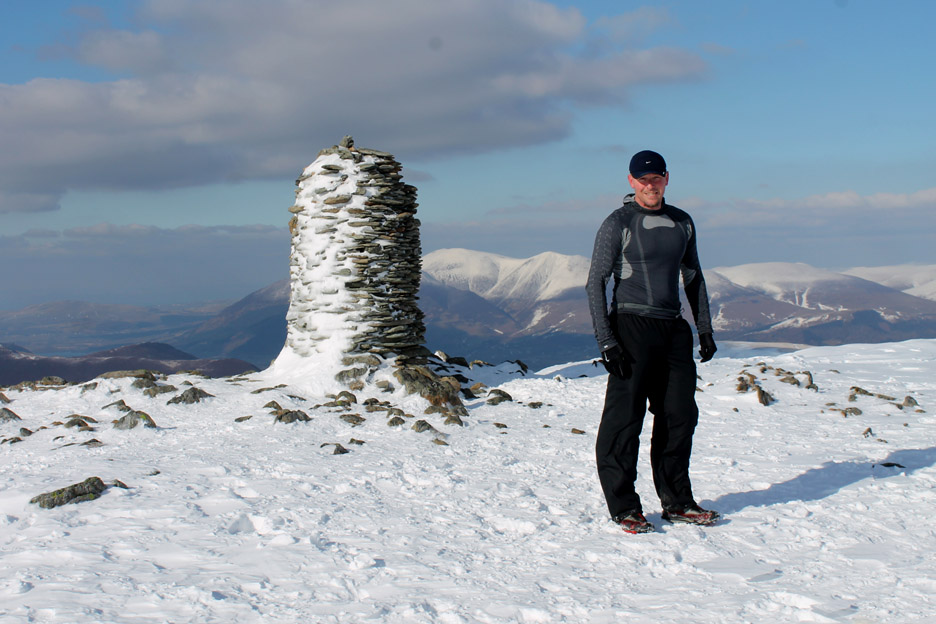
Back up to the summit . . . this side of the cairn is devoid of snow and so the dark stone stands out boldly against the white landscape.
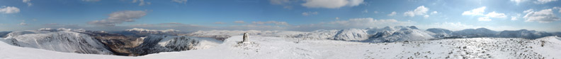
Time to go for a quick spin . . . but don't get dizzy this close to the edge. Click here or on the photo above for my Loweswatercam 360 degree annotated panorama
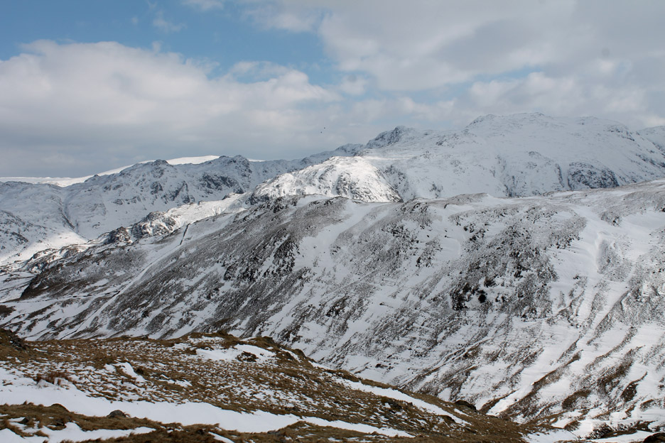
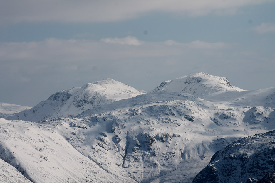
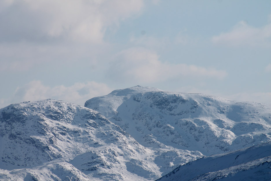
Time to change the lens and see what a few close-ups reveal. This is Bowfell and Esk Pike over Allan Crags . . . Esk Hause is the flat snow to the right.
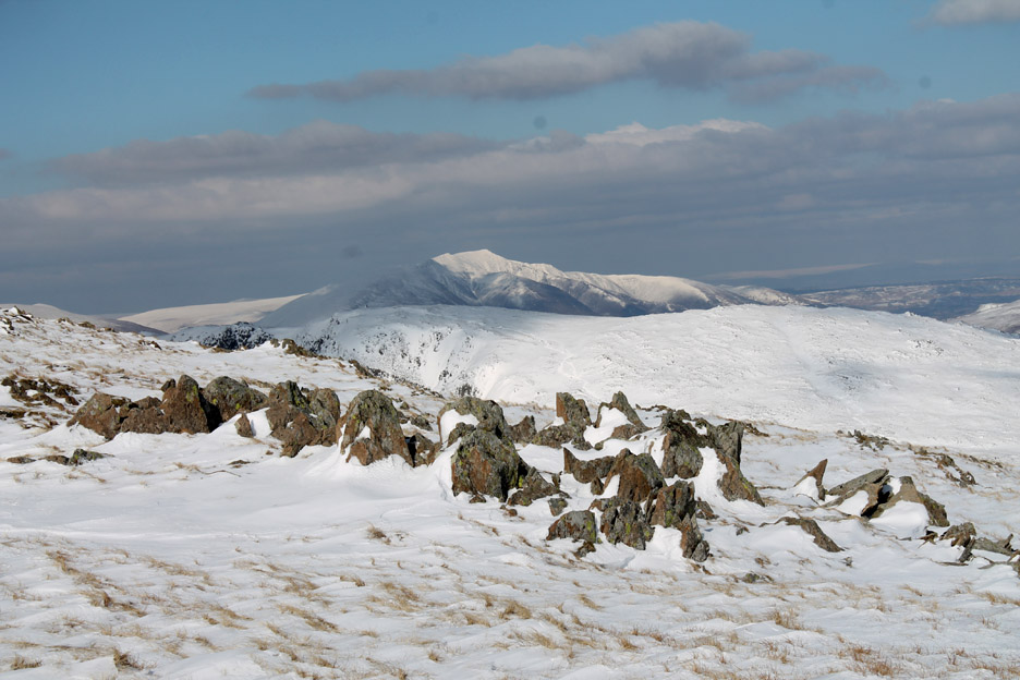
The highest summit in England . . . Scafell Pike . . . seen here beyond Broad Crag on the left.
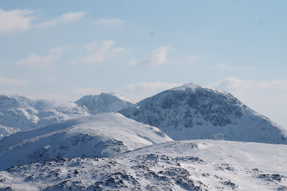
Distant Scafell seen beyond Brandreth, Green Gable and mighty Great Gable. Great Gable looks bigger but Scafell is in fact over two hundred feet (65m) higher.
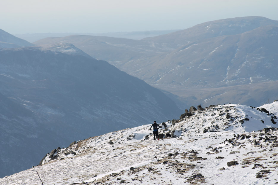
I thought I had the place to myself . . . but suddenly someone runs up from the Dale Head Tarn direction so we exchange cameras temporarily and record the moment for each other.
Behind me you can see Blencathra and Skiddaw. The guy taking my photo was practicing for a future Bob Graham run, a sub-24 hour, 66 mile, 42 peak marathon attempt around the Lakes. He had parked at Threlkeld earlier today, ran Blencathra and Skiddaw, returned to his car then driven to Catbells and was now completing a second run from Catbells up High Spy, Dale Head and returning via Hindscarth to Little Town . . . it puts my little 3 mile walk in perspective !
We chatted for a short while and he was on his way . . .
In no time at all . . . he was half way over to Hindscarth.
A group of snow covered rocks form a foreground for a final shot as I left the summit for my descent.
I was not the first but there had been very few people over this direction since the snow had fallen.
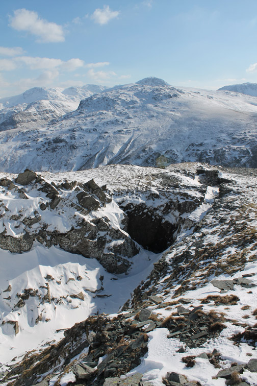
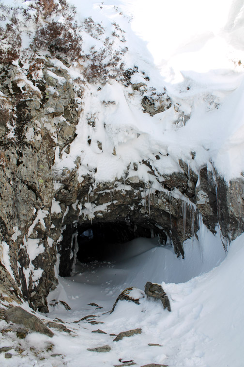
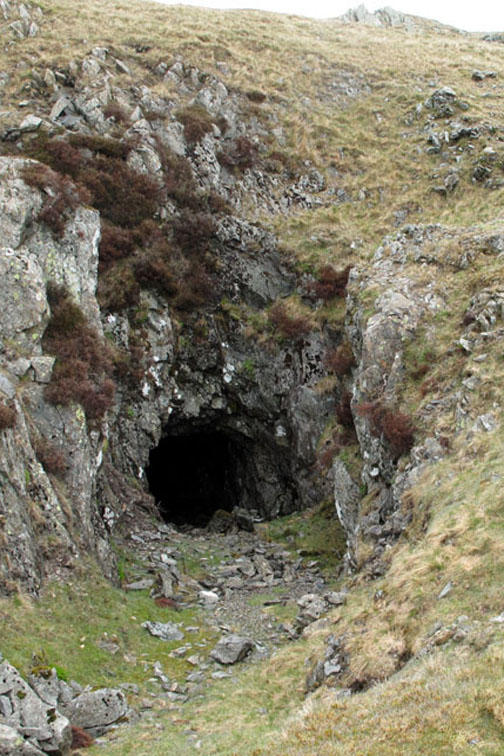
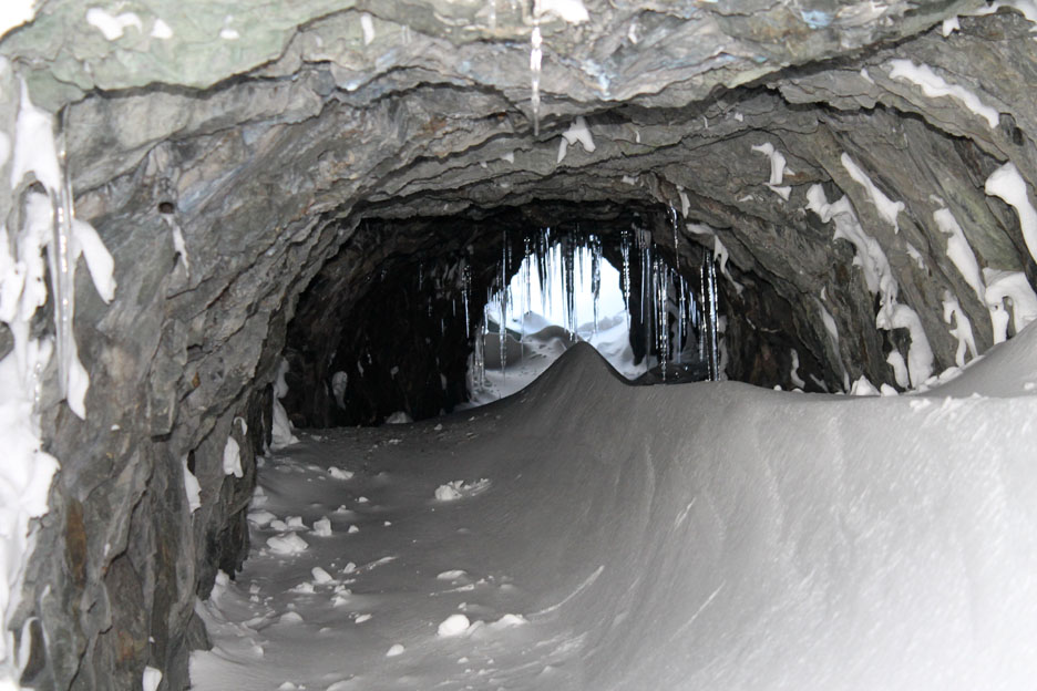
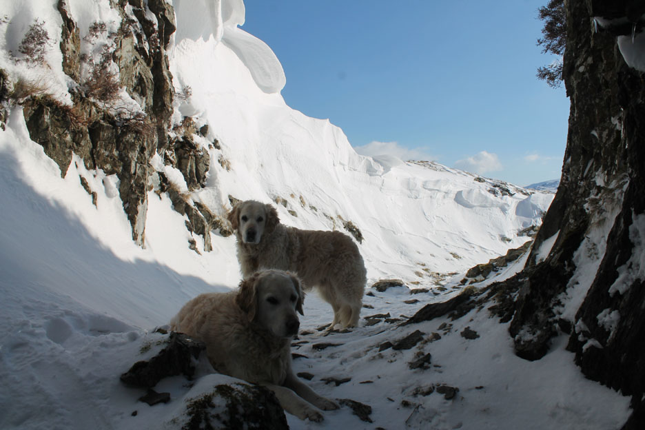
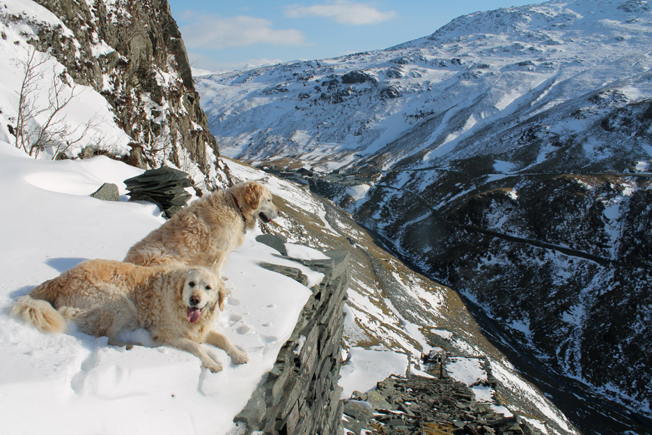
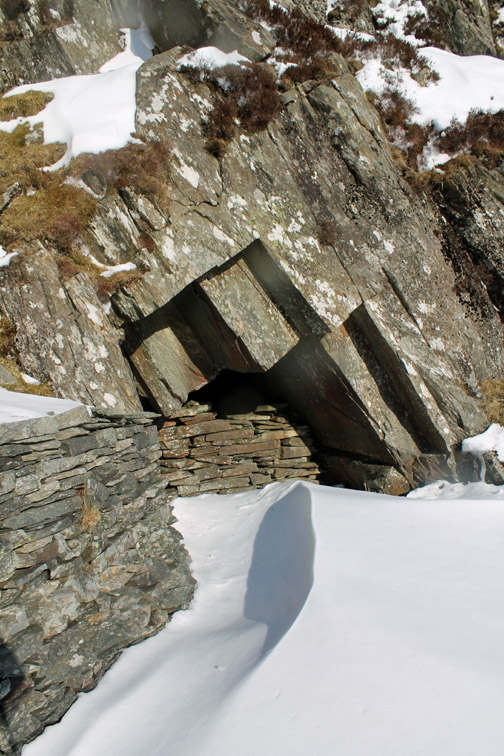
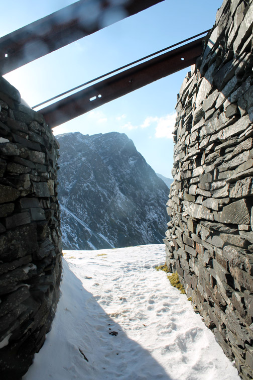
I didn't venture into or through the tunnel today for obvious reasons . . .
. . . but I did manage a photo of the dogs as I looked out from the entrance.
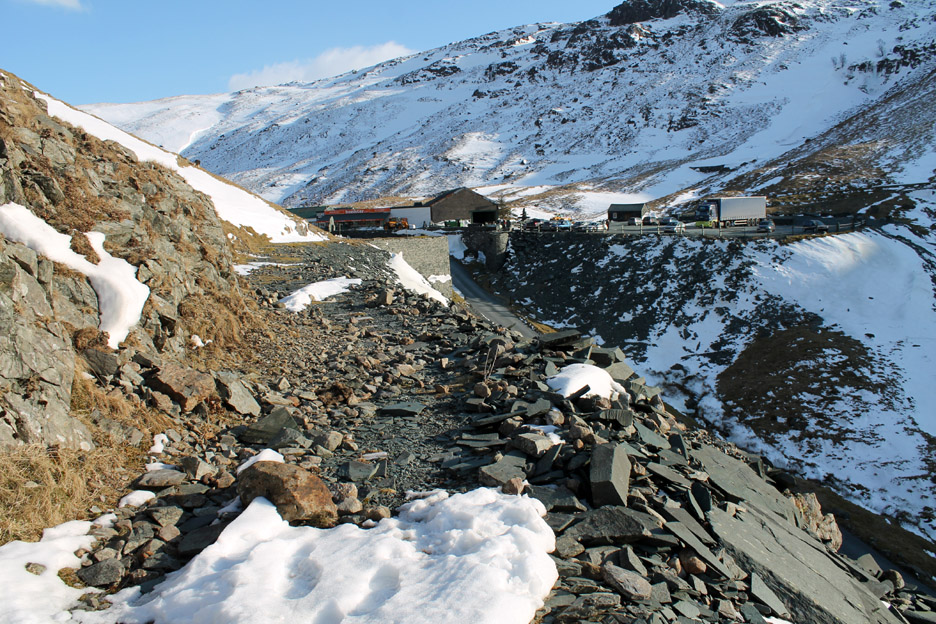
Lower down and steeper now. Care needed on the loose ground . . . the slate was even more slippery than the snow . . . but the microspikes worked really well. [ I wouldn't have come down this way without them or without having walked this route several times before.]
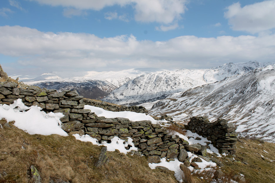
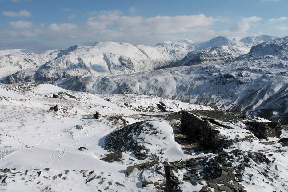
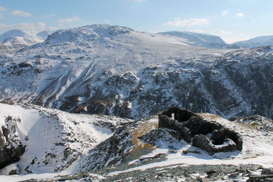
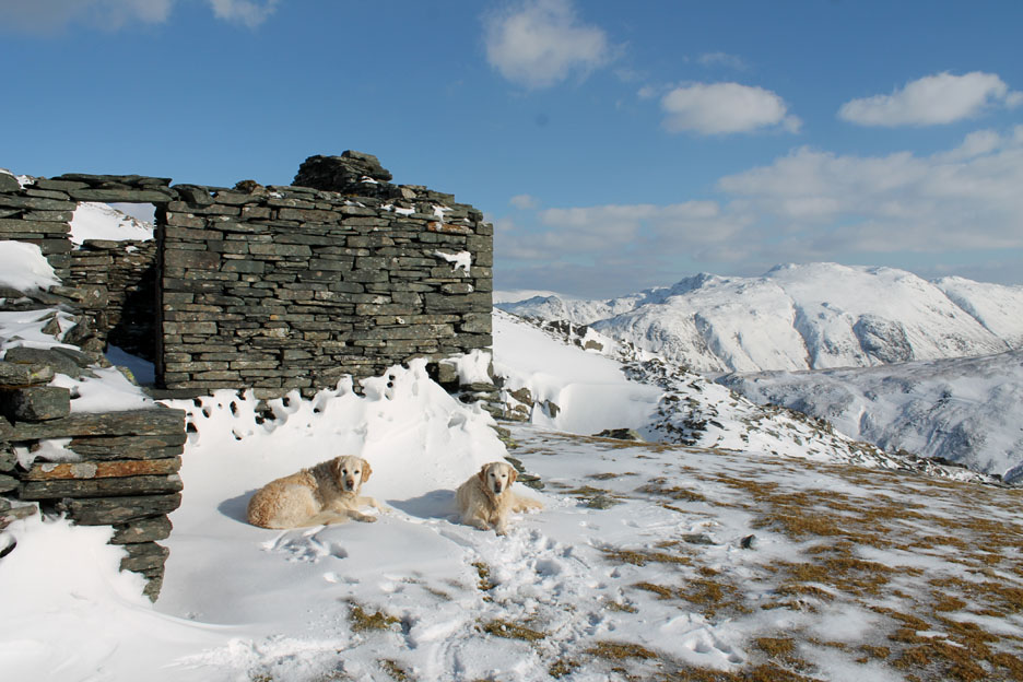
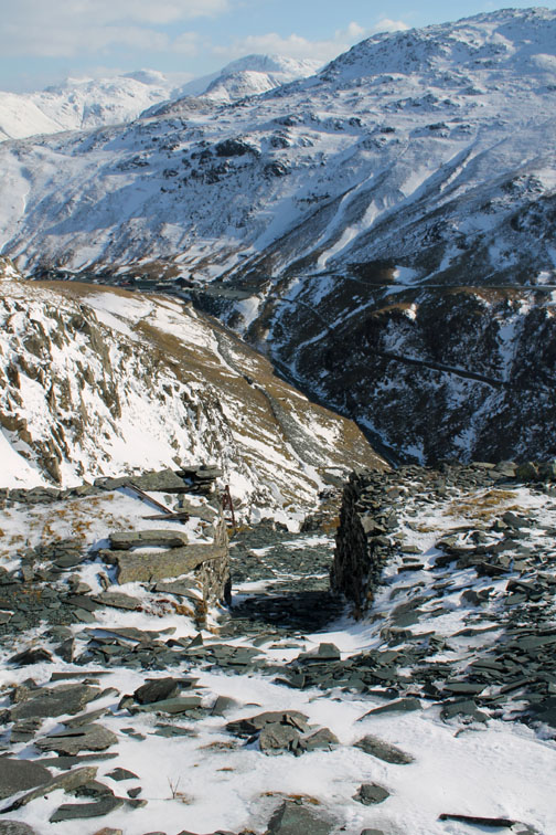
We pause outside one of the mine buildings for some chocolate and (for them) some dog treats.
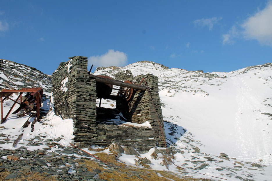
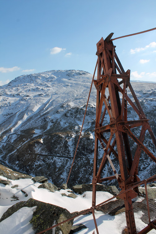
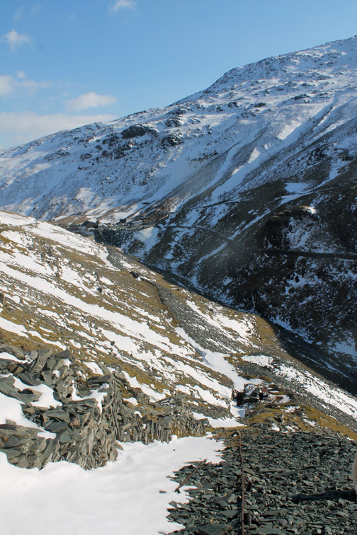
Above the top winding house of the old funicular railway.
Old working slate set against the blue sky.
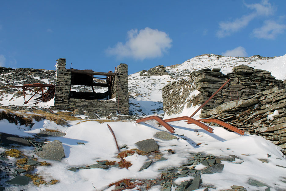
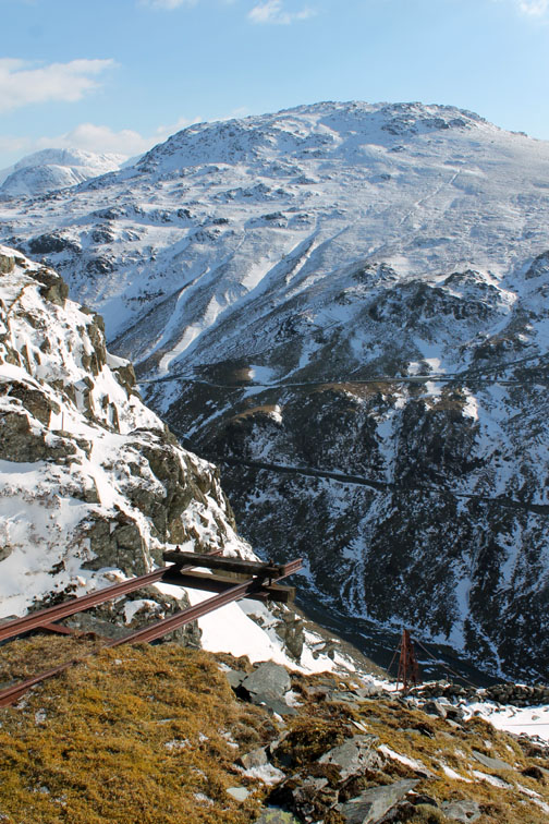
The bent rails signify the start of the descent to the valley below.
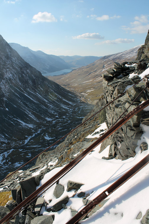
Looking down the route of the old cable railway.
There's a great view down towards the Buttermere Valley
" Mine Surveyors "
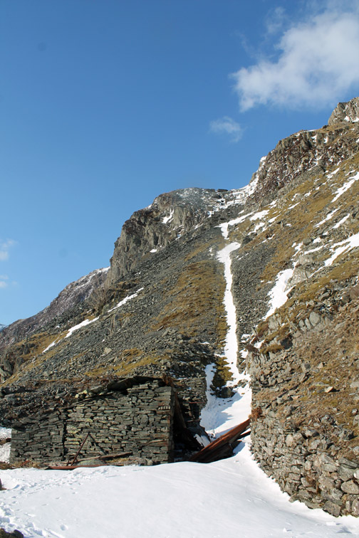
The old hut at the bottom of the incline has suffered from the weather in recent years and part of the roof is now blocking the tramway.
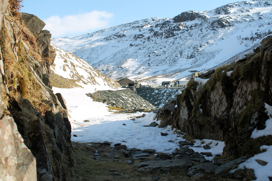
Through the small cutting . . . the end is in sight.
The familiar sight of that bright bracken coloured sign means that cup of tea is not far away.
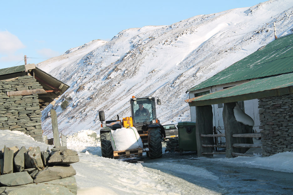
The car park is a bit of a lorry park today as another order is being dispatched from Honister.com. It is really nice to see the mine still working (in all its aspects) and thereby keeping the 400 year old tradition alive.
Give way . . . priority to the workers . . . he's bigger than us anyway ! Now where did I put that pound coin for that cuppa ? - - - o o o - - -
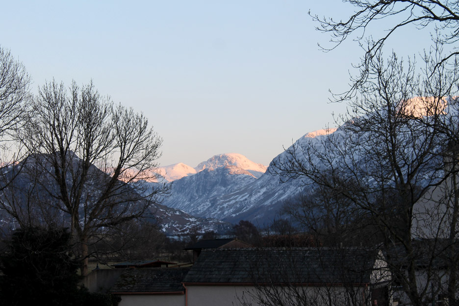
One last photo . . . from the garden again . . . as the late afternoon sun brightens the fells as it has done most of the day. - - - o o o - - - |
Technical note: Pictures taken with either Ann's Canon Sureshot SX220, my Canon G10 or 1100D SLR digital cameras. Resized in Photoshop, and built up on a Dreamweaver web builder. This site best viewed with . . . a second cup of tea at home afterwards. Go to Top . . . © RmH . . . Email me here Previous walk - 27th March 2013 - Buttermere ~ Round the Snowy Lake A previous time up here - 20th May 2010 Dale Head to Buttermere Next walk - 2nd April 2013 - Frozen in Honister Time
|