![]()

Remember: Press F11 for a full
screen view of this page.
|
|
|
Remember: Press F11 for a full
screen view of this page. |
| " Darling Fell in Valentine's Week " Date & start time: Monday 11th February 2013, 3.35 pm start. Location of Start : The Mosser Road end , Loweswater , Cumbria, Uk ( NY 128 217 ) Places visited : Darling Fell from Mosser Road. Walk details : 2.2 mls, 850 ft of ascent, 1 hour 30 mins. Highest point : Darling Fell 1270 ft - 391 m. Walked with : Ann and the dogs, Harry and Bethan. Weather : Sunny but a very cool north easterly breeze on the top. |
" Darling Fell in Valentine's Week " at EveryTrail [ Alter the settings to zoom or change the Map, use Everytrail to download the Gps route ] |
|
A local walk on a sunny afternoon ... ( I was not fit for a longer one due to severe 'man-flu') Still I survived the morning and after lunch it was felt that a breath of fresh air would benefit man, woman and dogs alike. We chose a walk that turned out to be very topical this Valentine's Week.
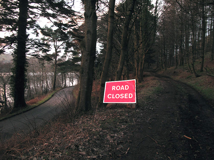
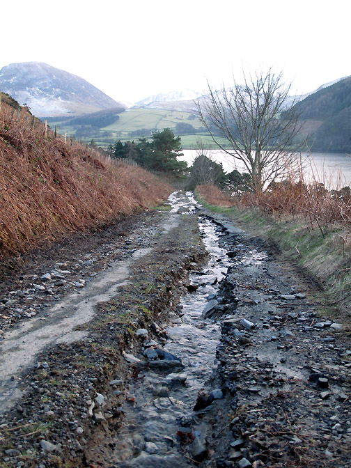
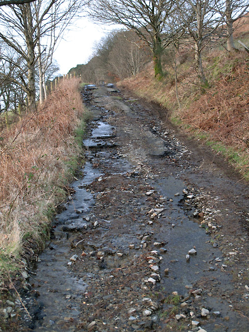
Don't panic . . . the road is open for pedestrians . . . and it is our way up onto Darling Fell. Lack of culvert maintenance by the highways authority has allowed a stream to overflow onto the roadway and cause such damage to the surface that the track has become almost impassable to motor vehicles . . . unthinking Gps road users beware !
We turn right over a stile onto the fell path and start our way up the steep side of the fell. A warning here to fell walking users of Gps . . . the green "right of way" bears no resemblance to the path once through the gate !
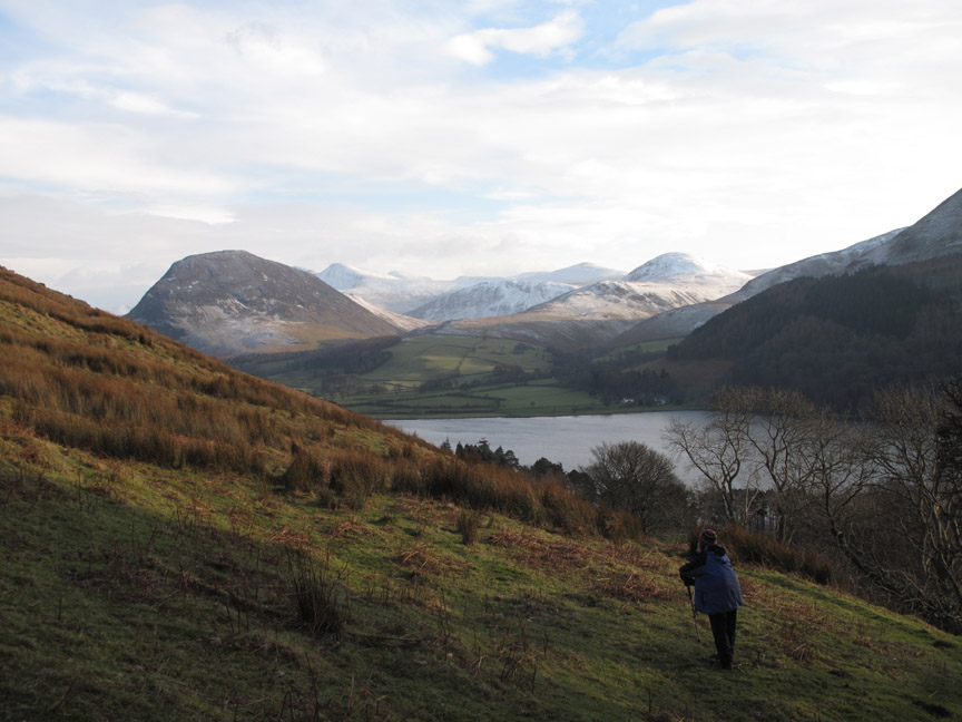
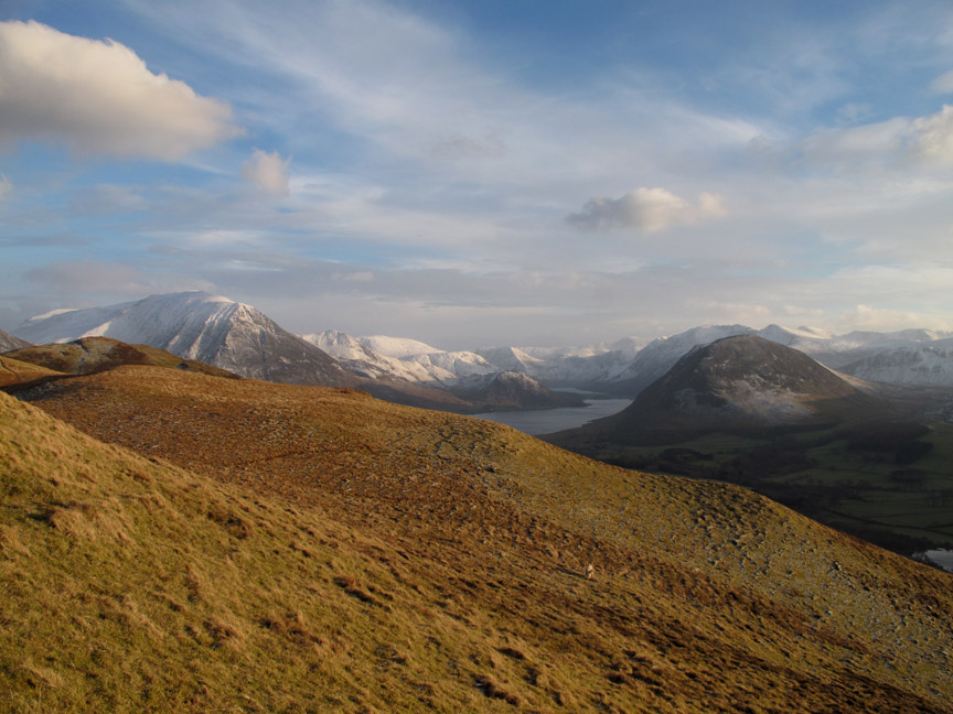
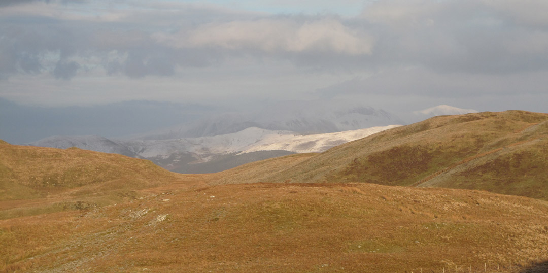
As we climb, the views across to the central fells improves dramatically.
Mellbreak and Hen Comb with Mosedale in between. The two fells probably have the same amount of snow but the heather on Mellbreak hides the snow more than the moorland grass on its partner.
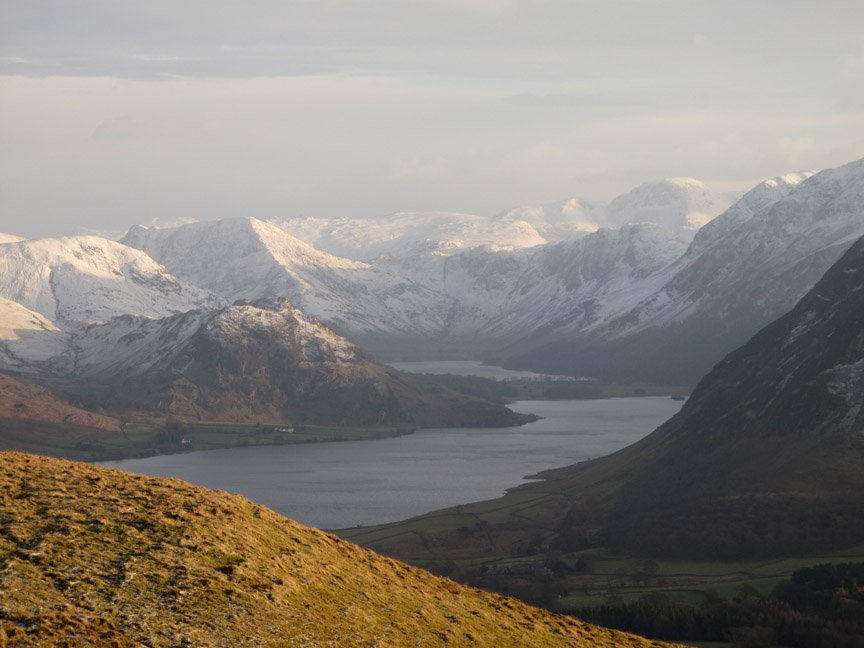
Zooming in on the head of Buttermere. The snow line probably starts at the 750 ft contour . . . I'll leave the names of the fells to you this time.
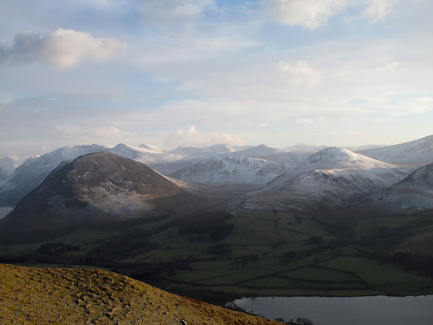
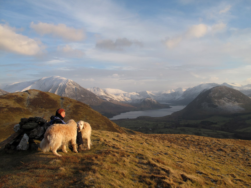
Ann stops for to enjoy the view from the cairn on the south eastern summit of Darling Fell. The most distant, and whitest of the summits here is Grisedale Pike (beyond Ladyside).
Hiding in the shadows . . . Skiddaw behind a snowy Lords Seat.
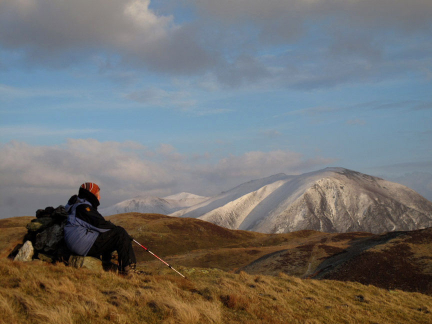
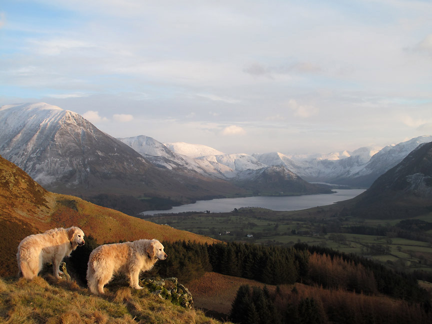
Ann is joined by the dogs who, after a play together, decide it is time to move on. It is far too cold to sit around for long anyway.
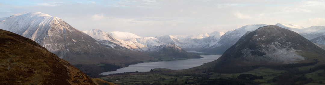
Crummock and Buttermere and the high fells continue to catch the eye . . . and draw the camera this sunny but cold afternoon.
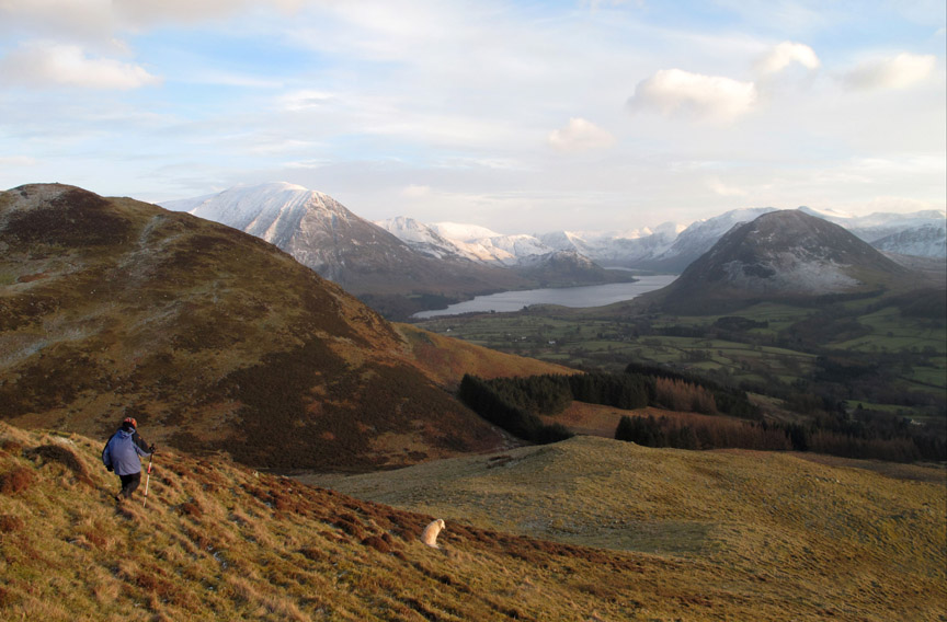
Descending the southern end of Darling fell . . . to pick up a good track down there that doesn't even feature on the O.S. 1:25k map.
Working our way down. The trees below flank the valley of Crabtree Beck.
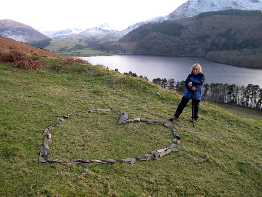
Romance is in the air . . . someone has drawn a heart in the stones alongside the old quarry. It's February the 11th . . . three days till Valentines day. [ You may wonder . . . but no . . . it wasn't me . . . romantic though I am ! ]
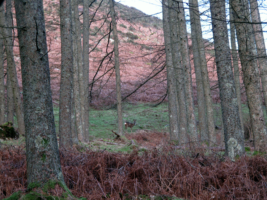
On the way back through the woods Ann spotted movement in the trees. [ Hold your cursor over the picture to zoom in on the Roe Deer. ] How romantic . . . Darling Fell . . . a rock Heart on the grass and and a white Hart in the forest ! - - - o o o - - - |
Technical note: Pictures taken with my Canon G10 digital camera. Resized in Photoshop, and built up on a Dreamweaver web builder. This site best viewed with . . . a bunch of flowers or a big box of chocolates ! Go to Top . . . © RmH . . . Email me here Previous walk - 9th February 2013 - Poor Weather keeps us low A previous time up here - 25th November 2008 Darling Fell with Hilton Next walk - 12th February 2013 - Mellbreak with some Snow
|