![]()

Remember: Press F11 for a full
screen view of this page.
|
|
|
Remember: Press F11 for a full
screen view of this page. |
|
" South to Punakaiki for a few days " Date & Time: Tuesday 2nd - Thursday 4th November 2011. Locations : Down the west coast to Punakaiki and on to Fax Glacier Places visited : Lake Rotoroa, Murchison. Westport, Punakaiki, Greymouth, Hokitiki, Ross, Fox Glacier. Accommodation : The Rocks Homestay, Punakaiki. With : Ann and myself. Weather : Changeable . . . sunny, but occasionally wet and windy. |
"
South to Punakaiki for a few days " at EveryTrail [ Alter the settings to zoom or change the Map, use Everytrail to download the Gps route ] |
|
We leave Ocean View at Marahau and head south across country where we spend the next few days exploring the scenery and attractions of the west coast.
Yesterday's heavy rain has cleared to leave a damp and cloudy day. Time to pack the car and leave our nice chalet.
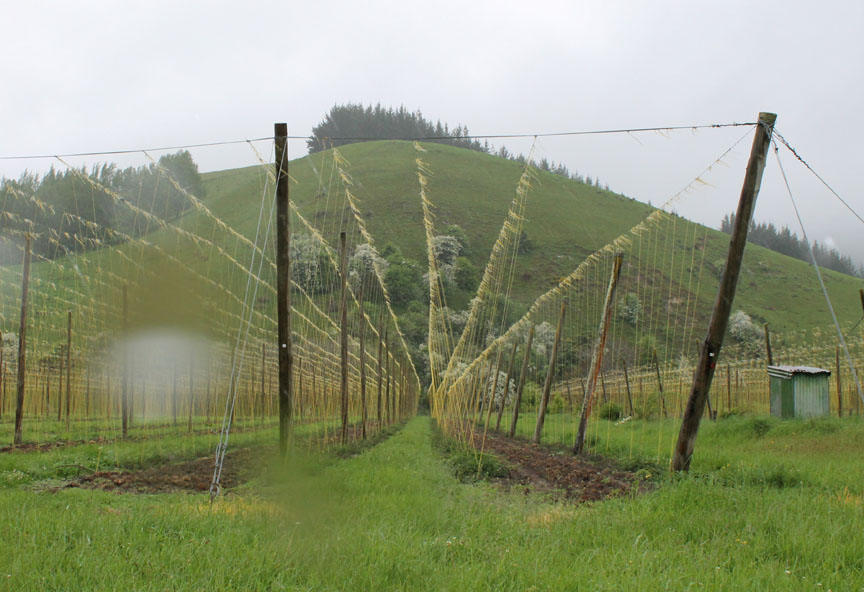
Extra tall vine fences alongside the road ? . . . no these are wires to grow hop plants for the brewing industry. Sorry about the rain on the lens . . . but there was a lot of it about as we headed south down the Motueka Valley
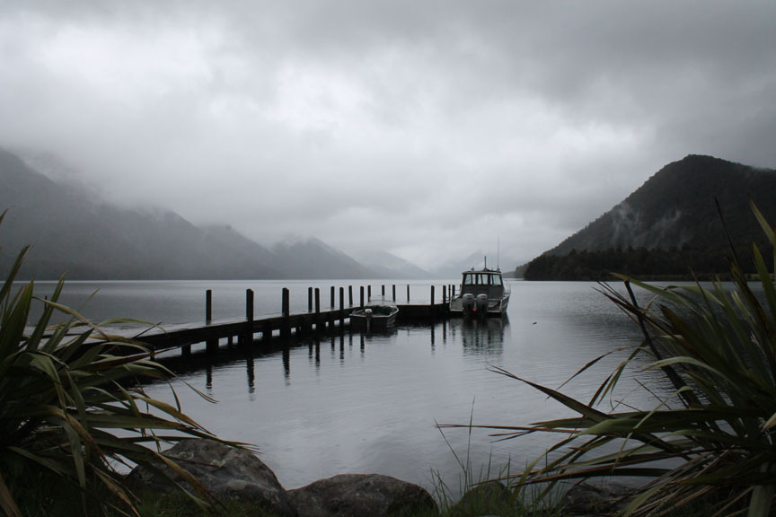
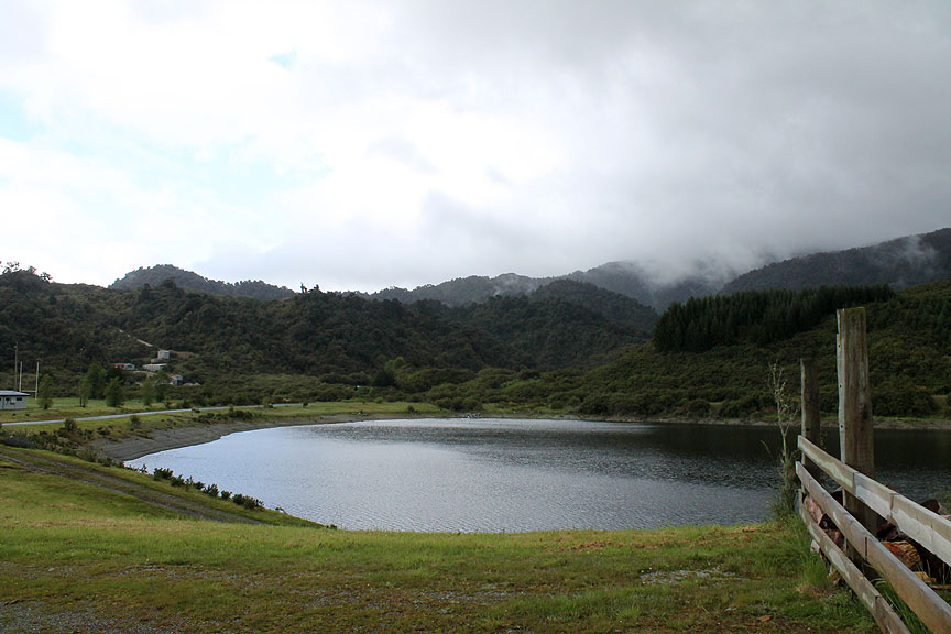
At Gowan Bridge there was a signpost for the Lake Rotoroa Scenic Reserve so we crossed the river and headed into the hills as our guide book suggested it was a scenically beautiful spot.
At the head of the road was the Lake Rotoroa Fishing Lodge (for more info on the region) and behind it a nice view of this large inland lake, the view only slightly spoilt by the poor weather.
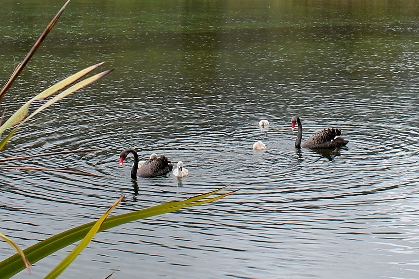
On the lake, a family of black swans, as the sky brightens to reveal some of the Braeburn Mountains (1000 to 1100m high).
Zooming in on the flotilla.
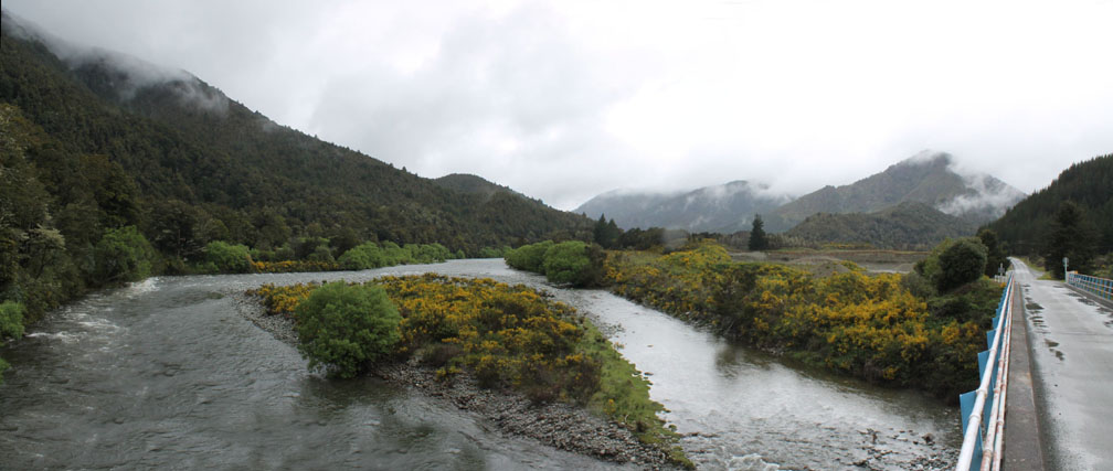
Back to the main Buller River valley now and heading in a more westerly direction towards the coast. The yellow broom is in full flower in what is the New Zealand's Spring.
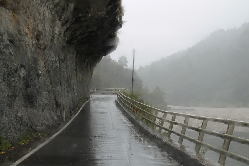
Another heavy rain shower as we round a bend in the river . . . and drive underneath a cliff. The short single track section of road has traffic lights at this point in order to avoid meeting others on the blind bend. This reduces the possibility of someone ending up in the drink . . . a good idea (the lights that is not the other !)
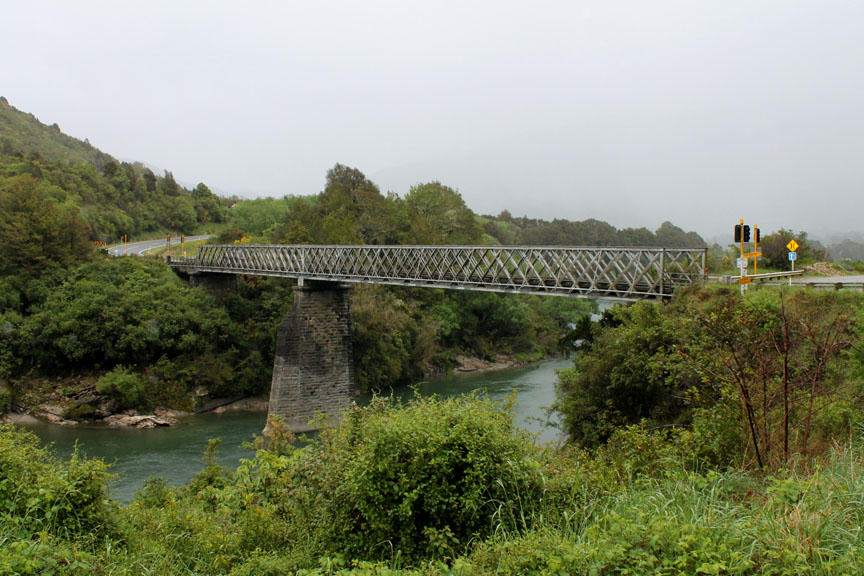
Driving out of the Buller Gorge and out of the bad weather We pause at more traffic lights at the old steel bridge in order to cross the Buller River once more.
. . . and on cue . . . the sea appears . . . I think this was Little Beach near Charleston.
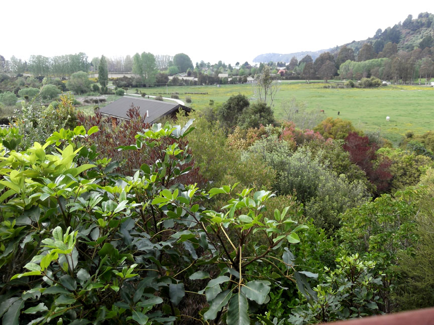
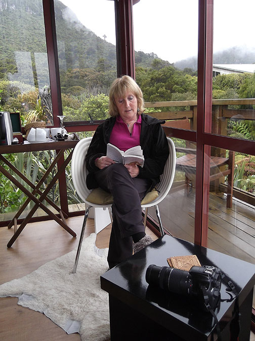
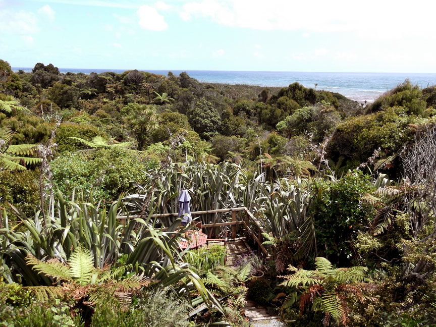
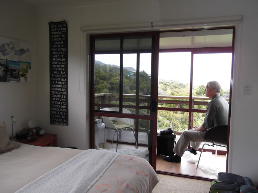
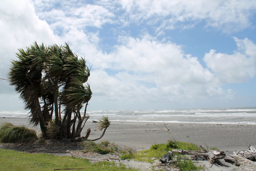
A wild but well organised front garden . . . taken from our balcony.
I think I might just sit and relax for a moment too. - - - o o o - - - My view was up to the wooded escarpment rather than the sea.
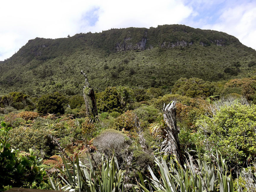
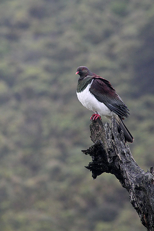
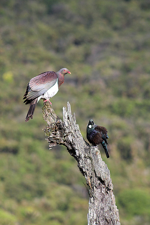
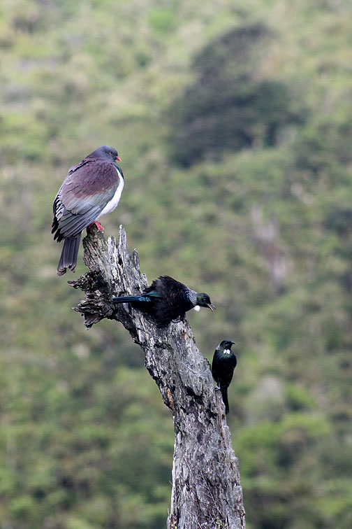
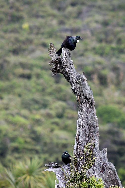
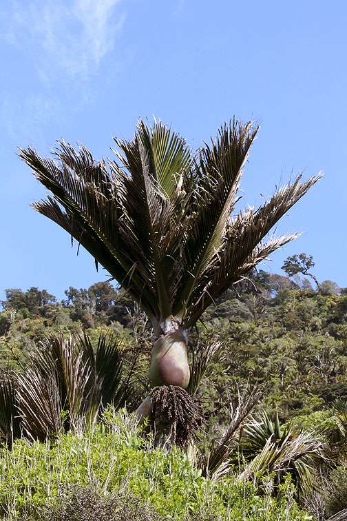
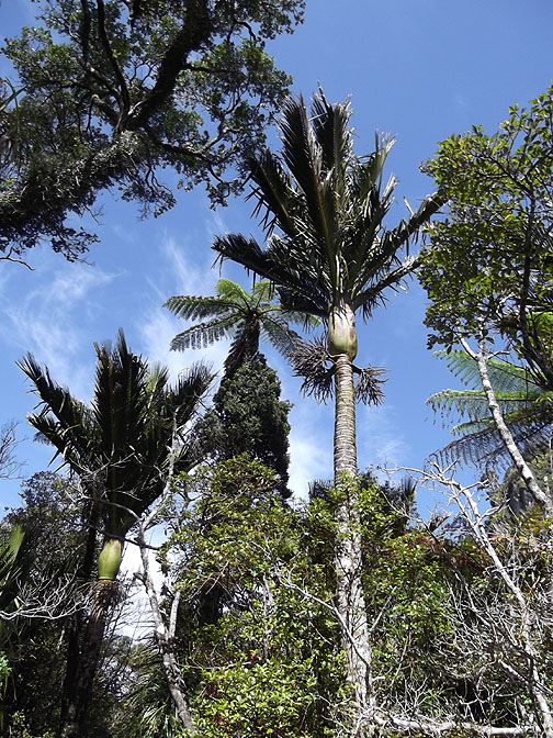
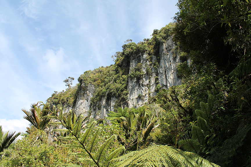
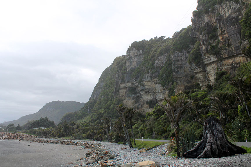
High above us was the limestone that overlooks the sea at this point on the west coast. The warm climate and the moist air allows the vegetation to thrive, giving thick forest and bushy growth right up to the top of the slopes. On the top of the more distant tree stump I spotted a pigeon . . . New Zealand style.
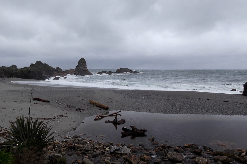
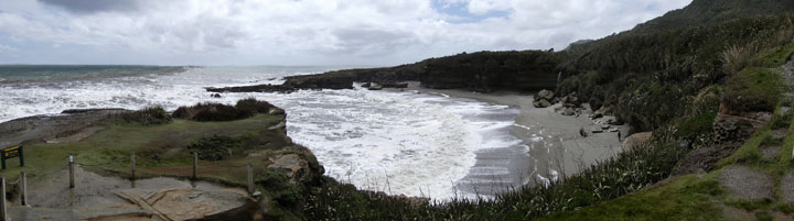
The beach at the Te Miko Scenic Reserve next morning.
Te Miko Bay Click here or on the photo above for a larger Loweswatercam annotated panorama
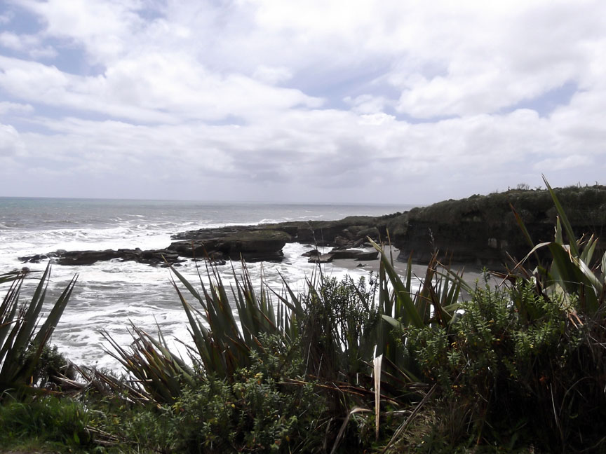
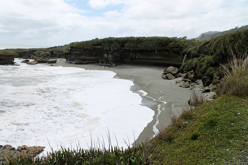
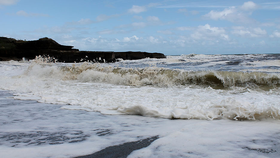
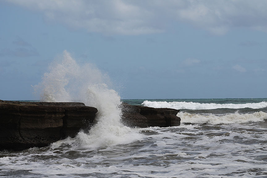
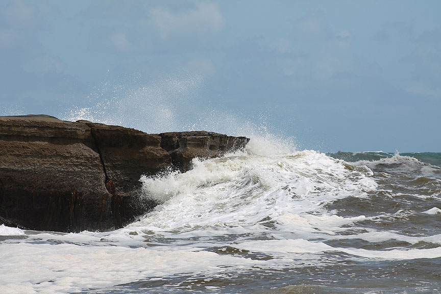
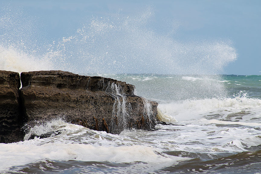
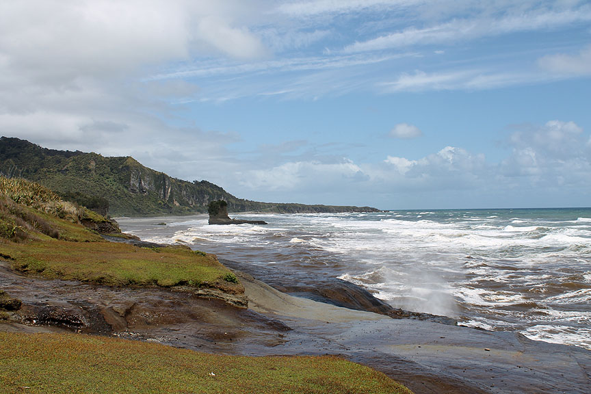
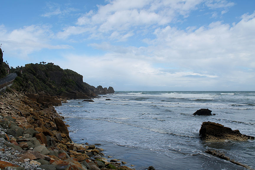
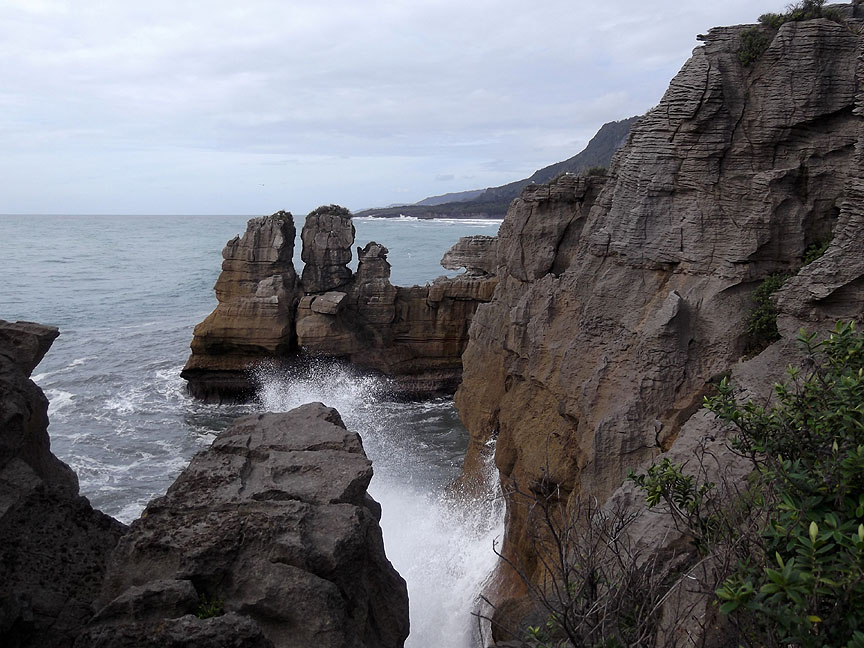
Big seas following yesterday's stormy day . . . the waves are crashing into the bay making it a spectacular place.
Down at sea level the waves are dramatic.
The horizontal strata of the rocks is attacked by the power of the waves.
No place to be swimming today . . . even if it was warm enough.
The Tasman Sea explodes against the rocks of South Island.
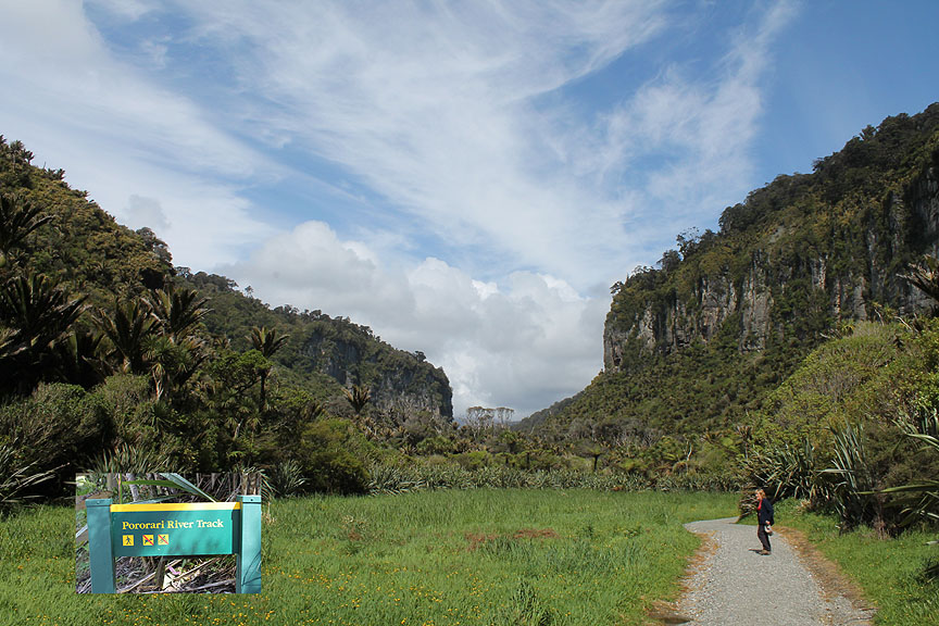
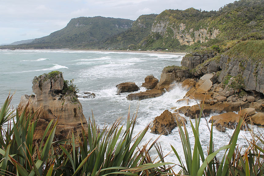
Back above the surf, looking south to Dolomite Point. - - - o o o - - - With the weather improving and the sun breaking through we drive along the coast road a short distance . . .
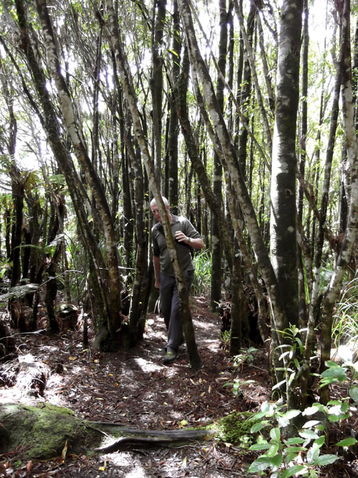
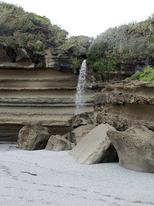
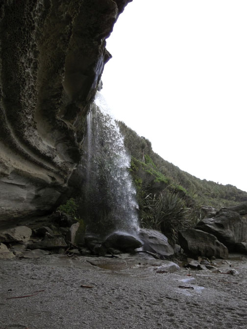
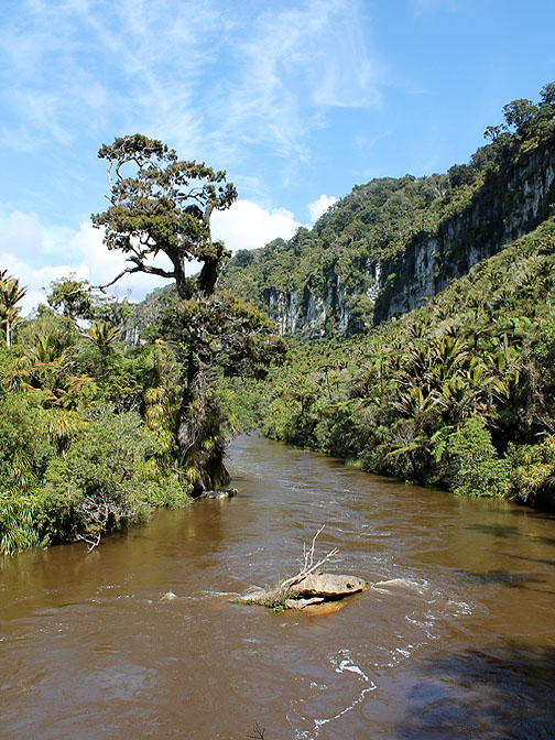
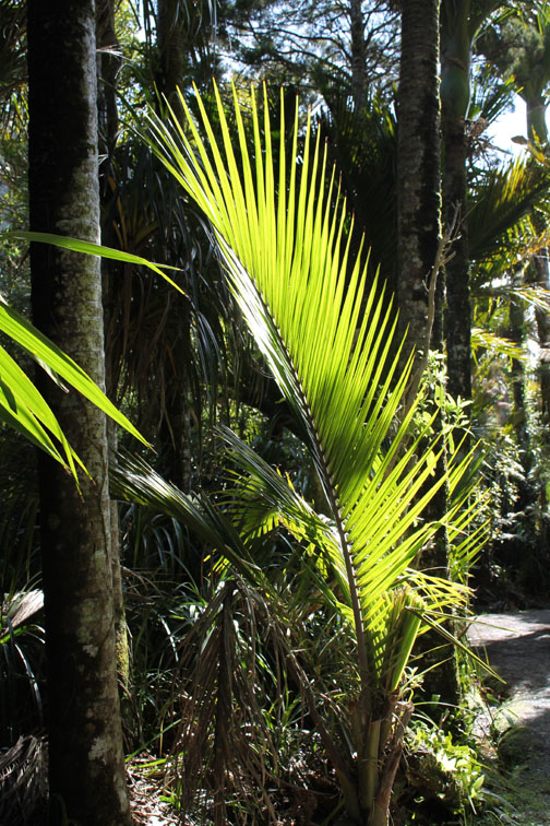
. . . and park up for a short walk up the Pororari River Track a well made and well signposted riverside walk and one of a series of long distance 'tramping paths' into the interior.
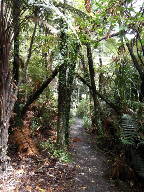
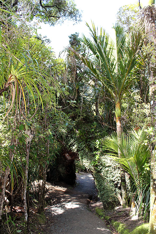
Light penetrates through the hole in the canopy . . .
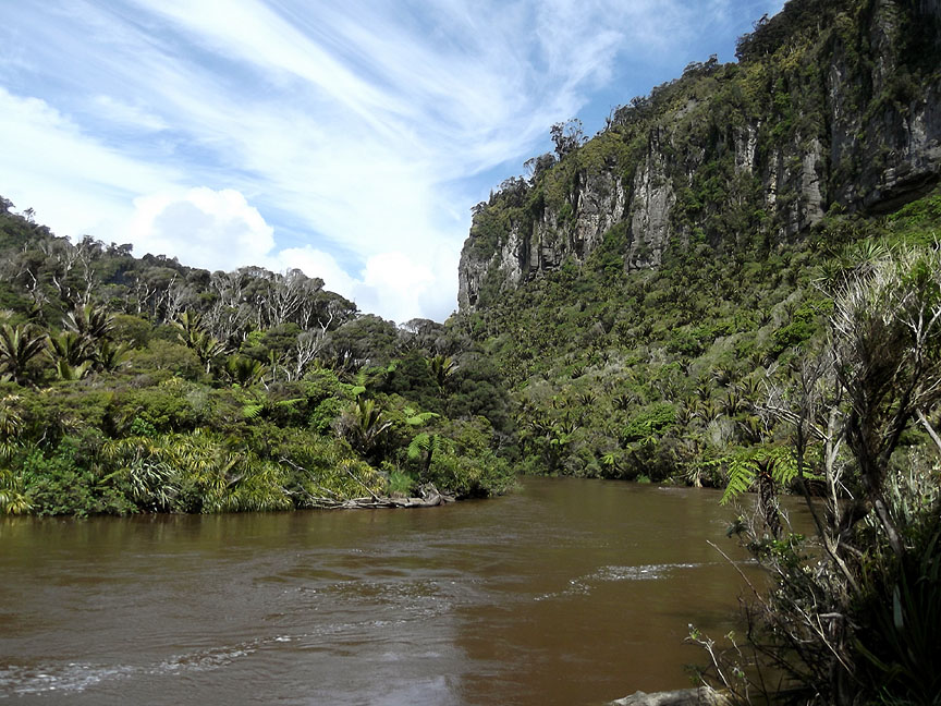
The Limestone escarpment high above us as we turn and make our way back.
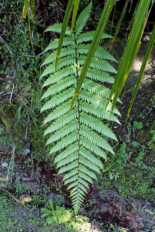
Everywhere there is plant life. Orchid, moss and fern all grow on this fallen log by the river. - - - o o o - - -
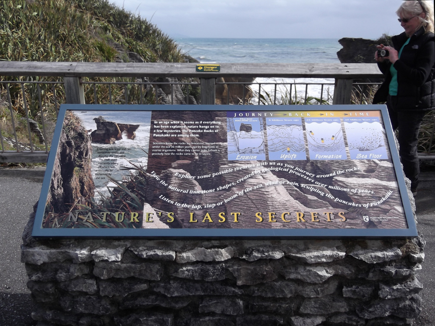
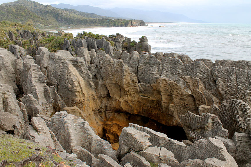
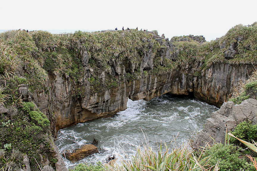
Back at the sea the tide is rising and with a good sea running we make our way over to the famous Punakaiki Pancake Rocks on the adjacent headland.
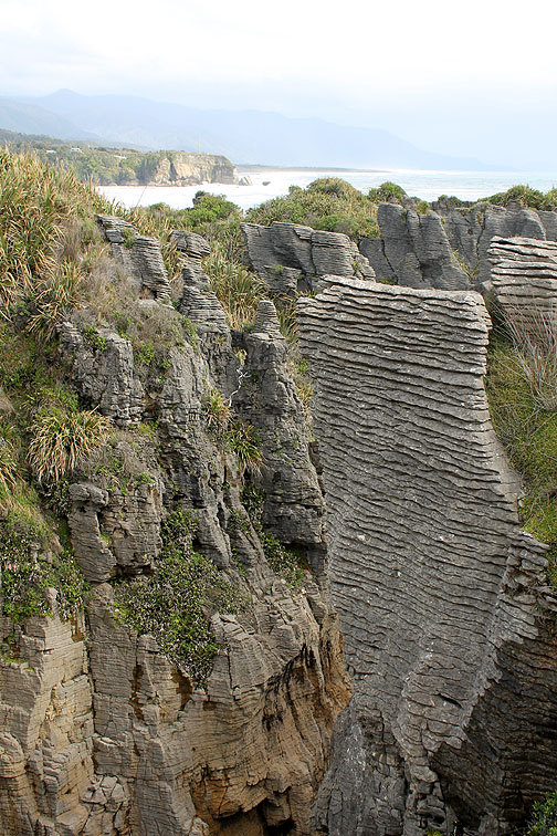
The rocks are famous for the natural sea blow-hole which blasts water high into the air and also the horizontal, close layered limestone strata of the Pancake Rocks, very rarely seen any where else in the world. Click here and listen to a guided tour of the area as you continue around (minimise the window ~ it will still play).
Quoting from the DOC Website "They were formed 30 million years ago from minute fragments of dead marine creatures and plants landed on the seabed about 2 km below the surface. Immense water pressure caused the fragments to solidify in hard and soft layers. Gradually seismic action lifted the limestone above the seabed" Unfortunately we were a little early for the blow-hole to be working properly. Click here for a Youtube video by "1garysan" if you want to get an idea of how it looks.
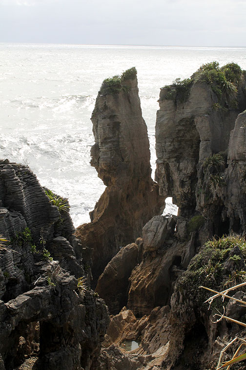
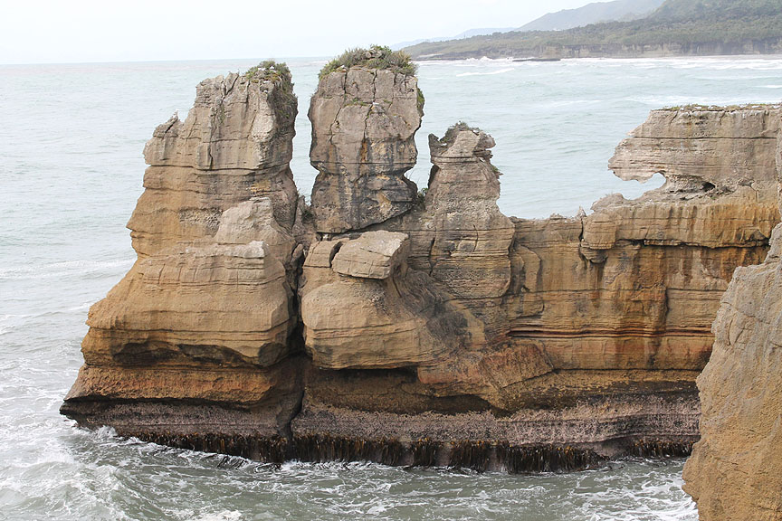
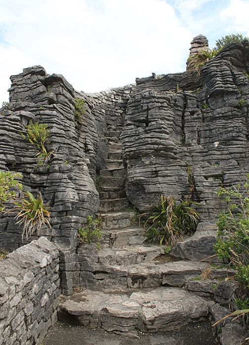
A 20 minute walk will take you around the headland to enjoy the rock scenery.
The local rock promontory looks like it is full of human, animal and sea creature shapes. How many can you imagine . . . hold your cursor over the picture to get a little help.
This would have been a sea cave at one time but the roof has collapsed and now the sea surges in with each tide.
Looking back up the coast towards the Pororari Valley and our accommodation a mile or so beyond.
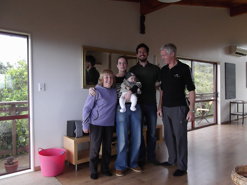
A delightful second evening at Eva and Roli's (and little Aaron) home. In the morning it was time to say goodbye and continue our journey round the coast. - - - o o o - - -
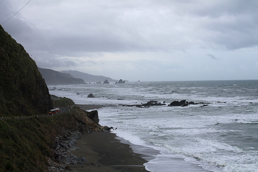
Another overcast and wind day but at least it was fine.
A large multi-wheeled tanker lorry passes, as I stop to survey the coastal scenery to the south.
The next major river crossing is of the Grey River at Greymouth. The river was named after the New Zealand's politician Sir George Grey, rather than the colour of the water. The Maori name is 'Maori pa Mawhera' or 'wide spread river mouth'.
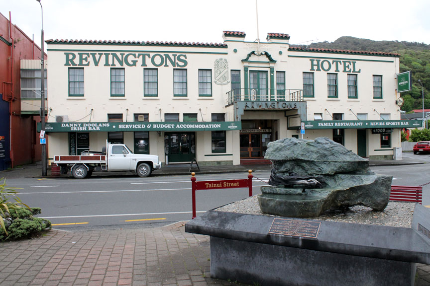
The town has a famous history of gold mining, forestry, coal mining, brewing and Jade, a sample of which forms part of a sculpture opposite the classic Revington's Hotel in the centre of town.
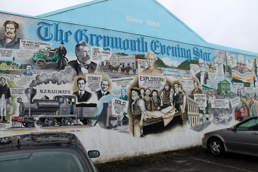
The local paper is proud of the town's heritage and has commissioned this fine mural.
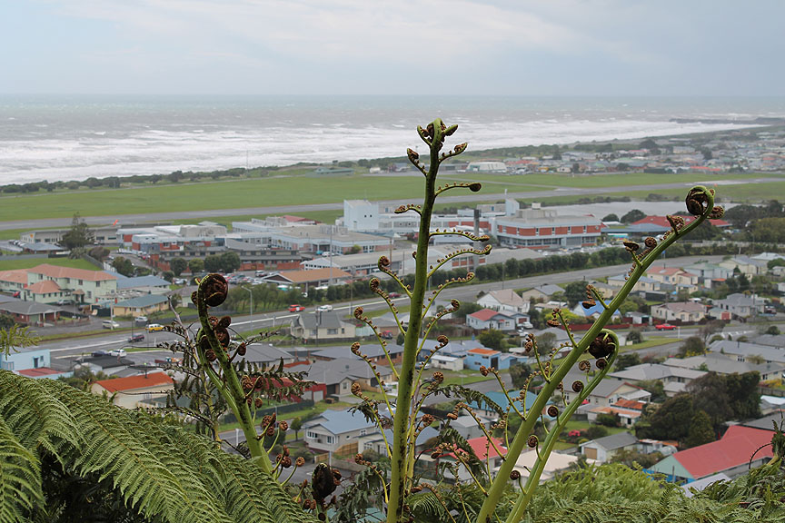
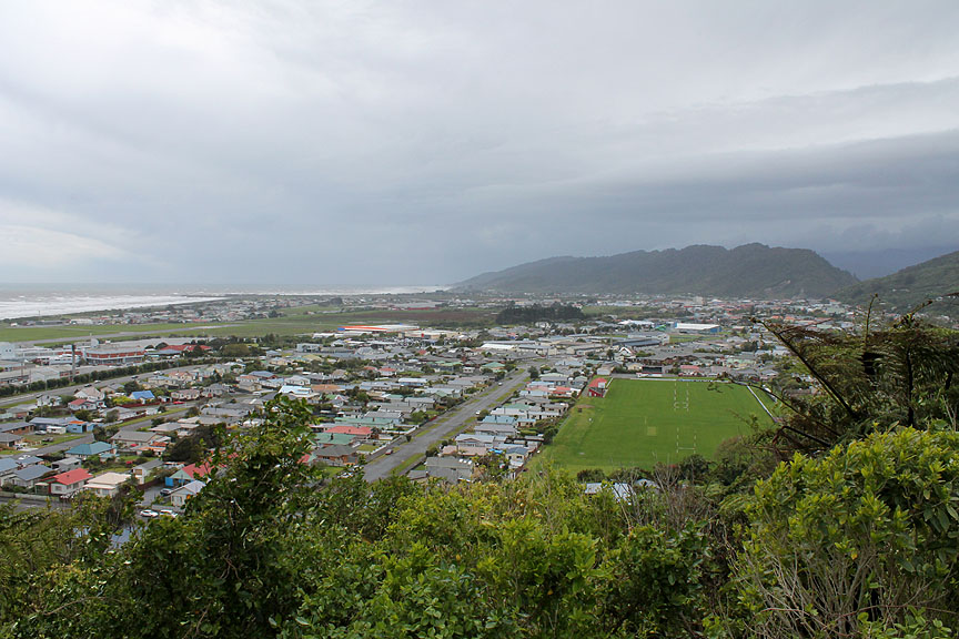
We take a short detour up the hill to a viewpoint overlooking the town.
Check out the similar Rotary Club Webcam from this same viewpoint.
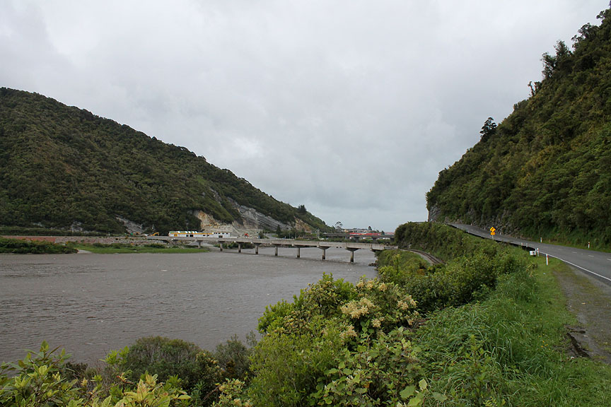
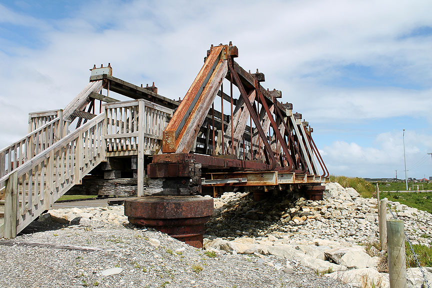
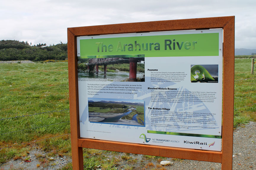
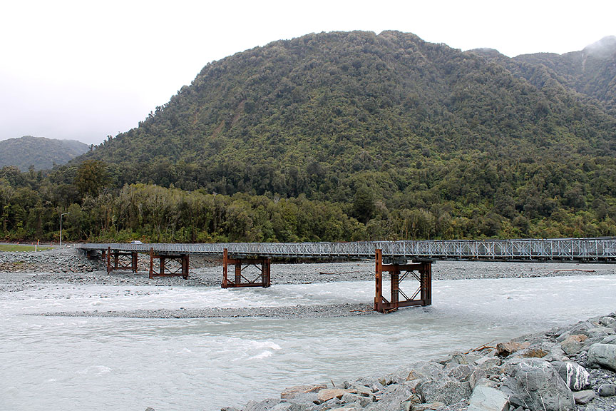
Moving on, we cross another major river system where there was a section of old bridge reconstructed in a small parkland alongside the main road.
Full details were given on the adjacent notice ( the bridge photo can be seen at the top) The Arahura River valley is famous as a classic source of the 'green stone' we know as Jade. Ancient Maori routes converged on this area as the ancient tribes searched for and traded this semi-precious stone.
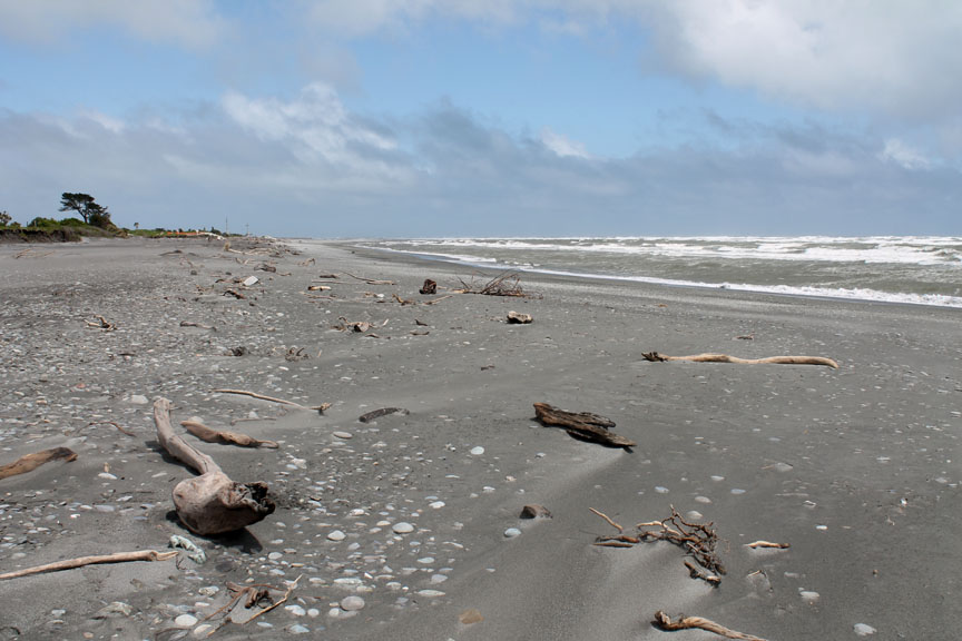
Just down the coast is the wind swept bay of Hokitika. The beach debris and stones may well have been washed down the Arahura River and spread out along the coast.
Did I say it was windy ?
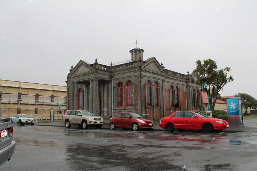
Unfortunately another rainy squall blew in as we visited the Museum but we were inside enjoying the displays and picking up on a little history . . . and we were warm and dry.
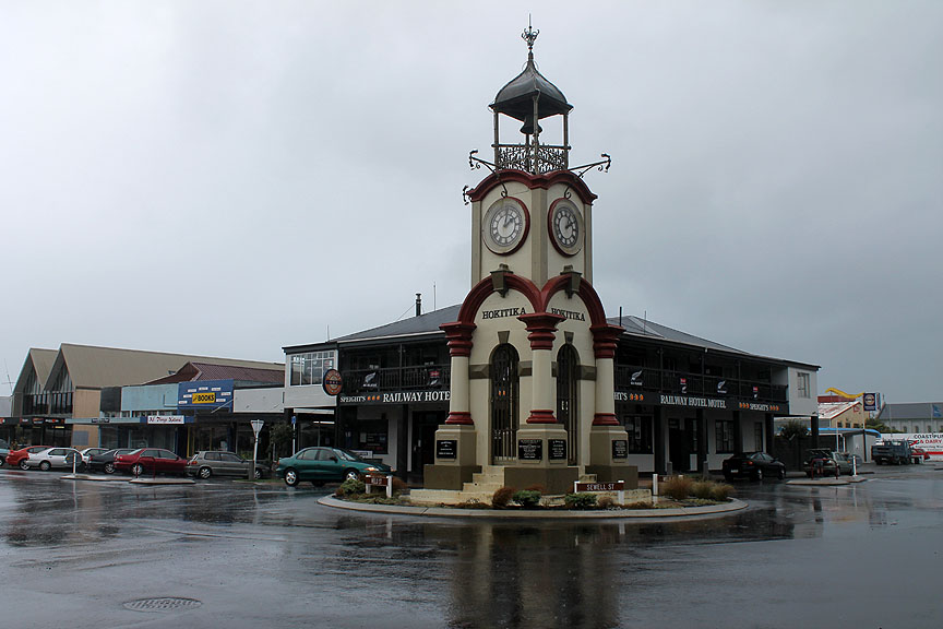
With such an important Jade industry locally, we also made a point of visited the Jade Factory shop (and cafe). From our window seat we could look out on the bell tower in the centre of Hokitika
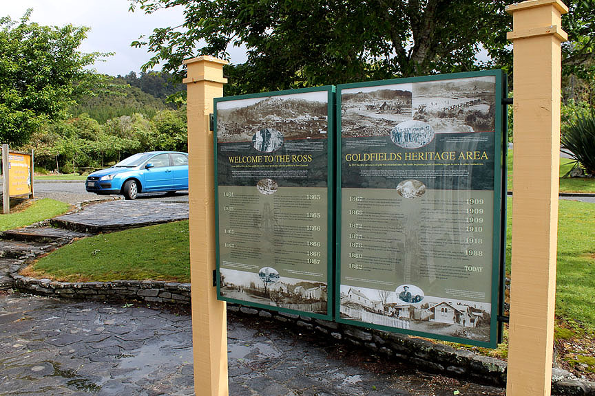
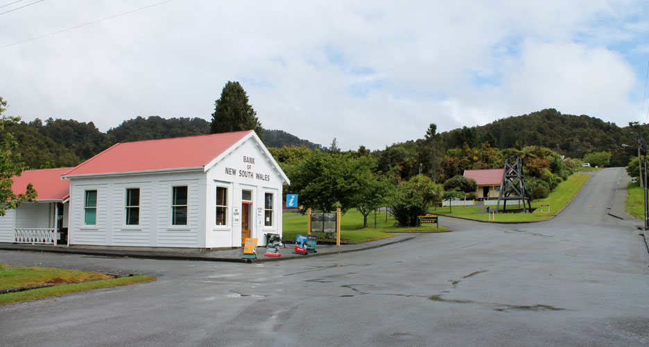
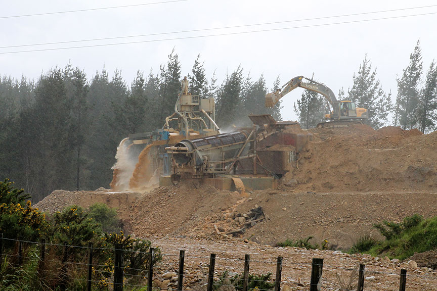
Gold also features in the history of the town of Ross further down the coast as we continued our drive down the coast after lunch.
At the top of the mining village were several classic old buildings that were built at the time of the local gold rush. The replica old bank building now serves as the local museum and information centre and there is the oldest wooden church in South Island across the road.
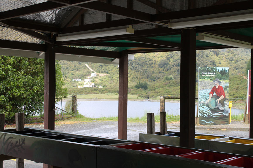
Modern day tourists can pan for gold at the centre.
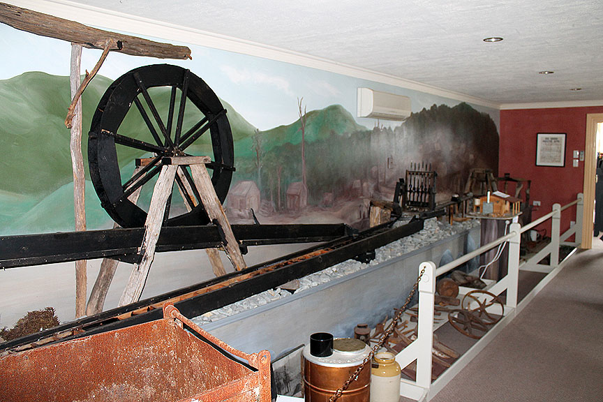
While inside there is a whole series of artifacts and displays to enjoy. ( The flash of the camera illuminates the scene as unfortunately they were in the middle of a short power cut !)
The lake and the scenery around has been reclaimed after the gold mine closed. This whole area was a mass of mud, tracks, railways, water pipes and sluices and the lake was created from an open quarry where the floating dredgers dug and panned for gold.
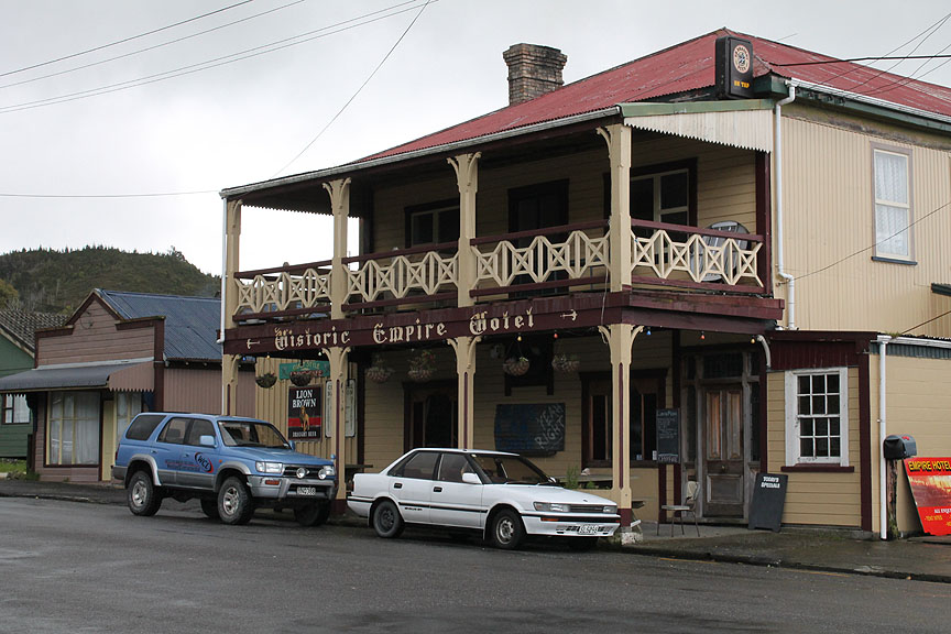
An historic old hotel in Ross, over the road from the museum.
On the way out of town we had a glimpse of the gold trade as a modern day mine prospect was being worked. No-one would say how much it was worth but they employed a reasonable labour force and loads of heavy machinery so they must be finding a reasonable amount of gold even today.
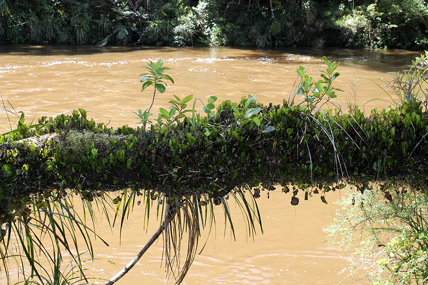
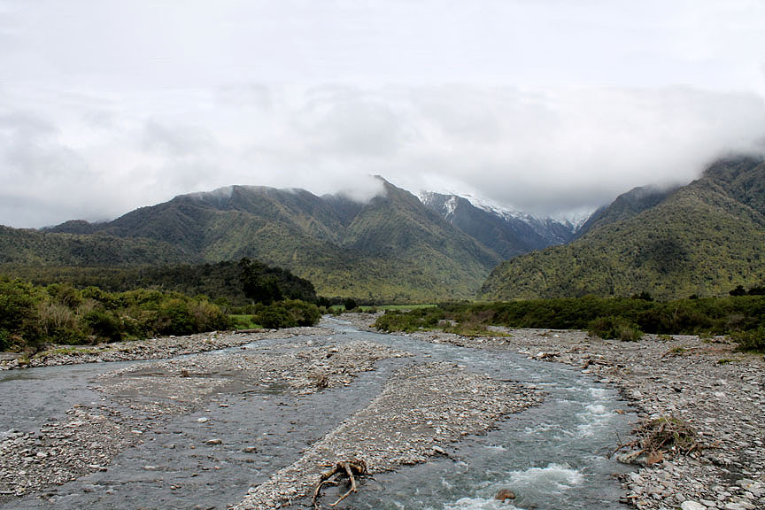
Nearing our destination now at the end of a slightly long driving day. We cross several large rivers like this one but this crossing was significant by offering us our first view of snow on the southern alps. The wide alluvial bed was evidence of the strong glacial action high in the hills.
One last bridge as we cross the Waiho River, close to Franz Joseph Glacier township. Next stop, Fox Glacier, our destination.
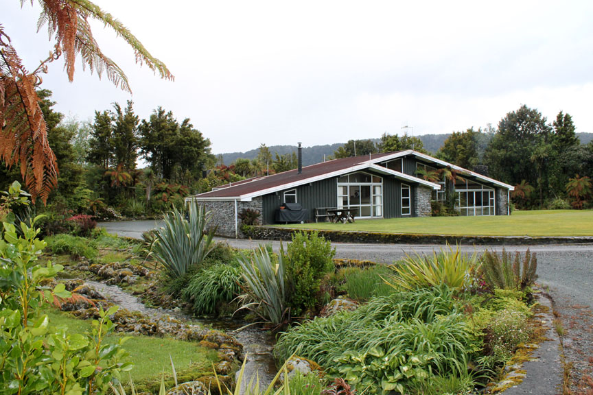
Our knock on the door was answered by Raelene Tuck and we were welcomed inside.
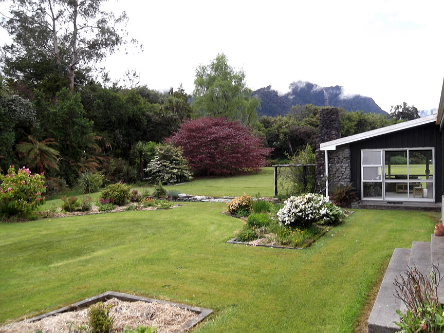
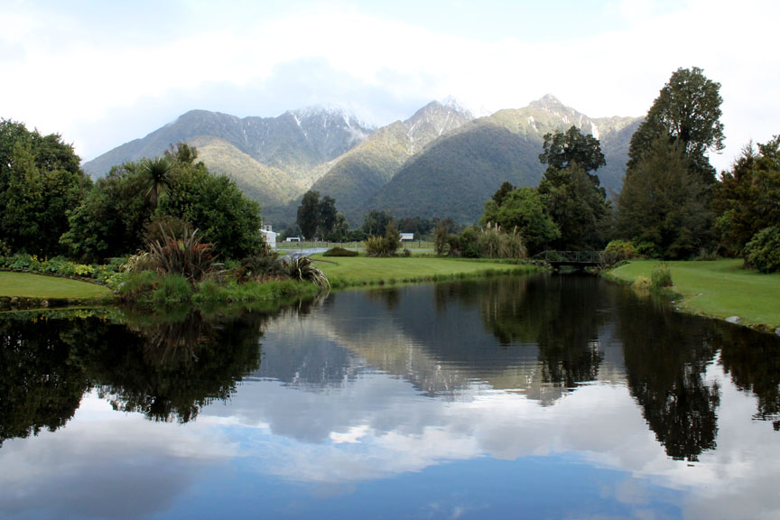
She has a wonderful B&B homestay in an extensive bungalow set within lovely gardens. Why is it called Reflection Lodge, I hear you say . . .
Take another look across the front drive and you see the most wonderful reflections of the high mountains. We would venture up towards the glacier tomorrow . . .
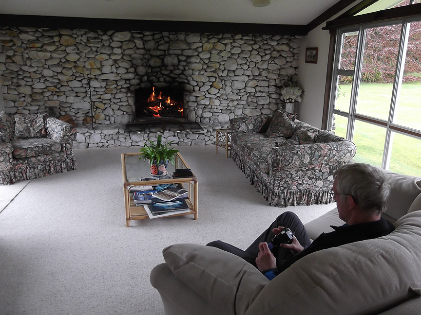
. . . but now it was time to relax, enjoy a glass of wine and review a few of the photos we had taken so far on this wonderful trip. - - - o o o - - - |
Technical note: Pictures taken with either Ann's Fuji Finepix Compact or my G10/1100D Canon cameras. Resized in Photoshop, and built up on a Dreamweaver web builder. This site best viewed with . . . a slightly dry wine after a slightly wet day.
© RmH.2010 # Email me here # Go to Home page
|