![]()

|
|
|
|
" New Zealand Holiday ... 3 . . . White Island Adventure " Date & Time: Thursday 27th October 2011. Locations : White Island and the Tarawera Falls Places visited : Rotorua, Whakatane, White Island, Kawerau, Lake Tarawera and back. Accommodation : Staying at Lake House, Rotorua. With : Ann and myself (and the pilot). Weather : High cloud but fine. Gentle breeze.
|
"
New Zealand - 3 - White Island " at EveryTrail [ Alter the settings to zoom or change the Map, use Everytrail to download the Gps route ] |
|
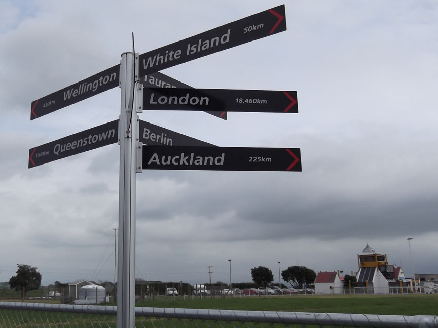
450 km from Loweswater to London, 19,460 km from London to Whakatane Airport, another 50 km and we'll be there. White Island here we come !
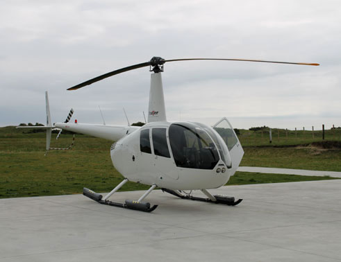
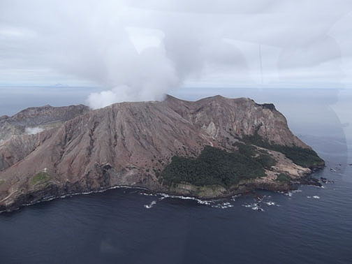
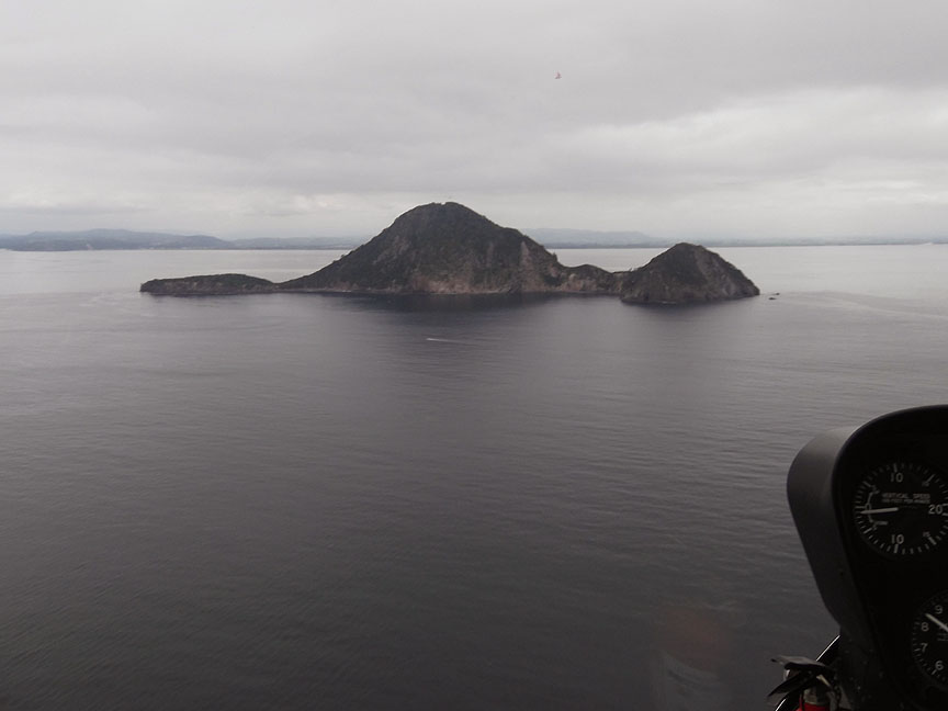
With our pilot Peter at the controls we headed out, just east of north, crossing over Moutohora Island en-route for distant White Island.
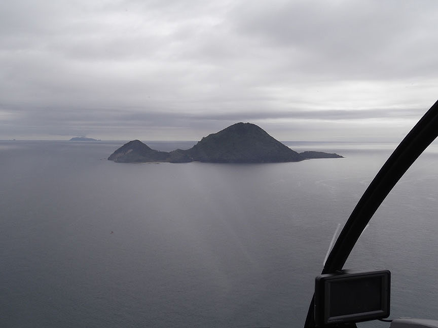
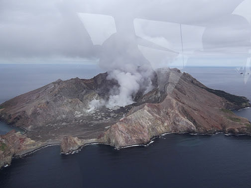
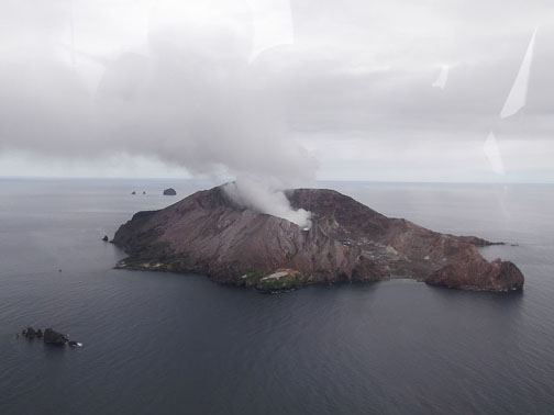
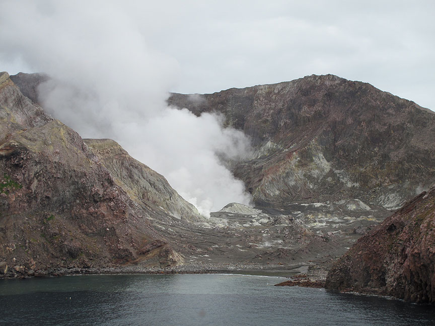
Closing on White Island. This is New Zealand's most active volcano, in the Bay of Plenty, off the northern coast of North Island. It is currently semi-dormant but has erupted in a big way in recent times.
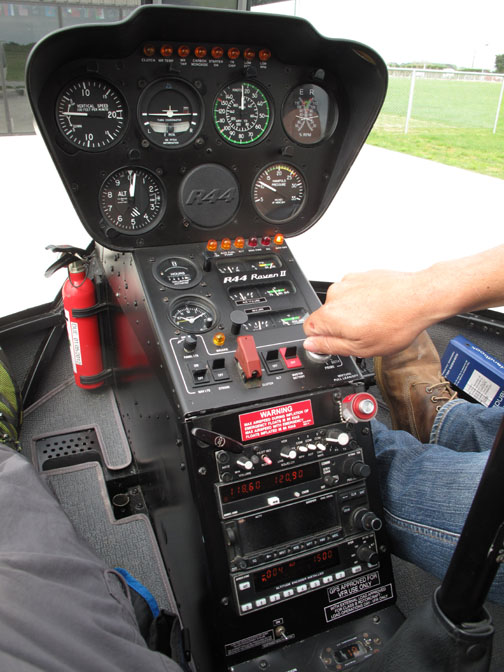
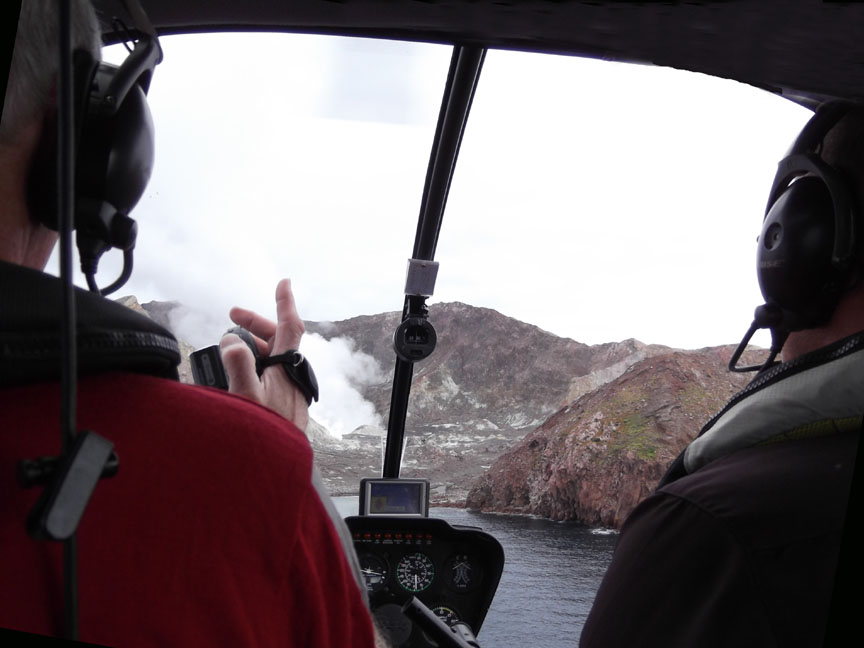
Video camera in hand, I film as Peter brings the helicopter into the bay.
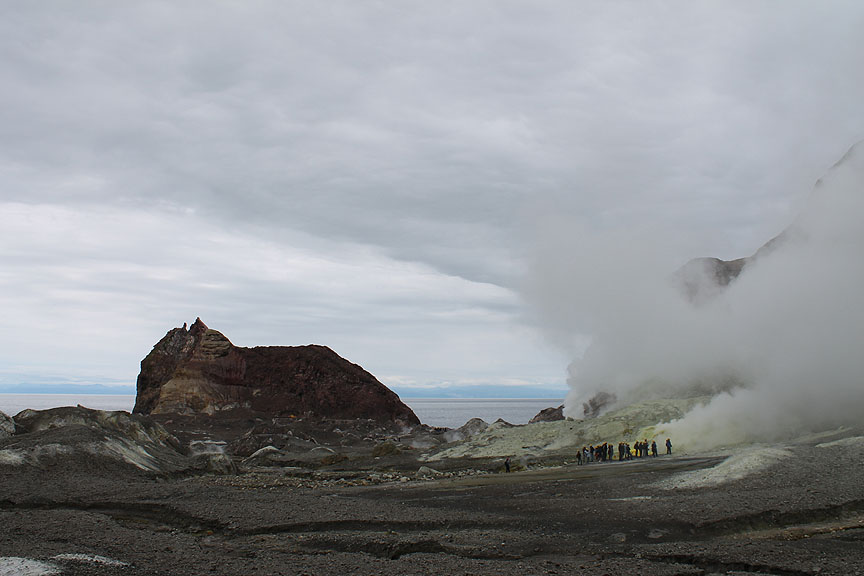
The smoke is from the cauldron of the volcano. We will land well out of the way, to the right, behind the reddish rock headland.
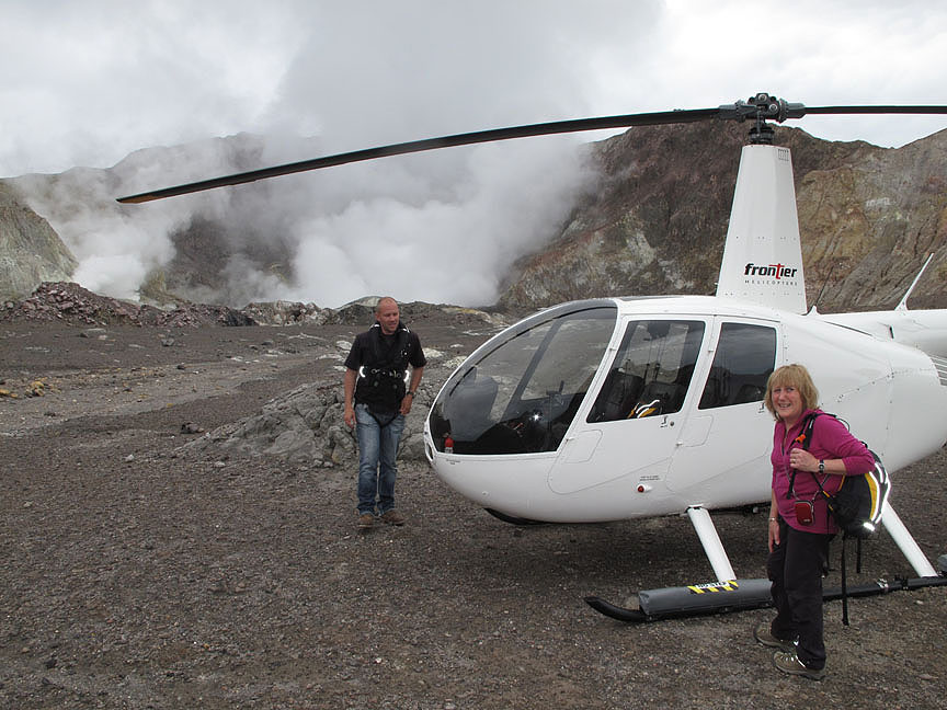
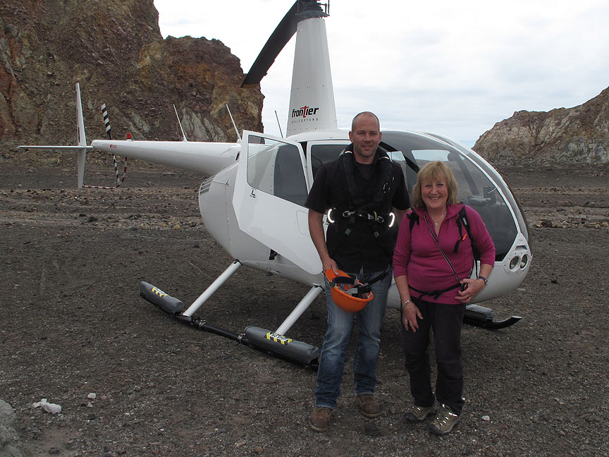
A soft landing on open ground . . . time for Peter to show us round.
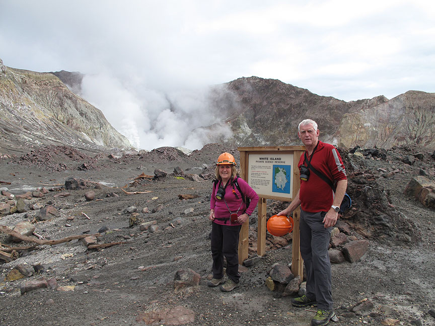
A new signboard welcomes us to White Island. The Maori name of 'Te Puia o Whakaari' means 'The Dramatic Volcano'. " Bring your own" hard hats and gas masks . . . from under the seat in the helicopter !
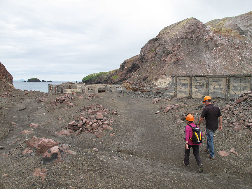
We start by walking over to the site of the old factory. It was in use between 1885 and 1933 to collect and refine sulphur for use in fertilizers, for medicinal purposes, making matches, gunpowder, sterilizing wine corks and vulcanizing rubber.
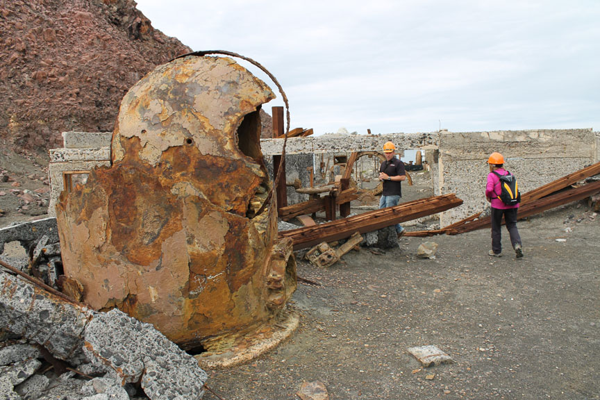
It had a chequered history including closing after its first year of business year due to the major 1886 volcanic eruption of Mount Tarawera on the mainland. Once re-opened the factory was worked intermittently for nearly twenty years until it unfortunately suffered catastrophic damage in a major eruption and landslide in 1914 here on the island when all of the workers lost their lives. The remaining structures of the old boilers, roof trusses, sifting and sort machinery and the like date from prior to the 1930's and show the ravages of eighty years or more in a sulphur rich, island environment. Read more here.
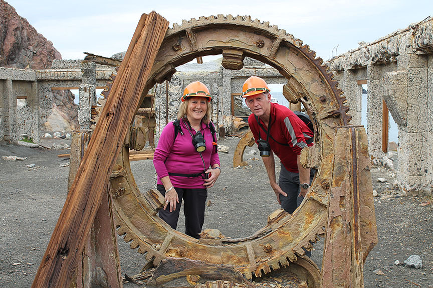
Part of the old grading drums used to process the sulphur which had been cut and collected from around the island. The bit in the middle is us ! Hold your cursor over the photo to see us on an alternative "out-of-this-world" holiday location.
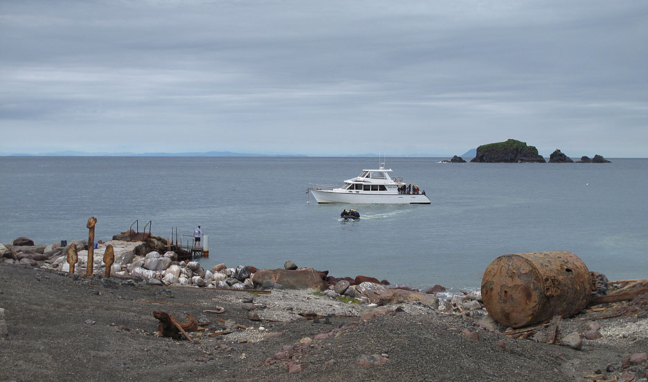
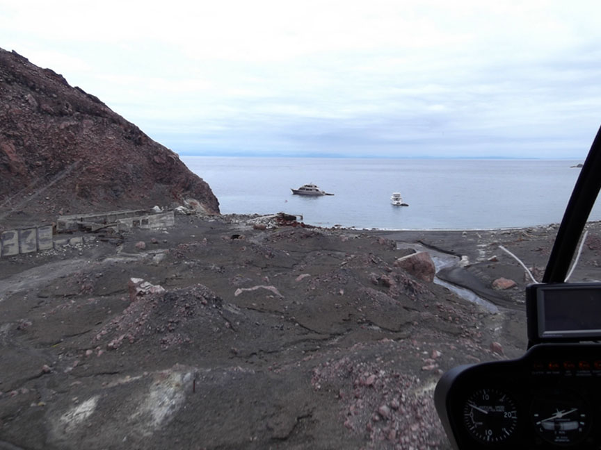
Having flown out to the island early, we were on our own for a while, but the regular tour boat has reached the island and is now bringing its passengers ashore by zodiac.
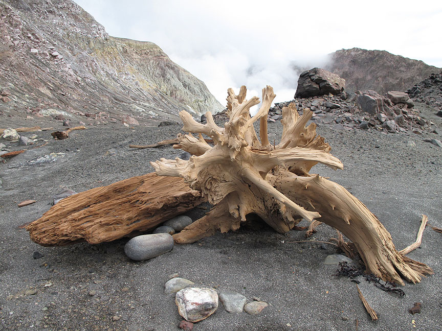
We continue our walk, passing this petrified tree trunk at the head of the beach.
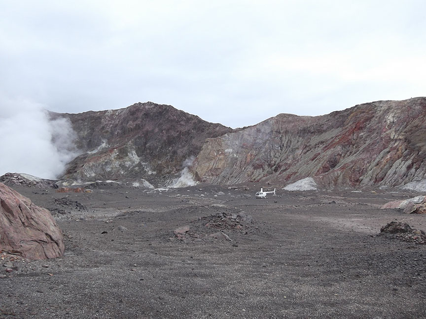
Our helicopter looks so small against the backdrop of the volcanic crater walls.
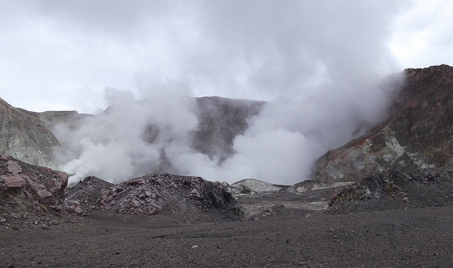
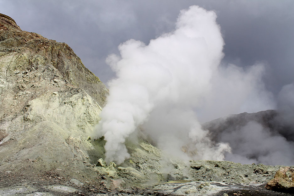
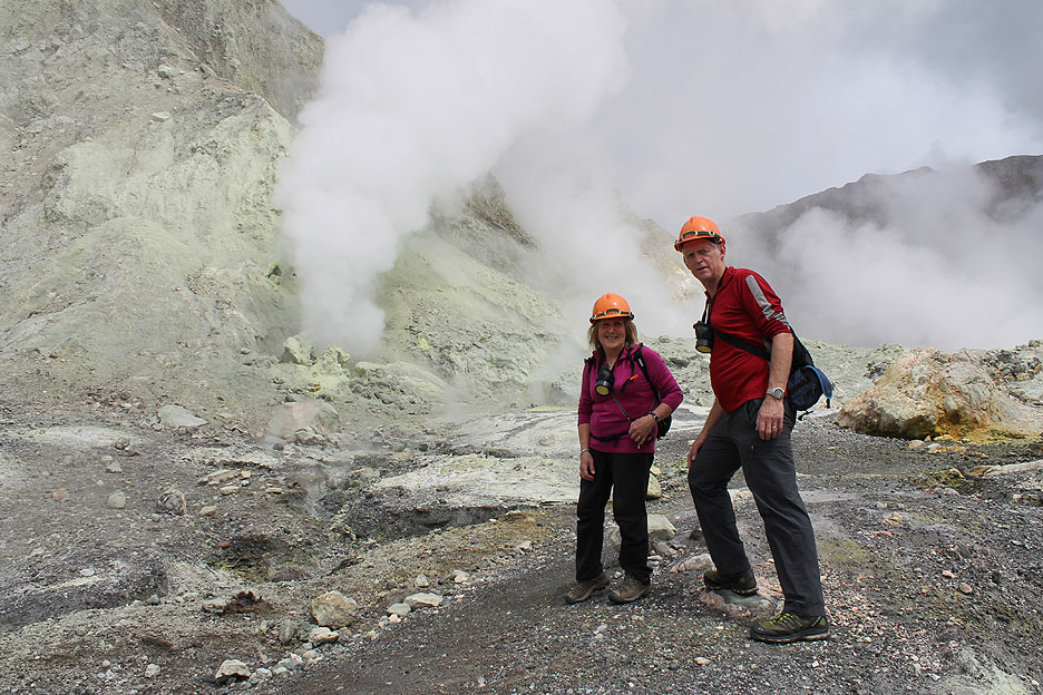
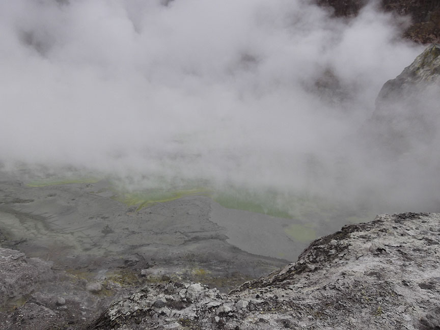
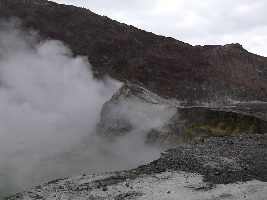
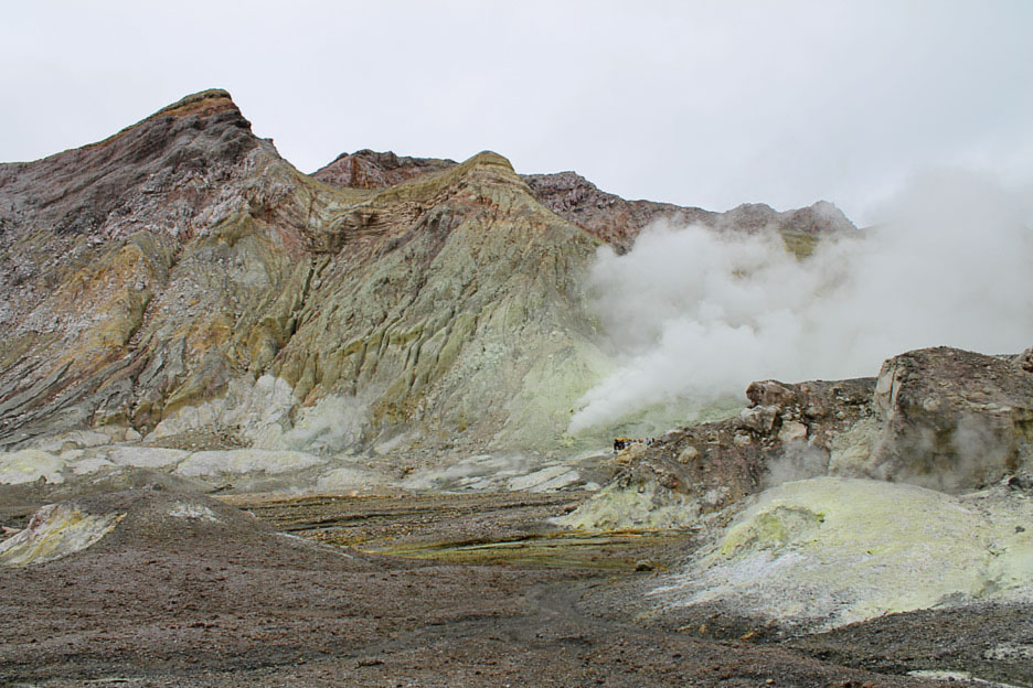
The centre of the island has a large steaming lake surrounded by sulphur fumaroles.
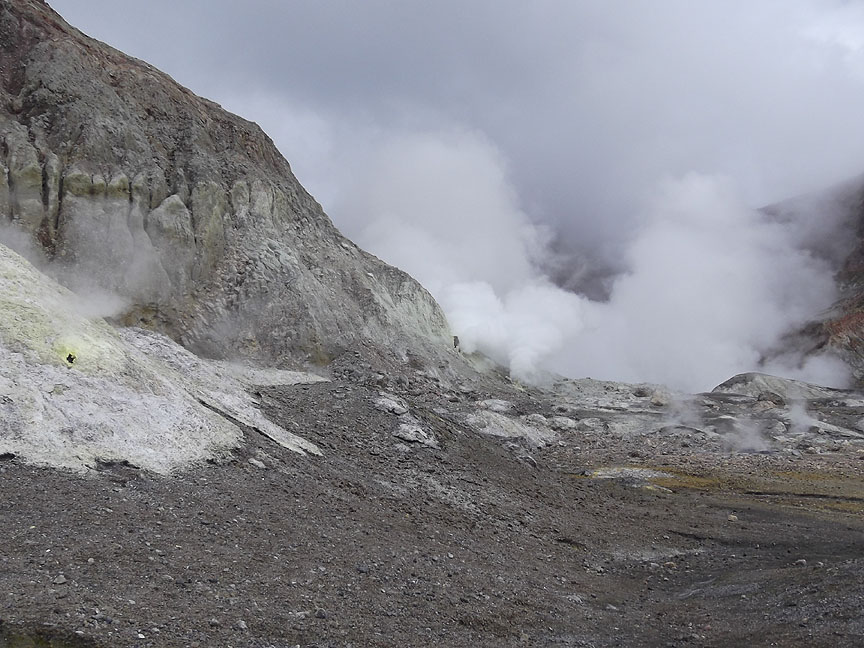
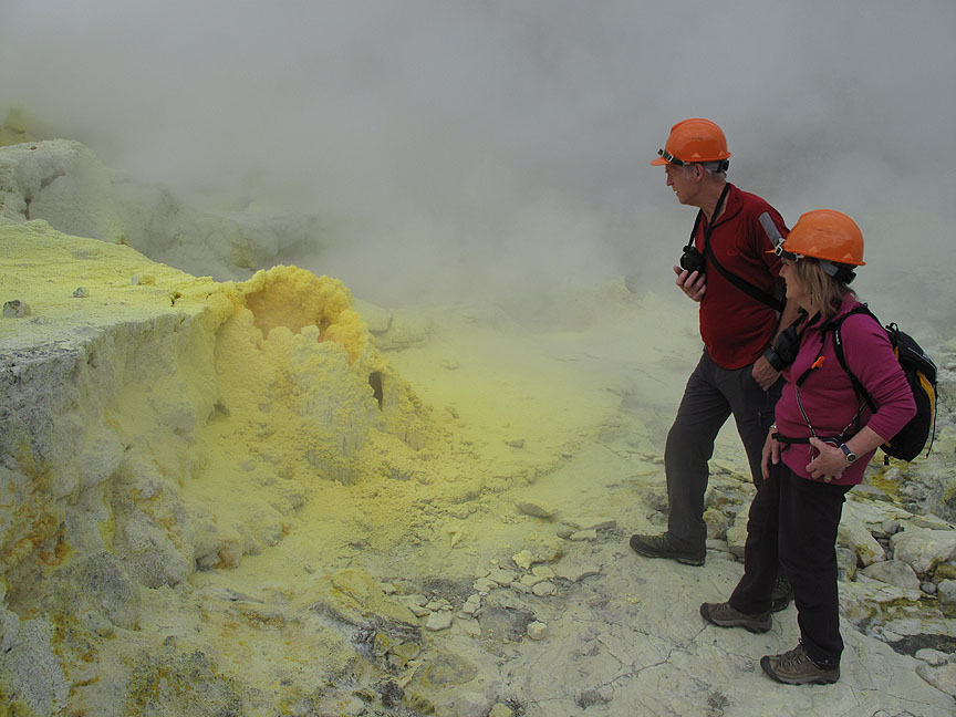
This was the most active side at present. That white covering is not snow but sheets of sulphur rock, with yellow vents blowing sulphur fumes into the air.
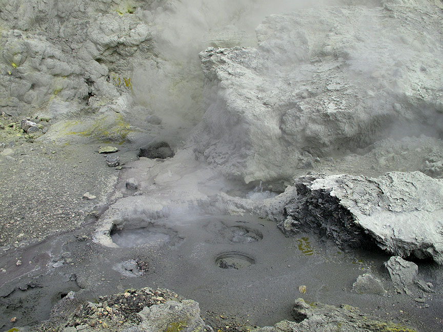
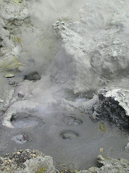
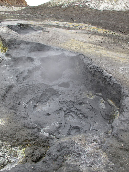
In places the ground has craters with bubbling mud pools.
The area has wonderful names like Donald Duck and Noisy Nellie Craters. They belch fumes from their vents, giving us just a hint of the vast power and ferocity within the earth's crust.
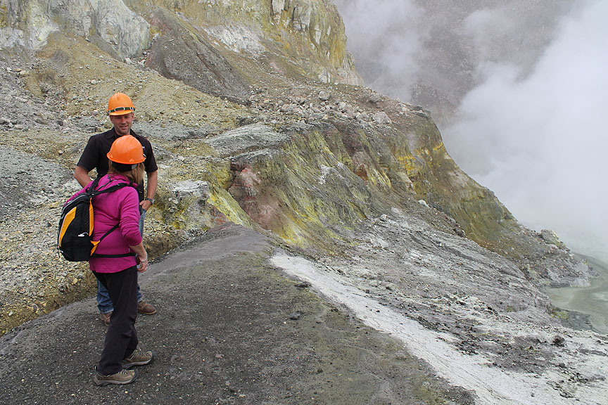
A loosely defined path takes us close to the vents . . . our pilot and guide makes sure we follow it.
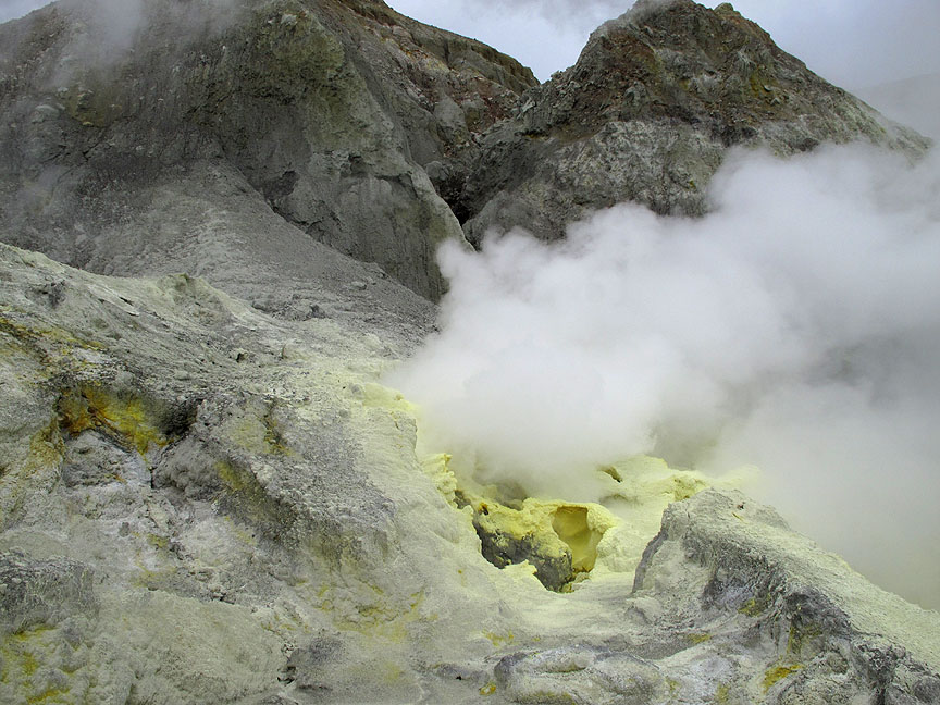
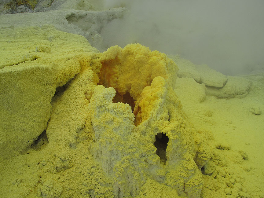
Another sulphur vent, the yellow is the pure sulphur which precipitates out on reaching the air. It was this sulphur that the mineral workers collected for export to the mainland.
A telephoto shot this time, using the camera technology to get closer to the vent.
The deep yellow was sulphur that has become molten in the intense heat and had dribbled back into the vent.
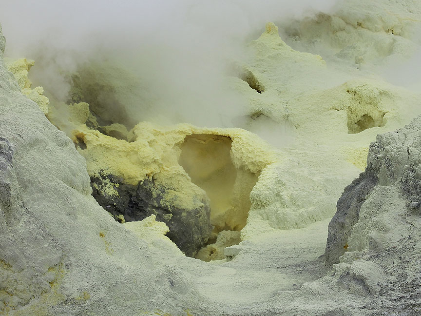
With the gentle breeze taking the fumes the other way, we were able to get close this time and to look right in. No trick or technical effects here . . . we were that close !
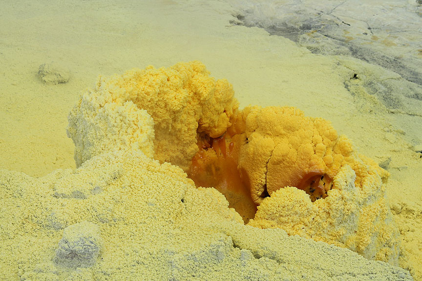
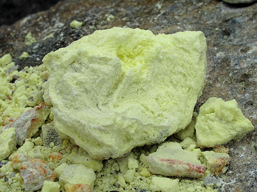
Raw sulphur.
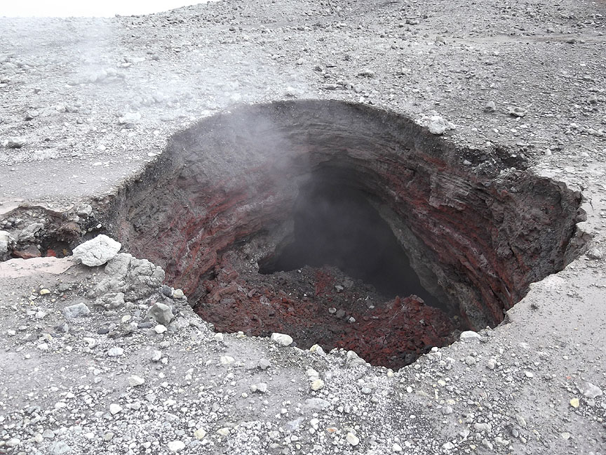
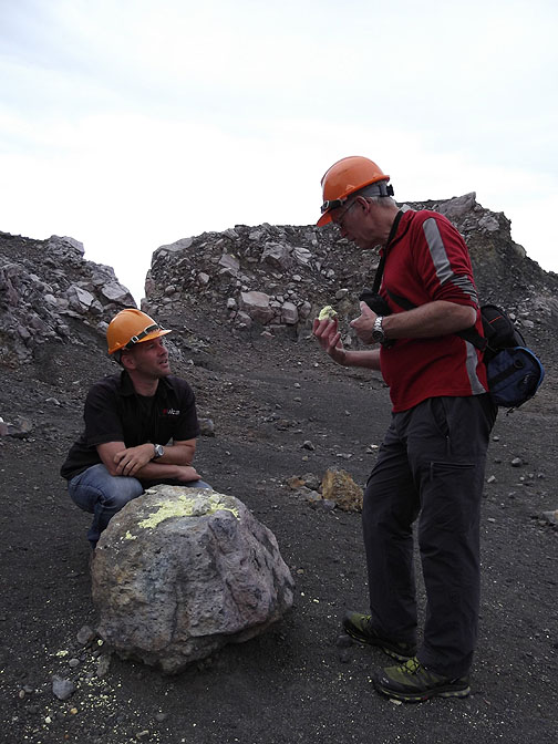
Did I say we had to keep to the path ? On this occasion we diverted from the marked path as this hole had appeared in recent weeks. It was about 20 feet deep.
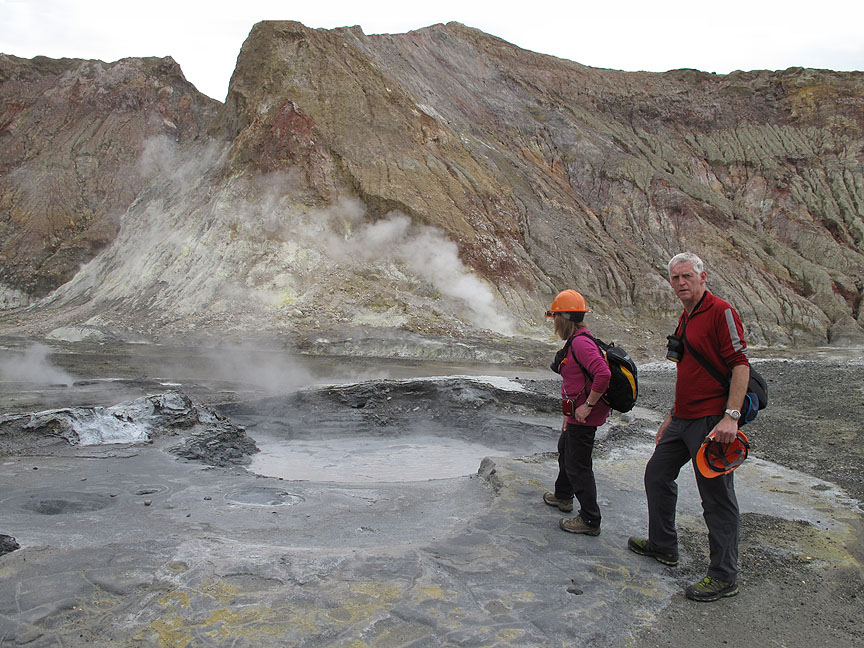
On the high ground at the lip of the sulphur lake, here at the centre of the island.
" Dante's Inferno " Down there was a lake of indeterminate depth, full of bubbling grey mud and sulphur. When tested, it had a pH. of lower than -6, which is therefore more acidic than concentrated sulphuric acid.
Not a place to venture.
The fumes roll around the crater and are blown up and away by the gentle breeze.
On our return walk we see the other party viewing the sulphur vents we investigated earlier.
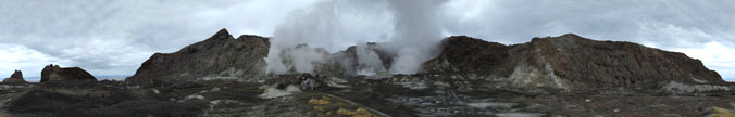
Looking round at the lunar, or Martian or Venusian landscape of the island. Click here or on the photo above for a full value Loweswatercam 360 degree annotated panorama.
More raw geology as we walk back down from the lake.
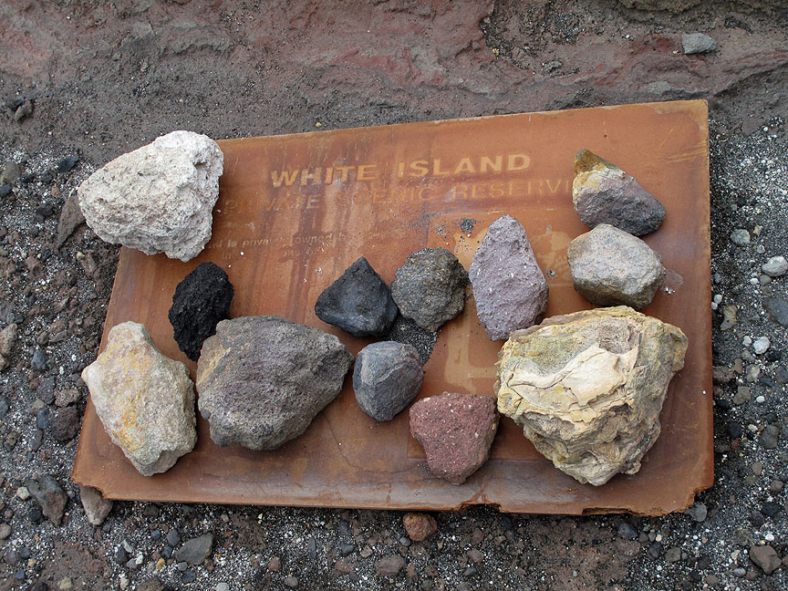
A collection of some of the rocks and minerals found on the island. The old sign board presumably dates from the creation of the "private scenic reserve" in 1953.
Back at the helicopter Peter, our excellent pilot and guide stops for a photo call with Ann. Thanks for an extremely memorable and well informed trip around the island.
Time to be away . . . as we take off and fly over the harbour.
. . . heading back for the mainland via Moutohora Island that we crossed on the way out. How do you follow that ? . . . I'm not sure but we'll try. - - - o o o - - - We made our way back towards Rotorua, but on consulting our guide book / road atlas (60 Scenic drives - John Cobb) we noticed a waterfall advertised as being in the forestry close to Kawerau, which was on our way home.
Entry Permit from the information centre . . . to gain access to the forestry roads and find this hidden gem of a waterfall.
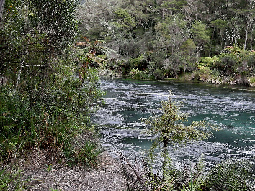
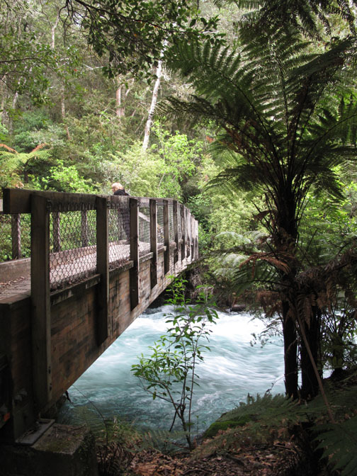
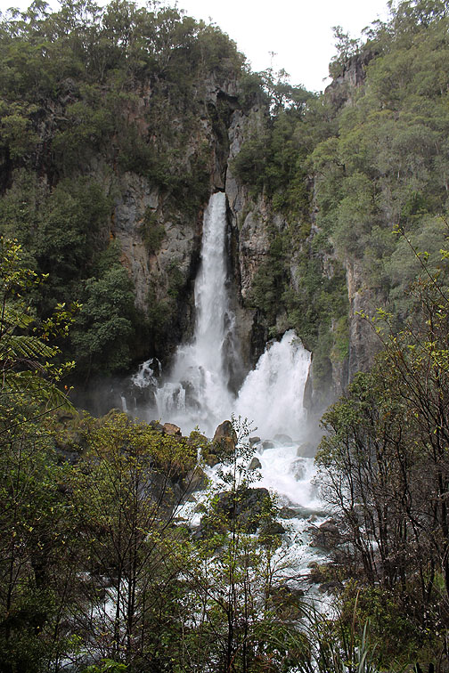
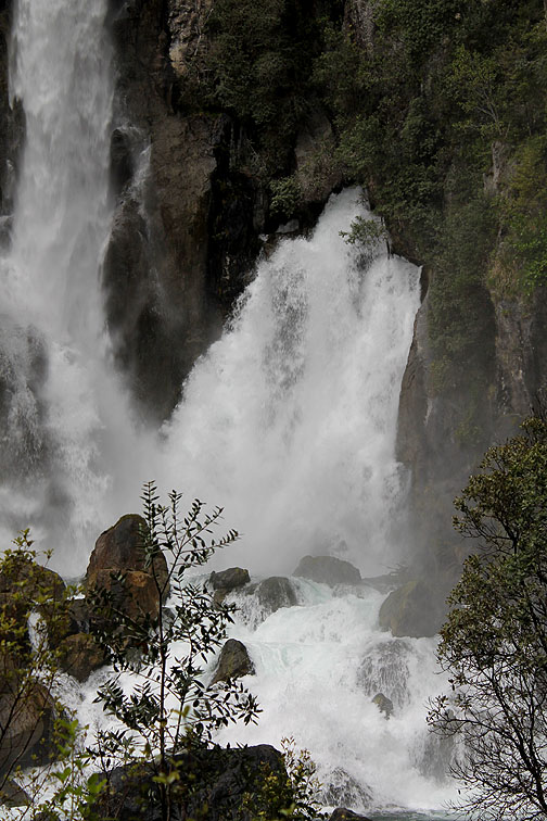
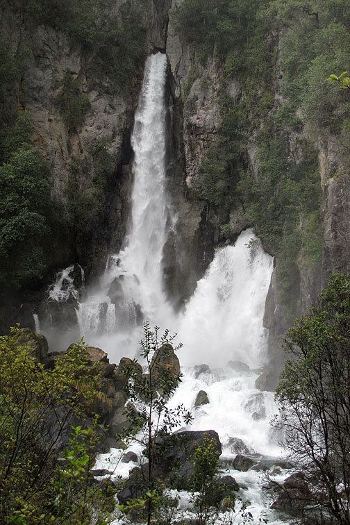
After a 17 km (10 miles) drive on un-made forestry roads we parked up at a forest clearing and took a twenty minute walk up river to the Tarawewa Falls.
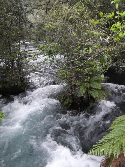
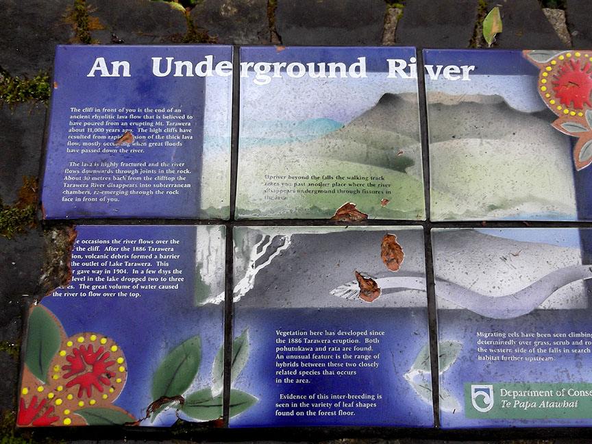
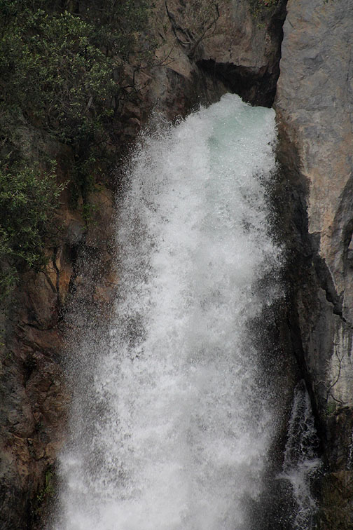
The falls are unusual in that they do not cascade directly over the cliff. Rather, they emerge from volcanic tunnels and ravines and plunge 65 metres (over 200 ft) down the vertical cliff face.
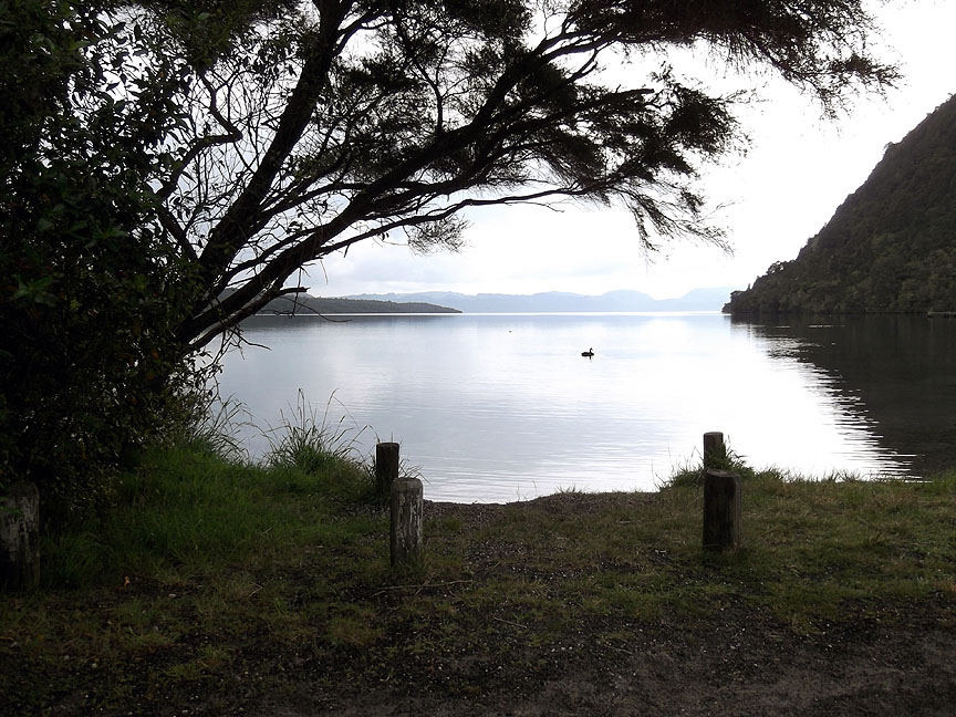
After seeing one of the most unusual waterfalls ever, we back-tracked through the forestry and drove up above the falls to see Lake Tarawewa itself . . . a peaceful if slightly midgey place to end the afternoon. |
- - - o o o - - - Technical note: Pictures taken with either Ann's Fuji Finepix T300, my Canon G10 or 1100D digital cameras. Resized in Photoshop, and built up on a Dreamweaver web builder. This site best viewed with . . . . hard hat and gas mask if you've got one. © RmH.2010 # Email me here # Go to Home page
|