![]()

Remember: Press F11 for a full
screen view of this page.
|
|
|
Remember: Press F11 for a full
screen view of this page. |
|
" Devoke Water and Rowan Tree Falls " Date & start time: Thursday 14th July 2011, 11.30 am start. Location of Start : The Birker Fell Road, Cumbria, Uk ( SD 171 977 ) Places visited : Seat How, White Pike, Woodend Heights, Yoadcastle, Stainton Pike, Rowan Tree Falls and ending at Fell Lane end on the Corney Fell Road. Walk details : 6.5 mls, 1400 ft of ascent, 1800 ft of descent, 5 hrs 35 mins incl lunch. Highest point : Stainton Pike ft 1618 ft - 498 m. Walked with : Maggie, Ian, Ann and the dogs, Harry and Bethan. Weather : Excellent sunshine and a warm breeze off the sea.
|
" Devoke Water and Rowan Tree Falls " at EveryTrail
[ Alter the settings to zoom or change the Map, use Everytrail to download the Gps route ] |
|
Today we're in the south western part of the Lakes near Ravenglass and Maggie and Ian join us for the walk. Maggie wanted to see Devoke Water and Ian, Rowan Tree Falls, so with two cars on offer we did the obvious and created a linear walk from the Birker Fell Road, passed Devoke and across the tops towards Waberthwaite. That should please everyone.
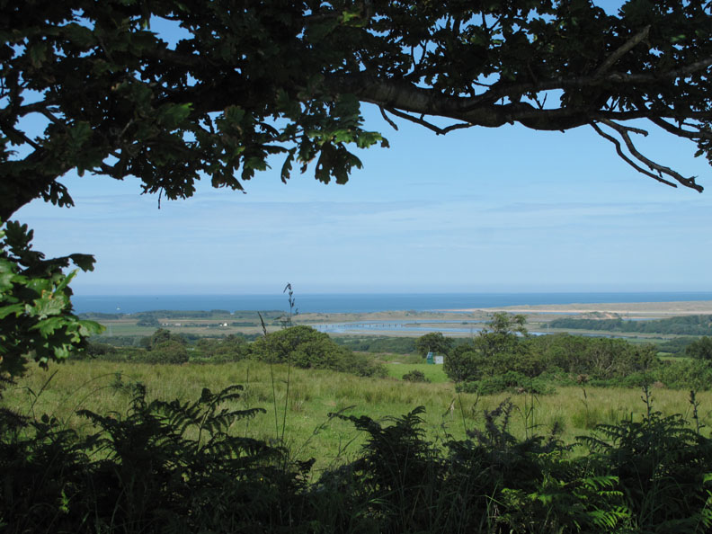
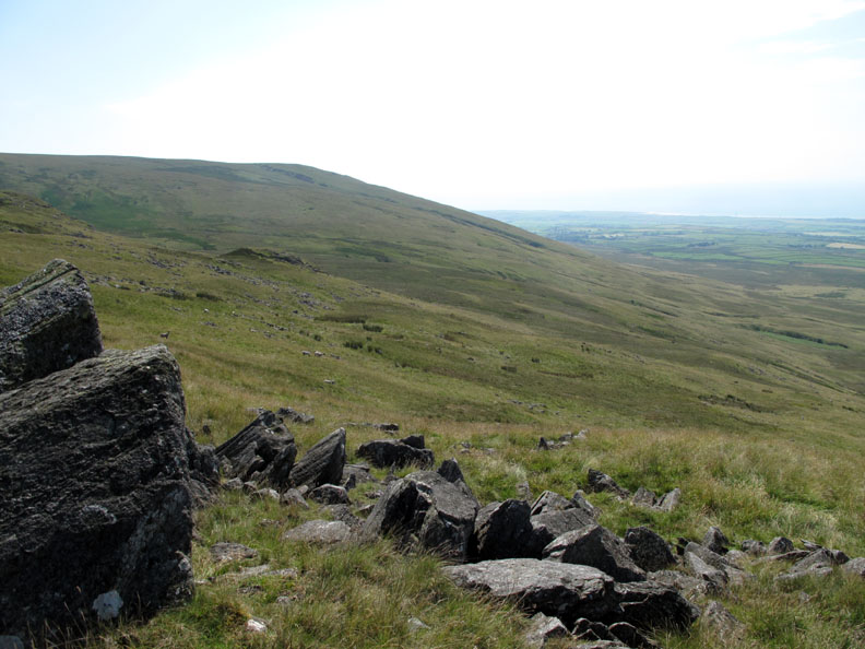
The view from the Corney How fell road near Grange Farm. We arrived early (we can do it if we try), parked our car on the roadside at the end of the planned walk and even had time to enjoy the view down to the Ravenglass Estuary where the River Esk joins the sea.
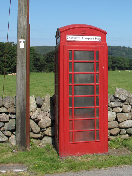
We were here last in Nov 2006 and the phone box was in dire need of love and attention. Five years and a coat of 'Pillar Box Red' later and the world is looking a whole lot better. [ Hold your cursor over the picture to look back to the phone box as we first saw it.] - - - o o o - - - Having met and squeezed four people and two dogs into Ian's car, we drove round to the Birker Fell Road and parked at the moorland cross-roads at the turn to Devoke Water.
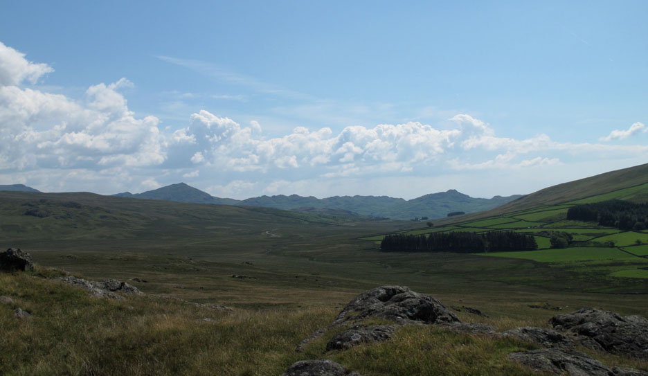
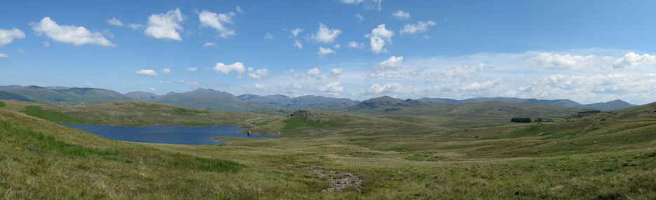
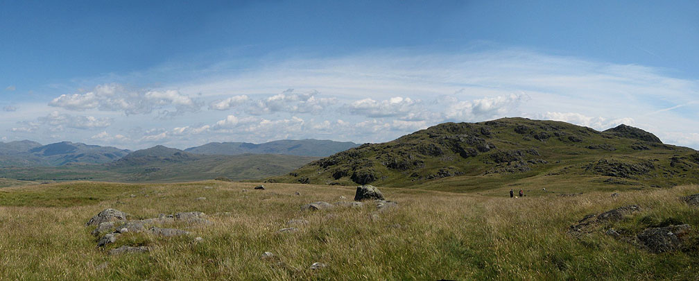
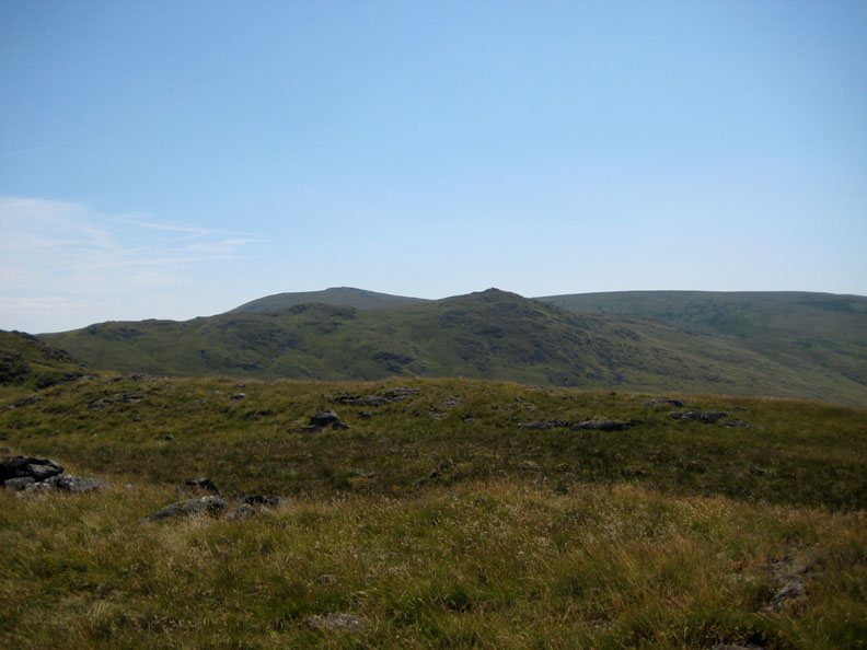
The wide panorama of the central and southern fells that would accompany us for most of the day.
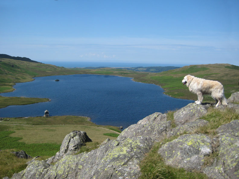
The first climb was up onto Seat How which gave us delightful views down to Devoke Water and out to the coast.
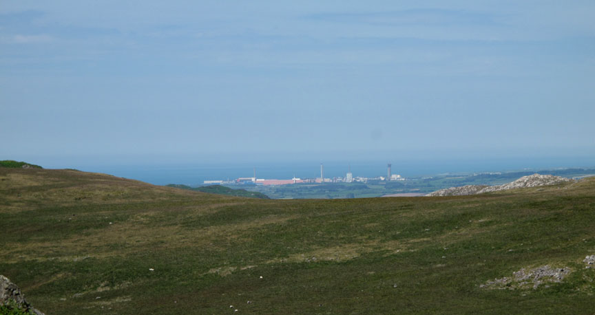
Zooming in on Sellafield to the right in the previous picture. A major provider of employment locally, the nuclear reprocessing site is possibly in line for a new power station soon.
From Seat How we look across the fields of Woodend Farm to the distant outline of Caw and Stickle Pike, outliers on the south western-most part of the Lake District.
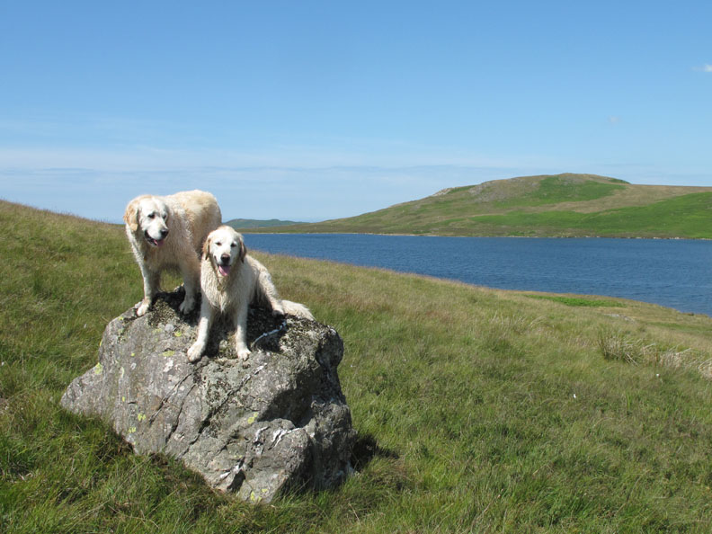
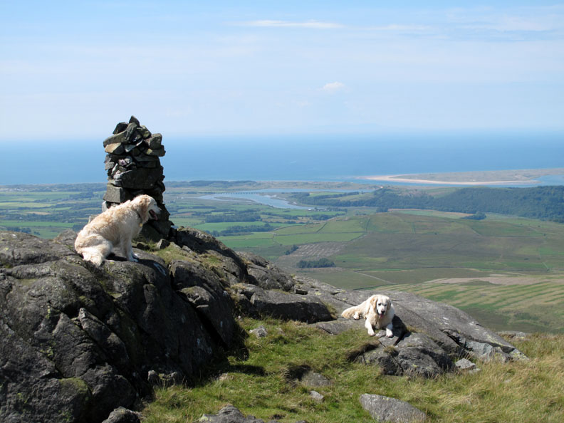
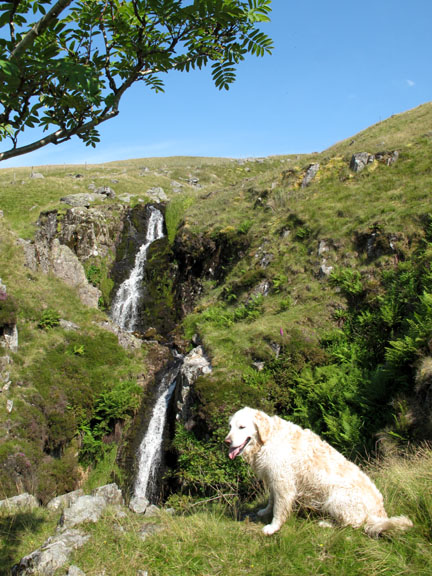
Harry looks down on Devoke Water. Who says dogs can't appreciate a nice view ? . . . He was there for ages.
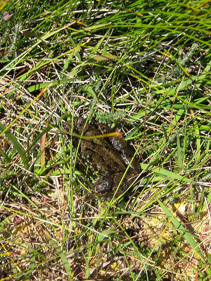
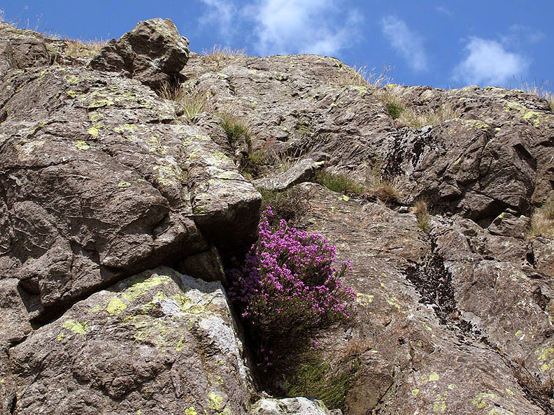
A brilliant patch of heather in full bloom amongst the rocks of the summit outcrop.
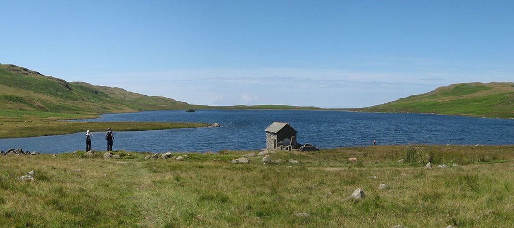
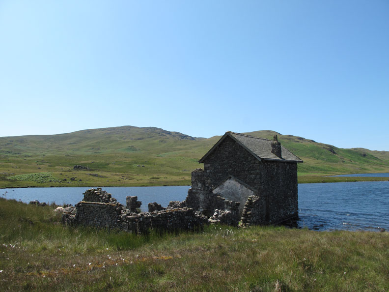
Walking down to the boat house by the lake . . . that's me down by the waterside.
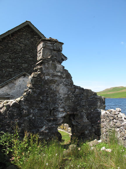
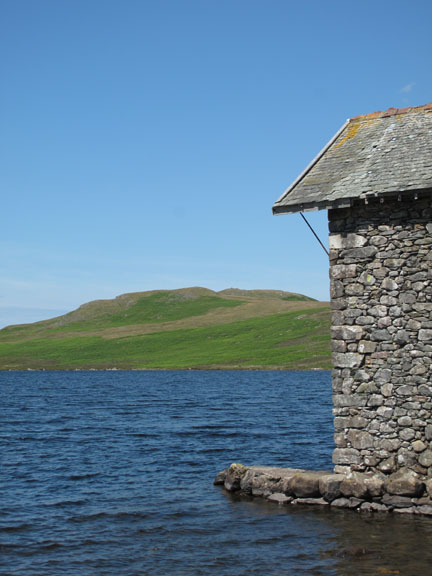
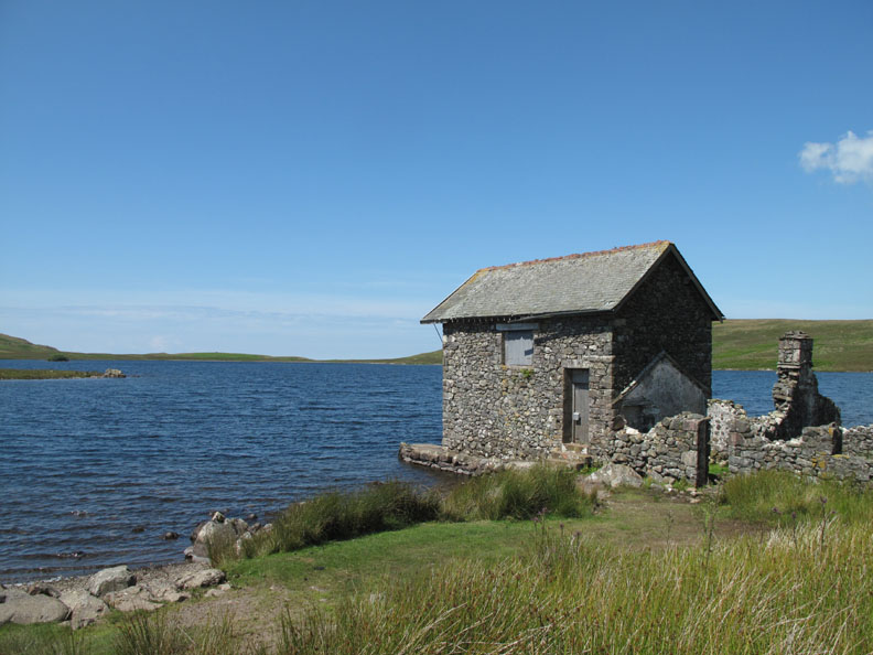
The main boathouse looks in good condition but the rear of the building is in ruins.
Well secured . . . I wonder how often it is used ?
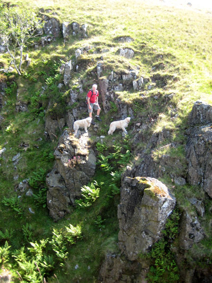
Harry and Bethan up to their rock climbing antics again.
We strike out for our next summit . . . following the beck up towards White Pike.
That glorious, ever present panorama stretched out behind us today. Click here or on the photo above for a larger Loweswatercam annotated panorama.
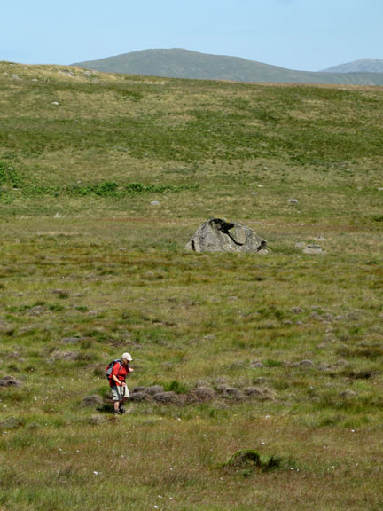
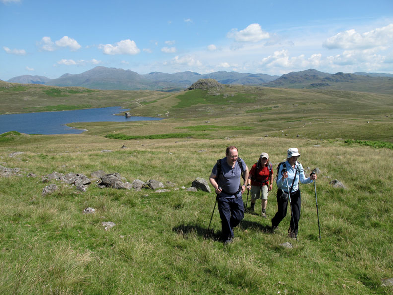
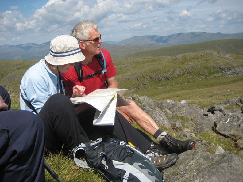
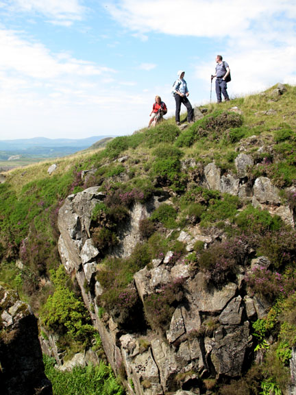
Unusually well spread out . . . I blame it on Ian talking too much !
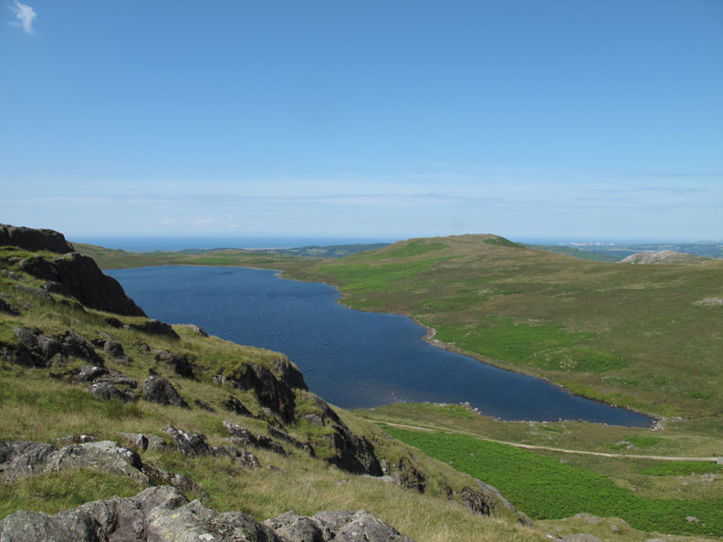
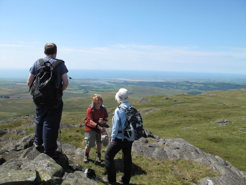
From the tall cairn on White Pike we can look down on the Ravenglass Estuary and across to the Isle of Man.
It was a short distance across to Woodend Height just to the south.
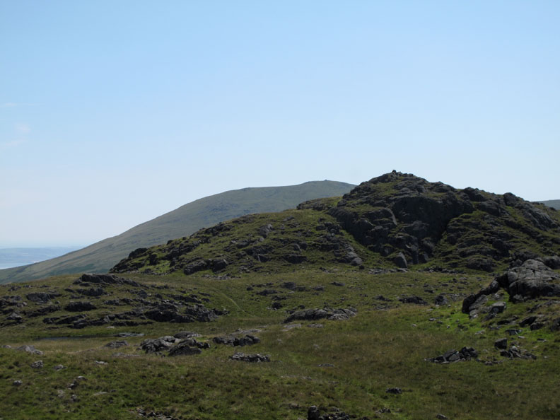
When you are up there, the summit blends into the high ground of Yoadcastle but it commands a fine view of the major Lakeland fells.
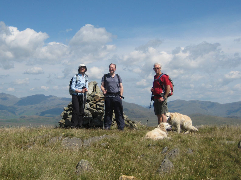
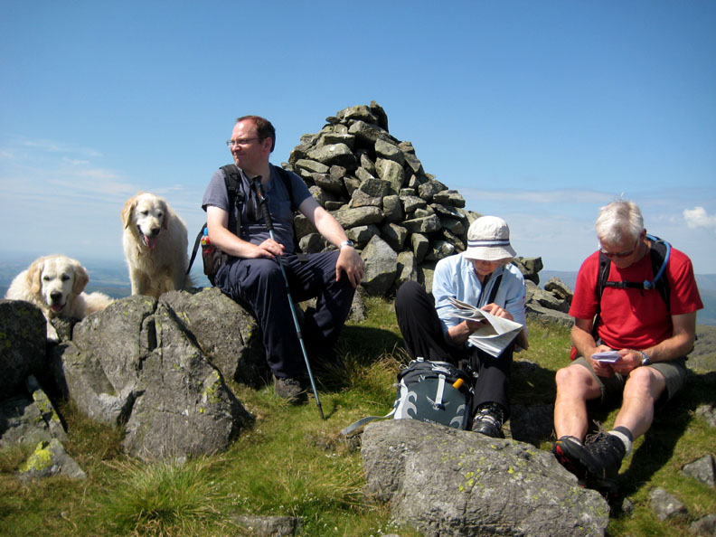
Five sixths of the party on Woodend Height . . . taken by Ann.
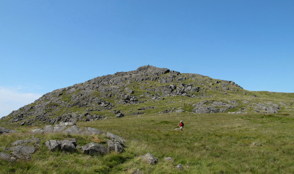
Craggy Yoadcastle with the grassy Whit Fell behind. This was our planned lunch stop today . . . but the drinks had already been well sampled in today's warm sunshine.
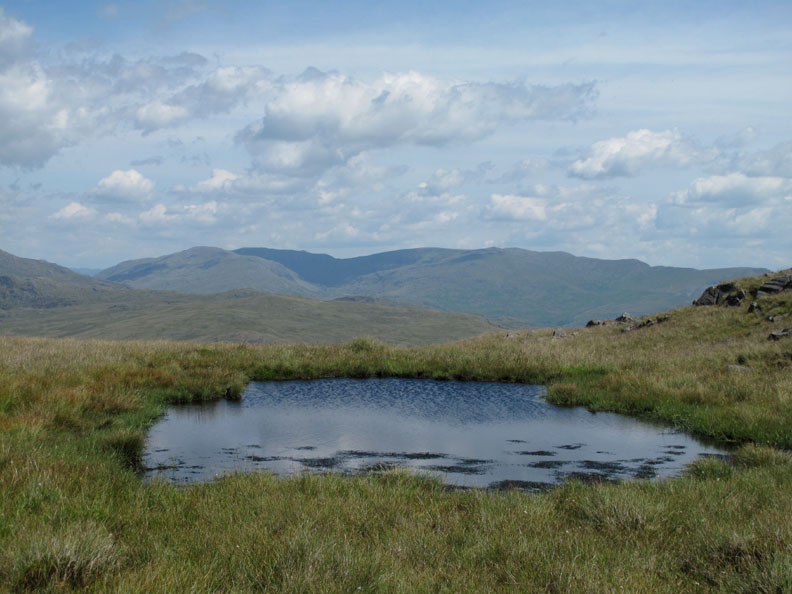
The Coniston Fells, from Grey Friar across to Dow Crag and White Maiden as seen above the surface of a wind-ruffled summit tarn.
Overseeing the conversation . . . enjoying the view and the slight breeze on Yoadcastle.
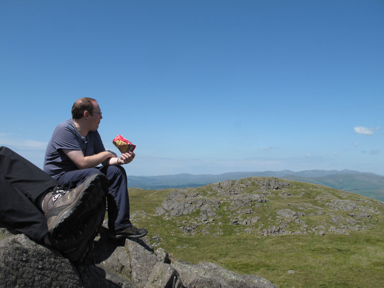
Feet up as it's lunchtime . . . looking north east to the high fells. It was about now that Ian decided a nice moist jam sandwich would have been preferable to a dry packet of crisps, however nice the flavour.
Behind us, the ever present Wasdale, Eskdale, Harter Fell panorama. Beautifully clear on a day like today.
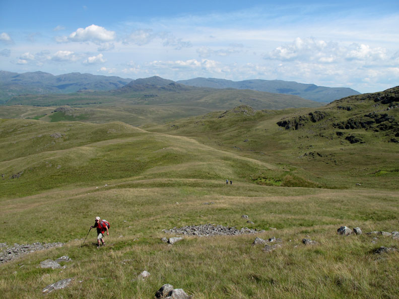
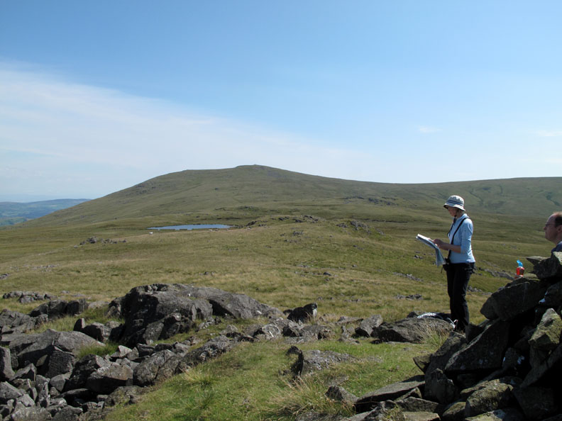
Ahead, the prospect of a reasonably level moorland walk over to Stainton Pike.
Leaving Yoadcastle . . . it looks a lot more rounded from this side.
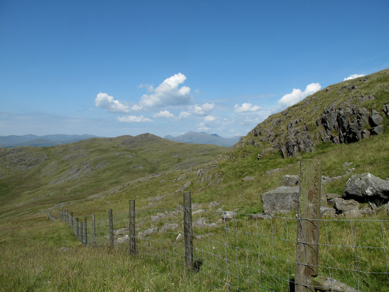
One fence carefully climbed over and we're on the last ascent of the day.
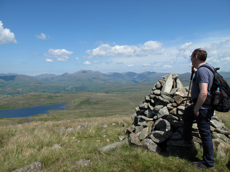
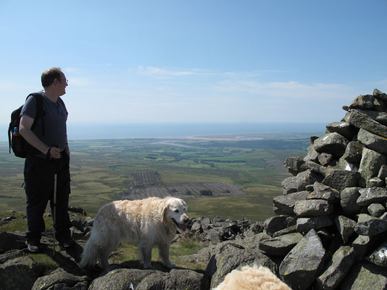
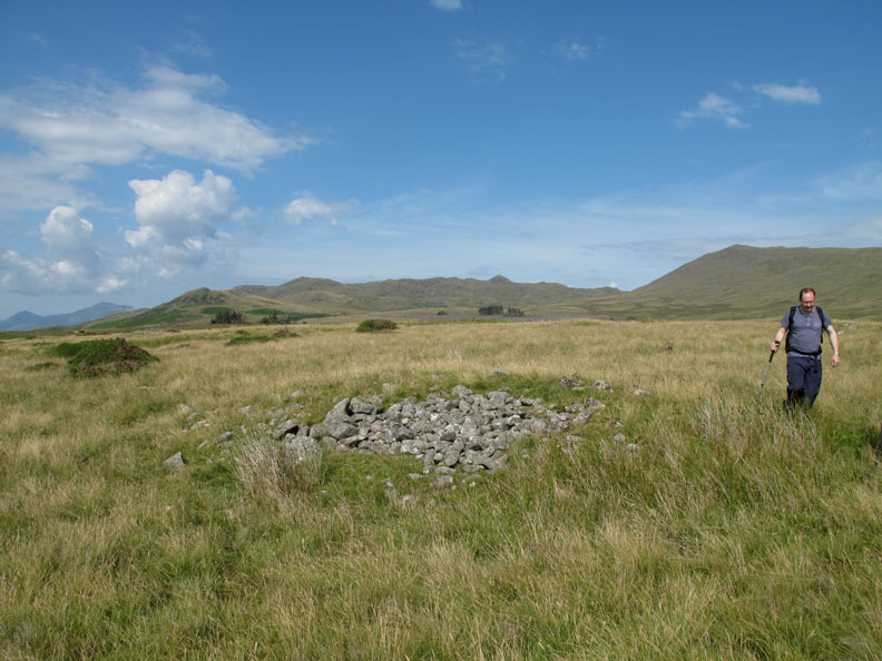
The highest point of Stainton Pike has a large cairn, the largest of the five summit cairns we have visited today. The weather is holding and the views are extensive, despite a slight distance haze which more or less obscures the Isle of Man.
Maggie hasn't been over this way before. Obviously impressed, she wants to know which fell is which so she can recognise them next time she's here.
Ian seems unimpressed about extending the walk to Whit Fell. I must admit , an extra three quarters of an hour and mile and a half of walking may seriously jeopardize our ability to obtain tea and scones later !
Decision made . . . Holehouse Tarn and Whit Fell will await another day.
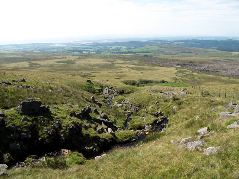
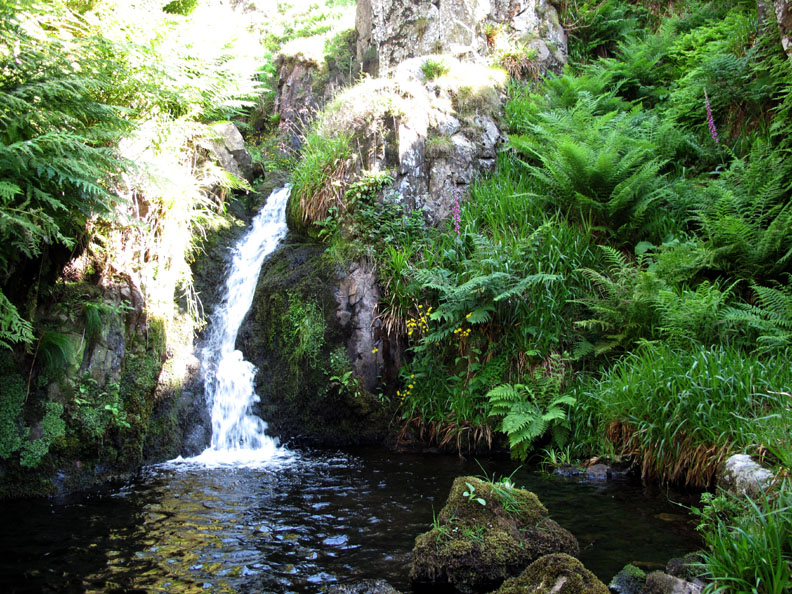
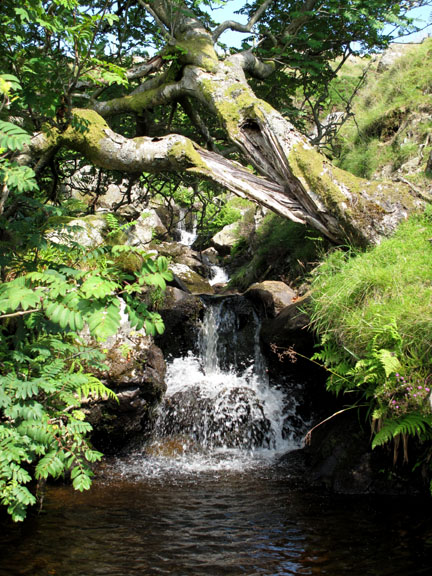
Now to drop down and find the next objective of the day . . . Rowan Tree Falls. The Fell and Rock Club book of The Lakeland Fells has the falls as a lead photo on the chapter about Stainton Pike. It is about half way down there somewhere, hidden in a ravine.
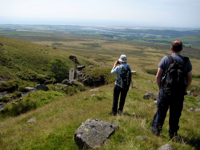
We walk diagonally down and by so doing meet up with the beck. Aiming slightly higher across the fell side meant that the falls were bound to be below us and consequently easy to find.
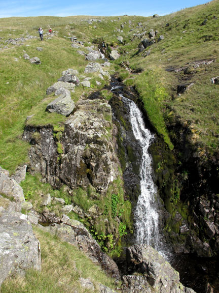
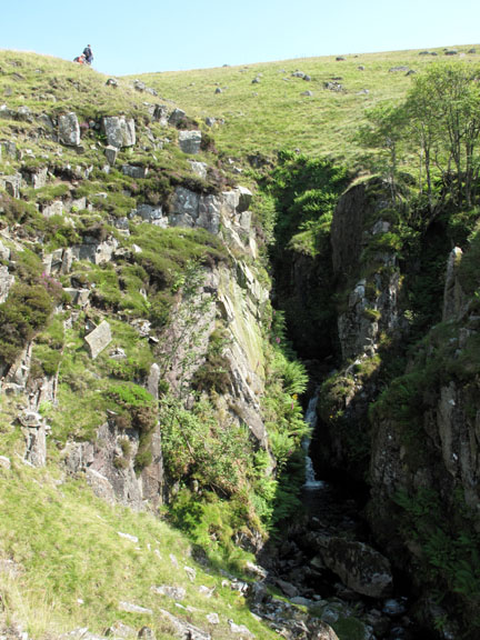
This must prove that I don't suffer from vertigo ! As if to prove the point, the first of the Rowan trees that grow along the ravine of Rowantree Gill can be seen on the other side.
The plunge pool at the heart of the ravine was not very deep but the moist air (and lack of sheep) meant that the micro-climate produced lush vegetation of ferns and flowers. A real delight.
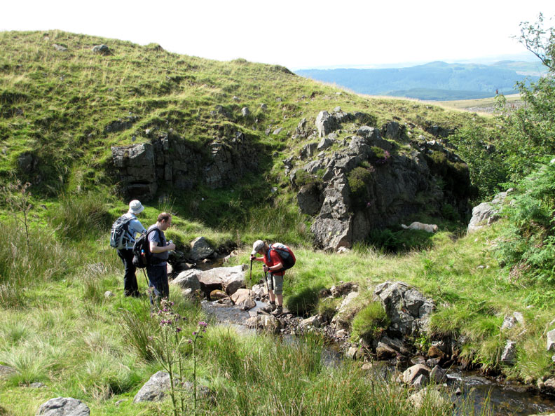
Time for the others to cross over.
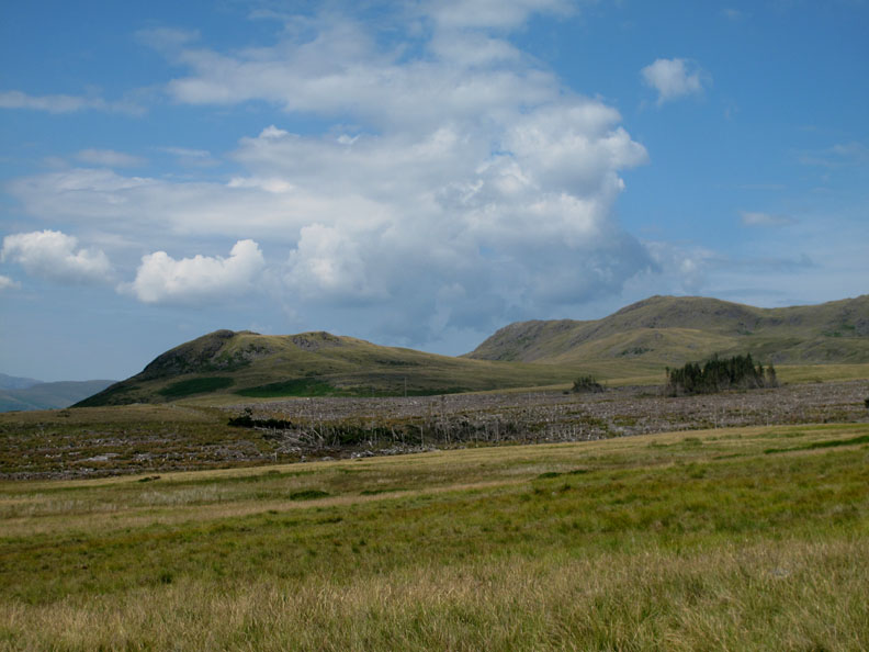
The Knott to the left, visited by Ann and myself last time we were here, but it was not on the agenda for today. The forestry shown on the map had been cleared in recent years but some of the damaged trees have been left in a disorganised stand presumably because they were not economic to clear away.
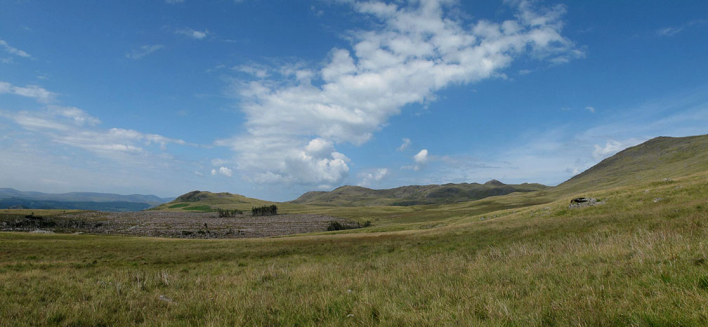
A wider view showing the skyline route that we have climbed today.
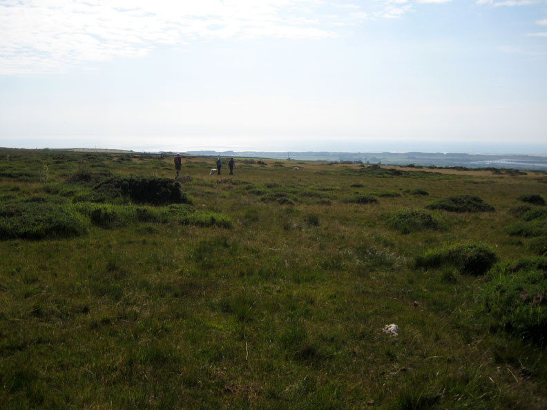
Now to find our way across a mile and a half or so of rough ground. Tussock grass, heather, a little gorse, marshy ground and somewhere a bridleway that we would like to have found.
Ian and I were both looking hard for the path but it failed to reveal itself. The going was getting rougher and occasionally rather damp !
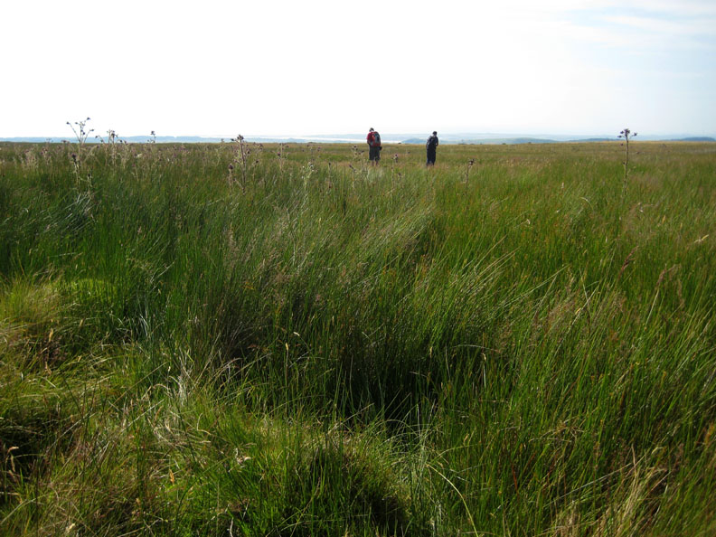
Aiming for higher ground we reached the area shown on the map as cairns and an ancient homestead and the going suddenly became easier.
Hey . . . we even found the path ! We were never really lost in this open ground on this fine day but it would have been nicer to have found it sooner. Perhaps it didn't really exist at the point where we obviously crossed it a short while back.
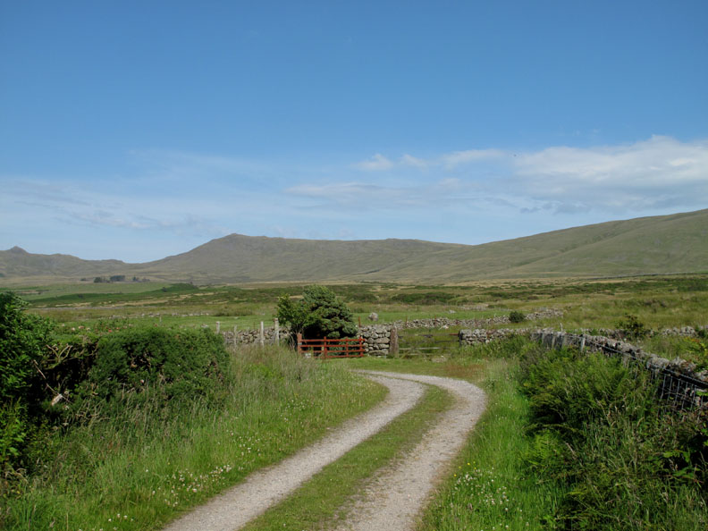
All's well that ends well . . . and we're back at the drive to Grange Farm. The car should be at the bottom of the track just a short way down now.
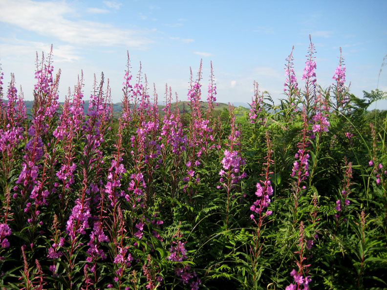
Seasonal flowers of daffodils and bluebells have given way to summer foxgloves, and here Rose Bay Willow Herb.
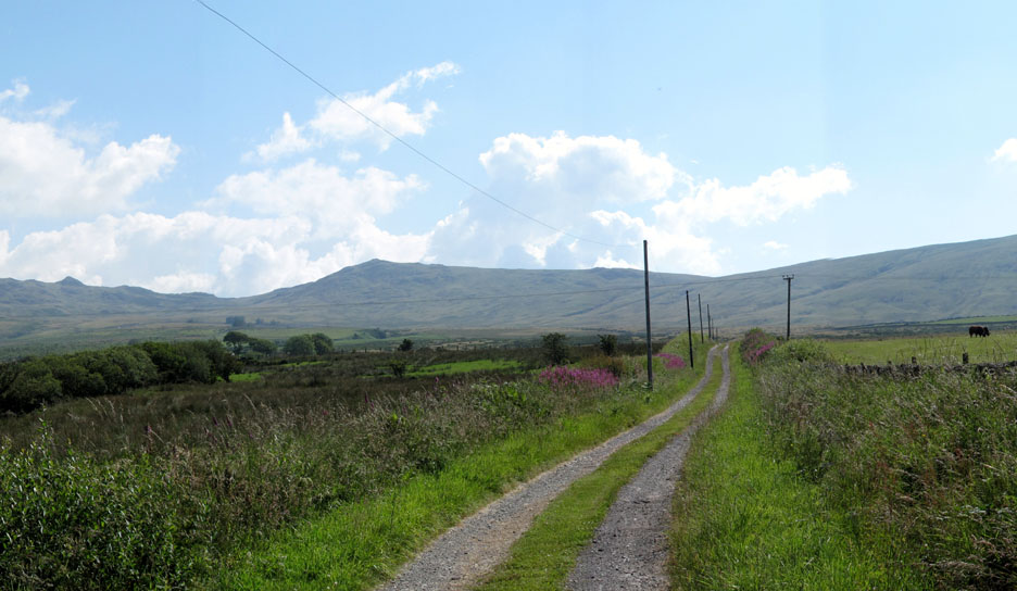
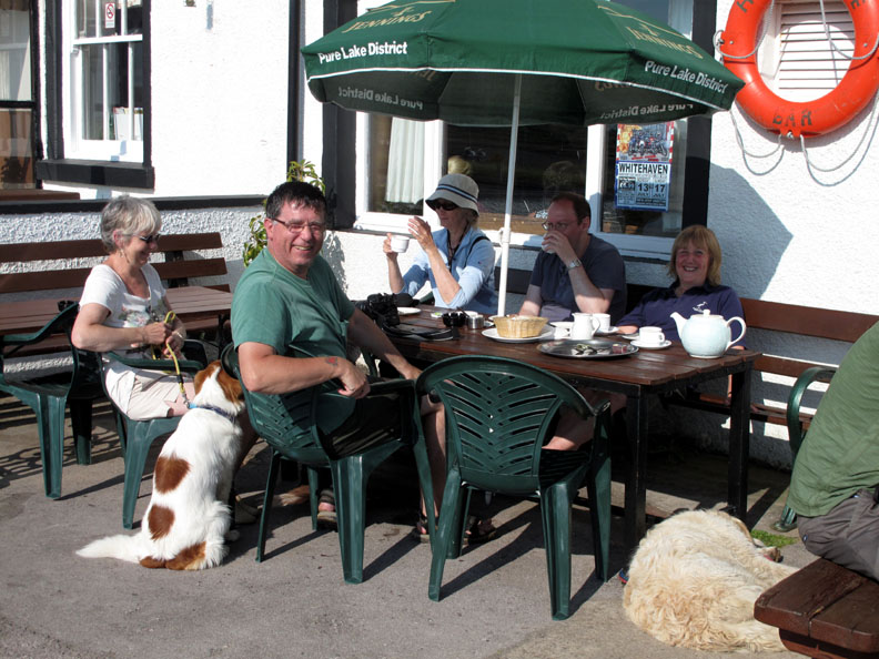
A final panorama from the road end, looking back on a great linear walk. - - - o o o - - Using the power of modern telephonic communications, we were able to meet up with David and Ros down at the seaside at Ravenglass.
A huge pot of tea and the last scones of the day were much appreciated. - - - o o o - - - |
Technical note: Pictures taken with either Ann's Canon 75 or my Canon G10 digital camera. Resized in Photoshop, and built up on a Dreamweaver web builder. This site best viewed with . . .
a large pot of tea Go to Top . . . © RmH.2011 . . . Email me here Previous walk - 9th July 2011 Low Ling Crag on Crummock Water A previous time up here - 1st November 2006 Stainton Pike and the Rowan Tree Falls Next walk - 16th July 2011 A dramatic Loweswater Sunset
|

 and scones from the