![]()

Remember: Press F11 for a full
screen view of this page.
|
|
|
Remember: Press F11 for a full
screen view of this page. |
|
" Whin Rigg & Illgill Head ~ The Wasdale Screes " Date & start time: 11th April 2011, 1 pm start. Location of Start : Roadside near Woodhow Farm, Wasdale, Cumbria, Uk ( NY 142 042 ) Places visited : Lund Bridge, Greathall Gill, Whin Rigg, Illgill Head, Straighthead Gill, Brackenclose car park to end. Walk details : 6.5 mls, 2175 ft of ascent, 5 hrs 30 mins. Highest point : Illgill Head 1,998ft - 609m. Walked with : Dave and Josie, Ann and the dogs, Harry and Bethan. Weather : Clearing after rain, sun by the end. Very windy by the edges, dry throughout.
|
"
Whin Rigg & Illgill Head ~ The Wasdale Screes " at EveryTrail [ Alter the settings to zoom or change the Map, use Everytrail to download the Gps route ] |
|
Dave and Josie are on holiday in Nether Wasdale so they invited us over to walk a fell or two near them. A poor morning forecast allowed us to enjoy a sociable coffee beforehand and gave the weather plenty of time to clear.
The rain has stopped and the clouds are slowly lifting . . . so it's about time we should get out for our walk.
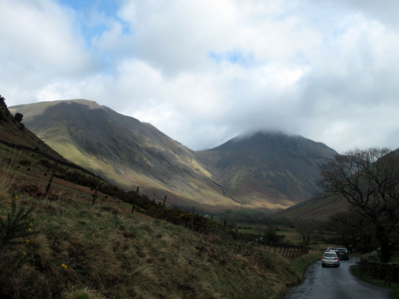
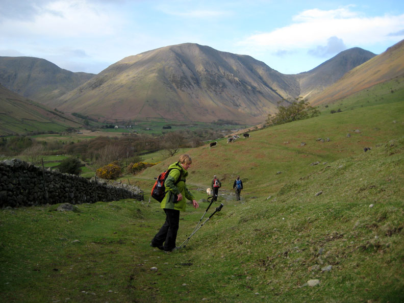
A quick drive up to Brackenclose car park to leave a car handy for the end of the day.
After collecting the Josie and Ann, we drive in Dave's car to the bottom end of the lake to start our walk.
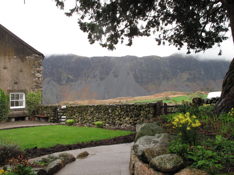
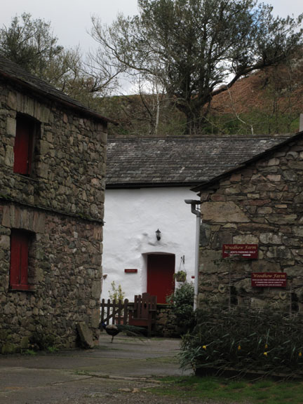
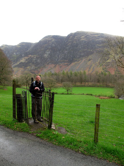
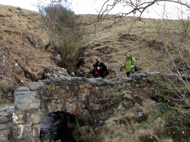
The route starts at the kissing gate by Woodhow Farm . . .
. . . and crosses a field, down to the River Irt the well known river that nobody know where it starts !
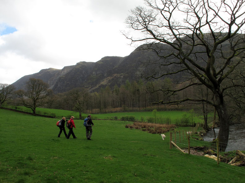
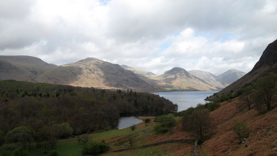
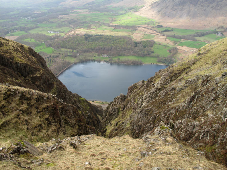
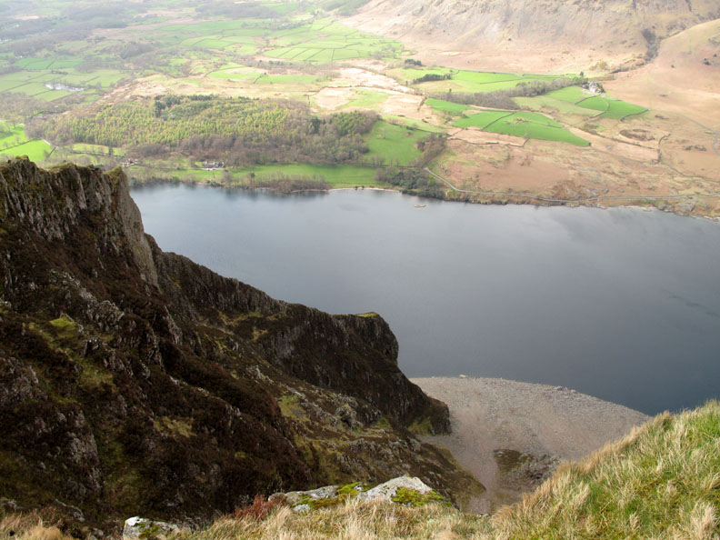
The Lund Bridge is the first bridge south of the lake and we cross it in order to get over to the base of the steep climb up to Whin Rigg.
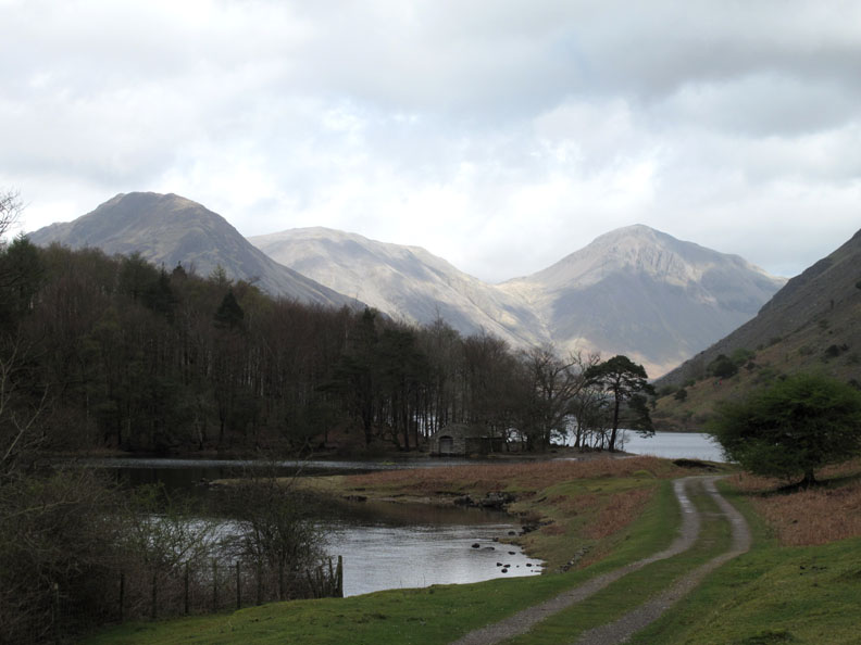
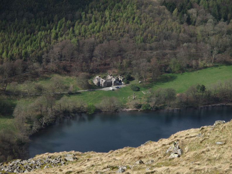
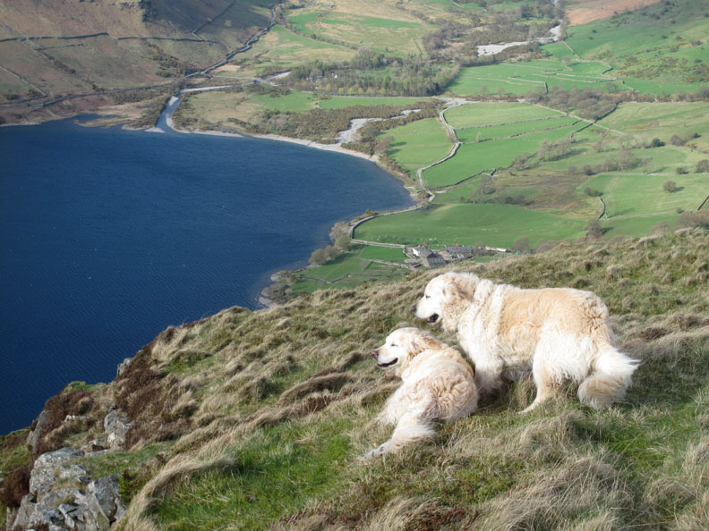
No need to hurry and so there's time to catch a view of the old boathouse tucked away at the outflow of the lake.
As we climb the view improves and with the clearing skies the fells become covered in dappled sunshine.
The climb is that steep that it feels almost like going up in a lift.
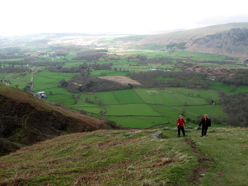
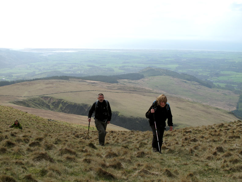
The green fields of Wasdale are spread out below us as we reach the top of Greathall Gill.
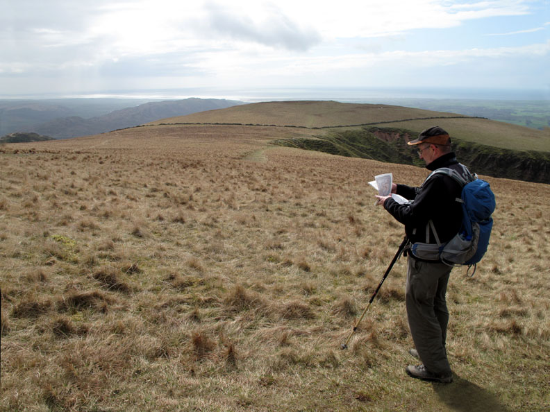
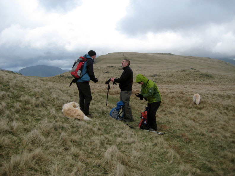
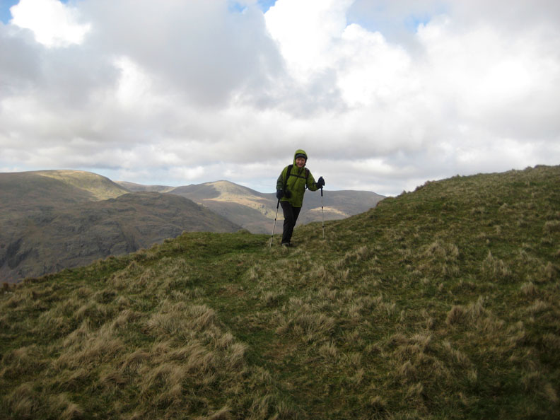
Dave checking the map to check out the surrounding fells.
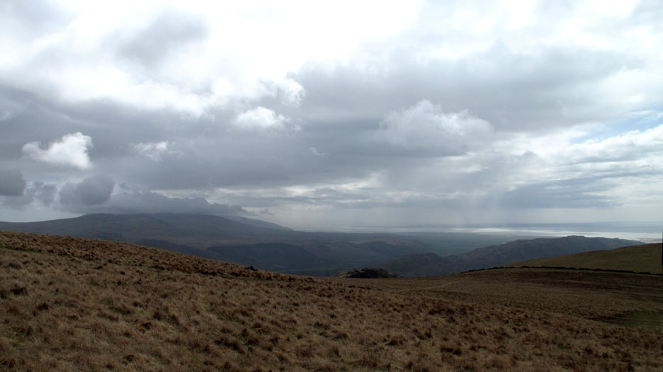
Just under cloud and within his view are the Ulpha Fells of Yoadcastle, Stainton Pike, Buck Barrow and Black Combe. In addition Muncaster Fell, the low, linear fell to the right and the craggy top of Great Bank not far below us here.
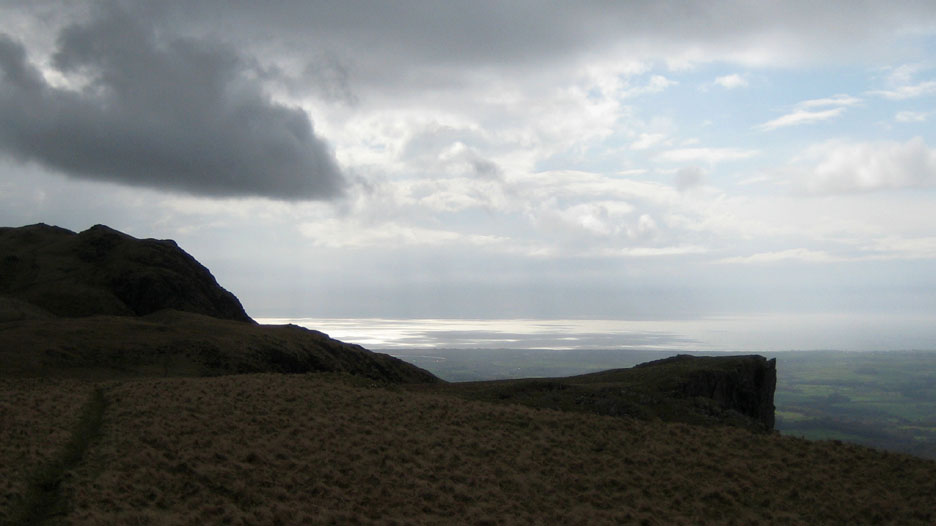
Irton Pike stands out at the end of the forestry. The village of Ravenglass can be just about seen in the haze, where the river estuaries converge and flow out to sea.
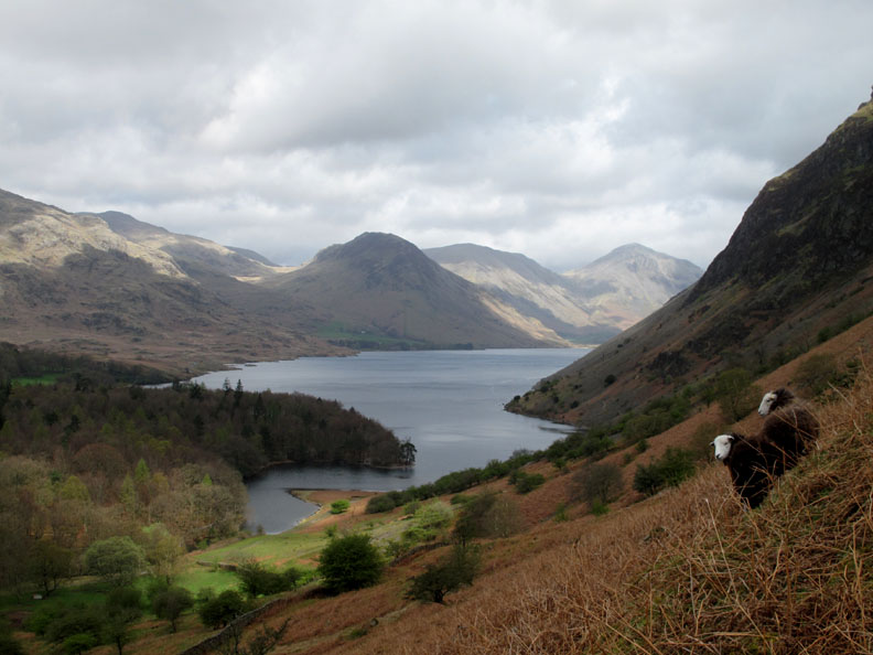
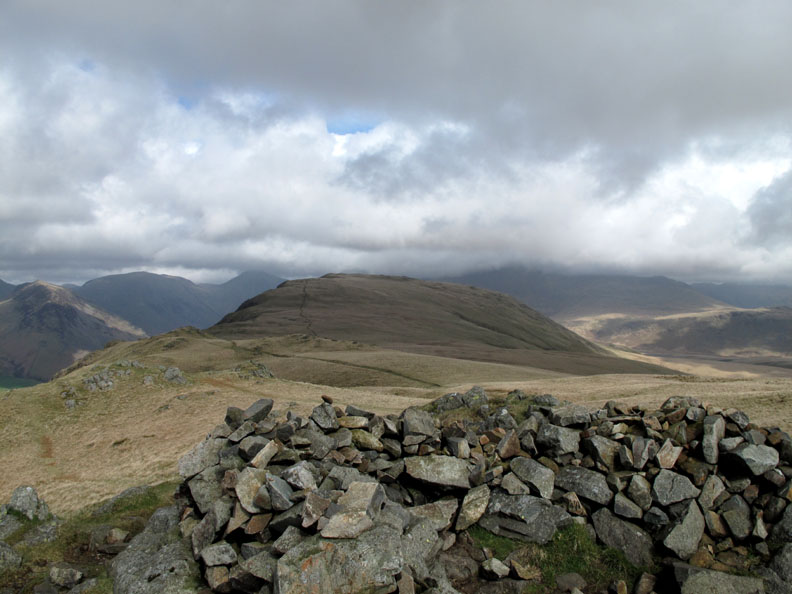
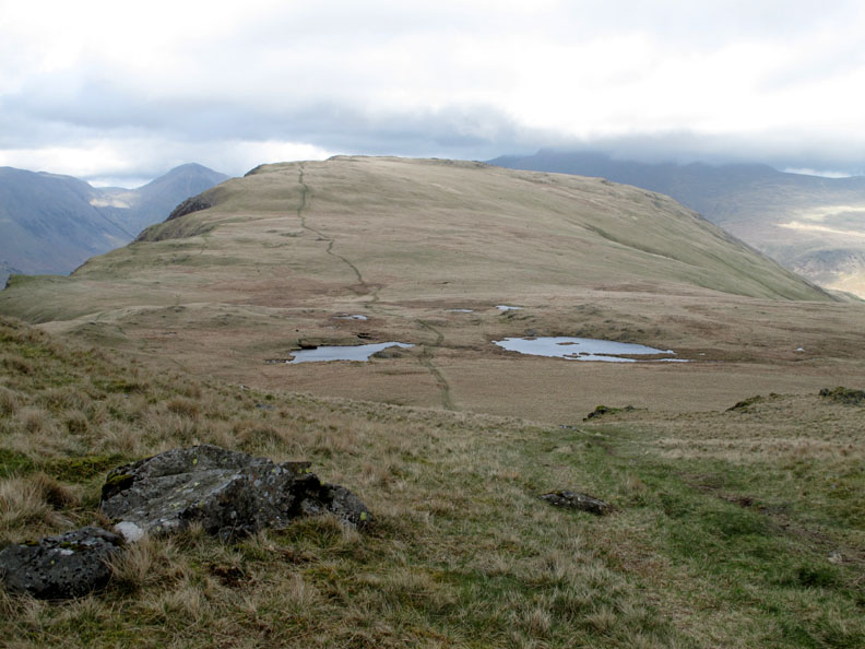
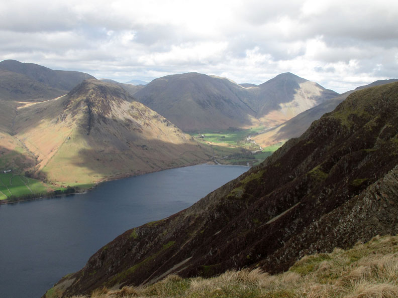
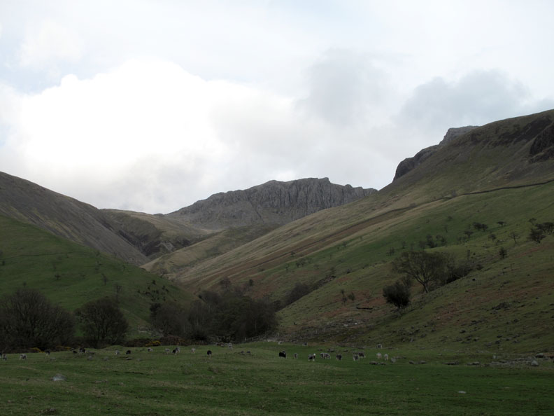
Standing in the shelter of Whin Rigg we get our first view along the length of the fell to Illgill Head at the northern end.
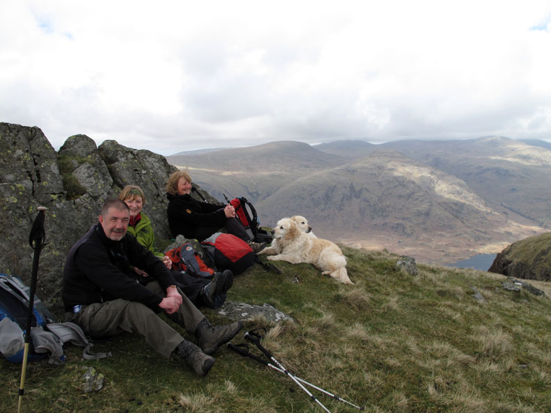
That long morning coffee (or tea) has kept us going well until now, but it's nearly three in the afternoon ! We don't fancy carrying the sandwiches for the whole walk so we declare that it's definitely time for lunch.
A nice burst of sunshine lights up the Wasdale Hall Youth Hostel far below us.
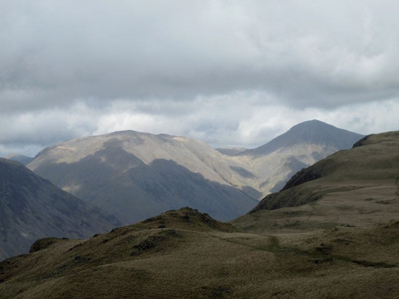
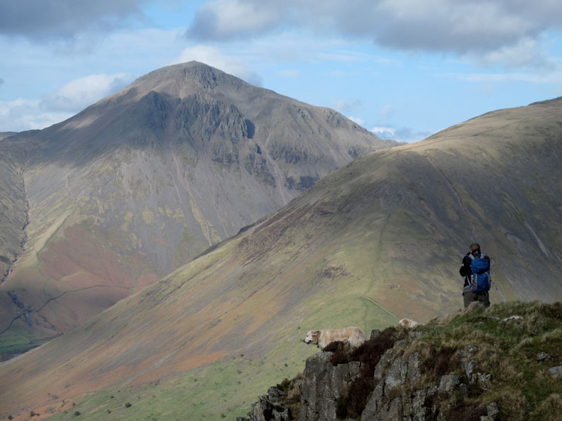
Looking around, the cloud patterns scurry across Kirk Fell and Great Gable.
For the first time Harter Fell has managed to catch a little sunshine too.
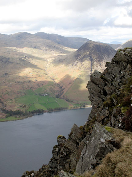
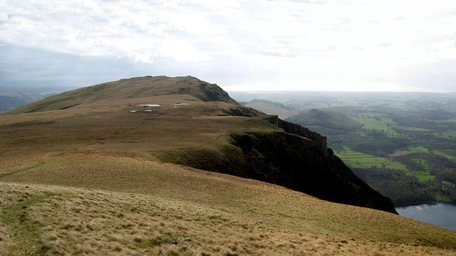
We set off to walk along the edge and enjoy the views across to the adjacent fells. In the picture here is Middle Fell with the Greendale Beck flowing down its left hand side.
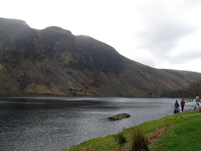
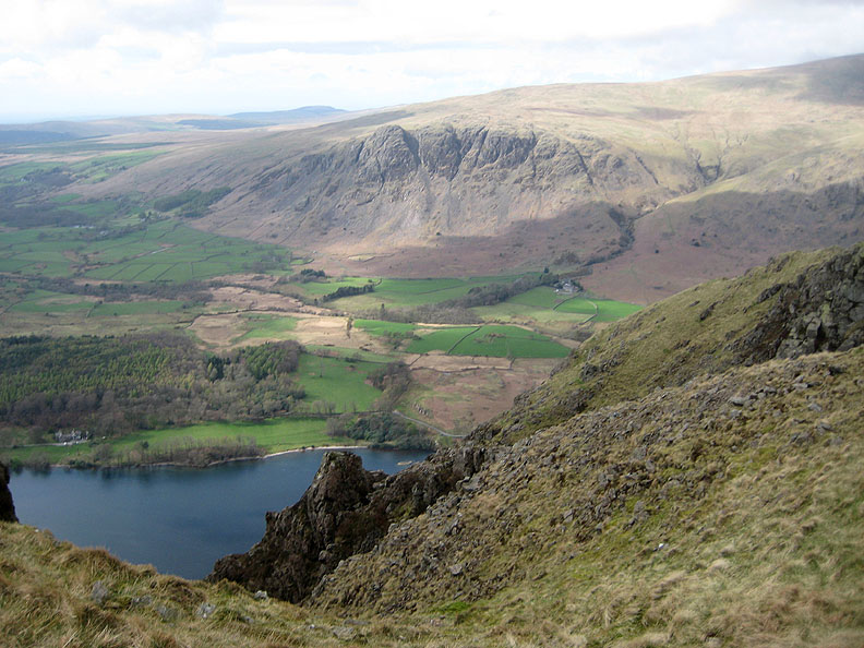
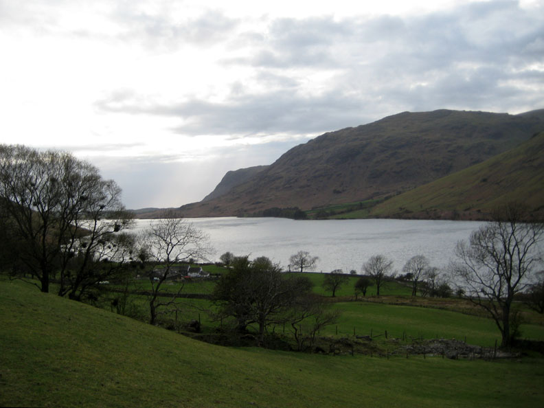
Across the next gully on the screes we have a clear view of Buckbarrow and its spectacular crags. It was the solid nature of these to rock masses, Whin Rigg and Buckbarrow, that caused to ancient glaciers to be constricted and so dig deep into the landscape. Wastwater, the deepest lake in the Lake District, is so deep in fact that the bed of its lake is below sea level.
No such scouring effect up here as the tarns on Whin Rigg are quite shallow. The obvious path up the centre past the tarns is okay, but we'll keep much further to the left so that we can look forward to the wonderful views of the Screes from above.
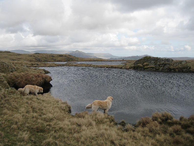
Not too far left to start with . . . as the dogs usually enjoy a paddle in the water.
The wind is remarkably strong as can be seen from the ripples on the water. The fells behind are Harter Fell, Green Crag with Brown Pike (the outlier of Coniston's Dow Crag) in the centre.
Time for an extra layer as we approach the windier side of the fell.
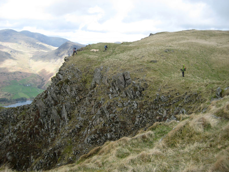
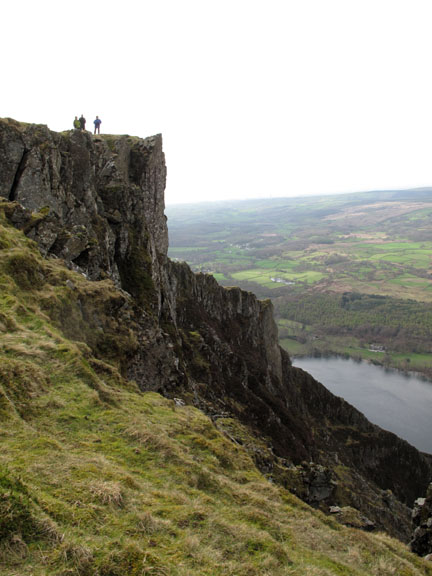
Taking care near the edges . . . the views are a photographer's delight
This is where the camera's anti-shake technology really starts to work overtime. The gullies amplify the wind speed and the camera is difficult to hold still.
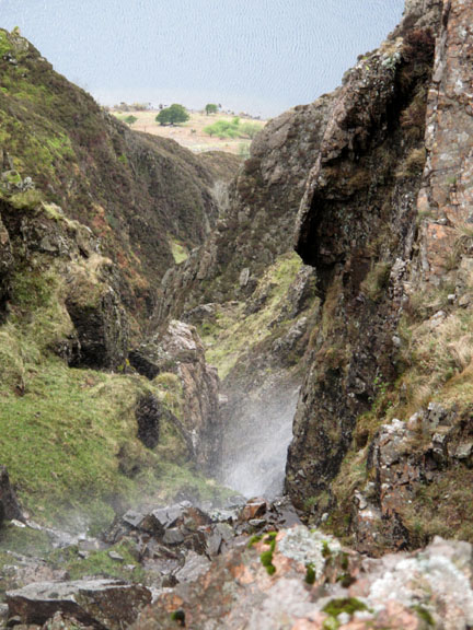
Bell Crag now and Dave is standing steady against the updraft for his next photo. The gully Harry and I were approaching has a small stream draining this side of the fell.
Green fields and the hamlet of Greendale opposite where Dave & Josie are staying this week. This dramatic rib of rock is the base of High Adam Crag and there's a large fan of broken rock making a huge scree shute at its base. A certain geographical author calls this fallen rock tallus . . . but I don't think "The Wasdale Tallus" will catch on as a popular local name !
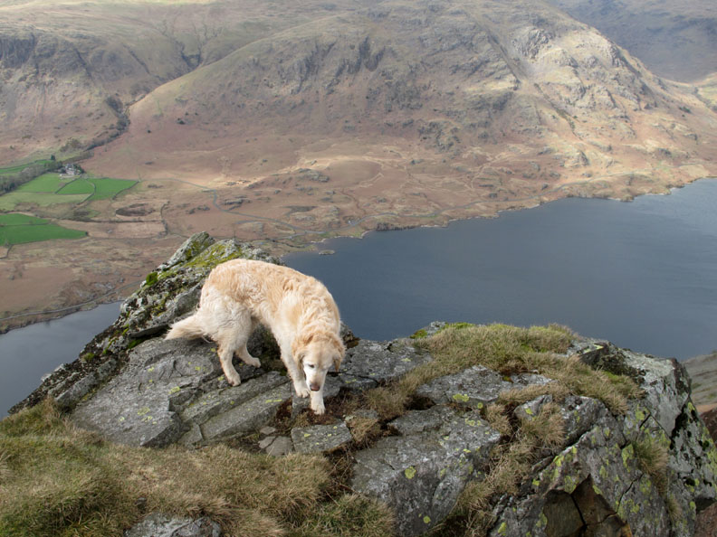
Stable on four feet but perhaps she ought to come a little away from the edge.
Looking back past High Adam Crag to the sunlight reflecting off the West Cumbrian coast.
The wider panorama as we leave Whin Rigg to be 'the fell in the distance'.
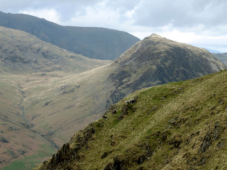
Sheep may safely graze . . . if they are careful about the updraft too.
Cam Crags (I think . . . as the map is not too specific).
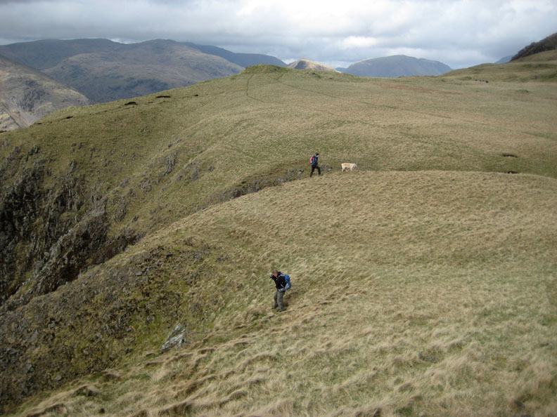
As we approach the higher ground at the Illgill Head end, the scree scenery becomes a little less dramatic as the ribs of harder rock in between the scree slopes become less vertical.
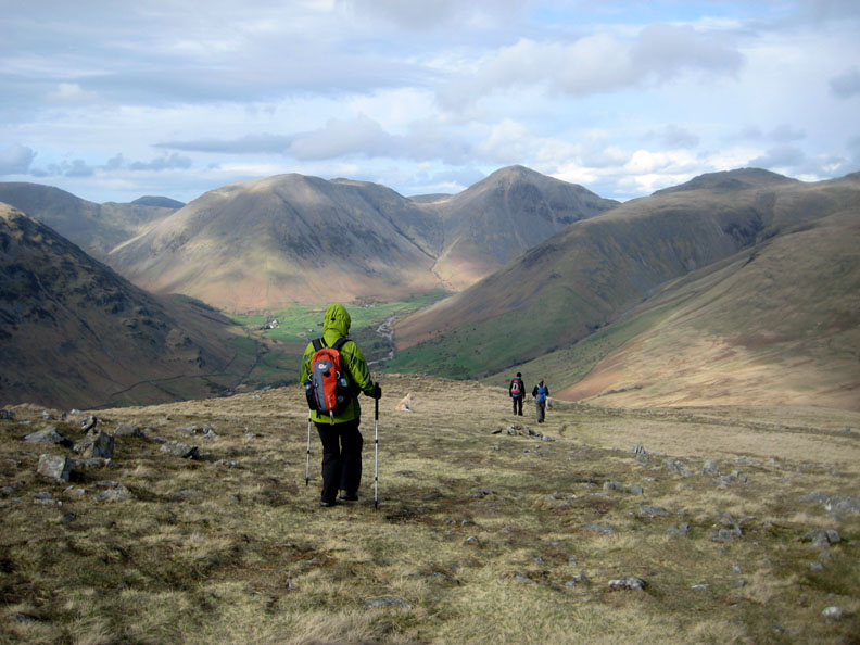
Rounding the summit area and leaving the view of the screes, Josie is pushed along by her poles and by the strong wind.
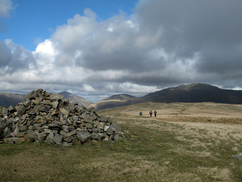
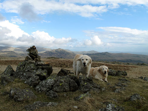
Illgill Head is another of these fells that has numerous summit cairns. This is the first and major one but it is on the lower of the three defined summits.
The direct sunlight is more widespread now as we start our descent to Brackenclose.
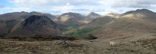
The wider view of the head of Wasdale. Click here or on the photo above for a larger Loweswatercam annotated panorama.
Leaving the path, as I have a slight habit of doing, I wonder over to a cairn marked on the outer side of the fell.
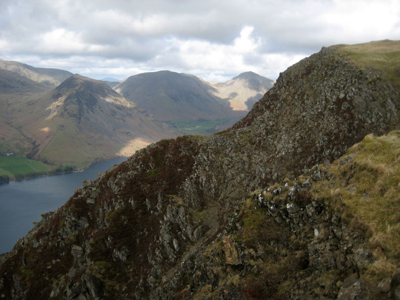
No great stone cairn but a nice view down to Wast Water for myself and the dogs.
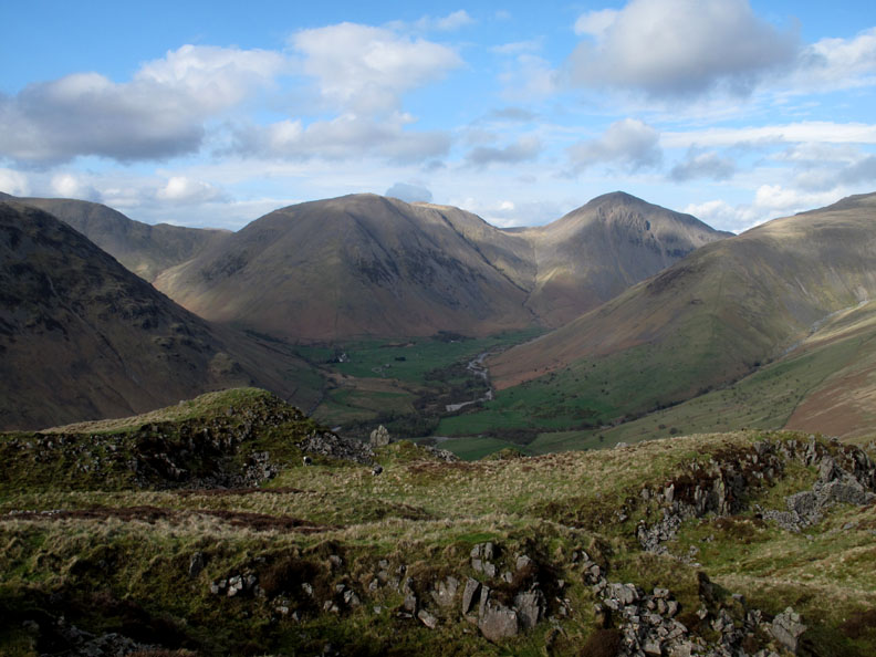
Dave has diverted over too and is also impressed by the view of Great Gable.
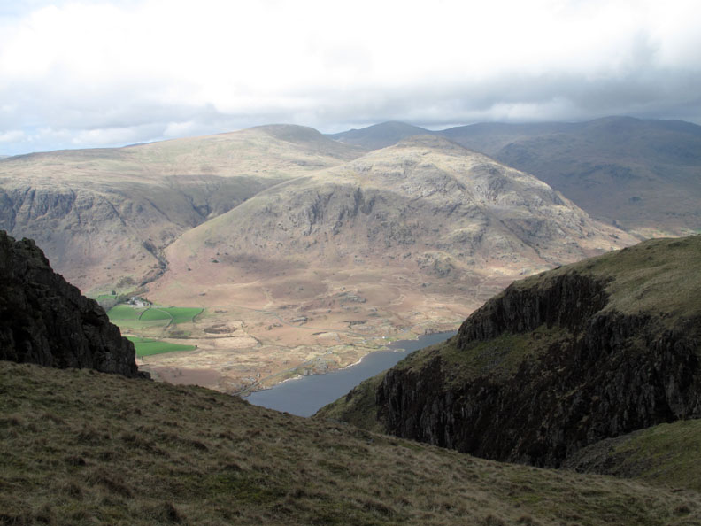
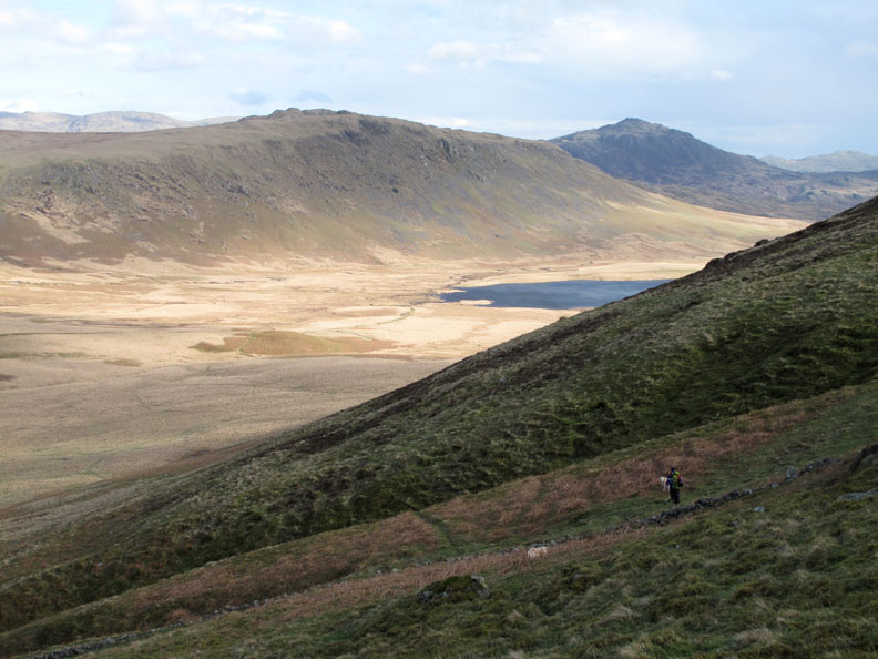
The ladies had kept to the main path down so we had to walk over to catch them up. On the way over we had a fine backdrop of Burnmoor Tarn, Eskdale Fell and Harter Fell.
The stone waller had just completed a sheep or cripple hole at the end of his shift a few years ago but never returned to finish the rest of the wall across to the stream on the left . . . enough stone is there but I wonder if the wall will ever be completed ?
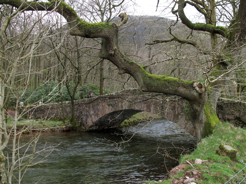
Walking down to the valley below, the path crosses over two delightful hump-back bridges so close that they look like one bridge.
Out of the breeze now and Josie decides she doesn't need all those extra layers she put on earlier.
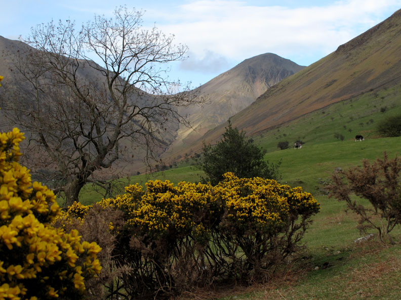
No leaves on the trees yet but the gorse bushes are starting to bloom nicely.
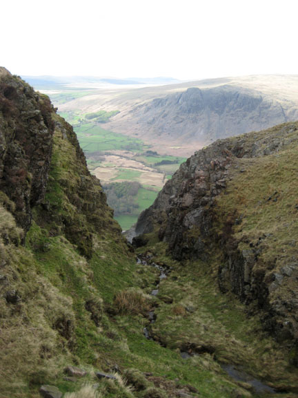
Just as we ascended the other end like a lift, looking at this series of pictures quickly makes you feel like you have just pressed the ground floor button again. The buildings below are all part of Wasdale Head Hall Farm.
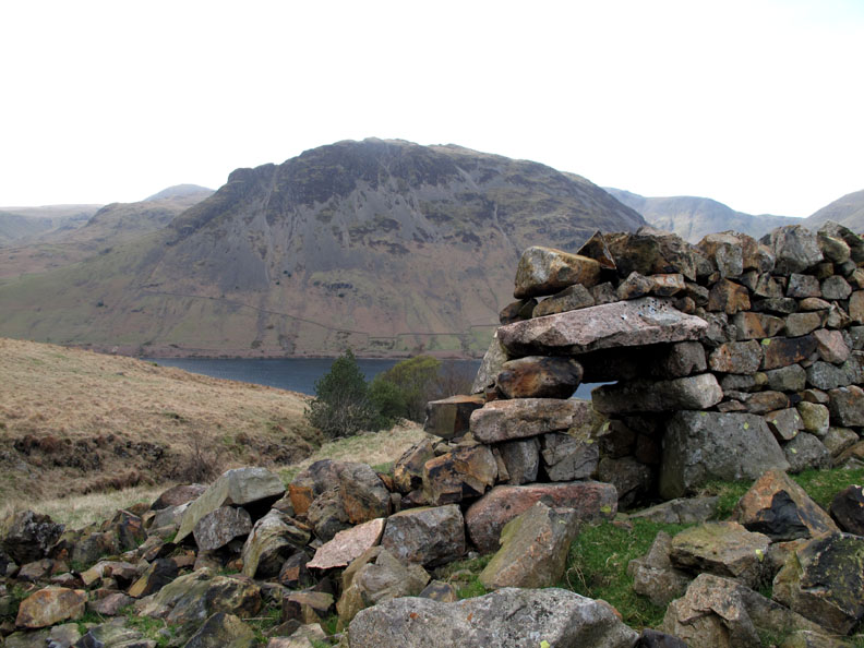
Scafell Pike from approximately 3000 ft below. The summit is actually hidden above and behind Pike Crags. A short hop now to the second car waiting patiently under the trees . . . I hope I remembered to bring the keys for it. - - - o o o - - -
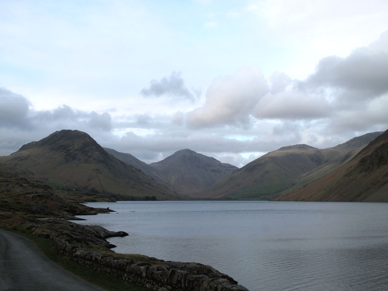
Don't panic . . . we're underway and driving back down the lakeside road at the end of a lovely afternoon's walk. This view featured as "Britain's Favourite View" and forms the inspiration for the Lake District National Park logo. - - - o o o - - - Back at the cottage in Greendale Dave and Josie very kindly entertain us once again and while they do, the sun makes one last break from under the high cloud to light up the fells that we had just climbed.
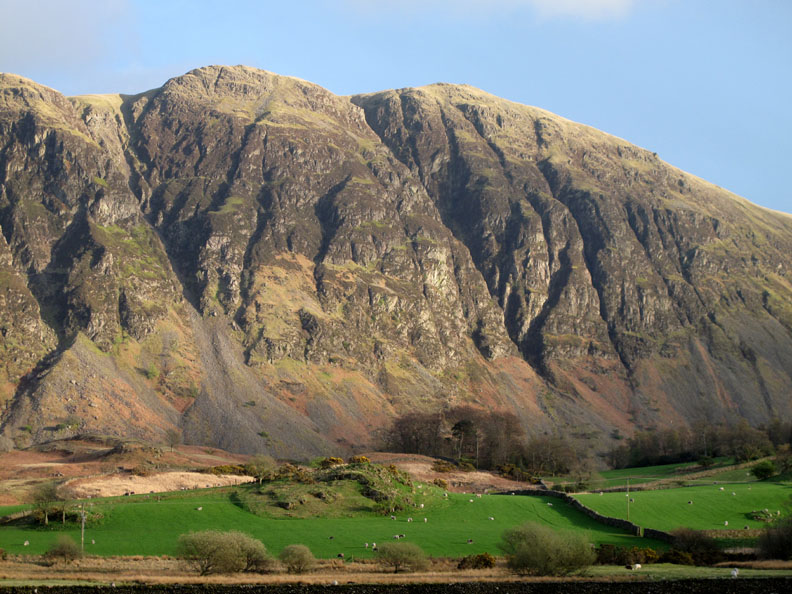
This is Whin Rigg seen from below. We had lunch near the summit and were almost blown over by the wind funneling up the gullies.
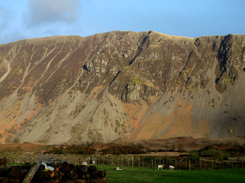
Illgill Head with the more gentle scree slopes at the northern end . . .
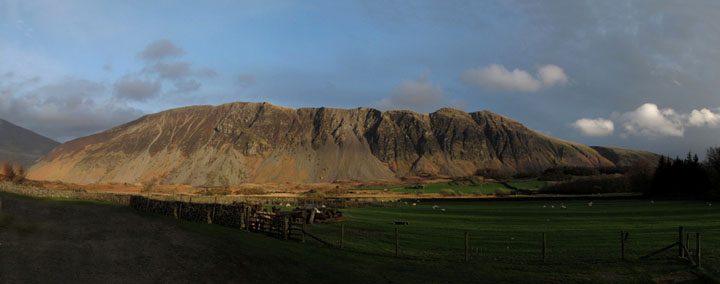
. . . and here the full glory of a sunny end to a Wasdale day. For best effect, click here or on the photo above for a larger Loweswatercam annotated panorama. - - - o o o - - - |
Technical note: Pictures taken with either Ann's Canon 75 or my Canon G10 digital camera. Resized in Photoshop, and built up on a Dreamweaver web builder. This site best viewed with . . . tea, coffee, cheese and biscuits. Go to Top . . . © RmH.2011 . . . Email me here Previous walk - 9th April 2011 Rest Dodd and The Nab A previous time up here - 11th April 2005 Wasdale Screes, Burnmoor and the Boot Inn Next walk - 17th April 2011 Routenbeck Woods near Sale Fell
|