![]()

Remember: Press F11 for a full
screen view of this page.
|
|
|
Remember: Press F11 for a full
screen view of this page. |
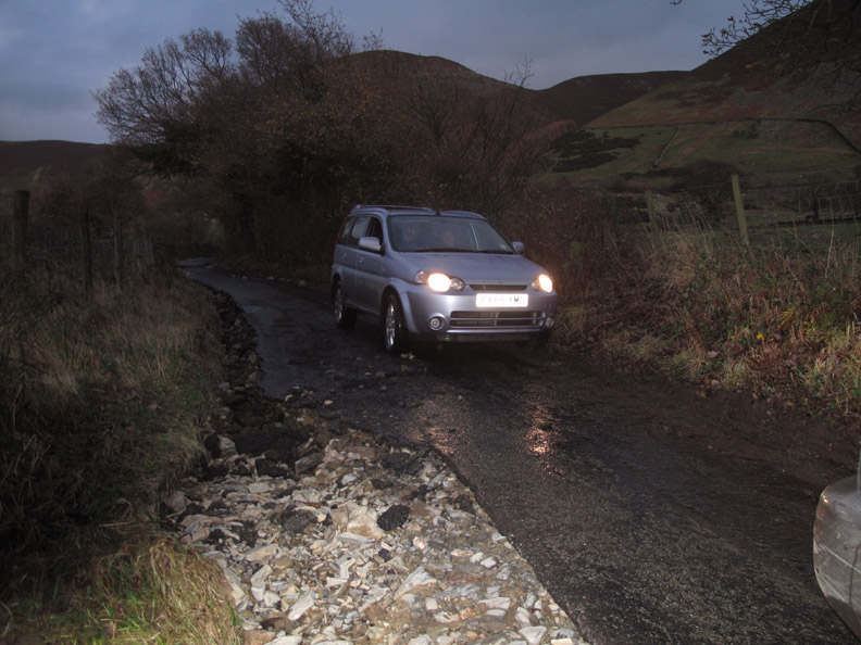
| Date & start time: Friday 20th November 2009. Location of Start : The red phone box, Loweswater , Cumbria, Uk ( NY 143 211 ) Places visited : Stayed local today, Loweswater and Lorton. Walk details : [ not really applicable today ] Highest point : The spirit of the local folk that we met during the day. With : Ann and the dogs, Harry and Bethan. Weather
: The rain stopped
early morning and there's the prospect of some brief sunshine. |
|
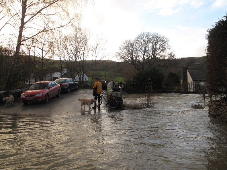
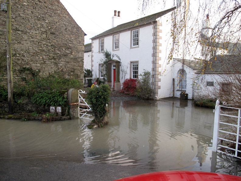
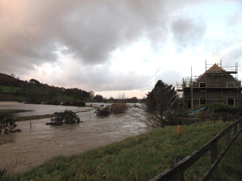
Day Two of the November floods and there's no access out of the valley to Keswick so I had a day at home and explored locally. We started by going the check out the neighbours, especially those whose electricity had been cut off by the storms.
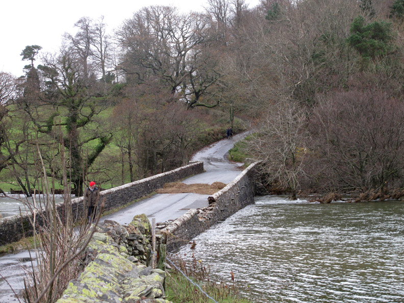
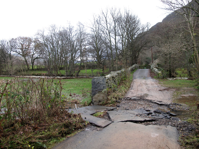
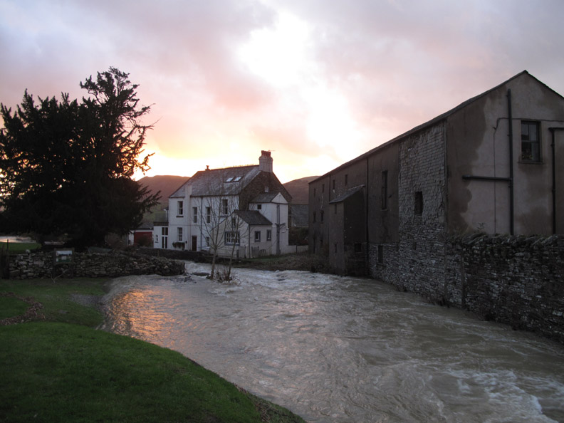
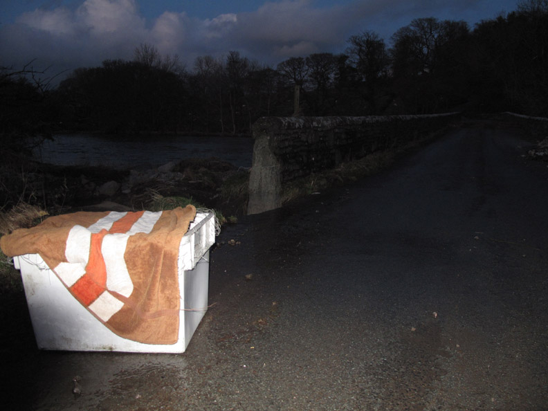
First a check of our bridge. The pressure of water has damaged the parapet. [ Hold your cursor over the photos to compare with yesterday's picture]
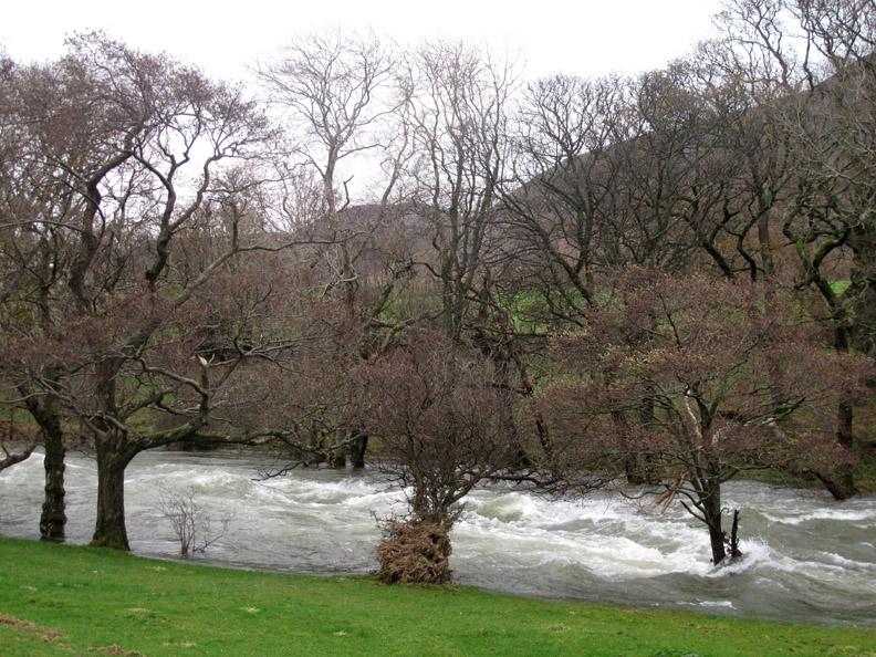
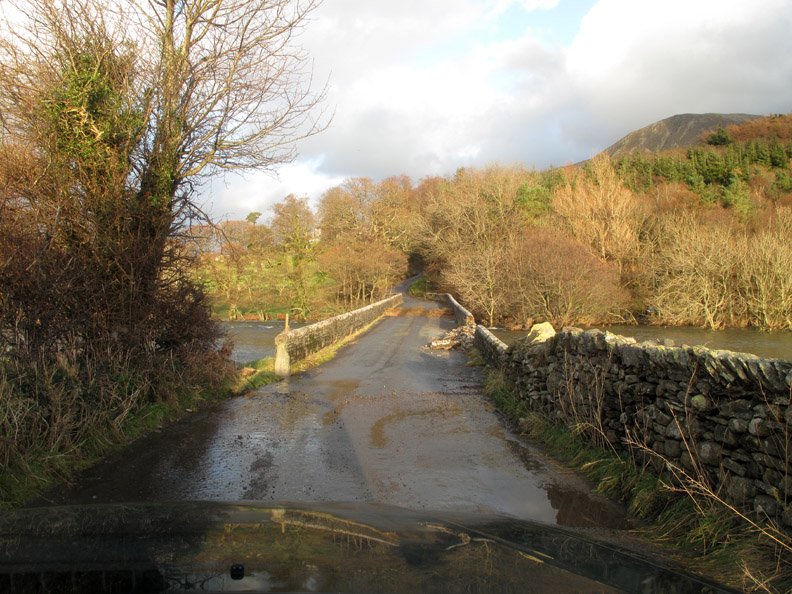
The River Cocker just below the bridge is still in spate, high above it's normal flood levels. The central fallen tree opposite has brought down the power lines to a few of the houses locally .
In adversity, the village community feeling comes to the fore, as people stop and chat about the conditions and their experiences over the last two days.
A close up of the fallen parapet but there are no cracks in the tarmac of the bridge itself so hopefully this bridge is Ok.
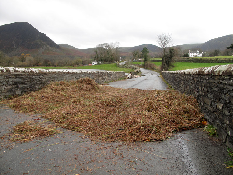
A huge pile of reeds and grass which has formed a tide line on the bridge.
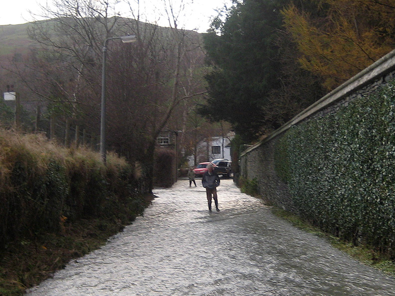
A local walk around shows how the tarmac has been lifted by the flood waters adjacent to Low Park bridge. - - - o o o - - - The forecast was for afternoon sunshine . . . and it seemed to be coming true.
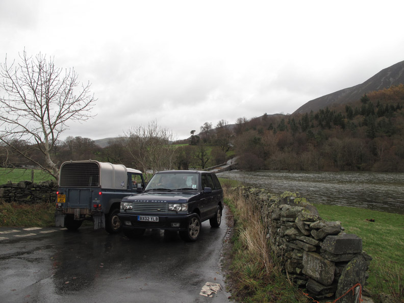
Ann and I take a drive down to Lorton.
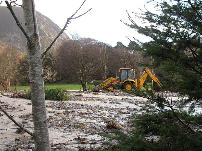
Someone is out and starting to dig out the bed of the River Lisa to encourage the water back under it's local road bridge.
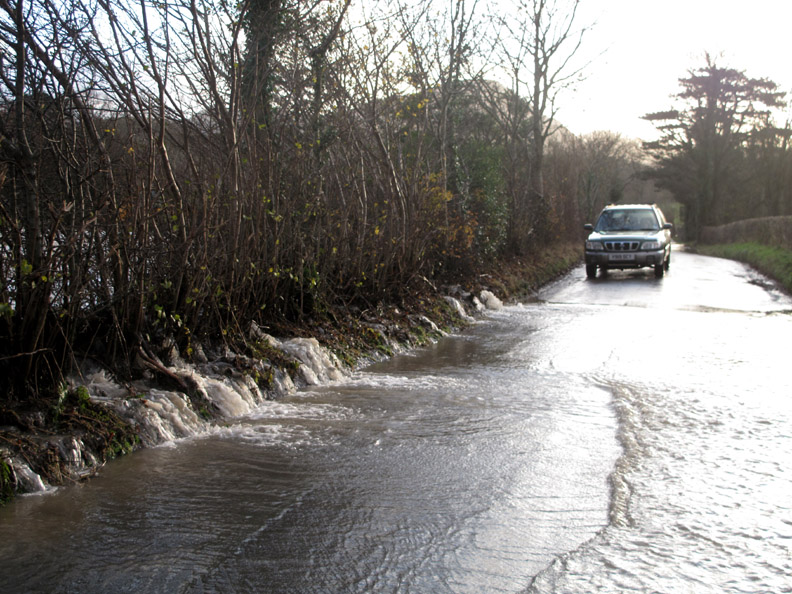
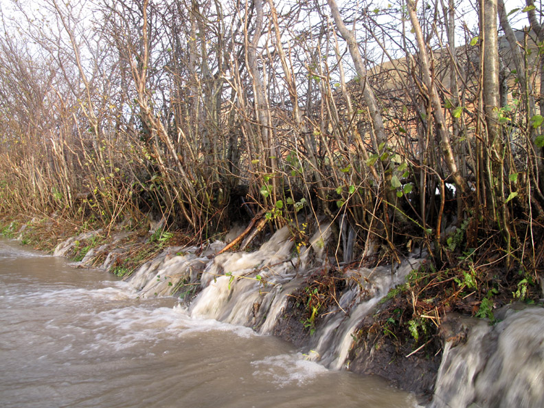
In the mean time the river is flooding the fields and draining through the hedge onto the road.
The brown water brings mud and stones onto the road.
The River Lisa on it's temporary route down to the Buttermere turning.
The water had got to go somewhere . . . did someone open the gate or did the catch fail under the pressure of water ?
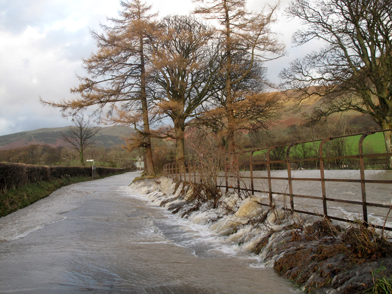
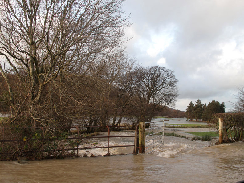
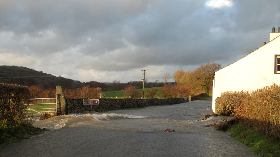
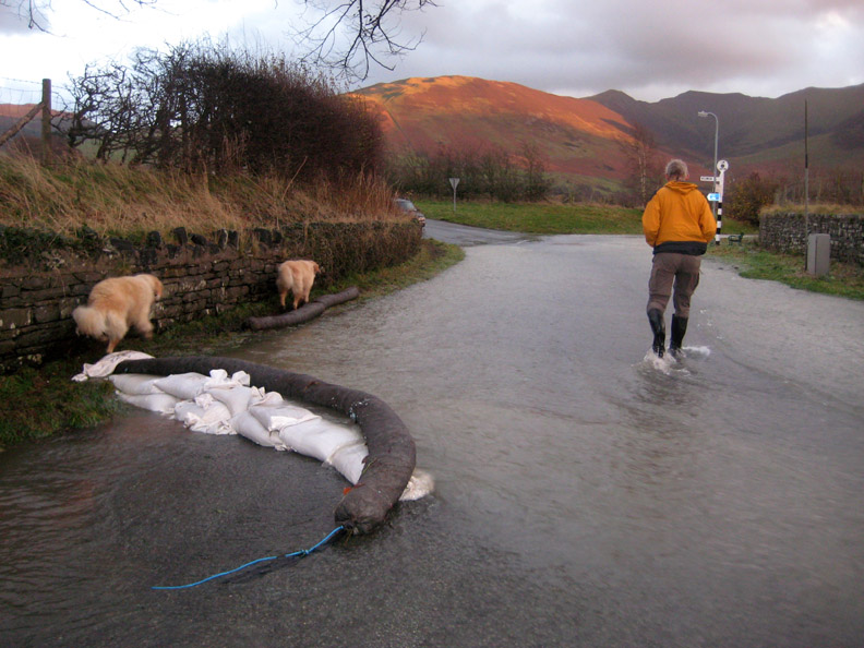
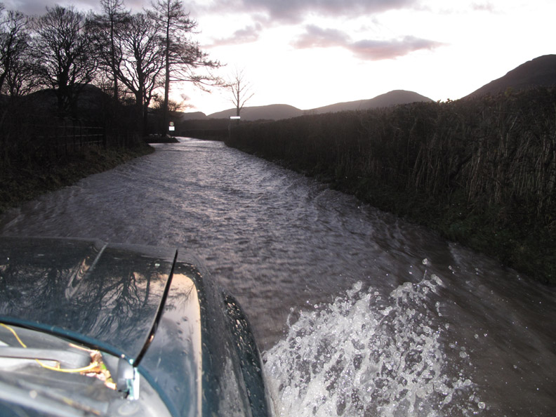
The Hope Beck has also left it's normal stream bed and now floods out across the road at New House Farm. The Barn Tea Rooms are shut today.
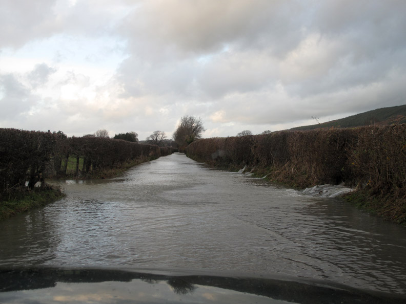
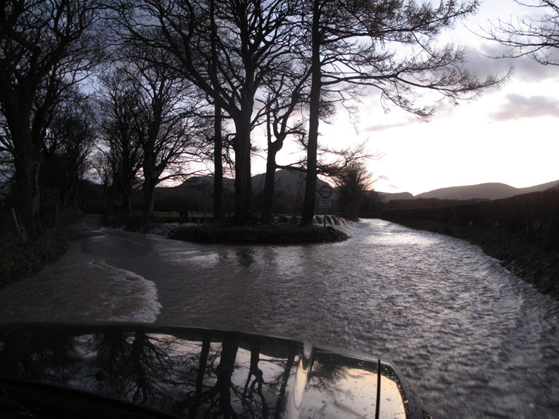
Down close to Lorton the last two hundred yards of the road is still covered in fast flowing water. This is the Boon Beck which has burst it's banks at the top of the village. It is still flooding across the fields and down the roadway.
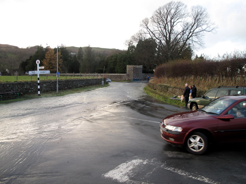
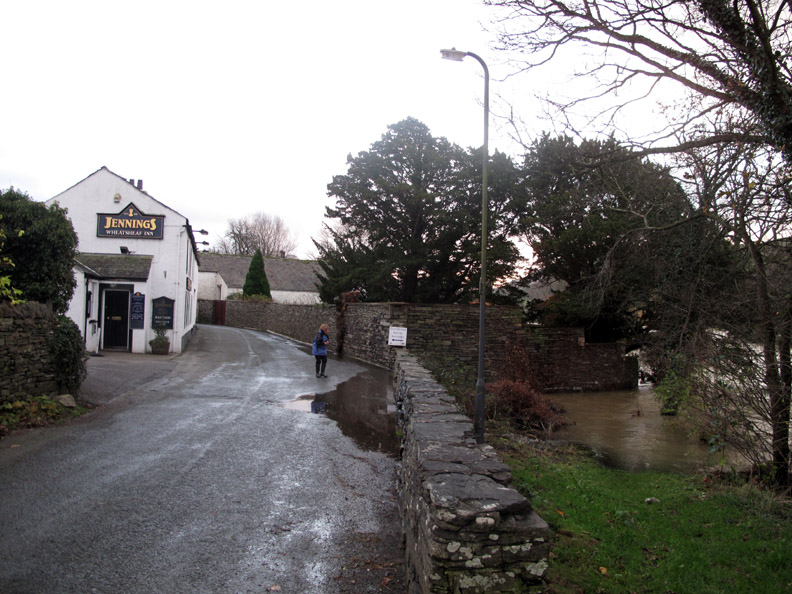
We parked at the junction in Low Lorton where the water level is slowly falling.
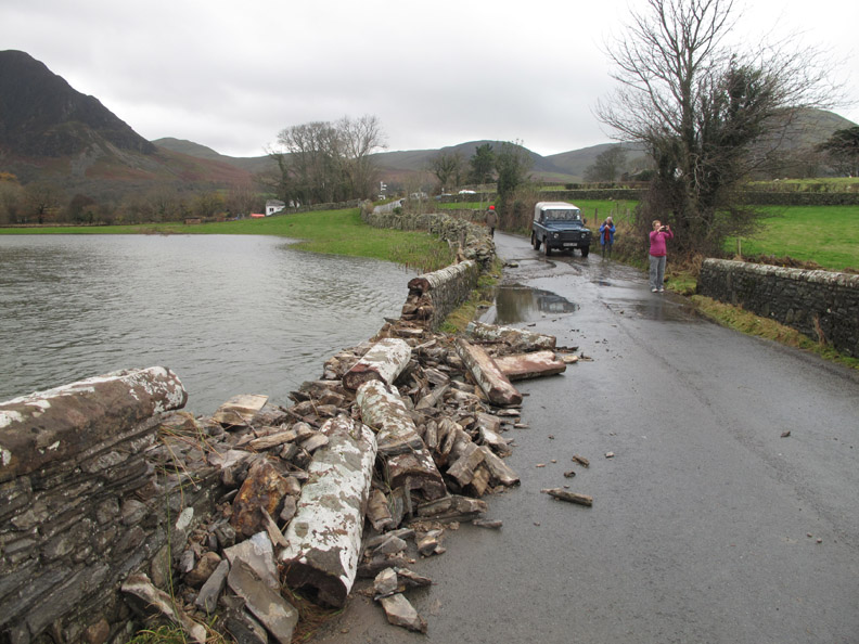
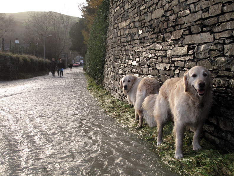
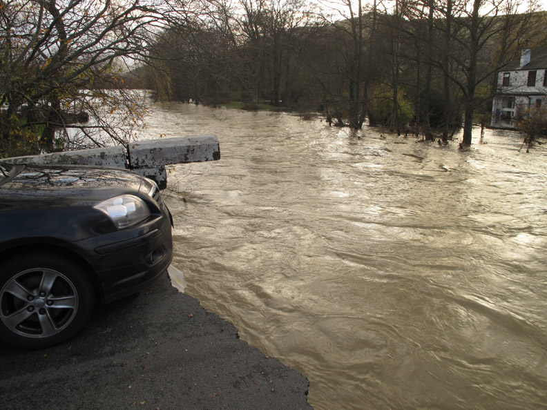
Reports locally say that the Lorton Bridge has disappeared, so we walk down to the river. The dogs preferred the high ground, nervous of walking in the fast flowing water.
The road water meets the river here at the bridge.
Or should I say . . . what's left of the bridge.
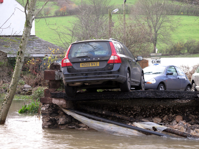
A coping stone is poised over the torrent . . . and that number plate is remarkably close to the edge of the tarmac.
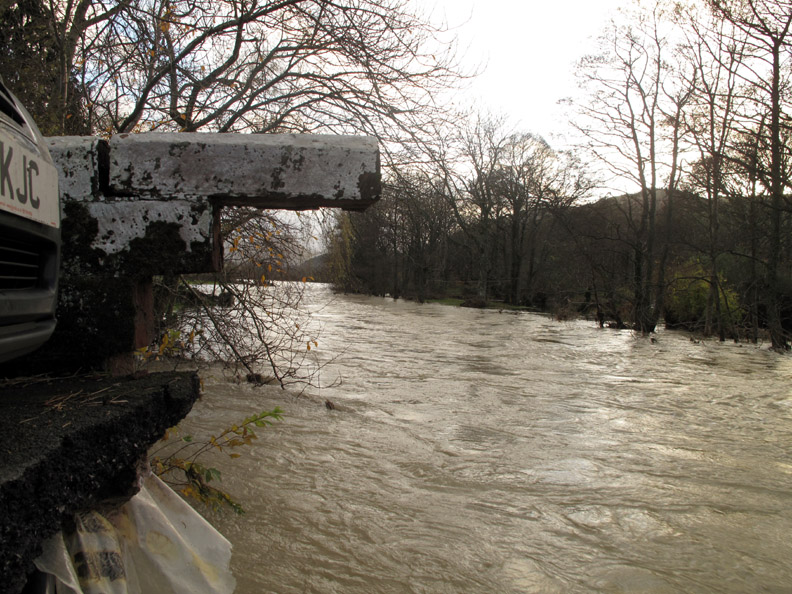
It floods onward down the valley, carrying away everything in it's path.
"Waiting for the Ferry "
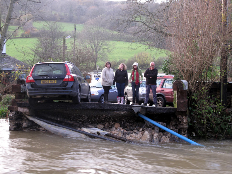
I thought the car on our side was close, look at the Volvo on the other side, one wheel over the edge ! The cars were parked here as being slightly safer on the relatively high ground of the bridge. In actual fact two more were parked on the bridge itself and were lost to the water when the bridge collapsed.
Back on this side, Bridgend House close to the river is on higher ground and probably hasn't suffered as much as the ones on the opposite side of the river.
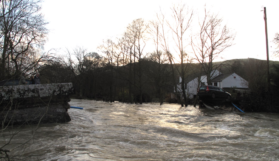
The River Cocker flooding through the old Lorton Bridge.
Back up the hill to the car, it's always more difficult walking against the tide.
The Wheatsheaf in Lorton. The wet carpets are up and the tables are stacked so they must have had problems too.
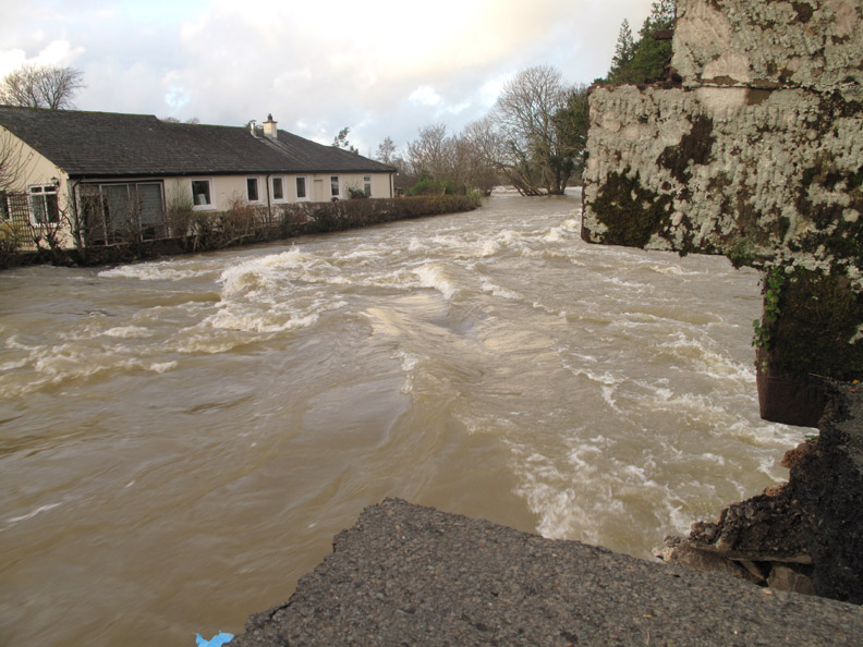
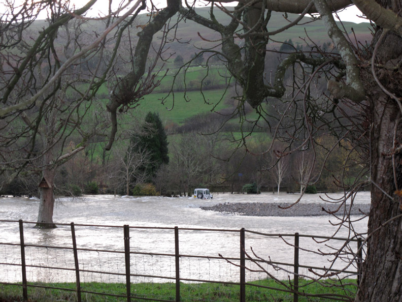
Looking across the river, a Land Rover lost from the bridge is sitting in the middle of the flooded meadows.
Some say it was risky development next to the river but the water only rose to just above the dwarf wall. The ability of the river to expand and fill the fields over the low river bank opposite has saved this side from more severe problems.
" We'll take the high ground and you take the low ground "
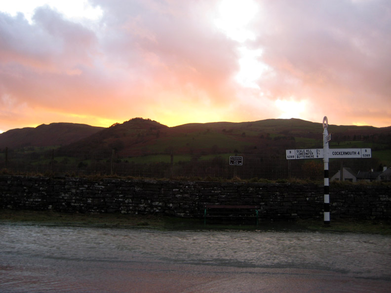
The afternoon is progressing fast and the sun is setting behind Low Fell and Fellbarrow.
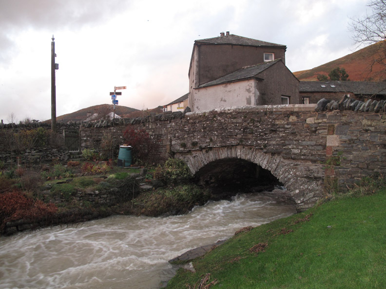
Rather than chance the fast flowing water back up the main valley road, we drove up through High Lorton towards the top gated road. This is the Boon Beck (Aiken Beck) bridge in the centre of High Lorton. [ Hold your cursor over the photos to compare with yesterday's levels]
The river is a lot less angry today as it passes the back of Yew Tree Hall. [ Hold your cursor over the photos to compare with yesterday's levels]
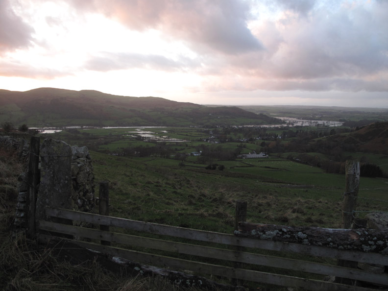
From the top road we get a view down over the flooded valley.
More standing water up here as rainwater floods off the fells.
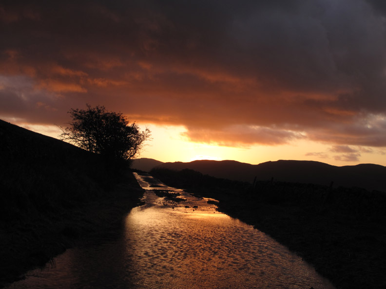
A dark exposure as the sun fades with a bright burst of sunset orange.
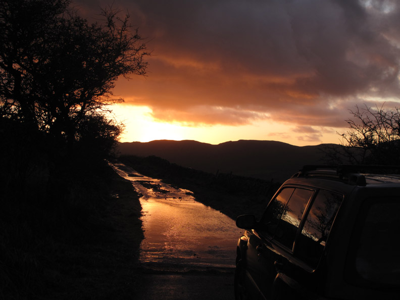
Following the Hope Beck road back down to the valley. The overnight rain has badly lifted and scarred the narrow road leaving whole areas without tarmac.
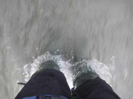
The Buttermere junction again and the water is still pouring off the fields. This photo was taken out of the window as I drove along, hence the splash of the bow wave.
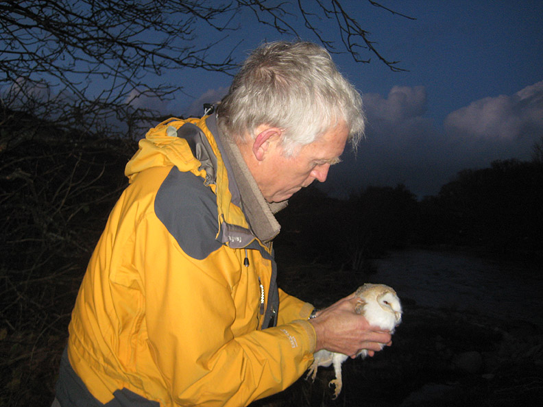
The Buttermere turn. Time to get home and see to the Owl that has been sleeping in the kitchen all day.
Following advice from Muncaster World Owl Centre and Knoxwood Owl Sanctuary it was felt best to release our owl now while he was still fit, despite the fact that he had not eaten much while in our care. The forecast for tonight is reasonable and he was in a good state to look after himself now.
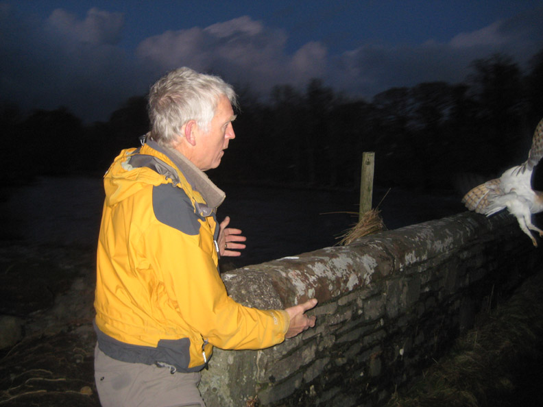
Early evening was the best time so we took him back to the spot where I had picked him up early yesterday.
And with a strong flap of the wings he was up and away. - - - o o o - - - About midnight it was calm and quiet outside. In the distance we could heard an owl calling . . . could it be him ? . . . I would like to think so. - - - o o o - - - These photos of mine have all been taken in our own valley over the last 24 hours. All this water had been pushing downstream demolishing the Lorton and Southwaite bridges before creating havoc in Cockermouth. Unfortunately there has been a loss of life when the North bridge in Workington was washed away, carrying a policeman to his death. A sad loss for the family of PC Barker, and the whole community. - - - o o o - - -
Cockermouth rescues. Not my photos but more pictures of the Cockermouth floods can be found here on Flikr courtesy of "Escape to Cumbria.com" and at a link I've been sent for the Guardian on-line. - - - o o o - - -
- - - o o o - - - |
|
Technical note: Pictures taken with either Ann's Canon 75 or my Canon G10 digital camera. Resized in Photoshop, and built up on a Dreamweaver web builder. This site best viewed with . . . the better weather today. © RmH.2009 # Email me here # or leave me a Guest Book Entry Previous report - 19th Nov 2009 The November Gales A previous time up here - 23rd October 2008 A stormy Loweswater 2008 Next report - 22nd Nov 2009 The November Gales - Day 3+4
|