![]()

Remember: Press F11 for a full
screen view of this page.
|
|
|
Remember: Press F11 for a full
screen view of this page. |
|
Day 5 of our Pembrokeshire Holiday. Date : Thursday May 14th 2009. Places visited : The Druidstone Hotel to South Pembrokeshire, Stackpole and Barafundle Bay. Walk details : Pembrokeshire coast path round Stackpole and the Bosherston Lily Ponds. Distance travelled : 3.75 miles, 600 ft of ascent. ( details of the walk ) Weather : Blue skies and sunny weather but the prospects were not good to start. Pembrokeshire may be little England beyond Wales . . . but they drink intelligent beer ! |
|
|
Druidston is mid way down St Brides Bay, the bay at the western end of West Wales, therefore it's a short distance down to Milford Haven, across to Pembroke and over to the southern Pembrokeshire coast. We're heading for limestone and red sandstone country, with lush farmland, early potatoes and high sea cliffs facing the Atlantic.
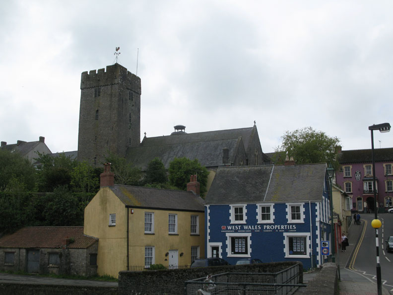
The Parish Church at Pembroke and a few colourfully decorated buildings in the old town.
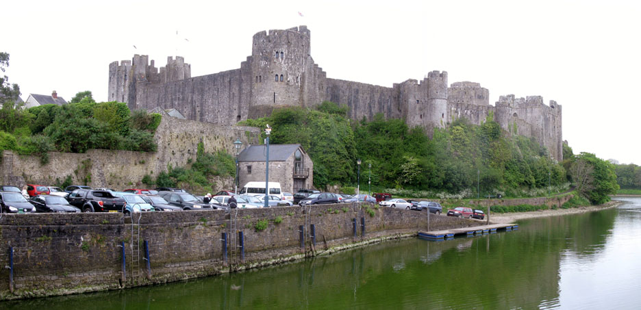
From the same location, Pembroke Castle with flags flying but looking a little sad in the dull, morning light.
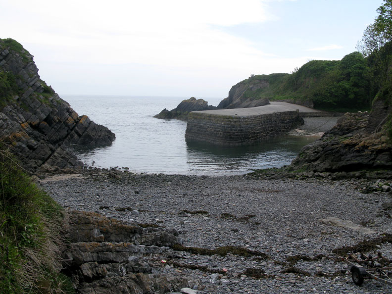
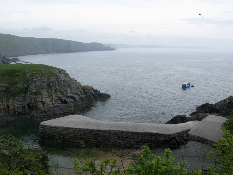
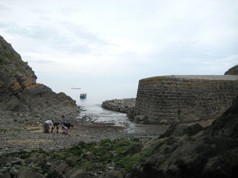
Half tide at Stackpole Quay, the smallest harbour in Pembrokeshire ! Car parking, cafe and informative handouts, courtesy of the National Trust.
Limestone to the west, red sandstone to the east, Stackpole sits on the geological boundary of two rock stratas. In more modern times the quay has been given an unexplained round cement topping which must make it difficult to walk on.
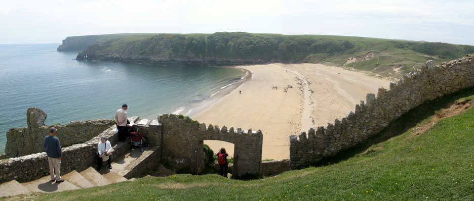
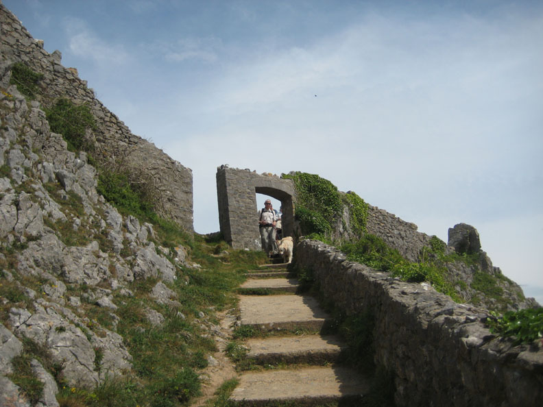
A short walk across the cliffs leads everyone, including us, to Barafundle Bay. Decorative walls, a legacy of the once prestigious Stackpole Estate.
An easy path and set of steps take us through the arch and down towards the bay.
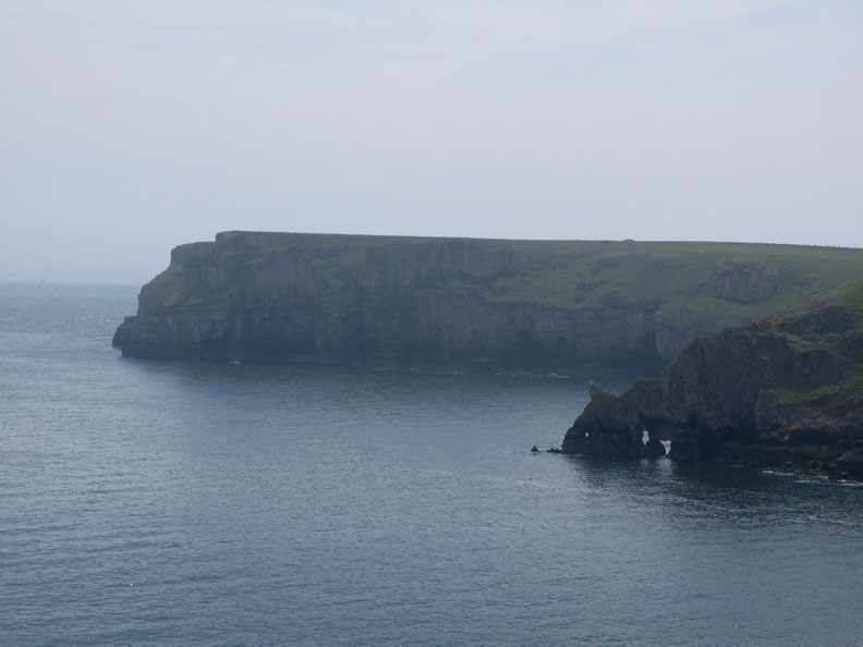
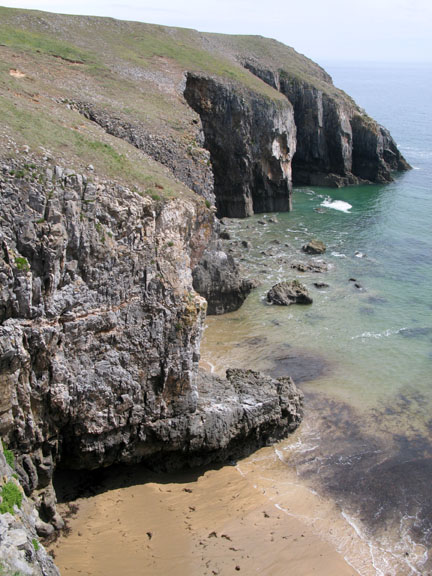
With Stackpole Head and the distinctive rock arches out to the left and dunes to the right, Barafundle Bay is reputedly one of the most beautiful beaches in Britain.
The headland and the rock arches in close-up.
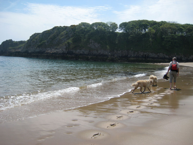
Time to feel the sand between your toes . . . !
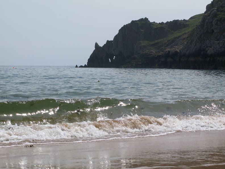
Recent stormy weather has left a slight residue of seaweed in the water. Apart from the temperature, the sea looked almost inviting enough for a swim . . . but not quite !
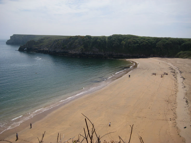
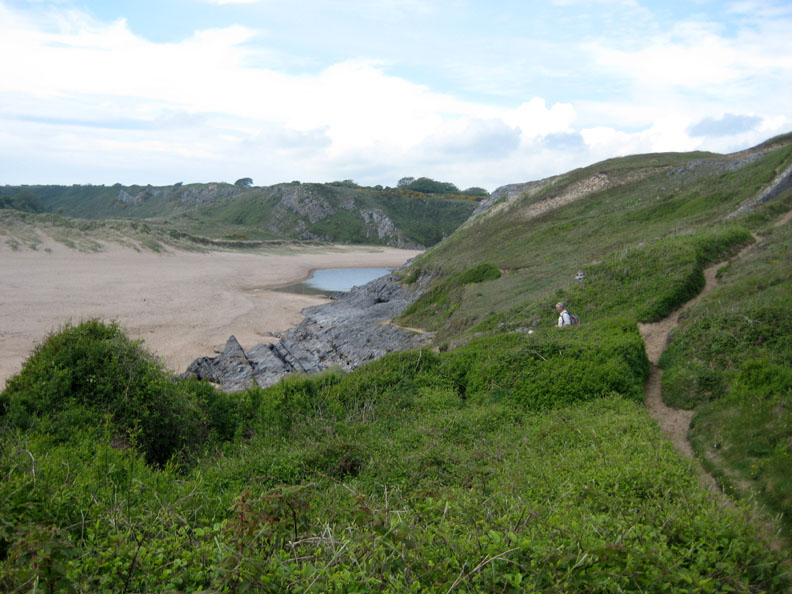
We climb up through the dunes and continue on round the coastal path. The path down to the beach, that we used earlier, can be seen on the other side of the bay.
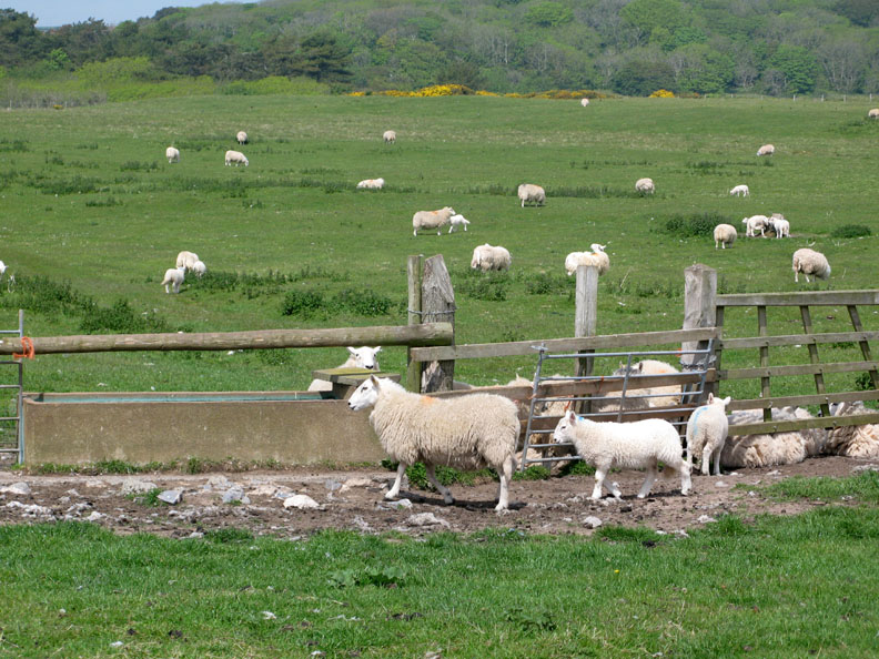
No Herdwicks here, these are Dorset or possibly a cross-bred lowland sheep.
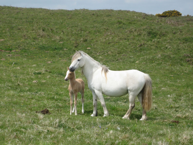
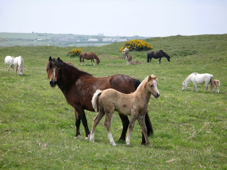
The Stackpole Warren is an area of grassland and dunes that straddles the area between Stackpole Head and the lakes of Bosherston. Famous for it's Bronze and Iron Age archaeological sites, it is now home to a large herd of ponies.
The youngsters are well grown and full of energy, but still appreciate the protective shelter offered by their mums.
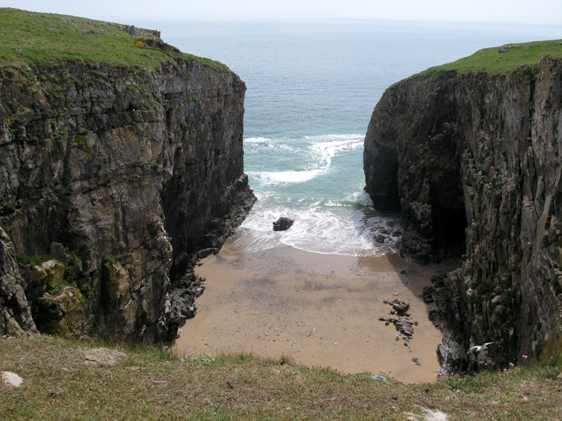
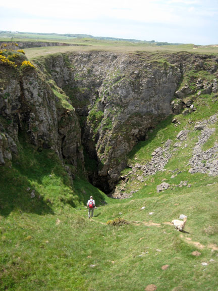
Stunning cliff scenery here as we suddenly come across a deep inlet with a sandy beach far below.
Not a great place to get stuck on a rising tide.
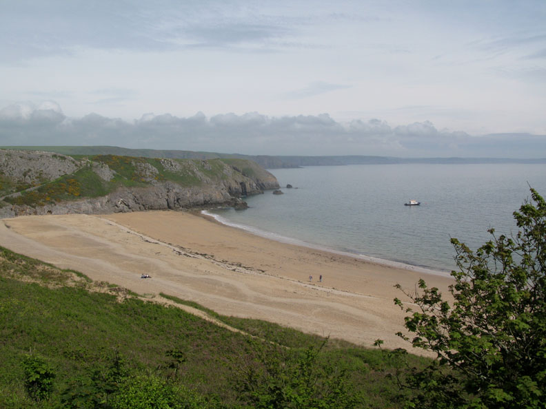
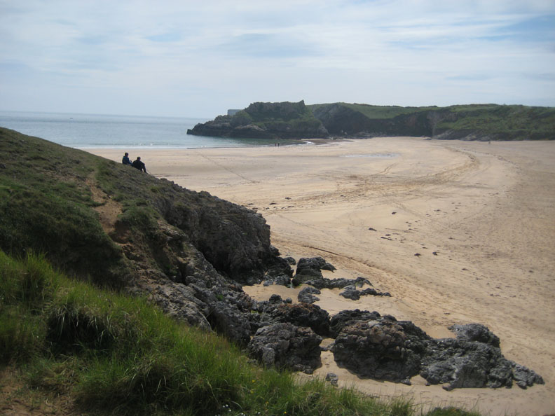
At the far end of the Warren the path drops down as we approach Broad Haven Beach.
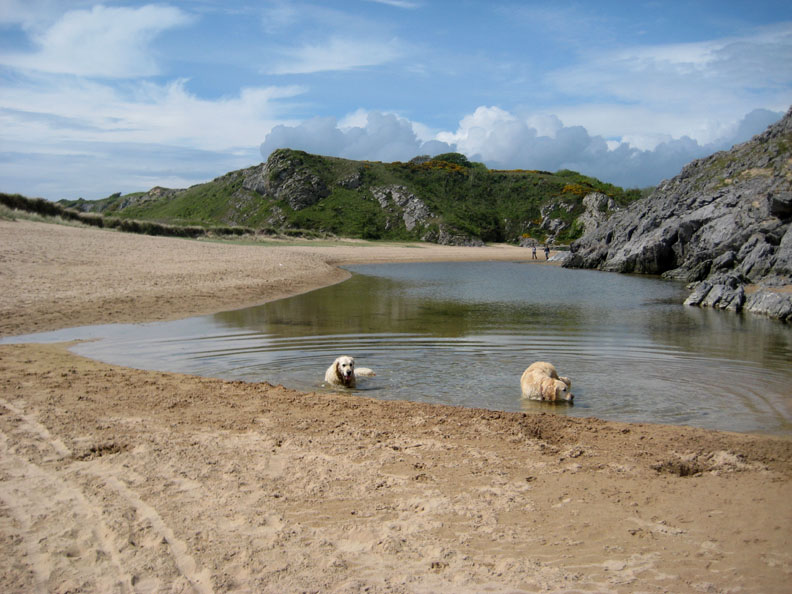
Another excellent sandy beach, wider and deeper than Barafundle.
At the top of the beach, a tidal pool has developed and the dogs take the opportunity for a swim.
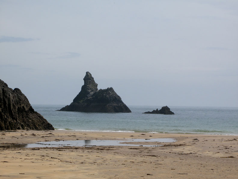
A short distance out to sea is a rather impressive sea stack known as Church Rock, so-called because of it's tall, steeple-like structure.
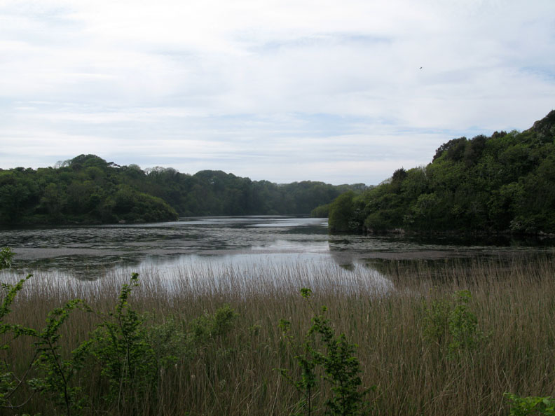
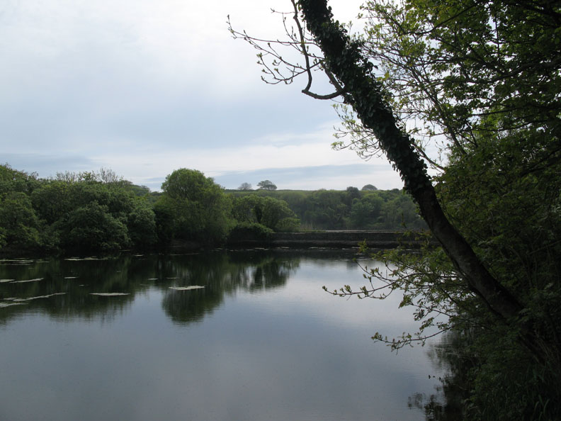
Broad Haven river was blocked many years ago by the Stackpole Estate as part of a grand landscaping scheme . As a result, the river estuary estuary ceased to be tidal as the river backed up to form a three armed, fresh water lake.
It became a wildlife haven and due to the success of the water plants that were introduced, it became known as the Bosherston Lily Ponds.
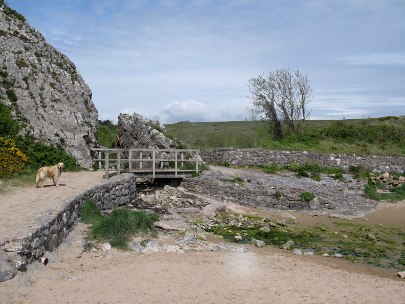
Green Bridge, one of several crossings of the ponds which allowed the Victorians to walk the estate and enjoy the scenery.
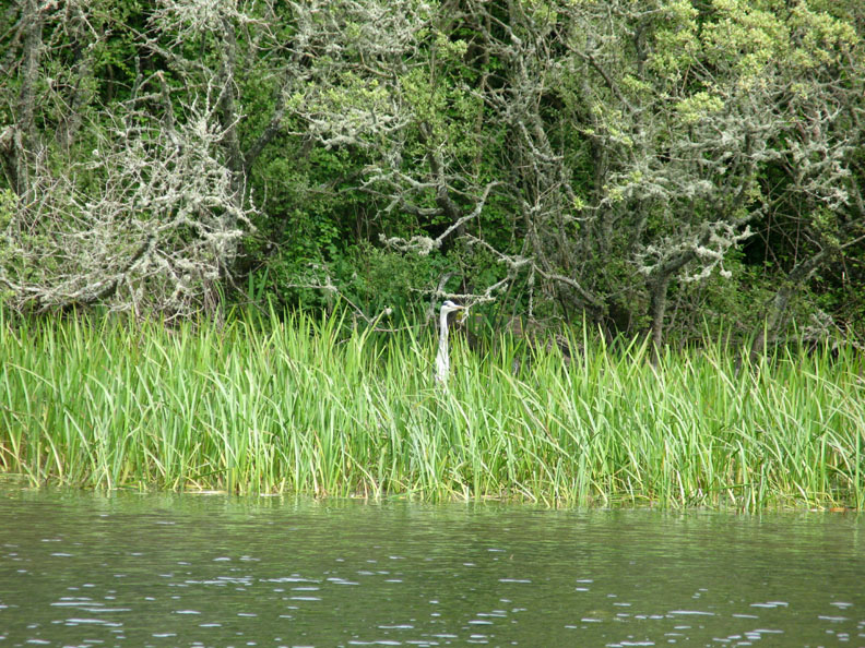
The wildlife thrives too, with an abundant bird life, including this Heron on the far bank.
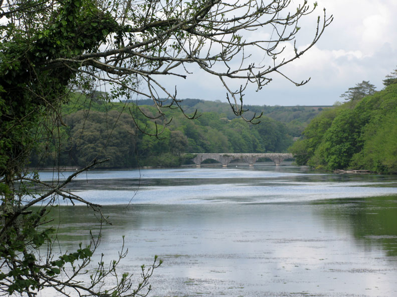
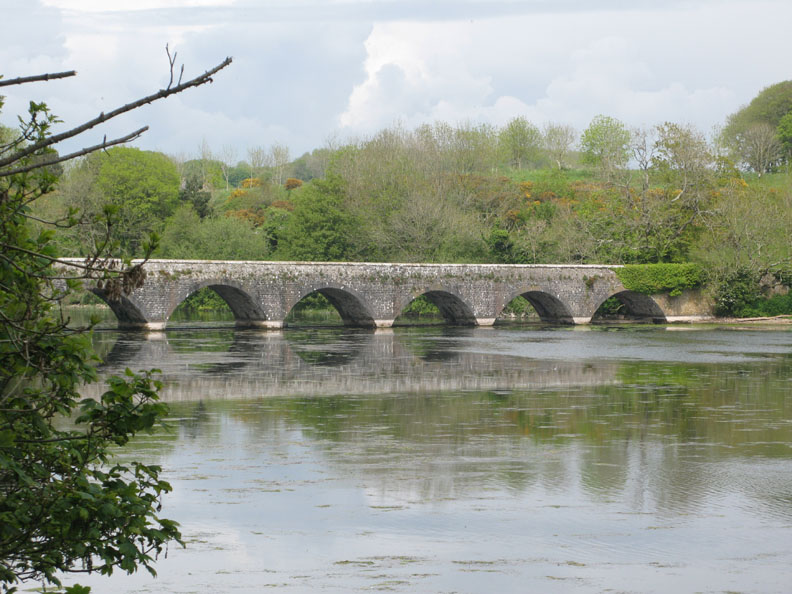
Eight Arch Bridge towards the head of the inlet. Stackpole House used to be visible behind the bridge but had fallen into disrepair and was demolished as recently as 1963. The estate was then acquired by the National Trust and the grounds have subsequently been protected and opened up for visitors.
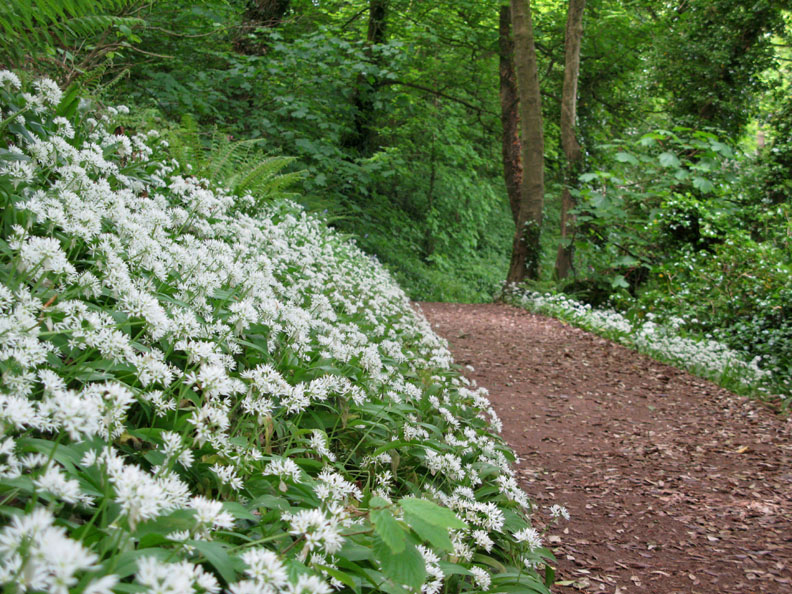
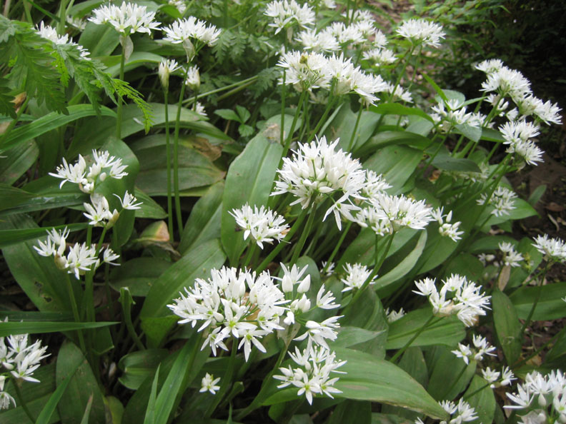
Wild Garlic in profusion on the woodland walk alongside the lake.
Can't you just smell the aroma. No? . . . go to the kitchen now, break open and crush a clove of domestic garlic and you'll get the idea ! [ Poke it a few times and it will get really wild ! ]
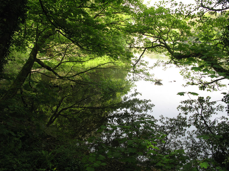
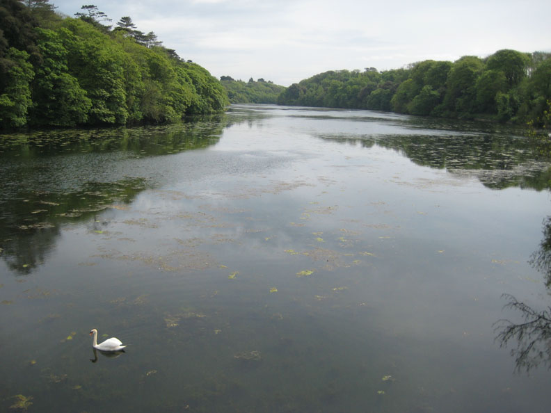
A swan halts in the shallows as the still water reflects him / her and the vegetation of this part of the woodland.
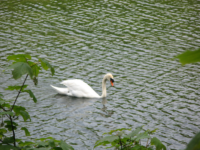
One of several Mute Swans on the rippled water.
Closer now to the Eight Arched Bridge . . . we would cross this in order to complete the circle and return to the car park.
A little early in the season yet for the Lilies, they blossom and cover large swathes of the lake later in the year.
Back where we started at Stackpole Quay . . . the tide is now fully out. - - - o o o - - - After refreshment at the Stackpole tearooms (definitely recommended) we drove around Bosherston Village and across to St Govan's.
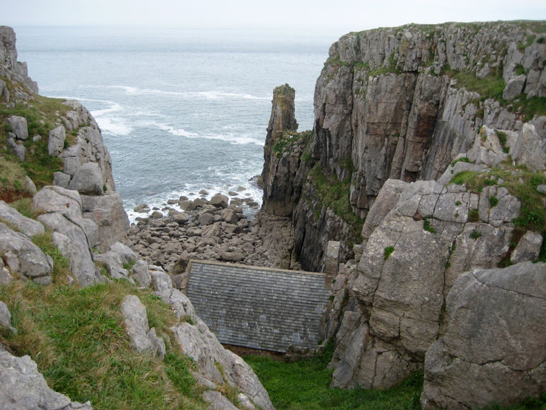
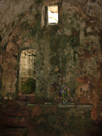
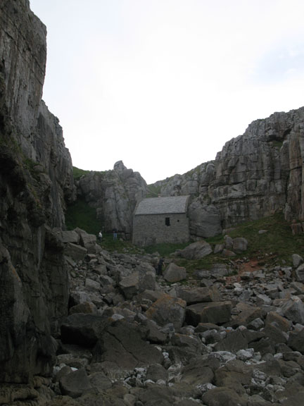
Tucked in a recess, part way down the cliff at Castlemartin, is the ancient church of St Govan.
Reputedly built on the site of a cave where the Saint hid from a band of marauders, it became a spiritual home for the priestly gentleman. The site includes an ancient well and the chapel.
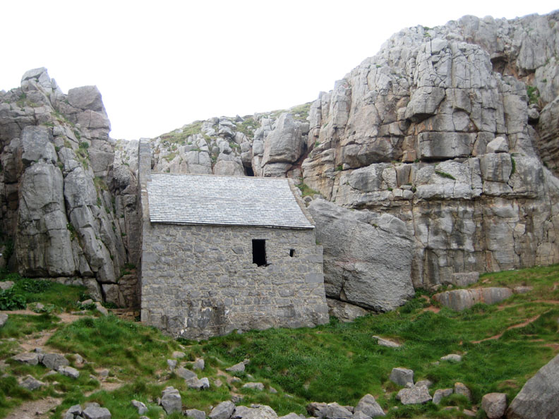
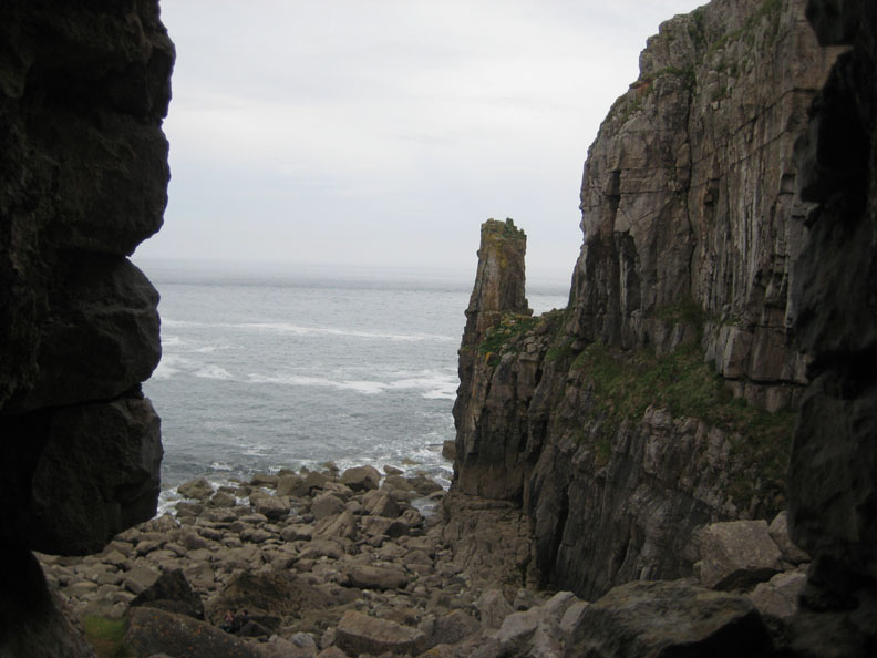
The view from the window where St Govan presumably sat and contemplated the world.
The small cleft in the rock has several horizontal ridges in the wall, reputedly where the rock folded round the ribs of the Saint, as a result of which he was never found. As a child I always thought the marks were vertical and I couldn't understand the story, but subsequent visits over the years allowed me to correct the first memories and re-establish the myth. Viewers of an understanding nature will refrain from asking how many years ago my first visit was, but I now measure it as a percentage of a century rather than as a specific quantity of decades !
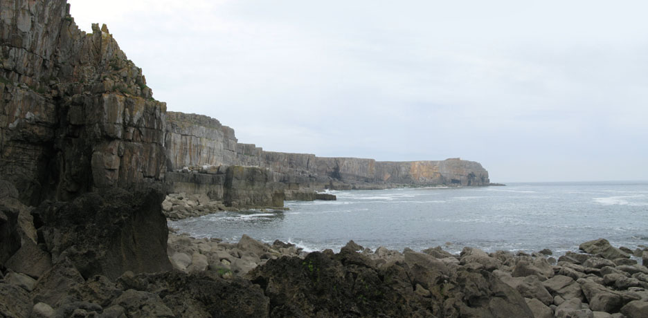
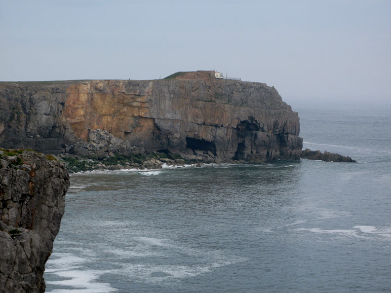
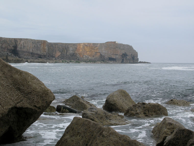
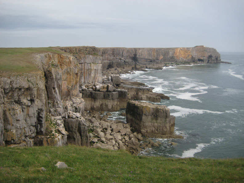
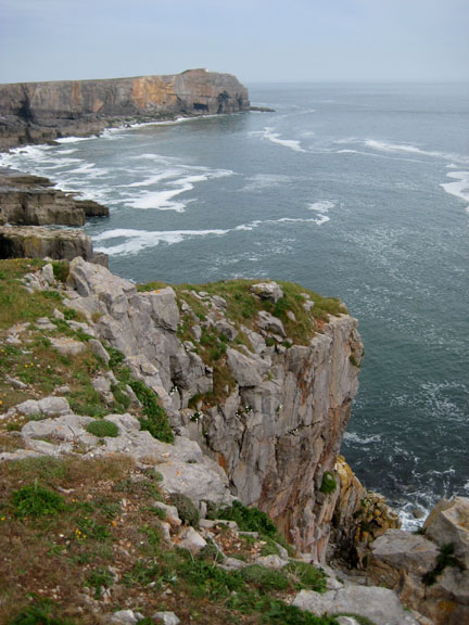
St Govan's Head, a mighty band of limestone jutting out into the Bristol Channel.
On the headland, a Coastguard Lookout, protected from the landward side by a large bank of earth. This is Castlemartin Tank Range country and one errant mis-fire and they'll need all the protection they can get.
Even on a calm day like today, the large waves still reflect the strong westerly winds of the last few days. [ Move your cursor over the photo to see the effect ]
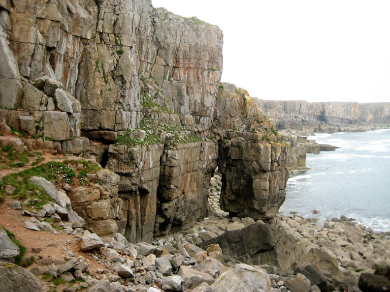
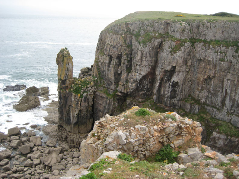
A rock arch, possibly the basis of a sea stack in years to come.
Moving back up to the top of the cliff we look down on another cliff stack.
St Govan's Head, again from the sanctuary of the cliff top.
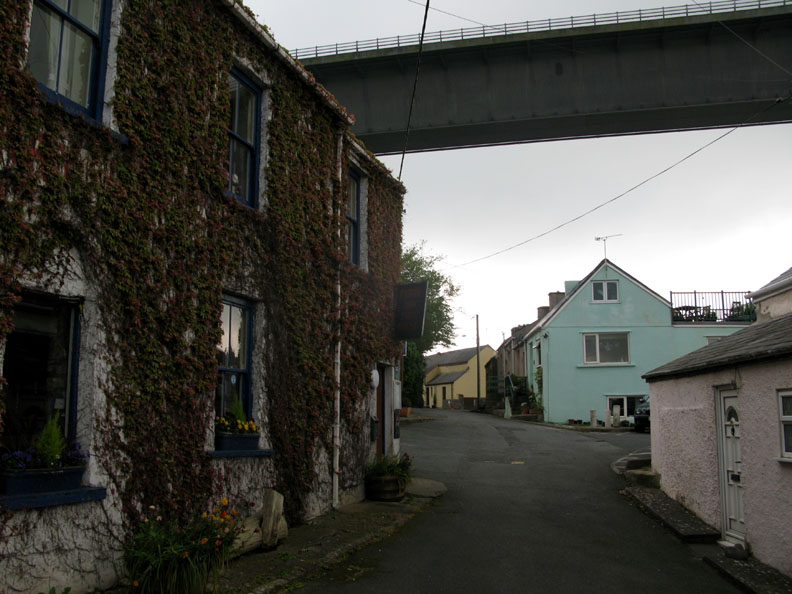
A successful day's sight-seeing day completed, we returned to Druidston via the Milford Haven Toll Bridge.
The box girder structure flies out over the houses of Pembroke . . .
. . . and takes us back to our hotel for the night. - - - o o o - - - |
|
Technical note: Pictures taken with with my Cannon G7 or Ann's Ixus 75 Digital camera. Resized in Photoshop, and built up on a Dreamweaver web builder. This site best viewed with . . . that wild garlic aroma that drifts in the air. © RmH.2009 # Email me here # or leave me a Guest Book Entry Go to page 1 2 3 4 5 6 7 8 - Go to Next Our previous time here - 13th to 21st May 2005 A visit to Swansea and Pembrokeshire.
|