![]()

|
|
|
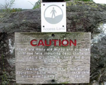
| Date & Time: Saturday 2nd August 2008. 10.30 am start. Location of Start : The Walna Scar Road (western end), Seathwaite, Cumbria, Uk. ( SD 240 969 ) Places visited : Seathwaite Tarn, Near and Far Gill, Goat Hause, Dow Crag, Buck Pike, Brown Pike, Walna Scar, White Maiden, White Pike, the Quarries, Walna Scar road and back to the car. Walk details : 7.75 mls, 2475 ft of ascent, 6 hours. Highest point : Dow Crag 2,555ft ( 778m)Walked with : David, Andrew, John, Richard, Ann and the dogs, Polly, Harry and Bethan. Weather : Overcast and low cloud but forecasted to lift. Possibility of sunshine but showers in the west. A warning notice at Walna Scar Road end |
|
A mini OFC Meet, as a group of friends and webmasters who haven't walked together for far too long meet up for a Saturday walk in the Southern Fells. Dow Crag was the objective, to be climbed from the less frequented side.
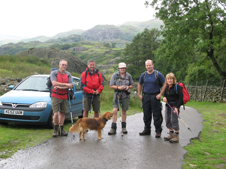
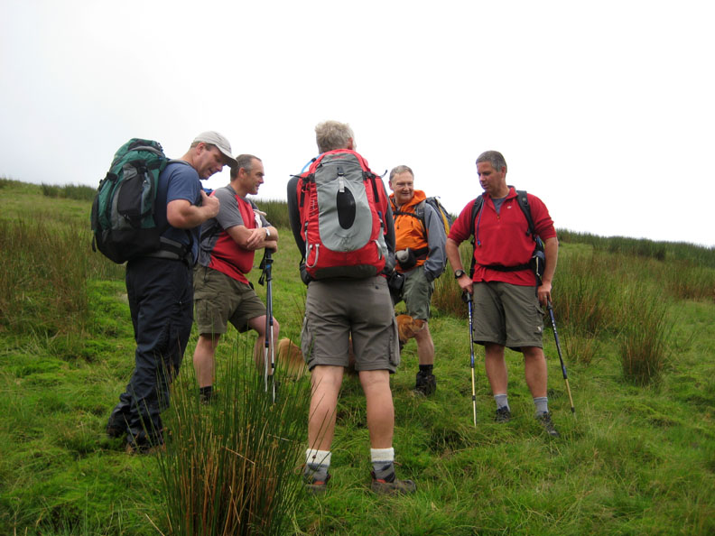
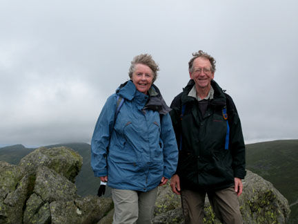
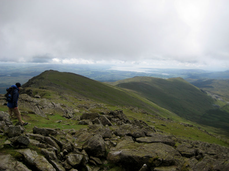
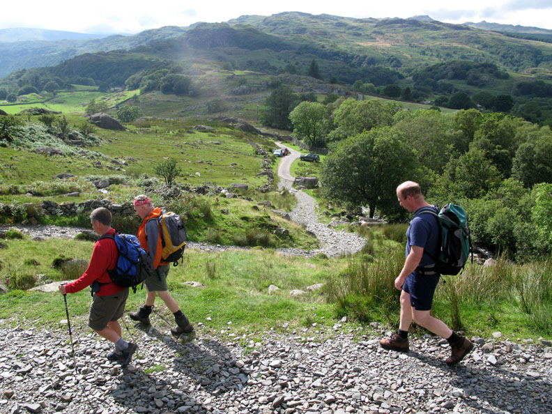
Start of the walk, the Walna Scar Road end above the Duddon Valley. David, Andrew, John with Polly, Richard and Ann . . . that might be a tail of one of our dogs behind !
A warm walk, despite the damp conditions, as we climb the track to Seathwaite Tarn. Caw Fell is the highest summit in the background.
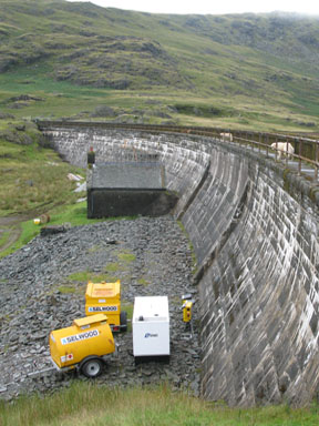
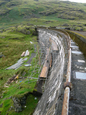
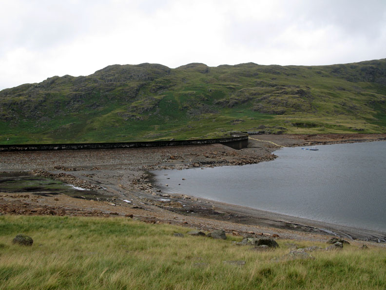
There were " No Admittance - Building site " notices on the first gate and we were passed by a contractors lorry making it's way out. This was certainly one of the prettiest construction sites I've been on in a long while. Up ahead there were the signs of where they have been working on the reservoir wall.
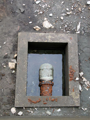
In order to work on the dam wall, they had not only drained the lake using the outflow points but they had also installed heavy pumping gear to reduce the water level even further, below the lowest point of the wall (hence the power generators).
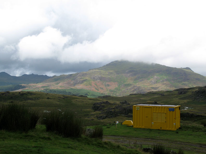
The weather was brightening as forecasted. Harter Fell with a big yellow container, setting the photo in time but not doing a lot for the view !
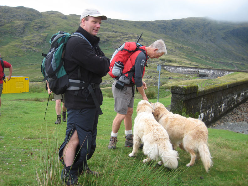
I'm offering the dogs a few treats but Ann seems to be photographing Richard's leg ? It's warm so he's undone his waterproof trouser sides to cool off.
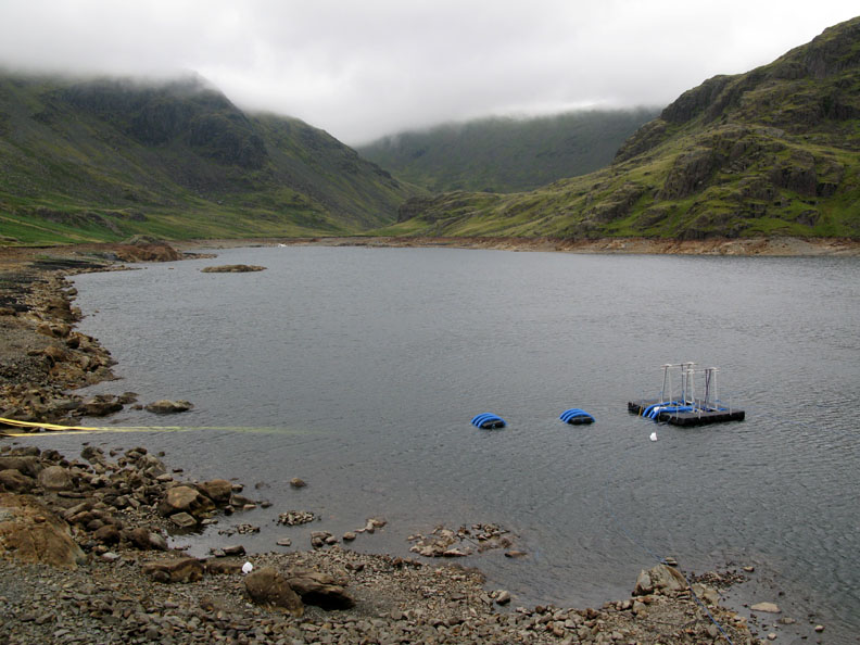
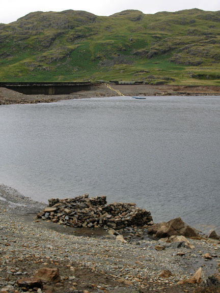
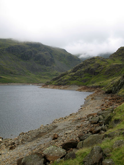
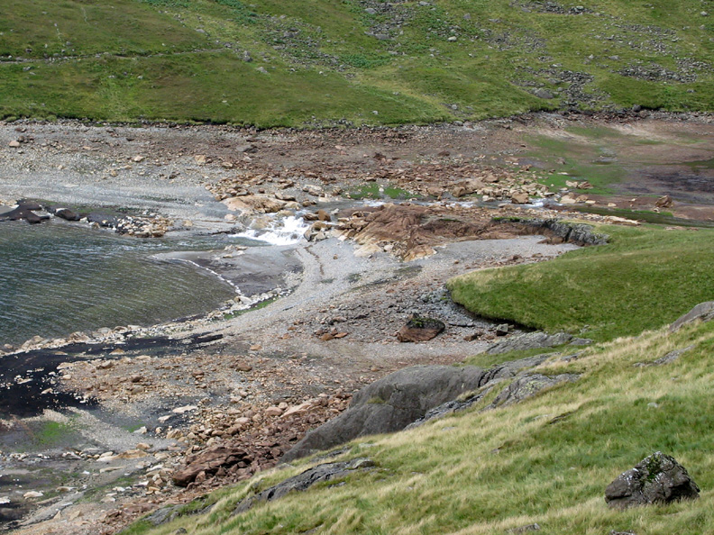
The artificially low water level during the work on Seathwaite Tarn dam.
The path traversed up and over the green bluff in the last photo. There's plenty of water about and the rocks are quite slippery today.
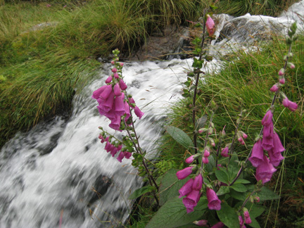
Perhaps we should call this Seathwaite Force. This waterfall has been submerged ever since the original lake was flooded.
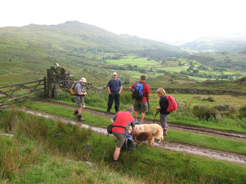
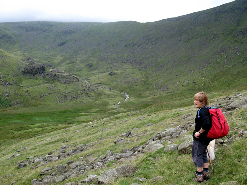
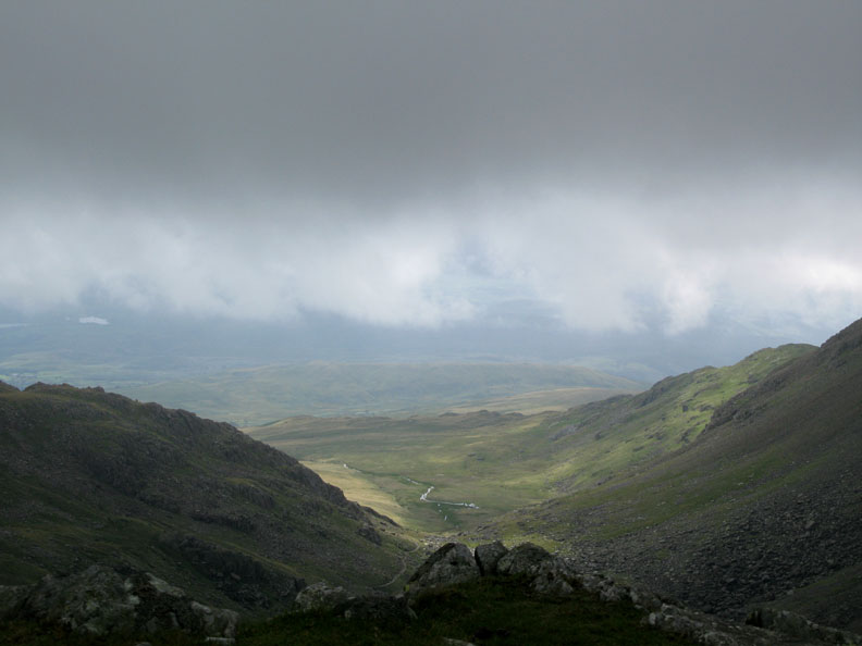
The head of Seathwaite Valley as we start the climb to the right, up towards Goat Hause. The ridge in the distance connects Swirl How to Brim Fell.
The blokes stop for important discussions . . . where to have lunch ? . . . it's a bit early yet !
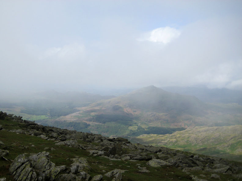
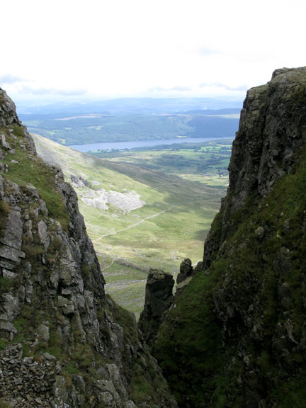
The cloud level is still down on the tops but we were still in clear weather here as we made the Hause and admire the view down the other side towards Coniston.
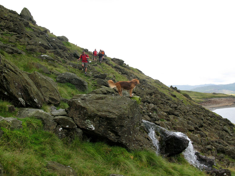
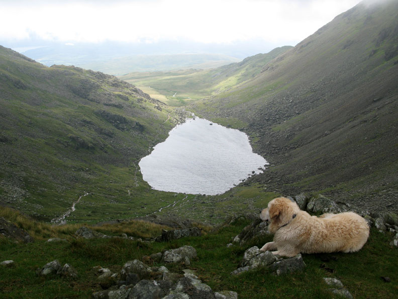
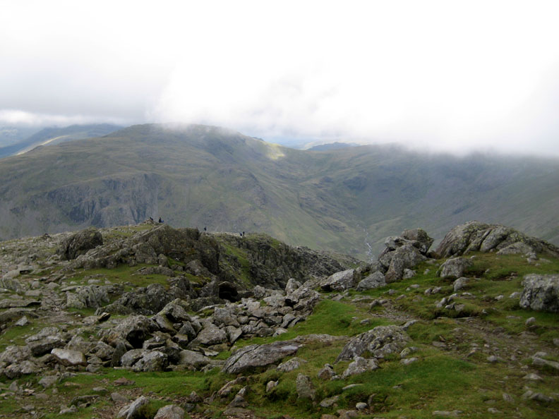
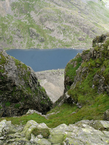
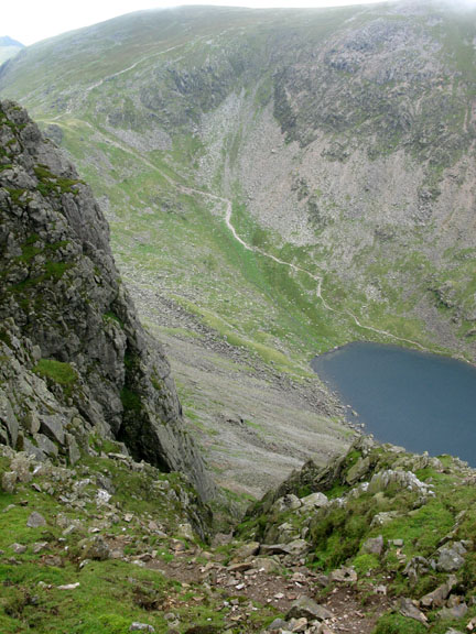
Harry pauses on a rock bluff, now with a clear view of Goats Water.
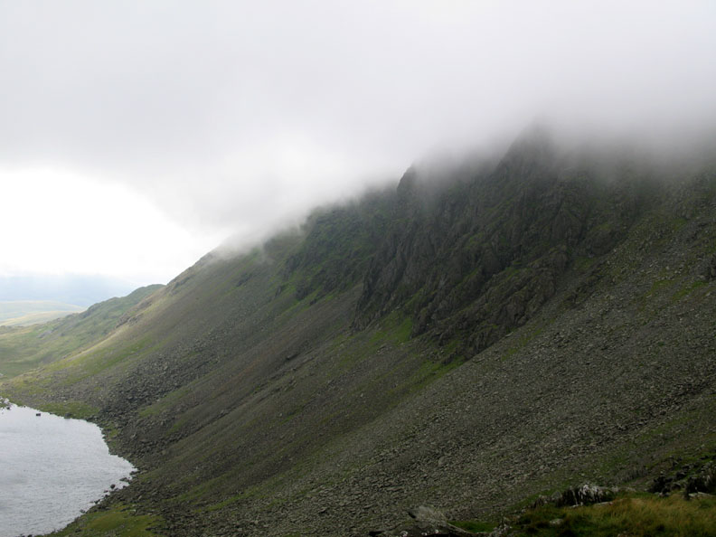
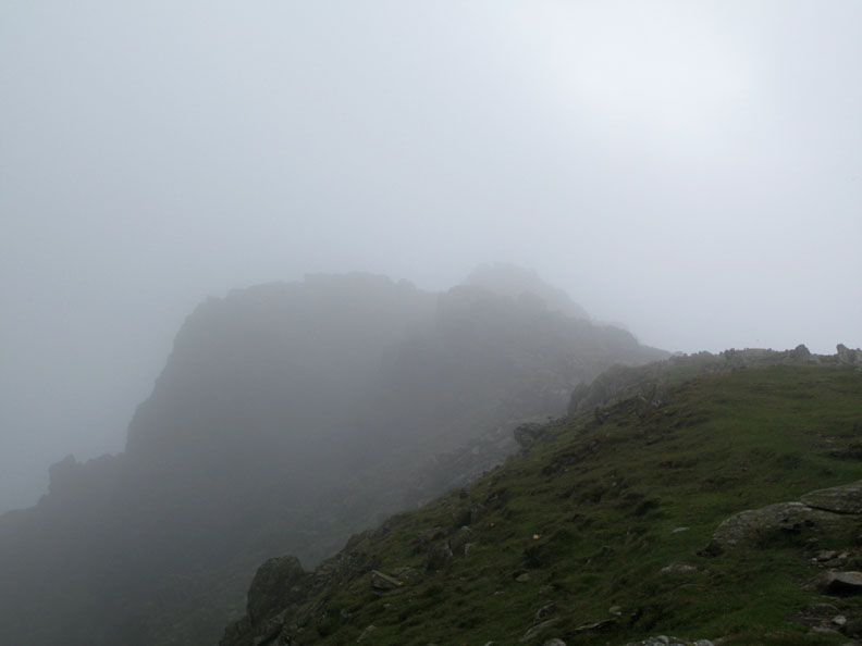
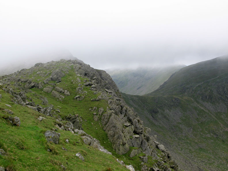
Dow Crag still very much in cloud.
More important discussions . . . yes this will do . . . far enough up but yet not in the cloud . . . it's definitely time for lunch !
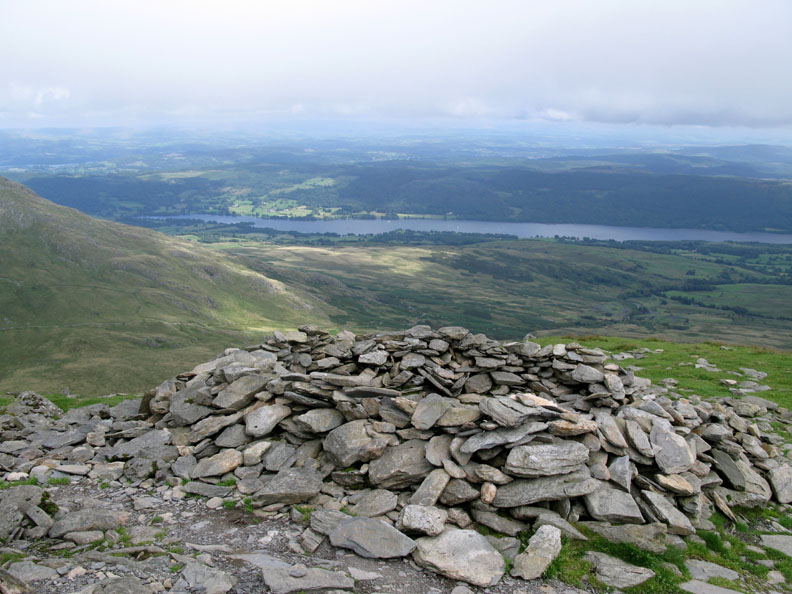
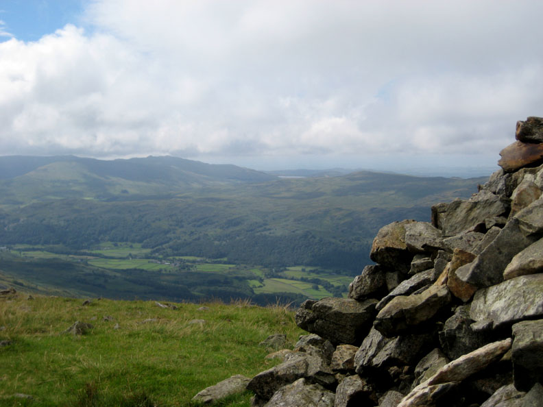
Afterwards, Andrew contemplates the wider view of Goats Water and Coniston Water now clear below. The cloud seems to be lifting a little.
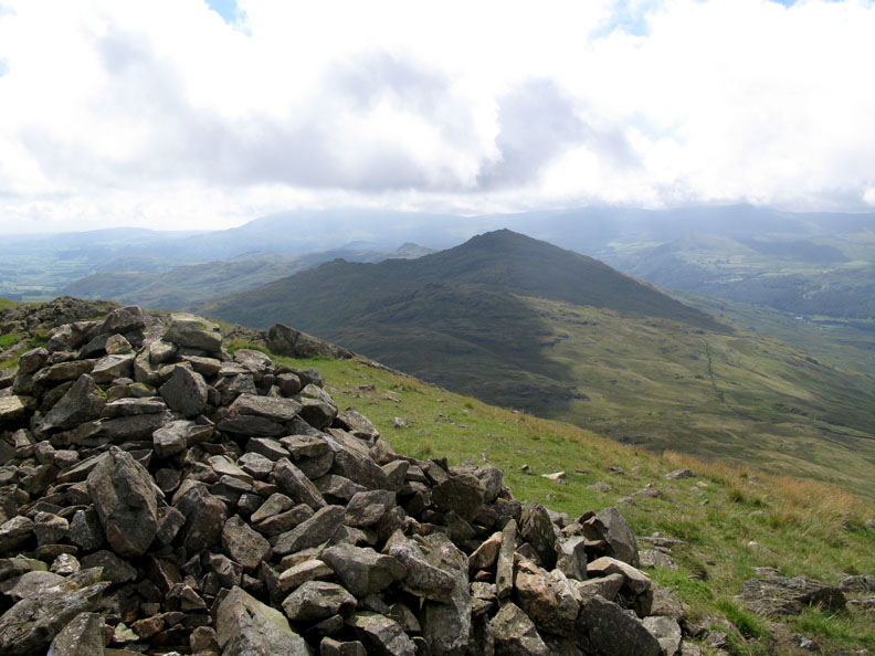
Dow Crag summit and there's a definite brightness up here.
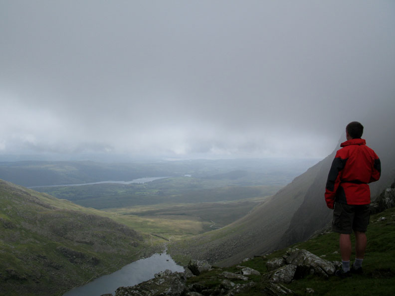
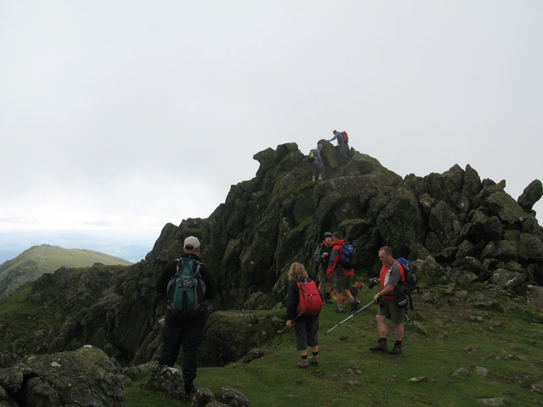
As we waited for another couple to descend from the final summit rocks the weather cleared and we enjoy the views we had been quietly hoping for all the way up.
Sunshine on Harter Fell away to the west.
Grey Friar to the north is also just clear of cloud.
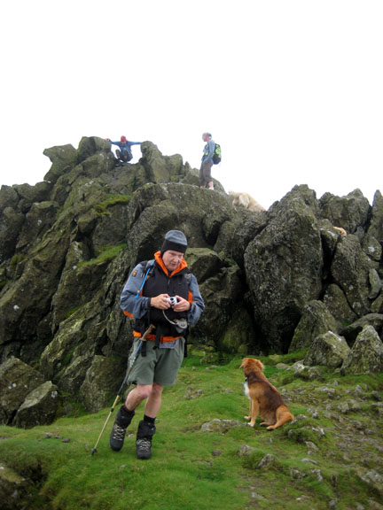
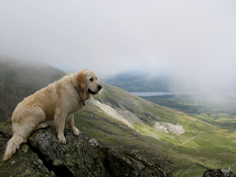
The Goat Crag Quarries to the east are just clear . . . of Harry.
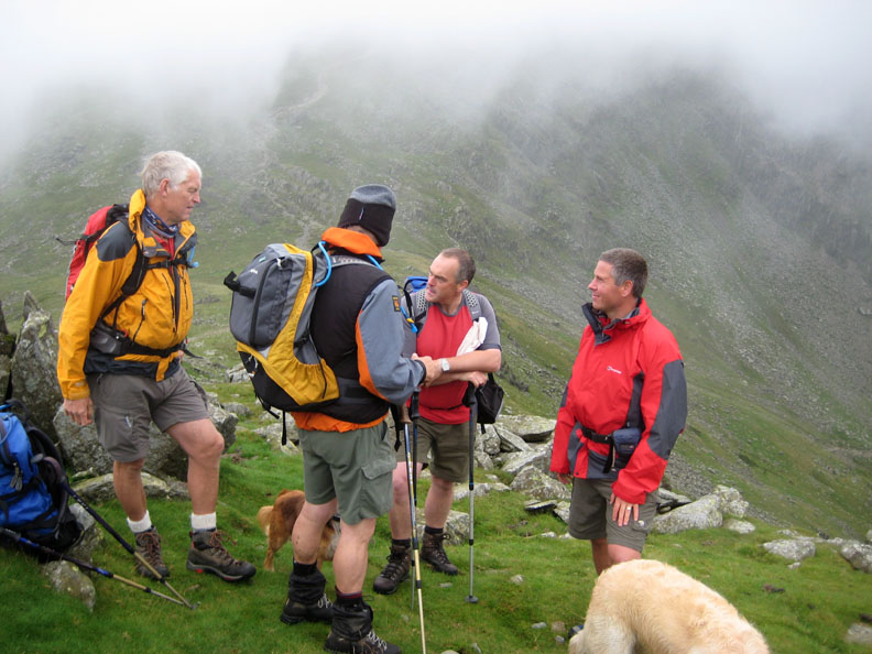
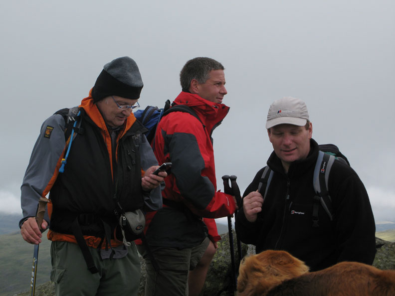
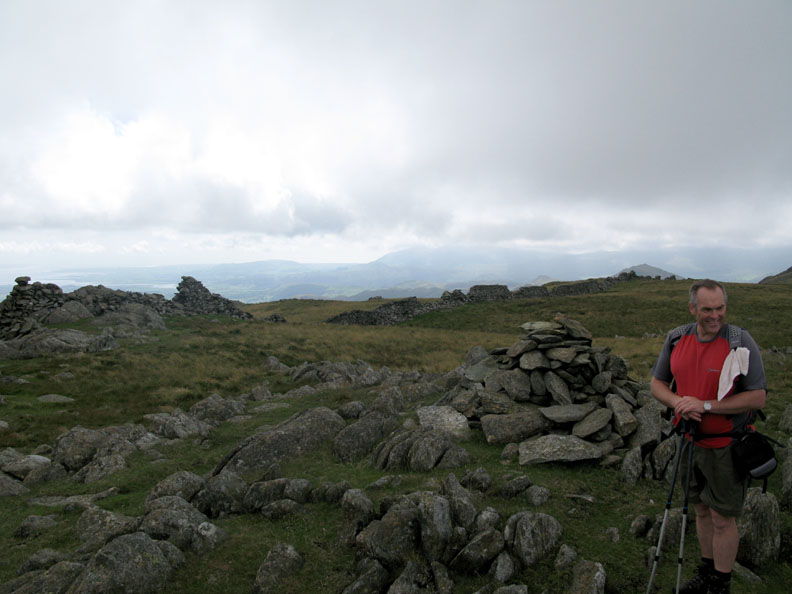
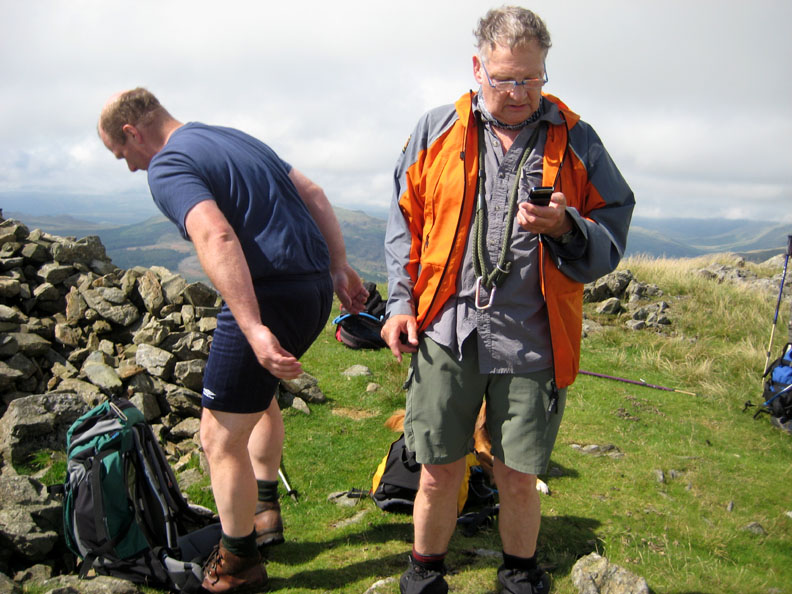
A photo study of three fellas . . . by Ann of course. John gets out his new phone and tries for the cricket scores via it's internet connection, Andrew enjoys the view and contemplates his summit photo and Richard talks to Polly, both just happy to be here.
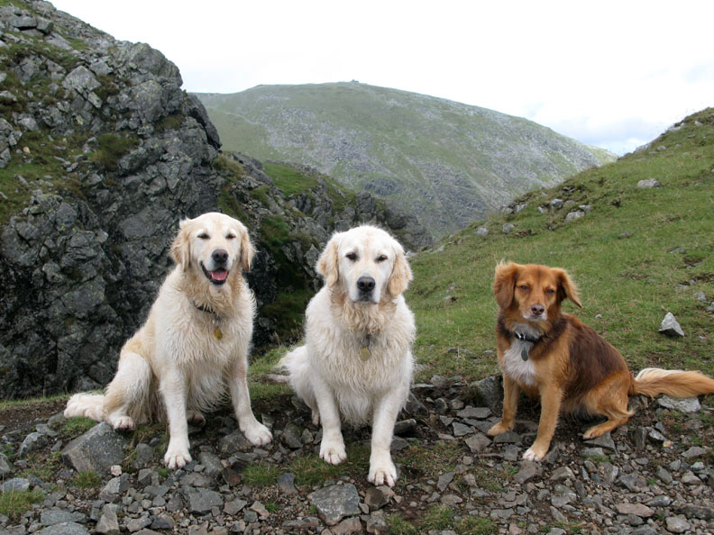
The three dogs pose in front of a distant, cloud free Coniston Old Man. All looking this way for a change . . . Maybe it was the dog treat on top of the lens which held their attention ?
We leave the summit and make our way down towards Buck Pike and on to Brown Pike.
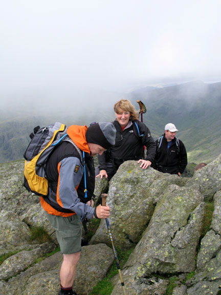
Looking back, the weather has closed in again and the top is back in cloud. Our ten minutes on the summit was timed perfectly. It would not be clear of cloud again for the rest of the afternoon.
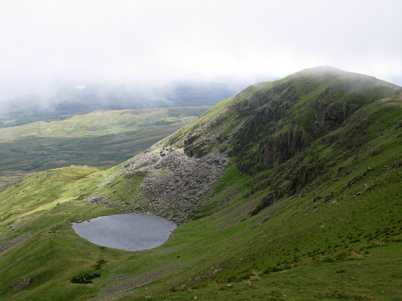
Brown Pike from Buck Pike, with Blind Tarn below and it's old slate quarries clinging to the side of the crags.
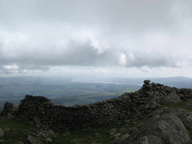
Strong sunshine now looking over Brown Pike wind shelter, south east towards Coniston Water and Grisedale Forest.
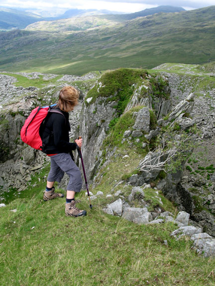
We cross the Walna Scar Road and climb the short rise opposite onto Walna Scar fell itself.
White Maiden . . . the summit not the chap on the right . . . that's David.
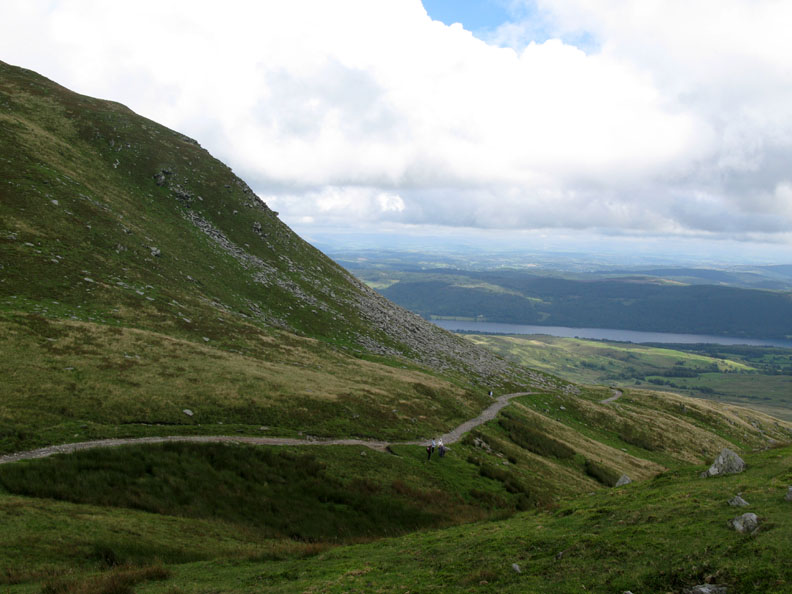
Distant views of Millom and the Duddon Estuary.
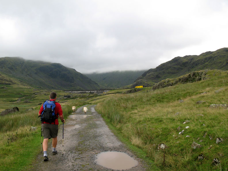
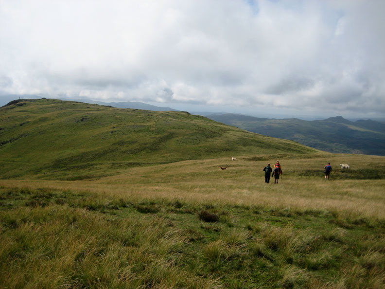
The weather was fine and we had made good time, so we walked on across the moorland grass towards White Pike.
Looking down the line . . . Caw, Stickle Pike and the Dunnerdale Fells, with Black Combe in the distance.
To the right, a distant view of Devoke Water too.
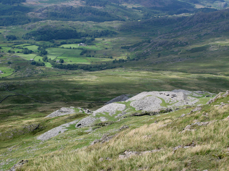
David looks down on Broughton Moor slate quarries, still in production by the look of it.
John struggles with technology again as Richard prepares to dive into his rucksack for something !
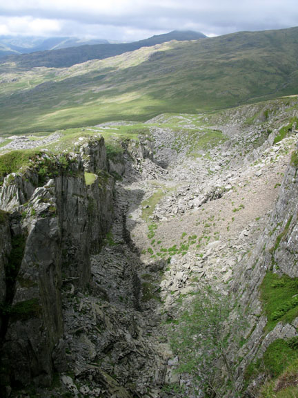
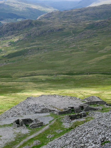
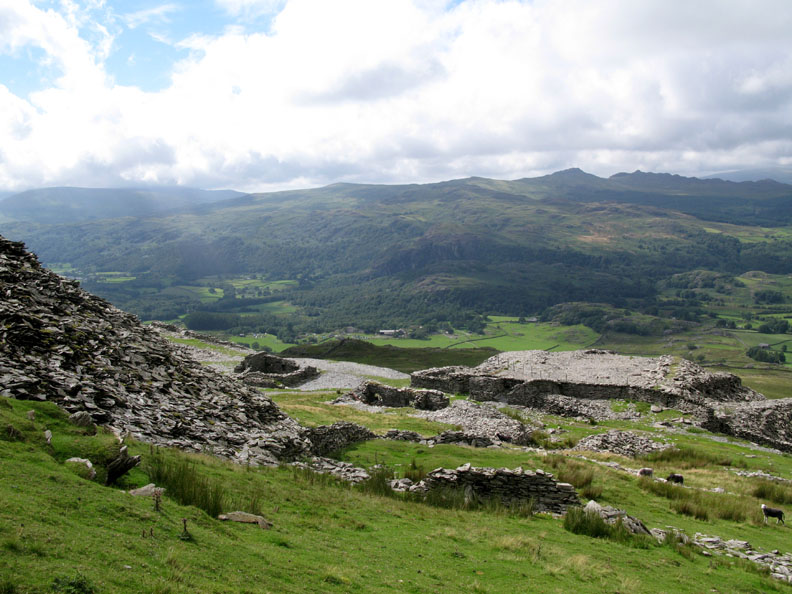
Walna Scar Quarries (disused) on the sunny side of the fell. We can see the cars far below. Our route down to the Walna Scar Road will take us past the quarries for a closer look.
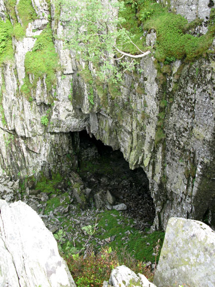
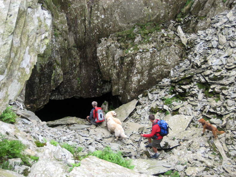
Andrew and I walk down to another undercut cliff face for a closer look but it doesn't appear to go in very far nowadays.
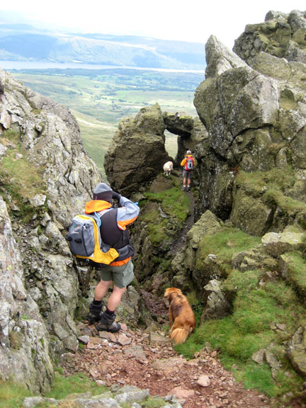
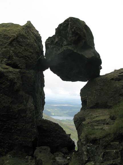
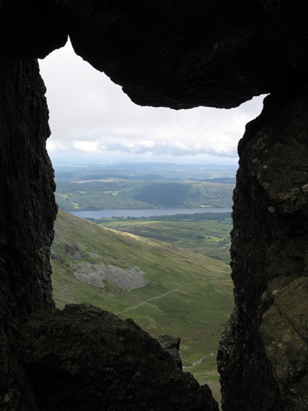
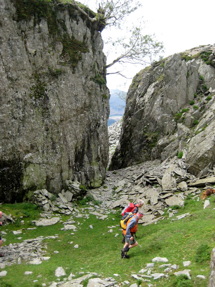
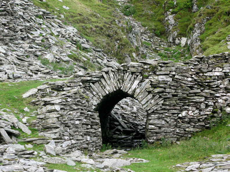
Our route down through the workings crossed this fine stone arched bridge.
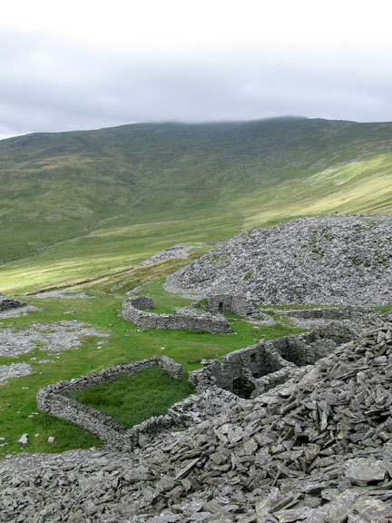
Black Combe and the Ulpha Fells of Yoadcastle, Stainton Pike and Hesk Fell form the backdrop to the lower workings.
We walk the last section of the Walna Scar Road as it rejoins the tarmac at the starting point of our walk six delightful hours ago. |
- - - o o o - - - Technical note: Pictures taken with my Cannon G7 or Ann's Ixus 75 Digital cameras. Resized in Photoshop, and built up on a Dreamweaver web builder. This site best viewed with . . . Plenty of men for Ann to walk with !! © RmH.2007 # Email me direct # Add to my Guest book (front page) Previous walk - 27th July 2008 Scafell Pike Red Cross Fundraiser A previous time up here - 3rd October 2006 The Wetherlam - Dow Crags Round - - - o o o - - - With thanks for their excellent company today . . . Andrew / David / John / Richard For their own personal photos and reports, feel free to click on any of the above links. [ Ann and my photos are incorporated together on this page ]
|