![]()

|
|
|
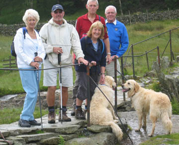
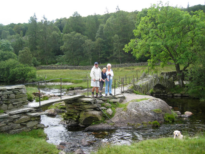
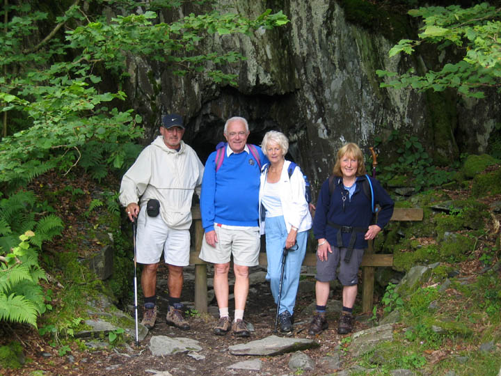
| Date & Time: Thursday 2nd August 2007. 11.30 am start. Location of Start : The Three Shires Inn, Little Langdale, Cumbria, Uk. ( NY 316 034 ) Places visited : Slater Bridge and the Cathedral Cave system. Walk details : 1.75 mls, 500 ft of ascent, 2 hrs so back in time for lunch. Highest point : Moss Rigg Wood Quarries 512 ft above sea level.Walked with : Dave Hughlock, Dave and Janice Swindlehurst, Ann and our dogs, Harry and Bethan. Weather : Sunny and blue skies all the way. Our group at Slater's Bridge ( photo taken by a kind lady visitor ) (left to right) . . . Janice, Dave H, Ann, myself and Dave S. |
|
|
Regular viewers of our Visitor's Gallery may well recognise the name Dave Hughlock from his emails from California. Dave is over in the UK on a visit to his home town of Preston, which he left almost forty years ago. Janice on the left was his classmate in school and between them they have organised a school reunion next week. In the mean time he expressed a desire to see Cathedral Cave for himself which we explored for the first time in June this year. This return visit to Little Langdale was organised and started with a rendezvous with Dave, Dave and Janice at the Three Shires Inn at 11 am.
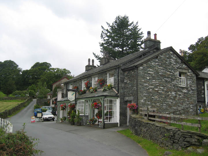
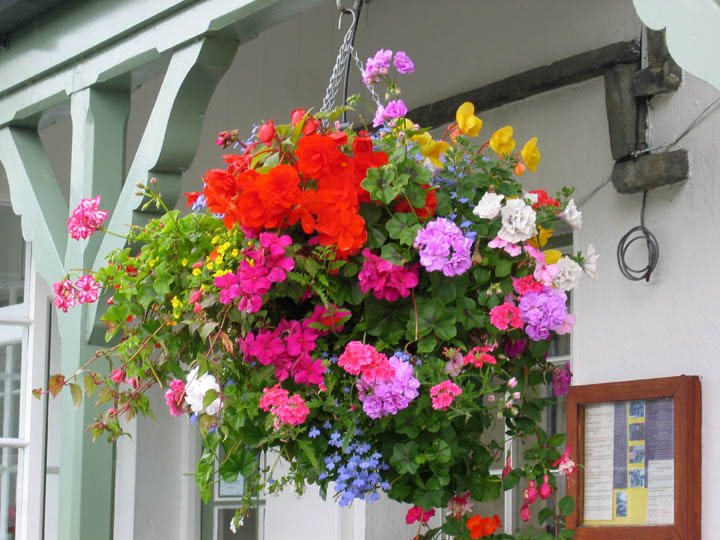
Trying to impress, we arrived early at the Little Langdale . . .
. . . and had time to enjoy the colourful hanging basket displays the pub had organised.
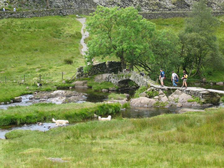
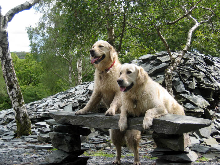
The two dogs make it to the water first - why am I not surprised ?
The two part bridge takes advantage of a central large rock and a very long slate slab. The arched packhorse bridge beyond is the longer of the two spans.
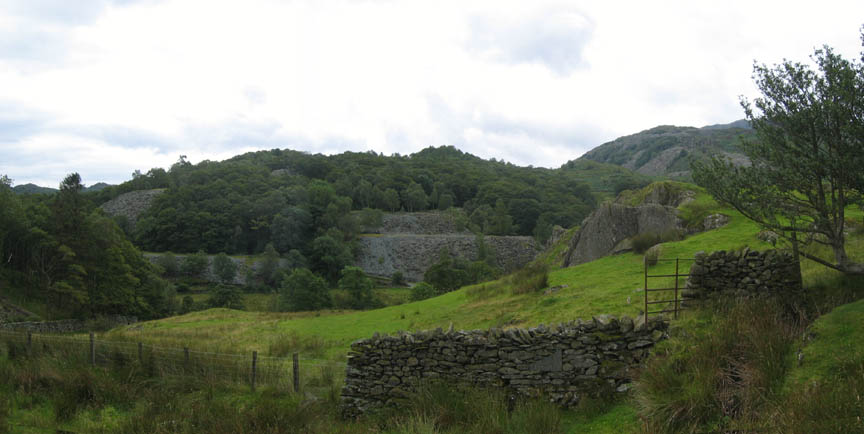
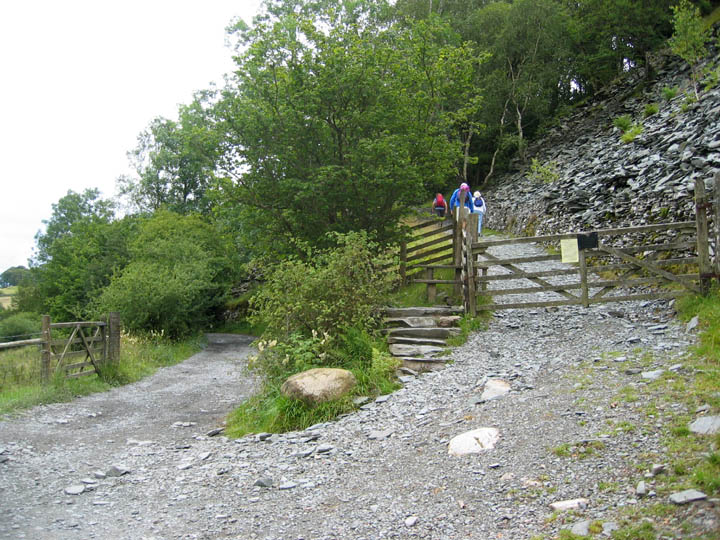
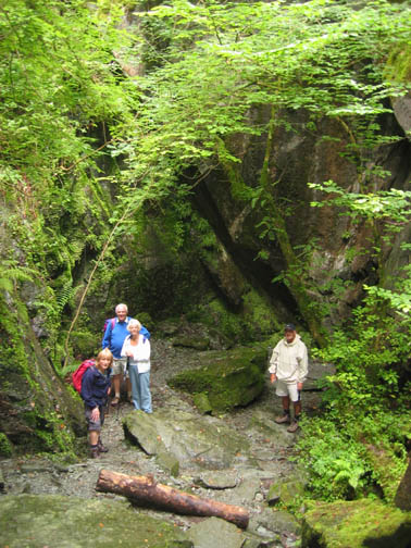
Across the river and off to find that inclined slope that leads up to the lower slate level. The hillside here is littered with quarry waste from years of mining.
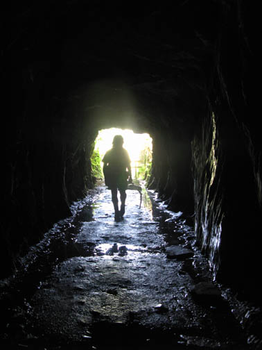
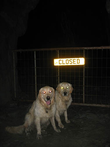
Having read the signs and accepted the conditions of entry we proceed into the mine. This first section hardly needs torches at all.
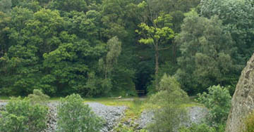
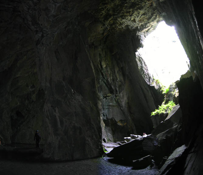
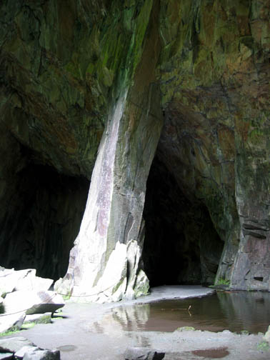
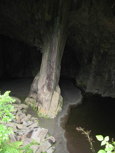
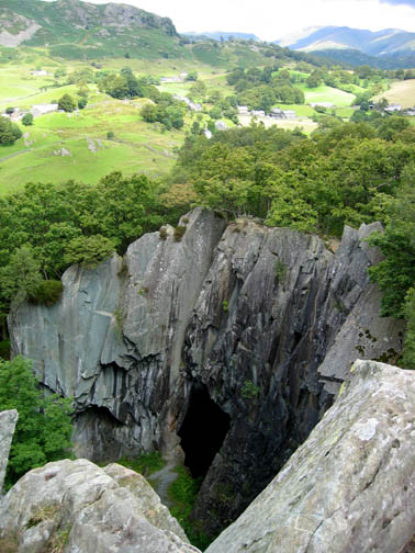
Suddenly the tunnel opens into a huge cavern with it's famous central pillar and a large opening like a window, to let in the light from outside.
Like Hodge Close Quarry over in Tilberthwaite, the relatively dry and abandoned quarry has provided a sheltered and humid environment which has allowed a profusion of trees and ferns to grow all across the quarry levels.
Equipped this time with a plan of the cave, and having taken advice we felt capable of exploring further. This tunnel is apparently safe to explore but does need sensible lighting and either helmets or a keen eye for the whereabouts of the ceiling !
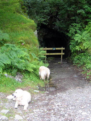
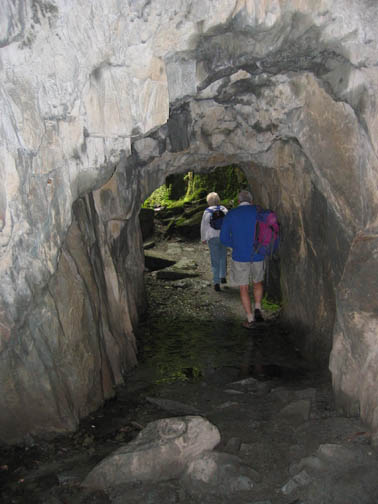
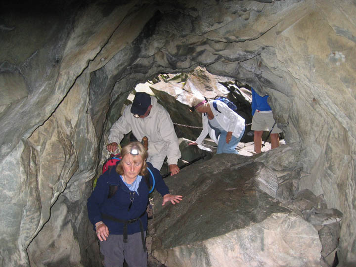
A short scramble over some entrance boulders and we were in another large, well engineered tunnel leading into the hill.
All trace of daylight is left behind as we reach a junction inside the workings. To the right (left in this picture) is a shorter tunnel leading to the Ahd A1 underground quarry.
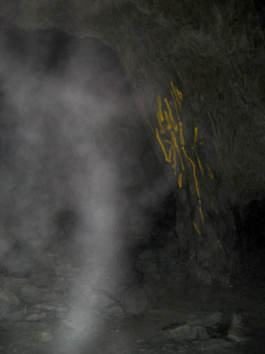
The chamber is gated due to the risk of slabs falling from the roof of this large underground slate cavern. The yellow lines are paint indications of cracked rock found in a recent mine survey. The tunnel continues on a short distance on the right) then ends.
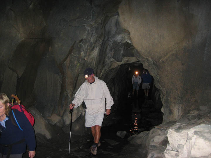
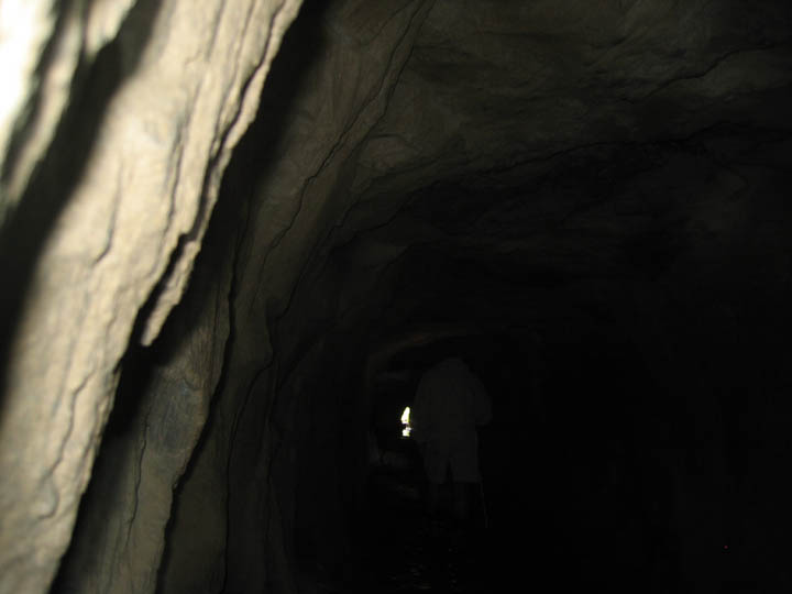
Back in the main tunnel we progress on. The passageway is about 400 feet long, but soon a chink of light indicated the way out onto the hillside and into Tilberthwaite Valley.
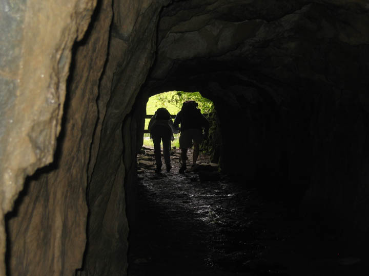
Remember to mind your head as the last few yards are a little lower than the rest.
A smile of satisfaction on three faces, and a look of relief on the fourth ! The map had guided us safely through the workings, out to the sunshine at the other end.
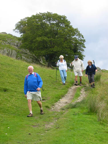
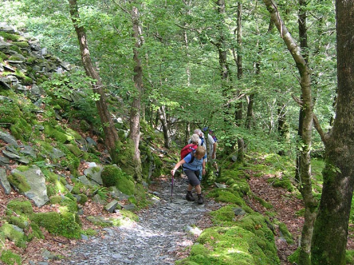
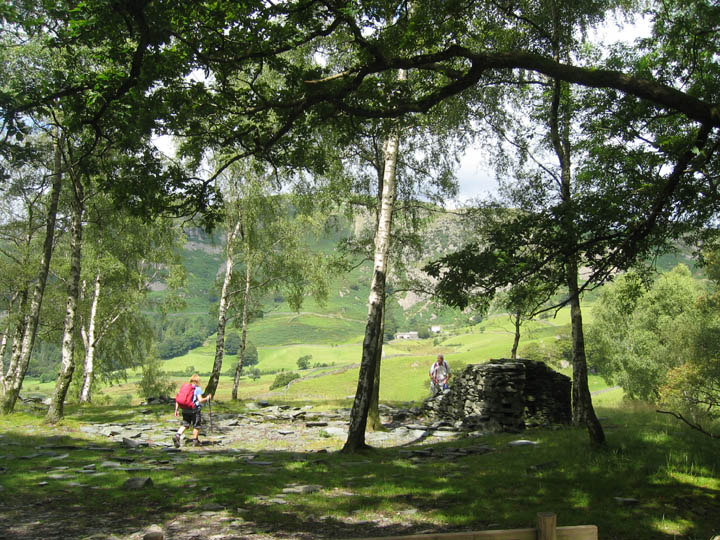
We now retraced our steps, but this time over ground rather than under. A well defined path leads up the hillside through the birch and oak wood. To our right, one of the big waste tips.
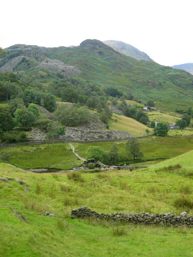
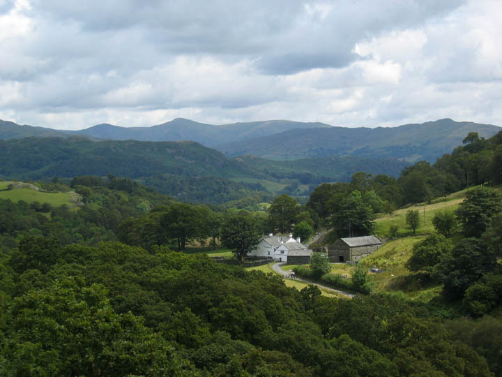
Up on the low summit of Moss Rigg Wood we can look out north east over Stang End Farm. Great Rigg on the Fairfield Round is the pointed fell in the distance and Loughrigg Fell (above Grasmere) the one to the right.
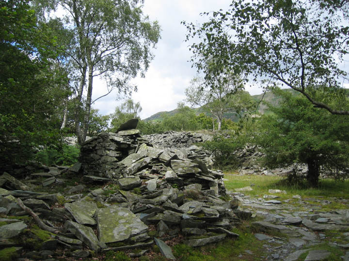
The top is one large slate tip scattered with evidence of many old mine buildings.
Someone has erected a modern seat out of the local slate - and it wasn't them !
We had walked back over our original tunnel and were now eighty to a hundred feet above the open chasm.
A series of old quarry paths and tracks took us across and then down the side of the old workings.
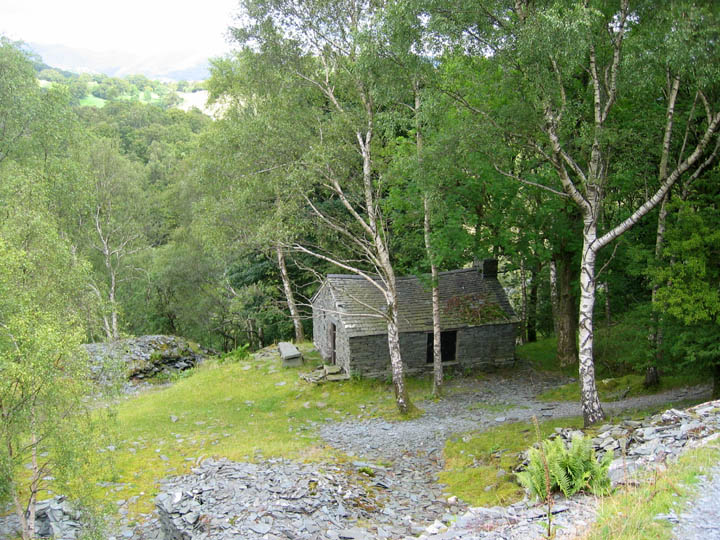
An old mine building, restored and now locked. It is probably a club climbing hut or something similar. A short last path took us back to our start at the Cathedral Cave entrance, where we reversed our route a short distance down the incline and followed the track way alongside the River Brathay to the new bridge.
The roadway is the bridle way to High Tilberthwaite, not open to general traffic, which crosses the river via this deep ford.
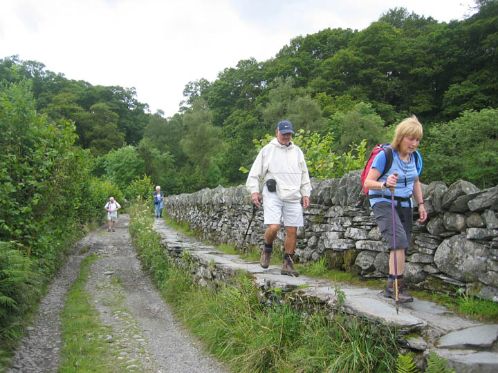
Dave follows Ann along the raised pavement adjacent to the Tilberthwaite track.
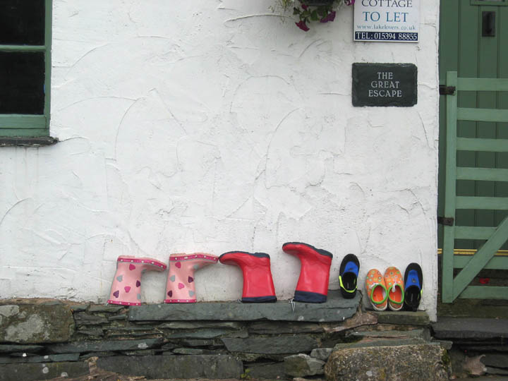
The coloured children's wellies complement the house sign on this delightful roadside holiday cottage.
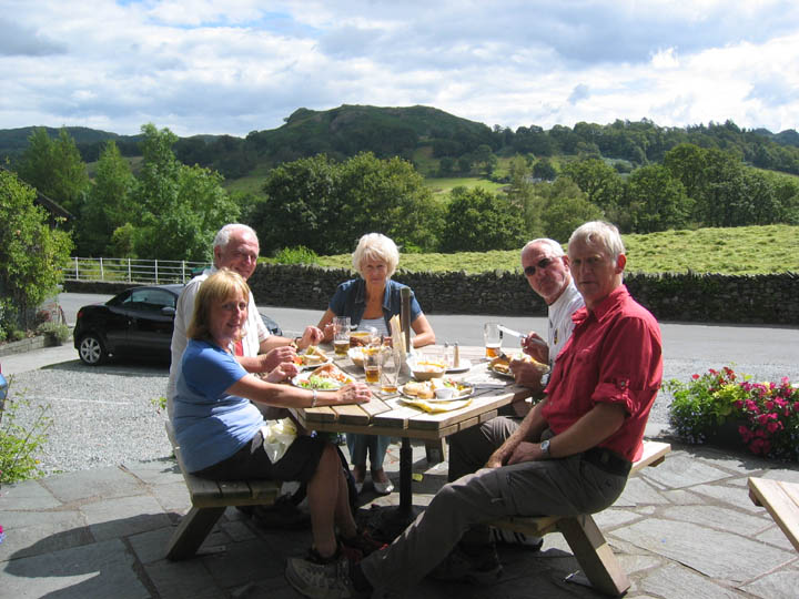
All too soon back at the pub . . . but that did mean that we had a little more time to enjoy a rather nice lunch outside in the sunshine. Cheers Dave . . . have a good flight home at the end of your stay and have a great reunion next week, all three of you. |
- - - o o o - - - Technical note: Pictures taken with a Canon Ixus Digital camera. Resized in Photoshop, and built up on a Dreamweaver web builder. This site best viewed with . . . an idea of where you are going and a map to lead the way. My thanks to Stephen Siddall for the web link, and to Allan, who ever you are, for the map and information. Previous walk - 31st July 2007 Summertime in Loweswater A previous time up here - 6th June 2007 Side Pike and Lingmoor, and it's hot again Next walk - 10th August 2007 The Honister Mine Cathedral Tour
|