![]()

|
|
|
|
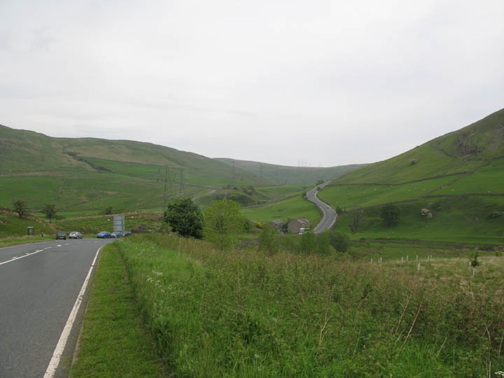
Date & Time: Sunday 3rd June 2007. 10.50 am start. Location of Start : The bottom of the A6 Shap Hill, Cumbria, Uk. ( NY 552 039 ) Places visited : Huck's Bridge, Ashstead Fell, Mabbin Crag, Castle Fell, Whinfell Beacon, Telecom's Repeater Station, Grayrigg Pike, Low and High Borrowdale Farms and back up the valley to Huck's Bridge. Walk details : 9.75 mls, 2500 ft of ascent , 6 hrs 20 mins. Highest point : Grayrigg Pike 1604 ft ( 494 m )Walked with : Anne and Andrew Leaney, Stephen Siddall and Sam, Ann and Harry and Bethan. Weather : Overcast, but the forecasted rain never appeared till the walk was over. Huck's Bridge on the old A6 road at Shap Bank. |
|
|
Following our Cross Fell walk yesterday, Andrew offered a walk in the outlying fells on the south eastern boundary of the National Park, in Lakeland's other Borrowdale. The plan was to walk out on the higher tops on the southern side of the valley and return along the farm track in the valley itself. Huck's Bridge, our start point, is possibly more well known as the start of the old A6 road climb north of Kendal on the way to Scotland. It was a major feature of the journey north in the old days, but the road is much improved, the lorries and cars more powerful and more able to cruise up the steep hill, and anyway the newer M6 motorway now takes the northbound traffic through the Tebay gap to the east. Our walk today would take us across the no-man's-land between the old and new roads on a ridge walk on the edge of the National Park.
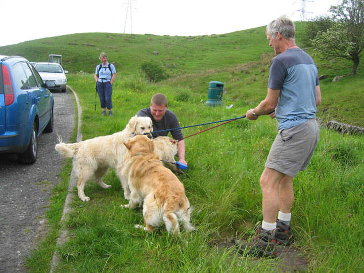
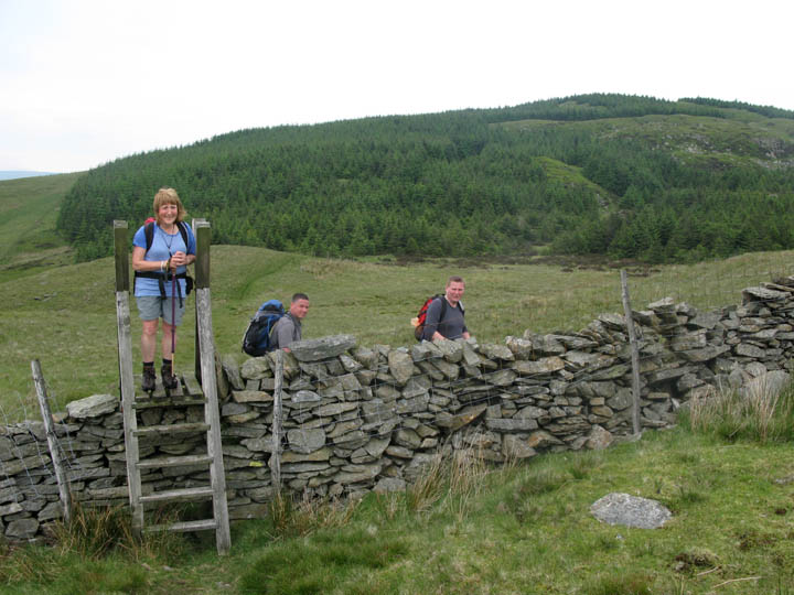
We all met up at Huck's Bridge layby. Old friends, who hadn't seen each other for doggy ages, exchanged manic greetings !!. Yes . . . a third golden retriever to walk with Harry and Bethan . . . Hello Stephen and hello Sam !!
Two hours later we were ready for the off . . . not really . . . the dogs settled after a short while and we could gather our gear to start the walk.
The view south from the first summit cairn of the day - Ashstead Fell.
That was a brisk start . . . time out to cool down, and looked around despite the rather hazy view. Anne, Stephen, myself and Andrew on Ashstead Fell
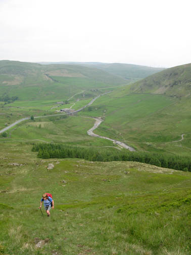
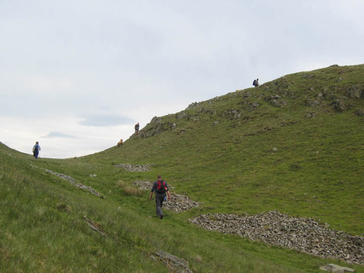
Having climbed to the first summit, the next part of the walk involved a leisurely ridge walk, albeit slightly undulating, across the subsequent tops heading in a south easterly direction. Next was the climb up Mabbin Crag.
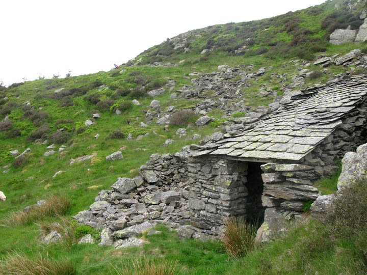
Beyond Mabbin was an old shelter. The old bothy had fallen into disrepair, but had been rebuilt on a smaller scale to give a one roomed shelter if required. If anyone is responsible for it is reading this, may I suggest a small amount of remedial work on the internal wooden beams now may prevent complete collapse of the roof structure in the near future.
From the forested section of the walk we crossed the open fell, pausing only for the occasional wall crossing as we climbed Castle Fell.
The final part of the undulating moorland climb onto Castle Fell.
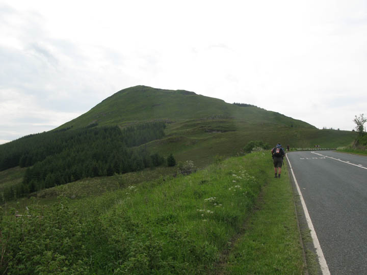
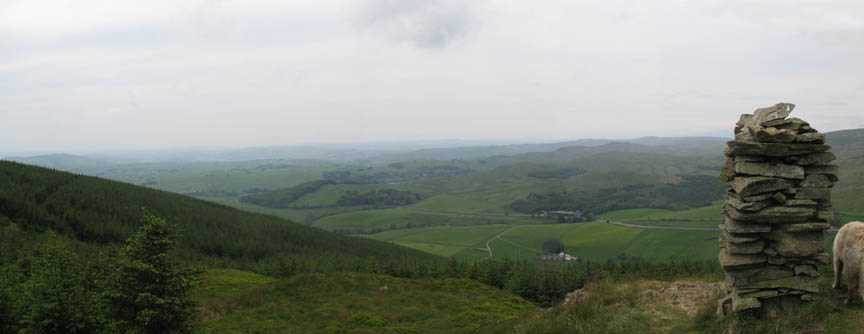
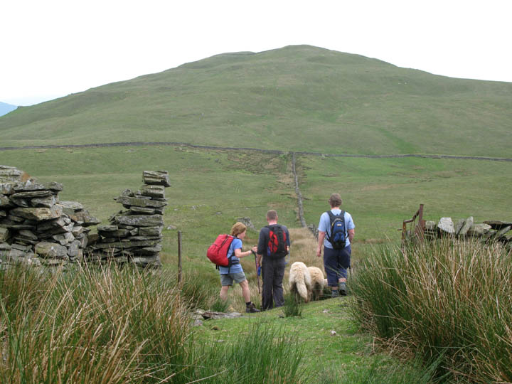
Beyond Castle Fell, an old gateway led us across Whinfell Common to the Beacon opposite.
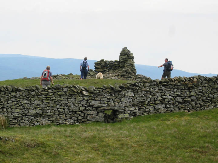
Looking like a miniature Thornthwaite Beacon, the large cairn and associated walls looked a great place to stop for lunch.
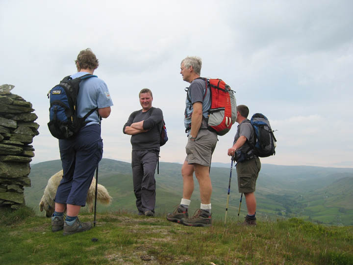
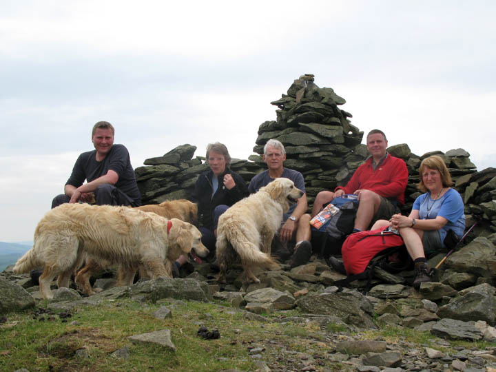
The official group photo. Stephen, Anne, myself, Andrew and Ann, with Bethan in the red collar, Sam (more golden) behind her and Harry next to me.
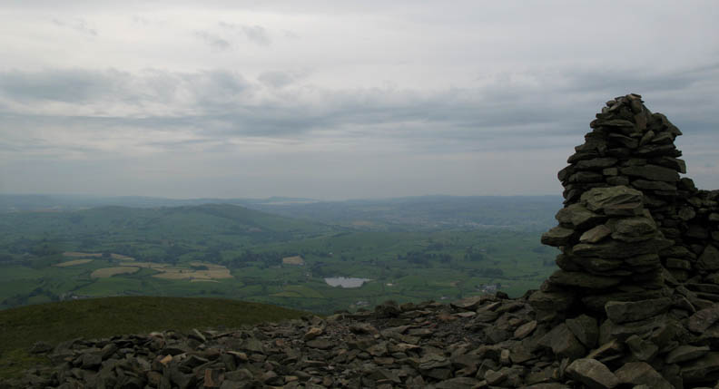
The dwarf wall had protected us from the cool southerly breeze. The forecasted rain (arriving about two-ish) was still a long way off, as we looked south west over Kendal to the distant Arnside Knott on the Grange-over-Sands estuary.
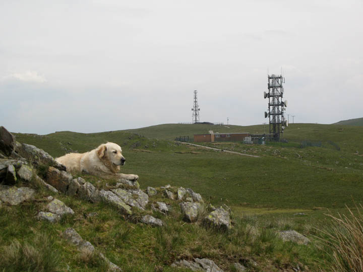
The weather holding, we pressed on along the ridge past the Telecom's repeater station on the hills above Patton Bridge. Andrew suggested that we may like to complete the ridge walk with the last summit, just showing here to the right hand side of the photo.
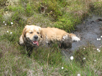
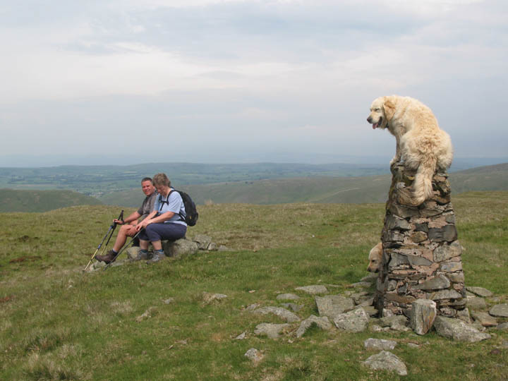
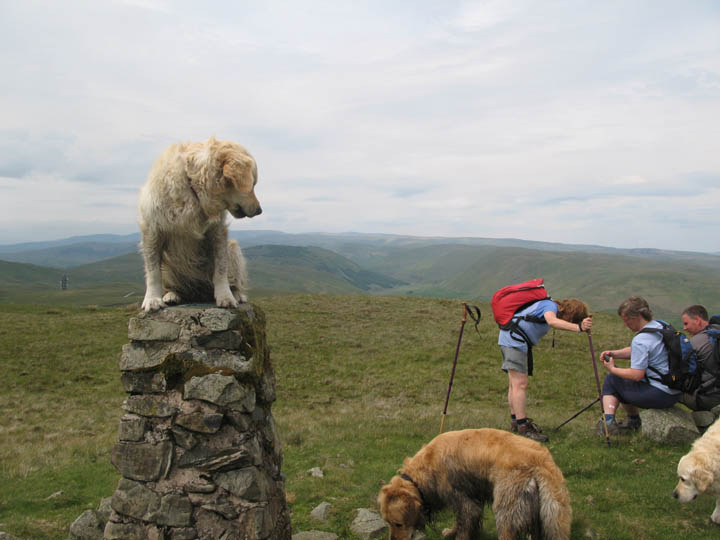
Ahh . . . a steep last climb so time to sit down for a rest. Anne and Andrew chose a convenient stone. Harry just had to go one better.
Vacating the top briefly, Bethan jumps on and claims "King of the Castle" Looking round she checks no-one is trying to take her place - touch her with your cursor !!
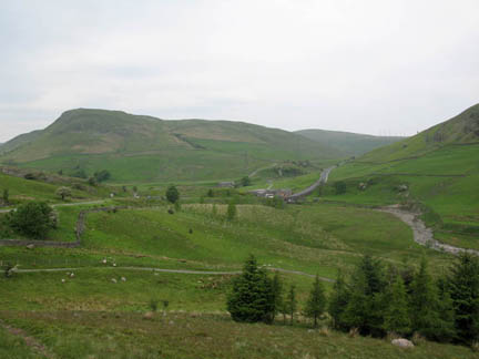
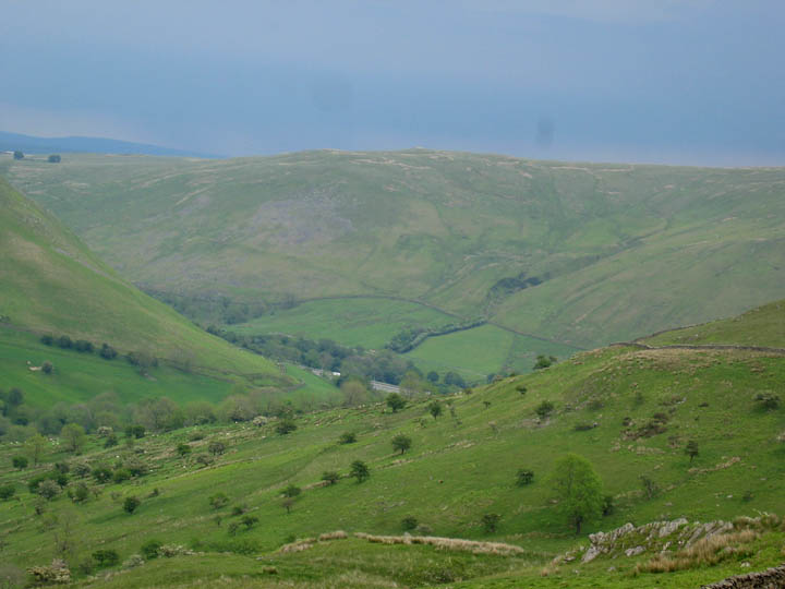
This summit was actually un-named but was adjacent to Grayrigg Pike, overlooking the M6 Lune Gap. As we descended from the top we could just see the motorway (and a white lorry) just below. Beyond is the start of the Howgill Fells with a rather dark sky behind. Perhaps that bad weather was closer than we thought ?
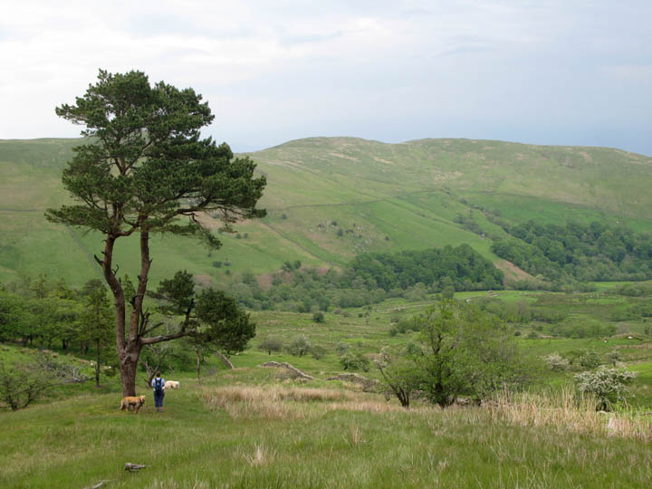
Anne passes a rather nice old Scots Pine Tree as we near the bottom of the Borrowdale Valley.
All we have to do is walk all that way back !!
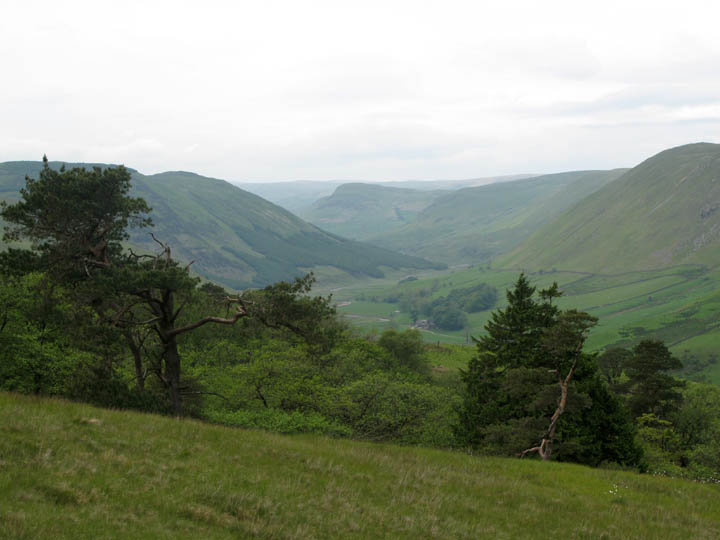
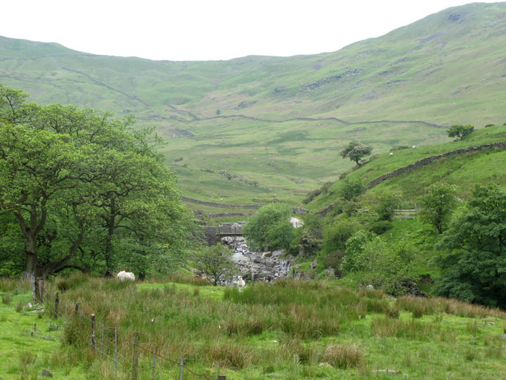
The scenery is reminiscent of Mid Wales as we walk up towards the first bridge over the river.
Across the cattle grid before the farm, we look back to the Telecom's towers that we passed earlier in the day.
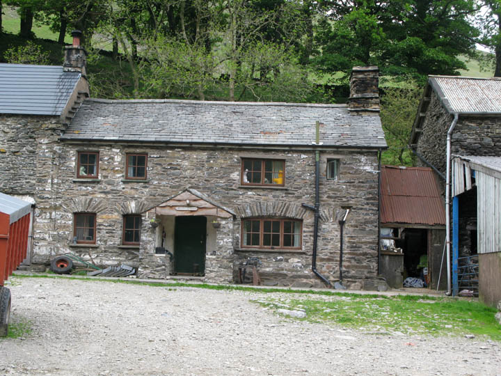
Low Borrowdale, a delightful old farm house amidst it's various outbuildings. It is currently up for sale, along with the rest of the land that makes up this working farm - any offers ?
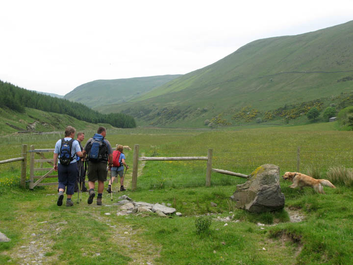
The gate leads through a hay meadow full of flowers, the most noticeable were the yellow buttercups. To the left the organisation Friends of the Lake District, who own this part of the valley, have been planting trees close to the river. [ The high ground to the right here is the Winash Fells which were potentially going to be covered in dozens of 300 ft tall wind generators until a keenly fought public enquiry decided that the scenery here on the edge of the park would be irrevocably spoilt by the projected wind farm, and threw out the proposal.]
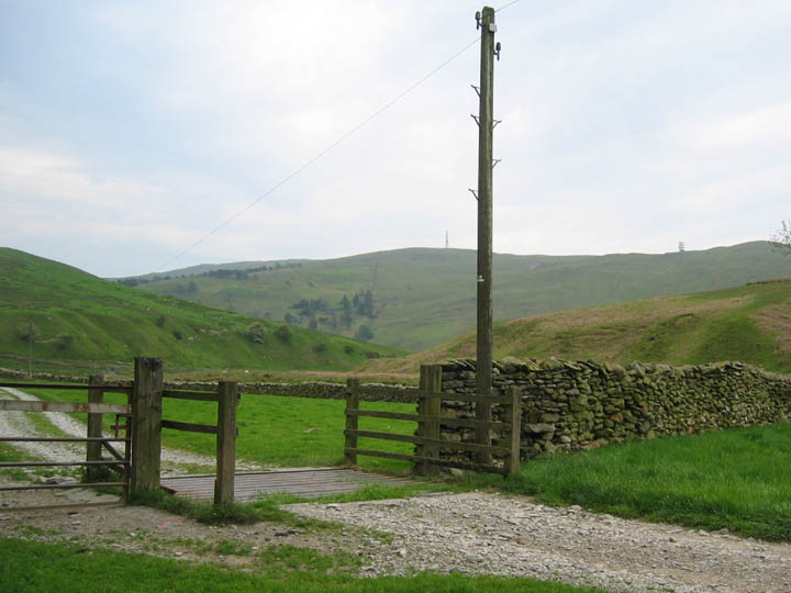
The electricity pylons coming into view mean that the end of the walk is in sight. Ahead is the A6 road and our cars parked at Huck's Bridge.
A short climb takes us back up to the road at the end of a long but different sort of walk in the moorland hills to the south east of the park. - - - o o o - - -
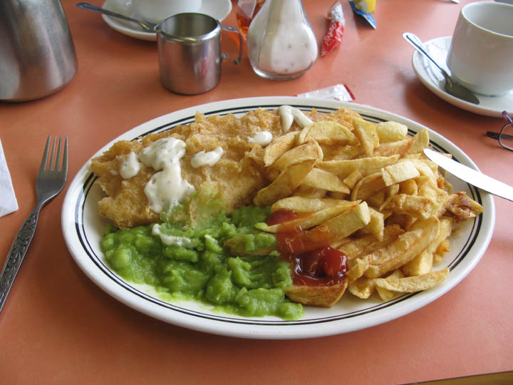
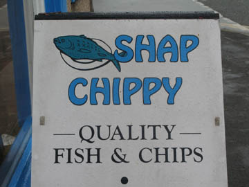
I've mentioned the village of Shap being famous for giving it's name to the steep A6 hill climb, but Shap is also famous in our books for the Fish and Chip Restaurant in the centre of the village ! A fine prospect after a good walk.
|
- - - o o o - - - Technical note: Pictures taken with a Canon G7 Digital camera. Resized in Photoshop, and built up on a Dreamweaver web builder. This site best viewed with . . . a large appetite for a fine "Old English Tradition" . . . and a pot of tea for two. © RmH.2007 # Email me here # Guest book (on the front page) Previous walk - 2nd June 2007 Cross Fell and Wild Boar Scar on the Pennines A previous time in the area - 23rd July 2006 Lonsleddale and a tale of Three Pillars Next walk - 6th June 2007 Side Pike and Lingmoor, and it's hot again
|