![]()

|
|
|
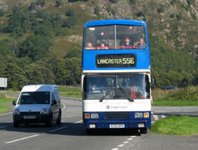
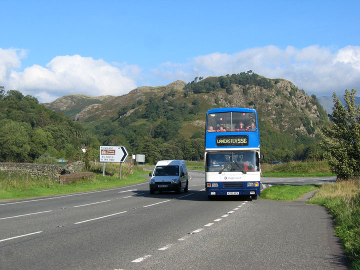
| Date & Time: Saturday 23rd September 2006. 10.45 am start. Location of Start : Legburthwaite (Stannah), in the Thirlmere Valley, Cumbria, Uk. ( NY 328 116 ) Places visited : By bus to Dunmail Raise, then walk to Grisedale Tarn, Dollywagon Pike, Nethermost Pike, Helvellyn, Lower Man, White Side, Raise, Sticks Pass, back to Stannah and the car. Walk details : 7.5 mls, 3250 ft of ascent , 5 hrs 55 mins. Walked with : Ann and the dogs. Weather : Beautifully sunny and warm north of Dunmail, cloudier and more humid to the south. Gentle breeze. The bus arriving at Stannah for the short trip south. |
|
|
Today we planned a linear walk, south to north, along the high fells of the Helvellyn Ridge.
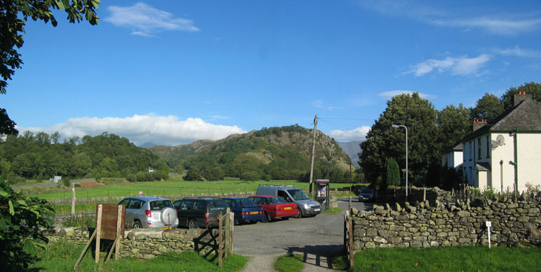
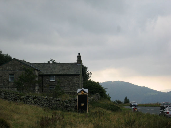
To start our day we drove to Stannah and parked the car in the grounds of the Parish Hall. The small parking area outside was already full so by placing a donation into the honesty box we were able to park all day in their car park.
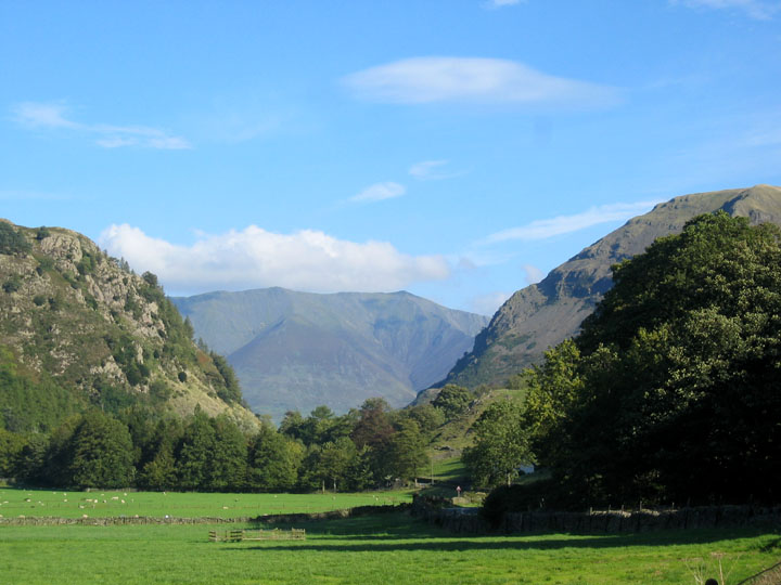
The weather promised a great day of sunshine. This was Blencathra through the the gap that was St John's in the Vale.
It was a few minutes late and already pretty full, but the bus fortunately had a few seats left for us. Tickets for two to Dunmail Raise please . . . well behaved dogs went free !
Ten minutes later we were dropped off at the top of Dunmail Raise by the old AA Box. The weather to the south was not so good, but it was cloudy rather than wet, so prospects were for a dry walk.
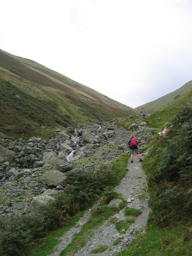
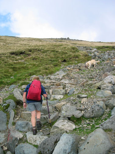
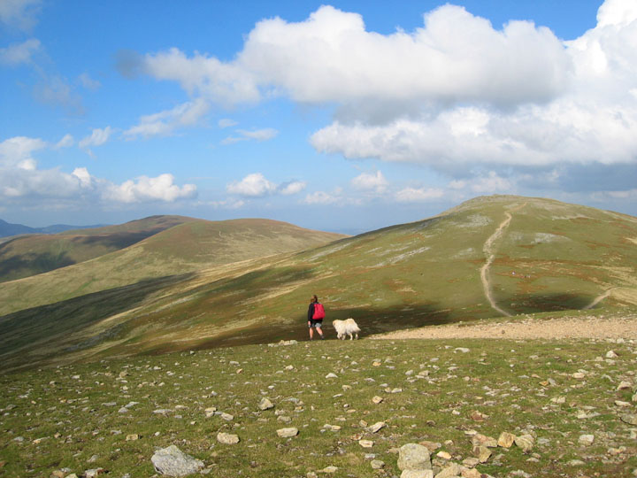
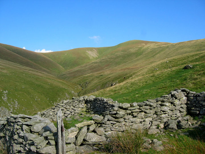
Up to the top and over to Grisedale Tarn. Not a road in sight, it is a different world up here.
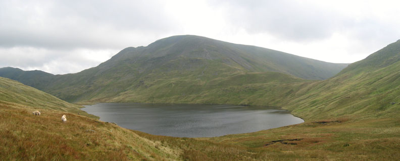
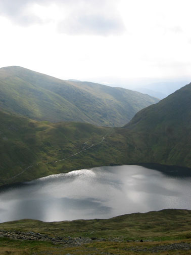
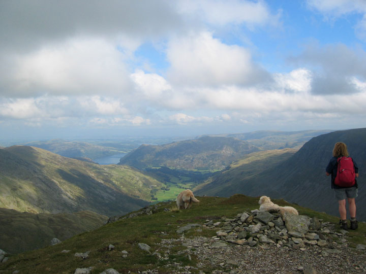
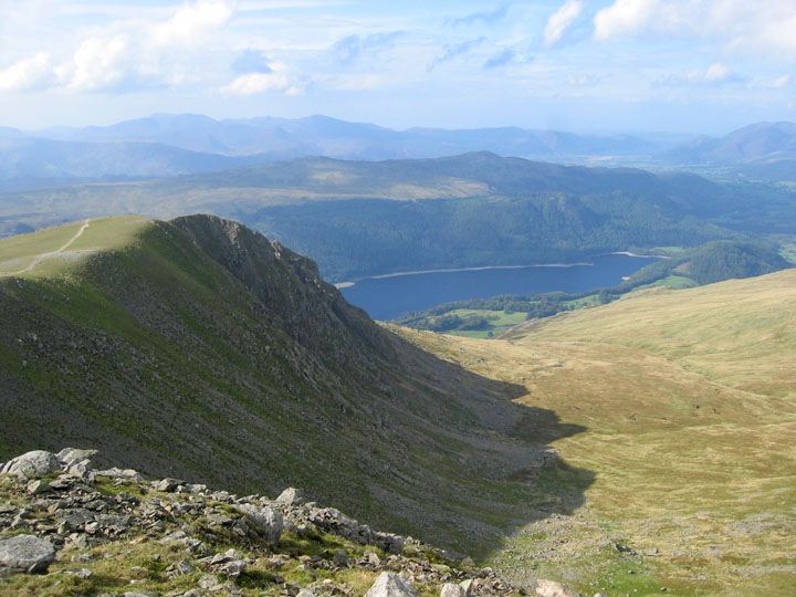
Chance of a breather as we reach the higher ground and our first view "over the hill". This is Patterdale's Grisedale Valley, looking down to Ullswater and Place Fell, with St Sunday Crag to the right.
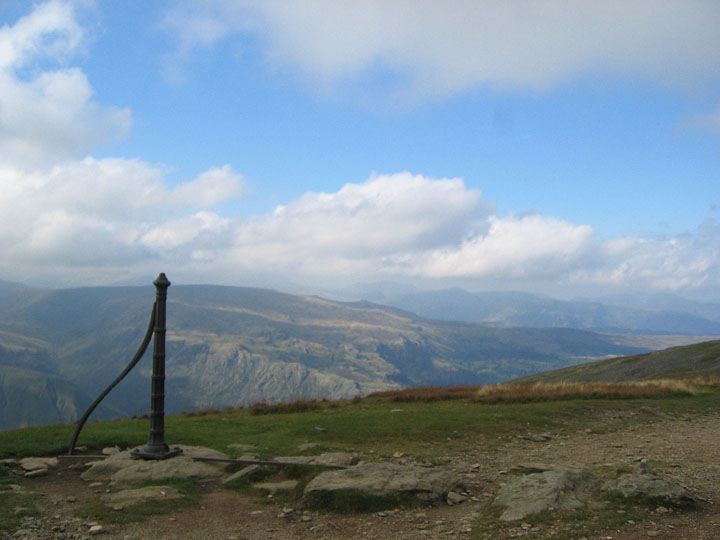
The old Victorian fence post and the turning point to the summit of Dollywagon Pike. The actual summit is slightly set back from the main path along the ridge towards Helvellyn.
The view from Dollywagon Pike, north east towards Ullswater. Dollywagon must be one of the evocative names of the Lakeland Fells. Like Glaramara, High Spy and Great Gable, they all conjure up feelings of wild places, high ridges or grand reputations.
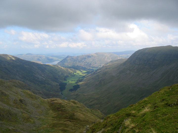
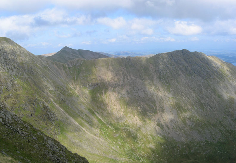
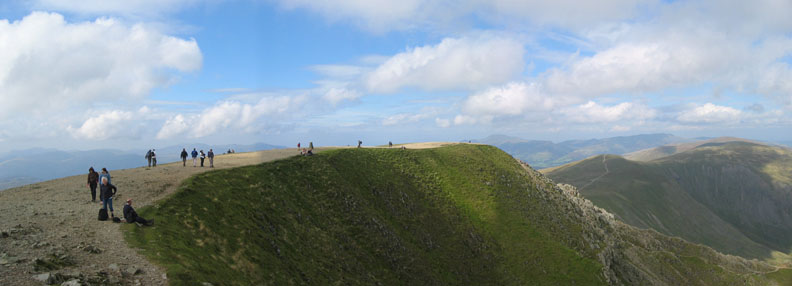
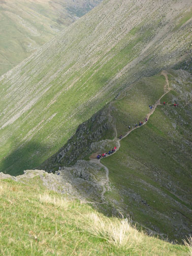
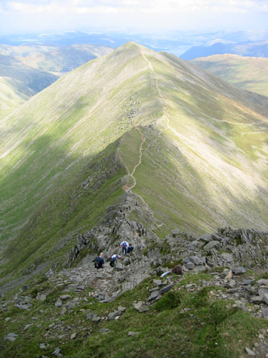
The cairn on High Crag is confusing as it is not a major summit. Nethermost Pike is in fact the flatter grassy summit ahead, with Helvellyn looking much closer now, just beyond it. Nethermost , when you reach it, is also a fine viewpoint of the famous Striding Edge.
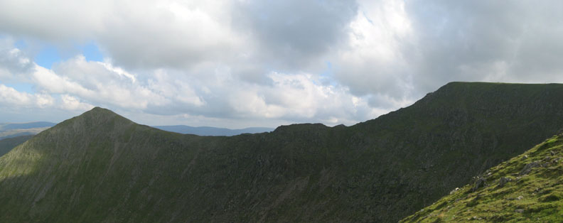
Sunshine and shadows across the face of High Spying How . . . Striding Edge.
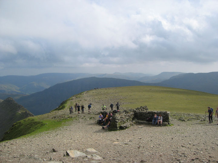
Looking south west from the summit cairn, the shelter is a popular picnic spot today.
Turning the other way gave us a view of the Trig Point and the summit's curved ridge.
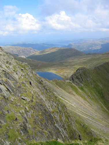
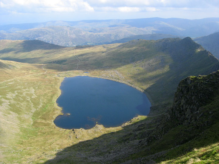
Lunch spot with a view. We sat on the edge and dangled our feet towards, but not actually in, the water of Red Tarn.
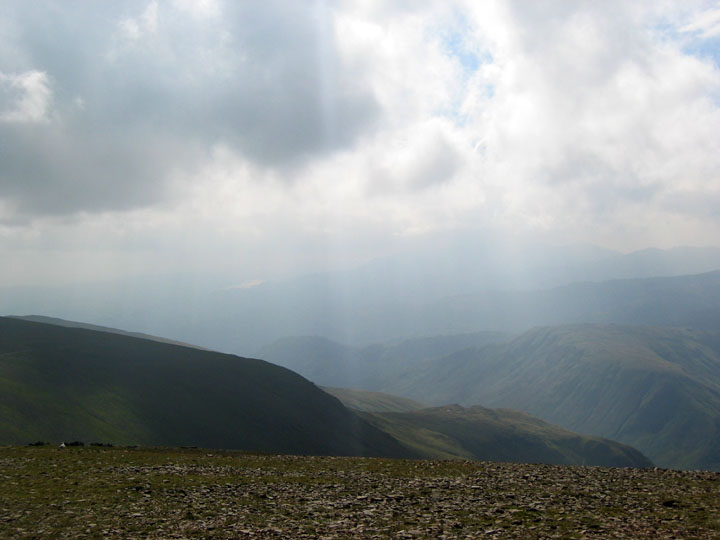
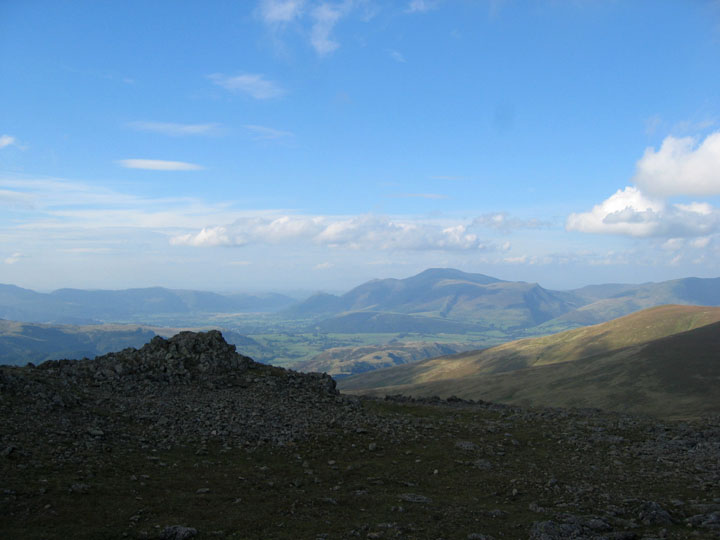
Time to move on . . . A hazy view south from the summit. Coniston Water is just about visible, but the Langdale Pikes were very indistinct through the hazy afternoon air.
Looking north however, visibility was better. This is the first cairn on the direct route down Helvellyn to the Swirls car park midway along the Lake.
A close up of Ullswater over the top of Catstycam.
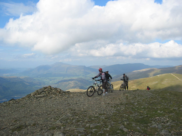
Mountain Bikers push their machines up the last part of the ascent to the summit of Helvellyn, as we start our way down towards Lower Man.
Browncove Crags as we saw them from Helvellyn's Lower Man summit.
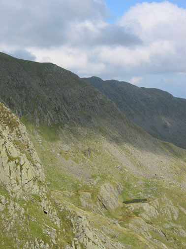
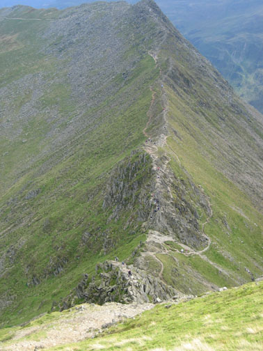
A panorama of Swirral Edge this time.
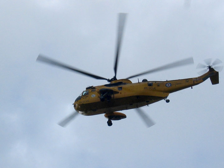
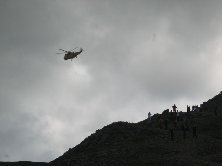
The RAF were out today and flew directly over the top of us.
This time they didn't fly round the summit or look to be searching the fell sides but continued on to Glenridding.
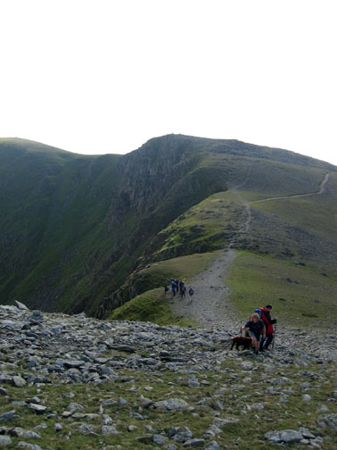
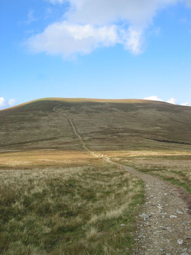
Our next objective was to cross from White Side over to Raise. Navigation was not difficult on the wide and obvious path.
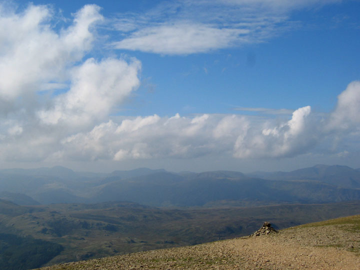
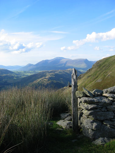
Shadows on the rocks near Raise summit provide a darker foreground for this distant view of Skiddaw.
The same post but the reverse view back up to Stybarrow Dodd.
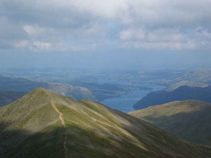
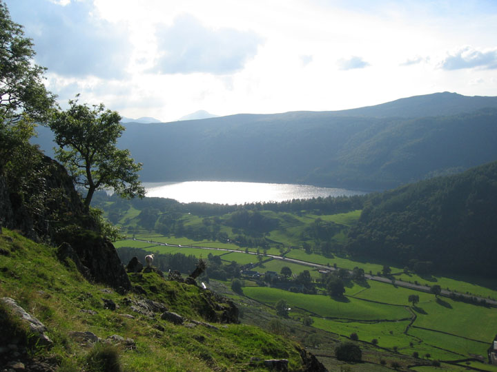
Thirlmere catching the late afternoon sun near the end of the walk. Only the steep descent to Stannah and we were done. - - - o o o - - - P. s. It turns that the helicopter we saw flying over head had been called out in a attempted rescue of four boys in in a swimming accident in Ullswater.
|
- - - o o o - - - Technical note: Pictures taken with a Canon IXUS 400 Digital camera. Resized in Photoshop, and built up on a Dreamweaver web builder. This site best viewed with . . . more of the northerly weather , less of today's southerly cloud. Go to Top # © RmH # Email me here # Go to 2006 Archive Previous walk - 22nd September 2006 Burnmoor Tarn and the Railway Children Walk By the way, only three walks to go now for our magic 428. Wetherlam and Dow Crag : Bowfell, Esk Pike and Rossett : Lingmell and Scafell Pike with Great End. |