![]()

|
|
|
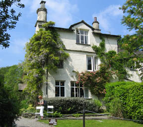
| Date & Time: Thursday 8th June 2006. 11 am start. ( Map ref: NY 365 063 ) Location of Start : Roadside parking adjacent to Rydal Mount, Cumbria, Uk. Places visited : Nab Scar, Heron Pike, Great Rigg, Fairfield, Hart Crag, Dove Crag, High Pike, Low Pike, and back to Rydall Mount. ( The Fairfield Round ) Walk details : 8.75 mls, 3,450 ft of ascent , 6 hrs 30 mins including a stop for lunch on Fairfield. Walked with : Ann and the two dogs. Weather : A very hot and sunny afternoon with virtually no breeze. Rydal Mount, Wordsworth's home from 1813 to 1850. |
|
|
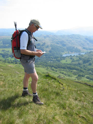
You learn something new every day. The house that old Wordsworth lived in all those years back was not the big Rydal Hall, but here at Rydall Mount. Still it was a nice looking place and open to the public to view. However we had other plans today . . . and the road leading up to Rydal Mount was a great place to leave the car at the start of our walk.
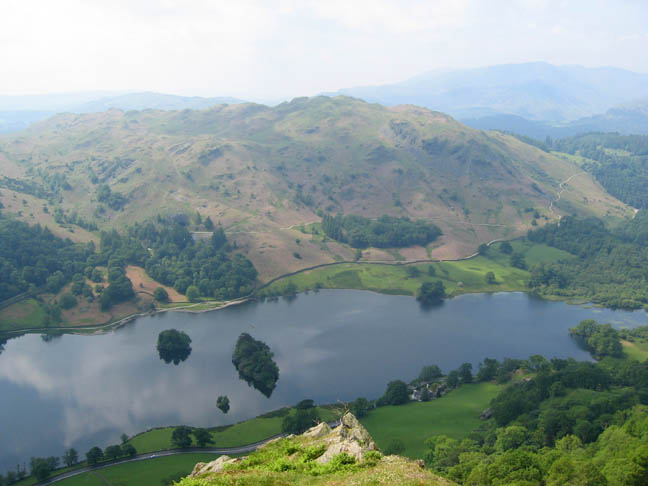
Climbing fast in the hot morning air we look down from Nab Scar onto Rydal Water and Loughrigg Fell.
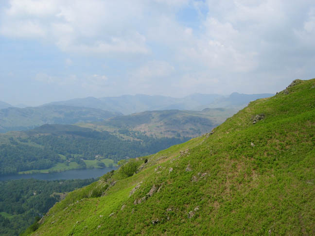
The deep blue haze took all the detail away from the distant views of the Langdales, Crinkle Crags and Bowfell.
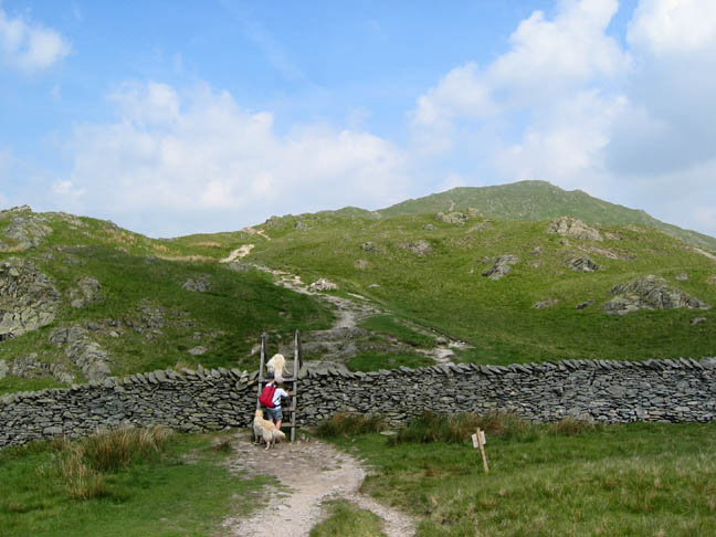
The ladder stile over the wall and the start of the high level walking. Ahead was Heron Pike.
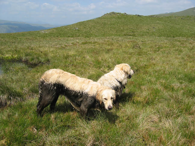
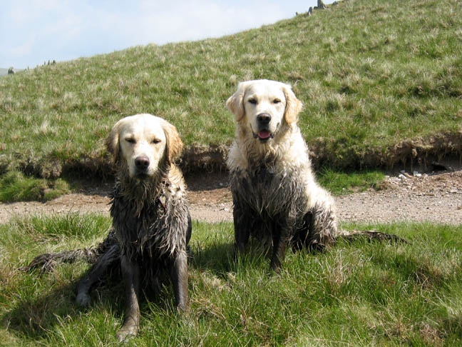
The dogs were also very hot and so spent an inordinate amount of time seeking out the small bogs and tarns on the ridge in order to cool down. Unfortunately these were more often than not rather peaty and the dogs acquired that half retriever / half chocolate lab sort of appearance.
Very proud of their new hair colouring, they posed for a photo. Due to the heat, the mud almost seemed to bake into their fur, and they remained this colour for the rest of the walk !
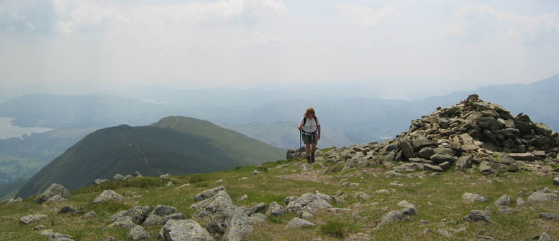
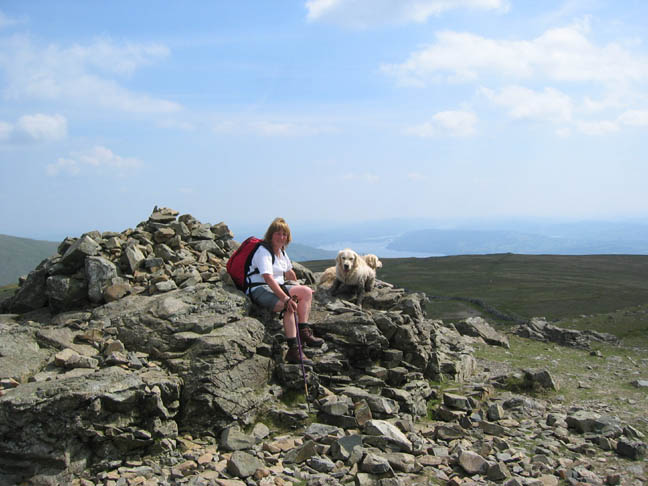
Ann making the summit of Great Rigg. Heron Pike below, with our path standing out along the ridge way.
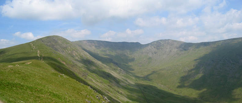
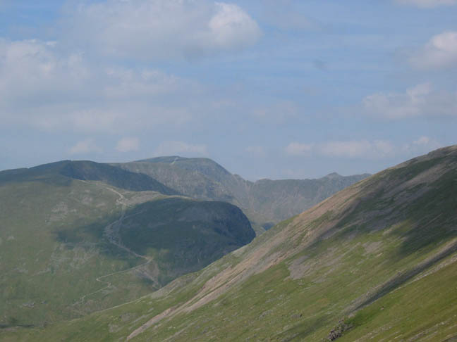
Great Rigg, Fairfield, Hart Crag and Dove Crag, the top part of the round as viewed from Heron Pike.
The zig-zag path up Dollywagon Pike leads on to Nethermost Pike and eventually Helvellyn itself. To the right, the level ridge of Striding Edge, with Catstycam's triangular peak behind.
Cofa Pike from our lunch spot on Fairfield summit. Click here or on the photo for a fuller panorama.
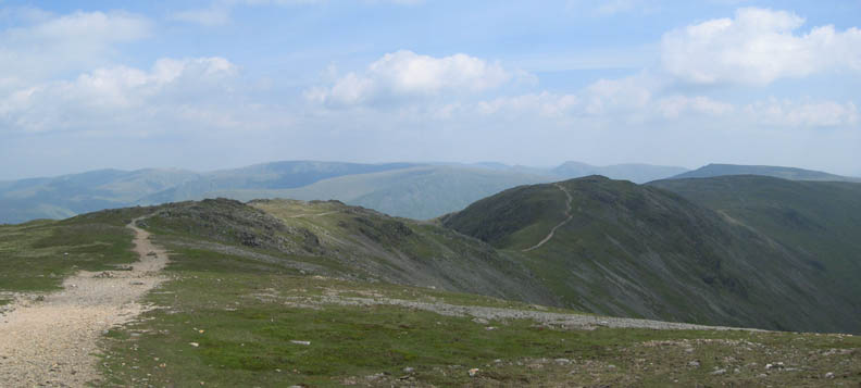
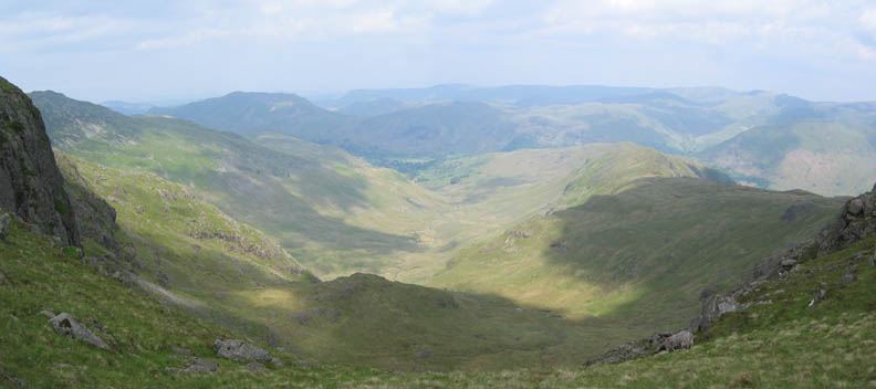
The flat summit of Fairfield leads off eastward to Hart Crag. The fells of the High Street region complete the background.
Walking to Hart Crag we had views to the left of Heron Pike, Great Rigg and our route of ascent. Thanks to the sheep for complimenting the foreground and encouraging the photo.
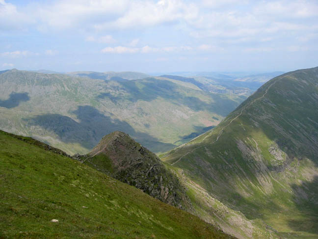
To our right, the views looked down Deepdale and across the Patterdale region to Place Fell.
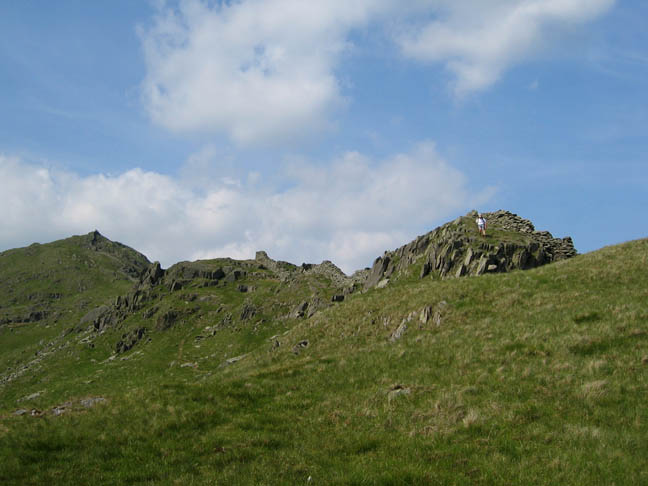
The round was proving relatively easy walking on generally well worn paths though we had to take care on several of the more rocky sections, such as here on the descent of Hart Crag.
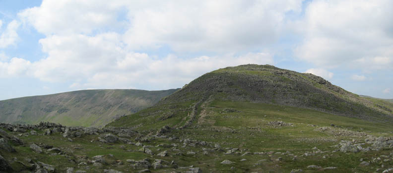
Dove Crag This was the summit we visited on the original Wainwright Walk back in November 2002
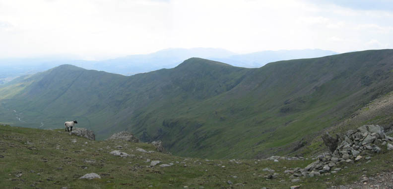
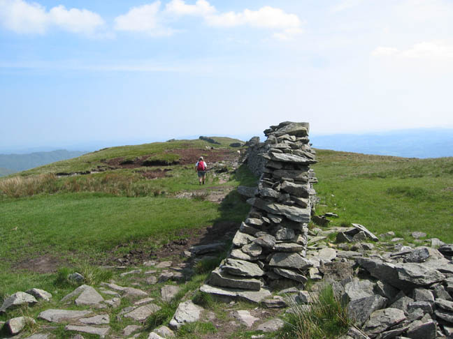
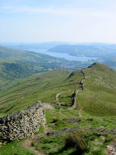
From here navigation was easy - follow the wall.
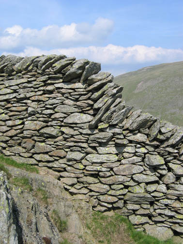
"The Great Wall of Fairfield" as it hugs the skyline from High Pike down to Low Pike.
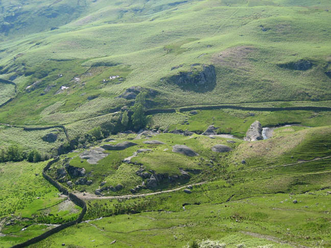
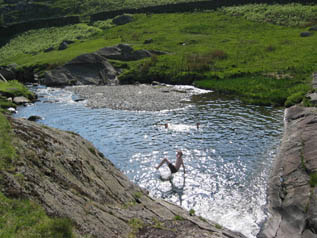
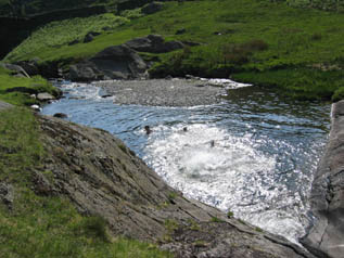
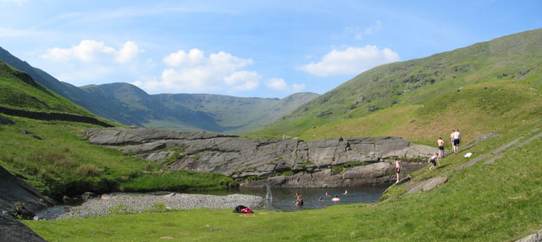
Beyond Low Pike we cut down to the right from the High Sweden Bridge path, and headed down to the river. The horizontal rock section almost blocking the river is known as Beckstones Jump ( or as Beckstones Jum on the new O.S. 1:25k map ) There looked the distinct possibility of a nice waterfall and a deep pool to cool down in. We were right, but just before we got there so did about twenty other young people so I passed on the swim, but we did encourage the dogs into the river lower down to try and clear some of the mud from their coats.
Beckstones Jum, the swimming pool and the high fells of the Fairfield Round behind. Another good day on the fells, if rather on the hot side.
|
- - - o o o - - - Technical note: Pictures taken with a Canon IXUS 400 Digital camera. Resized in Photoshop, and built up on a Dreamweaver web builder. This site best viewed . . . with a good supply of drinking water for us and the dogs. Go to Top # © RmH # Email me here # Go to 2006 Archive Previous walk - 7th June 2006 Maiden Moor, High Spy and a swim The previous time up here - 28th April 2000 ( Sorry no pictures on-line for this walk )
|