![]()

|
|
|
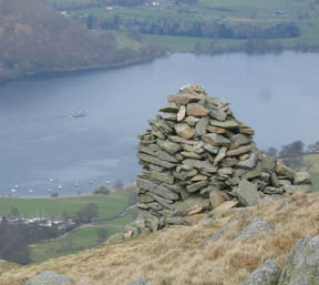
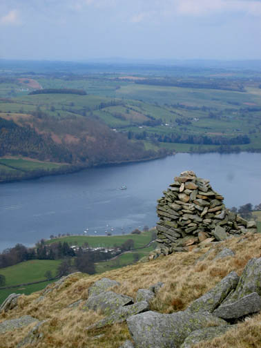
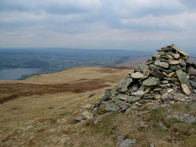
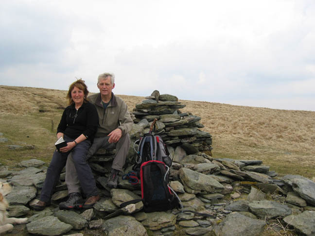
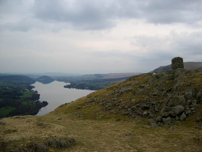
| Date & Time: Tursday 20th March 2006. 1.30 pm start. Location of Start : Howtown Pier, Ullswater, Cumbria, Uk. ( NY 444 198 ) Places visited : Howtown, Swarthbeck Gill, Arthur's Pike, Bonscale Pike, Loadpot Hill, Wether Hill, Pikawassa, Steel Knotts, Hallin Fell. Walk details : 9.02 mls, 3000 ft of ascent , 6 hrs 30 mins. Walked with : Jo (Hall) and her dogs, Ann and our dogs. (We are in a minority today). Weather : Morning rain cleared to give a fine, dry, but overcast afternoon. Hazy. The prominent cairn below the summit of Arthur's Pike. |
|
|
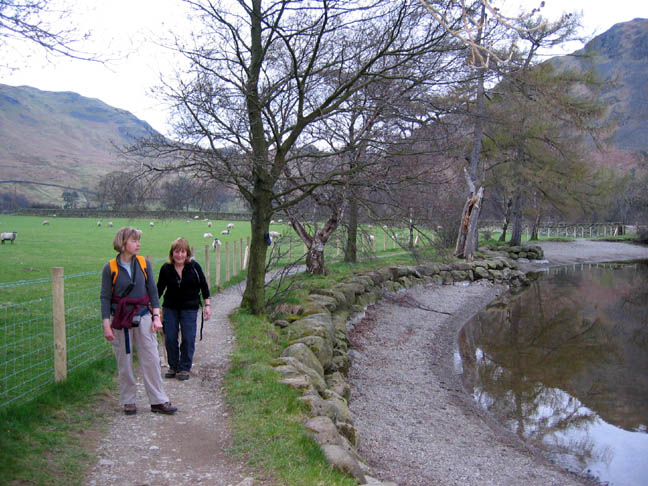
A chance to walk in the Far Eastern fells today. We started from the road adjacent to the Howtown Pier, after enjoying a short drive down the southern shore of Ullswater.
After crossing the first field on the signposted footpath we started the set off across the lower slopes of Bonscale Fell. Behind was Steel Fell and our return route would follow the skyline down from left to right.
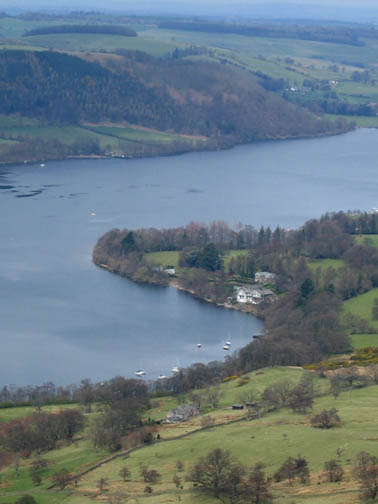
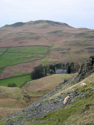
A steep path amongst the old bracken allowed us to climb rapidly above Howtown Bay. The view improved as we climbed. This is the first time we have really seen the view despite being up hear several times before ! This time the weather was on our side.
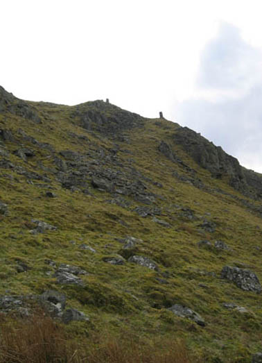
Walking under the Towers, we resisted the urge to climb the last hundred or so feet, in favour of the contoured path across to Arthur's Pike. This gave us an easier walk to the next fell, as we planned to return here after lunch.
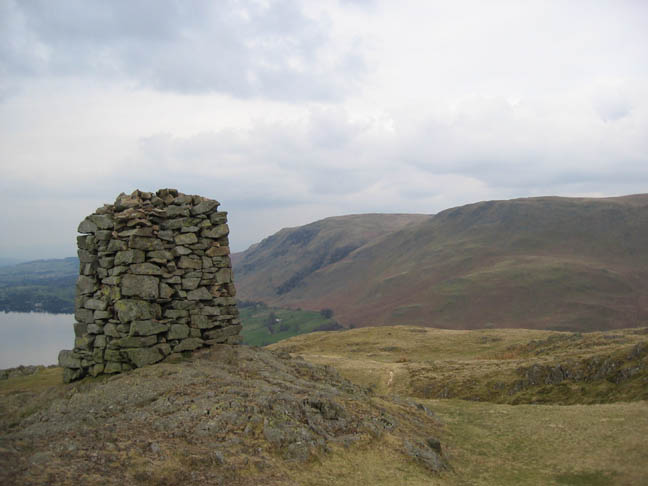
Arthur's Pike lower summit cairn - the one with the view.
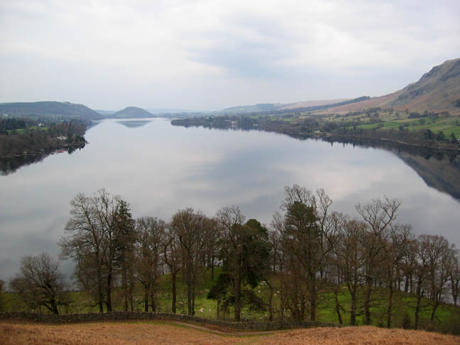
The view ! A fine panorama from St Sunday Crag, across the Helvellyn Range to Blencathra. In the middle distance, Place Fell and Gowbarrow, on either side of the lake. There was the remnants of the snow cornice on Helvellyn, but all the detail was lost in the increasing haziness.
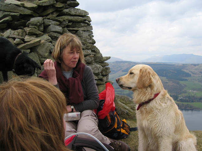
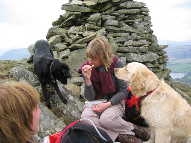
" Lunch - my lunch - you've had your biscuits." Jo discusses etiquette with Bethan, who is looking rather miffed.
. . . and she has to do the same with her dog Megan too.
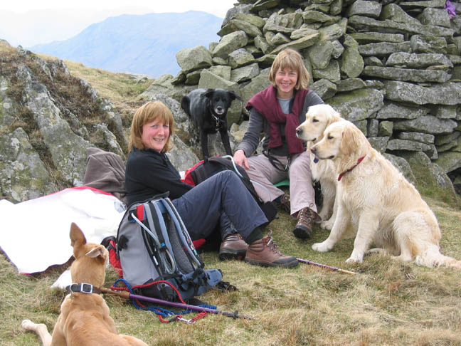
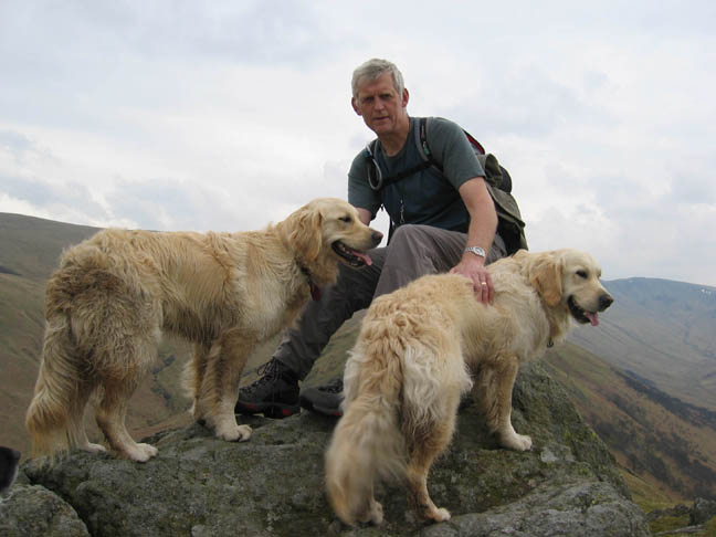
Where was I - oh yes - a lunchtime photo on Arthurs Pike. Look this way please - all of you.
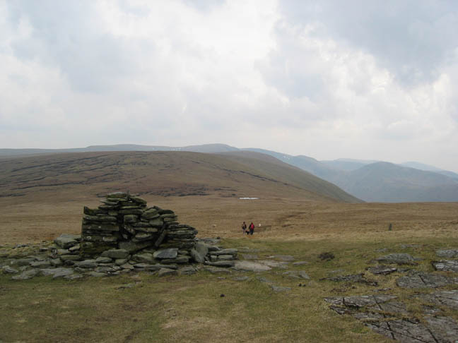
After our stop we climbed the short distance to the true summit of Arthur's Pike - A slightly less impressive cairn. In the haze beyond the end of the lake were the Pennines, Cross Fell still retaining its last vestige of snow.
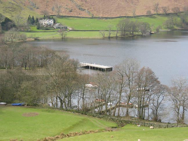
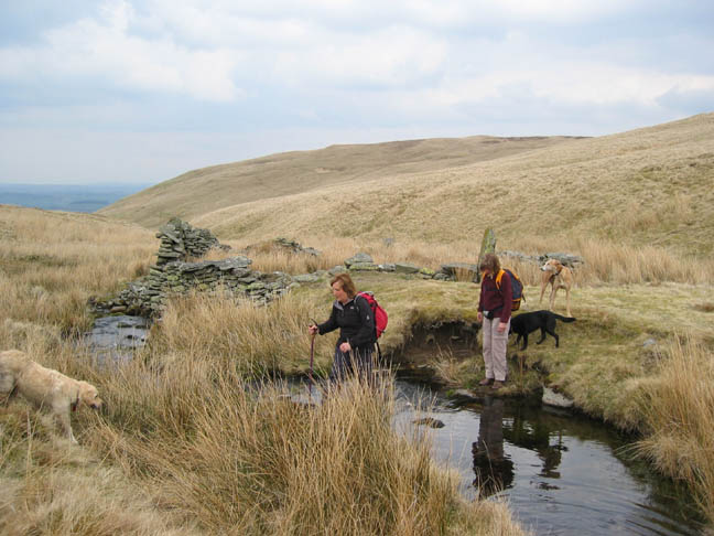
Back from Arthur's Pike on tracks across the grassy moorland, we re-crossed Swarth Beck at the old sheep fold. A rising path then took us across to Bonscale Pike and the towers we had seen earlier.
This time we were above the stone pillars and looked down on them and the lake below. The lake was relatively quiet, with only a couple of passing ferries, a few pleasure boats, and two old style sailing dinghies from the Outward Bound centre.
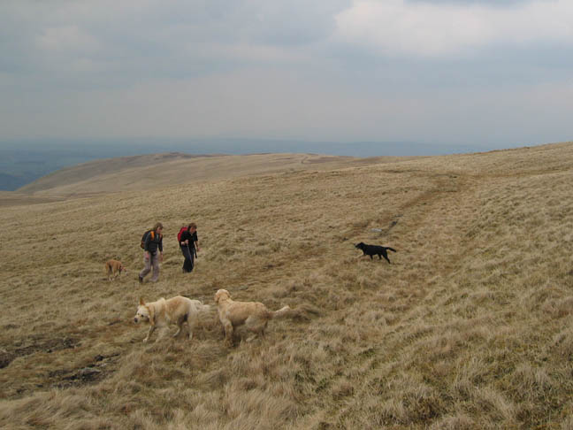
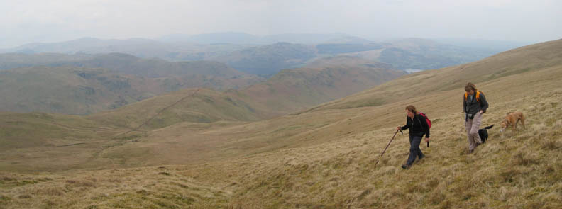
A further gradual rise up to Loadpot Hill. Part way up we cross the old Roman Road.
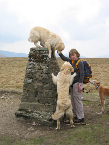
Just to prove that Harry is not the top dog in her family Megan ends up on the top of the pillar too.
Ann and myself at the ruins of Lowther House an old shooting lodge a short way below the summit of Loadpot Hill.
In Wainwrights day the tall chimney was still standing, but the ravages of time have taken their toll. See the "Previous time up here" pictures for a fuller explaination of these ruins.
Wether Hill is marked by a small cairn slightly off the highest point and from there we cut down the hillside towards the ridge of Steel Knotts below.
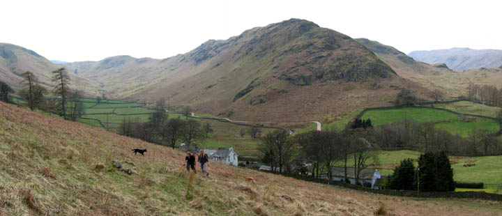
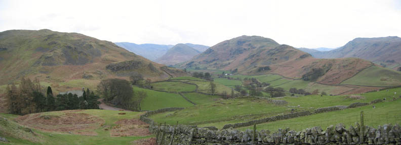
Jo and Ann looking back at the descent route, and at The Nab on the opposite side of Ramps Gill. High Street is the highest point of the ridge behind.
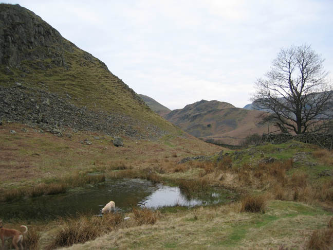
Lanty's Tarn, below Steel Knotts but still above the church. Fortunately the water was clean and the dogs emerged wet not muddy.
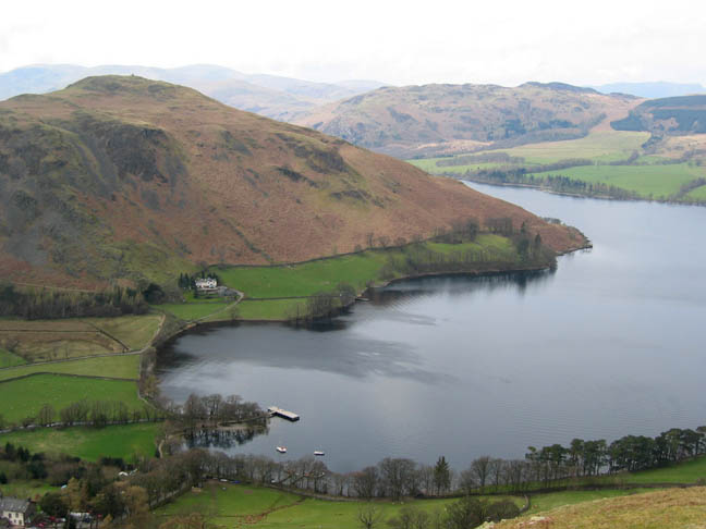
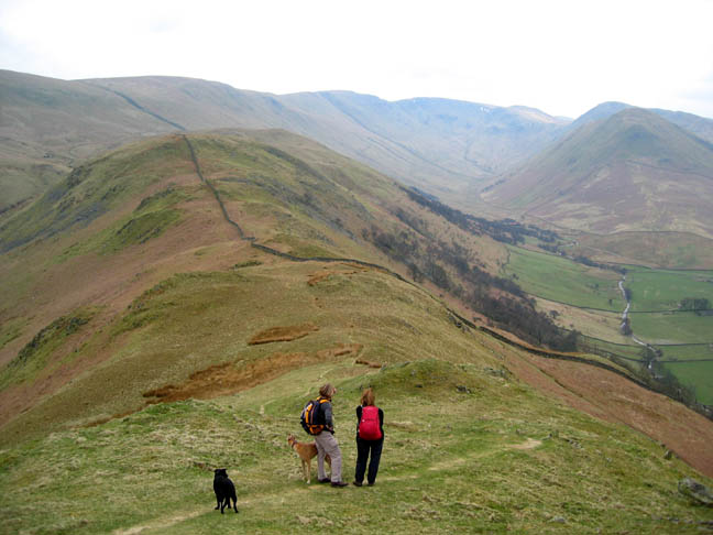
The clocks reverted to British Summer Time a few weeks back and the extra evening light, plus the fine weather, encourage us onward and upward to claim an extra summit for the walk, that of Hallin Fell. The Nab can be seen in the distance now, with the more prominent Beda Fell in the foreground.
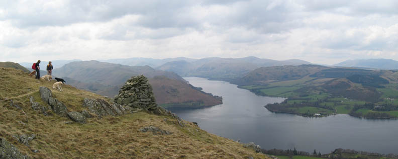
Our sixth summit of the day, Hallin Fell, with it's impressive square cairn. This is a popular fell with visitors as it is a relatively easy climb and rewards them with fine views of the lake both up in the Helvellyn direction, and here down towards Pooley Bridge.
Behind the cairn, Bonscale and Arthur's Pikes and we can view our day's walk more or less in one go.
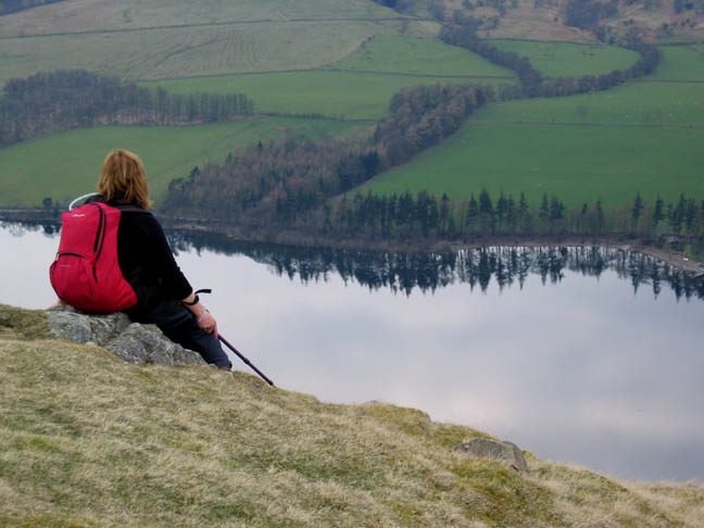
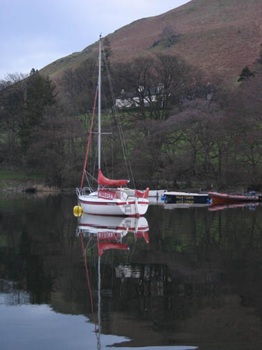
Time for a quite contemplation of the calm lake and to admire the reflections on the water, unruffled by wind or boat.
From the top we cut down to the lakeside at the point known as Geordie's Crag, the headland at the outer end of Howtown Bay. Click here or on the photo for a full panorama.
Back to the start, a short walk alongside the bay to the jetty.
|
- - - o o o - - - Technical note: Pictures taken with a Canon IXUS 400 Digital camera. Resized in Photoshop, and built up on a Dreamweaver web builder. This site best viewed . . . through the window of the Sun Inn at Pooley Bridge. Go to Top # © RmH # Email me here # Go to 2006 Archive Previous walk - 19th April 2006 Hen Comb and the lead mines with Jo Previous time up here - 11th October 2003 Howtown and Bonscale Fell
|