![]()

|
|
|
| Date & Time: 10th April 2006. 3 pm start. Location of Start : Bassenthwaite to Longlands Road near Orthwaite ( NY 252 338 ) Places visited : Burn Tod, Meal Fell and Great Cockup. Planned Walk details : 4.8 mls, 1500 ft of ascent. 2 hrs 30 mins. Actual Walk details : 5.9 mls, 2050 ft of ascent , 3 hrs 50 mins. Walked with : Ann and the two dogs. Weather : A sunny afternoon with high cloud approaching from the west. Ann making a quick get-away before I had even locked the car ! |
|
|
As an afternoon walk we planned a leisurely trip into two of the "Back of Skiddaw" fells, Great Cockup and Meal Fell. We started from the minor road behind Bassenthwaite Village and were expecting a two and a half hour walk. What happened during the walk became a cautionary tale for those who think they know where they are, think they know where they are going, and who also think their navigation is reasonably good. No great problems ensued as a result, but the extra hour of daylight was useful in order to complete the walk as planned. But I digress . . . .
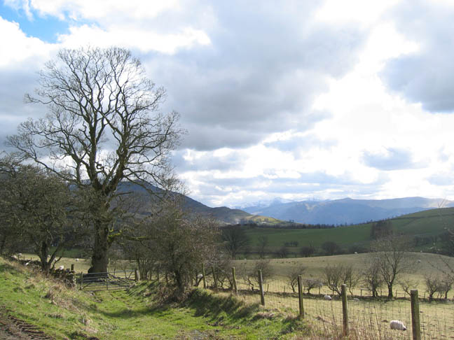
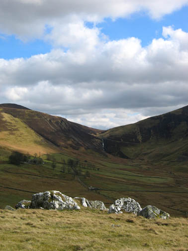
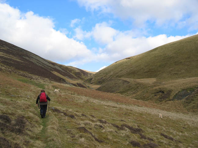
The North Western Fells from the farm track to Dash Farm We parked near Orthwaite and took the bridle way round the base of Great Cockup, heading east.
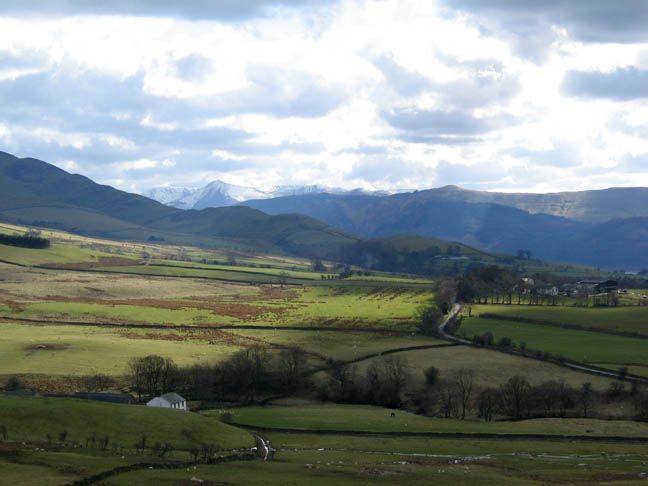
It was a great afternoon and the sunshine was shining on Bassenthwaite Lake. Our route was delightfully illuminated by the fast moving patches of light and shade caused by the passing clouds.
Brockle are the white quartz stoned crags on the hillside above Dash Farm which are prominently seen when viewed from the Cumbrian Way path to Dash Falls. Skiddaw had a fresh addition of snow from recent wintery showers but the sunshine had melted all but the last little bit from Bakestall summit.
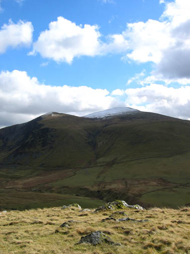
A slight but deliberate change of plan found us skirting Great Cockup in favour of a direct ascent of Meal Fell, returning by the former summit in order to give us a shorter, bog free route this late in the afternoon. This photo was about the time our (my) navigation started to go astray ! Meal fell was the rounded hillside behind Cockup. It had a steep south-west facing slope and a river flowing to it's source at it's right hand side. Simple! Go for it . . . . !
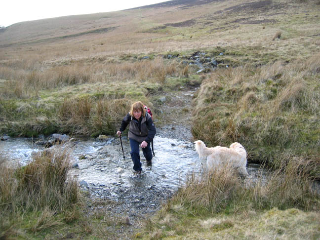
A river crossing was not out of order and fortunately it was shallow enough to wade through. I took it that this was the stream coming down Trusmadoor valley.
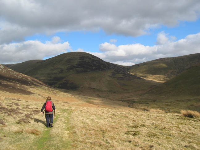
We proceeded up the path on the map and followed Burn Tod Gill up towards its head and then struck up the slope to the summit.
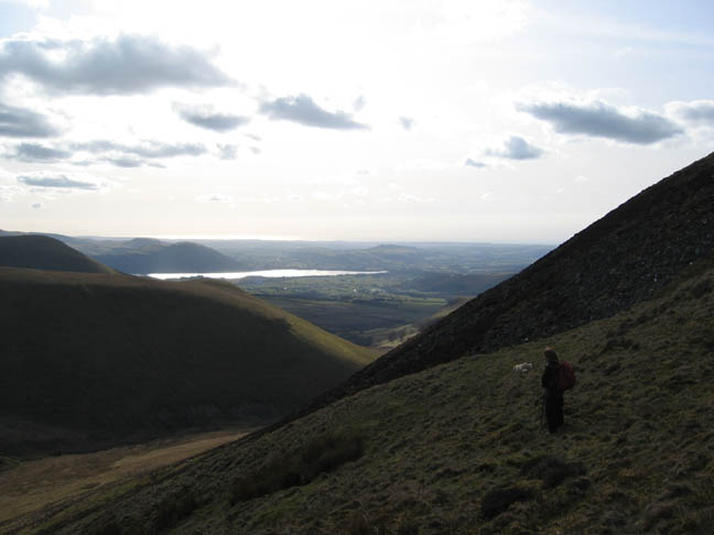
It did seem a bit steep and a bit further than we planned but it tied in with the map, more or less. No worries - it was giving us great views, both down the valley towards Bassenthwaite . . .
and now across the valley to Great Calver. Behind a snowy Foule Crag (protector of Sharp Edge) on the northern end of the Blencathra Ridge.
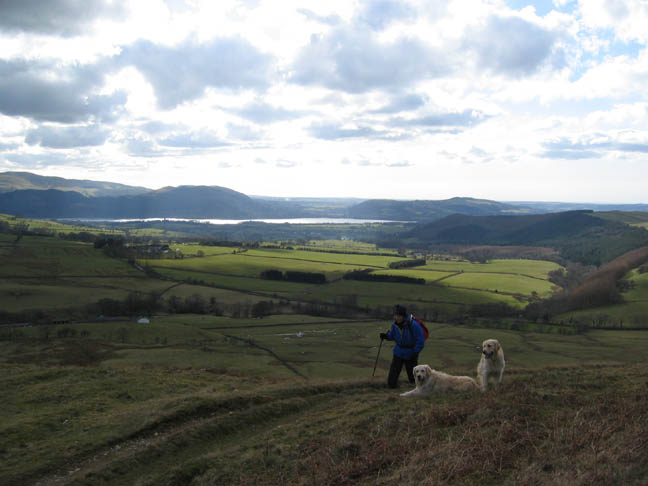
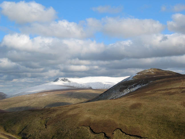
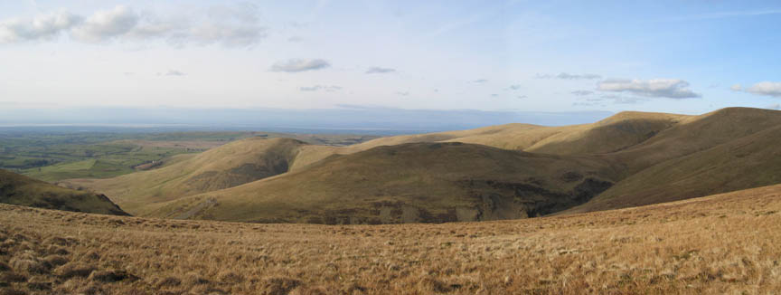
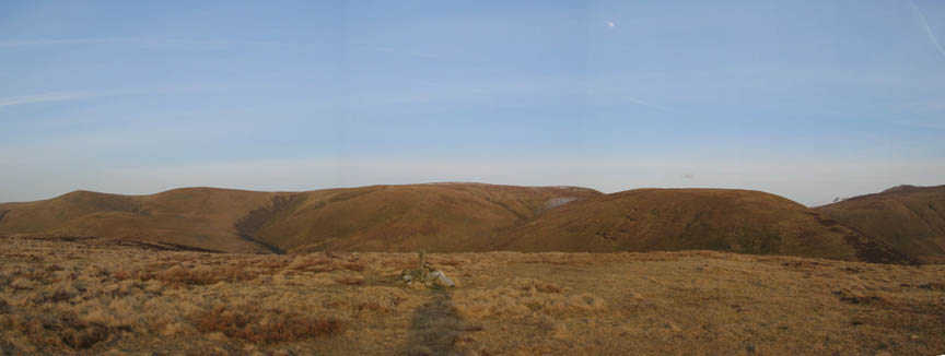
Across the valley was an ever increasing panorama of the Skiddaw fells - delightful.
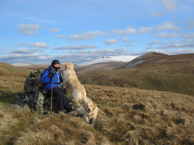
Ann on the summit. The wind was a little cold but the problem was the summit didn't look quite as it should.
There was a great panorama north too, Great Sca Fell, Little Sca Fell, Lowthwaite and Longlands Fells Unfortunately there was one in the foreground - Meal Fell - and if that was Meal Fell then where were we ? Out came the compass to take a three point bearing on our position. Two made sense, the other one didn't. It was really surprising how quickly my hands got very cold, and how frustrated I got just trying to identify landmarks and take bearings. I tried to get the compass to agree with where I thought I was rather than let the compass bearings tell me where they thought I was. We knew Great cockup was right and a more meaningful look at the map told me we were on Burn Tod - oops !!
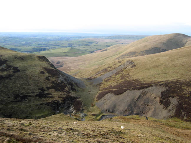
Still it was a nice afternoon . . . . so we cut down to the valley and found we were looking on the properly DRY valley of Trusmadoor. Burn Tod Gill was below us in this valley. We had been following Hause Gill.
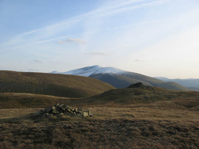
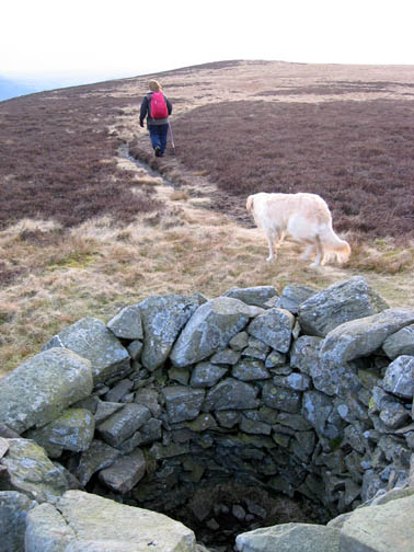
Back on track and up to Meal Fell summit. Joint honours for the highest point go to the cairn and the distant stone shelter.
Top honours for somewhere to get out of the breeze, however, went to the shelter so we stopped a short while for some light refreshments.
It just remained to walk as planned over to Great Cockup viewed here from the shelter walls on Meal Fell.
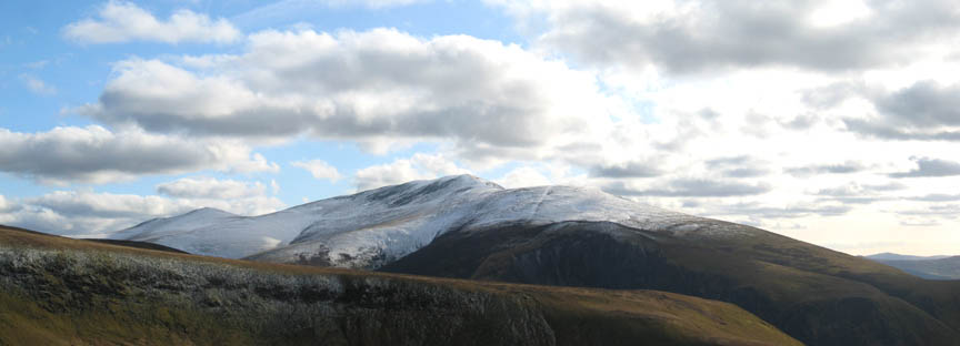
Looking back from Great Cockup (l to r): Little and Great Sca Fell, Knott, recently visited Burn Tod, with snowy Foule Crag just showing behind the slopes of Great Calva.
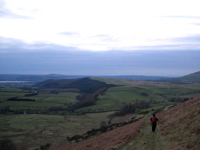
Back down on the original bridle way again as the evening light was closing in. The extra hour of summer daylight had meant we had time to complete our target of the two fells before we returned home.
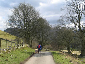
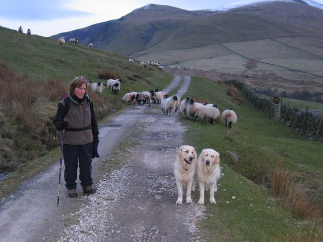
Ann and the two dogs and some sheep. She was looking more worried than they were, that we were being followed as we walked back to the car. The unplanned diversion cost us an extra mile, and an extra 550 feet of ascent, but it was a delightful walk nevertheless.
|
- - - o o o - - - Technical note: Pictures taken with a Canon IXUS 400 Digital camera. Resized in Photoshop, and built up on a Dreamweaver web builder. This site best viewed with . . . the brain engaged properly when studying the map ! Go to Top # © RmH # Email me here # Go to 2006 Archive Previous walk - 8th April 2006 Loweswater ~ Greys and Blues - with Gareth and Helen Previous time up here - 30th July 2000 - Sorry pictures are not on-line.
|