
|
|
|
| Date & Time: Saturday 4th March 2006, 12 noon start. Location of Start : Stonethwaite in Borrowdale, Cumbria, Uk. (NY 262 137 ) Places visited : A walk to Eagle Crag, Sergeant's Crag, High Raise, and back via Greenup Edge, Ullscarf and Dock Tarn. Walk details : 8.7 mls, 2,900 ft of ascent, 6.5 hrs. Walked with : Ann and the dogs. Weather : Beautifully sunny, cold winter's day but with one sharp wintry shower towards the end of the afternoon. |
|
|
This period of wonderful wintry weather was lasting well and so we planned another walk, this time in upper Borrowdale, to High Raise to be exact. A snow shower during the night had cast doubt on whether Honister pass would be open to traffic so we cut our losses and diverted round Whinlatter Pass, Derwent Water and Grange. It was further but it would have lost lots of valuable walking time if we had gone up via Buttermere and then found it shut.
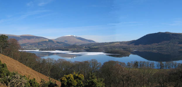
As it was we were well rewarded for our decision, as the view of the partially frozen Derwent Water was worth the extra diversion. The overnight snow had settled on the floating ice making it particularly white in appearance.
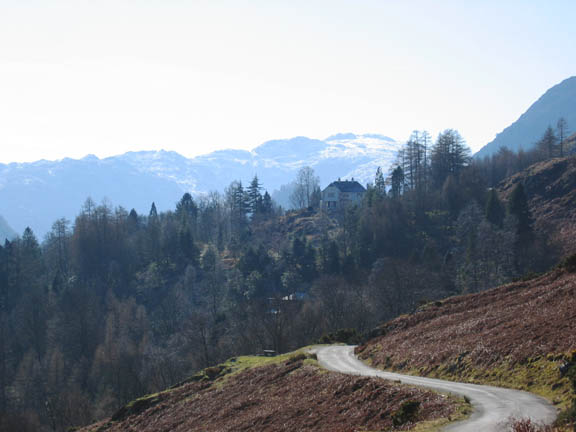
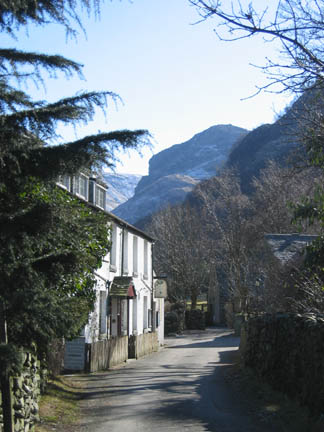
As we took the road around Catbells, Fellside House looked almost Tyrolean against its snowy background. Once over the bridge at Grange we drove up through Rosthwaite and into the Stonethwaite Valley
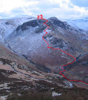
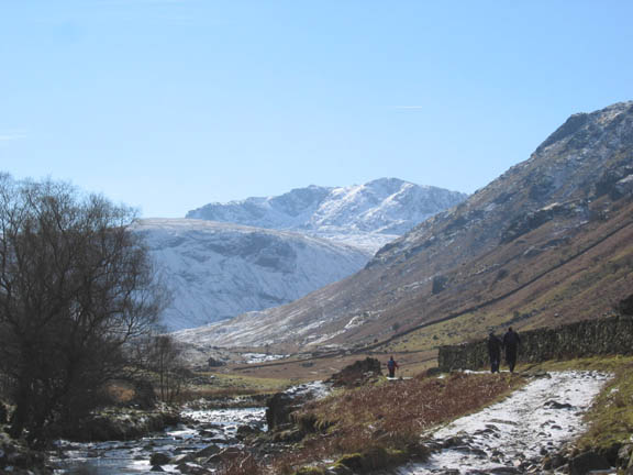
Bowfell, from the start of the Langstrath Valley. We crossed over the first bridge and set off diagonally up the face of Eagle Crag on the opposite side.
High Crag would be our last minor peak at the end of the walk. The final part of our route followed the pitched path down through the trees on the left. It would be after sunset by the time we got there.
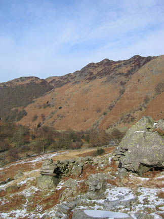
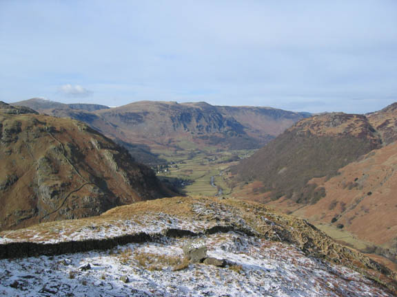
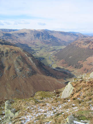
The grassy plateau above the first set of crags on Eagle Crag. As we climbed, we looked down on Upper Borrowdale and Castle Crag (hidden in the trees below the far ridge)
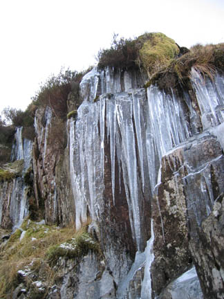
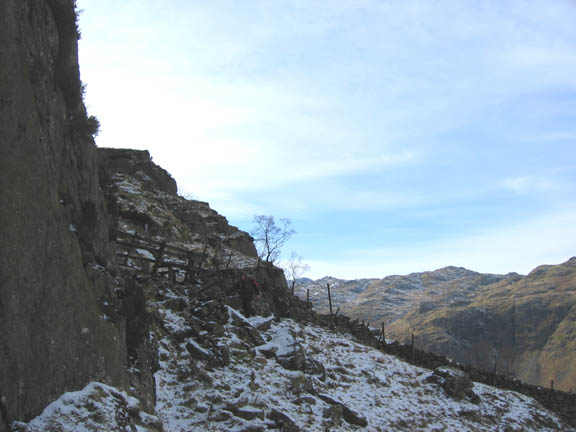
The short wooden fence and its stile, locating this is the crux of this climb. From here the route almost took care of itself as we zig-zags upward through the rocks.
The final grassy scramble to the top.
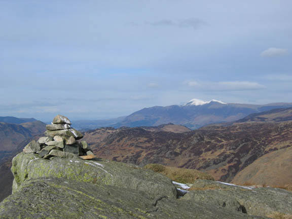
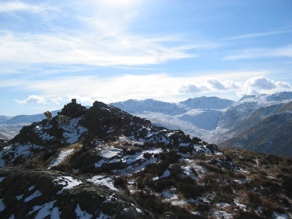
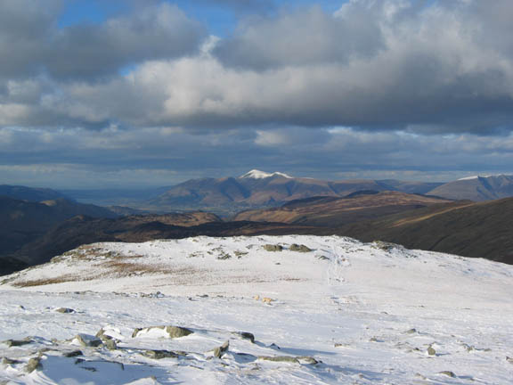
Topping out on Eagle Crag, with the snow covered peak of Skiddaw in the distance.
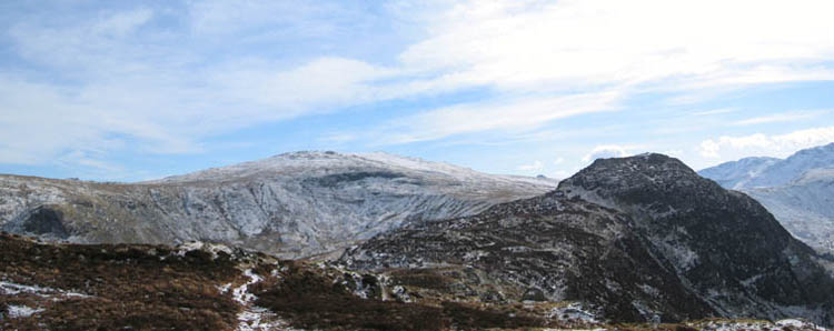
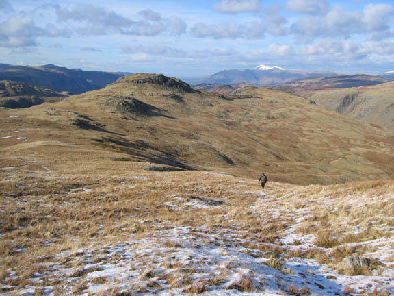
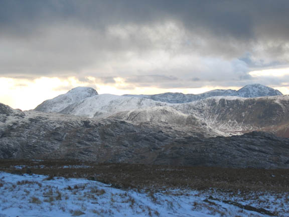
Turning around we had a glorious panorama of the high fells ahead of us. High Raise was our target, Sergeant's Crag is the darker peak in the foreground.
The snow on the high fells was pristine in its whiteness. We were above the snow line here too, but the amount of snow was not enough to cover the long tussock grass and heather on our ridge walk. The sunshine was melting the snow on the south facing slopes, so Glaramara opposite took on a striped appearance due to its undulating structure.
Making our way to Sergeant's Crag. More of the distant high fells became visible as we walked the ridge from Eagle Crag.
Harry and Bethan, first as ever to the summit, this time of Sergeant's Crag.
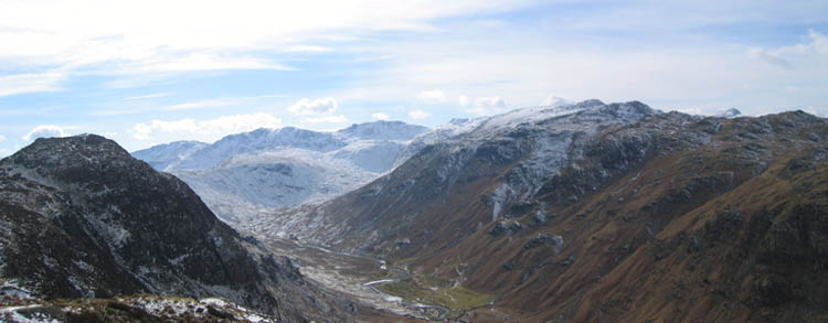
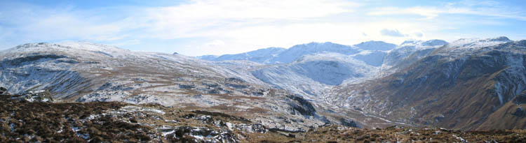
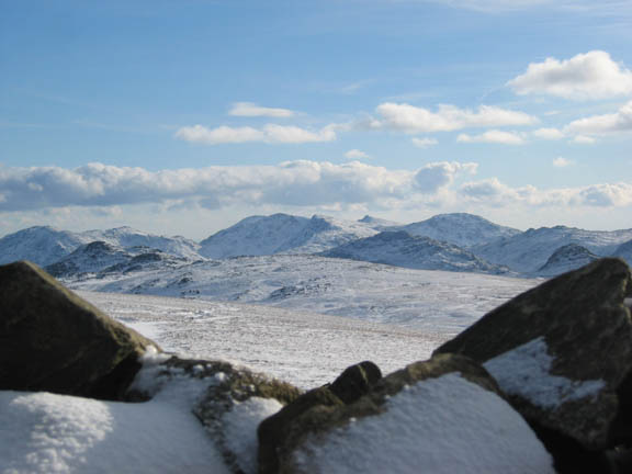
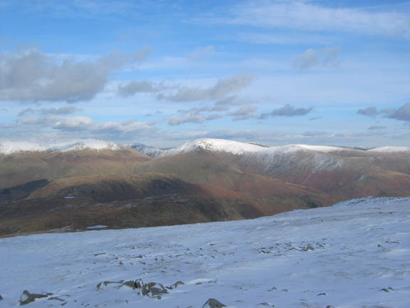
Our new panorama High Raise, Pike o' Stickle, Crinkles, Bowfell, Rossett Pike, Esk Pike and the Scafells.
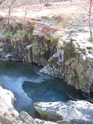
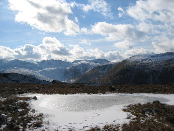
A minor frozen tarn along the way. Great End and the pointed top of Ill Crag are the highest peaks in the distance.
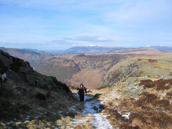
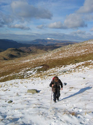
Ann climbing towards High Raise.
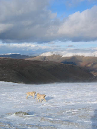
Entering the deeper snow, treading in my footsteps as this section was rather icy.
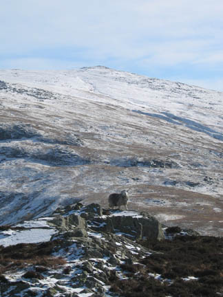
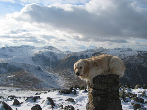
Top Dog - top climber - he couldn't go any higher today. Is he really happy, or just totally confused as to where he found himself - on top of the trig point !
The summit shelter on High Raise, quite large but with rather low walls, and a full layer of snow inside.
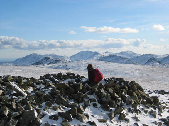
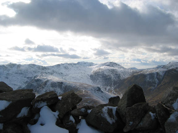
The Coniston Fells from the shelter - Wetherlam, Coniston Old Man, Brim Fell, Swirls, and Grey Friar. In front of them, Pike o' Blisco, Cold Fell, Harrison Stickle, and maybe even Sergeant's Man on the left.
Scafell Pike just tops out above Esk Pike from this higher vantage point. So much snow - so little time to play.
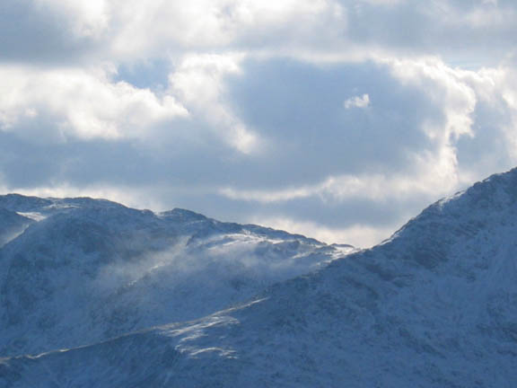
It looks delightful but beware . . . There are high winds up there, blowing the fine snow off Three Tarns and across the Band.
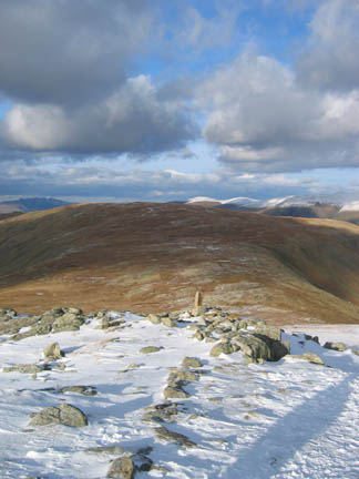
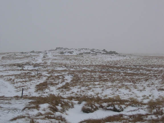
Time to go. High Raise is also known as High White Stones on the map. Ahead are the rocks known as Low White Stones. We make for the cairn following several sets of footprints as the path is well hidden.
Dollywagon Pike and Fairfield with St Sunday Crag behind. Partially in the shade and without snow are Steel Fell and Helm Crag, where we walked last week with the OFC
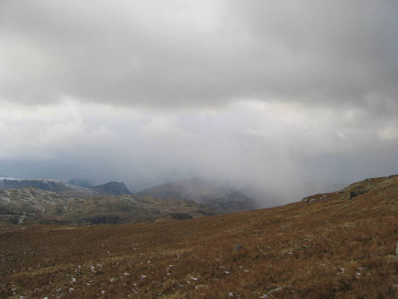
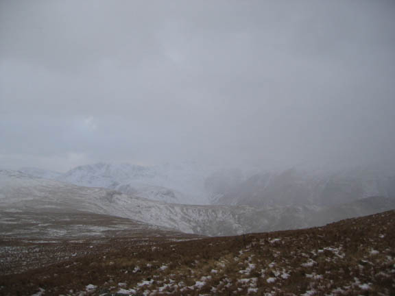
The wind was starting to get a little stronger. For us too the spindrift snow was being blown across the surface. To the west the clouds were getting thicker and it looked more and more wintry.
A snow shower was fast approaching from the west. Dale Head had disappeared, Honister was next and we were not far behind.
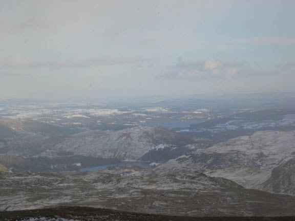
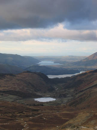
Grasmere and distant Windermere just as our visibility started to deteriorate.
The high fells are engulfed in the snow cloud. Time for waterproof outer garments and to pull the hat down a bit tighter.
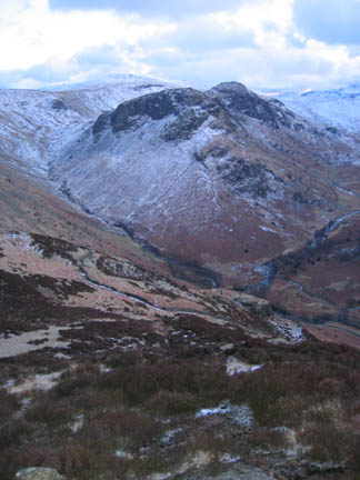
Ullscarf - we didn't get a view from here last time we were up in October '99 either, so my good lady informs me !
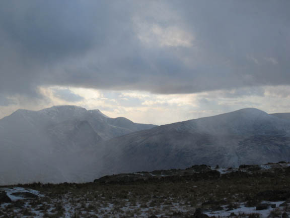
After the storm, the sky cleared as quickly as it had filled but there was a definite evening feel to the light now.
Gable Green Gable, Brandreth and Pillar behind in a slightly erie yellowish 'sunset' sort of light.
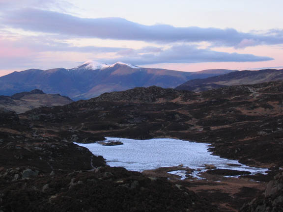
Frozen and snow covered Dock Tarn from High Crag.
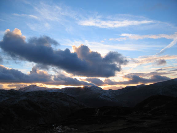
Sunset over the western Fells. Time to take the path down through the trees, back to Stonethwaite, before we lost the last of the daylight.
|
- - - o o o - - - Technical note: Pictures taken with a Canon IXUS 400 Digital camera. Resized in Photoshop, and built up on a Dreamweaver web builder. This site best viewed with . . . a pint in one hand, a menu in the other, plus some local currency at the Langstrath Hotel. Go to Top # © RmH # Email me here # Go to 2006 Archive Previous walk - 2nd March 2006 Dale Head, Hindscarth and Robinson Previous time up here - 15th August 2003 Eagle Crag in Langstrath with the Batchelors
|