
|
|
|
| Date & Time: Thursday 2nd March 2006. 11.30 am start. Location of Start : Honister NT car park. ( NY 225 135 ) Places visited : A walk to Dale Head, Hindscarth and Robinson, ending at Buttermere Village. Walk details : 6.1 mls, 2,360 ft of ascent 3,140 ft of descent, 4.5 hrs. Walked with : Ann and the dogs. Weather : Blue skies, little fluffy clouds, maximum visibility - brilliant ! |
|
|
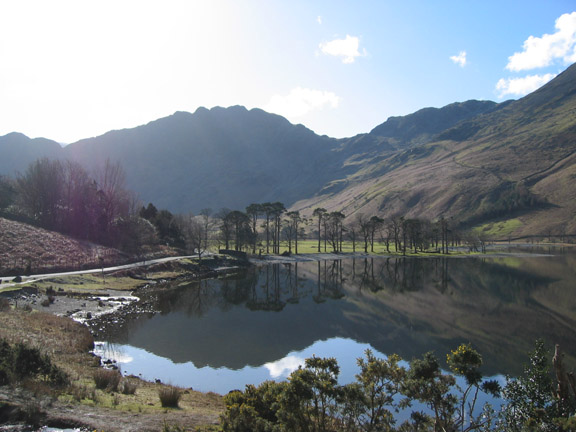
A brilliant weather day deserves a walk that incorporates the finest of views - now where shall we go ? Lets make a start with a drive up to Honister, and we'll pass the Buttermere Pines on the way.
Well that worked - now to keep up the standard of the views for the rest of the day . . . .
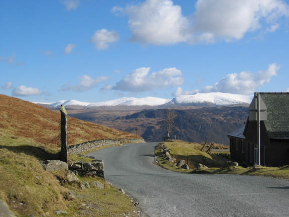
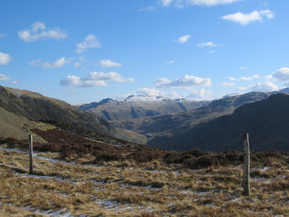
Our walk (which we did actually plan before we left the house) started at the top of Honister. As we rounded the top of the pass we were greeted by this fine view of the Helvellyn Ridge. We parked behind the hostel and made our way up towards Dale Head.
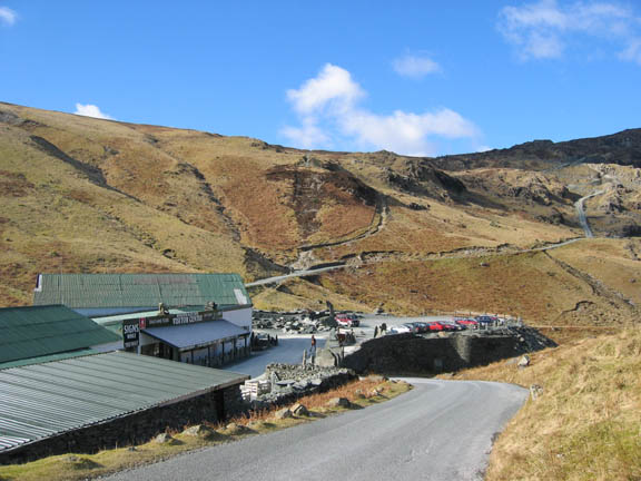
This is the Mine Shop and headquarters of Honister Slate. It was the start point for our walk last November when we climbed Gable for Remembrance Day.
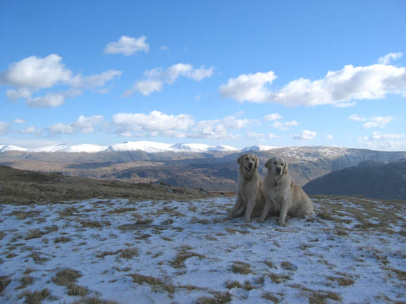
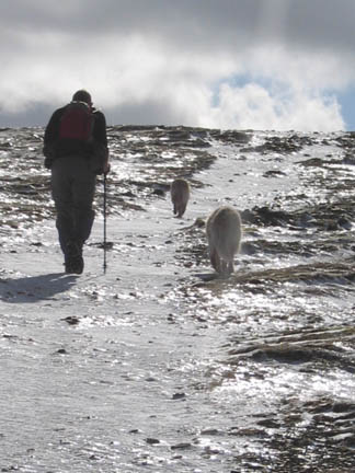
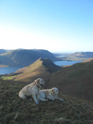
A passing cloud meant the dogs were in the shade, but I did managed to stop them running about, just for a second, to capture the photo.
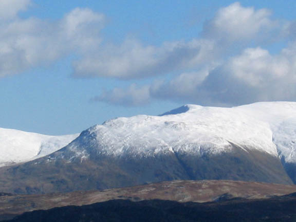
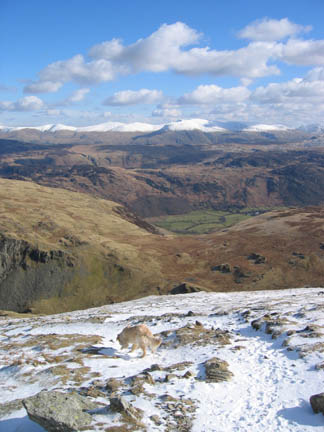
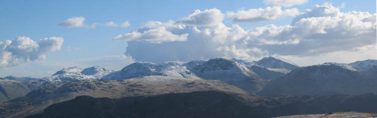
Zooming in behind them for a view of Helvellyn and Brown Cove Crags. The highest point of Helvellyn reaches over 3,100 feet and has had consistent snow for some time now.
Continuing our climb, we leave the steeper first section and continued the steady pull to the top. Ann pictured here with Allen Crags, Esk Pike, Bowfell and Great End in the background.
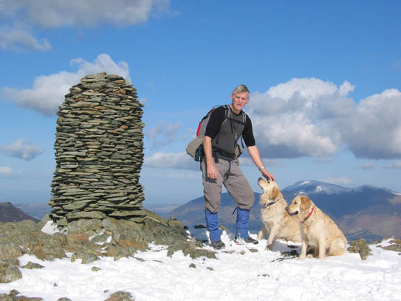
Ann's picture of me on Dale Head Summit, just to show I was really there. Now we had found the views we had set out to get. Click here or on the picture for the full 360 degree panorama
Time enough today to sit and soak up the view. Hardly a breath of air to chill the warm sunshine.
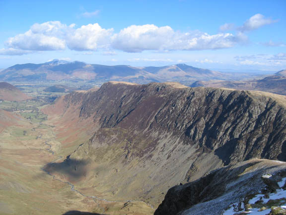
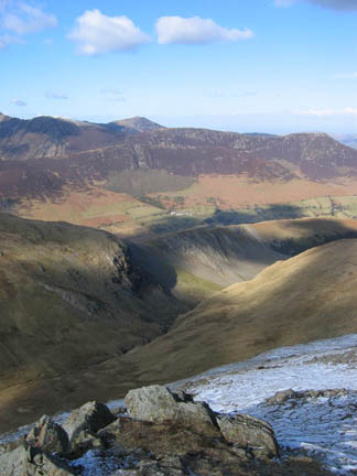
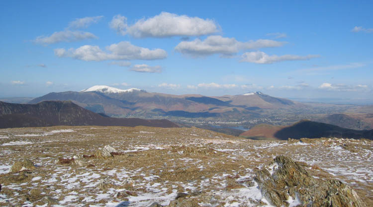
Looking down on the Catbells, High Spy, Maiden Moor ridge with distant views of Skiddaw, Blencathra and the white tops of the Pennines.
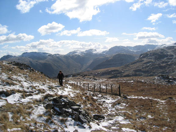
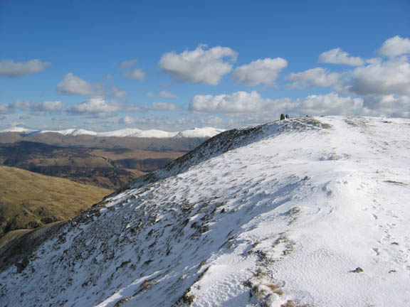
A brief excursion east to the viewpoint down towards Dale Head Tarn, and then back to the top. Our route would take us along the snow covered ridge ahead towards Hindscarth.
The fine summit cairn with Helvellyn behind.
Leaving the top. The deepest snow was on Dale Head summit but it hardly covered the boots, it was however extremely dry and fine. The hidden danger lay underneath, as we had to be aware of patches of ice where any surface water had frozen on the paths.
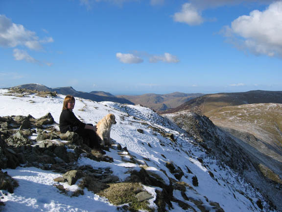
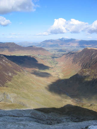
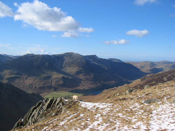
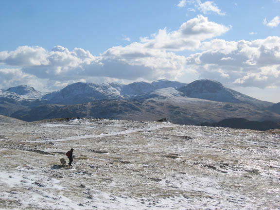
Bethan returns from a rock outcrop after taking in the view of the Buttermere Valley and the High Stile Ridge.
Another high passing cloud puts the face of Dale Head into shade and drops the apparent temperature by several degrees. This reinforced the fact that the temperature, despite the sun, was definitely below freezing up at this height.
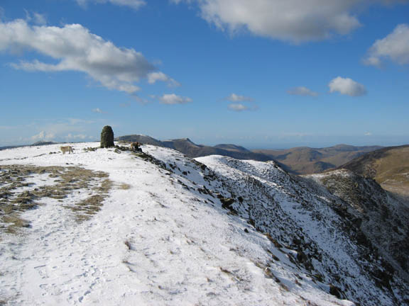
Hindscarth summit was an easy traverse along the ridge from Dale Head. The best view was from here, the lower northerly summit. The stone wind shelter was not needed today.
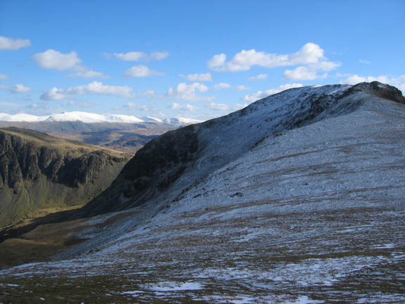
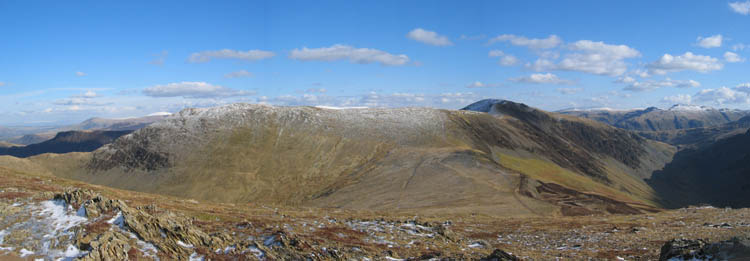
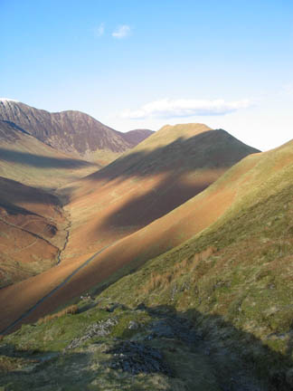
Esk Pike, Great End, the Scafells and Great Gable dominate the background. After leaving the flatter top of Hindscarth we headed back to continue the ridge walk to Buttermere. A deviation to the right took us from the main path down the slightly steeper gradient direct to the hause between Hindscarth and Robinson.
Looking back at Hindscarth and Dale Head from the ascent of Robinson.
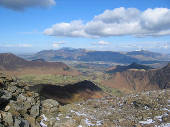
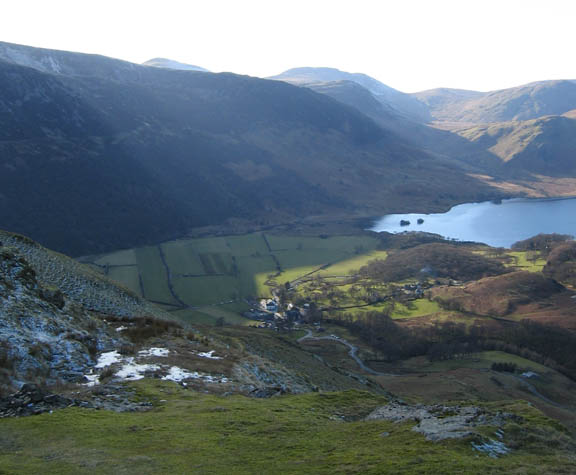
A closer view of Honister Hause and the Slate Mines with a large sprinkling of snow on Glaramara behind.
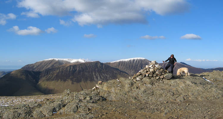
Robinson Summit cairn with the north western fells behind. Grasmoor and Eel Crag with the snow, Wandope in front, and Grisedale Pike behind Ann.
Another short walk north along the summit of Robinson this time. A flatter top but with similar views, this time over the top of Causey Pike to Skiddaw, and over Derwent Water to Blencathra.
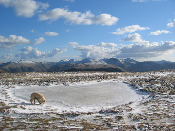
A frozen summit tarn on Robinson. Harry sensibly avoiding the ice, or perhaps wondering why he couldn't find the water for a swim.
A close up of that mountainous backdrop further enhanced by the slowly changing cloud formations above.
A virtually cloudless sky here as we left the distinctive twin peaked summit of Robinson.
The view ahead - Rannerdale Knotts, Crummock and Loweswater. as we descended to High Snockrigg (the dark foreground beyond the immediate ridge).
A wider shot of Robinson over Buttermere Moss from Snockrigg, with little hint of the snow we left behind Normally crossing the Moss would have been a wet walk, but the cold weather had frozen the ground sufficiently to make the going firm and virtually dry.
And so to journeys end at Buttermere, bathed in the last of the valley sunshine. It just remained to travel up and fetch the other car. Pity the Honister Rambler doesn't run in winter.
|
- - - o o o - - - Technical note: Pictures taken with a Canon IXUS 400 Digital camera. Resized in Photoshop, and built up on a Dreamweaver web builder. This site best viewed with . . . the keys to the second car safely tucked away before we left the first. Go to Top # © RmH # Email me here # Go to 2006 Archive Previous walk - 27th February 2006 The Steel Fell to Helm Crag Horseshoe Previous time up here - 16th August 2003 Dale Head with the Batchelors and the OFC
|