Retreat to the quiet of the Western Lakes
|
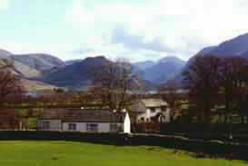
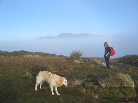
Date : 22nd November 2005, 10.30 start from Uzzicar in the Newlands Valley, Cumbria, UK. Location : Causey Pike, Scar Grags, Sail and Crag Fell / Eel Crags. Occasion : A very special walk above the clouds. Ann, myself, and the dogs Harry and Bethan. Walk details : 6.5 hrs, 6.8 miles, 3,250 ft of ascent, ending in the dark after a big day out. Weather : Cold grey and miserable in the valleys but with the prospect of clear tops of the fells. A grey start near Braithwaite |
 |
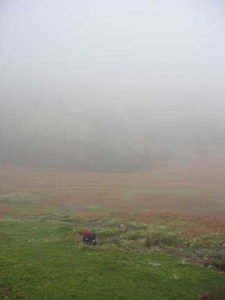
We set off in the mist and low cloud associated with a cold damp day in the Lakes. It was grey and the slight mist and cold felt that it might penetrate to the skin given half a chance. The forecast was good though. A cold day with valley mist hanging on for a time but clear on the tops.
 |
 |
Our climb up from Stoneycroft farm did little to encourage us as we climbed into the mist that was cloaking the fells above us.
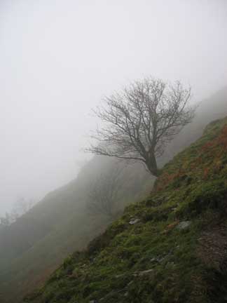
The tree looked nice though !
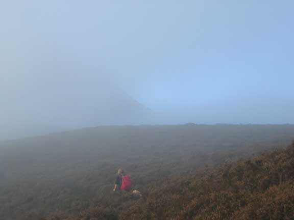
As we topped out on Rowling End, however, the grey was steadily taking on a blue tint and visibility was improving.
 |
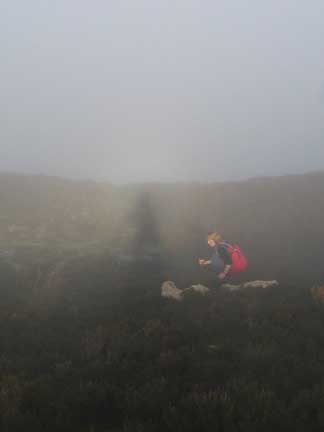 |
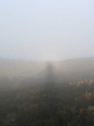
A Broken Spectre needs a combination of factors to achieve its full impact. The sun needs to be behind you and your shadow needs thick mist in front on which to fall. This one whilst not spectacular was, nevertheless, sufficiently strong to create the desired effect. Ann and the dogs were passing as I took the second shot.
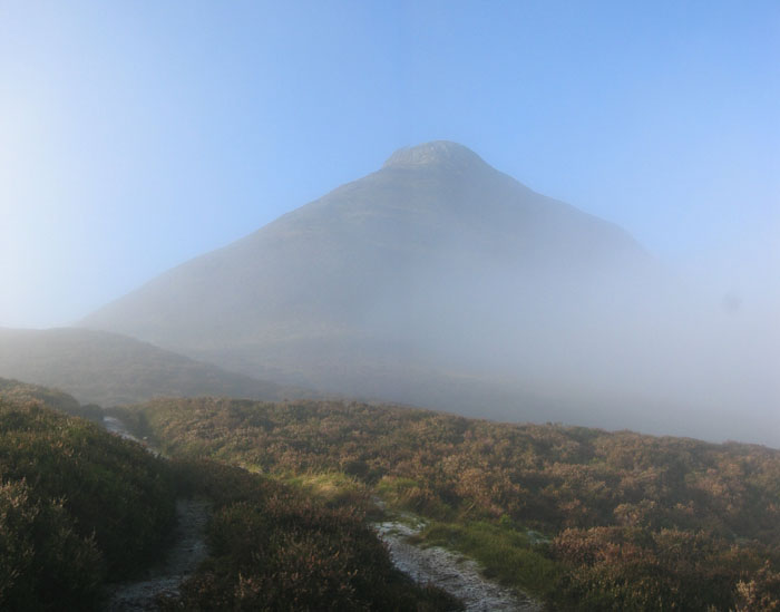
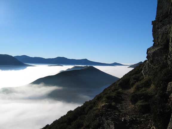
Morning Glory - Causey Pike makes a surreal appearance out of the mist.
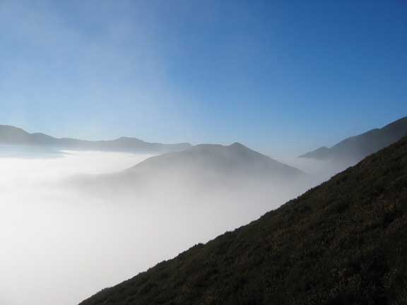
The forecast was coming true. The temperature inversion was holding and the surrounding hill tops revealed themselves as we climbed out of the layer of valley mist.
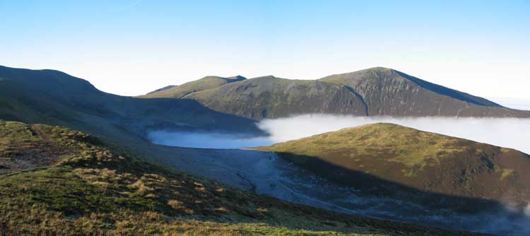
Click here or on picture for a fuller panorama from above Rowling End.
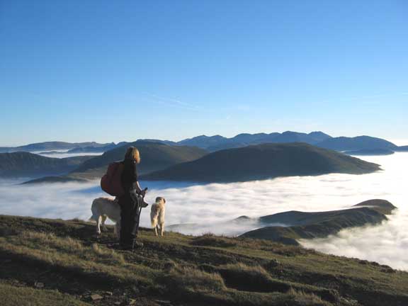
Ards Crag and distant High Stile from the ascent of Causey Pike.
Near the top of Causey we stopped yet again to view the spectacular cloud scene.
There seemed to be a thin secondary layer of clouds holding position above the thicker valley mist.
For those lucky enough to climb Catbells at just the right time, there would have been an amazing view, as its summit just showed above the clouds for a twenty minutes or so.
Behind is High Seat, and Helvellyn with the triangular summit of Catsyecam.
The final rock scramble up the knobbly bit of Causey Pike summit
was not made any easier by the distraction of the fine views all around.
At the top of Causey Pike, looking west.
Click here or on picture for a full panorama from Causey Pike
 |
 |
The Pennines and Great Mell Fell |
Lords Seat above a hidden Bassenthwaite Lake |
Stunning views, click here for the video panorama
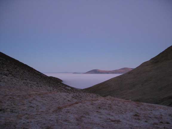
Looking north this time, the mist had penetrated up Coledale Valley. Below us the shadow of Causey Pike on Outerside meant that the frost of the last few days had not been able to clear from the area infront, known as High Moss.
The fells behind are Hopegill Head and Grisedale Pike to the right.
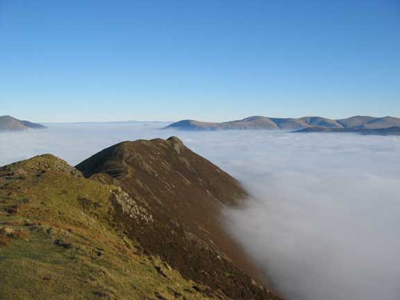
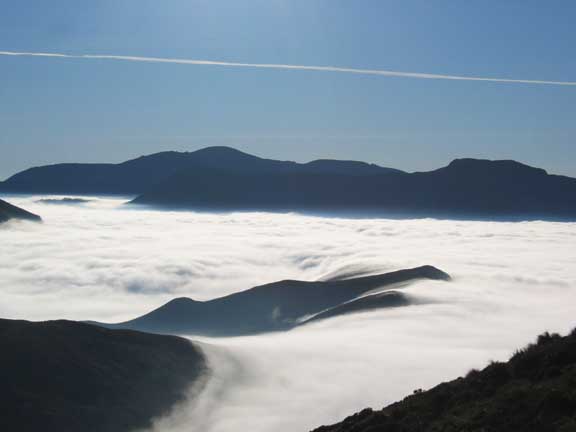
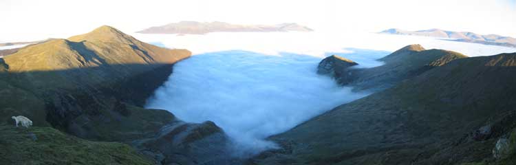
Looking back over a sea of mist
as we left the familiar shape of Causey Pike below us.
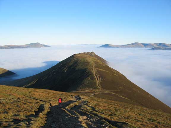
Climbing Sail Fell, the distant hills looked like islands in the mist.
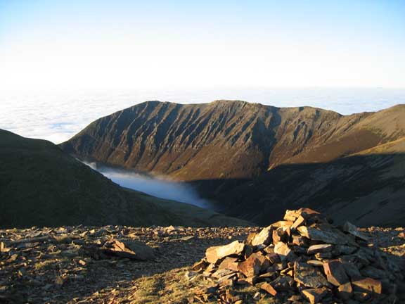
Buttermere with the slopes of Robinson, the rough outline of the top of Haystacks and the bulk of Kirk Fell on the left.
To the right, Pillar and High Crag, with Black Comb way in the distance through the gap in the middle.
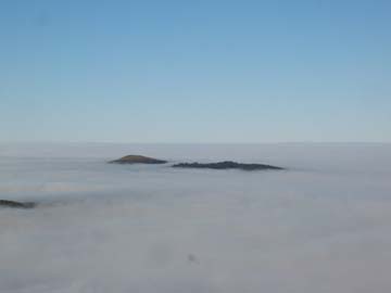
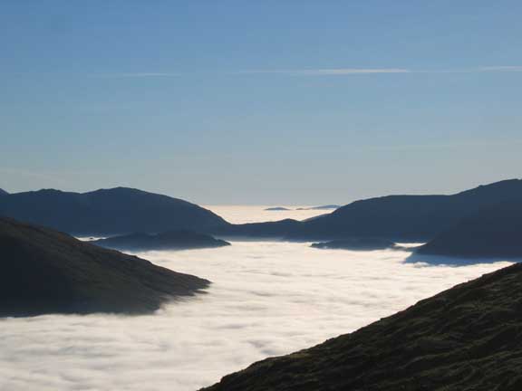
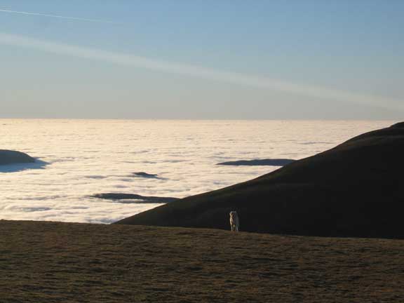
The cloud was not actually stationary. As the day progressed some of the marginal peaks appeared and disappeared from view. This made identification of some of them a more challenging task than normal.
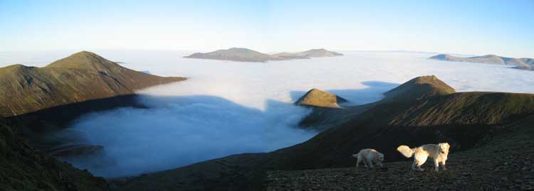
Swirling mists as the cloud rolls around Knott Rigg.
Newlands Pass is down there somewhere to the left and behind the Rigg.
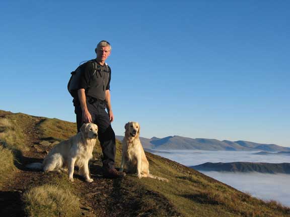
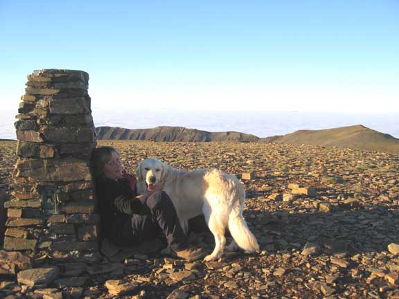
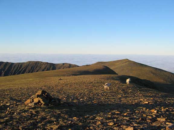
Me and them on Sail
Helvellyn in the Background.
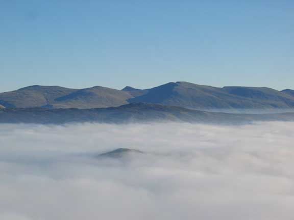
The view of Skiddaw from Crag Hill.
The peaks cast ever lengthening afternoon shadows on the cloud below.
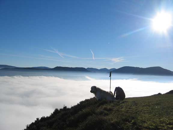
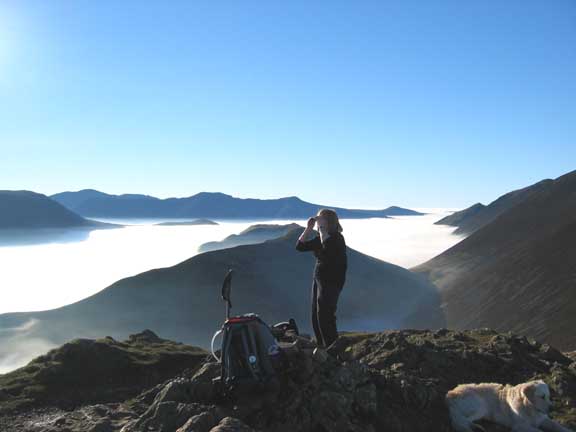
Ann rests with Harry by the trig point on Crag Hill and enjoys the view for a short while.
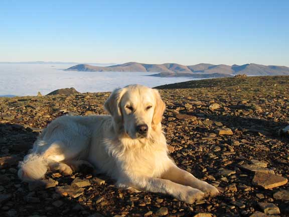
Handsome Lad sits and soaks up the sunshine . . .
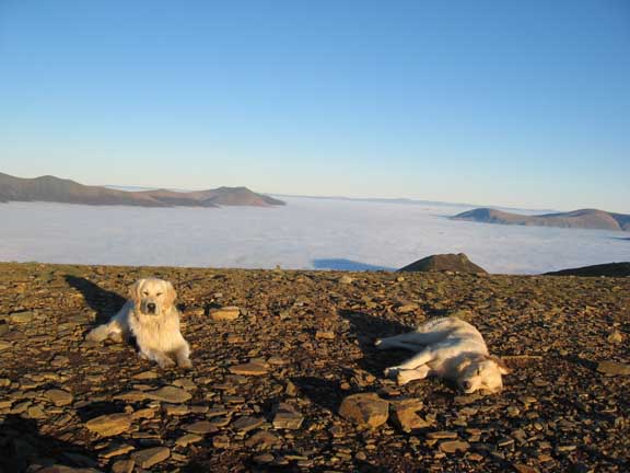
whilst the younger Bethan crashes out for a well earned dog-nap
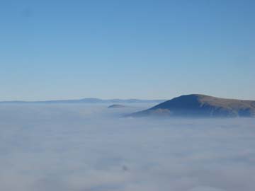
Looking south from Crag Fell.
Name the fells . . .not always as easy as you think. Great Bourne is definitely the one to the left, and presumably the others were Mellbreak, the top of Hen Comb and therefore the long thin one is Gavel. The other Loweswater Fells were hidden behind the mass of Grasmoor to the right.
We then set of north across the summit and towards the Eel Crag end of the fell.
Ahead was Hopegill Head and, yes, Criffel just standing proud of the mist which surrounded us on every side.
Whiteside and Gasgale Crags in the afternoon sun.
One attractive suggestion was to drop down here, back to the cottage, but we'd have to go and fetch the car later which wasn't quite so attractive.
So we planned our (rather long) exit from the hills . . . .
down into the Coledale Valley and back via the Outerside miners track.
The rough decent from Eel Crags brought us down to Coledale Hause.
 |
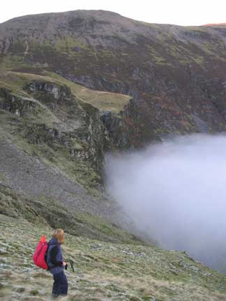 |
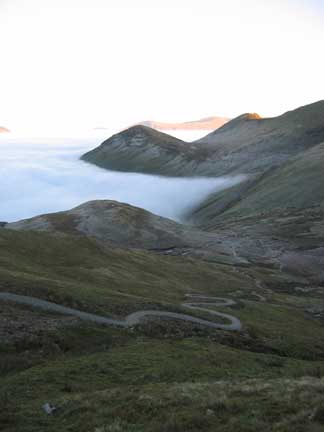
The engineered path down from the Hause made the initial part of this route problem free, but the off-path section above the mist, skirting round to the 'V' between Outerside and Causey was made more difficult by the heavy hoar-frost, as this area hadn't seen the sun all day.
Ann is looking down on what should be the Coledale Mine Buildings, as the sea of mist swirls around Force Crags.
A final shot as the light fades
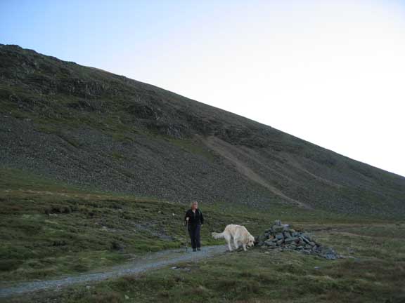
as we join the miners track alongside Outerside and back down to Stoneycroft and the waiting car.
The walk still took another half our or more, and was completed in darkness. The walk back from Eel Crags had taken longer than expected. At least the route was clear and navigation was no problem.
Technical note: Pictures taken with a Canon IXUS 400 Digital camera.
Resized in Photoshop, and built up on a Dreamweaver web builder.
This site best viewed . . . with variations of light and shade. (sunglasses and a torch !!!)
Go to Top . . . Home page . . . Go To Archive 2005
© RmH . . . Email me here