Retreat to the quiet of the Western Lakes
|
Date : Tuesday 13th July 2004. 12.30 start. Place : High Stile Ridge, Buttermere Fells. Occasion : A walk with Ann and the dogs Walk details : Buttermere village to Scale Force then up onto Red Pike, High Stile and High Crag before returning via the lakeside. 9.1 miles, 3440 feet of ascent, 7 hrs including lunch, and a beer at the Bridge Hotel. Weather : Excellent to start, a blue sky and a cool breeze. Great walking conditions, but turning overcast as the day progressed. |
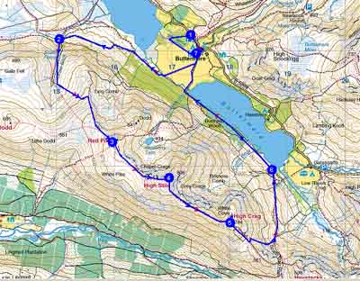 |
Today was forecasted a good day for weather so we set out with the intention to walk the Newlands Round. As we drove past Crummock the High Stile Ridge looked so inviting that we changed plans and checking that we had the right map, parked up in Buttermere Trust car park and set off on a rather different "round".
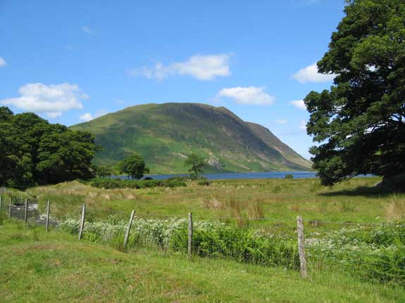
Instead of walking through the village we set off through Long How woods down the valley towards the top end of Crummock (where we had this fine view of Melbreak) and then we turned left and made our way upstream towards the Fish Hotel.
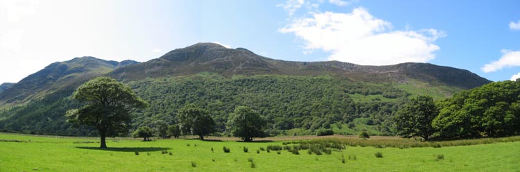
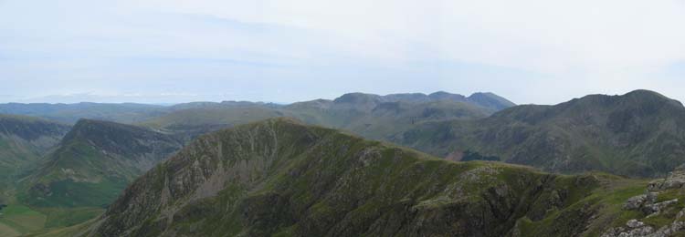
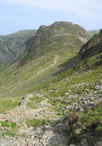
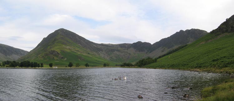
A panorama of our intended route for the day . . . viewed here from the Buttermere meadows.
Our walk was from right to left taking in Ling Comb Edge, Red Pike, High Stile and High Crag.

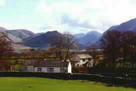
Summer has arrived and the Syke Farm campsite has started to fill up.
This is a delightful site with a good measure of level ground, a nice stream, and two pubs not far away !
 |
 |
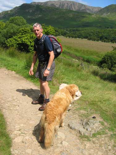
From the village we crossed the valley towards Scale Bridge and seizing a photo opportunity I carefully moved towards the river bank to get a view of Ann and the dogs crossing the bridge. Well that was the plan.
In order to remove unwanted foreground and to see where Ann had got to I leaned just that little bit too close to the edge and found myself adopting that King Arthur and Excalibur pose, you know the one with the sword rising out of the water, but in my case it was a camera held high ! (full marks for presence of mind if not style)
Still it was a fine day and once I had climbed out and wrung my clothes out I was fine. The rucksack contents were dry, the dog treats soggy but I think you will agree that the photo was worth it . . . NOT ! . . . (please note - genuine splash mark on lens)
Still back to the walk - Ann on the way to Scale Force.
Hawthorn Trees and the beauty of Grasmoor in perfect sunshine.
 |
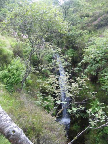 |
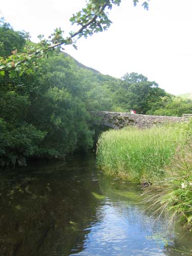
It never ceases to amaze how red the path is at Scale Force. An intrusion of iron rich rock to the left of the falls, the same rock that gives Ruddy Beck and Red Pike their names, breaks surface here and numerous footsteps carry the colour along the local paths for quite some way.
After checking out the falls, we took the left hand route up alongside the ravine, and the second picture is of the top cataract. The main waterfall is so deep in its cleft of rock that it could only be heard and not seen as we climbed.
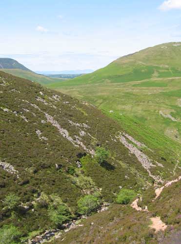
Once clear of the woodland climb the valley opens out and we started to get more distant views.
To the left is the dark edge of Carling Knott, the lighter ridge of Hen Comb and the southern slopes of Melbreak. In between we began to get views of Scotland and eventually our panorama included The Isle of Man as clear as a bell (that is if you can use a sound analogy for an aspect of vision ?)
After a steady climb through the heather slopes, the arrival at Ling Comb Edge suddenly allowed views to the north of Buttermere, Fleetwith, Dale Head and Hindscarth.
The shirt, shorts and camera bag were now dry and the mountains were looking their best . . . Bliss !
We had gained most of the height now and our route took us along the ridge towards Red Pike itself.
Not too many people about today.
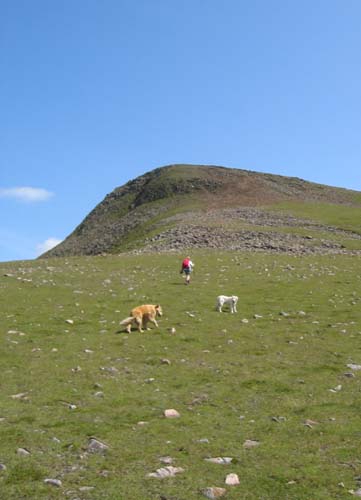
Red Pike summit is a daunting prospect when climbed direct but from this approach it is relatively easy.
Lunch at the top seemed a good idea - a reward after having completed the major part of the climb.
Lunch with a view.
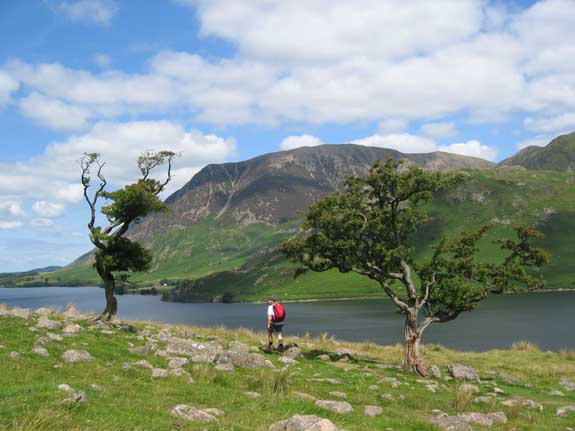
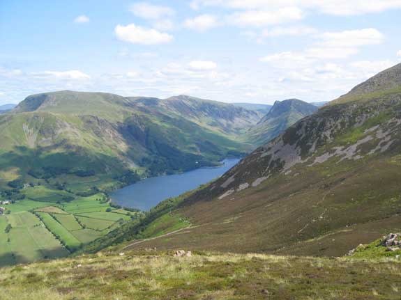
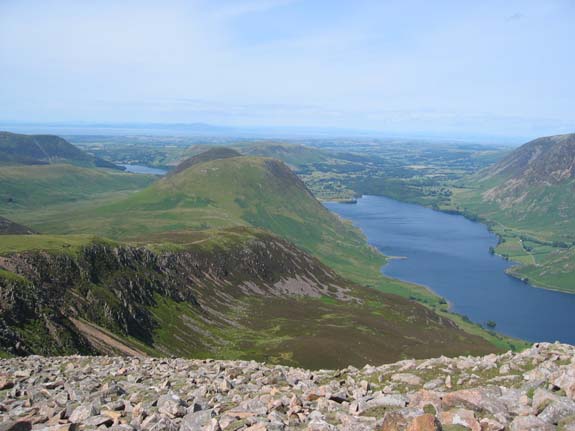
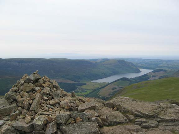
Looking back along Ling Comb Edge to Melbreak, Crummock and Loweswater, and the Solway Firth beyond.
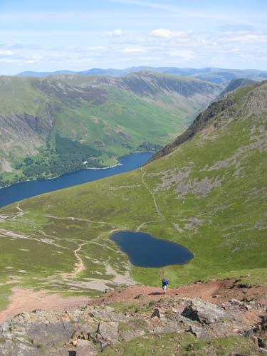
Forward again now, the puppy suitably refueled and rested, we crossed above the screes of Red Pike and made for High Stile, the highest part of the walk. Below us was Bleaberry Tarn.
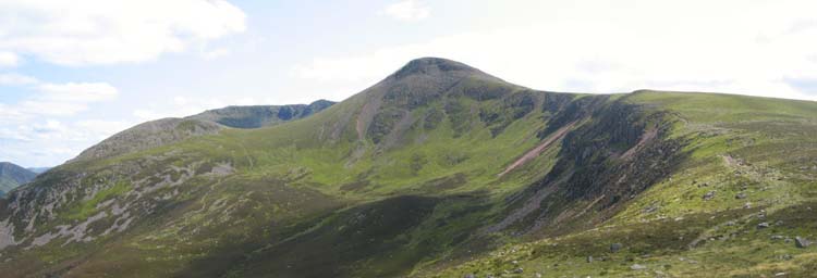
Red Pike from High Stile.
The colour of the red rock really showing well, but the sky was starting to get very overcast and the distant views were starting to become less distinct.
The view to the west from High Stile summit included Ennerdale Water and across to the distant Isle of Man.
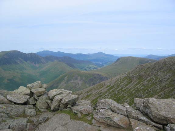
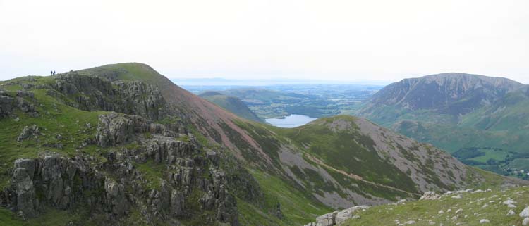
To the north an interwoven topography of High Crag, High Snockrigg leading to Robinson, Knott Rigg (Ards Crag) the darker ridge from Sail down to Causey Pike, and finally Skiddaw and Blencathra in the distance.
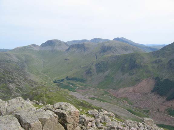
To the east, the panorama stretched from Fleetwith and Helvellyn to the Langdales, Gable, Kirk Fell and the Scafells, with Pillar to the right.
A good spot for a view if ever you need one.
The upper end of Ennerdale Valley is changing fast as the forestry continue to clear the lower slopes of Pillar.
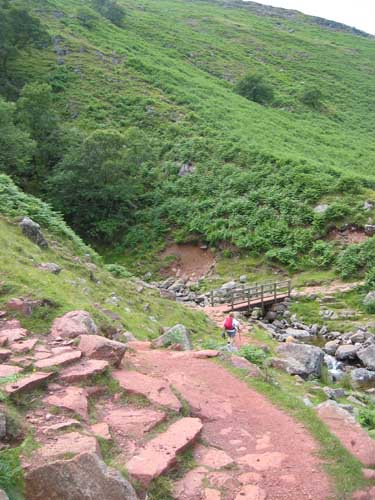
Below us the old woodland adjacent to the Scarth Gap / Black Sail path has gone leaving a hardly recognisable open track down to the forest road. In years past we struggled down that way avoiding the overhanging branches. Now there will be nothing but clear views up and down the valley.

Gamlin Edge too had been a difficult climb in the past, and its erosion a real scar on the hillside. The path has been landscaped and now blends into the grass between the two lose rocky patches. As fine an example of good path building as you are ever likely to see.
 |
 |
Six miles into the walk now we take a short break to finish the last flapjack for us, and the last dog biscuits for them.
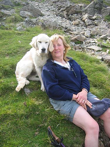
"Me and my best mate" . . .could that look be cupboard love ?
Oh yeh . . . the view . . . Haystacks of course . . a fine little fell.
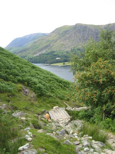
Heading for home now with the descent of the Scarth Gap path towards Buttermere.
The Mountain Ash is starting to develop berries already. July and another year is flying by.
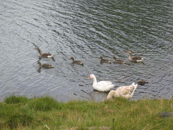
A young family of Greylag geese enjoy the waters of the lake.
As I found out earlier (!) the temperature has risen considerably as a result of the warm sunshine we've had this year.
A final look back to the head of Buttermere valley as we walked one way and the geese paddled off the other.
- - - o o o - - -
Technical note: Pictures taken with a Canon IXUS 400 Digital camera.
Resized in Photoshop, and built up on a Dreamweaver web builder.
This site best viewed . . . with a fast wicking t-shirt and dry shorts.
Go to Top . . . Home page . . . Go To Archive 2004
© RmH . . . Email me here