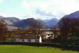
Retreat to the quiet of the Western Lakes
|
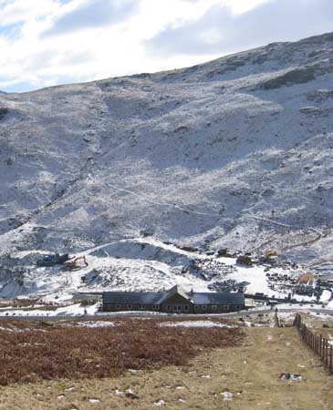
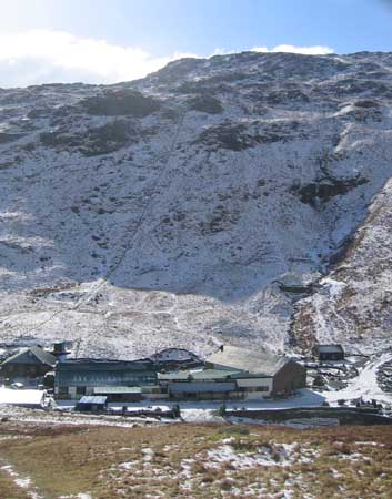
Time and place :Saturday 28th Feb 2004 Dale Head from Honister, Cumbria, Uk. Occasion : A winter walk with Pat and Mike, Ann and the dogs. Walk details : 2.8 miles, 1300 feet of ascent from the car park behind Honister YHA. Weather : A clear winters day, good sunshine but low temperatures. Snow melting on southern facing slopes. |
|
Yesterday's snow storm had not left a lot of snow, but due to the recent prolonged cold spell, what had fallen had settled and stayed. All the tops were covered in a white mantle and even in the valleys the snow gave everything a picture post card look.
Today was a day to walk high and admire the view.
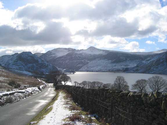
High Stile and Red Pike from the road past Crummock Water, a favourite viewpoint.
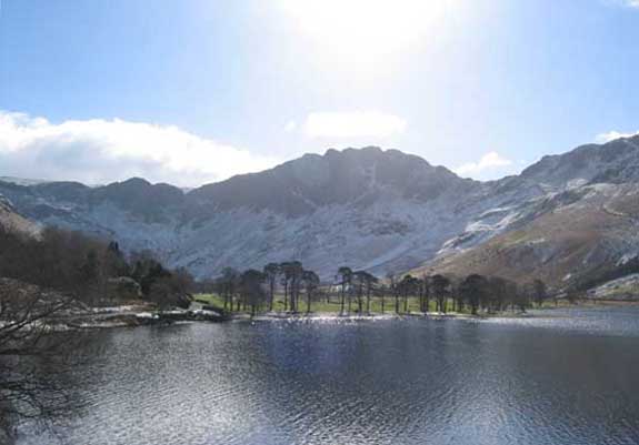
The famous Buttermere Pines with Haystacks behind.
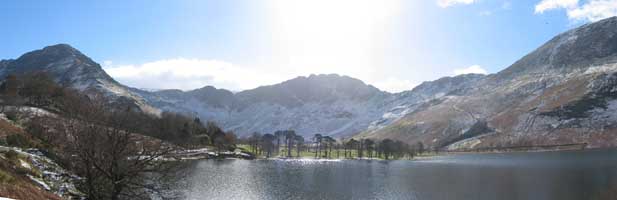
Click here or on the picture for a wider and fuller panorama.
 |
 |
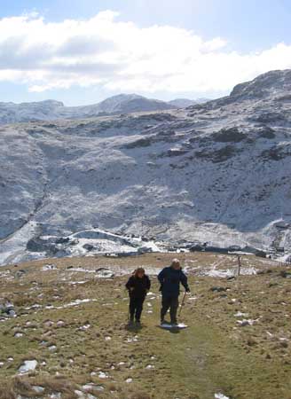
Ann and Mike climb the grassy slopes to Dale Head.
The warm sun was rapidly thawing the snow in these south facing slopes,
but Grey Knotts opposite was as white as ever, where the low winter sun had failed to penetrate the valley.
Climbing steadily now the view east to Glaramara and on to Helvellyn was getting better all the time.
 |
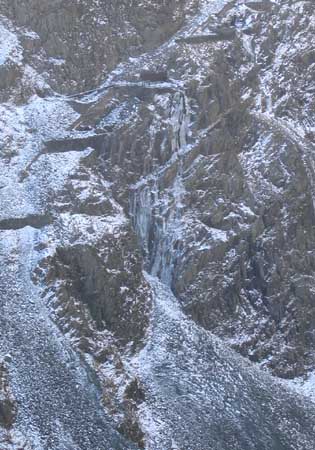 |
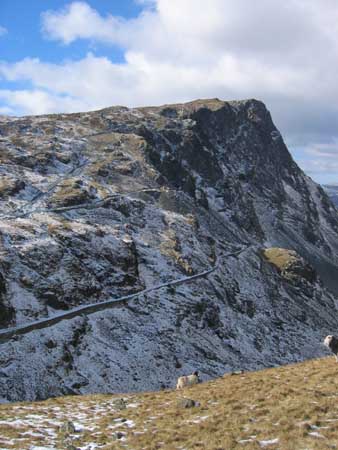
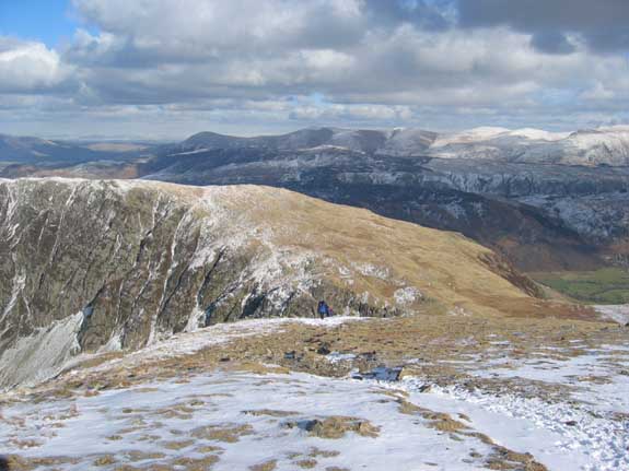
To our left the slopes of Honister Crag and its quarry roads was even more impressive than usual.
The mountainside is full of caves and entrances and the water flowing out of some of them formed fine icicle displays
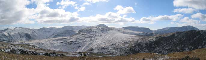
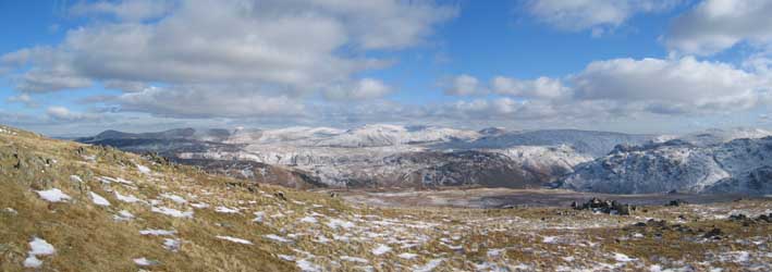
Gable and the Scafells gradually emerged from behind Grey Knotts as we climbed higher.
The panorama starts with Crinkle Crags and Bowfell, and ends with Kirk Fell and Pillar.
Click here or on the photo for a full size panorama.
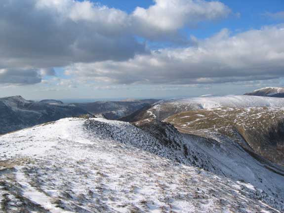
The High Stile Ridge (High Crag, High Stile and Red Pike) taken from the top quarry workings.
Nearly there, the full eastern panorama of the Helvellyn Ridge.
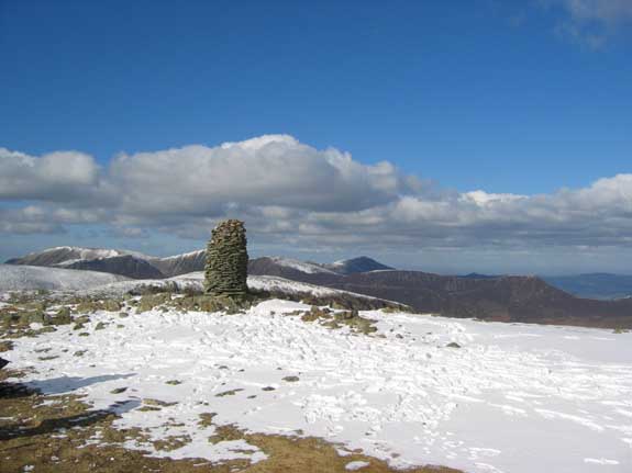
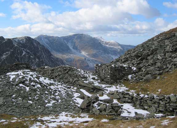
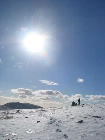
The summit cairn on Dale Head looking north over the north western fells.
The summit snowfield (ok - large patch) was beautifully crisp with fresh snow from the day before.
Looking north west we had fine views along the ridge to Robinson
with Hindscarth, Grasmoor and the Scottish hills beyond.
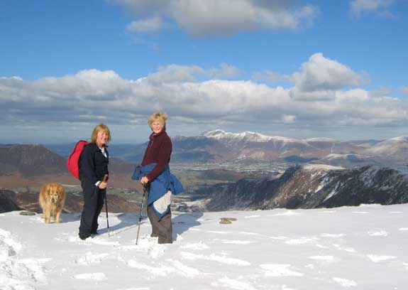
Ann and Pat with the Skiddaw fells behind.
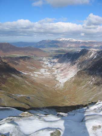 |
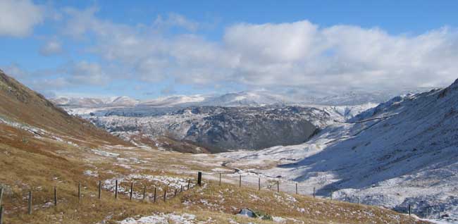
Taken from the cairn (hence the shadow) Newlands Valley is spread out 1800 feet below.
The valley did not get such a heavy fall of snow but the frost was still white in the cold valley air.
Skiddaw behind has a reasonable covering but only on its higher slopes above 2000 feet. |
Perfect winter weather and perfect winter views.
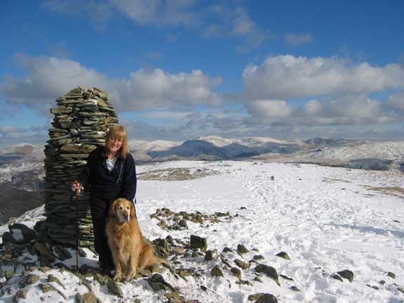
Ann and Holly.
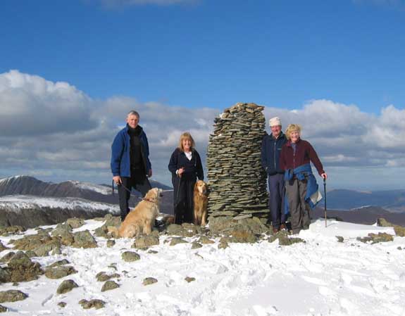
Group photo - Dale Head fashion.
( Thanks to the kind gentleman who took it for us. )
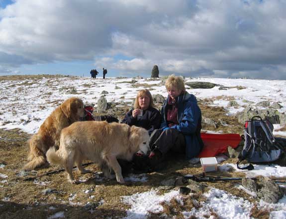
Lunch with altitude. Soup and a Sarnie for us but only dried biscuits for the dogs.
You can almost see a look of disappointment on their faces !
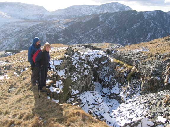
A short wander over to see the path as it climbs from High Spy.
 |
Alpine blue. Looking back our lunchspot takes on an atmosphere of its own. |
Down back to Honister now, but not without a deviation to the old mine workings on Yew Crag
These old workings produced slate from earliest times but there was no obvious track or tramway in to extract the stone. The green path was thirty feet up and inaccessible from the bottom of the quarry.
 |
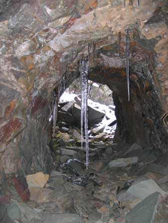 |
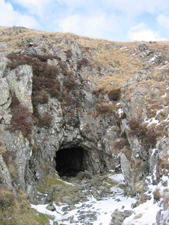
The answer lay lower down. The miners had tunnelled through to give access and drainage to the lower levels.
Inside the water was frozen giving glassy pools on the floor and fine ice stalactites from the roof.
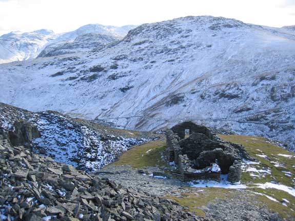
The top bothy or miners huts - home to the workers in older times.
 |
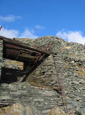 |
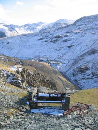
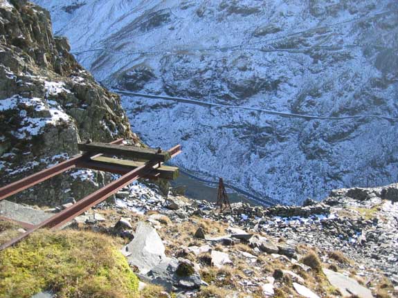
The old funicular railway winding drum still stands, albeit rather dilapidated now.
The cable ran up from the lower (empty) truck around the drum and down to the (heavier) loaded truck. In that way there was no need for engine power as the weight of the stone did all the work. The rod on the right worked a simple brake mechanism.
Presumably the Dram Road on Honister had a similar drum arrangement at its summit, evidence of which can be seen at the point where Mosses Trod sets off for Great Gable.
The end of the line - physically and metaphorically.
The mine workings on this side of the valley are no longer in production.
- - - o o o - - -
Technical note: Pictures taken with a Canon IXUS 400 Digital camera.
Resized in Photoshop, and built up on a Dreamweaver web builder.
This site best viewed . . . with a mug of hot soup !
Go to Top . . . Home page . . . Go To Archive 2004
© RmH . . . Email me here