|
|
|
 |
Remember: Press F11 for a
full screen view of this page. |
Web Counter when published
2 148 880 |
|
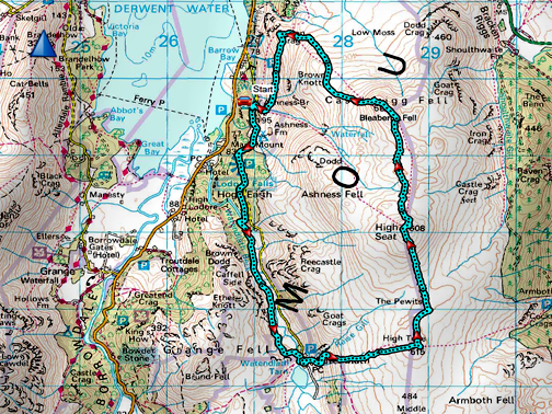
" Watendlath - High Tove - High Seat " Date & start time: 24th March 2024. 10.15 am start. Location of Start : Ashness Bridge car park, Borrowdale, Cumbria, Uk. ( NY 270 196 ). Places visited : Watendlath, High Tove, High Seat, Bleaberry Fell, Falcon Crag. Walk details : 8.25 miles, 1925 ft of ascent, 5 hours. Highest point : High Seat, 1,995ft - 608m. Walked with : Myself and Dougal the dog. Weather : Perfect . . . sunny, dry with the slightest of cooling breezes.
|
© Crown copyright. All rights reserved. Licence number PU 100034184. |
|
A grand day in prospect and also a walk with a purpose . . . I stuck my head over the parapet recently and got volunteered to lead a Mob Walk up here in two weeks time so I thought I had better go along and see what the path conditions were like before I lead a group up there. What a great walk though, five hours of lovely weather and loads of nice folk to talk to as well !
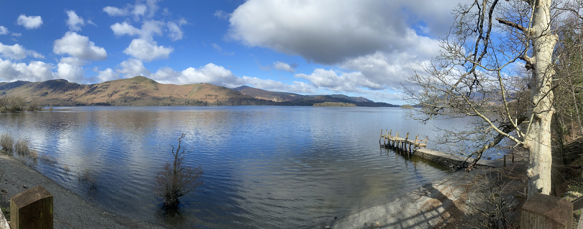
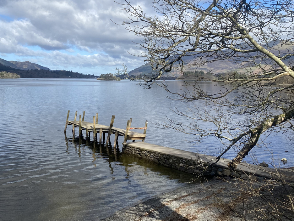
A quick stop down by the side of Derwent Water before I drive up to Ashness Bridge. There's something strange though . . .
The pier has suffered from the winter 's bad weather and seems to have risen up, probably due to the high water levels. The answer has to be a floating pontoon at the end of each jetty as this type of damage is always happening to the Derwent Water piers, but I have a feeling that the idea has been rejected by the Planning Board in the past.
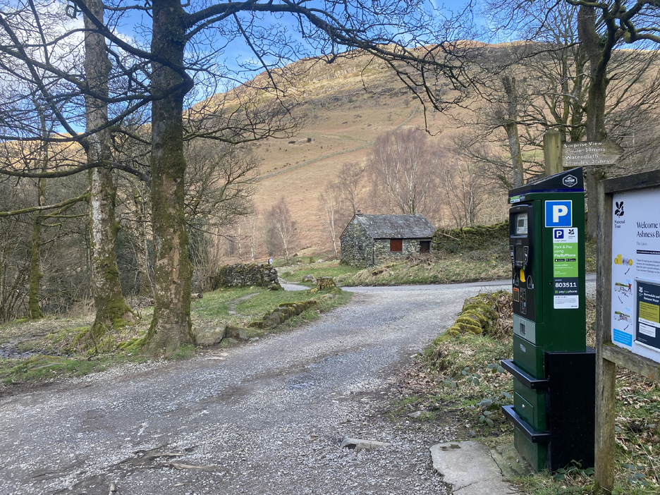
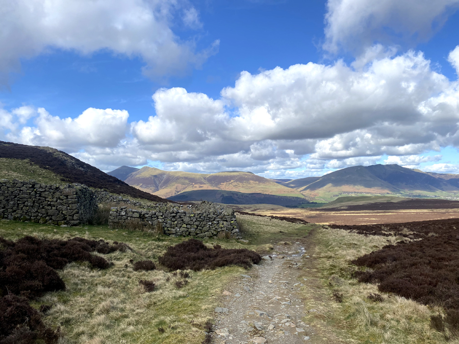
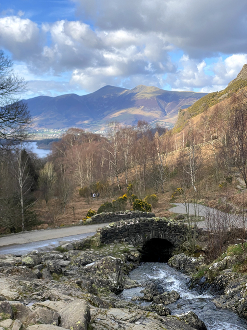
Start Point : There's a good car park just up the road from Ashness Bridge, free to National Trust members.
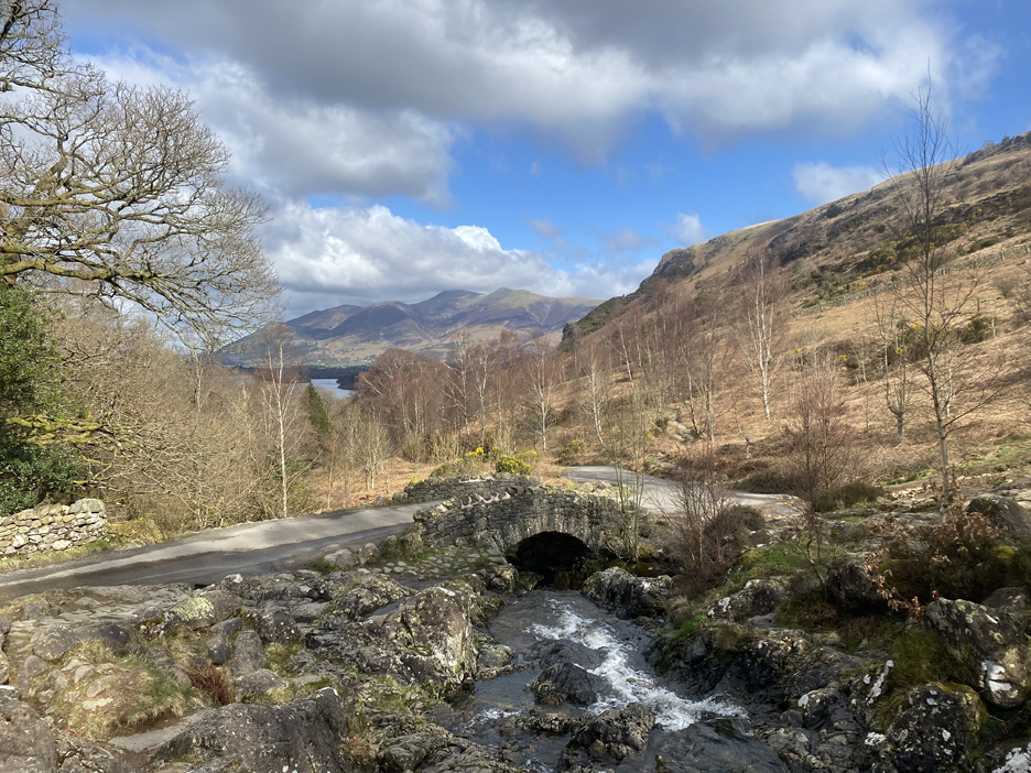
Before the walk proper I just had to go back and capture that chocolate box image. Early Spring is a good time to visit this famous bridge, as later in the year the leaves on the trees rather obstruct the distant view.
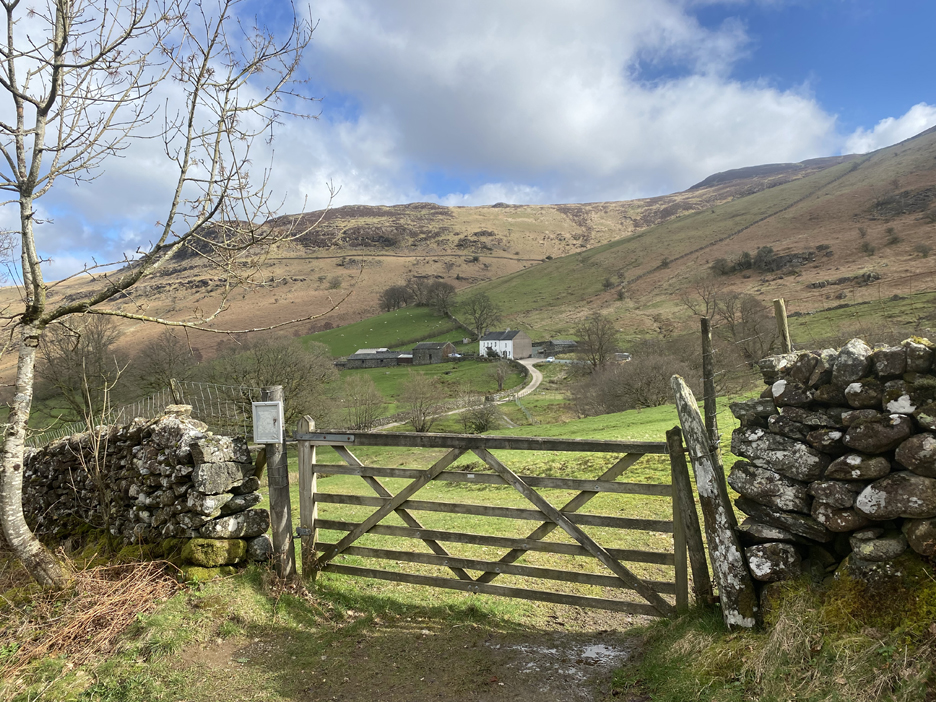
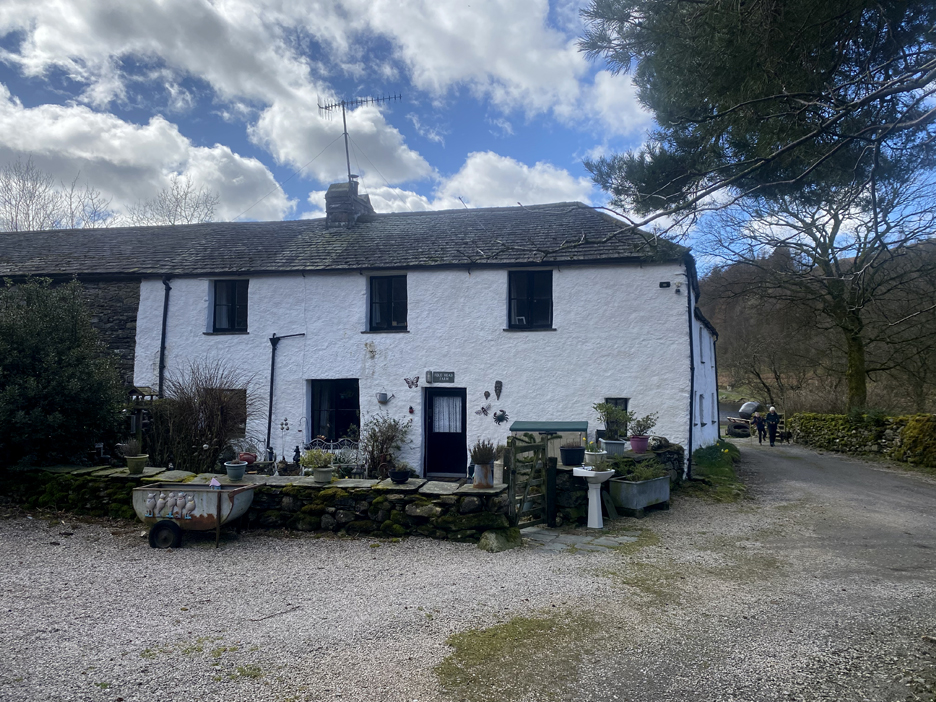
I set off up the road for a circular walk, outward along the Watendlath Valley and back along via the three adjacent tops. Through the gate is Ashness Farm which offers bed and breakfast in a 500 year old working farm environment.
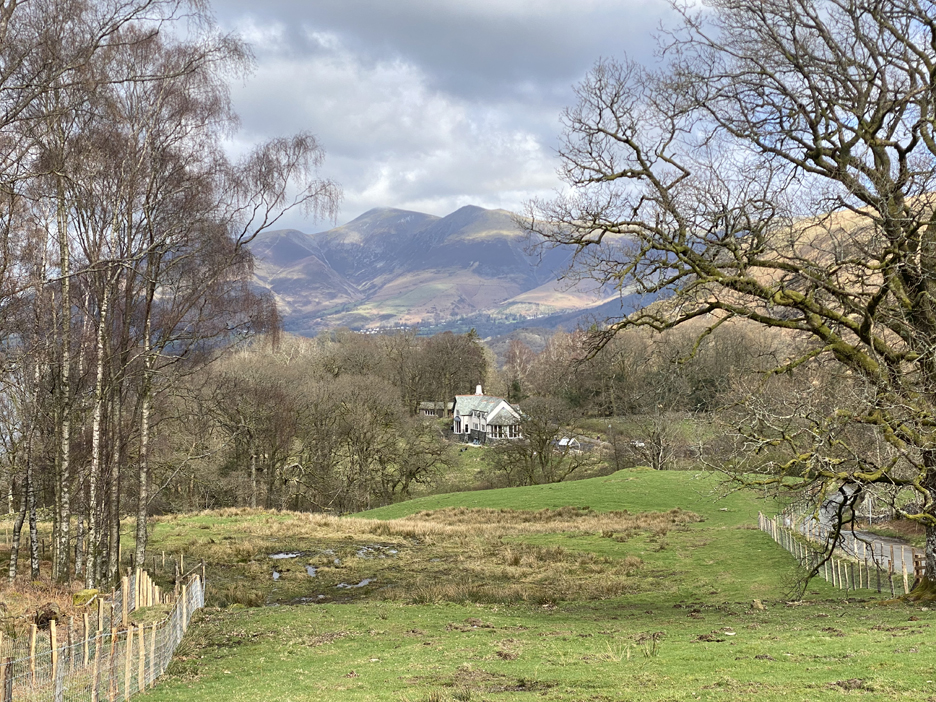
Ashness Lodge, much improved in recent years, provides the foreground to this photo of Skiddaw and Skiddaw Little Man.
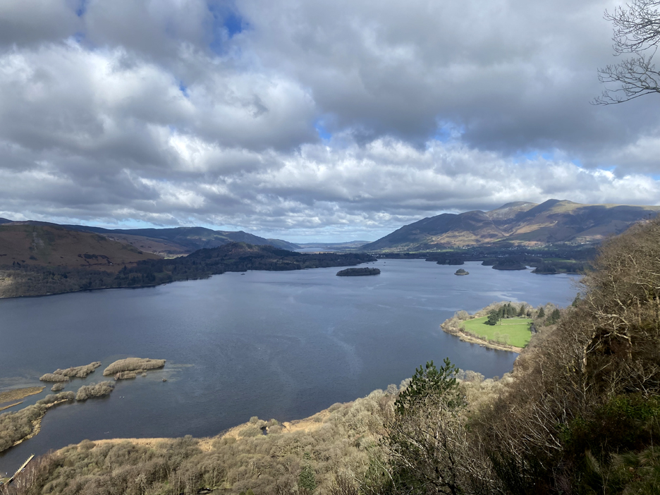
Just off to one side is the path to "Surprise View" which does still delight every time I visit.
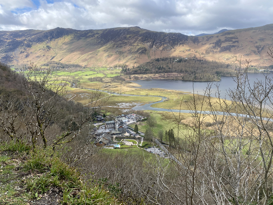
A surprisingly good view as well, down to the Lodore Hotel and their new Spa and Wedding facility.
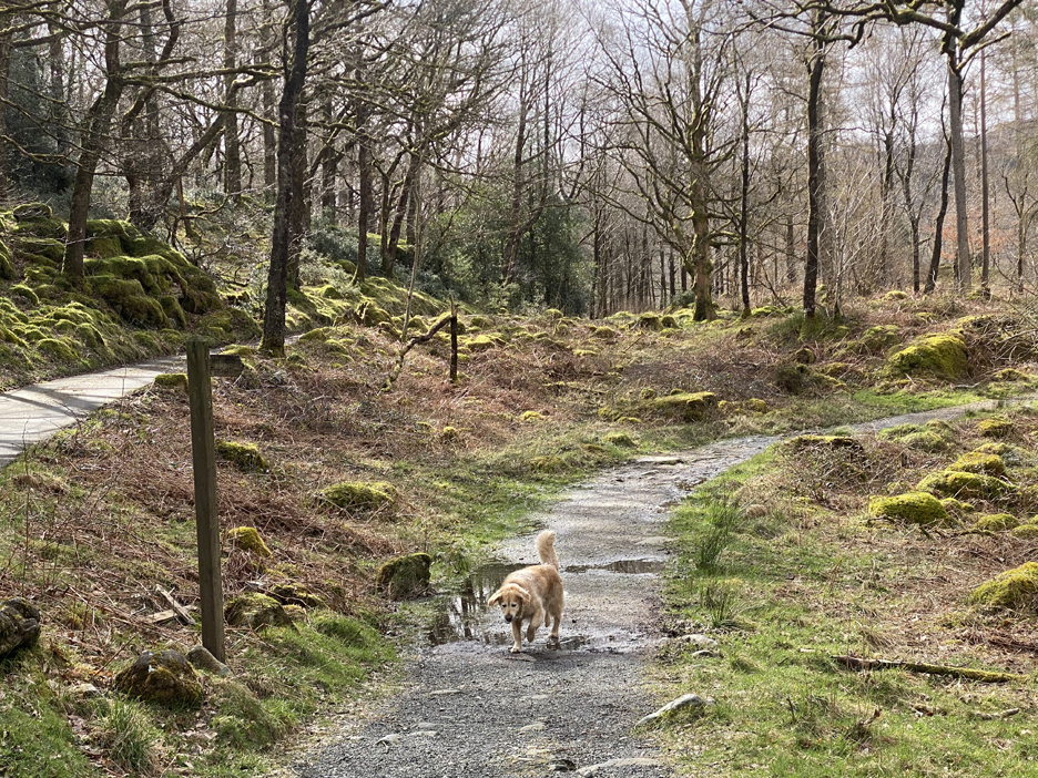
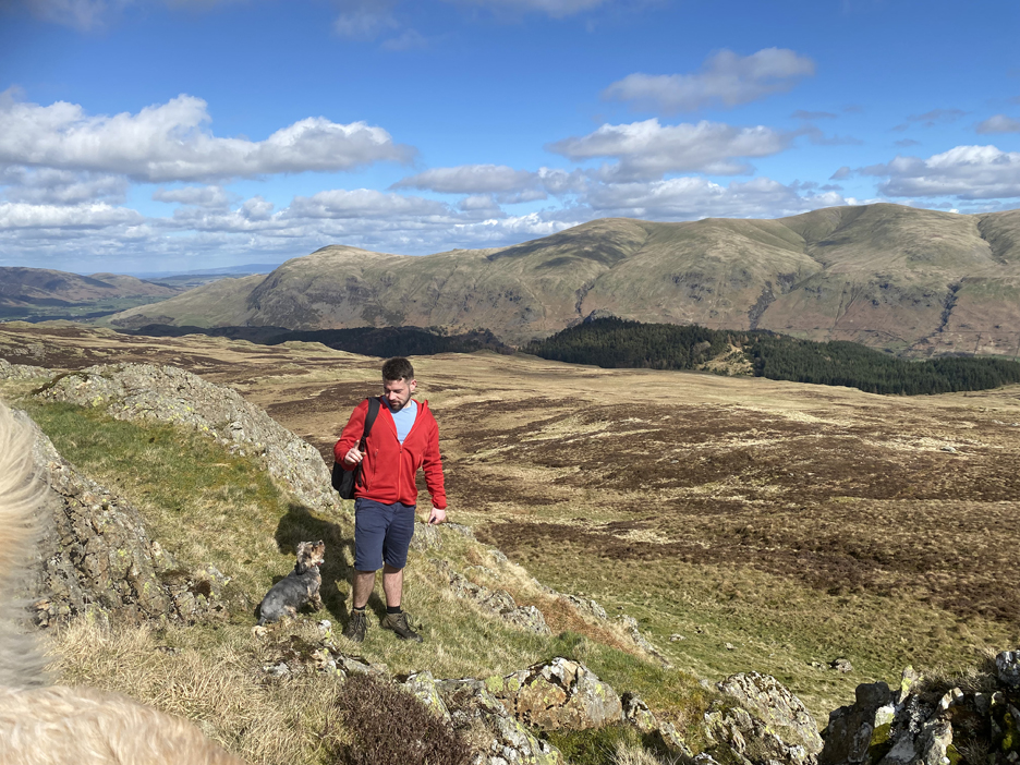
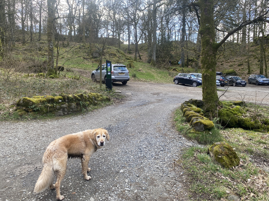
I leave the road at the footpath sign in order to walk up the riverside path of Watendlath Valley. Dougal here is confusingly walking the wrong way . . . but he does many more miles than I on these walks anyway.
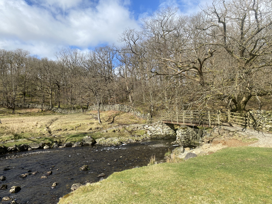
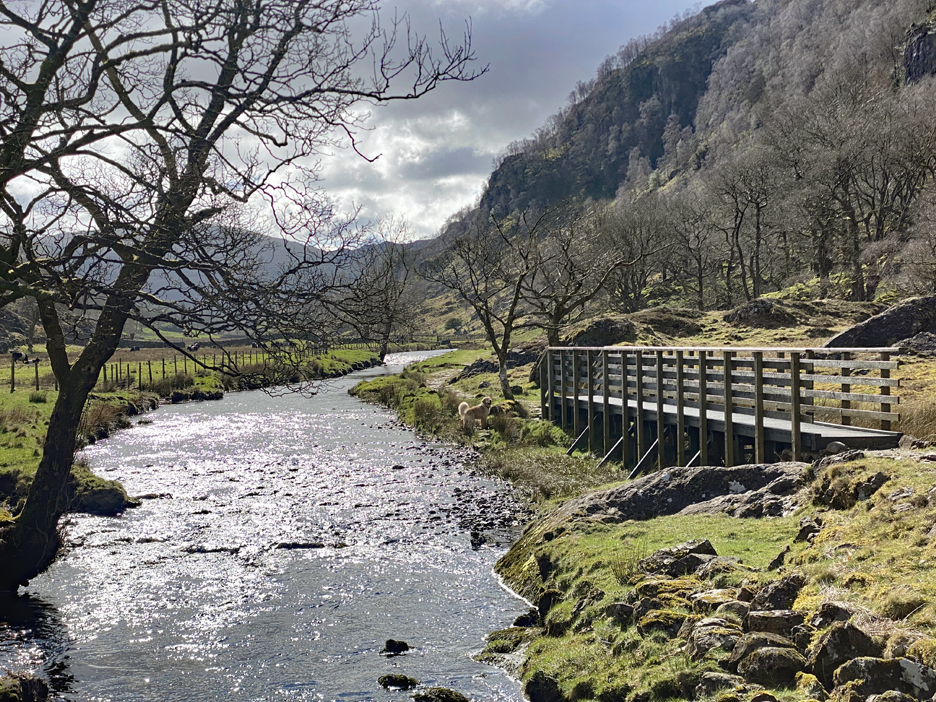
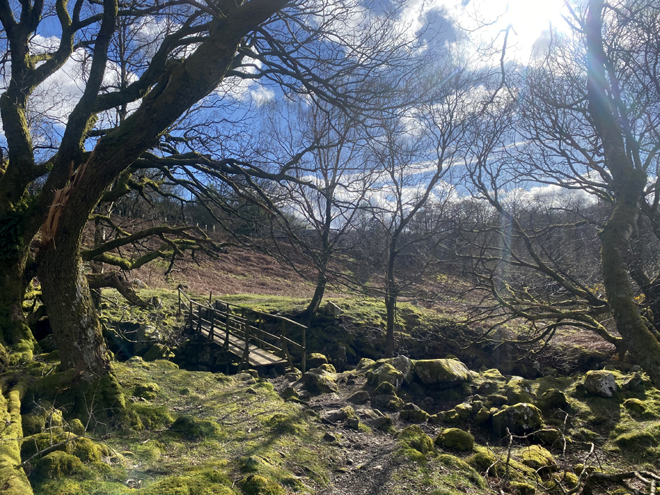
To get to the riverside path there's a good footbridge across the river.
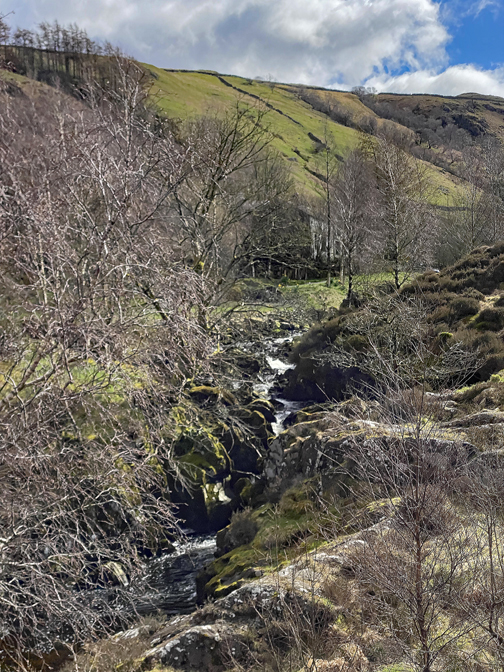
The first part of this path is classic Lakeland river scenery, walking through light oak woodland with the rocky stream below.
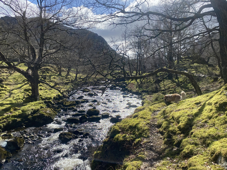
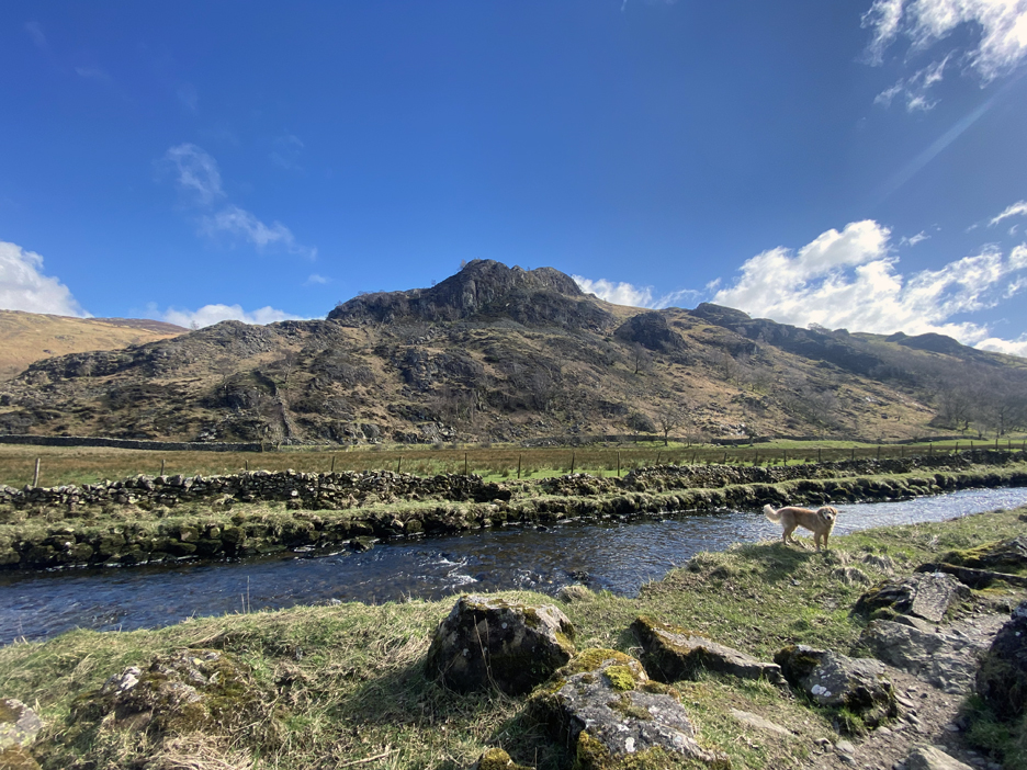
Part way up the scenery changes as I enter a more agricultural landscape with belted galloway cattle, albeit on the other side of the river. The path follows close under Ether Knott, crossing minor becks and avoiding ancient erratic and fallen boulders.
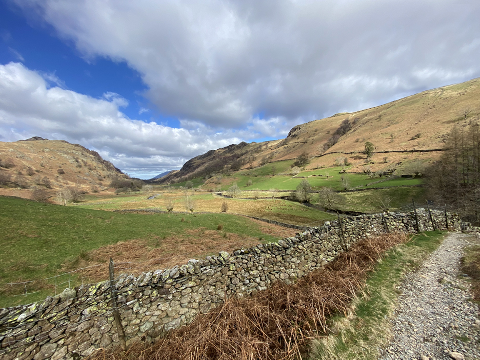
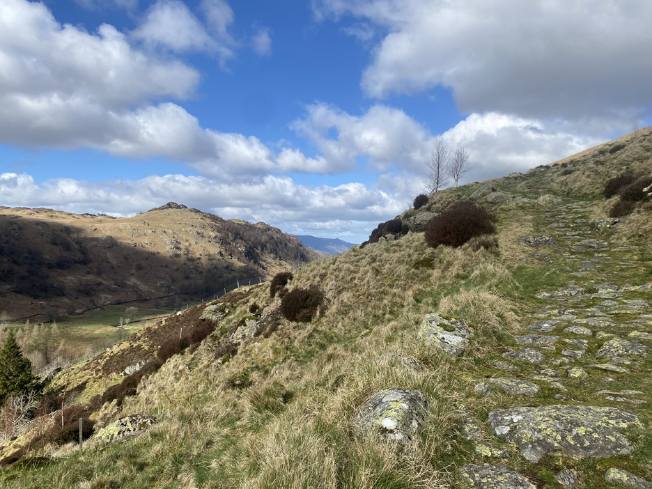
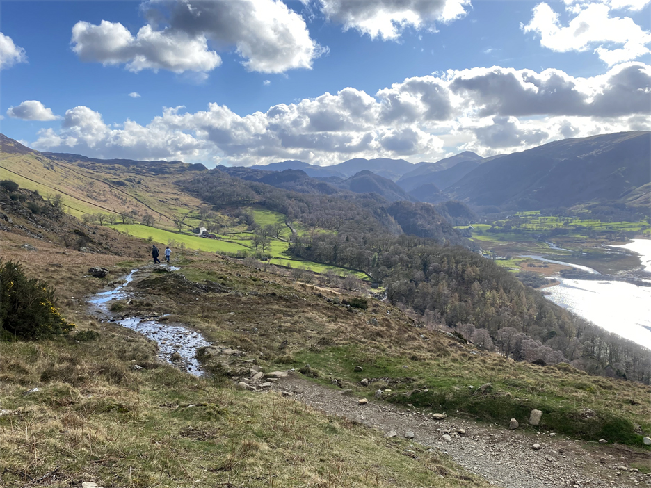
The path is rarely flat but it is still good . . . with the valley road, Reecastle Crag and High Seat in view on the other side.
As Dougal and I approach Watendlath Village the path has left the river and risen slightly following alongside the fell walls.
With the change of slope comes the ability to apply technology and generate power. The starting point is this weir which draws some water off to power an electric turbine nearby.
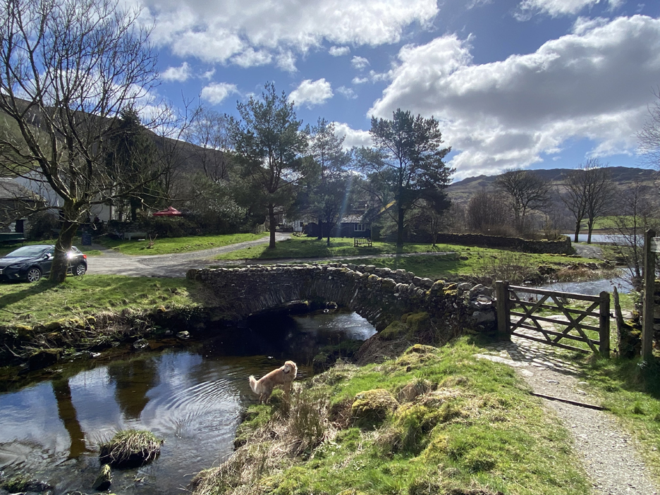
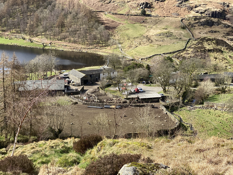
The gentle climb has brought us up to the bridge at Watendlath, an iconic packhorse bridge over the river.
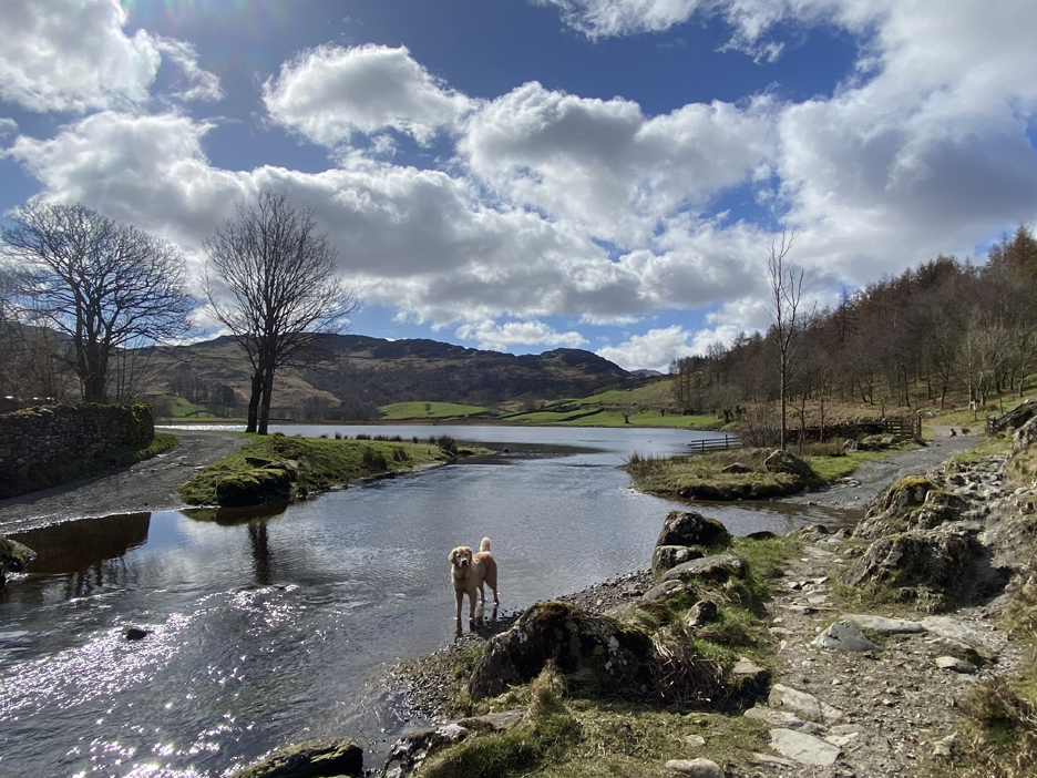
I walk up the path a little further to photograph the lake, Dougal just enjoys getting his feet wet.
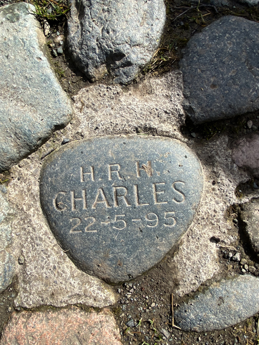
The grey stone with Prince (now King) Charles's visit date is set into the centre of the path, three stones away from the big boulder at this end of the bridge.
Leaving the garden seating area I pass Fold Head Farm the literary home of Judith Paris in the Cumbrian Rogue Herries novels.
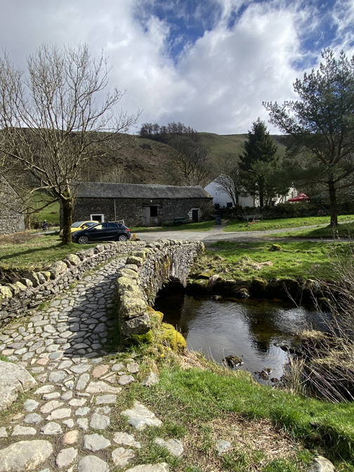
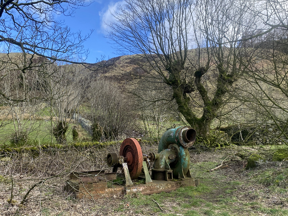
At the exit from the car park is a relic of earlier water power in the form of a large pelton water wheel, flywheel and belt drive pulley. Obviously hydro power, despite the newness of the weir outside, has long been a feature of the village.
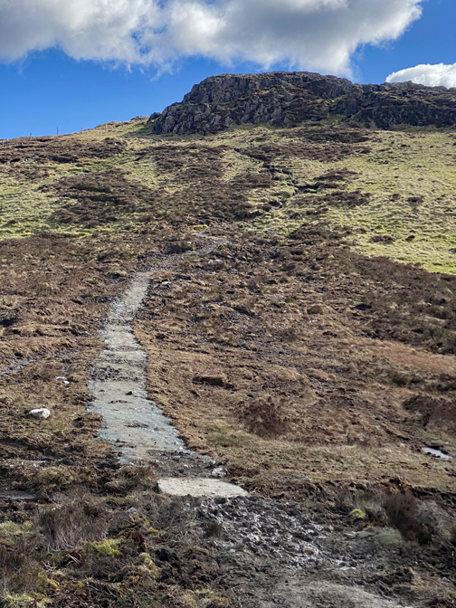
My path left the road to the right of the car park and soon joins a beautifully pitched path, which twists and turns its way up the fell side.
The steepness of the climb is rewarded by the rapidly expanding view across to the high fells.
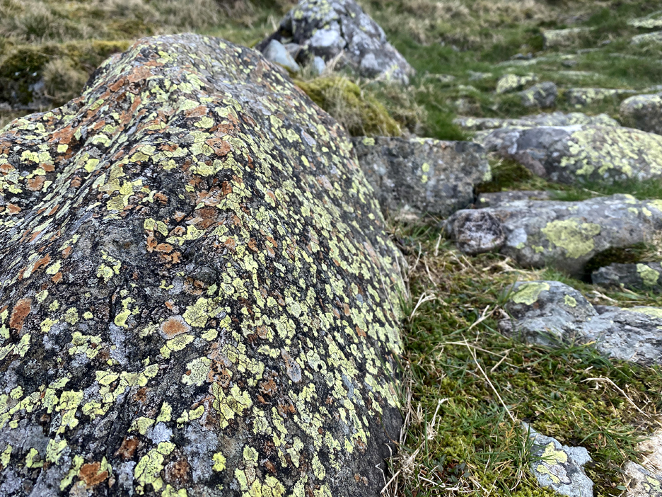
The path was laid many years ago and has ben incorporated into the surroundings by virtue of the grass growing between the stones.
The tune "Follow the yellow brick road" sprung to mind as I admire the multitude of different lichens on the stones, the majority of which have a bright yellow colour.
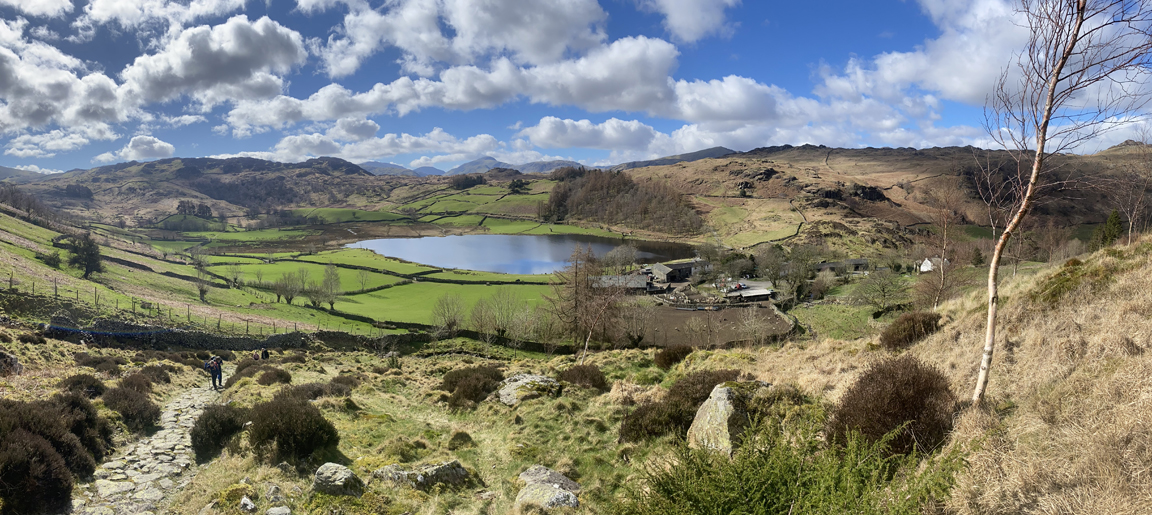
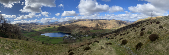
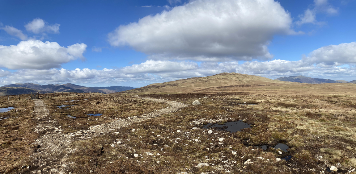
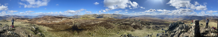
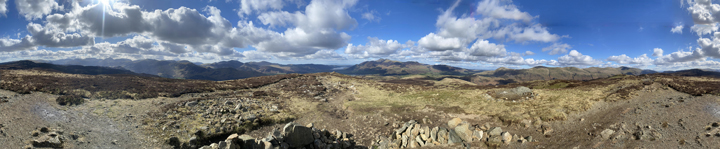
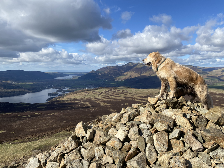
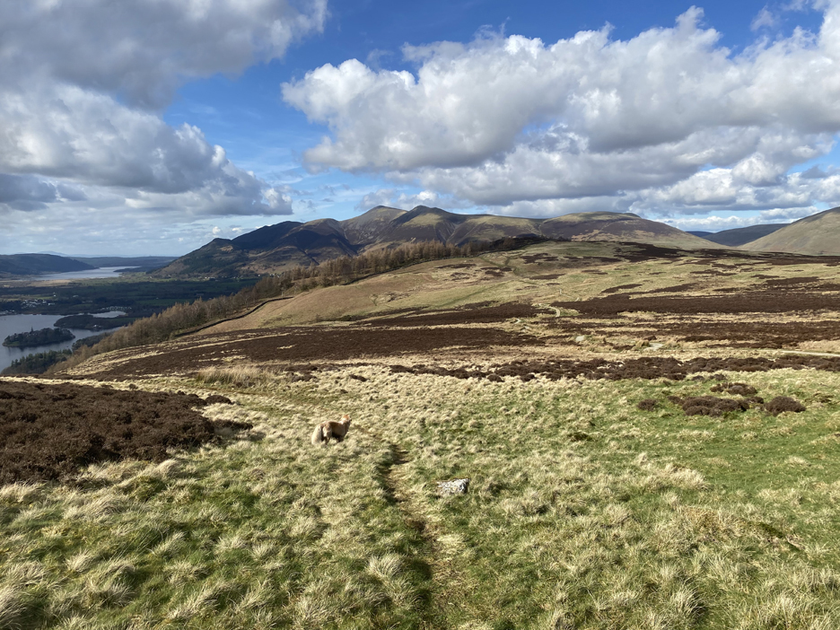
Climbing is relatively easy with the lichen distraction and at the first break of slope, I realise I'm higher up than I thought. Click
here or on the photo above for a larger
annotated panorama.
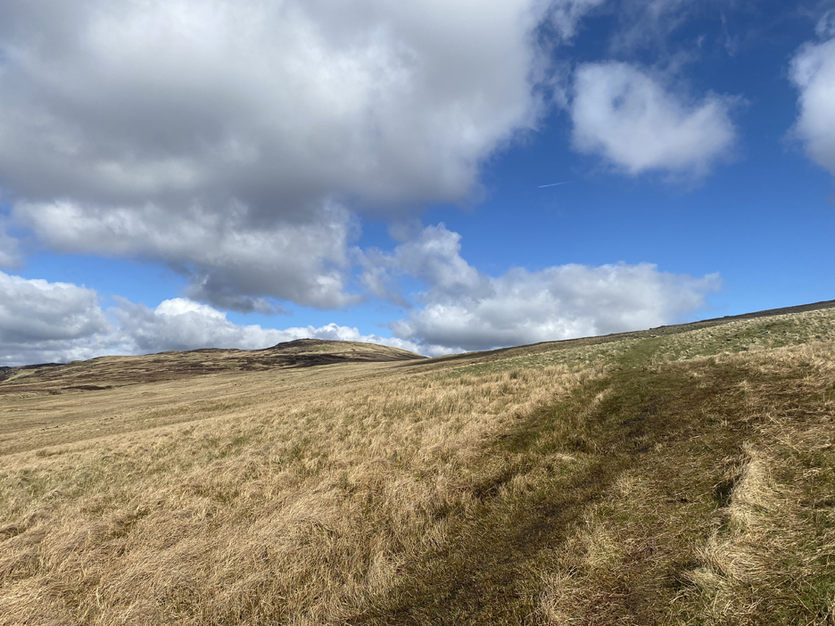
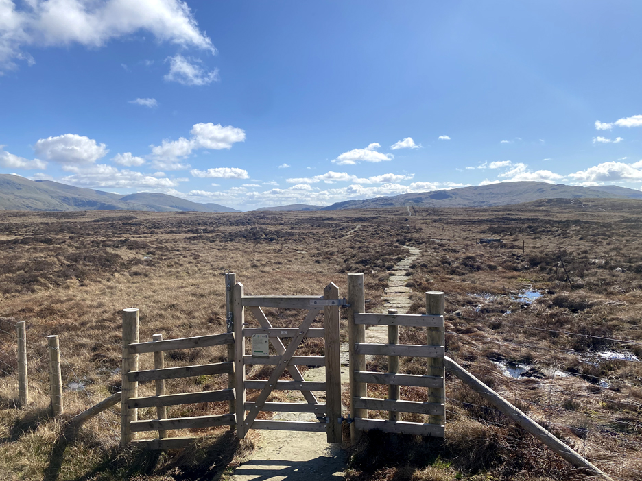
Through a gate and the landscape changes to more open moorland. The path is wide where folk have tried to avoid the wetter sections of the hillside.
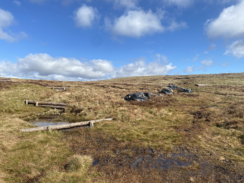
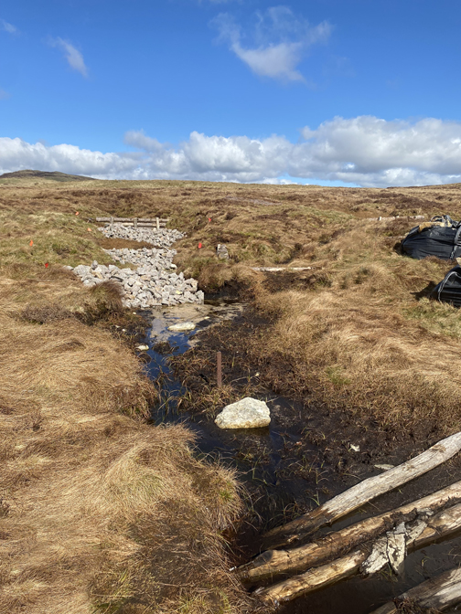
Near the top the peat moorland is undergoing restoration by the use of wood and stone barriers to stabilise the top soil.
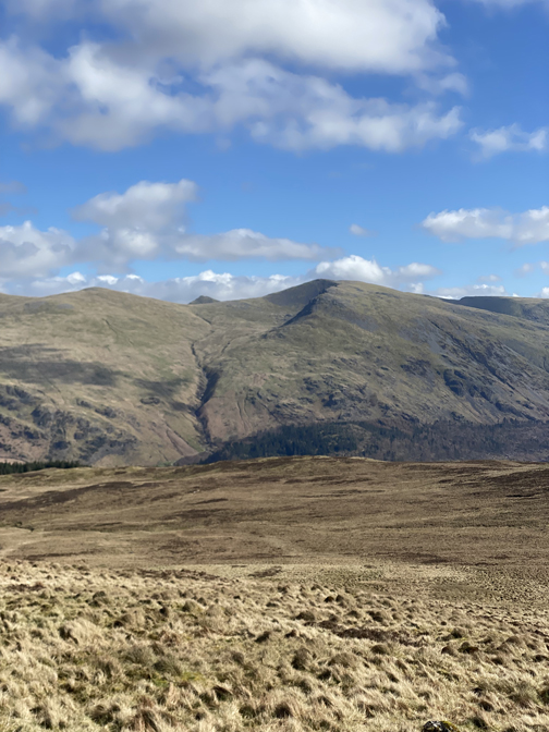
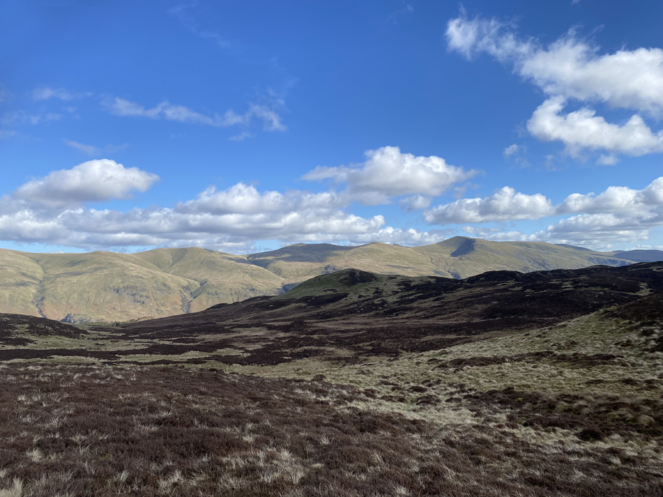
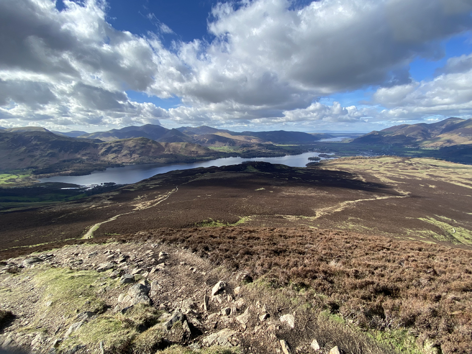
Through another gate and we arrive at a group of rocks known as High Tove, my first summit of the day. This was the view across to the Helvellyn Range, looking across the top of the heather covered summit of mighty(!) Armboth Fell.
The view south in this glorious sunshine included Ullscarf, Great End and the high Central Fells. Eagle, or is it Sergeant's Crag, stands out from the side of Ullscarf by virtue of it's darker, shaded colour.
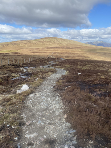
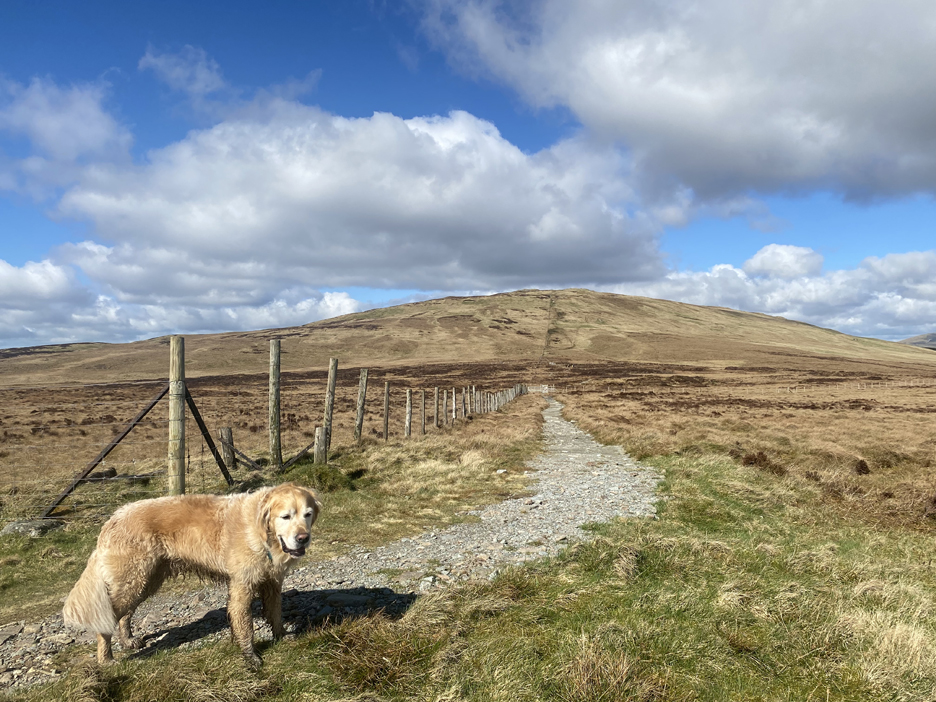
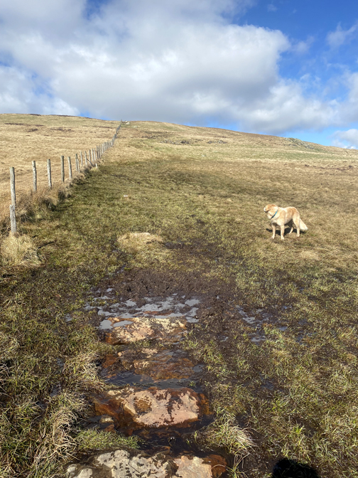
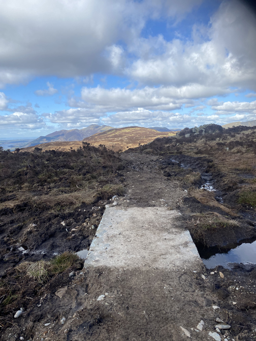
Time to be moving on . . . the purpose of today's walk was to check out the new paths that have been constructed up here. On this high moorland plateau the passage of walkers has eroded the peat bogs across the area. Between here, High Seat and Bleaberry Fell are areas that were notoriously muddy and on occasions virtually impassable. I arrive at High Tove via the left hand path, I leave by the right for High Seat.
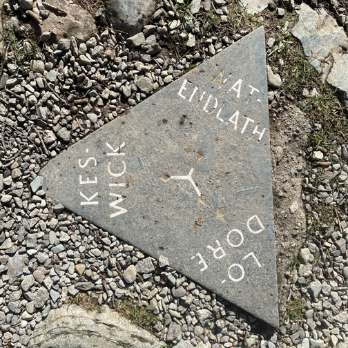
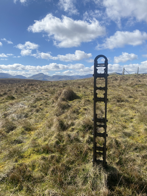
The corner turn on the fence line is marked on the 1:25k map as Eddy Grave Stake.
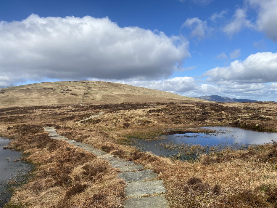
The path continues on across the area of ground known as The Pewits. There's no sign of the old path that used to follow the fence line . . . obviously new path is working well and the old erosion scars have healed over.
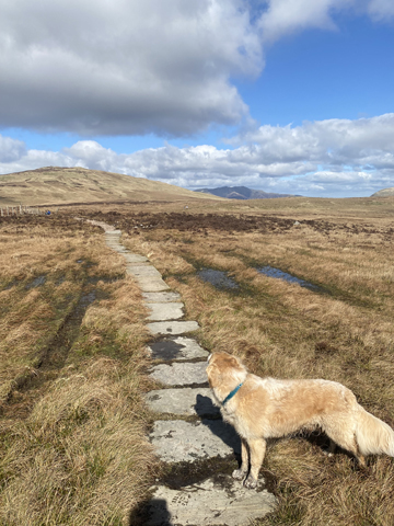
I cross the peat bog dry shod and unscathed . . . success !
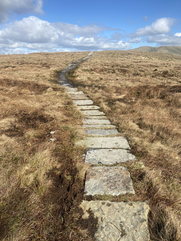
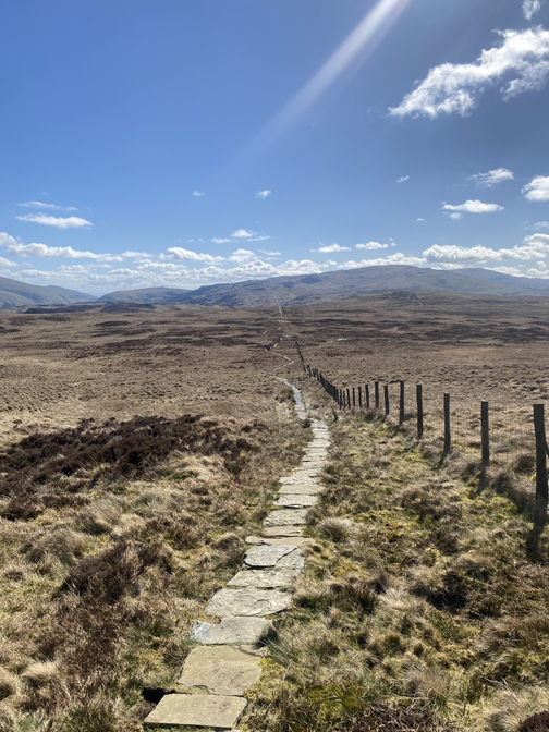
To be fair, the laid path extends a considerable way up the side of High Seat and only the last drop-off point is a problem.
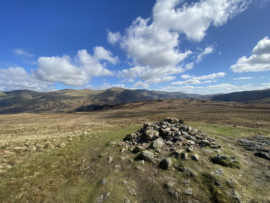
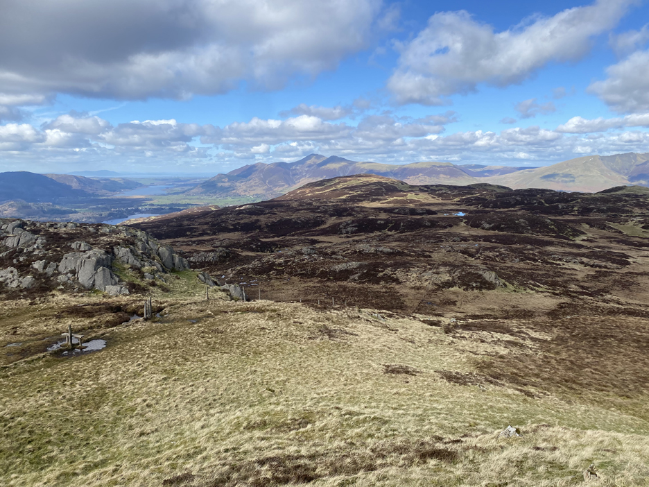
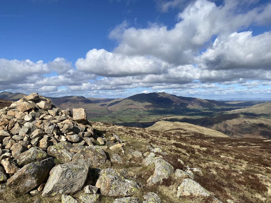
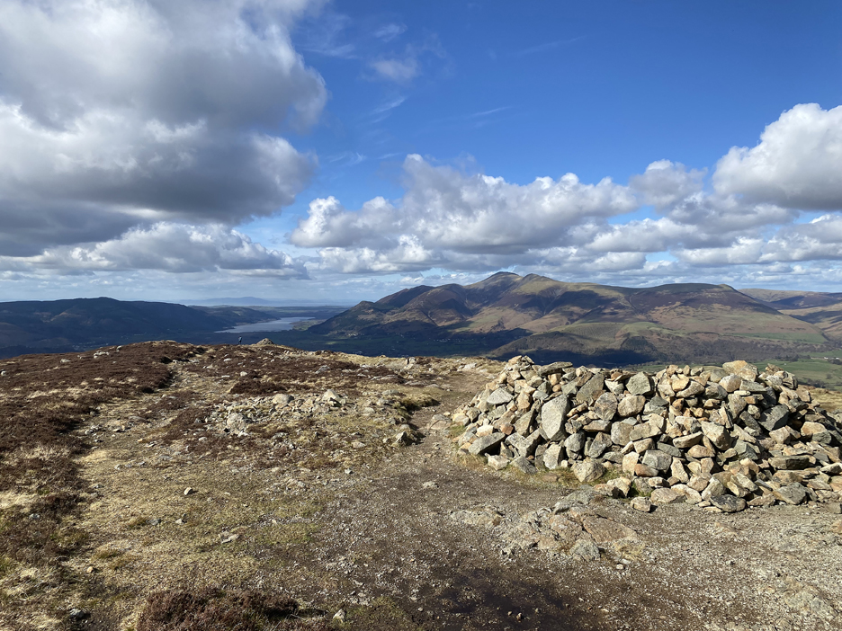
Just a short climb now and I arrive at the trig point at the summit of High Seat. This was the view south from top on this lovely day.
Likewise the view north to Skiddaw and Blencathra.
Click here or on the photo above for a larger and annotated version
Rather than monopolise the summit space and also to find somewhere out of the gentle but cold breeze I head over to an adjacent rock outcrop shown on the map as "Man". There I found . . . yes a man (plus a dog) who was just finishing his lunch . . . and I enjoyed a short conversation with Josh (Gibson) from Carlisle. He had been walking High Tove and High Seat from the Thirlmere side of the fells.
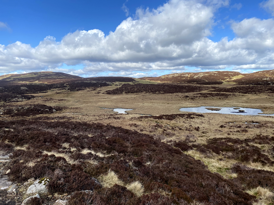
Because of the nice day, I extended my plans to take in a third summit, that of Bleaberry Fell, away in the distance in front of Skiddaw. The path on the map shows a route (dotted black line) that follows the fence for half the distance, which then crosses over and swings left just before you pass the small lake you can see in the photo.
The path seemed to be an "inverted soil" construction with few stone slabs that just spanned the water channels and no more. It was rather muddy in places after the recent rain.
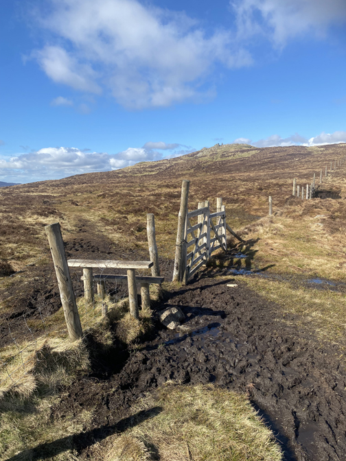
I could see what looked like the continuation of the path ahead . . . but the time or money must have run out for this short section of path . . . as it ended in a bog ! It must be the right way as there's an old wooden stile next to the second fencepost.
Navigation was difficult so don't try this in the dark ! Eventually this rather indistinct route joined up with the old footpath on the map, and everything made more sense.
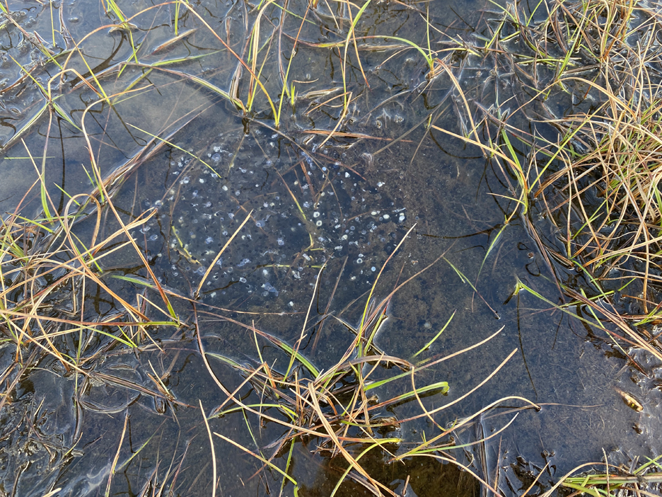
I Passed numerous upland pools and small puddles on this section of the path, several of which held new season frogs spawn.
The final ascent of the day found me on dry paths and once again enjoying the long distance views.
Blencathra, with Dodd Crag below, as seen from the first of the Bleaberry Cairns.
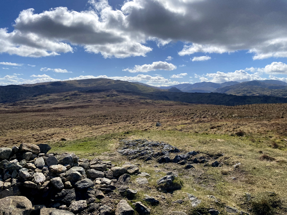
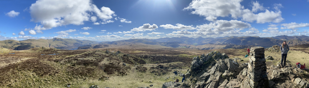
The main summit feature of Bleaberry Fell is a round wind shelter, protecting any occupants from all but northerly winds.
Click here or on the photo above for a 360 degree annotated panorama from the top of Bleaberry Fell.
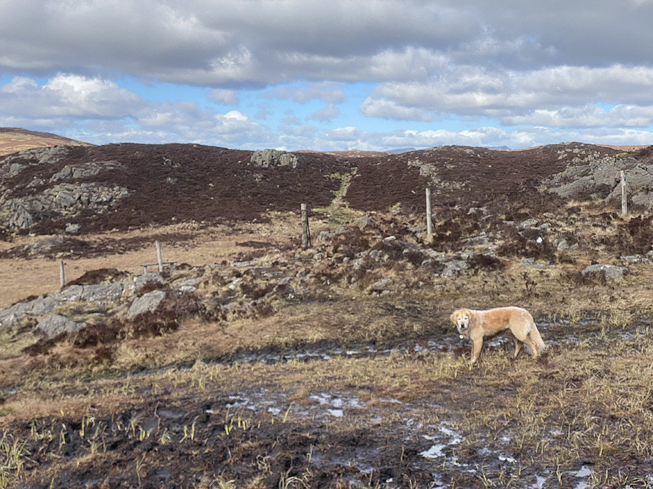
The second and northern summit cairn had grown in height temporarily, as Dougal surveys the scenery.
The path down from our lofty position heads off to the left then curls round towards Walla Crag at the centre of the picture. A sheep fold can be found in the shadows near the distant outlier summit rocks.
A short time later we were passing the sheepfold, ticking off another navigation mark along our route today.
The main path heads off right towards Walla Crag. Somewhere round here there should be the opportunity to head left for Ashness Bridge.
Not a well marked path to start but it did get more visible as it rounded the bank of winter heather.
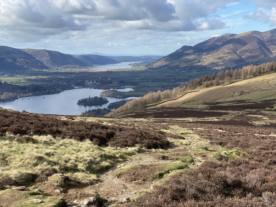
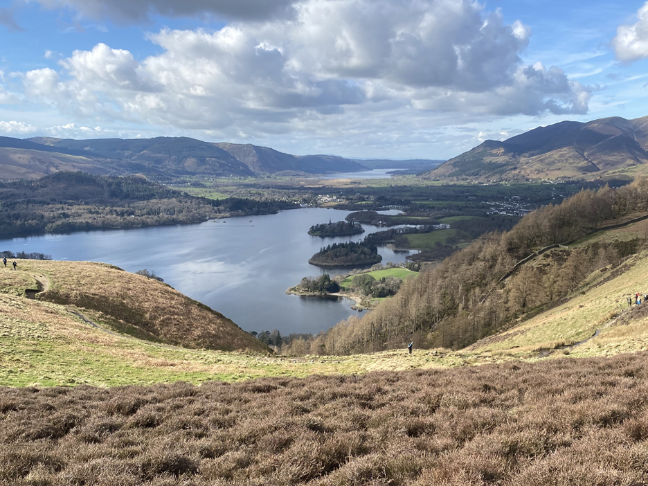
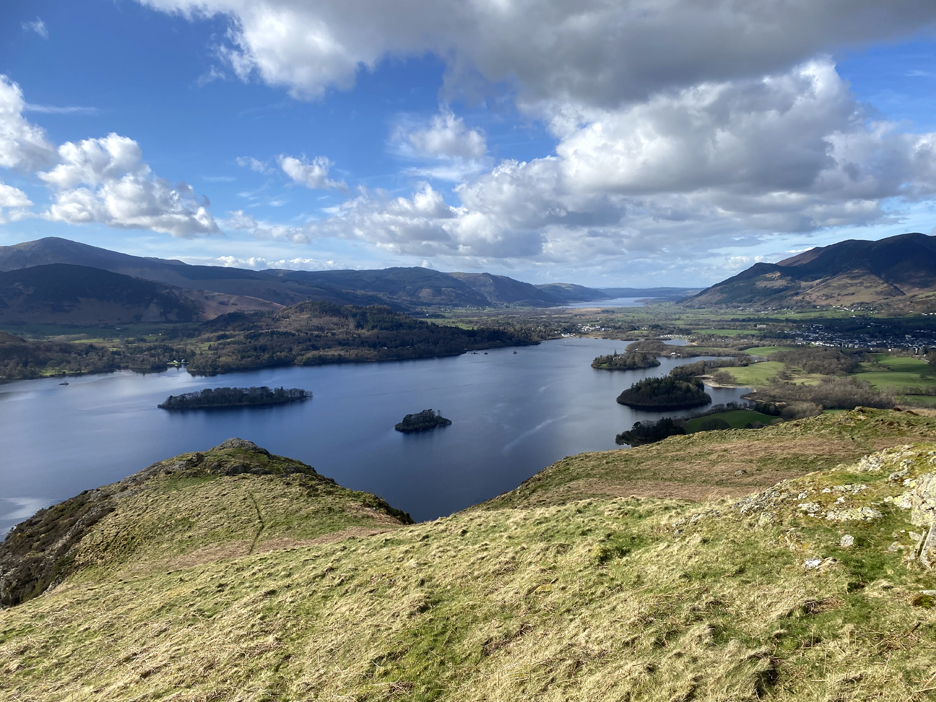
The view down the Cat Gill valley to the many islands of Derwent Water.
A small path deviated from the main route, over to the top of Falcon Crag, from where there's a great view down to Derwent Water and Keswick.
Looking south into the sun, you can see the River Derwent, the Jaws of Borrowdale, Castle Crag and on up the valley to the higher Central Fells.
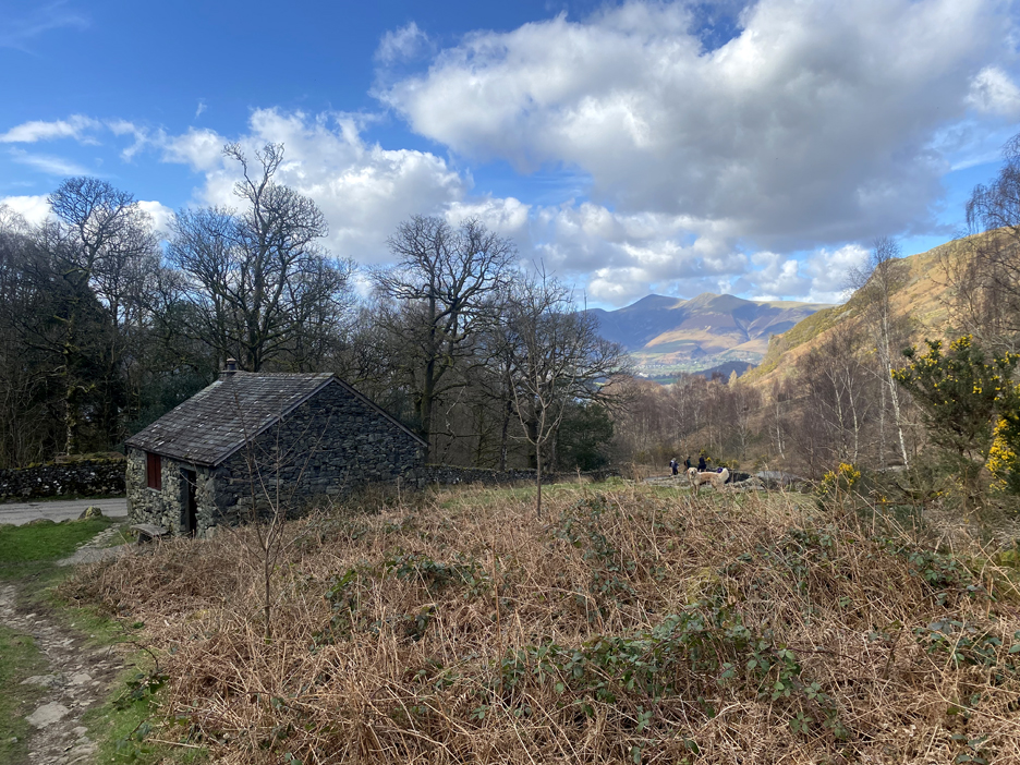
First sighting of Ashness Bridge and the car park in the trees where this round walk should end.
The small footbridge over Barrow Beck which means we're nearly back to the start.
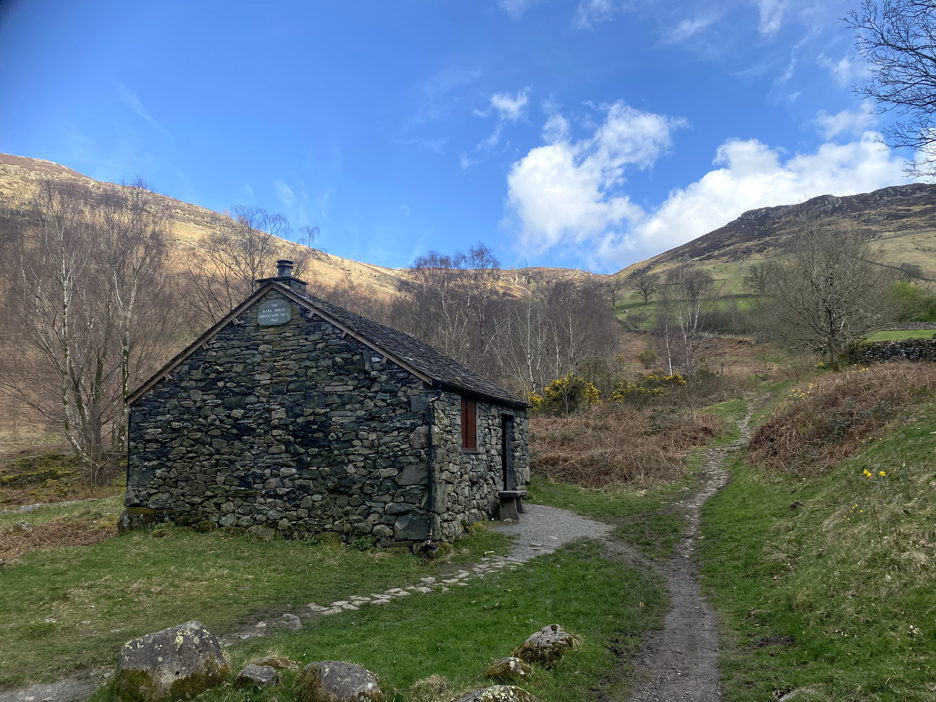
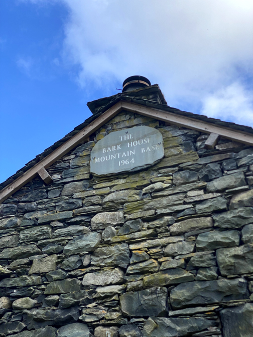
The old barn here is known as the "Bark House Mountain Base".
Bark House Mountain Base, Ashness Bridge On the edge of one of the remnants of the ancient Atlantic oakwood which once covered much of western Britain, Bark House was originally used to store oak bark before it was sent to the Keswick tannery. In the sixties it was used by the Scouts as a bunk house and also as a bothy. More recently the National Trust occasionally opens it up for visitors. This gives them somewhere to come and warm up by the fire and eat their sandwiches. It has no electricity so is a very basic one room space. Description courtesy of Geograph.org.uk
A few less cars in the car park on our return . . . time to head home. - - - o o o - - - Technical note: Pictures taken with my iPhone 11pro mobile phone camera. Resized in Photoshop, and built up on a Dreamweaver web builder. This site best viewed with . . . a spare sandwich to share at the end of the walk (due to the bonus flapjack !) Go to Home Page . . . © RmH . . . Email me here Previous walk - 19th March 2024 - Holme Woods Tree Planting A previous time up here - 25th October 2014 - Ashness and Barrow Cascades Boyd Harris's pictures from this area, including Bark House and the Ashness Lodge re-building 2019. Next walk - 30th March 2024 - Stan's Thirlmere Walk
|