![]()
Remember: Press F11 for a full
screen view of this page.
|
|
|
Remember: Press F11 for a full
screen view of this page. |
|
" Whoap and Lank Rigg " Date & start time: Monday 4th June 2012, 11.20 am start. Location of Start : The Cold Fell Road, Ennerdale Bridge, Cumbria, Uk ( NY 067 130 ) Places visited : River Calder, Whoap and Lank Rigg. Walk details : 5 mls, 1500 ft of ascent, 3 hrs 40 mins. Highest point : Lank Rigg summit, 1,775ft 541m Walked with : Maggie, Jo, Ann and the dogs, Amber, Harry and Bethan. Weather : Sunshine all the way, apart from the odd shadow underneath a passing cloud.
|
" Whoap and Lank Rigg " at EveryTrail [ Alter the settings to zoom or change the Map, use Everytrail to download the Gps route ] |
|
We are on the west coast escaping the Jubilee holiday crowds by walking two of the remote fells off the Cold Fell Road. Whoap is a grassy climb up from the infant River Calder, followed by a high level crossing to Lank Rigg which has a trig, a tarn and a shelter for lunch.
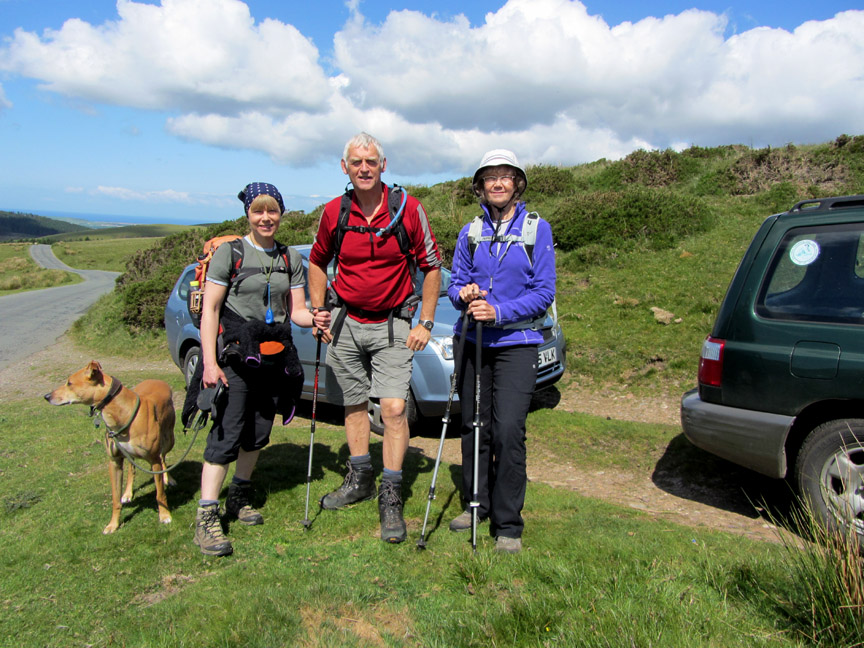
Who's a lucky guy . . . not just two lovely ladies to walk with today . . . . . . but three . . . and the sun is shining.
[ Do you think I could get commissions for portrait photography after today ? ] - - - o o o - - -
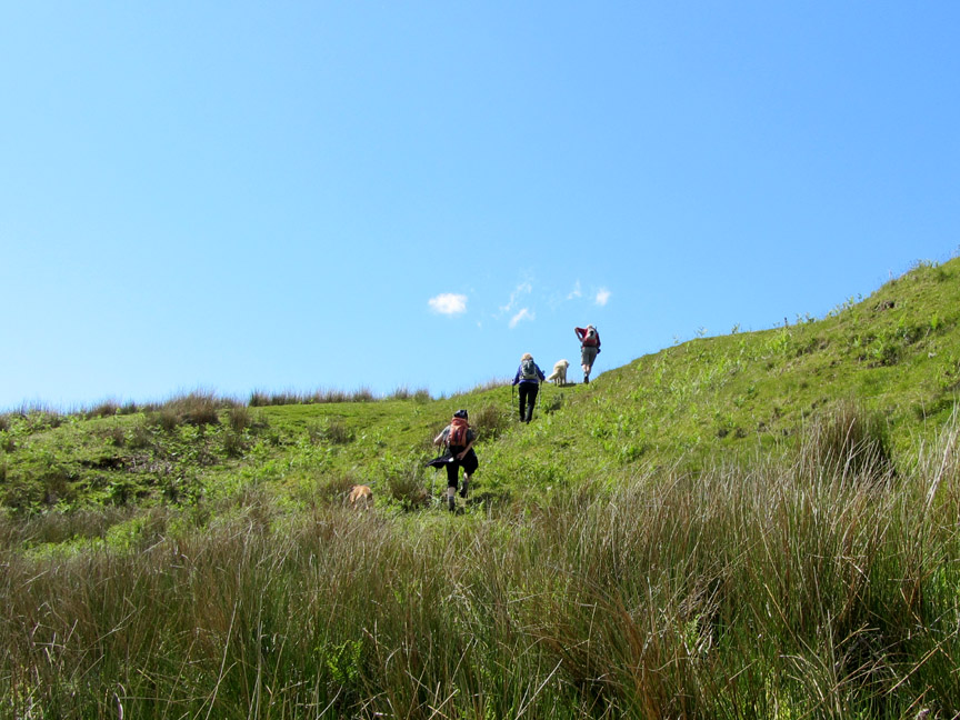
We parked on the Cold Fell Road close to Blakeley Rise and climbed the grass track that heads over the ridge. On the other side we get a complete view of our route . . . up Whoap to the left, across the skyline, climbing as we go and down from the high ground of Lank Rigg back to where we stand now.
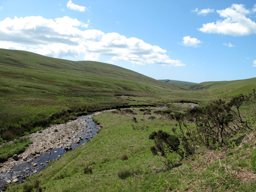
The River Calder starts its short, nine mile journey to the coast from the flanks of these fells.
Keen viewers may note that the ladies crossed further upstream on the second crossing . . .
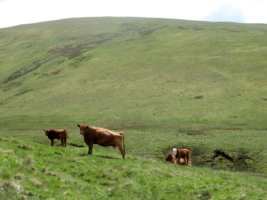
. . . the herd of cattle on the path was perhaps the reason. Best to give them a slightly wider berth to avoid complications.
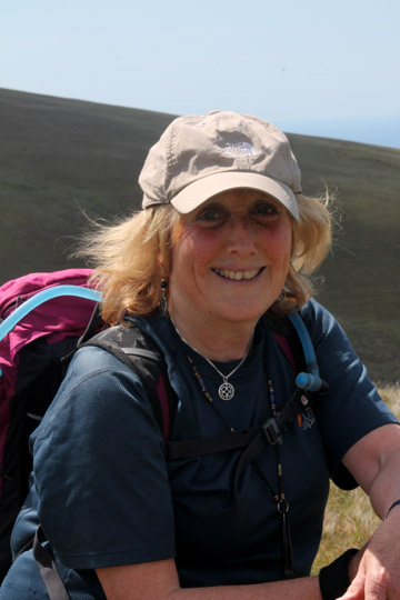
The other object of taking Jo's photo was to show her set against the Isle of Man in the background . . . but we seem to have got distracted !
As we climbed the grassy slope to Whoap the long distance views improved. Grike Fell now showing how much forestry has been cleared over the winter . . . ( the Isle of Man is off to the left now)
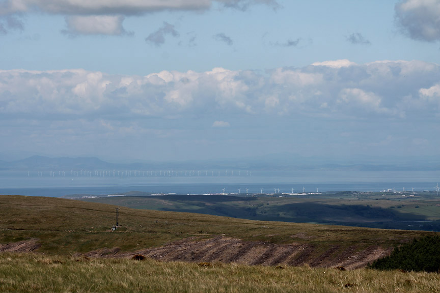
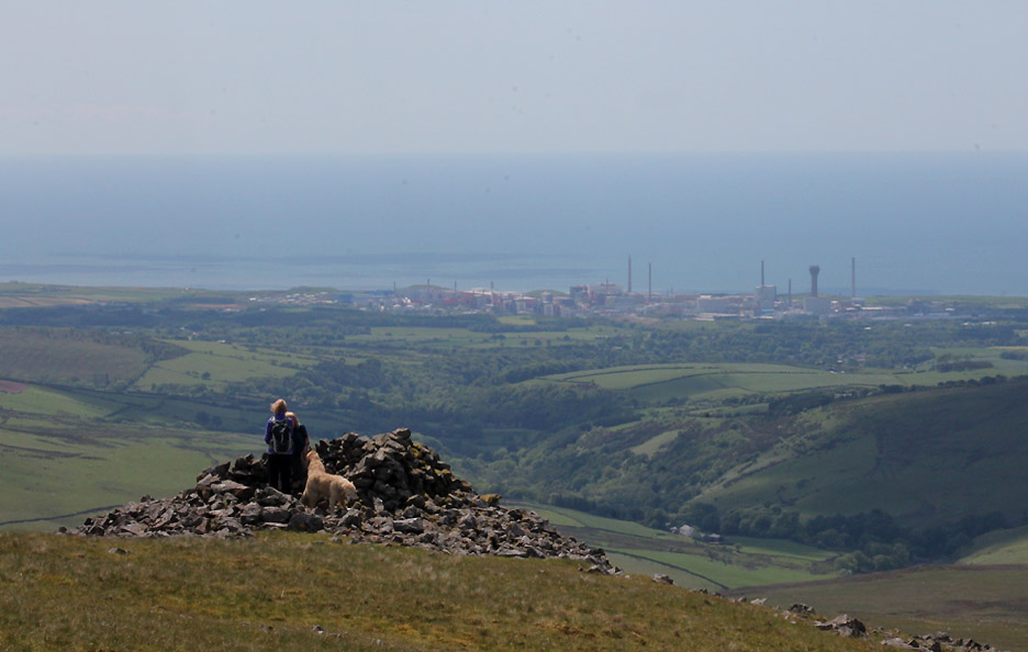
The Solway and Scotland . . . the haze hiding the majority of the off-shore wind farms. The radio mast on nearby Grike monitors the weather and such things as airborne radio activity, hopefully not emanating from the Sellafield reprocessing plant.
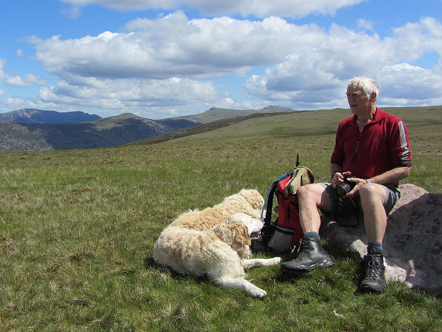
A useful stone near the summit of Whoap allows us to relax and enjoy the day.
If I squint really hard I can just about see the car where I left my sunglasses.
Looking the other way, all of us could enjoy the view down to Black Combe in the south west.
So far we had only met one person on our walk. Our bank holiday plan was working. That person, by the way, can be seen in the photo above left.
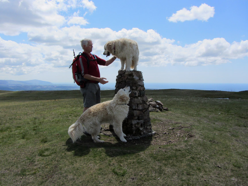
Bethan takes top dog position . . . but I'm lifting them on and off nowadays in order to avoid any problems. They do seem to enjoy being up there . . . each being 'top dog' over the other for a short while perhaps. [ Hold your cursor over the picture to see what I mean ]
Ann catches a summit photo of the all of us.
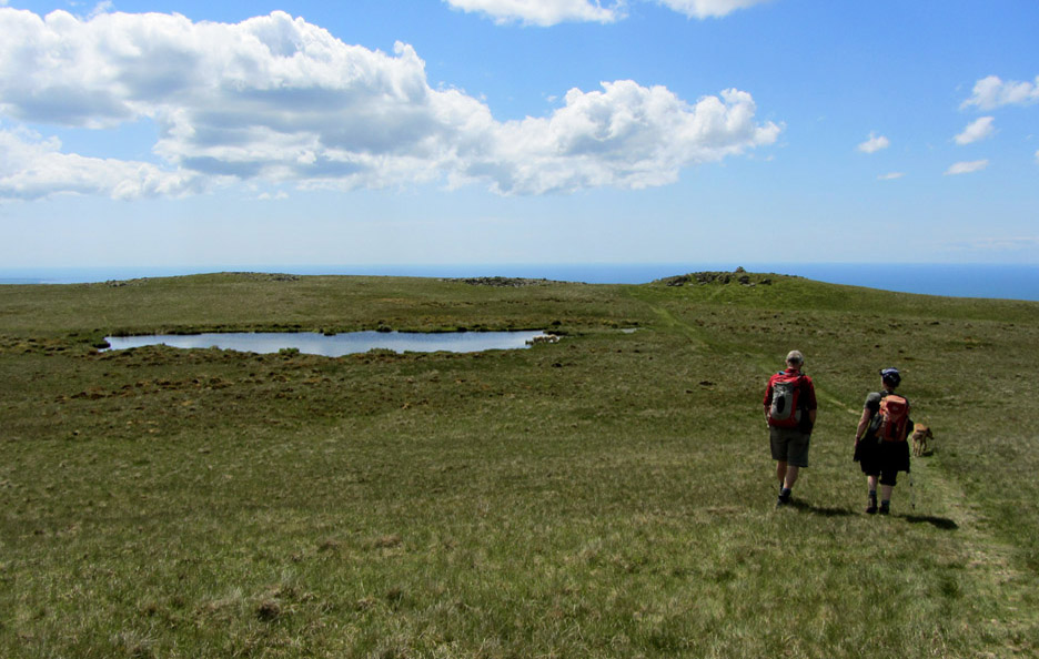
Off to the surprising little summit tarn and the lower cairn.
Beyond that second cairn is a fine stone shelter with a view out over Sellafield and the Irish Sea.
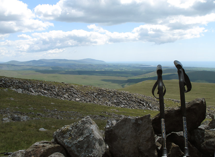
Time to rest the poles and have a little lunch.
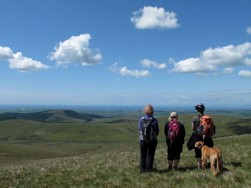
The afternoon was continuing to be warm and sunny and our return trip was laid out ahead. Follow the grass over the stones, down a bit, up a bit and head for the grassy rise in the middle distance.
The route ahead is studied by the girls . . . nice view but not their best sides. [ Hold your cursor over the picture to correct the problem ]
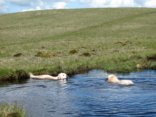
Down at the River Calder level once again. It was a dry crossing of the marshy ground, all but the last level section by the stream.
One last climb would take us back to the Cold Fell Road . . .
. . . and back to the car.
A final "au revoir" meaning . . . goodbye, "see you again" sometime . . . in the not too distant future hopefully. - - - o o o - - - |
Technical note: Pictures taken with either Ann's Canon Sureshot SX220, my Canon G10 or 1100D Digital SLR. Resized in Photoshop, and built up on a Dreamweaver web builder. This site best viewed with . . . sunshine and blue skies all the way. Go to Top . . . © RmH . . . Email me here Previous walk - 2nd June 2012 Walla Crag and Bleaberry Fell with Ian A previous time up here - 29th April 2007 Lank Rigg and Whoap on John's birthday Next walk - 13th June 2012 Loweswater Ladies Day Out
|